MaY 18 , 2025 .
Indonesia , Lewotobi Laki-laki :
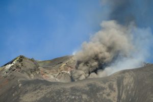
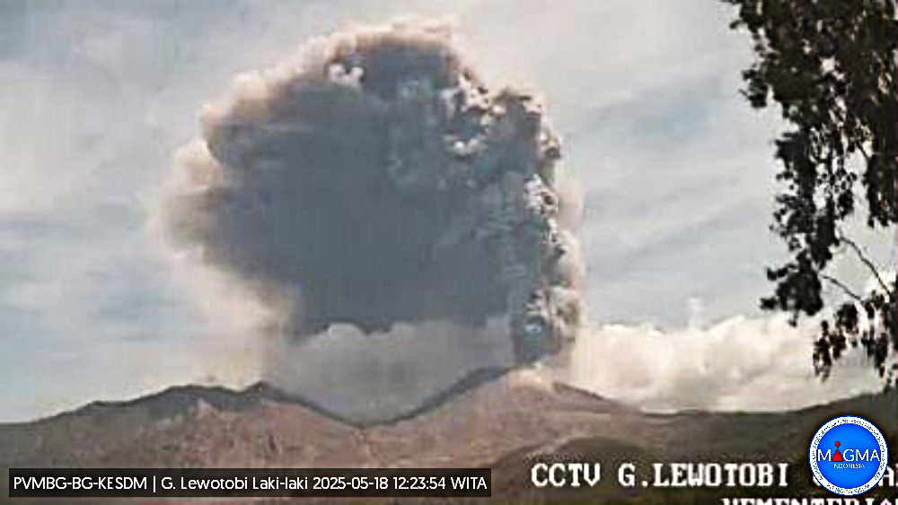
An eruption of Mount Lewotobi Laki-laki occurred on Sunday, May 18, 2025, at 12:46 WITA with an observed ash column height of ± 3,500 m above the peak (± 5,084 m above sea level). The ash column was observed to be gray in color with a thick intensity, oriented toward the north, northeast, and northwest. At the time of writing, the eruption was still ongoing.
VOLCANO OBSERVATORY NOTICE FOR AVIATION – VONA
Issued : May 18 , 2025
Volcano : Lewotobi Laki-laki (264180)
Current Aviation Colour Code : ORANGE
Previous Aviation Colour Code : orange
Source : Lewotobi Laki-laki Volcano Observatory
Notice Number : 2025LWK317
Volcano Location : S 08 deg 32 min 20 sec E 122 deg 46 min 06 sec
Area : East Nusa Tenggara, Indonesia
Summit Elevation : 5069 FT (1584 M)
Volcanic Activity Summary :
Eruption with volcanic ash cloud at 04h46 UTC (12h46 local).
Volcanic Cloud Height :
Best estimate of ash-cloud top is around 16269 FT (5084 M) above sea level or 11200 FT (3500 M) above summit. May be higher than what can be observed clearly. Source of height data: ground observer.
Other Volcanic Cloud Information :
Ash cloud moving from north to northwest. Volcanic ash is observed to be gray. The intensity of volcanic ash is observed to be thick.
Remarks :
Eruption recorded on seismogram with maximum amplitude 47.3 mm and maximum duration 56 second.
Source et photo : Magma Indonésie .
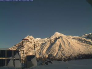
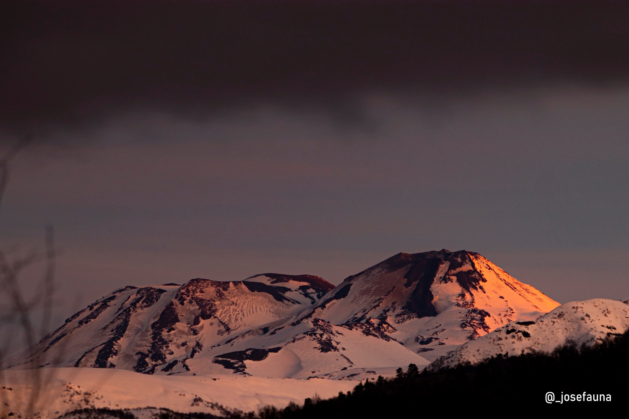
Chile , Nevados de Chillan :
Special Report on Volcanic Activity (REAV), De Nuble region, Nevados de Chillan volcanic complex, May 18, 2025, 12:15 a.m. local time (Continental Chile)
The National Geology and Mining Service of Chile (Sernageomin) announces the following preliminary information, obtained using the monitoring equipment of the National Volcanic Monitoring Network (RNVV), processed and analyzed at the Volcanological Observatory of the Southern Andes (OVDAS):
On Saturday, May 17, 2025, at 11:55 p.m. local time (03:55 UTC), monitoring stations installed near the Nevados de Chillan volcanic complex recorded an earthquake associated with rock fracturing within the volcanic system (VT volcano-tectonic type).
The earthquake characteristics after analysis are as follows:
TIME OF ORIGIN: 23:55 local time (03:55 UTC)
LATITUDE: 36.874° S
LONGITUDE: 71.335° W
DEPTH: 4.8 km
LOCAL MAGNITUDE: 3.1 (ML)
Observations:
No changes in the volcano’s seismic behavior were recorded after the event.
The Volcanic Technical Alert remains at Green.
Source : Sernageomin.
Photo : Josefauna .
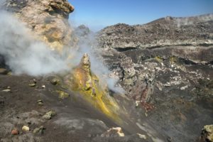
Ecuador , El Reventador :
DAILY STATUS REPORT OF REVENTADOR VOLCANO, Saturday, May 17, 2025.
Information Geophysical Institute – EPN.
Surface Activity Level: High, Surface Trend: No change
Internal Activity Level: Moderate, Internal Trend: No change
From May 9, 2025, 11:00 a.m. to May 10, 2025, 11:00 a.m.:
Seismicity:
Below is the count of seismic events recorded at the reference station.
Explosion (EXP) 96
Long Period (LP) 19
Emission Tremor (TREMI) 23
Harmonic Tremor (TRARM) 4

Rainfall/Lahars:
Since yesterday, no rain has been recorded in the volcano area, according to surveillance cameras and meteorologists. **Heavy rains in the region could remobilize accumulated material and generate mud and debris flows that would cascade down the volcano’s flanks and flow into downstream rivers.**
Emission/Ash Column:
Since yesterday, surveillance cameras and satellite images have shown several gas and ash emissions ranging from 400 to 160 meters above the crater in southwest, west, east, northwest, and west-southwest directions. In connection with this activity, the Washington-based VAAC agency issued an activity report for a gas and ash emission at 1,010 meters above the crater in a northwest direction.
Gas:
The MOUNTS satellite system recorded 12.7 tons of sulfur dioxide (SO2) measured on 05/16/25 at 1:56 PM TL.
Observation:
Over the past 24 hours, several episodes of incandescent material falling from the volcano’s flanks were observed, reaching up to 1,000 meters below the crater level. Furthermore, the volcano remained mostly cloudy to partly cloudy.
Alert Level – SGR: Orange
Source : IGEPN
Photo : Benjamin Bernard via volcanes ecuador / FB. ( 02/11/2024)
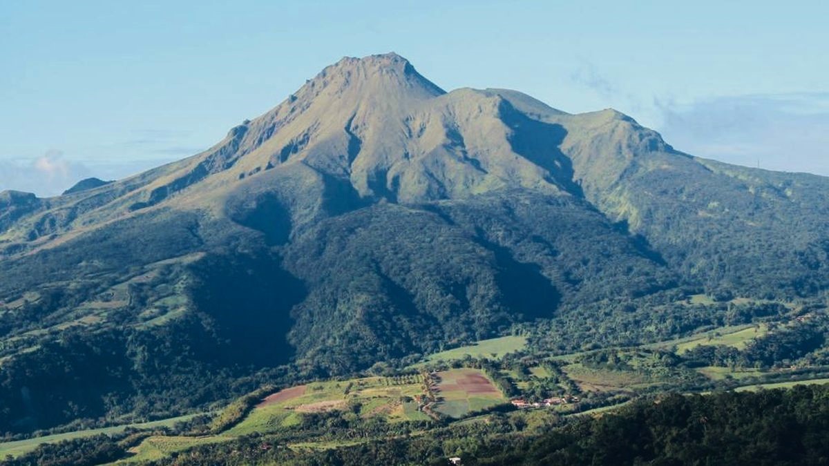
Guatemala , Santiaguito :
Weather conditions: Cloudy.
Wind: East.
Precipitation: 3.0 mm.
Activity:
Activity is reported at the Caliente Dome of the Santa María-Santiaguito volcanic complex, characterized by white degassing at an altitude of 500 meters above the crater. Weak and moderate explosions are generated, sending columns of gas and ash to heights of 800 to 900 meters above the dome, which are carried westward by the wind. At night, incandescence has been observed in the crater.

The Santiaguito Volcano Observatory (OVSAN) reports the collapse and descent of volcanic material toward the southern and southwest flanks of the dome. Activity remains high, so it is possible that, due to explosions or the effect of gravity, some of the accumulated material could collapse and generate pyroclastic flows over long distances toward the southwest, south, and southeast. The recommendations of Special Bulletin BESAN-002-2025 should be followed. Likewise, rains could cause lahars to descend into various ravines of the volcano.
Source : Insivumeh
Photo : Conred
La Martinique , Mount Pelée :
Weekly Report, Paris Institute of Earth Physics / Martinique Volcanological and Seismological Observatory
Saint-Pierre, May 16, 2025, at 2:45 p.m. local time (GMT-4)
Volcanic activity decreased significantly this week, with 31 earthquakes of volcanic origin observed.
Between May 9, 2025, at 4:00 p.m. (UTC) and May 16, 2025, at 4:00 p.m. (UTC), the OVSM recorded 31 low-energy volcano-tectonic earthquakes. These earthquakes were clearly identified as originating from one of the well-known seismically active zones on Mount Pelée, located between 1.0 and 1.4 km deep below the volcano’s summit. The superficial volcano-tectonic seismicity is associated with microfracturing within the volcanic edifice, linked to the global reactivation of the volcano observed since late 2018.
No earthquakes were felt by the population.
The previous week, the OVSM had recorded 256 earthquakes of volcanic origin. As of May 16, 2025, and over the past four weeks, the OVSM has observed a total of 625 volcanic earthquakes, an average of 156 to 157 earthquakes per week.
During phases of volcanic reactivation in volcanoes similar to Mount Pelée, seismic activity of varying intensity and frequency is commonly observed.
For more details on observations and interpretations of volcanic activity over the longer term, refer to the OVSM’s monthly bulletins.
The alert level is currently YELLOW: vigilance.
Source et photo : Direction de l’OVSM-IPGP.