January 08 , 2025 .
Italy , Stromboli :
WEEKLY BULLETIN, from December 30, 2024 to January 05, 2025. (issue date January 07, 2025)
SUMMARY OF ACTIVITY STATUS
In light of the monitoring data, it is highlighted:
1) VOLCANOLOGICAL OBSERVATIONS: Intense eruptive activity, with splashes coming from the North Crater area. The total hourly frequency varied between medium values (8 events/h) and high values (17 events/h). The intensity of the explosions was low and medium in the North Crater area and medium to high in the Center-South area.
2) SEISMOLOGY: The monitored seismic parameters do not show significant variations.
3) GROUND DEFORMATIONS: The ground deformation monitoring networks did not show significant variations over the past week.
4) GEOCHEMISTRY: SO2 flux at medium level
Soil CO2 flux from the Pizzo area (STR02) due to technical issues there are no updates.
The CO2/SO2 ratio in the plume (Stromboli Plume Network) shows high values.
Helium isotope ratio (R/Ra) dissolved in the thermal aquifer: last updated on 19 December 2024, with increasing values.
Soil CO2 flux in the San Bartolo area at medium values.
Soil CO2 flux in the Scari area at medium-high values.
5) SATELLITE OBSERVATIONS: The thermal activity observed by satellite in the summit area was generally low level with some isolated thermal anomalies of moderate level.
VOLCANOLOGICAL OBSERVATIONS
During the observation period, the eruptive activity of Stromboli was characterized by the analysis of images recorded by the INGV-OE surveillance cameras located at an altitude of 190 m (SCT-SCV) and at Punta dei Corvi (SPCT). The explosive activity was produced mainly by 4 eruptive vents located in the northern area of the crater and by 3 vents located in the central-southern area.
Observations of explosive activity captured by surveillance cameras
In the northern area of the crater, four vents are active and have produced explosive activity of low intensity (less than 80 m high) and sometimes of medium intensity (less than 150 m high). In addition, a low spattering activity was observed at the vents of sector N2. The emitted products were mainly composed of coarse materials (bombs and lapilli). The average frequency of explosions varied between 5 and 9 events/h.
In the Centre-Sud region, explosive activity was produced by at least three vents; The explosions were of variable intensity, from medium (less than 150 m in height) to high (more than 250 m in height) and produced fine materials sometimes mixed with coarse materials. The average frequency of explosions varied between 2 and 8 events/h
Source : INGV
Photo : stromboli stati d’animo / Sebastiano Cannavo
Costa Rica , Poas :
OVSICORI-UNA press release, updated on January 6, 2025
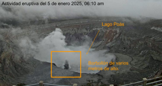
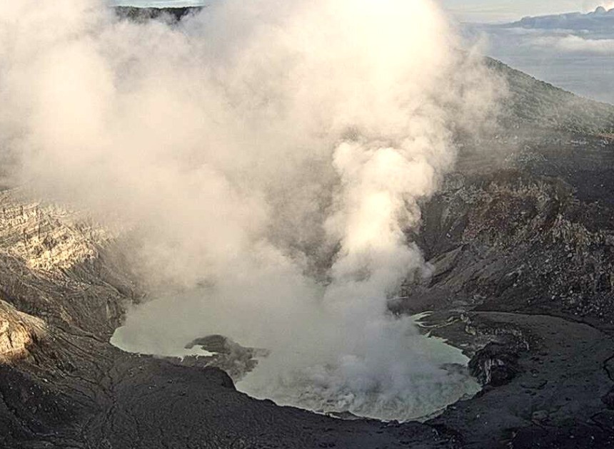
The Poás volcano presented a new eruption in the southern sector of the hyperacid lake starting on January 5, which reached several meters in height. This manifestation occurs after a period of slow intensification of several monitoring parameters, including seismic and acoustic tremor, proximal volcano-tectonic seismicity, an abnormal trend in the CO₂/SO₂ ratio that accelerated on January 5, an increase in gas flow and an increase in the temperature of the lake. These changes follow a period of crustal inflation in the north of the crater observed between the end of November and the beginning of December 2024, as well as in recent days.
Seismic activity:
Since late November 2024, changes in seismic patterns have been observed, which intensified during the first days of January 2025. Since then, temporary and moderate increases in the amplitude of background seismic tremor have been observed, while the number of long-period (LP) seismic events has decreased. These changes coincided with an episode of banded tremor, also in late November. Although the number of LP events has tended to decrease since late November, the amplitude of these events increased between 3 and 5 January. In parallel, an increase in the number of shallow proximal volcano-tectonic (pVT) earthquakes has been observed since 4 January 2025. Since then, at least 20 events with a magnitude between 0.6 and 2.2 have been recorded. Furthermore, since January 4, a large number of high-frequency earthquakes have been observed only in the vicinity of the crater. These could also be pVT earthquakes, but given their low amplitude, their classification as such cannot be conclusive. In the early hours of January 5, an episode of seismic and acoustic tremors began, accompanying the eruption observed at the southwest end of the lake. The seismic component of the tremor is of the spasmodic type, that is, it presents strong variations in amplitude following a succession of frequent events. Furthermore, the seismic amplitude of this episode was very high, higher than the amplitudes observed during the 2024 eruption. Since last night, the tremor has decreased to normal levels. pVT earthquakes are still observed.
Several scenarios are possible at this stage:
1) The pressurized fluids inside the volcano are slowly released by the new eruption and the activity decreases accordingly;
2) The flow of fluids towards the surface increases, which could lead to an increase in eruptive activity.
The volcano is at the ADVERTENCIA alert level.
Source : Ovsicori .
Photos : Ovsicori.
Italy / Sicily , Etna :
MONTHLY BULLETIN, REFERENCE MONTH December 2024. (issue date January 07, 2025)
SUMMARY OF ACTIVITY STATUS
In light of the monitoring data, it is highlighted:
1) VOLCANOLOGICAL OBSERVATIONS: Degassing activity of the summit craters.
2) SEISMOLOGY: Low seismic activity due to fracturing. Average amplitude of volcanic tremor in the low and medium-low levels.
3) INFRASOUND: Low infrasound activity, with sources mainly located in correspondence with the Northeast crater.
4) GROUND DEFORMATIONS: Over the last month, the ground deformation monitoring networks have not recorded any significant variations.
5) GEOCHEMISTRY: SO2 flux at medium level
Soil CO2 flux (EtnaGas Network): significantly decreasing, with low degassing values.
The partial pressure of dissolved CO2 in the aquifer (Ponteferro) shows values in seasonal variability.
Isotope ratio of peripheral sites: latest data on medium-high values (12/12/2024).
6) SATELLITE OBSERVATIONS: The thermal activity observed by satellite in the summit area was generally of low intensity.
VOLCANOLOGICAL OBSERVATIONS
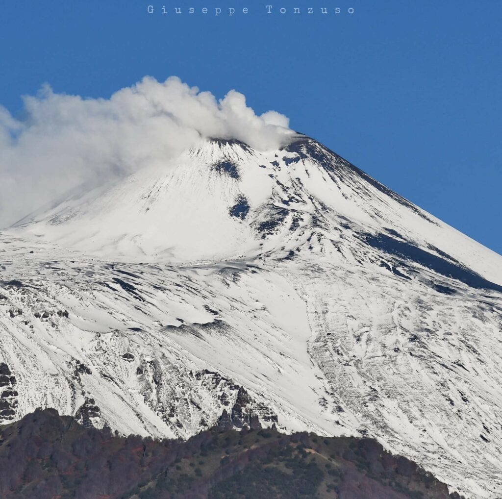
During the month in question, the monitoring of the volcanic activity of Etna was carried out by analyzing the images of the surveillance cameras of the INGV, Osservatorio Etneo (INGV-OE). During the period analyzed, the observation of the summit area and the craters was partly discontinuous due to the presence of cloud cover. Overall, during the periods of visibility, it was observed that the activity of Etna was characterized by a continuous degassing of variable intensity and regime in the individual craters.
In particular, the South-East crater is affected by an intense impulsive degassing. The Voragine and Bocca Nuova craters present a generalized degassing, especially along the western edge of the Bocca Nuova and the North-East crater is characterized by a degassing generated by a vent located at the bottom of the crater.
Source : INGV.
Photo : Giuseppe Tonzuso ( 7/12/2024)
Colombia , Galeras :
San Juan de Pasto, January 7, 2025, 4:30 p.m.
Following the monitoring of the activity of the Galeras volcano, the Colombian Geological Survey (SGC), an entity attached to the Ministry of Mines and Energy, reports that:
During the week of December 31, 2024 to January 6, 2025, volcanic activity showed an increase in seismicity. Compared to the previous week, the main variations in the monitored parameters were:
• An increase was recorded in both the frequency of earthquakes and the energy released.
• Seismicity related to rock fracturing predominated and this type of earthquake mainly presented an increase in seismic activity. Seismicity related to fluid dynamics maintained the levels recorded in the last two weeks.
• Most of the localized seismicity was concentrated within a 2 km radius around the center of the Galeras volcano crater, with a maximum magnitude of 1.6 and depths less than 4.3 km from the summit (4,200 m a.s.l.). The remaining seismic activity was scattered over several sectors of the Galeras volcanic complex influence zone, with maximum distances of 18 km and depths up to 14 km from the summit of the volcano.
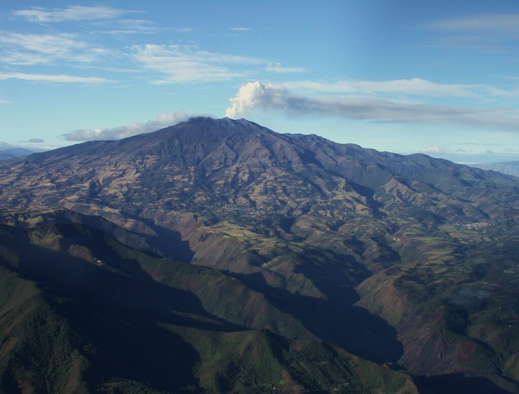
• Small gas emissions were observed in the fumarole fields of Las Chavas, to the west, and El Paisita, to the north of the active cone, with white columns, of low height and variable dispersion due to wind action.
• The other parameters of the volcanic monitoring showed stability.
Based on the above, the SGC recommends closely monitoring its evolution through the weekly bulletins and other information published through our official channels, as well as the instructions of local and departmental authorities and the National Disaster Risk Management Unit (UNGRD).
Volcanic activity remains in yellow alert status: active volcano with changes in the behavior of the base level of monitored parameters and other manifestations.
Source et photo : SGC
Philippines , Taal :
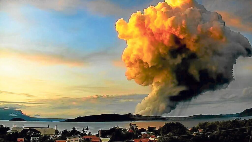
Taal Volcano in Batangas released 4,409 tons of sulfur dioxide following a minor phreatomagmatic eruption on Monday evening, the Philippine Institute of Volcanology and Seismology (Phivolcs) said.
Phivolcs’ data showed the volcano’s increased sulfur dioxide emissions from Sunday, January 5, until hours before its minor eruption at 7:34 p.m. on January 6 that brought about a weak 600-meter plume that drifted southwest and triggered a volcanic tremor that lasted three minutes.
Illustration: A minor eruption of Taal Volcano in Batangas early Tuesday, December 3, 2024, showing plumes rising 2,800 meters above the volcanic island in the middle of Taal Lake, captured by the Talisay City Observation Unit.
The volcano discharged 3,035 tons of sulfur dioxide on Sunday and 4,616 tons of sulfur dioxide earlier on Monday.
In its latest 24-hour monitoring, Phivolcs also said that Taal posted seven volcanic earthquakes, including five volcanic tremors lasting four to 15 minutes.
Phivolcs likewise noted one weak volcanic tremor that began on January 4 and continued until January 6.
Source : newsinfo . inquirer . net
Photo : Ville de Talisay


