December 02 , 2024 .
Indonesia , Ibu :
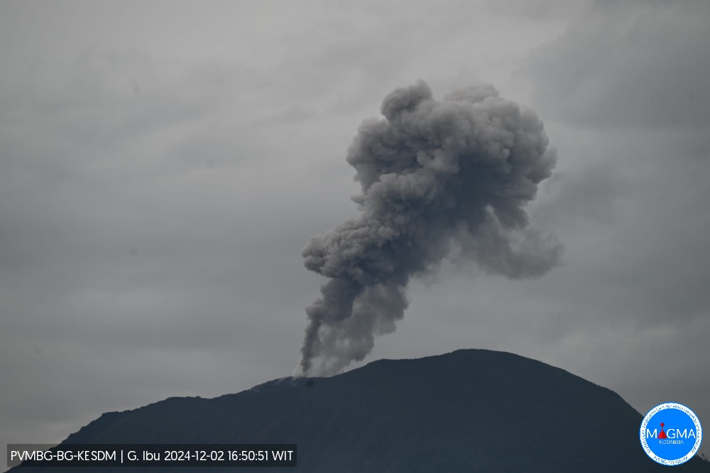
Mount Ibu erupted on Monday, 2 December 2024 at 06:50 UTC (15:50 local time) with the height of the ash column observed at ± 600 m above the summit (± 1925 m above sea level). The ash column was observed to be white to grey in colour with a moderate to thick intensity, oriented towards the South. This eruption was recorded on a seismograph with a maximum amplitude of 28 mm and a duration of 73 seconds.
VOLCANO OBSERVATORY NOTICE FOR AVIATION – VONA
Issued : December 02 , 2024
Volcano : Ibu (268030)
Current Aviation Colour Code : ORANGE
Previous Aviation Colour Code : orange
Source : Ibu Volcano Observatory
Notice Number : 2024IBU1247
Volcano Location : N 01 deg 29 min 17 sec E 127 deg 37 min 48 sec
Area : North Maluku, Indonesia
Summit Elevation : 4240 FT (1325 M)
Volcanic Activity Summary :
Eruption with volcanic ash cloud at 06h50 UTC (15h50 local).
Volcanic Cloud Height :
Best estimate of ash-cloud top is around 6160 FT (1925 M) above sea level or 1920 FT (600 M) above summit. May be higher than what can be observed clearly. Source of height data: ground observer.
Other Volcanic Cloud Information :
Ash cloud moving to south. Volcanic ash is observed to be gray. The intensity of volcanic ash is observed to be thick.
Remarks :
Eruption recorded on seismogram with maximum amplitude 28 mm and maximum duration 73 second.
Source et photo : Magma Indonésie .
Philippines , Mayon :
LAHAR ADVISORY FOR MAYON VOLCANO TO BE AFFECTED BY SHEAR LINE , 01 December 2024 , 03:30 PM
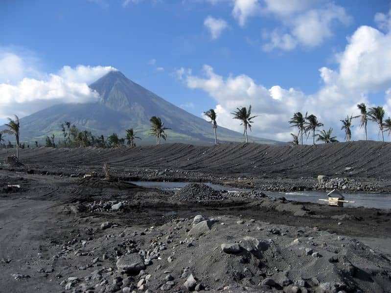
Based on the Weather advisory #23 issued at 11:00 AM today by the Philippine Atmospheric Geophysical and Astronomical Services Administration (PAGASA), a “shear line” weather system affecting Southern Luzon is predicted to cause continued severe intensity and potentially high-volume rainfall over Albay Province. This can generate volcanic sediment flows or lahars, muddy streamflows or muddy run-off in rivers and drainage areas on the monitored active volcano Mayon. DOST-PHIVOLCS thus strongly recommends increased vigilance and readiness of communities in pre-determined zones of lahar and related hazards on these volcanoes.
Prolonged and heavy rainfall may generate post-eruption lahars on major channels draining Mayon Volcano by incorporating loose material from remnant pyroclastic density current (PDC) deposits from the January-March 2018 eruption. The bulk of erodible PDC deposits occupy the watershed areas of the Miisi, Mabinit, Buyuan and Basud Channels. In addition, older and erodible eruption deposits that occupy the watershed areas on the eastern and western slopes of the edifice and can be remobilized as non-eruption lahars by erosion of banks and channel beds. Mayon lahars can threaten communities downstream of the above channels with inundation, burial and wash away. Potential lahars and sediment-laden streamflows may occur along the Miisi, Binaan, Anoling, Quirangay, Maninila, Masarawag, Muladbucad, Nasisi, Mabinit, Matanag, Basud and Bulawan Channels in Albay Province.
DOST-PHIVOLCS strongly advises the communities and local government units of the above identified areas of risk to continually monitor the weather conditions and take pre-emptive response measures for their safety from the on-going “shear line” weather system.
Source : Phivolcs
Photo : Auteur inconnu
Indonesia , Marapi :
Decrease in the activity level of Mount Marapi, West Sumatra, from level III (Siaga) to level II (Waspada). 1 December 2024
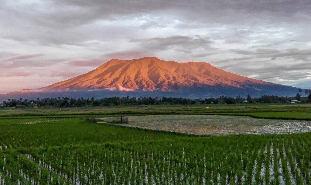
Marapi volcano (2,891 meters above sea level) is located at 0o 22′ 47.72″ S latitude – 100o 28′ 16.71″ E longitude. The eruptive character of Mount Marapi is explosive and also effusive. From early 1987 to the present, the eruption has been explosive, centered in the Verbeek crater.
Visual observation
Visual observation data from last week (23 – 30 November 2024).
Marapi was clearly visible until it was covered by fog. White smoke is observed from the main crater with fine to moderate intensity at a height of about 100-150 meters above the summit. There were two explosions/eruptions on 29 November 2024 but the height and color of the ash column were not observed as it was covered by fog/clouds.
Instrumental observation
The seismicity data for the period 23-30 November 2024 are dominated by emission earthquakes, while explosion/eruption earthquakes are recorded very rarely. The complete seismic data recorded 2 eruption earthquakes, 44 emission earthquakes, 7 shallow volcanic earthquakes, 12 deep volcanic earthquakes, 18 local tectonic earthquakes,
19 deep tectonic earthquakes and continuous tremors with an amplitude of 0.5 to 2 mm (dominant value 1 mm).
Since the beginning of November 2024, the Batupalano station inclinometer graph tends to be flat, especially on the tangential axis.
Assessment
The development of Mount Marapi activities until December 1, 2024 is as follows:
Visually, the activity of Mount Marapi is fluctuating, where this week it still tends to continue, its activity is dominated by emissions with a smoke height observed at a maximum of 150 meters above the summit. The eruption that occurred could not be observed visually as it was covered by fog/clouds, but it is believed that the range of material ejected from the eruption fell back around the crater area.
Eruption earthquakes are still recorded, but their number is very rare and emission earthquakes tend to decrease. The activity of these two types of earthquakes is a manifestation of the release of energy from fluctuations in volcanic earthquakes, especially deep volcanic earthquakes (VA) which are related to the supply/intrusion of magma from the depths. This week, deep volcanic earthquakes have further decreased compared to the previous week and local tectonic earthquakes around Mt. Marapi are still actively occurring, which could be related to the dynamics of magmatic intrusion.
In early October 2024, there was an increase in deep volcanic earthquakes (VA), followed by an increase in shallow volcanic earthquakes (VB) and a decrease in dv/v (seismic velocity variation) and coherence values in late October. Currently, the dv/v value is around zero, indicating that the pressure on the volcanic body has decreased and the coherence value has increased again, reflecting a more stable average condition although it has not yet returned to its normal state. (the coherence value is 0.9).
Currently, the seismic energy reflected by RSAM (Real-time Seismic Amplitude Measurement) fluctuates around the baseline.
Since early November 2024, the Batupalano station tiltmeter graph has tended to be flat, especially on the tangential axis, indicating that there is relatively no change in the deformation of the volcanic body, in terms of inflation.
InSAR images from the Sentinel 1 G. Marapi satellite show that there is no deformation anomaly between 15 and 27 November 2024.
The SO2 gas emission (flux) rate from the Sentinel satellite has been measured in relatively low quantities. The last measurement was 57 tonnes/day on 24 November 2024. This reflects that the activity of Mount Marapi is currently dominant in the form of degassing (gas release) with a relatively low SO2 magmatic gas content.
Based on the assessment of monitoring data, the activity of Mount Marapi generally fluctuates with a downward trend, especially in the past week. The potential for an eruption still exists, but based on the monitoring data available to date, it is unlikely that a major eruption will occur as in December 2023. Explosions/eruptions can occur at any time in the form of a form of accumulated energy release with the potential danger of ejecting eruptive material within a radius of 3 km from the activity center (Verbeek Crater), especially around the summit area of Mount Marapi.
Conclusions:
Based on the results of a comprehensive analysis and assessment, from 1 December 2024 at 15:00 WIB, the activity level of Mount Marapi has been lowered from level III (SIAGA) to level II (WASPADA).
Source : PVMBG
Photo : Dody.bukittinggi ( 12/2023)
Ecuador , El Reventador :
DAILY STATE REPORT OF THE REVENTADOR VOLCANO , Sunday, December 1, 2024.
Information Geophysical Institute – EPN.
Surface Activity Level: High , Surface Trend: No Change
Internal Activity Level: Moderate , Internal Trend: No Change
From November 30, 2024, 11:00 a.m. to December 1, 2024, 11:00 a.m.:
Seismicity:
The count of seismic events recorded at the station is detailed below.
Explosion (EXP) 56
Long Period (LP) 15
Emission Tremor (TREMI) 24
Harmonic Tremor (TRARM) 0
Rainfall / Lahars:
Since yesterday afternoon until the publication of this report, thanks to the satellite and meteorological monitoring system, no rain has been recorded in the areas surrounding the volcano. **In the event of heavy rains, these could remobilize the accumulated materials, generating mud and debris flows that would descend the sides of the volcano and flow into the adjacent rivers.
Emissions / Ash Column:
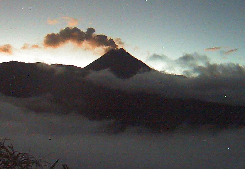
Since yesterday afternoon until the end of this report, thanks to the satellite monitoring system and surveillance cameras, several emissions of gas and ash have been recorded with heights between 200 and 700 meters above the level of the crater in West-Southwest, West and West-Northwest directions. This activity was also reported by the Washington VAAC agenda through 3 reports.
Other monitoring parameters:
The FIRMS, MIROVA-VIIRS and MIROVA MODIS satellite monitoring systems recorded 12 thermal anomalies, 2 moderate thermal anomalies and 1 moderate thermal anomaly respectively during the last 24 hours.
Observation:
Yesterday afternoon until the publication of this report, the volcano remained partly cloudy, with the exception of small episodes that allowed the descent of incandescent material to be recorded at 800 meters below the crater level.
Source : IGEPN
Photo : IGEPN
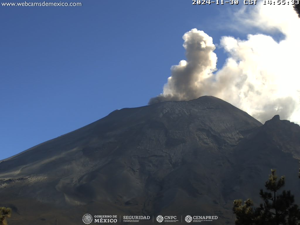
Mexico , Popocatepetl :
December 1, 11:00 (December 1, 17:00 GMT) , Activity of the last 24 hours
23 low intensity exhalations were detected, accompanied by water vapor, other volcanic gases and small amounts of ash.
In addition, 191 minutes of high frequency and low amplitude tremors were recorded. Between 5:10 and 6:30 today the most relevant phase took place, observing the fall of some fragments on the slopes.
During the morning and until the time of this report, a continuous emission of water vapor and other volcanic gases was observed that disperse towards the Southwest.
The volcanic alert fire of Popocatépetl is in yellow phase 2.
The scenarios anticipated for this phase are:
A few small to moderate explosions
Occurrence of tremors of varying amplitude
Light to moderate ash rains in the surrounding towns and in some more distant towns
Ejection of incandescent fragments within the 12-kilometre exclusion radius
The occurrence of lahars can be expected to descend into the ravines, due to the accumulation of ash on the slopes and their interaction with the rains expected in the coming weeks.
Possibility of pyroclastic flows not reaching the populations
Source et photo : Cenapred

