November 22 , 2024.
Iceland : Reykjanes Peninsula :
Eruption on the Sundhnúkur Fissure Swarm , Updated 21. November at 11:55 UTC
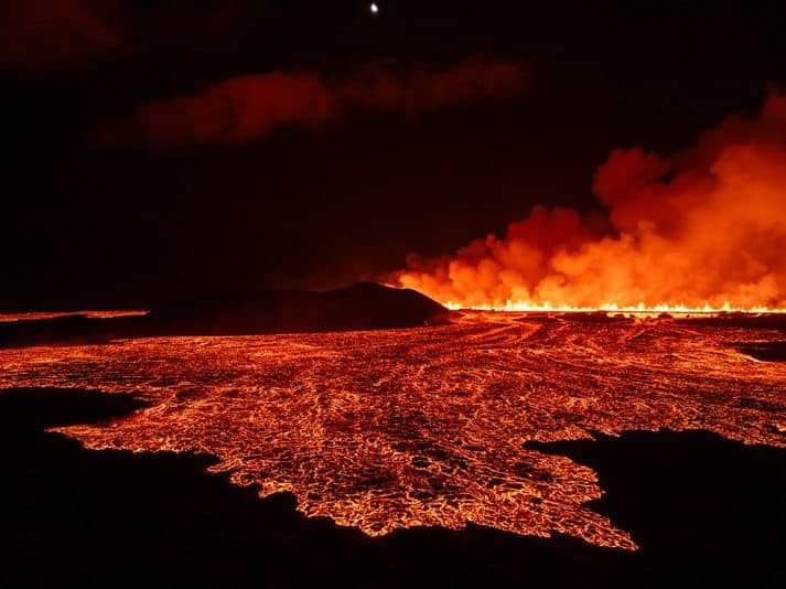
Lava has flowed across the Grindavíkurvegur (Grindavík road)
The eruptive fissure has shortened
A lava front has reached the hot water pipeline, the Njarðvík Line
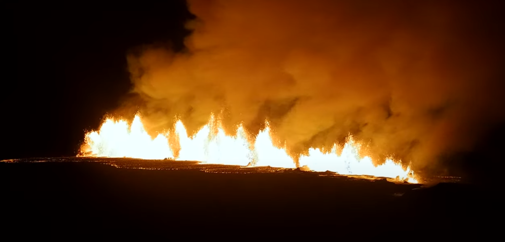
The eruption, which began at 23:14 on November 20, is ongoing. However, activity along the eruptive fissure has contracted by approximately 600 meters from its southern end, according to drone measurements conducted by the Special Forces of the National Police Commissioner. The most active area is now around the central part of the fissure, between Stóri-Skógfell and Sýlingarfell. Lava crossed the Grindavík road around 04:30 this morning. Shortly before 08:00, the lava front also reached the hot water pipeline, the Njarðvík Line.
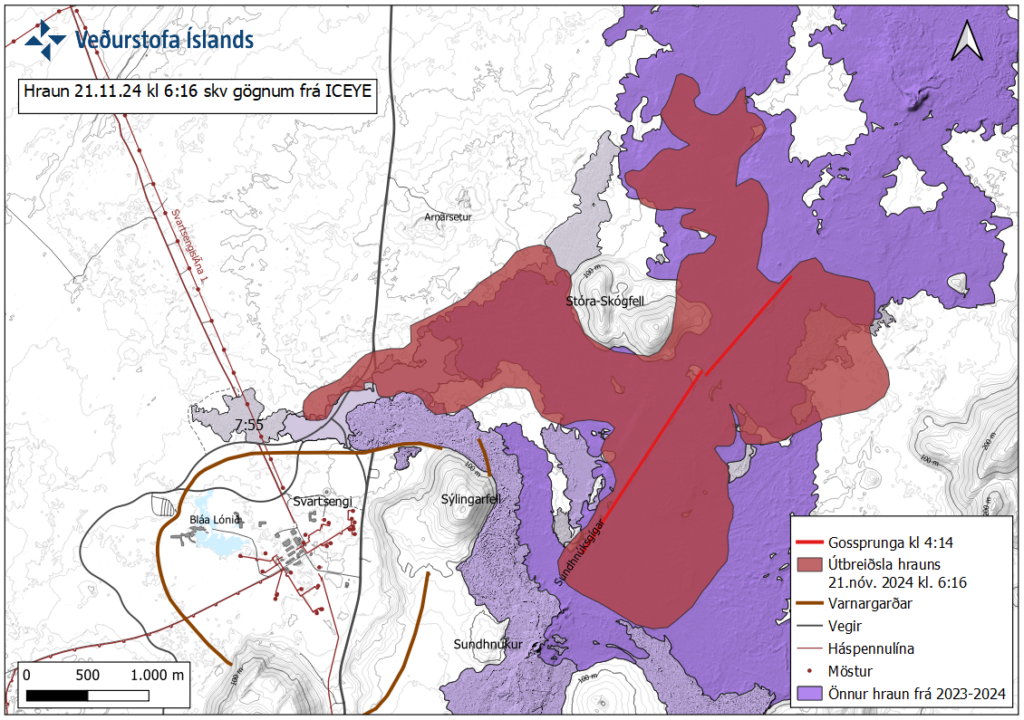
According to satellite imagery (ICEYE) from 06:16 this morning, the lava field now spans nearly 7 square kilometers. Approximate outlines of the lava field are shown on the accompanying map. The location of the fissure, as it appeared in satellite imagery taken at 04:14, is also indicated. Since the image was captured, the lava front has continued to flow westward beyond the hot water pipeline.
Seismic activity decreased significantly shortly after the eruption began, and only a few minor earthquakes have been recorded since. Deformation was detected in the first few hours following the eruption but is now minimal in the vicinity of the fissure.
The weatherforcast shows that winds from the northeast today (Thursday) and tomorrow (Friday) will carry gas pollution southward and westward from the eruption site. Gas pollution is likely to affect Grindavík, Svartsengi, and Reykjanesbær.
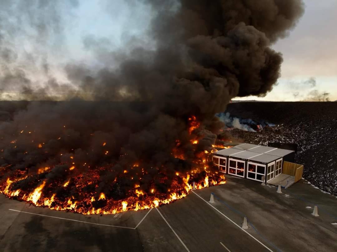
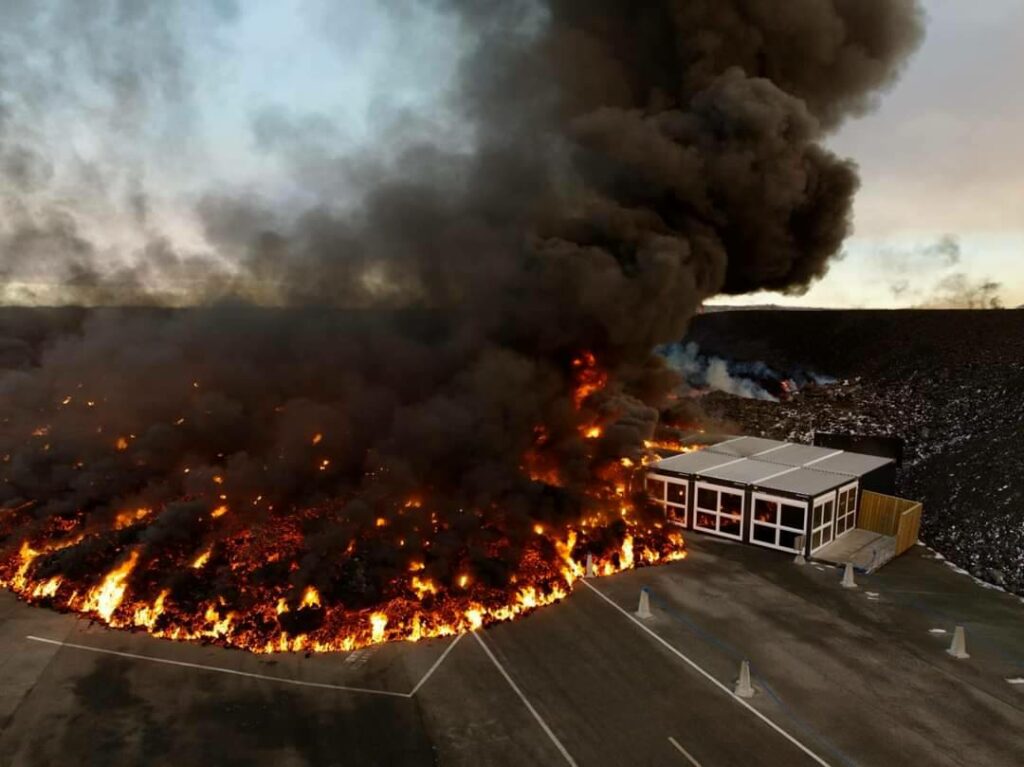
The entire Blue Lagoon car park is now covered in lava, with the exception of a few street lights at the end of what used to be a car park. The lava now appears to have spread a bit and has now passed over a sign directing visitors to the car park.
Lava continues to flow along the defence wall to the west of the Blue Lagoon.
Eruption activity remains fairly steady since this morning
Lava has reached the Blue Lagoon’s parking lot
Updated 21. November at 16:45 UTC
Lava has never flowed this far west before.
Seismic activity and deformation remain minimal.
Lava was advancing at a rate exceeding 100 meters per hour today.
The hazard assessment will be updated tomorrow, November 22, if conditions remain unchanged.
Eruptive activity between Stóra-Skógfell and Sýlingarfell appears to be similar to that observed earlier this morning. Seismic activity and deformation at the eruption site remain very low.
Initial measurements suggest that the volume of magma that has travelled from Svartsengi towards the Sundhnúkur crater row is equivalent to half the volume that moved during the eruption on August 22. More detailed results are expected in the coming days.
The lava flow that crossed Grindavíkurvegur and the hot water pipeline to the west has continued travelling westward. By midday, lava reached the parking lot at the Blue Lagoon and continues to advance. The rate of advancement was measured to be over 100 meters per hour between 12:09 and 13:35.
This lava field has now extended farther west than any lava flow from previous eruptions.
Source : IMO Iceland , icelandmonitor . mb
Photos : Afar TV , IMO. Vilhelm Gunnarsson
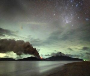
Indonesia , Dukono :
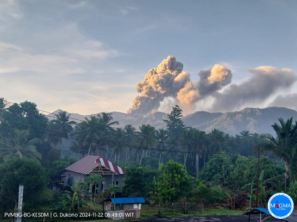
An eruption of Mount Dukono occurred on Friday, 22 November 2024 at 06:37 WIT with the height of the ash column observed at ±1300 m above the summit (±2387 m above sea level). The ash column was observed to be white to grey in colour with a thick intensity, oriented towards the northwest. At the time of writing, the eruption was still ongoing.
Seismicity Observation:
124 eruption earthquakes with an amplitude of 7 to 25 mm and an earthquake duration of 36.11 to 68.97 seconds.
11 distant tectonic earthquakes with an amplitude of 7-17 mm, earthquake duration 56.86-90.02 seconds.
1 Continuous Tremor with an amplitude of 3 to 7 mm, dominant value of 4 mm.
Recommendation
(1) People around Mt. Dukono and visitors/tourists are advised not to do any activities, climb or approach the Malupang Warirang Crater within a radius of 3 km.
(2) Considering that eruptions with volcanic ash occur periodically and the distribution of ash follows the direction and speed of the wind, so the landing area of ash is not fixed, it is recommended that the community around Mount Dukono always equip themselves with masks/nose and mouth covers to use when needed to avoid the threat of volcanic ash on the respiratory system.
Source et photo : Magma Indonésie
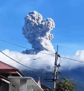
Colombia , Nevado del Ruiz :
Manizales, November 19, 2024, 7:35 p.m. .
From the monitoring of the activity of the Nevado del Ruiz volcano, the Colombian Geological Survey (SGC), an entity attached to the Ministry of Mines and Energy, reports that:
During the week of November 12 to 18, 2024, the volcano continued with unstable behavior. Compared to the previous week, the main variations in the monitored parameters were:
– The seismic activity associated with the fracturing of rocks inside the volcanic edifice decreased in the number of earthquakes recorded and in the seismic energy released. The earthquakes were located in the Arenas crater and on the different flanks of the volcano, at distances of less than 10 km from the crater. The depths of the events varied between less than 1 km and 6 km from the summit of the volcano. The highest magnitude of the week was 1.3, corresponding to the earthquakes recorded on November 13 at 15:52 and on November 15 at 17:17. These earthquakes were located respectively 3 km northeast (at a depth of 2 km) and 7 km west-northwest (at a depth of 6 km) of the Arenas crater. The recording of seismic activity related to the lava dome (protuberance or mound) located at the bottom of the crater also continued, which presented low energy levels.
– Seismicity related to fluid activity inside volcanic conduits and associated with pulsatile ash emissions maintained similar levels in the number of recorded earthquakes and decreased in the seismic energy released, while long-period signals increased. The energy levels of both types of signals (associated with ash emissions and long-duration) were mostly low. Confirmation of ash emissions and temperature changes of the emitted materials associated with some of these signals, carried out by the cameras (conventional or thermographic) used to monitor the volcano, was limited due to the atmospheric conditions of high cloudiness that persisted during the week in the volcanic area.
– The emission of water vapor and gases into the atmosphere continued from the Arenas crater. Sulfur dioxide (SO2) degassing rates were variable. For this week, the wind direction favored the measurement stations, however it is not yet possible to establish the changes compared to previous weeks. From satellite monitoring, similar values were observed during the degassing of SO2 compared to the previous week.
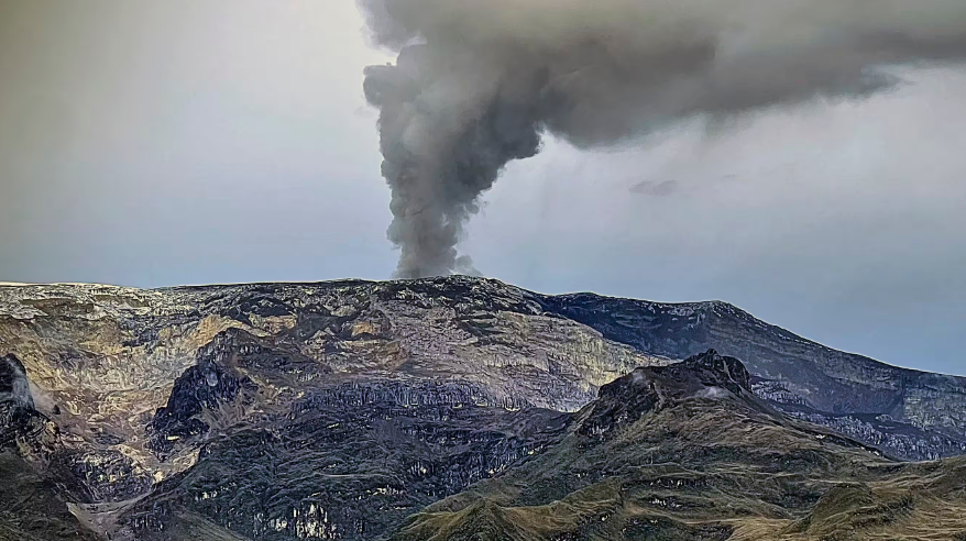
– The gas column reached a maximum vertical height of 1300 m and 2000 m in dispersion. Both values were measured on the volcanic summit during the ash emission on November 12 at 00:22. The dispersion direction of the column showed a dominant trend towards the southwest of the volcano.
– When monitoring thermal anomalies at the bottom of the Arenas crater, from satellite monitoring platforms, few reports of low energy anomalies were obtained. It should be mentioned that the detection of anomalies was limited due to the very cloudy atmospheric conditions that prevailed in the area.
Source : SGC
Photo : COLOMBIAN AIR FORCE
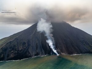
Guatemala , Santiaguito :
Atmospheric conditions: Partly cloudy
Wind: North-East
Precipitation: 21.4 mm.
Activity:
A degassing is observed on the crater that disperses towards the South-West. Weak to moderate explosions are recorded, expelling columns of gas and ash that reach up to 900 meters in height above the crater and disperse in a South-West direction. According to the WRF numerical model, the dispersion direction will remain South-West during the day.
At night and early in the morning, incandescence was observed in the crater of the Caliente dome and in the upper part of the lava flow in a West-Southwest direction. Weak, moderate and some strong block avalanches are recorded on the lava flow, on the southern flank and on the southeast flank. Fine ash falls are reported in the farms near the southwest of the Caliente dome. The occurrence of block and ash flows of moderate to strong characteristics is not excluded, as well as possible pyroclastic flows over long distances in different directions, therefore, one should not stay near or in the riverbeds near the foothills of the volcano.
Source : Insivumeh
Photo : Conred ( 10/2024).
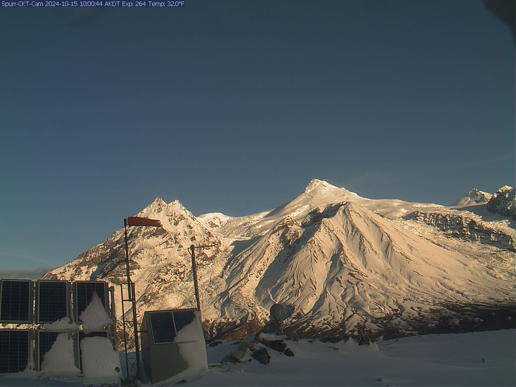
Alaska , Spurr :
Unrest continues at Mount Spurr. Small, shallow earthquakes underneath the summit region continue at a low rate. No activity was observed in partly cloudy satellite views over the past day, but very weak steaming in the summit area was seen in clear webcam views. AVO continues to closely monitor activity at Mount Spurr for signals that would indicate that the volcano is moving closer to an eruption.
Based on previous eruptions, changes from current activity in the earthquakes, ground deformation, summit lake, and fumaroles would be expected if magma began to move closer to the surface. Therefore, it is very likely that if an eruption were to occur it would be preceded by additional signals that would allow advance warning.
Local seismic, infrasound, web cameras, and GNSS stations are used to monitor Mount Spurr along with regional infrasound, lightning networks and satellite data.
Source : AVO
Photo : Boyce, Ellie / Alaska Volcano Observatory / University of Alaska Fairbanks, Geophysical Institute .

