November 21 ,2024.
Indonesia , Ibu :
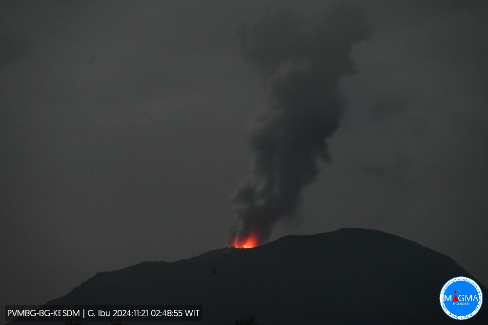
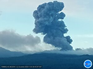
An eruption of Mount Ibu occurred on Thursday, 21 November 2024 at 02:48 WIT with the height of the ash column observed at ± 800 m above the summit (± 2125 m above sea level). The ash column was observed to be grey in colour with a thick intensity, oriented towards the South-West. This eruption was recorded on a seismograph with a maximum amplitude of 28 mm and a duration of 75 seconds.
VOLCANO OBSERVATORY NOTICE FOR AVIATION – VONA
Issued : November 21 , 2024
Volcano : Ibu (268030)
Current Aviation Colour Code : ORANGE
Previous Aviation Colour Code : orange
Source : Ibu Volcano Observatory
Notice Number : 2024IBU1119
Volcano Location : N 01 deg 29 min 17 sec E 127 deg 37 min 48 sec
Area : North Maluku, Indonesia
Summit Elevation : 4240 FT (1325 M)
Volcanic Activity Summary :
Eruption with volcanic ash cloud at 17h48 UTC (02h48 local).
Volcanic Cloud Height :
Best estimate of ash-cloud top is around 6800 FT (2125 M) above sea level or 2560 FT (800 M) above summit. May be higher than what can be observed clearly. Source of height data: ground observer.
Other Volcanic Cloud Information :
Ash cloud moving to southwest. Volcanic ash is observed to be gray. The intensity of volcanic ash is observed to be thick.
Remarks :
Eruption recorded on seismogram with maximum amplitude 28 mm and maximum duration 75 second.
Source et photo : Magma Indonésie.
United States / Mariana Islands , Ahyi :
On 20 November the Aviation Color Code for Ahyi Seamount was raised to Yellow (the second lowest level on a four-color scale) and the Volcano Alert Level was raised to Advisory (the second lowest level on a four-level scale) due to an ongoing submarine eruption. Plumes of discolored water were observed extending as far as several hundred meters away from the volcano in satellite images on 1, 10, and 19 November. Retrospective analysis of older satellite data revealed minor activity extending back to 5 August. Possible pumice floating on the ocean surface was identified in the most recent image. No volcanic activity was identified in data from underwater pressure sensors near Wake Island (about 2,270 km E of Ahyi), though submarine plumes had been observed in the past without clear hydroacoustic signals.
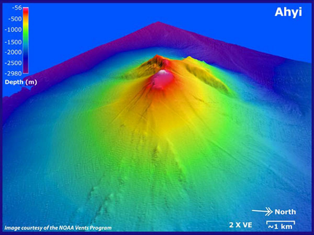
Ahyi seamount is a large conical submarine volcano that rises to within 75 m of the ocean surface ~18 km SE of the island of Farallon de Pajaros in the northern Marianas. Water discoloration has been observed there, and in 1979 the crew of a fishing boat felt shocks over the summit area, followed by upwelling of sulfur-bearing water. On 24-25 April 2001 an explosive eruption was detected seismically by a station on Rangiroa Atoll, Tuamotu Archipelago. The event was well constrained (± 15 km) at a location near the southern base of Ahyi. An eruption in April-May 2014 was detected by NOAA divers, hydroacoustic sensors, and seismic stations.
Sources : US Geological Survey , GVP.
Photo : Susan Merle (Oregon State University/NOAA Vents Program). GVP.
Japan , Suwanosejima :
The Japan Meteorological Agency (JMA) reported that eruptive activity at Suwanosejima’s Ontake Crater continued during 11-18 November. Crater incandescence was observed nightly in webcam images. A period of continuous ash emissions during 01h07-02h00 on 16 November produced ash plumes that rose as high as 1.5 km above the crater rim. An explosion was recorded at 11h27 and produced ash emissions that rose 300 m above the crater rim and entered weather clouds. Ash emissions continued, rising as high as 1.1 km above the cater rim, and ceased at 13h44. An eruptive event at 15h42 on 16 November generated an ash plume that rose 1 km above the crater rim and drifted W. An explosion at 16h19 generated an ash plume that rose 1.5 km above the crater rim and drifted W. No emissions were described from and explosion at 19h20. Ashfall was occasionally observed within a 1.5-km-radius according to the Suwanosejima Branch of the Toshima Village Office (3.5 km SSW). The Alert Level remained at 2 (on a 5-level scale) and the public was warned to stay at least 1.5 km away from the crater.
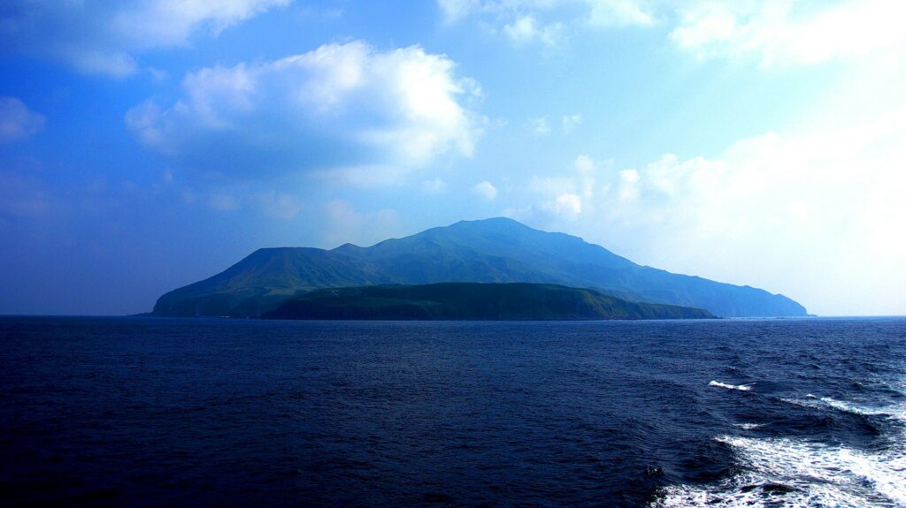
The 8-km-long island of Suwanosejima in the northern Ryukyu Islands consists of an andesitic stratovolcano with two active summit craters. The summit is truncated by a large breached crater extending to the sea on the E flank that was formed by edifice collapse. One of Japan’s most frequently active volcanoes, it was in a state of intermittent Strombolian activity from Otake, the NE summit crater, between 1949 and 1996, after which periods of inactivity lengthened. The largest recorded eruption took place in 1813-14, when thick scoria deposits covered residential areas, and the SW crater produced two lava flows that reached the western coast. At the end of the eruption the summit of Otake collapsed, forming a large debris avalanche and creating an open collapse scarp extending to the eastern coast. The island remained uninhabited for about 70 years after the 1813-1814 eruption. Lava flows reached the eastern coast of the island in 1884. Only about 50 people live on the island.
Source: Japan Meteorological Agency (JMA) , GVP.
Photo : / Wikipedia.
Indonesia , Lewotobi Laki-laki :
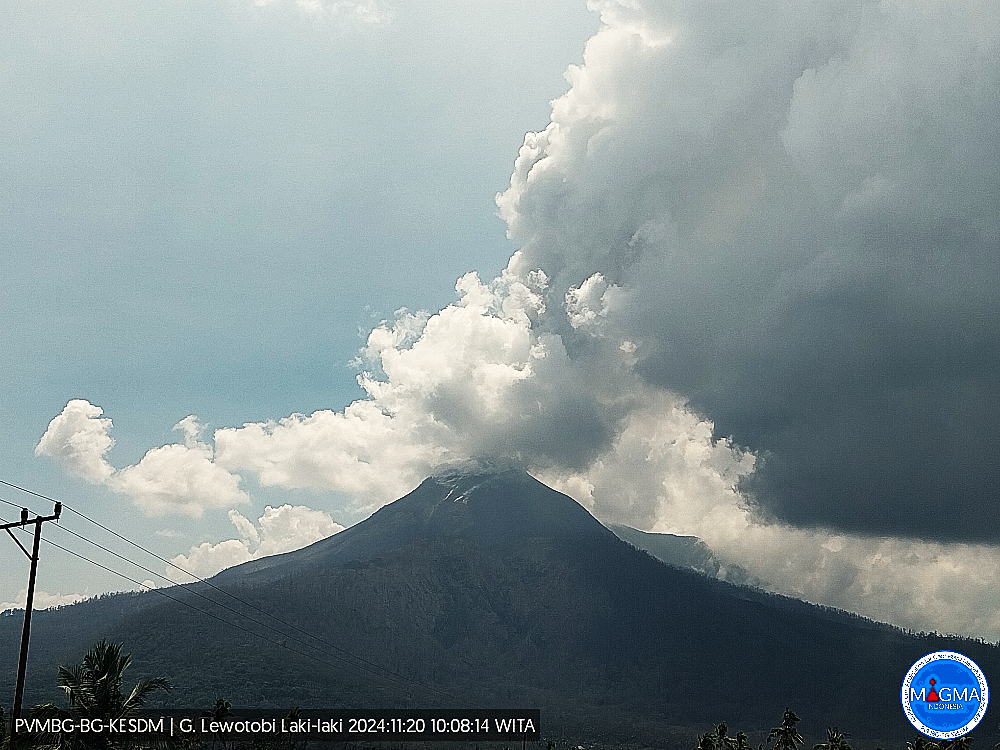
The Pusat Vulkanologi dan Mitigasi Bencana Geologi (PVMBG) reported that eruptive activity at Lewotobi Laki-laki remained at a high-level during 13-19 November, producing ash plumes, lava fountaining, and an advancing lava flow on the W flank, and continued to impact residents and transportation. Daily white-and-gray ash plumes rose as high as 2.5 km above the summit and drifted SW, W, and NW. According to the Darwin VAAC ash plumes rose 2.4-4.6 km (8,000-15,000 ft) a.s.l. during 13-16 November, or with maximum above-summit heights of 2.9 km on 13 November and 2.6 km during 14-16 November.
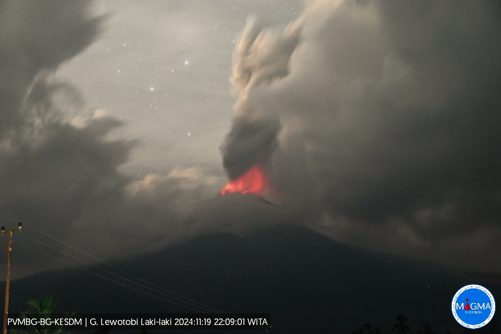
Webcam images captured during dark hours throughout the week often showed summit incandescence. A webcam image from 00h13 on 15 November captured either tall lava fountaining or the explosion of incandescent material high above the summit, and incandescent material descending the upper flanks. A webcam image from 00h18 on 17 November showed areas of incandescence on the distal part of the W flank lava flow. The flow advance towards Klatanlo Village (3 km NW) based on a drone overflight later that day. According to a news article BNPB stated that residents from Klatanlo Village will not be permitted to return to their homes due to unsafe conditions and will be relocated. The village will also be prone to potential lahars. Residents were prohibited within a radius of 7 km from the center of Laki-laki, though on 18 November the extended zone on the SW, W, and NW flanks was reduced to 8 km. Loud rumbling was reported on 19 November.
News articles noted that multiple domestic and international flights in and out of Lombok Airport were cancelled or rerouted on 13 November mainly due to ash from the 9-km-high ash plume produced on 12 November. The Komodo International Airport (313 km W), Frans Xavier Seda Airport (252 km W), H. Hasan Aroeboesman Airport (126 km WSW), and the Soa Airport (190 km W) remained closed, and tourists and residents continued to be moved to other islands by boat. On 14 November the Gusti Ngurah Rai International Airport (840 km W) cancelled 41 domestic and international flights. As of 20h00 on 15 November a total of 6,388 evacuees remained in evacuation shelters across six locations. By 18 November almost all airports had returned to normal operations; the Frans Xavier Seda Airport remained closed.
Sources: Pusat Vulkanologi dan Mitigasi Bencana Geologi (PVMBG, also known as CVGHM), Antara News, Antara News, Antara News, Antara News, Antara News, Antara News, Antara News, Antara News , GVP.
Photos : Magma Indonésie.
Mexico , Popocatepetl :
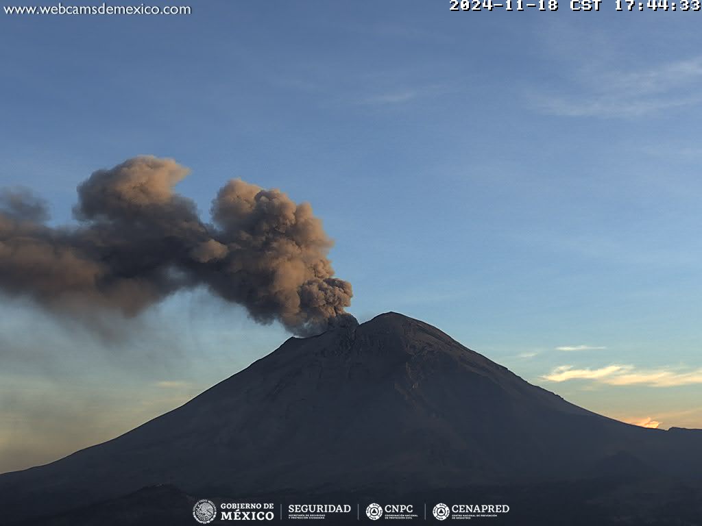
November 20, 11:00 (November 20, 17:00 GMT) , Activity in the last 24 hours:
12 exhalations were detected, accompanied by water vapor, volcanic gases and small amounts of ash. In addition, 41 minutes of low amplitude and high frequency tremor were recorded .
During the morning and at the time of this report, a continuous emission of water vapor, volcanic gases and ash was observed, with dispersion towards the Southwest (SW) of the crater .
The Popocatépetl volcanic alert fire is in yellow phase 2.
Centro Nacional de Prevención de Desastres (CENAPRED) reported that eruptive activity continued at Popocatépetl during 12-19 November. The seismic network recorded 11-52 long-period events per day that were accompanied by steam-and-gas emissions sometimes containing minor amounts of ash. The seismic network also recorded daily tremor, characterized at high-frequency and low-to-moderate amplitude, with periods lasting four hours and 54 minutes to as long as eight hours and five minutes. According to the Washington VAAC ash plumes were visible in webcam and satellite images during 13-16 November rising 5.8-7 km (19,000-23,000 ft) a.s.l. and drifting mostly SW, W, and NW and occasionally N and NNE. The Alert Level remained at Yellow, Phase Two (the middle level on a three-color scale) and the public was warned to stay 12 km away from the crater.
Sources : Centro Nacional de Prevencion de Desastres (CENAPRED), Washington Volcanic Ash Advisory Center (VAAC), GVP.
Photo : Cenapred

