November 19 , 2024.
Indonesia , Ibu :
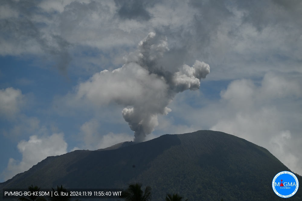
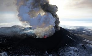
Mount Ibu erupted on Tuesday, 19 November 2024 at 23:55 WIT with the height of the ash column observed at ± 700 m above the summit (± 2025 m above sea level). The ash column was observed to be grey with a thick intensity, oriented towards the West. This eruption was recorded on a seismograph with a maximum amplitude of 15 mm and a duration of 47 seconds.
VOLCANO OBSERVATORY NOTICE FOR AVIATION – VONA
Issued : November 19 , 2024.
Volcano : Ibu (268030)
Current Aviation Colour Code : ORANGE
Previous Aviation Colour Code : orange
Source : Ibu Volcano Observatory
Notice Number : 2024IBU1113
Volcano Location : N 01 deg 29 min 17 sec E 127 deg 37 min 48 sec
Area : North Maluku, Indonesia
Summit Elevation : 4240 FT (1325 M)
Volcanic Activity Summary :
Eruption with volcanic ash cloud at 02h55 UTC (11h55 local).
Volcanic Cloud Height :
Best estimate of ash-cloud top is around 6480 FT (2025 M) above sea level or 2240 FT (700 M) above summit. May be higher than what can be observed clearly. Source of height data: ground observer.
Other Volcanic Cloud Information :
Ash cloud moving to west. Volcanic ash is observed to be white to gray. The intensity of volcanic ash is observed to be thick.
Remarks :
Eruption recorded on seismogram with maximum amplitude 15 mm and maximum duration 47 second.
Source : Magma Indonésie .
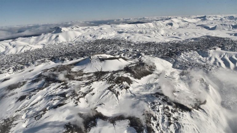
Chile , Puyehue-Cordon Caulle :
Seismology
The seismological activity of the period was characterized by the recording of:
75 VT type seismic events, associated with rock fracturing (Volcano-Tectonic). The most energetic earthquake had a Local Magnitude (ML) value equal to 2.7, located 4.7 km to the South-Southwest, at a depth of 4.8 km in reference to the 2011 crater.
5 LP type seismic events, associated with fluid dynamics within the volcanic system (Long Period). The size of the largest earthquake evaluated from the Reduced Displacement (DR) parameter was equal to 11 cm2.
Fluid Geochemistry
No anomalies have been reported in sulfur dioxide (SO2) emissions to the atmosphere in the area near the volcanic complex, according to data published by the Tropopheric Monitoring Instrument (TROPOMI) and the Ozone Monitoring Instrument (OMI) Sulphur Dioxide Group.
Satellite Thermal Anomalies
From Sentinel 2-L2A and Landsat 8-9 images, an area of greater thermal radiation is identified in the area surrounding the emission center of the 2011 eruption, where the laccolith is located, as well as other smaller areas associated with the thermal springs.
Geodesy
Geodetic observations, based on 2 operational GNSS stations installed in the volcanic area studied, show continuity in the inflationary process, observing in particular:
– Horizontal and vertical displacements maintain their trends compared to what was previously observed. The vertical increase shows an average rate of 1.8 cm/month, slightly higher than that of the previous month.
– The distance between the two stations tends to lengthen with a variation rate of 1.2 cm/month.
Based on the trends and directions of the displacements of the current period, continuity in the inflationary process is observed, indicating a permanent increase in pressure and/or volume inside the volcanic complex.
Surveillance cameras
The images provided by the surveillance cameras, installed near the volcanic complex, did not record any degassing columns or variations related to surface activity.
Satellite geomorphological analysis
No morphological changes attributable to volcanic activity are observed.
The seismic record remains low both in terms of occurrence and magnitude. Some subsequent analyses allow to observe the persistence in the mechanism and position of the seismic sources.
The inflationary deformation process continues at rates similar to those observed in recent months. Other superficial changes are not observed.
Due to the above, the volcanic technical alert is maintained in:
YELLOW TECHNICAL ALERT: Changes in the behavior of volcanic activity.
Source : Sernageomin
Photo : lmneuquen.
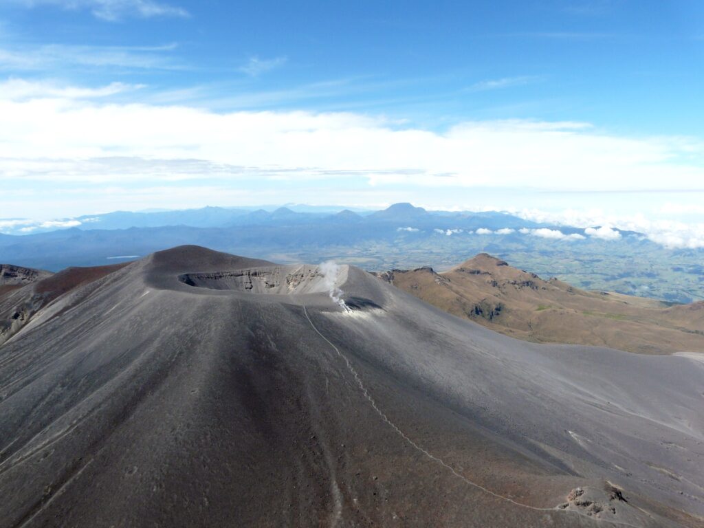
Colombia , Purace – Los Coconucos volcanic range:
Popayán, November 12, 2024, 3:30 p.m.
From the monitoring of the activity of the Puracé volcano – Los Coconucos volcanic chain, the Colombian Geological Survey (SGC), an entity attached to the Ministry of Mines and Energy, reports that:
In the week of November 5 to 11, 2024, seismic activity continued to record a significant number of events, mainly related to the transit of fluids towards the interior of the volcano. This seismicity presented low energy levels, similar to those observed in previous weeks, located under the building of the Puracé volcano, with depths of less than 2 km.
Most of the seismicity related to rock fracturing (VT type) was concentrated near the crater of the Puracé volcano and to the northeast of it, with depths of up to 6 km.
Regarding deformations, monitoring of volcanic gases, electromagnetic fields and acoustic sensors, no significant variation was observed. For their part, in the images captured by the installed webcams, it was observed that high degassing was maintained in the fumarole fields.
Based on the above, the SGC recommends closely monitoring the evolution of volcanic activity through weekly bulletins and other information published in official channels, as well as following the instructions of local and departmental authorities and the National Disaster Risk Management Unit (UNGRD).
The volcanic activity alert status remains at yellow alert: active volcano with changes in the behavior of the base level of monitored parameters and other manifestations.
Source et photo : SGC
Hawaii , Kilauea :
Tuesday, November 12, 2024, 10:17 AM HST (Tuesday, November 12, 2024, 8:17 PM UTC)
19°25’16″N 155°17’13″W,
Summit Elevation: 4,091 ft (1,247 m)
Current Volcanic Alert Level: ADVISORY
Current Aviation Color Code: YELLOW
Activity Summary:
Kīlauea Volcano is not erupting. Seismicity and ground deformation at the summit, East Rift Zone, and Southwest Rift Zone are low.
Summit Observations:
Seismic activity in the Kīlauea summit region remained low over the past week, with 19 earthquakes of magnitude 2.2 or less. The Uēkahuna tiltmeter, northwest of Kaluapele, the summit caldera, remained relatively flat with no significant changes over the past week. The Sand Hill tiltmeter, southwest of Kaluapele, continues to show slow inflation (about 2 microradians over the past week). The most recent measurement of the summit sulfur dioxide (SO2) emission rate was about 60 tons per day on September 17, a value representative of non-rupture conditions on Kīlauea.
Rift Zone Observations:
The number of shallow earthquakes in the upper and middle eastern rift zone (ERZ) has been low over the past week, with 25 earthquakes of magnitude 2 or less in the upper ERZ and 39 earthquakes of magnitude 2.2 and less in the middle ERZ. GPS instruments in the middle ERZ region show continued slow inflation and extension of this region over the past week.
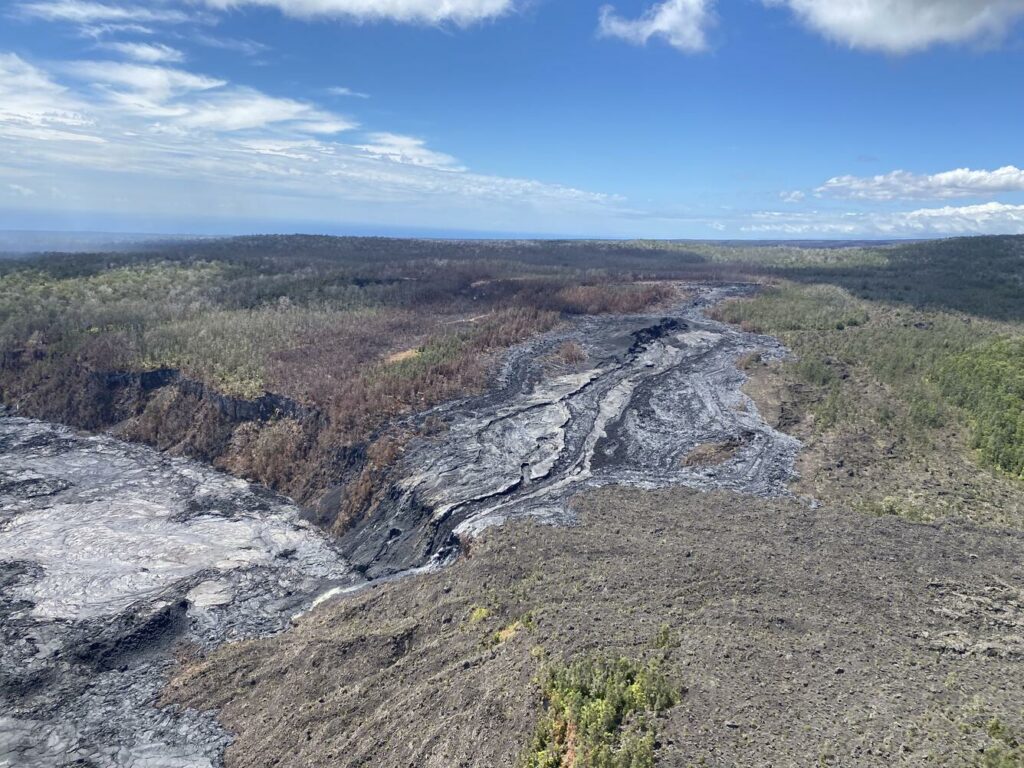
Recent eruptive activity has occurred in the middle eastern rift zone, in and near Nāpau Crater, between Makaopuhi Crater and Puʻuʻōʻō. There is no indication of downstream changes in the lower eastern rift zone.
Source : HVO
Photo : USGS / L. DeSmither ( 10/2024).
Costa Rica , Rincon de la Vieja / Poas :
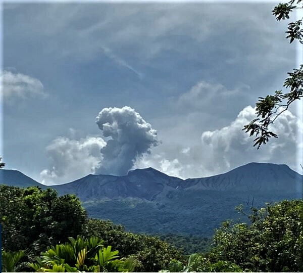
Rincón de la Vieja Volcano
Latitude: 10.83°N;
Longitude: 85.34°W;
Altitude: 1916 m
Current Activity Level: Warning
This week, 4 eruptions and two expirations were recorded. These eruptive manifestations are rich in volcanic gases, water vapor and aerosols. None of them generated lahars or ash emissions. The energy of these eruptive events has shown a slight increase since October 28. The sequence of banded tremors that began on November 8 continued until November 11. On November 13 between 9:00 and 10:00 31 volcano-tectonic earthquakes were recorded south of the active crater with depths between 3 and 4 km. The appearance of long-period signals and « tornillos » type signals continues.
The dominant frequency of « tornillos » shows a similar trend to last week. Last week, geodetic stations did not detect any significant deformation. The MultiGas station recorded a weekly average of 1.3 ± 0.6 for CO2/SO2 and 0.08 ± 0.02 for H2S/SO2, typical compositions of gases originating from surface magma. During the last week, the plume direction on the volcano was not favorable for calculating the SO2 flux using the NOVAC stations. No atmospheric SO2 detections have been made by the Sentinel-5P satellite since October 19.
Poas Volcano
Latitude: 10.20°N;
Longitude: 84.23°W;
Altitude: 2687 m
Current activity level: Warning
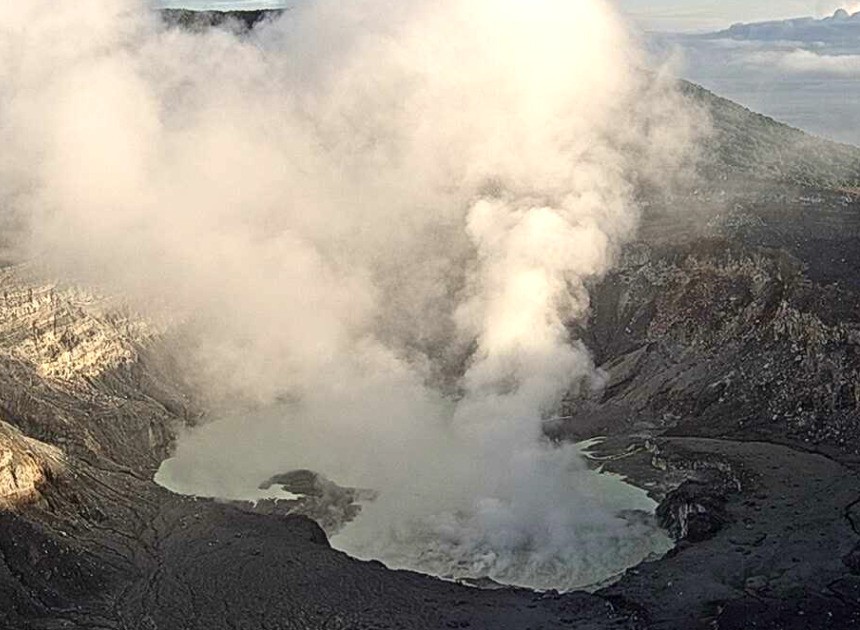
The seismic tremor remains of moderate to low amplitude and very stable. Frequent LP (long period) type seismic events with low frequency and low amplitude are recorded. The number of LP events has been increasing in recent weeks. On November 12, in the early morning, three signals, mainly acoustic but also seismic, were detected. Analyses indicate sources to the South-Southeast of the active crater, possibly landslides linked to soil saturation due to the intense rains of last week. Geodetic observations do not detect any significant deformation.
Moderate convection of Poas mouth A.
The MultiGas station recorded weekly averages of 0.6 ± 0.1 for SO2/CO2 and 0.03 ± 0.01 for H2S/SO2. This week, at the visitors’ point of view, SO2 values up to 2 ppm were recorded. During the last week, the direction of the volcanic plume was not favorable for calculating the SO2 flux using the NOVAC station. SO2 was detected in the atmosphere by the Sentinel-5P satellite several times this week and could be measured on November 9. The lake level rose again this week with a significant increase of approx. 0.4 m.
Source : Ovsicori.
Photos : CNE ( 2020 ) , Ovsicori ( 18/11) .

