November 03 , 2024.
Italy , Stromboli :
Statement on the activity of Stromboli, 02 November 2024, 19:05 (18:05 UTC)
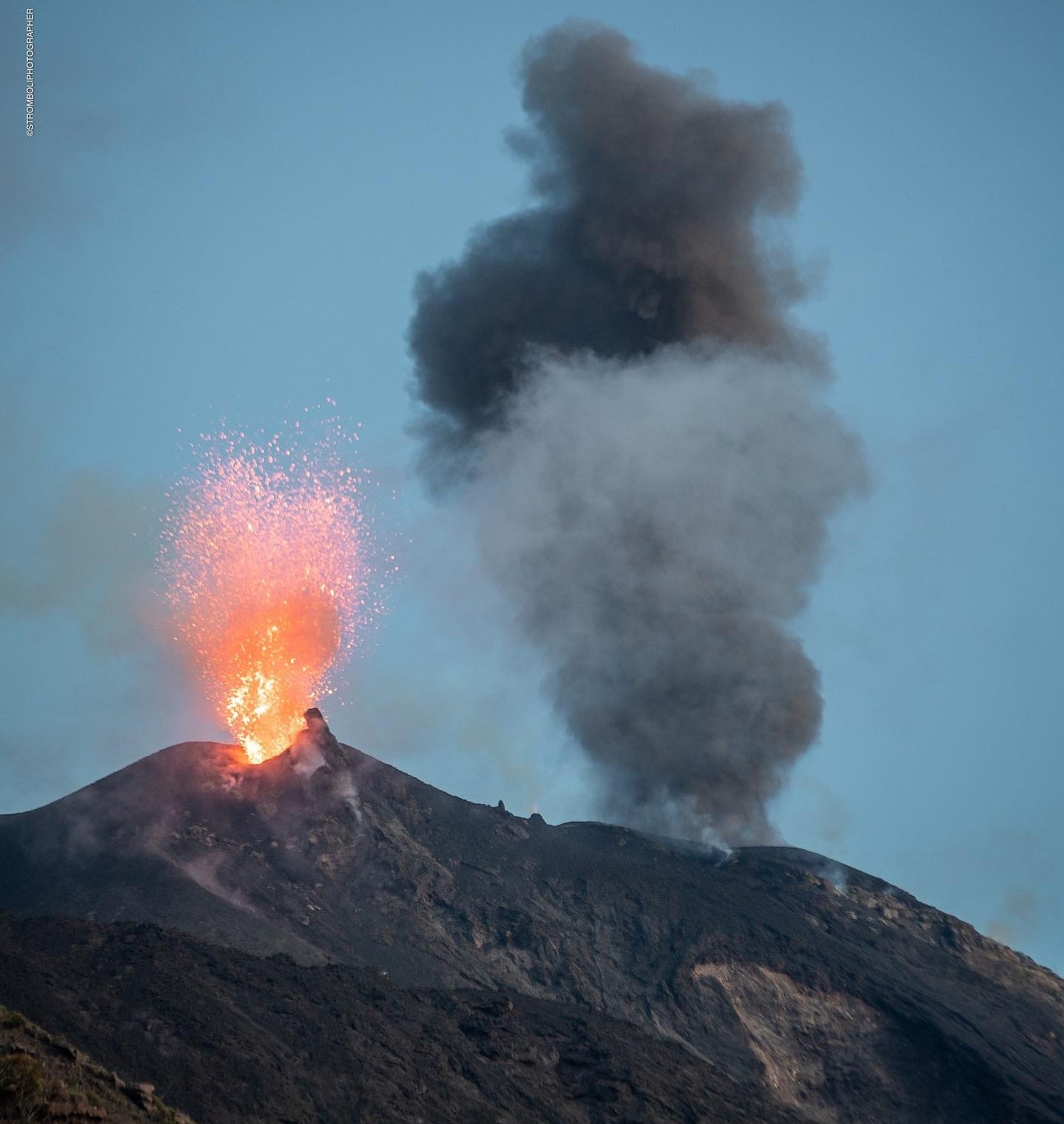
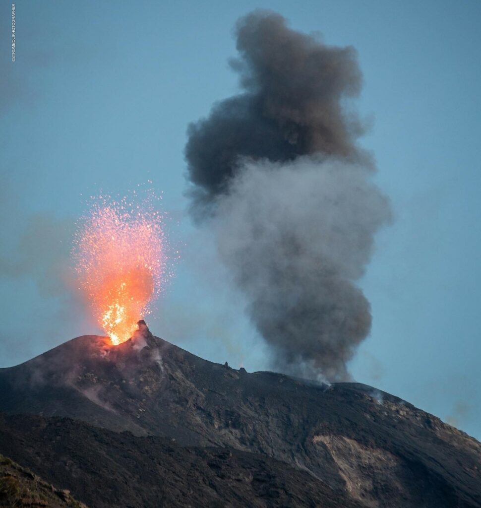
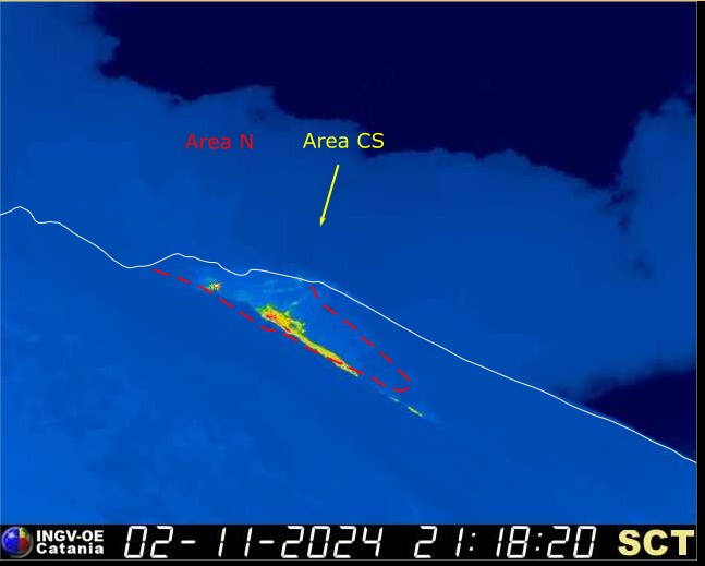
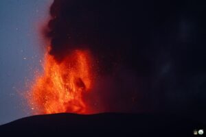
The National Institute of Geophysics and Volcanology, Osservatorio Etneo, reports that, from the images of the INGV-OE surveillance cameras, it can be observed that at 14:20 UTC a sequence of explosions of higher energy than normal began, with a first event in the area of the North crater, followed immediately by another in the same area, and at 14:21 UTC by an event in the area of the Center-South crater. The first event caused the sliding of hot materials inside the furrow dug during the activity of July 2024 in the upper part of the Sciara del Fuoco.
Following this latest explosion, a lava overflow started from the northern area of the crater, still ongoing, with an active lava front in the upper part of the Sciara del Fuoco.
From a seismic point of view, from about 14:18 UTC, a succession of seismic transients related to explosive activity was observed, the most energetic of which were recorded at 14:20 and 14:21 UTC. This phase was accompanied by a sudden increase in the average tremor amplitude, which went from a high level to a very high level, and then quickly returned to the previous level. No significant changes were reported in the frequency of occurrence and amplitude of explosion earthquakes.
Regarding ground deformations, the Timpone Del Fuoco (TDF) inclinometer station recorded an overall amplitude variation of 0.5 microradians at 14:20. No significant changes were recorded at the GNSS stations.
Further updates will be communicated shortly.
Source : INGV
Photos : Stromboli stati d’animo / Sebastiano Cannavo
Mexico , Popocatepetl :
November 2, 11:00 (November 2, 17:00 GMT) , Activity in the last 24 hours
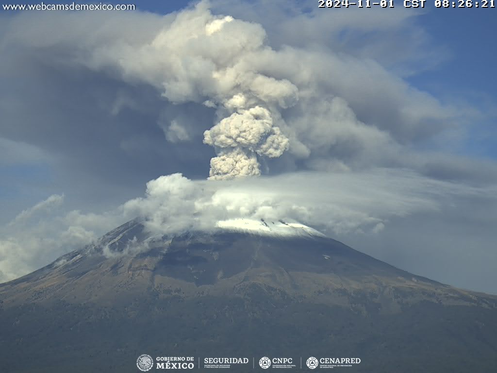
28 exhalations were detected, accompanied by water vapor, volcanic gases and ash. In addition, 1,224 minutes of high-frequency tremors of low to medium amplitude were recorded.
The National Center for Communication and Civil Protection Operations (Cenacom) reported yesterday a slight ash fall in Ozumba, in the State of Mexico; Tlaxcala, Chiautempan, Papalotla and Zacatelco in the state of Tlaxcala.
At the time of this report, there is no visibility towards the volcano, due to cloudy conditions in the area, however, during the early morning hours, the continuous emission of water vapor and volcanic gases could be seen scattered towards the North.
The Popocatépetl volcanic alert fire is in yellow phase 2.
The scenarios anticipated for this phase are:
A few small to moderate explosions
Occurrence of tremors of varying amplitude
Light to moderate ash rains in the surrounding towns and in some more distant towns
Ejection of incandescent fragments within the 12-kilometer exclusion radius
The occurrence of lahars can be expected to descend into the ravines, due to the accumulation of ash on the slopes and their interaction with the rains expected in the coming weeks.
Possibility of pyroclastic flows not reaching the populations
Source et photo : Cenapred.
Indonesia , Merapi :
MOUNT MERAPI ACTIVITY REPORT, October 17 to October 24, 2024, Published on October 25, 2024
OBSERVATION RESULT
Visual
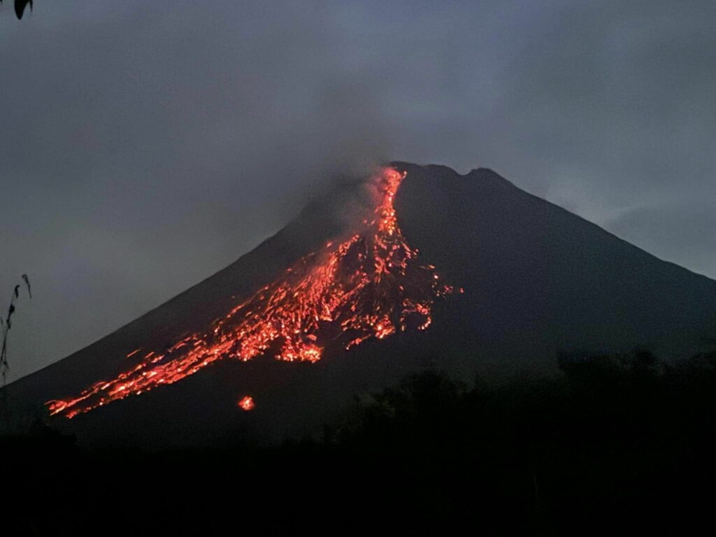
The weather around Mount Merapi is generally clear in the morning and night, while it is foggy from noon to evening. White smoke, thin to thick, low to moderate pressure and 300 m high was observed from Mount Merapi Babadan observation post on October 26, 2024 at 05:28 WIB. This week, lava avalanches were observed 130 times upstream of the Bebeng River up to a maximum of 2000 m. The sound of avalanches was heard 9 times from Babadan post with low to moderate intensity.
The morphology of the Southwest dome was observed to change due to dome growth activities, lava avalanches and hot cloud avalanches. Based on the analysis of aerial photos dated October 24, 2024, the volume of the Southwest dome was measured at 3,077,000 m3 and that of the Central dome at 2,361,800 m3.
Seismicity
This week, the seismicity of Mount Merapi recorded:
508 multi-phase (MP) earthquakes,
1 low-frequency (LF) earthquakes,
1037 avalanche (RF) earthquakes,
7 tectonic (TT) earthquakes.
The intensity of earthquakes this week is higher than last week.
Deformation
The deformation of Mount Merapi monitored by EDM this week showed a relatively similar average shortening rate to last week.
Rainfall and Lahars
This week, there was rain at the Mount Merapi observation post with a rainfall intensity of 56 mm/hour for 90 minutes at Kaliurang post on 30 October 2024. No additional flows or lahars were reported in the rivers that originate on Mount Merapi.
Conclusion
Based on the results of visual and instrumental observations, it was concluded that:
The volcanic activity of Mount Merapi is still quite high in the form of effusive eruptive activity. The activity status is set at the « SIAGA » level.
Source : BPPTKG
Photo : Maud Charlatte ( 03/10 /2024).
Ecuador , El Reventador :
DAILY STATE REPORT OF THE REVENTADOR VOLCANO , Saturday, November 02, 2024.
Information Geophysical Institute – EPN.
Surface Activity Level: High , Surface Trend: No changes
Internal Activity Level: Moderate , Internal Trend: No changes
From November 01, 2024, 11:00h to November 02, 2024, 11:00h :
Seismicity:
The count of seismic events recorded at the station is detailed below.
Explosion (EXP) 104
Long Period (LP) 12
Emission Tremor (TREMI) 9
Harmonic Tremor (TRARM) 7
Rainfall / Lahars:
Yesterday afternoon, moderate rainfall was recorded. No mud and/or debris flows were generated. **Heavy rainfall could remobilize the accumulated materials and generate mud flows with debris (lahars), which could descend on the flanks of the volcano and flow into adjacent rivers**.
Emissions/ash column:
Due to technical transmission problems, it was not possible to observe emissions using surveillance cameras. On the other hand, thanks to the GOES-16 satellite system, two gas and ash trails were detected at night and in the morning, in a South and South-Southeast direction, with heights below 1000 meters above the crater level. In relation to this activity, the VAAC agency in Washington issued three reports of ash clouds, in a southeast and southwest direction, with heights of 700 meters above the crater level. In addition, since yesterday afternoon, the staff of the Geophysical Institute reported several episodes of gas and ash in a southwest, southeast and south-southeast direction with heights between 500 and 1000 meters above the crater level.
In addition, based on these emissions, yesterday evening (20:18 TL), citizen reports reported a slight ash fall in the San Luís sector, located southeast of the Reventador volcano in the Napo province and in the sectors surrounding the volcano. It is recommended to take appropriate measures and receive information from official sources.
Other monitoring parameters:
Satellite platforms: FIRMS: detected 8 thermal anomalies, MIROVA-MODIS: 2 thermal anomalies and MIROVA-VIIRS: 2 thermal anomalies.
Observation:
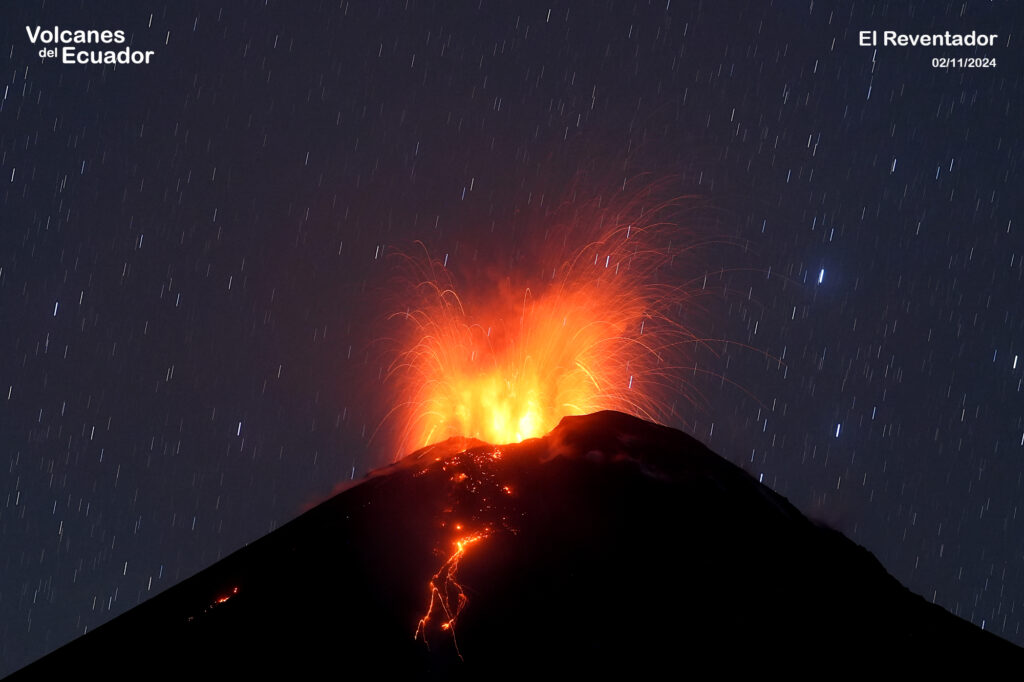
During the night, the staff of the Institute of Geophysics observed 2 episodes of collapse of the lava front on the East and South-East flanks. Similarly, they reported this morning the descent of a small pyroclastic flow on the East flank. Thanks to satellite monitoring, since yesterday afternoon until the closing of this report, the sector remains partly cloudy
Alert level: Orange
Source : IGEPN
Photo : Benjamin Bernard / Volcanes del Equateur , 2/11/2024
Hawaii , Kilauea :
Saturday, November 2, 2024, 6:46 AM HST (Saturday, November 2, 2024, 16:46 UTC)
19°25’16 » N 155°17’13 » W,
Summit Elevation 4091 ft (1247 m)
Current Volcano Alert Level: ADVISORY
Current Aviation Color Code: YELLOW
Activity Summary:
Kīlauea volcano is not erupting. Weak steaming is occasionally visible from the inactive September 15–20 lava flow field within and adjacent to Nāpau Crater in the middle East Rift Zone. Earthquake counts in the summit region and upper East Rift Zone remain slightly above background levels; elsewhere on Kīlauea, seismicity remains low. No changes have been detected at the summit, in the lower East Rift Zone, or in the Southwest Rift Zone, and an offshore earthquake swarm at Kama‘ehuakanaloa volcano (formerly Lō‘ihi Seamount) last night had no apparent effect on Kīlauea.
Summit Observations:
Earthquake counts in Kīlauea’s summit region remain slightly above background levels. Tiltmeters at Uēkahuna and Sand Hill—respectively northwest and southwest of Kaluapele, the summit caldera—have shown no significant changes over the past day. The most recent measurement of the sulfur dioxide (SO2) emission rate from the summit was approximately 60 tonnes per day on September 17, a value representative of noneruptive conditions at Kīlauea.
Rift Zone Observations:
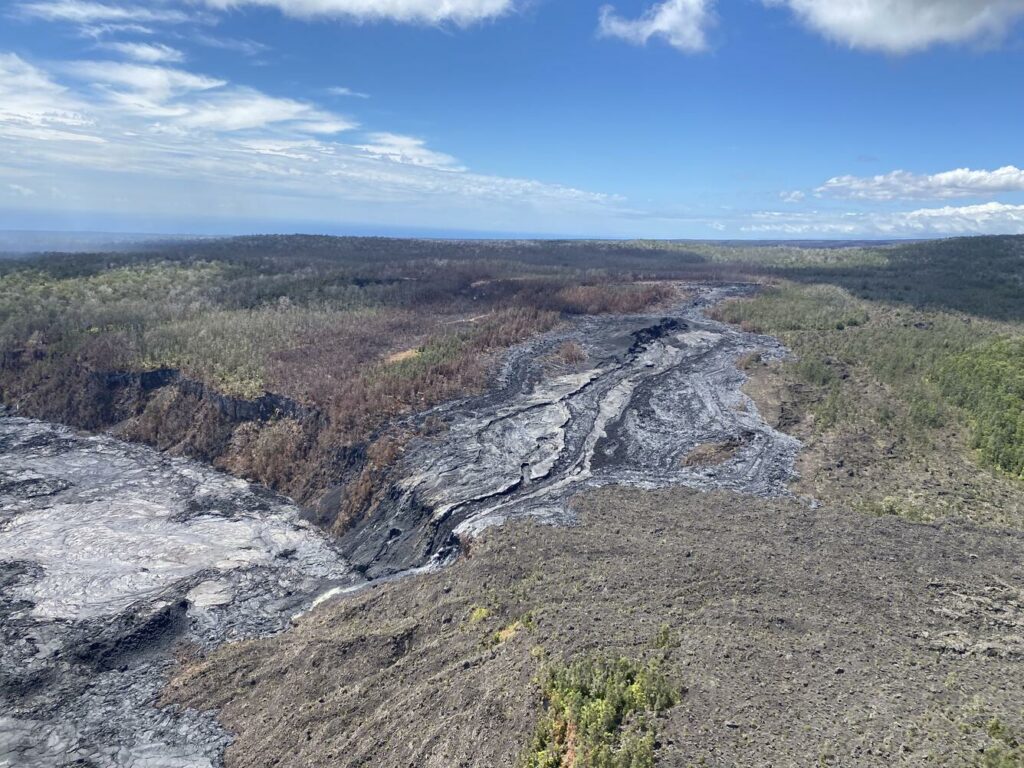
The recent middle East Rift Zone eruption near Nāpau Crater stopped on September 20. Only occasional, weak steaming from the eruption site has been seen in webcam imagery since that time. No SO2 from the eruption site was detected on September 23 during measurements along Chain of Craters Road, indicating that SO2 emissions from the middle East Rift Zone are negligible.
Shallow earthquake counts in the upper East Rift Zone remain slightly above background levels, while counts in the middle East Rift Zone remain low. No tremor has been recorded on seismometers near the recent eruption site since September 20. Tiltmeters and GPS instruments in the area show low rates of deformation at this time.
All recent unrest was confined to the middle East Rift Zone between Makaopuhi Crater and Puʻuʻōʻō, and there are no indications of any changes downrift in the lower East Rift Zone.
Source : HVO
Photo : USGS / L. DeSmither. ( 11/10/2024).

