October 30 , 2024.
Italy / Sicily , Etna :
WEEKLY BULLETIN, from October 21, 2024 to October 27, 2024. (issue date October 29, 2024)
SUMMARY STATUS OF ACTIVITY
In light of the monitoring data, it emerges:
1) VOLCANOLOGICAL OBSERVATIONS: Degassing activity at the summit craters, low intra-crater explosive activity of the Northeast crater and sporadic and modest ash emission from the Southeast crater.
2) SEISMOLOGY: Low seismic activity due to fracturing. Average amplitude of volcanic tremor in the middle and low levels.
3) INFRASOUND: Low infrasound activity.
4) GROUND DEFORMATIONS: Ground deformation monitoring networks have not recorded significant variations
5) GEOCHEMISTRY: SO2 flux at medium level
The soil CO2 flux is at medium values.
The partial pressure of dissolved CO2 in groundwater has values within the seasonal variability.
The Helium isotope ratio in peripheral sites is at high values, last updated on 10/14/2024
6) SATELLITE OBSERVATIONS: The thermal activity observed by satellite in the summit area was generally low level with some moderate level thermal anomalies.
VOLCANOLOGICAL OBSERVATIONS
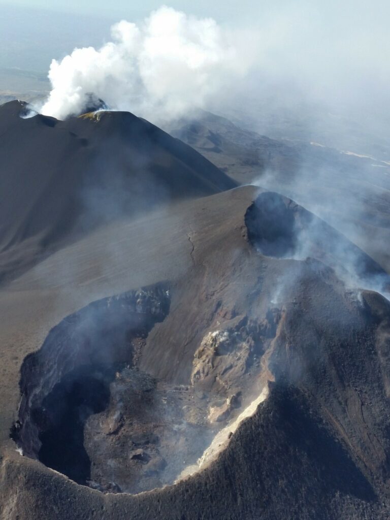
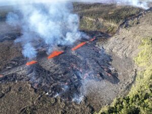
During the week, the monitoring of the volcanic activity of Etna was carried out through the analysis of the images acquired by the surveillance camera network of the National Institute of Geophysics and Volcanology, Osservatorio Etneo . Although the observations were carried out irregularly due to the weather conditions, no changes were detected during the visibility windows compared to what had been reported in the previous period. In detail, the state of volcanic activity of Etna continues to be characterized by a modest intra-crater explosive activity of the North-East crater and by the appearance of episodic and light ash emissions from the South-East crater . As for the Bocca Nuova and Voragine craters, their activity is dominated by a state of degassing with variable regime and intensity.
SEISMOLOGY
The seismicity related to the fracturing processes was characterized by a low level of activity: no earthquakes with a magnitude equal to or greater than 2.0 were recorded.
During the week, the average amplitude of the volcanic tremor showed medium-low values. The locations of the centroids of the sources of the volcanic tremor concerned the areas of the North-East crater and the Voragine crater, in a depth range mainly between 2500 and 3000 m above mean sea level, showing a clear superficiality for the sources located under the Voragine crater
Source : INGV
Photo : Joseph Nasi (8/2024)
Italy , Stromboli :
WEEKLY BULLETIN, from October 21, 2024 to October 27, 2024. (issue date October 29, 2024)
SUMMARY STATUS OF ACTIVITY
In light of the monitoring data, it emerges:
1) VOLCANOLOGICAL OBSERVATIONS: During this period, intense eruptive activity with splashes was observed from the northern area of the crater. The total hourly frequency was oscillating between average values (8-10 events/h). The intensity of the explosions was low in the northern crater area and medium to high in the central-southern area.
2) SEISMOLOGY: The monitored seismological parameters do not show significant variations.
3) GROUND DEFORMATIONS: The island’s ground deformation monitoring networks did not show any significant changes to report for the period under review.
4) GEOCHEMISTRY: SO2 flux between medium – medium-high and increasing
CO2 flux from the ground: under verification.
CO2/SO2 ratio in the plume: between high and very high values.
Helium isotope ratio in the thermal aquifer: in medium values
CO2 flow at Mofeta in the San Bartolo area: variable between medium and high values.
CO2 flow at Scari: stable values around 160 g/m2/day.
5) SATELLITE OBSERVATIONS: The thermal activity observed by satellite in the summit area was generally low.
VOLCANOLOGICAL OBSERVATIONS
During the observed period, the eruptive activity of Stromboli was characterized through the analysis of images recorded by the INGV-OE surveillance cameras located at an altitude of 190 m (SCT-SCV) and at Punta dei Corvi (SPCT). The explosive activity was mainly produced by 4 (four) eruptive vents located in the northern area of the crater and by 2 (two) vents located in the central southern area.
Observations of the explosive activity captured by the surveillance cameras
In the area of the northern crater (N), four active vents were observed that produced explosive activity of low intensity (less than 80 m in height) and sometimes medium (less than 150 m in height).
In addition, splashes were observed, sometimes intense on October 23. The products emitted in eruption were mainly coarse materials (bombs and lapilli). The average frequency of explosions ranged from 5 to 9 events/h.
In the Centre-South (CS) area, explosive activity was produced by at least two vents, the explosions were of variable intensity ranging from medium (less than 150 m in height) to high (more than 250 m in height) emitting fine materials mixed with coarse materials. The average frequency of explosions ranged from 1 to 3 events/h.
Source : INGV
Photo : Stromboli stati d’animo / Sebastiano Cannavo
Indonesia , Lewotobi Laki-laki :
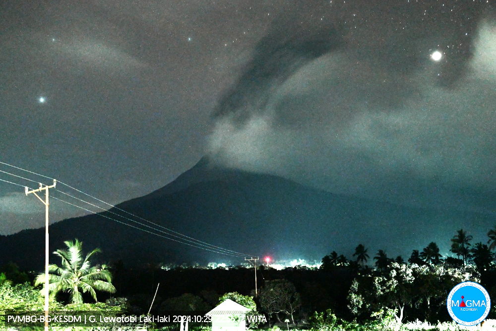
An eruption of Lewotobi Laki-laki occurred on Tuesday, October 29, 2024 at 22:51 WITA with the height of the ash column observed at ± 800 m above the summit (± 2384 m above sea level). The ash column was observed to be gray in color with a thick intensity, oriented towards the Southwest. This eruption was recorded on a seismograph with a maximum amplitude of 7.4 mm and a duration of 357 seconds.
VOLCANO OBSERVATORY NOTICE FOR AVIATION – VONA
Issued : October 29 , 2024
Volcano : Lewotobi Laki-laki (264180)
Current Aviation Colour Code : ORANGE
Previous Aviation Colour Code : orange
Source : Lewotobi Laki-laki Volcano Observatory
Notice Number : 2024LWK694
Volcano Location : S 08 deg 32 min 20 sec E 122 deg 46 min 06 sec
Area : East Nusa Tenggara, Indonesia
Summit Elevation : 5069 FT (1584 M)
Volcanic Activity Summary :
Eruption with volcanic ash cloud at 14h51 UTC (22h51 local).
Volcanic Cloud Height :
Best estimate of ash-cloud top is around 7629 FT (2384 M) above sea level or 2560 FT (800 M) above summit. May be higher than what can be observed clearly. Source of height data: ground observer.
Other Volcanic Cloud Information :
Ash cloud moving to southwest. Volcanic ash is observed to be gray. The intensity of volcanic ash is observed to be thick.
Remarks :
Eruption recorded on seismogram with maximum amplitude 7.4 mm and maximum duration 357 second.
Source et photo : Magma Indonésie.
Chile , Descabezado Grande :
Special Report on Volcanic Activity (REAV), Del Maule Region, Descabezado Grande Volcanic Complex, October 29, 2024, 14:20 local time (Continental Chile)
The National Geology and Mining Service of Chile (Sernageomin) announces the following PRELIMINARY information, obtained through the monitoring equipment of the National Volcanic Monitoring Network (RNVV), processed and analyzed at the Volcanological Observatory of the Southern Andes (Ovdas):
On Tuesday, October 29, 2024 at 13:59 local time (16:59 UTC), monitoring stations installed near the Descabezado Grande volcanic complex recorded an earthquake associated with the fracturing of rocks within the volcanic system (VT volcano-tectonic type).
The earthquake characteristics after its analysis are as follows:
TIME OF ORIGIN: 13:59 local time (16:59 UTC)
LATITUDE: 35.585° S
LONGITUDE: 70.756° West
DEPTH: 3.2 km
LOCAL MAGNITUDE: 3.1 (ML)
Observations:
No changes in the seismic behavior of the volcano were recorded after the event.
The volcanic technical alert remains at Orange level.
Source : Sernageomin.
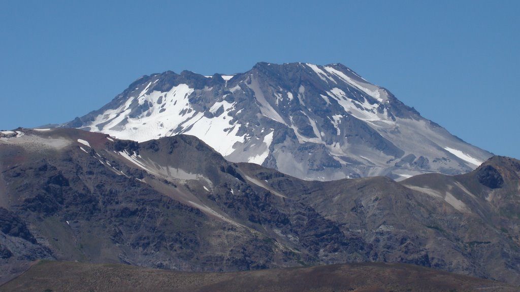
Photo : Sernageomin ( 2017) .
Ecuador , El Reventador :
DAILY STATE REPORT OF THE REVENTADOR VOLCANO , Tuesday, October 29, 2024.
Information Geophysical Institute – EPN.
Surface Activity Level: High , Surface Trend: No Change
Internal Activity Level: Moderate , Internal Trend: No Change
From October 28, 2024, 11:00 a.m. to October 29, 2024, 11:00 a.m.:
Seismicity:
The count of seismic events recorded at the station is detailed below.
Explosion (EXP) 102
Long Period (LP) 16
Emission Tremor (TREMI) 34
Harmonic Tremor (TRARM) 3
Rainfall / Lahars:
Since yesterday afternoon, thanks to satellite image monitoring and weather forecasts, the presence of moderate rains has been observed in the volcano area, without generating mud or debris flows. **In the event of heavy rains, these could remobilize the accumulated materials, generating mud and debris flows that would descend the sides of the volcano and flow into adjacent rivers.
Emissions / ash column:
Since yesterday, no gas or ash emissions have been recorded according to satellite image monitoring. In connection with this low activity, the W-VAAC agency has not issued activity reports for the volcano in the last 24 hours.
Other monitoring parameter:
In the last 24 hours, the MIROVA-MODIS satellite system detected 1 moderate thermal anomaly, while MIROVA-VIIRS detected 1 weak thermal anomaly.
Observation:
Since yesterday, due to unfavorable weather conditions, the volcano has been observed to remain cloudy most of the time following monitoring of satellite images and weather forecast media.
Alert Level: Orange
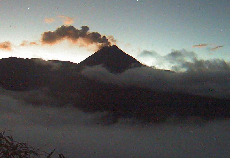
Source et photo : IGEPN

