October 18 , 2024 .
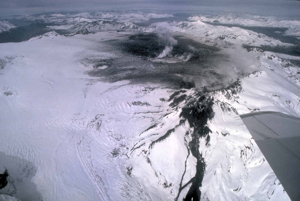
Kamchatka , Karymsky :
VOLCANO OBSERVATORY NOTICE FOR AVIATION (VONA)
Issued: October 17 , 2024
Volcano: Karymsky (CAVW #300130)
Current aviation colour code: ORANGE
Previous aviation colour code: orange
Source: KVERT
Notice Number: 2024-86
Volcano Location: N 54 deg 2 min E 159 deg 26 min
Area: Kamchatka, Russia
Summit Elevation: 1486 m (4874.08 ft)

Volcanic Activity Summary:
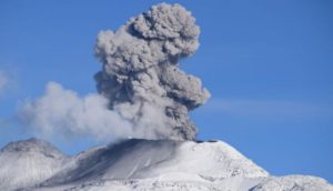
Explosions sent ash up to 3 km a.s.l. at 19:45 UTC on 17 October; to 20:10 UTC ash cloud rose up to 6 km a.s.l., and at 22:10 UTC ash cloud was at 3 km a.s.l. for 180 km to the east-southeast of the volcano.
A moderate activity of the volcano continues. Ash explosions up to 10 km (32,800 ft) a.s.l. could occur at any time. Ongoing activity could affect international and low-flying aircraft.
Volcanic cloud height:
6000 m (19680 ft) AMSL Time and method of ash plume/cloud height determination: 20241017/2010Z – Himawari-9 14m15
Other volcanic cloud information:
Distance of ash plume/cloud of the volcano: 46 km (29 mi)
Direction of drift of ash plume/cloud of the volcano: ENE / azimuth 67 deg
Time and method of ash plume/cloud determination: 20241017/2010Z – Himawari-9 14m15
Source : Kvert.
Photo : N. Gorbach, IVS FEB RAS. ( 2021)
Indonesia , Lya ( Endeh Api ) :
Increased activity of G. lya from level I (normal) to level II (WASPADA)
Lya volcano is administratively located in Ende Regency, East Nusa Tenggara Province and geographically, its summit is located at 8.897 0 S latitude, 121.6450 E longitude and has a height of 637 m above sea level.
The characteristics of G. Lya eruptions generally occur in the main crater through magmatic eruptions that produce volcanic ash, ejections of incandescent rocks and lava flows accompanied by collapses at the summit of Mount Lya. Fissures develop around the active crater of Mount Lya, indicating a weak zone inside the volcano, which may cause a major landslide to the sea during a future eruption of Mount Lya.
The evolution of G. lya activity from 1 July 2024 to 16 October 2024 is as follows:
Visual monitoring of lya for the period from 1 July 2024 to 16 October 2024, notes that the volcano was clearly visible until it was covered by fog, white smoke from the main crater was observed with low to medium-high intensity around 50 to 300 m above the summit.
The earthquakes recorded between 1 July 2024 and 16 October 2024 were 233 deep volcanic earthquakes, 160 local tectonic earthquakes, 1 felt earthquake, and 127 deep tectonic earthquakes.
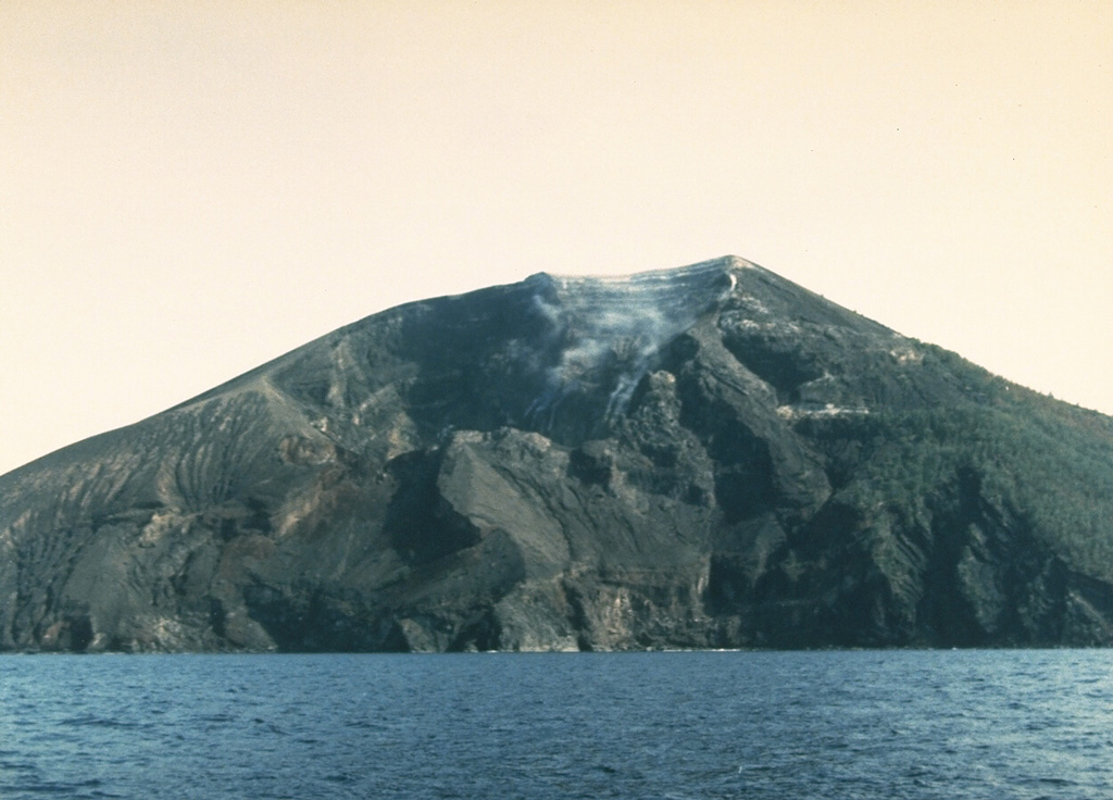
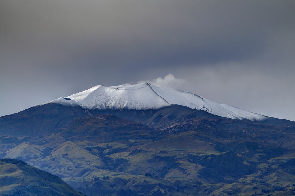
The southern side of the small Iya volcano in central Flores with a weak plume rising from a crater near the summit. Gunung Iya is the southernmost of three volcanoes forming a small peninsula south of Ende.
The seismicity of G. Iya is dominated by deep volcanic earthquakes. The deep volcanic earthquake was associated with magmatic activity beneath the Puncak crater of G. Iya.
The seismicity records of G. Iya for the period August to October 16, 2024 indicate that the recorded deep volcanic and local tectonic seismicity increased significantly compared to the seismicity from July 1 to 31, 2024. This increase in seismicity could indicate an increase in pressure within the body of G. Iya due to increased magmatic activity, which can trigger shallow earthquakes, which can cause eruptions.
You should be careful if a large-magnitude tectonic earthquake is recorded around Mount Iya, as it will affect the volcanic activity of Mount Iya.
Based on the results of visual and instrumental monitoring of G. Iya showing increased activity and potential hazard threats, the activity level of G. Iya has been increased from Level I (normal) to Level II (WASPADA), starting from 17 October 2024 at 08:00 WITA with recommendations adapted to the latest potential hazard threats.
Mount Lya Activity Level at Level II (WASPADA),
Gunung Iya is the southernmost of a group of three volcanoes comprising a small peninsula south of the city of Ende on central Flores Island. The cones to the north, Rooja and Pui, appear to be slightly older and have not shown historical activity, although Pui has a youthful profile (a reported 1671 eruption of Pui was considered to have originated from Iya volcano). Iya, whose truncated southern side drops steeply to the sea, has had numerous moderate explosive eruptions during historical time.
Source : PVMBG , GVP .
Photo : Ruska Hadian, 1985 (Volcanological Survey of Indonesia).
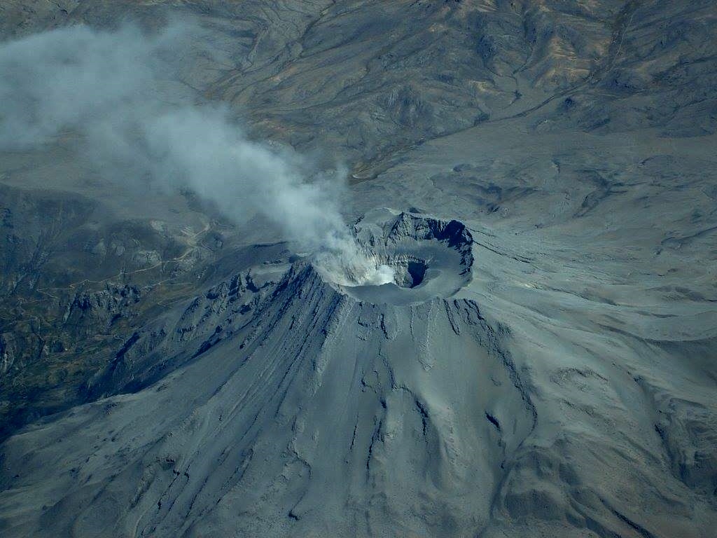
Chile , Hudson :
Special Report on Volcanic Activity (REAV), Aysen Del General Carlos Ibanez Del Campo region, Hudson Volcano, October 17, 2024, 6:45 p.m. local time (continental Chile).
The National Geology and Mining Service of Chile (Sernageomin) publishes the following PRELIMINARY information, obtained through the monitoring equipment of the National Volcanic Monitoring Network (RNVV), processed and analyzed at the Southern Andean Volcanological Observatory (Ovdas):
Since Wednesday, October 16, 2024, from 12:00 local time (15:00 UTC), an increase in the seismic parameters of the Hudson Volcano has been recorded, mainly the seismicity associated with rock fracturing (volcano-tectonics), counting at the time of this report a total of 160 events of this type.
The highest energy volcano-tectonic earthquake occurred on October 17, 2024, at 14:16 local time (17:16 UTC), with a local magnitude (LM) of 2.5. The event was located 2.9 km east-southeast of the caldera center, with a depth of 4.4 km.
In addition, on October 17, 2024, at 16:38 local time (19:38 UTC), an earthquake associated with fluid dynamics inside the volcanic system (long-period) with a reduced displacement value of 212 cm2 was noted. This earthquake was located in the southeast sector, inside the volcanic caldera.
OBSERVATIONS:
Vigilance continues for a possible evolution of the present process.
The volcanic technical alert remains at the Green level.
Sources : Sernageomin.
Photo :Norm Banks, 1991 (U.S. Geological Survey).
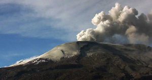
Colombia , Puracé – Los Coconucos volcanic chain :
Popayán, October 15, 2024, 3:30 p.m.
From the monitoring of the activity of the Puracé volcano – Los Coconucos volcanic chain, the Colombian Geological Survey (SGC), an entity attached to the Ministry of Mines and Energy, reports that:
During the week of October 8 to 14, seismic activity continued to record a significant number of events. The seismicity associated with fluid dynamics inside the volcano presented energy levels similar to those observed the previous week and was located under the building of the Puracé volcano, at depths of less than 1 km. The seismicity related to rock fracturing (type VT) did not show any notable magnitude and was concentrated mainly near the crater of the Puracé volcano, as well as below the Piocollo volcano, with depths of up to 3 km.
In addition, the slow deformation process that began in April 2022 on the Puracé volcano continued to be recorded. On the other hand, the monitoring of volcanic gases, electromagnetic fields and acoustic sensors did not show significant variations. Regarding the images captured by the installed cameras, it was observed that high degassing was maintained in the lateral fumarole.
Based on the above, the SGC recommends carefully monitoring the evolution of volcanic activity through weekly bulletins and other information published in the
official channels, as well as complying with the instructions of local and departmental authorities and the National Disaster Risk Management Unit (UNGRD).
The alert status for volcanic activity remains in yellow alert status: active volcano with changes in the behavior of the base level of the monitored parameters and other manifestations.
Source : SGC
Photo : José M. Arboleda ( 03/2024).
Peru , Ubinas :
Analysis period: from October 01, 2024 to October 15, 2024. Arequipa, October 16, 2024.
Alert level: Yellow
The Geophysical Institute of Peru (IGP) reports that the eruptive processes of the Ubinas volcano (Moquegua region) continue. During this period, no ash emissions have been recorded. Only the probability of explosive activity or ash emissions persists. Consequently, the volcanic alert level remains at Yellow.
During the period of analysis, the occurrence of 58 volcano-tectonic (VT) earthquakes was detected, associated with rock rupture processes occurring inside the volcano. In addition, 103 seismic signals were recorded, associated with the movements of volcanic fluids (gas and magma).
The surveillance cameras allowed to identify emissions of gas and water vapor that reached heights of 700 m above the summit of the volcano, which were dispersed mainly towards the West and South-West sectors of the Ubinas volcano. On the other hand, the monitoring of the deformation of the volcanic structure did not show any significant deformation of the volcanic edifice.
Moderate emissions of sulfur dioxide (SO2) were observed (572 t/day). 28 thermal anomalies (maximum value of 6 MW) have been identified, associated with the presence of a lava body in the Ubinas crater.
RECOMMENDATIONS
• Keep the volcanic alert level at YELLOW
Source : Cenvul.
Photo : Auteur inconnu