May 17 , 2024.
Indonesia , Ibu :
Increased G. Ibu activity level from level III (SIAGA) to level IV (AWAS).
The results of the evaluation of G. Ibu’s activities in the North Moluccas province are presented as follows
Visual observation
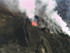
Visual observations of Mount Ibu for the period May 1-15, 2024 observed white, gray and black smoke coming from the main crater of light, medium to thick intensity, 100-5,000 meters high from the summit. The weather is sunny to rainy, with light to moderate winds.
During this period there were eruptions of Mount Ibu, whose eruptive column tended to be higher and larger than usual.
On May 11, 2024 at 00:24 WIT, an eruption occurred with the height of the eruptive column observed approximately 4,000 meters above the peak, gray in color with thick intensity leaning towards the North and Northwest. Incandescence was observed, and the sound of rumbling and explosions could be heard all the way to the PGA station.
On May 12, 2024 at 00:58 WIT, an eruption occurred and lasted 3 minutes 20 seconds. The height of the eruptive column was not observed.
On May 13, 2024 at 09:12 WIT, an eruption occurred with the height of the eruptive column observed approximately 5,000 meters above the peak, gray in color with thick intensity oriented towards the North and Northeast. There was an explosion and roar all the way to the PGA Post.
On May 14, 2024 at 09:12 WIT, an eruption occurred and lasted 3 minutes 51 seconds. The height of the eruptive column was not observed.
On May 15, 2024 at 1:54 p.m. WIT, an eruption occurred with the height of the eruptive column observed at approximately 5,000 meters above the peak, gray in color with thick intensity oriented towards the West, and a sound of Roar could be heard all the way to the PGA Post.
On May 16, 2024 at 09:58 WIT, an eruption occurred with the height of the eruptive column observed approximately 5,000 meters above the peak, gray in color with thick intensity oriented towards the North and Northeast, and a roaring sound could be heard all the way to the PGA Post.
Instrumental observation
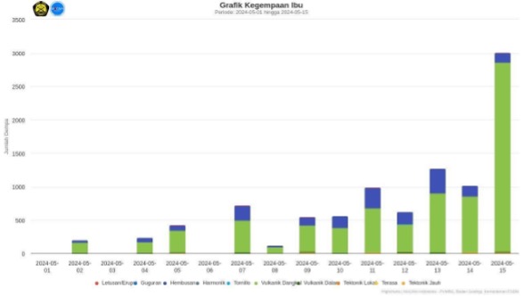
Between May 1 and 15, 2024, the seismicity recorded on Mount Ibu was 40 eruption earthquakes, 7 avalanche earthquakes, 1,850 emission earthquakes, 49 harmonic tremor, 13 « Tornillos » type earth, 7,590 shallow volcanic earthquakes, 80 deep volcanic earthquakes, 1 local tectonic earthquake, 132 distant tectonic earthquakes and 1 felt earthquake.
On May 13, 2024 at 1:14 p.m. WIT, the MMI II earthquake was recorded. According to the Ternate BMKG station, the source is 59 km northwest of Jailolo, in the North Moluccas, with a depth of 17 km. Since the tectonic earthquake incident, Drumbeat earthquakes have often appeared, especially after the eruption.
On May 15, 2024, the number of shallow volcanic earthquakes reached 2,830.
On May 16, 2024 at 10:55 a.m. WIT from the BMKG Ternate station, an earthquake with a magnitude of 2.8 was recorded, at a depth of 1 km, with the epicenter southwest of Tobelo, north of Moluccas.
On May 16, 2024, from 10:38 to 12:12 WIT, a series of shallow earthquakes with an average amplitude of 3 mm were recorded.
Seismicity graph of G. Ibu for the period from May 1 to 15, 2024
Assessment
Since around mid-April 2024, visual activity and seismicity, i.e. deep volcanic earthquakes, have seen a significant increase. Apart from this, a series of intense shallow earthquakes were also recorded, indicating an increase in pressure due to migration of magma to shallow depths.
The height of the eruptive column also tends to increase until it reaches 5,000 meters from the summit crater. The ejection of incandescent lava reached a radius of approximately 1.5 km from the crater rim.
Recommendation
Based on the results of visual and instrumental monitoring which show an increase in volcanic activity on Mount Ibu, the activity level of Mount Ibu was increased from level III (SIAGA) to level IV (AWAS) from from May 16, 2024 at 3:00 p.m. WIT.
Source : PVMBG
Iceland , Reykjanes Peninsula :
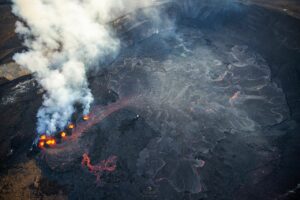
Magma accumulation beneath Svartsengi continues at a steady rate . About 16 million cubic meters of magma has been recharged to the magma reservoir since 16 March
Updated 16 May at 13:00 UTC
Magma accumulation beneath Svarstengi continues at a steady rate.
About 16 million cubic meters of magma has been added to the magma reservoir.
Increased probability of another dyke propagation and/or a volcanic eruption in the coming days.
Sundhnúkur crater row is the most likely location of another eruption.
An eruption could start with very little (or no) warning time
Around 80 earthquakes were detected in the area around the dyke intrusion yesterday, 15 May, most of them below M1.0. This is similar to the seismic activity that has been detected in recent days, but about 50 to 80 earthquakes have been measured per day, most of them occurring in two main areas, between Stóra-Skógfell and Hagafell and south of Þorbjörn. Signs of new magma migration from the Svartsengi reservoir to the previous diking area, may comprise localized small seismic swarms in and around the intrusion, rapid changes in deformation and pressure changes in boreholes in the area.
Magma accumulation continues beneath Svartsengi and land uplift is ongoing at the same rate as that observed since early April 2024. Therefore, there is still an increased probability that in the coming days a new dyke intrusion and another volcanic eruption in the Sundhnúkur crater row could occur.
Prior to previous dyke intrusions and volcanic eruptions, about 8 to 13 million cubic meters had been added to the magma reservoir before the reservoir failed and magma flowed from this to the Sundhnúkur crater row. Now, the amount of magma that has been added is more than the upper limit, as a total of ~16 million cubic meters have been added to the reservoir since 16 March, when the last eruption started.
Lesson learned from the Krafla Fires was that as the number of dyke propagations increases, more pressure is needed to trigger them. Therefore, it must be considered likely that magma will once again flow from the Svartsengi magma reservoir to the Sundhnúkur crater row, but there is an uncertainty as to when sufficient pressure will be reached to trigger a new dyke propagation and/or eruption.
Source : IMO
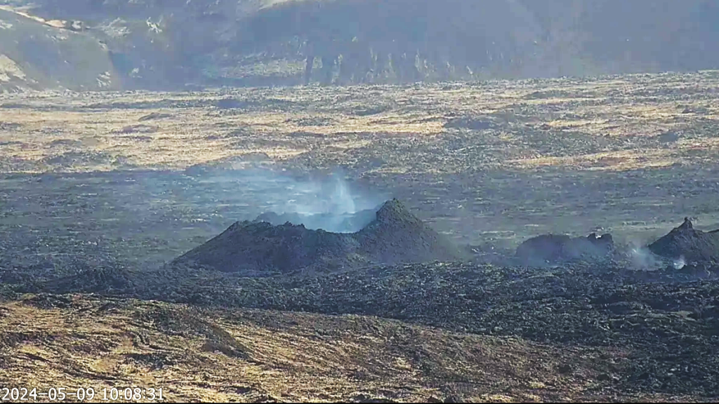
Photo : RÚV – Webcam à Orbirn
Russia / Kuril Islands , Ebeko :
VOLCANO OBSERVATORY NOTICE FOR AVIATION (VONA)
Issued: May 16 , 2024
Volcano: Ebeko (CAVW #290380)
Current aviation colour code: ORANGE
Previous aviation colour code: orange
Source: KVERT
Notice Number: 2024-26
Volcano Location: N 50 deg 41 min E 156 deg 0 min
Area: Northern Kuriles, Russia
Summit Elevation: 1156 m (3791.68 ft)
Volcanic Activity Summary:
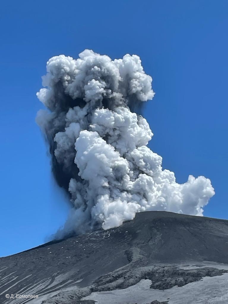
A moderate explosive eruption of the volcano continues. According to visual data from Severo-Kurilsk, explosion sent ash up to 2.5 km a.s.l., and ash cloud drifted to the north-east of the volcano.
A moderate explosive eruption of the volcano continues. Ash explosions up to 6 km (19,700 ft) could occur at any time. Ongoing activity could affect low-flying aircraft and airport of Severo-Kurilsk
Volcanic cloud height:
2000-2500 m (6560-8200 ft) AMSL Time and method of ash plume/cloud height determination: 20240516/2106Z – Visual data
Other volcanic cloud information:
Distance of ash plume/cloud of the volcano: 5 km (3 mi)
Direction of drift of ash plume/cloud of the volcano: NE
Time and method of ash plume/cloud determination: 20240516/2106Z – Visual data
Source : Kvert
Photo : D. Ermolaev ( archive)
Philippines , Taal :
TAAL VOLCANO ADVISORY , 16 May 2024 , 07:00 PM
This is a notice of weak phreatic activity at Taal Volcano.
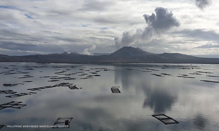
Four (4) minor successive phreatic or steam-driven eruptions at the Taal Main Crater occurred today between 08:54 AM to 08:57 AM, 11:07 AM to 11:10 AM, 01:48 PM to 01:50 PM and 05:37 PM to 05:38 PM based on visual and seismic observations. The events produced white steam-laden plumes that rose between 50 and 300 meters above the Main Crater before drifting west-northwest based on IP camera monitors. Sulfur dioxide (SO2) emissions increased on 13 May 2024 at 5,094 tonnes/day. Average SO2 emissions since January this year remain high at 8,686 tonnes/day. Weak phreatic activity is likely driven by the continued emission of hot volcanic gases at the Taal Main Crater and could be succeeded by similar events. The background levels of volcanic earthquake activity and ground deformation detected at Taal indicate that unrest is unlikely to progress into magmatic eruption.
DOST-PHIVOLCS reminds the public that Alert Level 1 prevails over Taal Volcano, which means that it is still in abnormal condition and should not be interpreted to have ceased unrest nor ceased the threat of eruptive activity. At Alert Level 1, sudden steam-driven or phreatic explosions, volcanic earthquakes, minor ashfall and lethal accumulations or expulsions of volcanic gas can occur and threaten areas within TVI. Furthermore, degassing of high concentrations of volcanic SO2 continues to pose the threat of potential long-term health impacts to communities around Taal Caldera that are frequently exposed to volcanic gas. DOST-PHIVOLCS strongly recommends that entry into TVI, Taal’s Permanent Danger Zone or PDZ, especially the vicinities of the Main Crater and the Daang Kastila fissure, must remain strictly prohibited. Local government units are advised to continuously monitor and assess preparedness of their communities and undertake appropriate response measures to mitigate hazards that could be posed by long-term degassing and related phreatic activity. Civil aviation authorities must advise pilots to avoid flying close to the volcano as airborne ash and ballistic fragments from sudden explosions and wind-remobilized ash may pose hazards to aircrafts.
DOST-PHIVOLCS is closely monitoring Taal Volcano’s activity and any new significant development will be immediately communicated to all stakeholders.
Source : Phivolcs
Photo : CNNPH , marcello Teofilo ( archive).
Nicaragua , Conception :
The Concepción volcano, on the island of Ometepe, in the Great Lake of Nicaragua, recorded a small to moderate explosion on Thursday accompanied by gas and ash, without causing damage or danger to the population, authorities reported.
The explosion of the Concepción, whose height reached 1,610 meters, was recorded at 2:20 p.m. local time (8:20 p.m. GMT), followed by the emission of ash and gas, according to the authorities, who activated an alert system on the Ometepe Island.
“The Concepción volcano caused an explosion of gas and ash with a column height (plume) approximately 2 kilometers high from the crater rim,” the Nicaraguan government said in a report.
The magnitude of this explosion is classified as small to medium, and it is estimated that the expelled ash will reach surrounding communities where a thin layer of ash (with an estimated maximum thickness of 1 millimeter) will fall, according to authorities.
At the time of writing, there are still small residual tremors associated with the explosion, while the degassing flow has returned to its normal parameters, according to the Executive.
« This event does not imply greater danger for the population, but there is the possibility that over the course of hours or days small explosions of gas and ash may occur, with characteristics lower than the current one. or similar,” he said.
Source : 100% Noticias.
Photo : La prensa.


