April 02 , 2023.
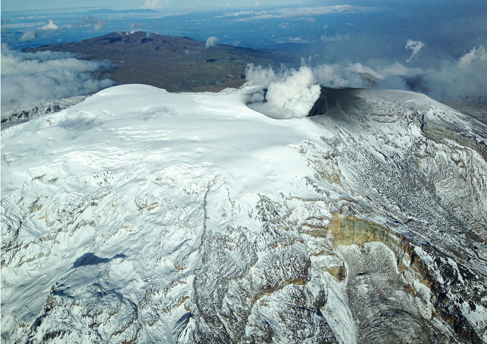
Colombia , Nevado del Ruiz :
Manizales, April 1, 2023 10:30 a.m.
Regarding the monitoring of the activity of the NEVADO DEL RUIZ VOLCANO, the MINISTRY OF MINES AND ENERGY through the COLOMBIAN GEOLOGICAL SERVICE (SGC) informs that:
The recording of rock fracturing seismicity continues inside the volcanic edifice. Yesterday March 31, 8,800 events were recorded, reaching a maximum magnitude of 2.6 ML corresponding to the 12:36 p.m. earthquake. Seismicity remains localized in the southwestern sector of the volcanic edifice at a distance from the crater of between 2.0 and 5.0 km. The increase in activity associated with the movement of fluids inside the volcanic conduits is highlighted, particularly at night and this morning, most likely associated with ash emissions, some of which have been confirmed thanks to web cameras. The maximum height of the column of gas and / or ash observed yesterday was 1300 m measured from the summit of the volcano and the direction of dispersion of the column oscillated between the South-West and the South-East.
There was also a report of a thermal anomaly in the crater area.
It is important to point out that the activity of the volcano at the ORANGE LEVEL can fluctuate and sometimes decrease compared to the previous days. This does not mean that the volcano has returned to a lower level of activity. To change the level and return to the yellow level, a prudential time is required where trends and patterns can be observed that allow us to deduce the possible decrease in activity, which is why it is warned that the level of activity of the Nevado del Ruiz volcano will remain at the ORANGE LEVEL for several weeks. Meanwhile, if there is an acceleration of processes suggesting an impending eruption or the eruption itself occurring, the activity level will turn red.
The community is recommended to remain calm, but to be attentive to the information provided by the Colombian Geological Service on the evolution of the state of the volcano.
The level of activity of the volcano remains at the ORANGE LEVEL of activity or (II): PROBABLE ERUPTION IN TERM OF DAYS OR WEEKS.
Source et photo : SGC.
Indonesia , Merapi :
Report on the activity of Mount Merapi from March 24, 2023 to March 30, 2023, Published on March 31, 2023
RESULTS OF OBSERVATIONS
Visual
The weather around Mount Merapi is usually sunny in the morning and afternoon, while the evening is foggy. White, fine to thick, low to medium pressure, 550 m high white smoke was observed from the Mount Merapi observation post in Babadan on March 25, 2023 at 07:00.
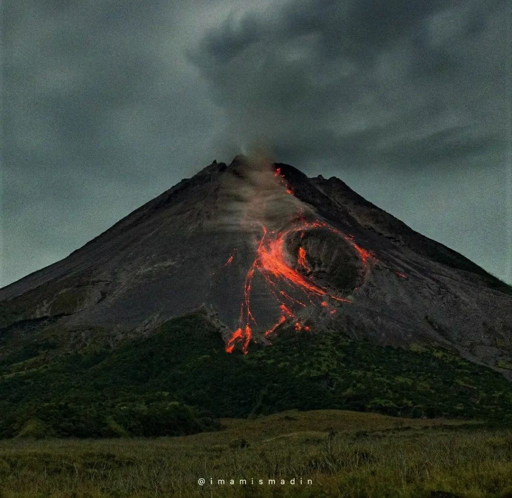
This week there were 2 southwestward lava avalanches (the main one toward Kali Boyong) with a maximum slip distance of 1000m. Lava avalanches were observed up to 176 times in a southwesterly direction (the main ones towards Kali Bebeng and Boyong) with a maximum slip distance of 2,000 m. The noise of the avalanches was heard once from the Babadan post with a low intensity.
On the Central dome and the South-West dome no significant change was observed. According to an aerial photo dated March 13, 2023, the measured volume of the Southwest dome is 1,686,200 m3 and that of the central dome is 2,312,100 m3.
Seismicity
This week, the seismicity of Mount Merapi showed:
2 earthquakes of hot cloud avalanches,
56 deep volcanic earthquakes (VTB),
820 avalanche earthquakes (RF),
7 tectonic earthquakes (TT).
215 multi-phase (MP) earthquakes
The intensity of this week’s seismicity is still quite high.
Deformation
Mount Merapi’s deformation that was monitored using EDM and GPS this week showed a shortening rate of 0.08 cm/day.
Rain and lahars:
This week, it rained at the G. Merapi observation post with a rain intensity of 36 mm/hour for 55 minutes at the Kaluirang post on March 29, 2023. No increase in the flow of the rivers descending from Mount Merapi has been reported.
Conclusion
Based on the results of visual and instrumental observations, it is concluded that:
-The volcanic activity of Mount Merapi is still quite high in the form of effusive eruption activity. The state of the activity is defined at the « SIAGA » level.
Source : BPPTKG
Photo : imamismadin
Alaska , Aniakchak :
56°54’21 » N 158°12’32 » W,
Summit Elevation 4400 ft (1341 m)
Current Volcano Alert Level: ADVISORY
Current Aviation Color Code: YELLOW
Elevated earthquake activity continued beneath Aniakchak volcano over the past 24 hours. Around 1–4 earthquakes per hour were noted. Clouds obscured satellite observations over the last day.
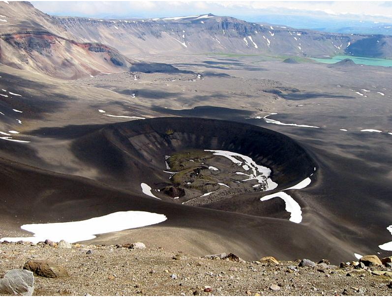
Looking into Aniakchak Caldera across the dark tephra cone produced during the May – June 1931 eruption, one of the largest eruptions in Alaska in the last 100 years. In the bottom of the cone is a moss-dappled lava and spatter field produced during the last stages of eruption. In the distance is the exposed wall of Half Cone, (another site of explosive activity) and the turquoise Surprise Lake.
The current period of seismic unrest began in October 2022. Increases in seismic activity have been detected previously at other similar volcanoes, with no subsequent eruptions. We expect additional shallow seismicity and other signs of unrest, such as gas emissions, elevated surface temperatures, and surface deformation to precede any future eruption, if one were to occur.
AVO monitors Aniakchak with a local network, which currently consists of three functional seismometers, as well as satellite remote sensing data and regional infrasound and lightning networks.
Source : AVO.
Photo : Plucinski, T. A. / Alaska Volcano Observatory / U.S. Geological Survey
Kamchatka , Bezymianny :
VOLCANO OBSERVATORY NOTICE FOR AVIATION (VONA)
Issued: April 02 , 2023
Volcano: Bezymianny (CAVW #300250)
Current aviation colour code: ORANGE
Previous aviation colour code: orange
Source: KVERT
Notice Number: 2023-40
Volcano Location: N 55 deg 58 min E 160 deg 35 min
Area: Kamchatka, Russia
Summit Elevation: 2882 m (9452.96 ft)
Volcanic Activity Summary:
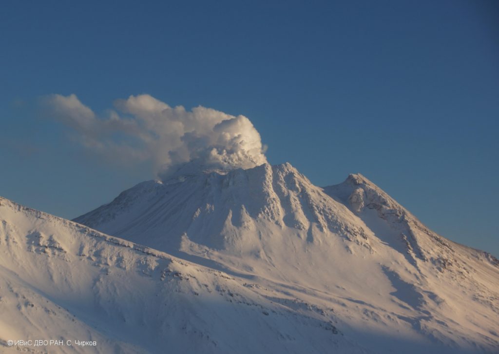
The activity of the volcano is gradually increasing. Probably, a new block of lava is squeezed out on the lava dome of the volcano, this is accompanied by the collapse of avalanches. Satellite data by KVERT showed an ash plume extended about 35 km to the east from the volcano.
The extrusive eruption of the volcano continues. Ash explosions up to 10-15 km (32,800-49,200 ft) a.s.l. could occur during next several days. Ongoing activity could affect international and low-flying aircraft.
Volcanic cloud height:
3000 m (9840 ft) AMSL Time and method of ash plume/cloud height determination: 20230402/0540Z – Video data
Other volcanic cloud information:
Distance of ash plume/cloud of the volcano: 35 km (22 mi)
Direction of drift of ash plume/cloud of the volcano: E / azimuth 98 deg
Time and method of ash plume/cloud determination: 20230402/0410Z – Himawari-9 14m15
Source : Kvert.
Photo : S. Chirkov, IVS FEB RAS
Guatemala , Fuego :
Weather conditions: Clear weather
Wind: East
Precipitation: 0.0 mm.
Activity:
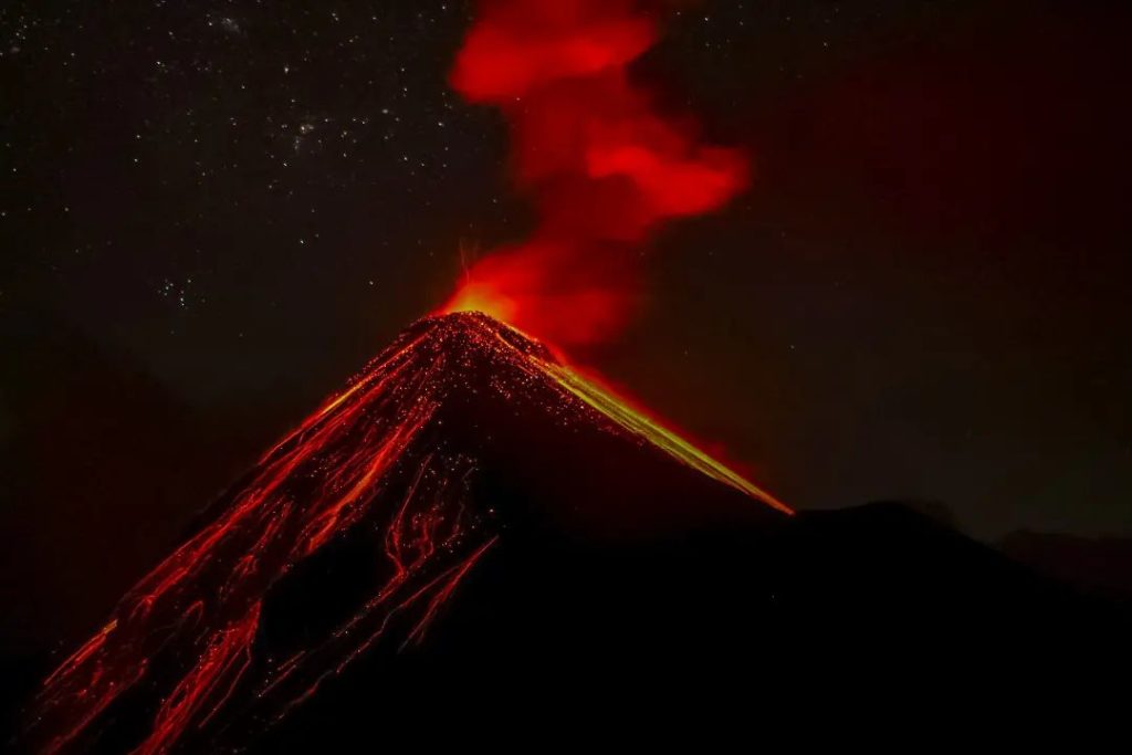
The Fuego Volcano Observatory reports 6 to 10 weak and moderate explosions per hour, which generated columns of ash at an altitude of 4,500 to 4,800 meters above sea level (14,763 to 15,748 feet) , which dispersed to the west and southeast due to variable winds. Low to moderate rumblings were heard along with weak shock waves that rattled the roofs and windows of homes near the volcano.
Incandescent pulses were observed at a height of 100 to 200 meters above the crater. This generated weak avalanches around the crater and towards the Seca, Taniluyá, Ceniza, Trinidad, El Jute, Las Lajas and Honda ravines, whose material reached the edge of the vegetation. The material in its descent caused fine ash to rise 100 meters high. Fine ash fall is recorded in Panimaché I, Morelia, Santa Sofía, La Rochela, El Porvenir, Sangre de Cristo, Finca Palo Verde, among other nearby communities, there is a likelihood of ash fall in communities in the South- West and West.
Source : Insivumeh.
Photo : Desnivel Tour

