July 26 , 2022.
Japan , Sakurajima :
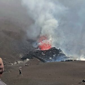
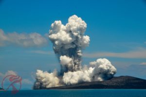
Sakurajima (Japan) and Vulcano (La Fossa cone, Aeolian Islands): two volcanoes with various eruptive phenomena and behaviors in common.
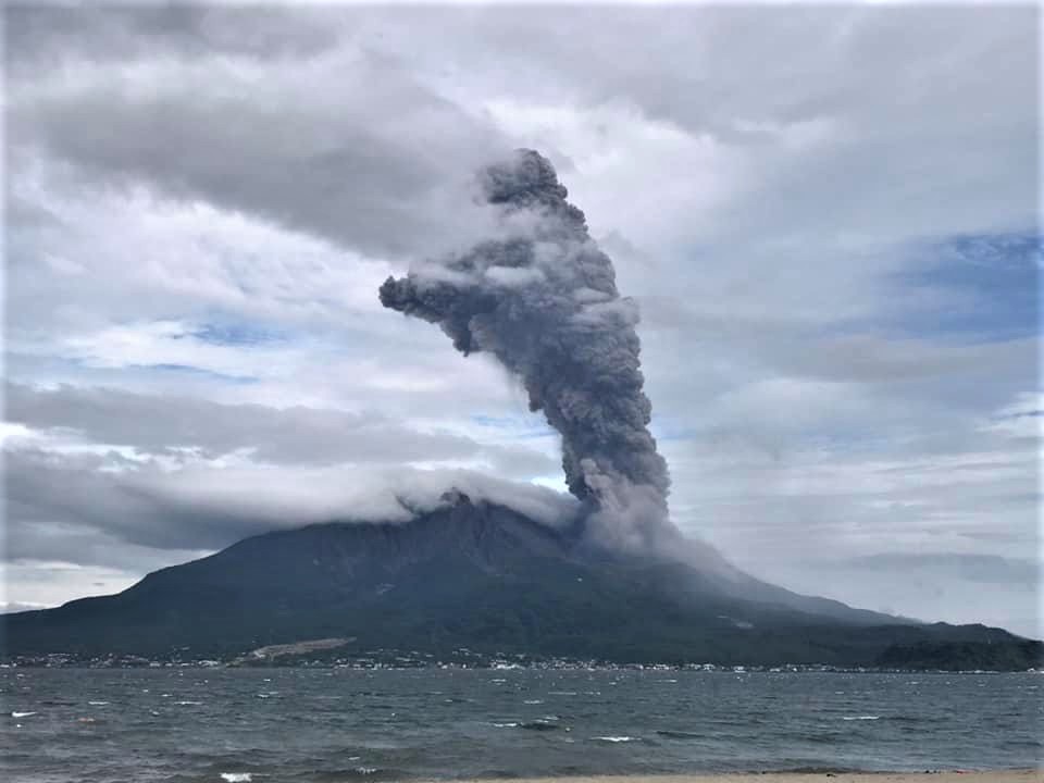
Yesterday, in southern Japan, one of the most famous stratovolcanoes in the Far East returned to the eruption stage: Sakurajima, located near the large city of Kagoshima.
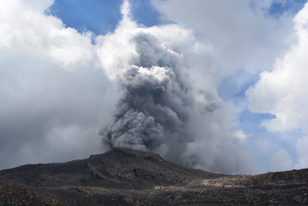
The eruption occurred at 8:05 a.m. local time, with an explosion that threw bombs and blocks up to about 2.5 km from the crater. No report reports damage or injuries, but on Sunday evening the inhabitants of the municipalities closest to the volcano (a hundred) were evacuated and the JMA raised the alert level to 5, the highest in Japan. However, bulletins indicate that the ballistic trajectories of volcanic material ejected by the explosions could affect an area up to about 3 km from the main crater. And in recent weeks, some ash columns have risen up to 2.8 km a.s.l. on the crater rim. Television videos shot yesterday from the city of Kagoshima show an eruptive column about 1.5 km high, very dark and therefore rich in ash, typical of eruptions classified as vulcanian (as is the typical launching of blocks and bombs).
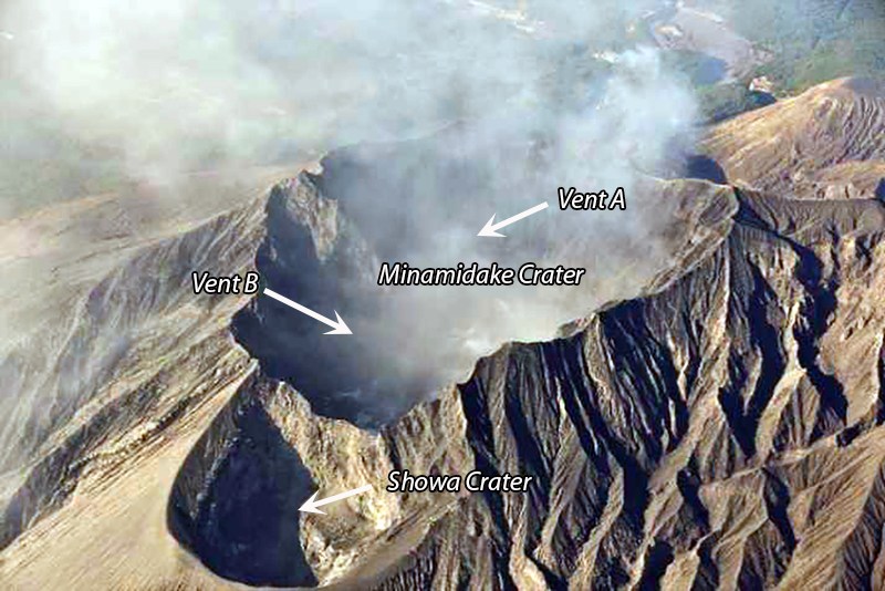
Sakurajima Volcano is an open vent volcano, one of the most active in the world, located in the Aira Caldera and produces many of its own vulcanian-like eruptions like the one that occurred yesterday. From October 1955 begins a sequence of these types of eruptions, still in progress, which sees the alternation of two active craters: the Minamidake crater and the Showa crater. It is from the first of these two craters that the currently visible vulcanian cycle occurs.
Even the La Fossa crater on the island of Vulcano, over the past centuries, has gone through long decades of open conduit activity like Sakurajima, with very similar eruptive phenomena, although currently on Vulcano the crater conduit de La Fossa is closed and only degassing is observed. Also the cone of La Fossa and the now inactive cones of Vulcanello are located inside a caldera and have gone through a long eruptive period (in the Middle Ages and slightly later) of contemporaneous or near-contemporary activity.
Besides the eruptive style and some similar structural characters, the similarities between the two volcanoes do not end there and also concern the eruptive stories. Once the Japanese volcano was an island but – as happened with Vulcano and Vulcanello, also in medieval times – following the eruption of 1914, the island joined another piece of land: the peninsula of ‘Osumi.
The weather observatory in southwestern Japan says an on-site survey of the Sakurajima volcano has found no significant changes in the area. The volcano had an explosive eruption on Sunday night.
The observatory raised its eruption alert level to the highest of five. This is the first time the level-five alert, which requires evacuation, has been issued for Sakurajima.
On Monday morning, the observatory sent a survey team to determine exactly where volcanic rocks have landed and to assess damage.
The team found volcanic ashes in the northern and eastern parts of the volcano but found no remarkable changes. An aerial survey using a helicopter was hampered by clouds over the crater.
Officials warn of more eruptions of a similar scale as crustal movements there indicate the volcano remains expanded even after the eruption.
Sources : INGV, 3.nhk.or.jp
Photos : Via INGV , Koki Arima.
Colombia , Chiles / Cerro Negro :
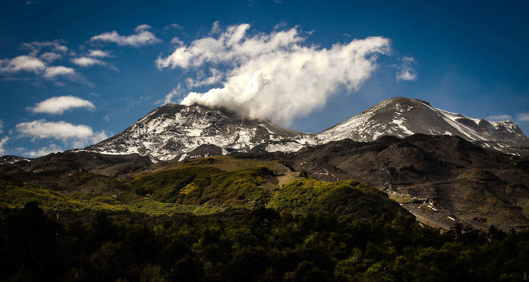
Bulletin of extraordinary activity of the Chiles and Cerro Negro volcanoes.
The activity level of volcanoes remains at the YELLOW LEVEL ■ (III): CHANGES IN THE BEHAVIOR OF VOLCANIC ACTIVITY
From monitoring the activity of the CHILES AND CERRO NEGRO VOLCANOES, the COLOMBIAN GEOLOGICAL SERVICE (SGC) reports that:
Following the changes in the activity of the Chiles – Cerro Negro Volcanic Complex (CVCCN) and its unstable behavior, today, July 25, 2022, a Unified Command Post (PMU) took place, in which He discussed not only of the activity of the CVCCN, but also certain prevention and mitigation actions to reduce the vulnerability and reduce the risk in the event of a possible increase in the activity of this volcanic complex.
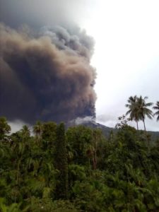
Since the information reported in the Extraordinary Bulletin of July 23, 2022, the behavior of the activity has shown an acceleration of the seismic energy released reflected in the size of the earthquakes, highlighting the occurrence of an earthquake associated with fracturing rocks of magnitude 5.7 on July 25 at 8:33 a.m., the largest event recorded since the start of continuous monitoring from November 2013. This earthquake was felt in some places in the departments of Nariño, Putumayo, Caquetá and Cauca, and Province of Carchi in Ecuador, causing some damage to buildings, particularly in Ecuador. The earthquake was located 15 km southeast of the summit of the Chiles volcano and 8 km deep from the same summit (4700 m above sea level).
Since July 23 at the time of publication of this bulletin, a total of 19 earthquakes with a magnitude equal to or greater than 2.5 have been recorded, which, due to their superficial nature, have been felt in the municipality of Cumbal (Department of Nariño), also standing out, those registered today July 25 at 8:38. of magnitude 3.9, at 9:41 a.m. with 3.4 and at 9:57 a.m. with a magnitude of 3.2. In addition, the slight increase in seismicity recording related to the movement of fluids within the volcanic system is highlighted, recording a daily maximum of 75 earthquakes on July 24, exceeding the 64 earthquakes of July 20. These seismic manifestations were accompanied by ground deformations (observed instrumentally) which began at the end of March 2022 and continue to this day.
According to what was discussed in this Unified Command Post (PMU) held today, July 25, 2022, the MINISTRY OF MINES AND ENERGY, through the COLOMBIAN GEOLOGICAL SERVICE, reports that the CVCCN continues to a yellow activity level (changes in the behavior of volcanic activity). Based on the current behavior of this seismicity and what has been historically recorded in this active volcanic region, the possibility of the occurrence of more high-energy earthquakes, which can be felt and can alter the quality of life of the populations of the region, is not excluded in the zone of volcanic influence.
Source : SGC
Photo : Agence uno , Biobiochiles
Hawaii , Kilauea :
19°25’16 » N 155°17’13 » W,
Summit Elevation 4091 ft (1247 m)
Current Volcano Alert Level: WATCH
Current Aviation Color Code: ORANGE
Activity Summary:
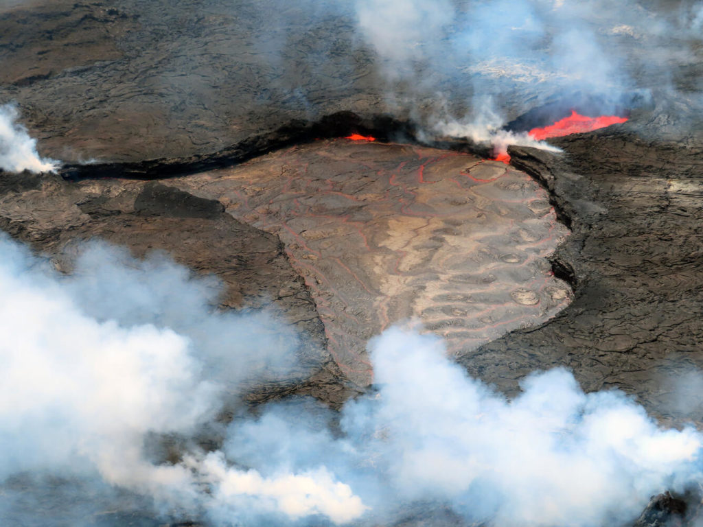
The summit eruption of Kīlauea Volcano, within Halemaʻumaʻu crater, has continued over the past 24 hours. All recent lava activity has been confined to the crater and current data indicate that this scenario is likely to continue. No significant changes have been noted at the summit or in either rift zone.
Summit Observations:
Eruption of lava from the Halemaʻumaʻu western vent into the active lava lake has continued over the past 24 hours. The lava level of the active lake surface remained at the level of the bounding levees. Extensive ooze-outs along the western margin continued until around 7 pm HST last night and are no longer active at this time. Measurements from an overflight on July 19, 2022 indicated that the crater floor has risen about 133 meters (437 feet) . Summit tiltmeters continue to show a steady deflationary since around 7 am HST yesterday morning. A sulfur dioxide (SO2) emission rate of approximately 1,300 tonnes per day (t/d) was measured on July 21, 2022. Summit tremor is steady for this eruption’s long term base-line level.
Rift Zone Observations:
No unusual activity has been noted along the East Rift Zone or Southwest Rift Zone; steady rates of ground deformation and seismicity continue along both. Measurements from continuous gas monitoring stations downwind of Puʻuʻōʻō in the middle East Rift Zone remain below detection limits for SO2, indicating that SO2 emissions from Puʻuʻōʻō are negligible.
Source : HVO
Photo : USGS/ L. Gallant.
Peru , Sabancaya :
Analysis period: from July 18, 2022 to July 24, 2022, Arequipa, July 25, 2022.
Alert level: ORANGE
The Geophysical Institute of Peru (IGP) reports that the eruptive activity of the Sabancaya volcano remains at moderate levels, that is to say with the recording of an average of 30 daily explosions, with columns of ash and of gas up to 1.5 km altitude above the summit of the volcano and their subsequent dispersion. Therefore, for the following days, no significant change is expected in eruptive activity.
The IGP recorded and analyzed the occurrence of 262 earthquakes of volcanic origin, associated with the circulation of magmatic fluids inside the Sabancaya volcano. An average of 30 explosions was recorded daily, in addition to recording Volcano-Tectonic (VT) type events associated with rock fracturing inside the Sabancaya volcano.
Monitoring the deformation of the volcanic structure using GNSS techniques (processed with fast orbits) does not show any significant anomalies. However, in general, an inflation process was observed in the northern sector (surroundings of the Hualca Hualca volcano). Visual surveillance identified columns of gas and ash up to 1.5 km above the summit of the volcano, which were dispersed towards the south-west, south-east and east sectors of Sabancaya. Satellite recordings have identified the presence of 9 thermal anomalies, with a maximum value of 52 MW, associated with the presence of a lava body on the surface of the crater of the volcano.
RECOMMENDATIONS
• Keep the volcanic alert level orange.
• Do not approach within a radius of less than 12 km from the crater.
Source : Cenvul
Photo : Ingemmet
Mexico , Popocatepetl :
July 25, 11:00 a.m. (July 25, 4:00 p.m. GMT)
During the last 24 hours, according to the monitoring systems of the Popocatépetl volcano, 17 low intensity exhalations have been detected, accompanied by water vapor and volcanic gases, sometimes accompanied by ash. In addition, 18 minutes of low amplitude tremor and two volcano-tectonic type earthquakes were recorded, the first recorded yesterday at 11:04 p.m. and the second today at 7:57 a.m. local time, both with a magnitude of 1, 7.
During the morning and at the time of this report, an emission of water vapor, gas and sometimes a slight amount of ash was observed, which disperses towards the West.
CENAPRED urges NOT TO APPROACH the volcano and especially the crater, because of the danger of falling ballistic fragments and, in case of heavy rains, to stay away from the bottom of the ravines because of the danger of mudslides and of debris.
The Popocatépetl volcanic alert traffic light is in YELLOW PHASE 2.
Source : Cenapred.

