March 21 ,2022.
New Zealand , Ruapehu :
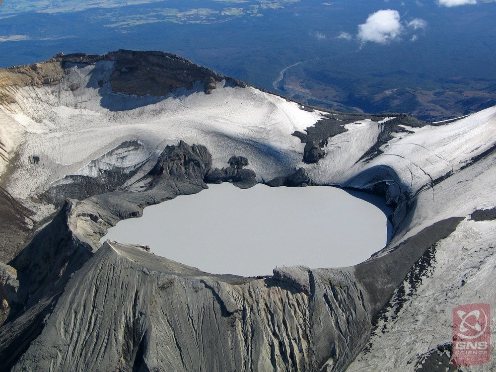
Mt Ruapehu’s crater lake heating is accompanied by strong volcanic tremor. Volcanic Alert Level raised to Level 2. , Published: Mon Mar 21 2022 1:45 PM
Aviation Colour Code remains at Green
Another heating phase has started at Mt Ruapehu and Crater Lake (Te Wai ā-moe) temperature has now reached 31 °C. This temperature rise has been accompanied by strong levels of volcanic tremor. The Volcanic Alert Level at Mt Ruapehu is raised to Level 2 in response to these changes.
Typically, over periods of months, Ruapehu’s crater lake undergoes heating and cooling cycles. A new heating cycle has started and has been accompanied by strong levels of volcanic tremor (volcanic earthquakes).
We consider there is an increased likelihood of eruptive activity as strong tremor is indicating increased gas flux through the system. Despite an increase in gas flow, the lake temperature is only responding slowly, suggesting a partial blockage may exist in the vent beneath the lake. This could allow pressure to build up within the volcano.
The interpretation of this activity is consistent with elevated volcanic unrest and therefore we have raised the Volcanic Alert Level to Level 2.
In January 2022 the lake temperature peaked at 32°C. Following this peak through to late February the lake temperature declined to around 27-28 °C. Since 13 March a heating trend has become established, and the lake temperature is now 31 °C. As sometimes occurs during these heating phases, volcanic tremor activity has been recorded.
The modelled heat flow into the lake is currently estimated at about 330 MW (megawatt), up from 100 MW in February 2022.
The lake is currently overflowing into the Whangaehu river, but the flow level is believed to be minor. The lake colour is expected to change to a darker grey colour as sediments on the lake floor are disturbed during the influx of hot fluids heating the lake.
The Volcanic Alert Level rises to Level 2 which reflects the current level of elevated volcanic unrest. The Volcanic Alert Level should not be used to forecast future activity. However, at Volcanic Alert Level 2, eruptions are usually more likely than at Volcanic Alert Level 1.
The Aviation Colour Code remains at colour Green.
Mt Ruapehu is an active volcano and has the potential to erupt with little or no warning when in a state of elevated volcanic unrest.
Source : Geonet / Craig Miller / Duty Volcanologist.
Photo : Bradd Scott / GNS.
Indonesia , Semeru :
VOLCANO OBSERVATORY NOTICE FOR AVIATION – VONA
Issued : March 20 , 2022
Volcano : Semeru (263300)
Current Aviation Colour Code : ORANGE
Previous Aviation Colour Code : orange
Source : Semeru Volcano Observatory
Notice Number : 2022SMR71
Volcano Location : S 08 deg 06 min 29 sec E 112 deg 55 min 12 sec
Area : East java, Indonesia
Summit Elevation : 11763 FT (3676 M)
Volcanic Activity Summary :
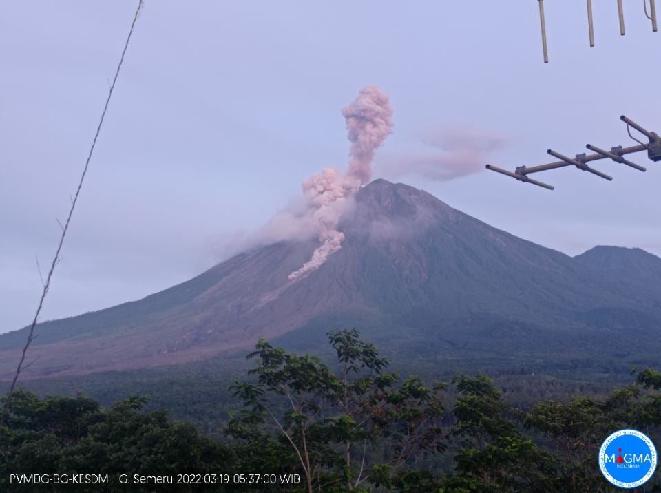
Eruption with volcanic ash cloud at 23h45 UTC (06h45 local)
Volcanic Cloud Height :
Best estimate of ash-cloud top is around 14003 FT (4376 M) above sea level, may be higher than what can be observed clearly. Source of height data: ground observer.
Other Volcanic Cloud Information :
Ash-cloud moving to north
The volcano was clearly visible until it was covered in fog. Smoke from the crater was not observed. The weather is cloudy to rainy, the wind is weak in the South-West. The air temperature is around 21-23°C.
The earthquake of the eruption was recorded, but visually the height of the eruption and the color of the ashes were not observed.
Seismicity is linked to magma and tectonic activity. It was recorded:
– 18 earthquakes of eruptions/explosions
– 2 emission earthquakes
– 1 deep volcanic earthquake
– 3 distant tectonic earthquakes
Sources : Magma Indonésie , PVMBG.
Ecuador , Sangay :
DAILY REPORT OF THE STATE OF SANGAY VOLCANO, Sunday March 20, 2022.
Information Geophysical Institute – EPN.
Surface Activity Level: High, Surface Trend: No change.
Internal activity level: High, Internal trend: No change.
Seismicity: From March 19, 2022, 11:00 a.m. to March 20, 2022, 11:00 a.m.:
Explosion (EXP) 21
Long Periods (LP) 48
Emission Tremors (TREMI) 27
Lahars (LH): 1
Rains / Lahars:
Thanks to the Windy satellite system, the occurrence of rains in the volcano area has been recorded. **In the event of heavy rains, these could remobilize the accumulated materials, generating mudslides and debris that would descend on the flanks of the volcano and flow into the adjacent rivers.**
Emission / ash column:
No emission was observed on the GOES-16 satellite. The Washington VAAC reported several ash emissions observed by satellite with Southwest and West directions up to about 870 meters above crater level. Yesterday afternoon, emissions were observed at heights greater than 1000 meters above the level of the crater and in a southwesterly direction.
Gas:
There are no SO2 values in the MOUNTS source.
Other Monitoring Parameters:
The FIRMS app records 36 thermal alerts in the last 24 hours.
Observation:
The weather conditions are permanently cloudy.
Alert level: Orange.
Source : IGEPN.
Photo : Flytouio
Costa Rica , Rincon de la Vieja / Turrialba / Poas :
Weekly bulletin of the OVSICORI-UNA volcanic monitoring program, March 18, 2022.
Rincon de la Vieja Volcano:
Latitude: 10.83°N;
Longitude: 85.324°W;
Altitude: 1895m
Current activity level: 3 (volcanic eruption)
Potentially associated dangers: Lahars, gas, phreatic and phreato-magmatic eruptions, proximal ballistic projections, acid rain, ashes.
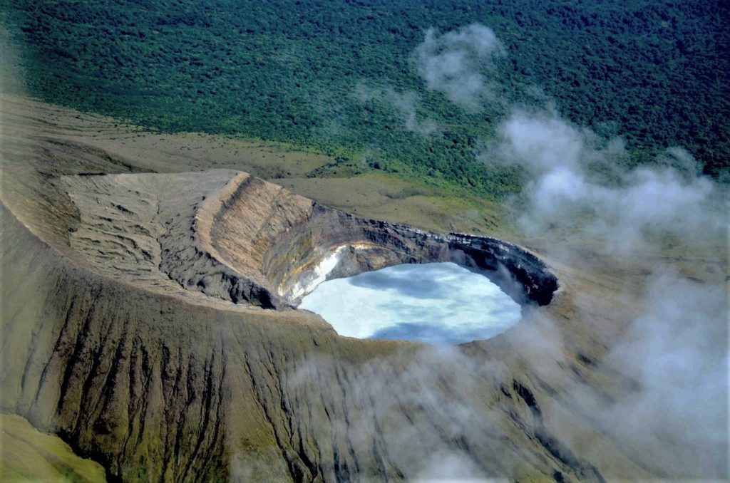
An eruption occurred on March 15 without any material coming out of the crater, another of low amplitude was recorded on March 17 at night. The tremor which had subsided returned after the March 15 eruption. About thirty VT-type events were recorded between March 17 and 18 in the Las Pailas sector, the most important being that of the evening of the 17th with a magnitude of 1.6. The RSAM has returned to a minimum level. No SO2 emissions have been detected by satellite monitoring since the January 30, 2022 eruption. The eruption and events this week are considered to have failed to alter the current level.
Turrialba Volcano
Latitude: 10.025°N;
Longitude: 83.767°W;
Altitude: 3340m.
Current activity level: 3 (volcanic eruption)
Potentially associated hazards: gas, ash emission, proximal ballistic projections, acid rain.
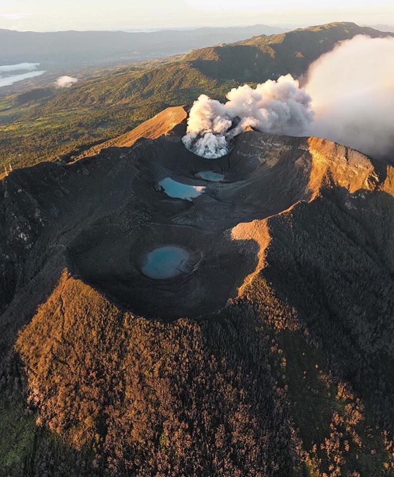
The last phreatic eruption occurred on February 28, since that date several rumblings have been recorded, some associated with small ash emissions. Seismic activity has returned to a level before June 2021. No rumbling occurred during the week, LP-type events are less frequent, an increase in the number of short tremors is observed but they have a low amplitude. The tint of the lake has returned to a level similar to that recorded before October 2021. The amount of SO2 measured in the atmosphere using satellite photos shows a downward trend from January.
Poas Volcano
Latitude: 10.2°N;
Longitude: 84.233°W;
Altitude: 2780m.
Current activity level: 2 (quiet active volcano)
Potentially associated dangers: gas, phreatic eruptions, proximal ballistic projections, acid rain, lahars.
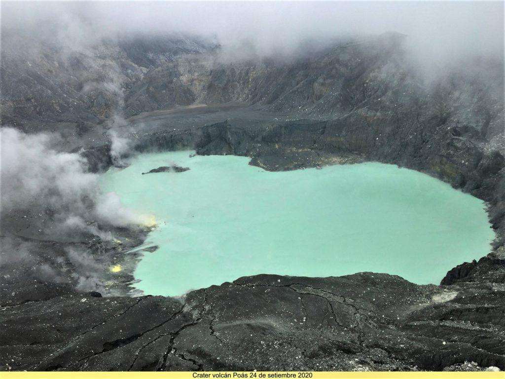
No eruption has been detected since the beginning of 2022. Seismicity is at an intermediate level with around 100 events per day (compared to 50 when low or 200 when high). The period presents a greater number of daily LP-type events, there are no VT-type events, nor short tremors. There is a lot of convection in the lake. It has not been possible to measure a significant contribution of SO2 to the atmosphere by satellite since the end of January 2022.
Source : Ovsicori.
Photos : Federico Chavarría-Kopper – Ovsicori , jcarvaja17 , Ovsicori ( archive).
Mexico , Popocatepetl :
March 19, 11:00 a.m. (March 19, 5:00 p.m. GMT)
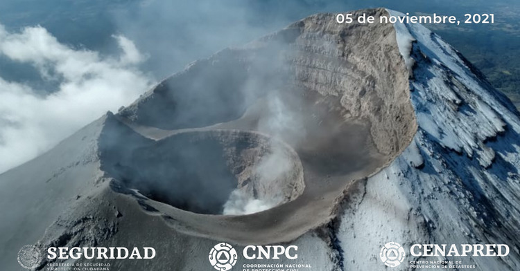
During the last 24 hours, according to the monitoring systems of the Popocatépetl volcano, 12 low intensity exhalations have been detected, accompanied by water vapor, gas and sometimes slight amounts of ash. In addition, 507 minutes of low amplitude tremor were recorded.
Similarly, there were continuous emissions of steam and volcanic gases that dispersed east-northeast.
CENAPRED urges NOT TO APPROACH the volcano and especially the crater, because of the danger of falling ballistic fragments and, in case of heavy rains, to stay away from the bottom of the ravines because of the danger of mudslides and of debris.
The Popocatépetl volcanic alert traffic light is in YELLOW PHASE 2.
Source et photo : Cenapred

