August 31 , 2021 .
Hawaii , Kilauea :
19°25’16 » N 155°17’13 » W,
Summit Elevation 4091 ft (1247 m)
Current Volcano Alert Level: ADVISORY
Current Aviation Color Code: YELLOW
Activity Summary:
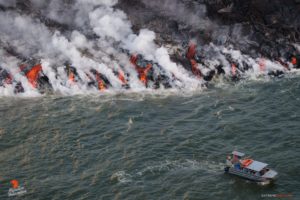
Kīlauea volcano is not erupting. However, intrusive activity that began on August 23 continues south of Kīlauea caldera. Ground deformation in Kīlauea’s south summit region continues, though at a lower rate than what has been seen in earlier intrusive pulses over the past week. Current earthquake activity remains low compared to the earlier pulses of this intrusive activity. The East Rift Zone remains quiet.
Observations:
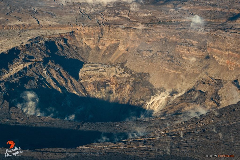
Observations over the past 24 hours suggest that magma continues to be supplied to the ongoing intrusion beneath the area south of Kīlauea’s summit. However, the current rate of ground deformation in Kīlauea summit region, within Hawaiʻi Volcanoes National Park, is significantly lower than the rates seen in the first intrusive pulse spanning August 23-25 and the initial rates of the second intrusive pulse beginning on August 26.
Over the past 24 hours, approximately 98 earthquakes were recorded at Kīlauea summit and south of Kīlauea caldera. Most of the earthquakes were less than magnitude 2 and occurred approximately 1-4 km (0.6-2.5 mi) below the surface. These small earthquakes have occurred at up to 8 detected earthquakes per hour. These earthquake rates are significantly lower than the rates observed during pulses in activity last week.
At the time of this statement, activity continues but there is no indication of upward migration of earthquakes toward the surface or change in deformation that would indicate shallowing of the source intrusive activity. Accordingly, Kīlauea’s Volcano Alert Level and Aviation Color Code remain at ADVISORY/YELLOW.
The Hawaiian Volcano Observatory (HVO) continues to closely monitor Kīlauea for changes in activity. Beginning tomorrow, HVO will return to issuing weekly Kīlauea updates every Tuesday. HVO will issue additional messages as necessary.
Source : HVO.
Photo : Bruce Omori .
Alaska , Great Sitkin :
52°4’35 » N 176°6’39 » W,
Summit Elevation 5709 ft (1740 m)
Current Volcano Alert Level: WATCH
Current Aviation Color Code: ORANGE
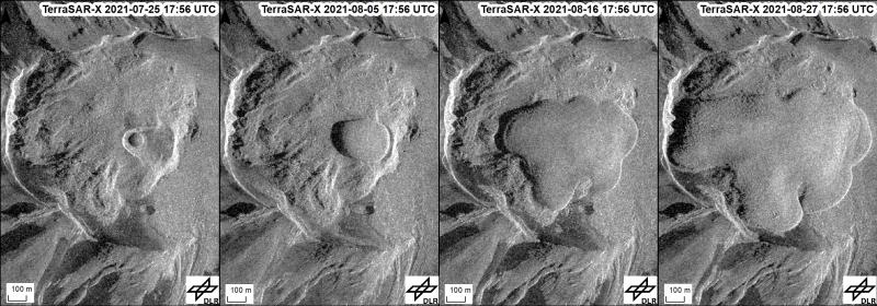
Elevated surface temperatures and small earthquakes were detected over the past day at Great Sitkin Volcano, consistent with continued growth of a lava dome. Satellite imagery from the weekend showed the lava dome to be about 1090 m (~3576 ft) across. Gas emissions were observed in satellite data, but no explosions or significant ash emissions were detected.
The growth of the new lava dome at the summit of Great Sitkin is seen in a series of high-resolution satellite radar images between July 25 and August 27, 2021. Over this time the dome grew from ~90 m to ~1000 m across (~300–3300 ft). Lava filled the May explosion crater by August 4 and has now been flowing down the sides of the 1974 lava dome and across the summit crater floor. These images have some distortion caused by the oblique satellite illumination angle, but nicely capture changes at summit of Great Sitkin.
There is no indication of how long lava effusion will continue during the current eruption, and it is possible that explosive activity could occur with little or no warning. Great Sitkin Volcano is monitored by local seismic and infrasound sensors, satellite data, web cameras, and remote infrasound and lightning networks.
Source : AVO.
Photo : Dietterich, Hannah / Simon Plank (German Aerospace Center, DLR). TerraSAR-X/TanDEM-X © DLR e.V. 2019.
Italy / Sicily , Etna :
COMMUNICATION ON THE ACTIVITY OF ETNA, August 30, 2021, 23:06 (21:06 UTC)
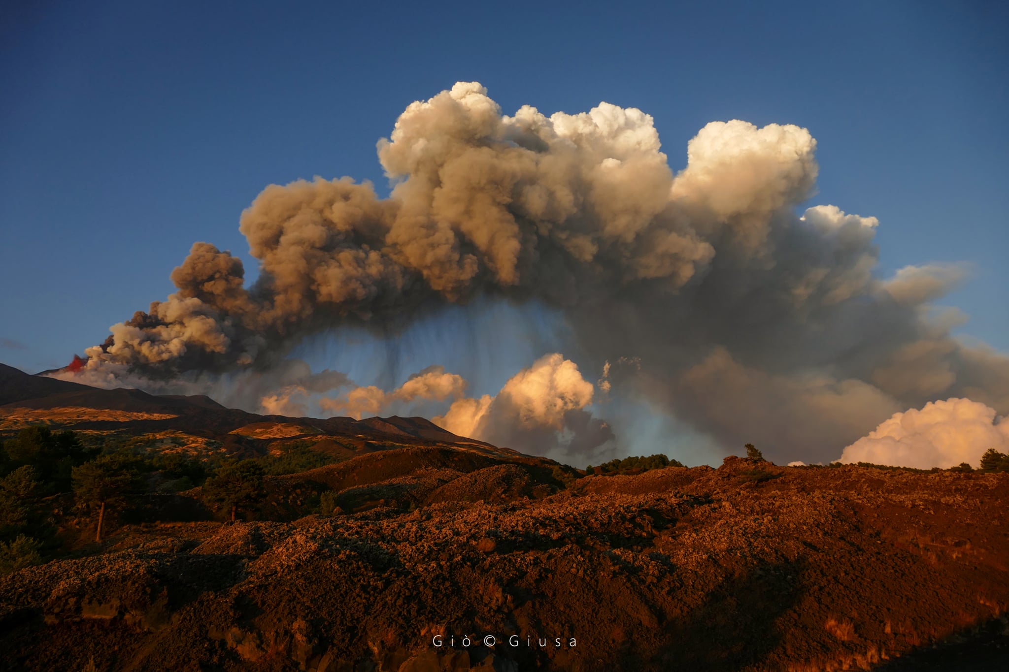
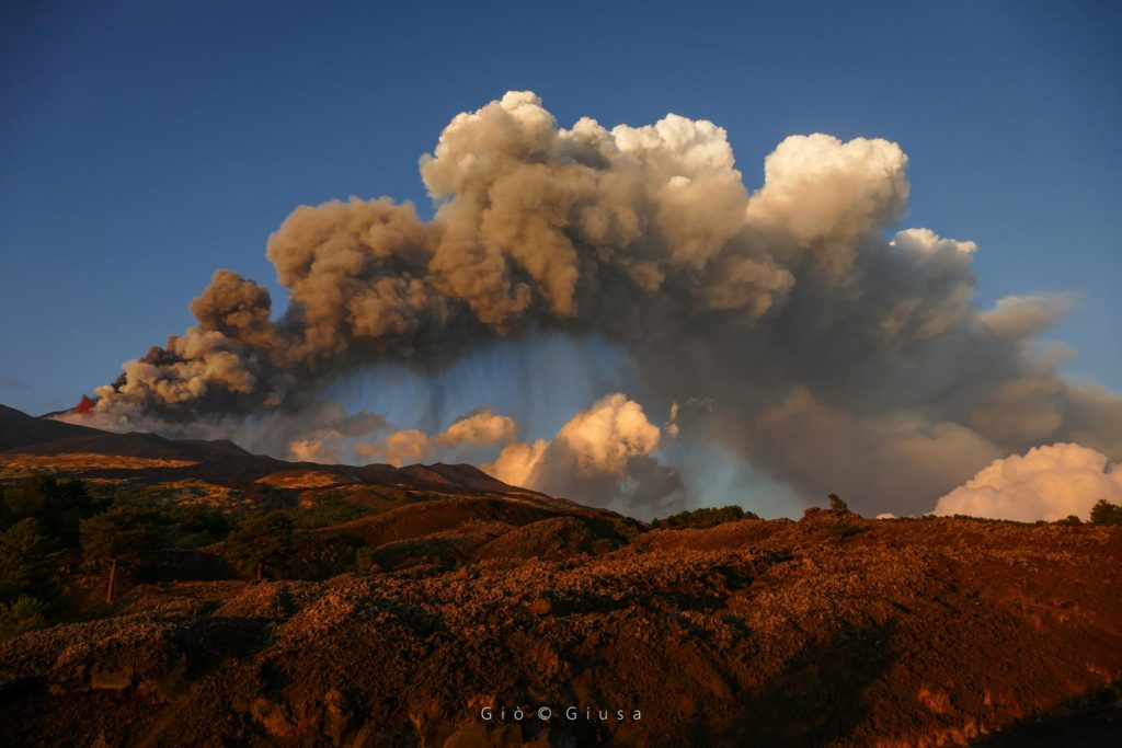
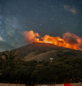
The National Institute of Geophysics and Volcanology, Osservatorio Etneo reports that from around 8:00 p.m. UTC there is a resumption of weak Strombolian activity at the South East Crater.
The trend of the mean amplitude of the volcanic tremor, from 20:00 UTC, is characterized by fluctuations on medium-low values.
The centroid of the volcanic tremor sources is located in correspondence with the crater of Bocca Nuova at an altitude of about 2700 m above sea level. Infrasound activity remains at low levels.
Analysis of soil deformation signals does not show significant changes on GNSS and inclinometric networks.
Further updates will be communicated shortly.
Source : INGV.
Photo : Gio Giusa .
Indonesia , Ili Lewotolok :
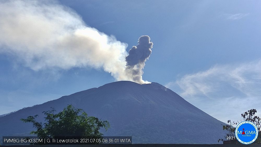
Level of activity at level III (Siaga) since November 29, 2020 at 1:00 p.m. WITA. This increase in status was motivated by an eruption on November 27, 2020 at 05:57 a.m. WITA with a height of gray to black ash columns observed at 500 m above the summit (1923 m altitude) with a strong intensity, oriented towards the west. Eruptions still occur today.
The volcano is clearly visible until it is covered in fog. The smoke from the crater is white, gray and black with moderate to strong intensity, about 50-500 meters above the summit. The weather is sunny, the wind is weak to moderate to the west and northwest. The air temperature is approximately 23.6-33.3 ° C. Humidity 55.9-70.1%. An eruption occurred at a height of 300 to 400 meters above the summit, the ash column of the eruption was white / gray.
According to the seismographs of August 30, 2021, it was recorded:
24 eruption / explosion earthquakes
34 emission earthquakes
1 harmonic tremor
1 local tectonic earthquake.
VOLCANO OBSERVATORY NOTICE FOR AVIATION – VONA.
Issued : August 26 , 2021
Volcano : Ili Lewotolok (264230)
Current Aviation Colour Code : ORANGE
Previous Aviation Colour Code : orange
Source : Ili Lewotolok Volcano Observatory
Notice Number : 2021LEW37
Volcano Location : S 08 deg 16 min 19 sec E 123 deg 30 min 18 sec
Area : East Nusa Tenggara, Indonesia
Summit Elevation : 4554 FT (1423 M)
Volcanic Activity Summary :
Eruption with volcanic ash cloud at 02h39 UTC (10h39 local). Eruption and ash emission is not continuing.
Volcanic Cloud Height :
Best estimate of ash-cloud top is around 7754 FT (2423 M) above sea level, may be higher than what can be observed clearly. Source of height data: ground observer.
Other Volcanic Cloud Information :
Ash-cloud moving to West
Remarks :
Seismic activity is characterized by continuous volcanic tectonic Earthquake.
Sources : PVMBG, Magma Indonésie .
Photo : PVMBG. (5/08).
Costa Rica , Rincon de la Vieja :
Activity report of the Rincón de la Vieja volcano, August 30, 2021.
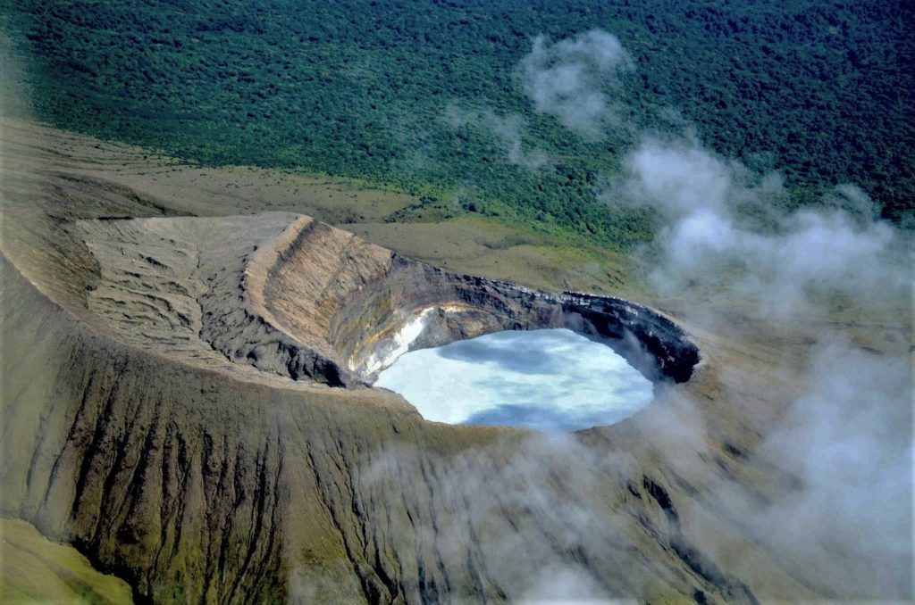
On August 30, 2021 at 8:17 local time, an eruption was recorded on the Rincón de la Vieja volcano, the height reached by the column is unknown due to the visibility conditions of the site.
Duration of activity: 1 minute.
Ash fall reported: No ash fall reported
Sulfur odor reported: No sulfur odor reported.
Hydrovolcanic or phreatomagmatic eruptions
The Rincón de la Vieja volcano has exhibited eruptive activity almost every year since September 2011. However, since mid-April of this year, the volcano has maintained almost continuous activity, consisting of small to moderate hydro-volcanic eruptions rich in vapor. The noticeable but slow increase in hydrothermal explosive activity began to be noticed from mid-March 2020 until reaching a maximum between May 25 and 26, culminating with the ash emission of May 26, 2020. at 7:05 p.m.
Since then, hydrothermal explosive activity has shown a gradual decline.
To compare several of the recent hydrothermal eruptions with each other, we can calculate a magnitude associated with the energy dissipated during the eruptions due to the expulsion of gases confined inside the volcano, which causes a pressure wave or a sound wave. due to the difference between the internal pressure of the volcano and the external atmospheric pressure. Thus, the eruption of January 30, 2020, which is one of the largest on record in the past 3 years, had a magnitude of 4.95. The maximum eruption recorded over the period March-May 2020 occurred on May 25 at dawn and was of magnitude 4.5. Subsequently, the activity decreased … / …
Source : Ovsicori :
Read the article : file:///C:/Users/Utilisateur/Downloads/cenizasrinconvieja26mayo2020.pdf
Photo : Federico Chavarría-Kopper – Ovsicori

