January 16 , 2021 .
Kamchatka , Klyuchevskoy :
VOLCANO OBSERVATORY NOTICE FOR AVIATION (VONA)
Issued: January 16 , 2021
Volcano: Klyuchevskoy (CAVW #300260)
Current aviation colour code: ORANGE
Previous aviation colour code: orange
Source: KVERT
Notice Number: 2021-11
Volcano Location: N 56 deg 3 min E 160 deg 38 min
Area: Kamchatka, Russia
Summit Elevation: 4750 m (15580 ft)
Volcanic Activity Summary:
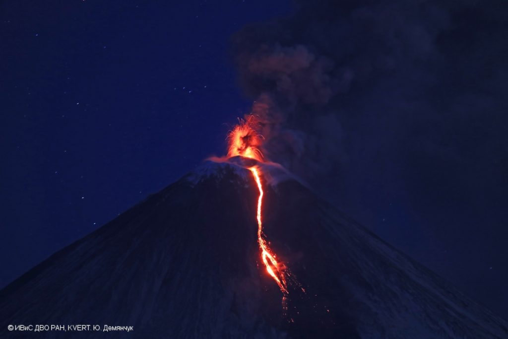
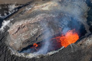
A moderate explosive-effusive eruption of the volcano continues. According to video data, a gas-steam plume with some amount of ash is extending for 90 km to the east of the volcano.
A moderate explosive-effusive eruption of the volcano continues. Ash explosions up to 7-8 km (23,000-26,200 ft) a.s.l. could occur at any time. Ongoing activity could affect low-flying aircraft.
Volcanic cloud height:
5500-6000 m (18040-19680 ft) AMSL Time and method of ash plume/cloud height determination: 20210116/0000Z – MODIS TERRA (31m32)
Other volcanic cloud information:
Distance of ash plume/cloud of the volcano: 90 km (56 mi)
Direction of drift of ash plume/cloud of the volcano: E / azimuth 80 deg
Time and method of ash plume/cloud determination: 20210116/0000Z – MODIS TERRA (31m32)
Source : Kvert.
Photo : Yu. Demyanchuk. IVS FEB RAS, KVERT.
Martinique , Montagne Pelée :
Weekly report on the activity of Mount Pelée for the period from January 08, 2021 to January 15, 2021.
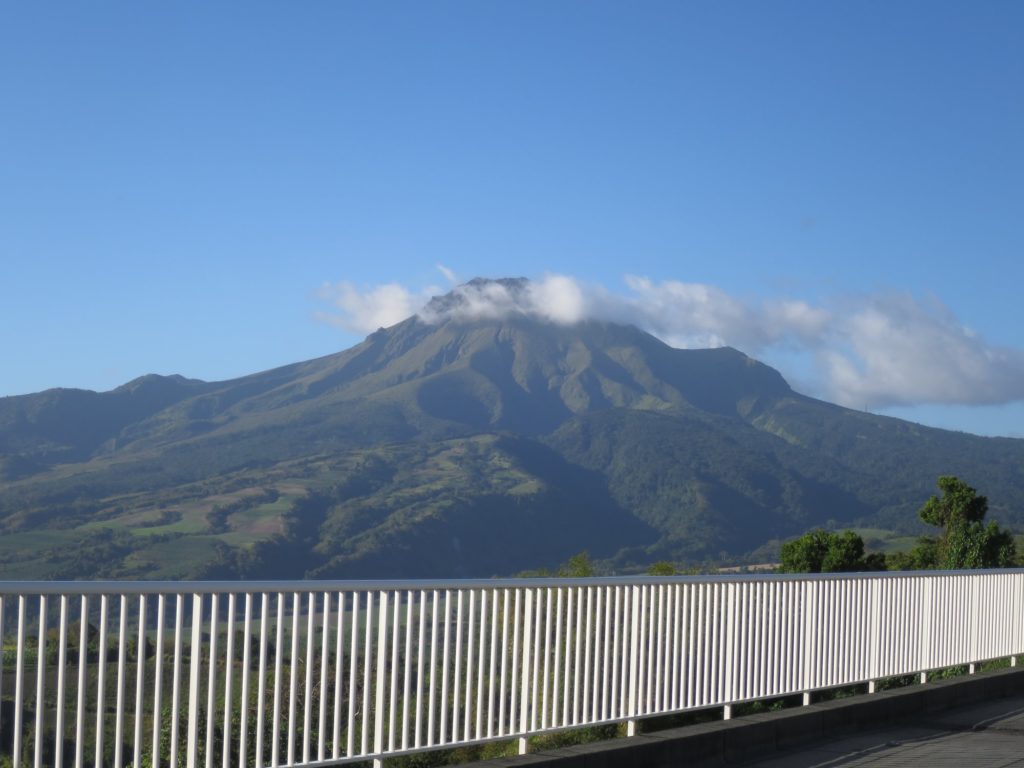
The seismicity of volcanic origin has decreased slightly over the past week, but remains significant. None of these earthquakes were felt by the population.
Between January 6, 2021 at 4 p.m. UT (local time + 4 hours) and January 15, 2021 at 4 p.m. UTC (local time + 4 hours), the OVSM recorded at least 22 volcano-tectonic earthquakes of magnitude less than or equal to 1 , located at shallow depth within the volcanic edifice, between 60m and 1000m above sea level. This volcano-tectonic type seismicity associated with high frequency signals is linked to micro-fracturing in the volcanic edifice.
During the period of this report, OVSM recorded 2 isolated long-period type earthquakes. These signals containing low frequencies are associated with the migration of fluids in the volcanic edifice.
During phases of volcanic reactivation, it is common for periods of higher seismic activity to alternate with phases of weaker seismicity. The seismicity of volcanic origin remains however clearly above the average base level recorded between January 1, 2015 and April 2019 (date of the start of its increase).
As a reminder, if the Pelée has been the subject of increased surveillance since the triggering of the yellow vigilance, the possibility of an eruption is not on the agenda.
Source : Direction de l’OVSM IPG.
Photo : observatoire volcanologique.
Indonesia , Merapi :
Mount Merapi Activity Report, January 8-14, 2021
I. OBSERVATION RESULTS
Visual
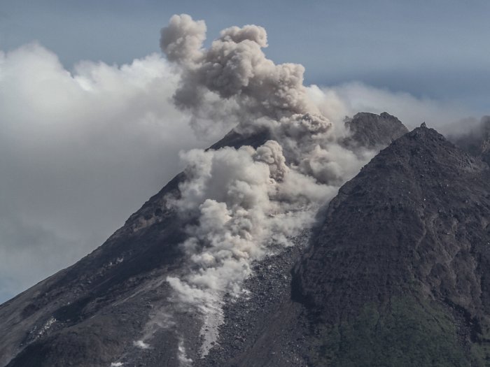
The weather around Mount Merapi is generally sunny in the morning, while the afternoon until evening is foggy. There is white smoke, thin to thick with low pressure. A maximum smoke height of 650 m was observed from the Mount Merapi observation post in Selo on January 11, 2021 at 5 a.m.
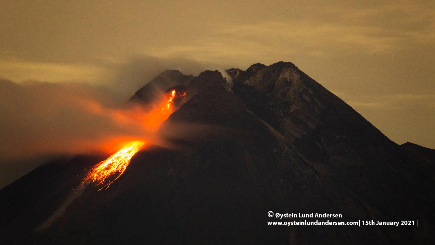
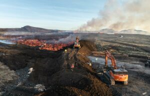
In one week, 128 incandescent lava avalanches were observed with a maximum sliding distance of 900 meters southwest of the Kali Krasak. Avalanche clouds occurred twice with a maximum slide distance of 600 meters southwest to the upper reaches of the Kali Krasak and recorded on a seismogram with a maximum amplitude of 45 mm and a duration of 120 seconds.
Morphological analysis of the summit area based on photos of the Southwest sector from January 14, 2021 shows a change in the morphology of the peak area due to avalanche activity and the development of new lava domes.
A new lava dome, referred to as the 2021 lava dome, is located in the southwest sector of Mount Merapi around the 1997 Lava Cliffs. On January 14, 2021, the measured volume of the lava dome was 46,766 m3 with a growth rate of about 8,500 m3 / day.
Seismicity
This week, the seismicity of Mount Merapi recorded:
2 hot cloud avalanches (AP),
208 shallow volcanic earthquakes (VTB),
803 multi-phase earthquakes (MP),
1056 avalanche earthquakes (RF),
172 emission earthquakes (DG)
16 tectonic earthquakes (TT).
The intensity of internal seismicity has decreased significantly this week compared to last week. Meanwhile, RF-type earthquakes that reflect lava avalanche activity from the eruption tend to be high.
Deformation
The deformation of Mount Merapi which was monitored using EDM this week showed a shortening rate of 6cm / day. Over the past two weeks, the rate of distance shortening has shown a significant decrease.
Rain and lahars
This week there was rain at the Mount Merapi Observation Post with the highest rainfall intensity of 60mm / hour for 80 minutes at Babadan Post on January 12, 2021 and it was reported that there was an increase in the flow of the Kali Gendol.
Conclusion
Based on the results of visual and instrumental observations, it is concluded that:
The volcanic activity of Mount Merapi is still quite high in the form of effusive eruption activity. The status of the activity is defined at the “SIAGA” level.
Source : BPPTKG.
Photos : Oystein Lund Andersen , Hendra Nurdiyansyah .
Chile , Nevados of Chillan :
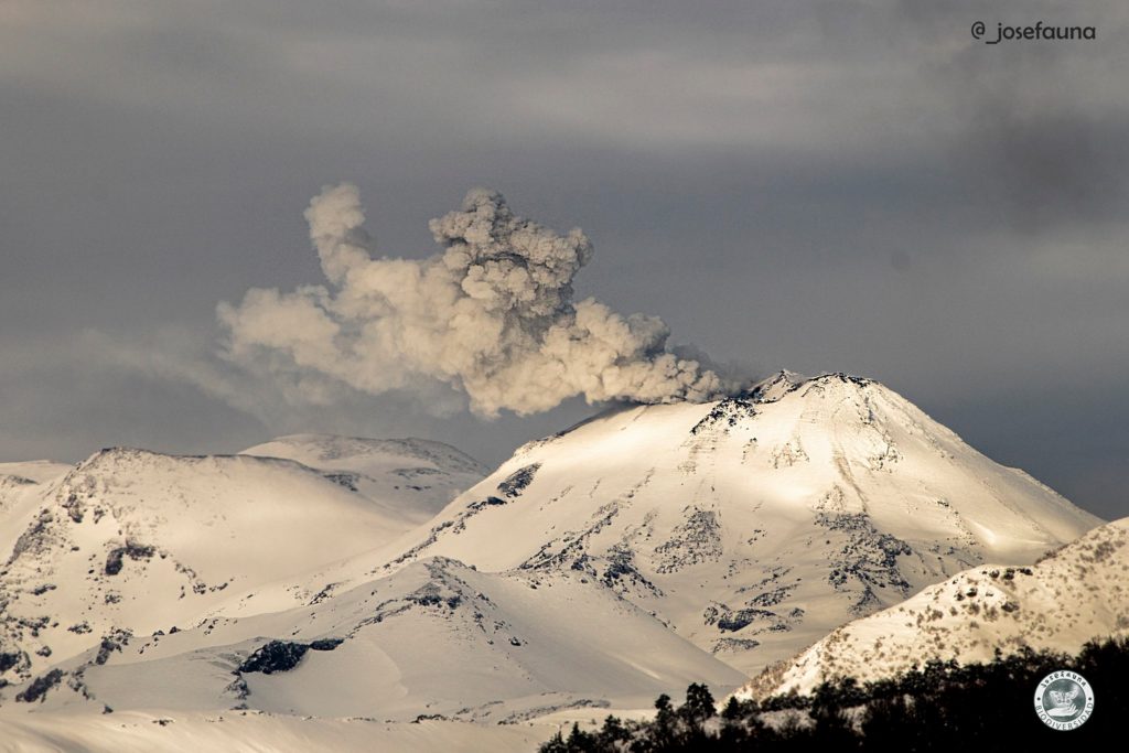
Special Report on Volcanic Activity (REAV), Ñuble region, Nevados de Chillán volcanic complex, January 14, 2021, 15:10 local time (Continental Chile)
The National Service of Geology and Mines of Chile (Sernageomin) publishes the following PRELIMINARY information, obtained thanks to the monitoring equipment of the National Volcanic Monitoring Network (RNVV), processed and analyzed in the Volcanological Observatory of the Andes of the South (Ovdas):
On Thursday, January 14, at 14:41 local time (17:41 UTC), the monitoring stations installed near the Nevados de Chillán Volcanic Complex recorded an earthquake linked to the fracturing of rocks (Volcano-Tectonic).
The characteristics of the earthquake after its analysis are as follows:
ORIGINAL TIME: 14:41 local time (17:41 UTC)
LATITUDE: 36.892 ° S
LONGITUDE: 71.340 ° W
DEPTH: 3.9 km
LOCAL MAGNITUDE: 3.1 (ML)
OBSERVATIONS:
After the occurrence of this event, no significant changes were recorded in the internal dynamics of the volcanic complex, as well as in the high intensity surface activity.
The volcanic technical alert remains at the Yellow level.
Source : Sernageomin .
Photo : Josefauna.
Saint Vincent , Soufrière Saint Vincent :
LA SOUFRIÈRE BULLETIN , JANUARY 15, 2021 8:00 PM
Work continued today at the La Soufrière Volcano, with the support of the helicopter. An observation flight was conducted this morning by Professor Robertson and Dr. Stinton, one of the two scientists who arrived on Wednesday to provide support to the SRC Team.
Conditions were not ideal but allowed for clear views mainly into the western parts of the crater.
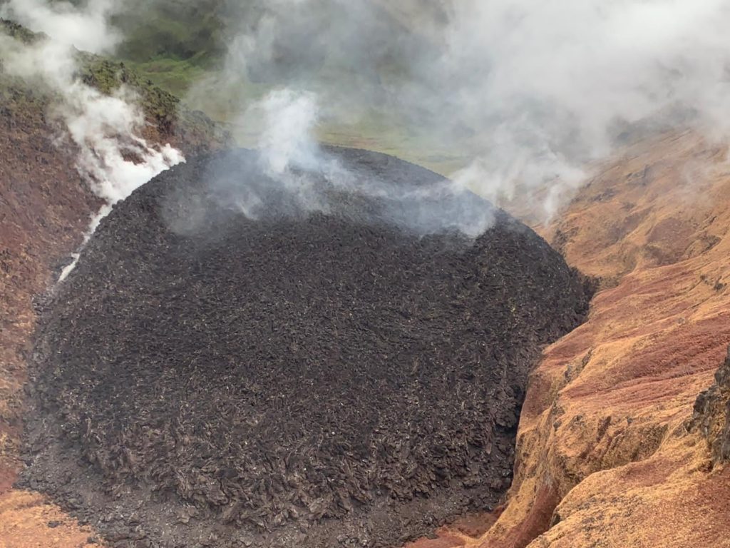
Observations made indicate that the dome has continued to grow; and is now about three quarters (¾) the height of the pre-existing 1979 dome. Growth of the dome continues with lateral spreading of material towards the east and west along the moat areas surrounding the 1979 dome.
Gas emissions were observed from several areas of the 1979 dome as well as the crater floor through several cracks which have developed.
Damage to the vegetation was extensive within the eastern, southern, and western parts of the inner crater walls. The damage reported on previously that is occurring along the upper part of the south western crater rim, has continued to slowly extend downslope.
Installation of a new seismic and continuous GPS monitoring station began on the upper southern flank of the volcano by a team led by Instrumentation Engineer, Lloyd Lynch of the SRC.
Alert level remains at Orange. The volcano continues to exude magma on the surface and steam can still be observed from the Belmont Observatory. Persons living in areas close to the volcano should expect strong sulphur smells for several days to weeks, depending on changes in wind direction.
Source : Nemo .
Photo : UWI

