August 16 , 2020.
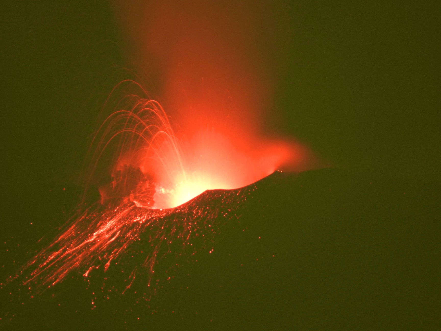
Italy / Sicily , Etna :
ETNA COMMUNICATION [UPDATE n. 65]
The National Institute of Geophysics and Volcanology, Osservatorio Etneo, announces that as of 3:00 p.m. GMT yesterday, an increase in Strombolian activity is observed at the New Southeast Crater. The explosive activity produces a cloud of volcanic ash that dispersed east-southeast and reaches a height of between 4 and 4.5 km above sea level.
From the seismic point of view, the amplitude of the tremor shows variations in the range of average values and, sometimes, in that of high values. The location of the source of the tremor is confined to the New Southeast Crater area between 2900 and 3000 m above sea level. From an infrasound point of view, there are no significant changes.
Regarding the deformations of the ground, there are no significant variations.
ETNA COMMUNICATION [UPDATE n. 66]
The National Institute of Geophysics and Volcanology, Osservatorio Etneo, reports that a decrease in Strombolian activity is observed at the New Southeast Crater. There are sporadic and light ash emissions that quickly disperse into the atmosphere.
From the seismic point of view, the amplitude of the volcanic tremor shows a stationary image with fluctuations around medium-high values and a source located in correspondence with the New Southeast Crater between 2900 and 3000 m altitude.
From the infrasound point of view, no significant activity is reported.
From the observation of the parameters relating to the deformations of the ground, no significant variation is detected.
Further updates will be communicated shortly.
Source : INGV.
Photo : INGV , 11 Aout 2020.
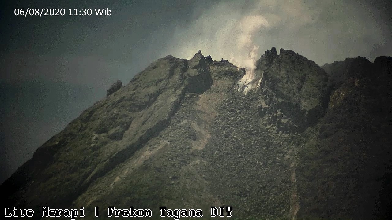
Indonesia , Merapi :
Mount Merapi Activity Report, August 7-13, 2020.
I. OBSERVATION RESULTS
Visual
The weather around Mount Merapi is generally sunny in the morning and night, while the afternoon and evening is foggy. White smoke, thin to thick, is observed with low pressure. A maximum smoke height of 200 m is observed from the Mount Merapi in Selo observation post on August 7, 2020 at 5:45 p.m. WIB.
Morphological analysis of the crater area based on photos of the southeast sector shows no change in the morphology of the dome. The volume of the lava dome based on measurements using aerial photos with drones on July 26, 2020 was 200,000 m3.
Seismicity:
This week, the seismicity of Mount Merapi recorded:
9 emission earthquakes (DG),
8 shallow volcanic earthquakes (VTB),
69 multiple phase earthquakes (MP),
2 low frequency earthquakes (LF),
38 avalanche earthquakes (RF),
14 tectonic earthquakes (TT).
The intensity of the seismicity this week is relatively the same as last week.
Deformation
The deformation of Mount Merapi which was monitored using EDM this week showed a shortening of the distance of the beacons of about 2 cm.
Rain and lahars:
This week there was rain at Mount Merapi Observation Post with the highest rainfall intensity of 31mm / hour for 165 minutes at Kaliurang Post on August 11, 2020. There was no rain. lahars or additional flow in the rivers that descend from Mount Merapi.
Conclusion:
Based on the results of visual and instrumental observations, it is concluded that:
1. The lava dome is currently in stable condition.
2. The volcanic activity of Mount Merapi is still quite high and is at the “WASPADA” activity level.
3. The potential dangers today are hot clouds from the collapse of the lava dome and the eruption of volcanic material from explosive eruptions.
Source : BPPTKG.
Photo : Frekom , 06/08/2020.
Guatemala , Santiaguito :
Type of activity: Pelean
Morphology: Complex of dacitic domes
Geographical location: 14 ° 44 ’33 ˝ Latitude N; 91 ° 34’13˝ Longitude W.
Height: 2,500msnm.
Atmospheric conditions: clear
Wind: south-east
Precipitation: 0.00 mm.
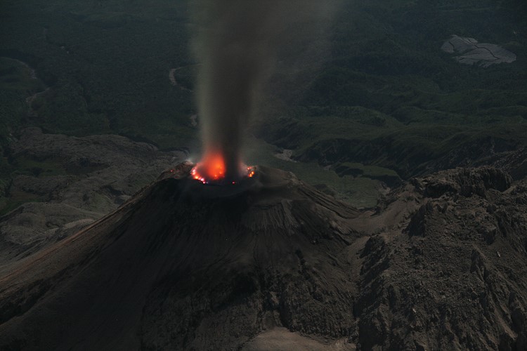
Activity:
The Caliente Dome is observed with a white fumarole mainly of water vapor at a height of 3,100 meters (9,843 feet), which the wind moves to the west and southwest of the volcanic complex. An incandescence is observed on the crater of the Caliente dome. Weak explosions and moderate explosions are recorded up to 3100 meters (10 170 feet) of altitude, with a slight presence of ash on the volcanic perimeter. The STG3 seismic station records moderate to strong block avalanches, constantly observed on the South, South-West and South-East flanks, some reaching the base of the dome, and others accompanied by small pyroclastic flows. Larger pyroclastic flows could be generated. (The recommendations of the special bulletin of the Santiaguito volcano 56-2020, remain valid).
Source : Insivumeh .
Photo : Marc Szeglat / Wikimedia , 2009.
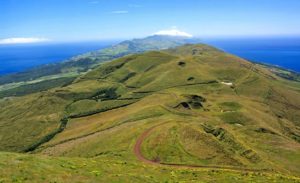
El Salvador , Santa Ana (Ilamatepec) :
Location: shared by the departments of Santa Ana and Sonsonate
Altitude: 2381 meters above sea level
Type of volcano: Stratovolcano
Type of activity: Vulcanian – Strombolian
Last eruption: October 1, 2005.
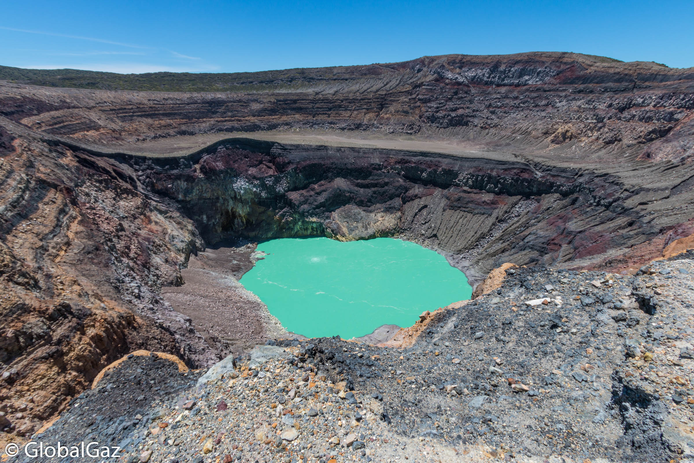
The seismic vibration of the volcano remained between 19 and 23 RSAM units per day on average, that is to say in the normal range. During the month, a total of 30 earthquakes related to the movement of fluids in the volcanic system were recorded. As for the earthquakes associated with rock fractures, five were recorded. Concerning Sulfur Dioxide (SO2) emissions, measured with DOAS equipment, they fluctuated between 116 and 415 tonnes per day, with an average of 238 tonnes / d, the threshold being 300 tonnes / d.
According to the analysis of monitoring data, the volcano continues to be active within the normal range.
Source : Marn .
Photo : globalgaz