March 11 , 2020 .
Italy /Sicily , Etna :
Weekly bulletin from 02/03/2020 to 08/03/2020 (issue date 10/03/2020).
SUMMARY OF ACTIVITY STATUS
In light of the monitoring data, it is highlighted:
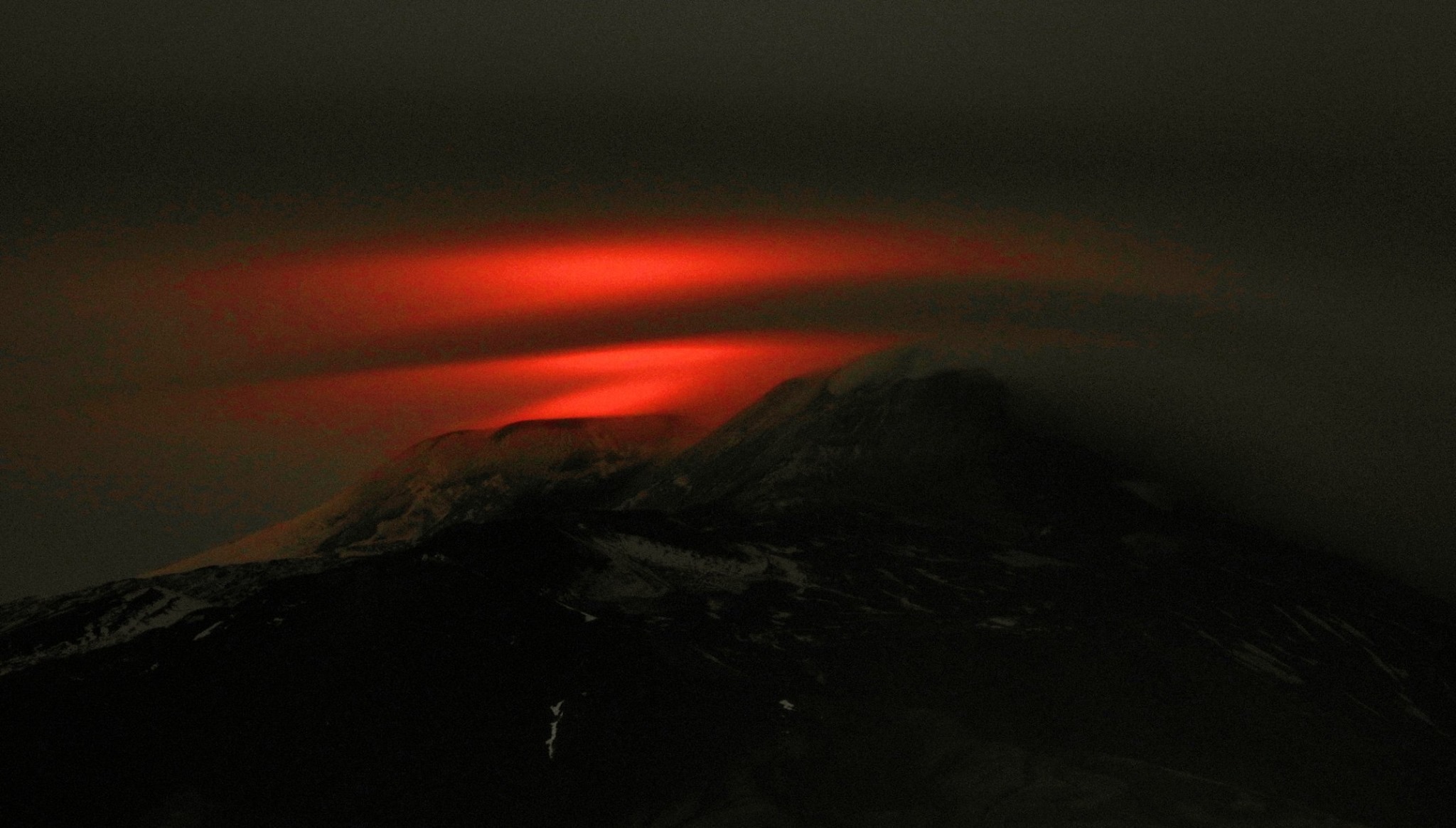
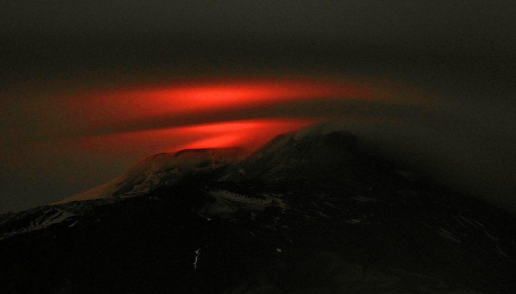
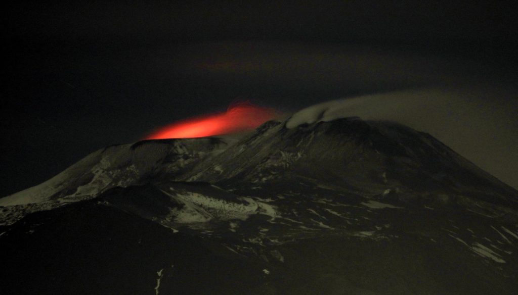
1) VOLCANOLOGICAL OBSERVATIONS: Strombolian and effusive intra-crater activity of the Voragine crater. Discontinuous ash emissions and discontinuous strombolian activity in the Northeast crater and the New Southeast crater.
2) SEISMOLOGY: Low seismic fracturing activity; stationarity of the parameters of the volcanic tremor.
3) INFRASOUND: Moderate infrasonic activity.
4) DEFORMATIONS: The Etna soil deformation monitoring networks have not shown any significant variation to report during the last week.
5) GEOCHEMISTRY: The flow of SO2 is at an average level. The flow of CO2 from soils is at medium-low levels. The partial pressure of dissolved CO2 does not show significant variations. The isotopic ratio of helium is fixed at medium-high values. No update on the CO2 / SO2 ratio is available.
VOLCANOLOGICAL OBSERVATIONS
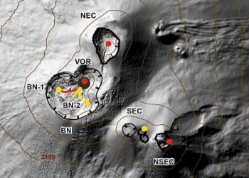
During the week, monitoring of volcanic activity in the summit craters of Etna (Fig. 3.1) was carried out by analyzing images from the network of surveillance cameras from the INGV Catania section, Etneo Observatory (INGV- OE).
Fig. 3.1 – Map of the area of the summit crater (DEM 2014, Laboratory of aerogeophysics – Section Rome 2, mod.). Scalloped black lines = edge of upper craters: BN = Bocca Nuova, inside which BN-1 and BN-2 are observed; VOR = Voragine ; NEC = Northeast Crater; SEC = Southeast Crater; NSEC = New southeast crater. Yellow dots = degassing vents. Red dots = mouths with eruptive activity. Red line = active flows. Yellow lines = flows in cooling. Gray circle = ash cone.
During the period considered, the upper craters were mainly characterized by an explosive strombolian and effusive activity of Voragine (VOR), and by a degassing with a discontinuous strombolian activity and intermittent ash emissions from the New Southeast Crater (NSEC) and the Northeast Crater (NEC) (Fig.3.1).
Volcanic tremors:
The time trend of the average amplitude of volcanic tremor remained at an average level during the week while from March 7, it showed a slight increase, reaching a high level. The location of the source of the tremor is located under the summit craters, at a depth of about 2200-2600 meters above sea level.
Source : INGV.
Read the whole article : file:///C:/Users/Utilisateur/AppData/Local/Packages/Microsoft.MicrosoftEdge_8wekyb3d8bbwe/TempState/Downloads/BollettinoEtna20200310%20(1).pdf
Photos : INGV, Boris Behncke.
Philippines , Kanlaon :
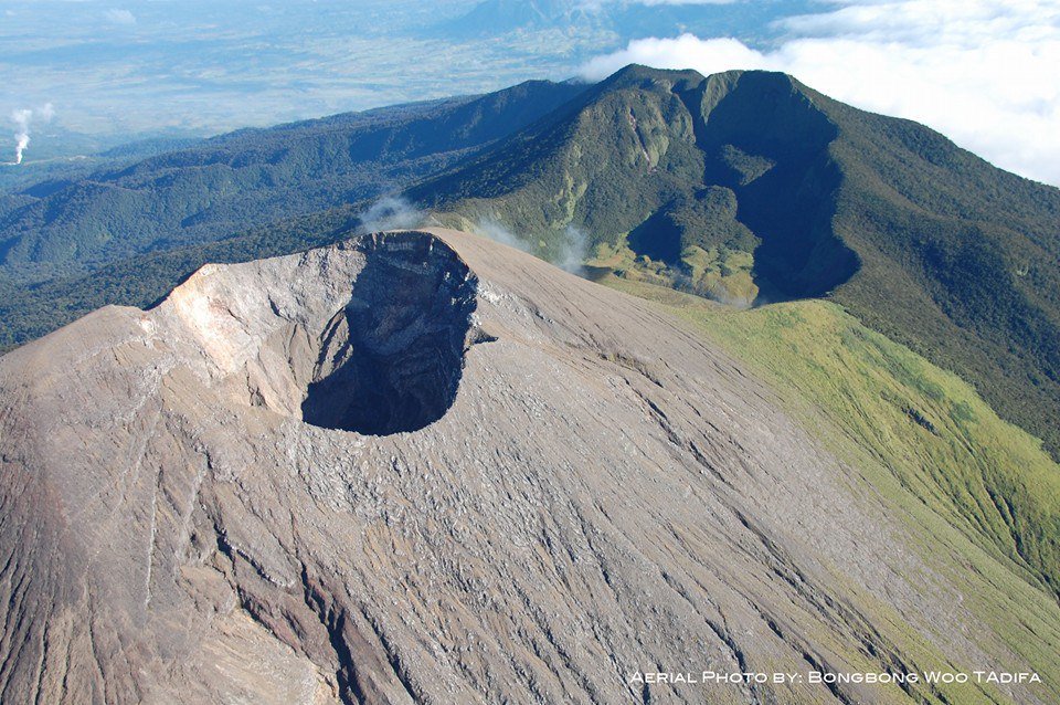
KANLAON VOLCANO BULLETIN: 11 March 2020 10:00 A.M. – Alert Level 0 (normal) to Alert Level 1 (abnormal)
This serves as a notice for the raising of the alert status of Kanlaon from Alert Level 0 (normal) to Alert Level 1 (abnormal).
Kanlaon Volcano’s seismic monitoring network recorded a total of eighty (80) volcanic earthquakes since 9 March 2020 dominated by seventy-seven (77) low frequency events that are associated with magmatic fluids beneath the edifice. The increased seismic activity could be succeeded by steam-driven or phreatic eruptions at the summit crater, despite the absence of visible degassing or steaming from the active vent this year. Ground deformation data from continuous GPS measurements indicate a period of long-term slow inflation of the edifice since 2017, while short-term electronic tilt monitoring on the southeastern flanks recorded slow inflation of the lower slopes since May 2019 and pronounced inflation of the upper slopes in the end of January 2020. These parameters indicate that volcanic processes are underway deep beneath the edifice that may be caused by deep-seated degassing or hydrothermal activity or magmatic intrusion.
Alert Level 1 status now currently prevails over Kanlaon Volcano, which means that it is at an abnormal condition and has entered a period of unrest. The local government units and the public are strongly reminded that entry into the 4-kilometer radius Permanent Danger Zone (PDZ) must be strictly prohibited due to the further possibilities of sudden and hazardous steam-driven or phreatic eruptions. Civil aviation authorities must also advise pilots to avoid flying close to the volcano’s summit as ejecta from any sudden phreatic eruption can be hazardous to aircraft.
DOST-PHIVOLCS is closely monitoring Kanlaon Volcano’s activity and any new development will be relayed to all concerned.
Source : Phivolcs.
Photo : Bongbong Woo Tadifa.
Peru , Ubinas :
Analysis period: March 2 to 8, 2020. Arequipa, March 9, 2020.
Alert level: ORANGE
The Geophysical Institute of Peru (IGP) reports that the eruptive activity of the Ubinas volcano remains at low levels. To date, the recording of earthquakes associated with the rise of magma to the surface is rare. There are weak and sporadic emissions of bluish gases (of magmatic origin) and water vapor. According to this scenario, the possibility of volcanic explosions and / or ash emissions is low.
Between March 2 and 8, the IGP recorded and analyzed a total of 112 seismic events associated with the dynamic behavior of the Ubinas volcano, with the predominance of seismic signals of the Volcano-Tectonic (VT) type, related to the fracturing of rocks inside the volcano On average, 8 earthquakes per day were recorded with magnitudes below M1.6. The seismic activity linked to the rise of magma (hybrid type) decreased both in number of events (2 daily earthquakes) and in energy.
Surveillance cameras recorded light and sporadic emissions of blue gases (of magmatic origin) and water vapor, with heights less than 300 m above the summit of the volcano. Monitoring the deformation of the volcanic structure does not record any significant anomalies. MIROVA satellite surveillance did not record any thermal anomalies.
Source : IGP.
Photo : Auteur inconnu.
Colombia , Nevado del Ruiz :
Weekly newsletter of the Nevado del Ruiz volcano
The level of activity continues at the level of yellow activity or (III): changes in the behavior of volcanic activity.
Regarding the monitoring of the activity of the Nevado del Ruiz volcano, the COLOMBIAN GEOLOGICAL SERVICE reports that:
According to the results obtained from the monitoring of the activity, through the different parameters, the Nevado del Ruiz volcano continued to show unstable behavior during the last week. An acceleration of the volcanic process and therefore changes in the level of activity of the volcano are not excluded.
The seismicity linked to the dynamics of the fluids, inside the volcanic channels, showed an increase in the number of recorded events and the seismic energy released, compared to the previous week. This seismic activity has been characterized by the presence of continuous volcanic tremors, pulses of volcanic tremors, earthquakes of long type and very long period recorded individually or jointly with pulses of volcanic tremor. The earthquakes presented varying energy levels and spectral content. Some of these signals were associated with gas and ash emissions, such as those reported today, with column heights measured at the top of the volcano up to 700 m and dispersion influenced by wind direction and speed. , which varied from the Southwest to the Southeast of the volcano. These emissions were confirmed by cameras installed in the volcano area and reports from officials of the Los Nevados National Natural Park.
The seismicity generated by the fracturing of rocks (volcano-tectonic type) increased in number of earthquakes and decreased in the seismic energy released, compared to the previous week. This type of seismicity was located mainly to the northeast of the volcano and to a lesser extent, in the Arenas crater, to the south and southeast of it. The depths of the earthquakes ranged from 0.4 to 6.2 km. The maximum magnitude recorded during the week was 0.7 ML (local magnitude), for the earthquakes located northeast of the Arenas crater.
It should also be noted, the occurrence of several episodes of seismicity of the « drumbeat » type, volcano-tectonic earthquakes, of short duration and of very low energy level. This type of seismicity is linked to the processes of ascent and evolution of a dome on the surface of the volcano.
It is important to note that some minor changes were observed in the data obtained by the inclinometers.
In tracking information from the Mirova and NASA FIRMS web portals, they have reported low to moderate energy thermal anomalies on the volcano in the past week.
The Nevado del Ruiz volcano continues at the yellow activity level.
Source : SGC.
Photos : SGC , archivo/Caracol Radio .
Hawaii , Mauna Loa :
19°28’30 » N 155°36’29 » W,
Summit Elevation 13681 ft (4170 m)
Current Volcano Alert Level: ADVISORY
Current Aviation Color Code: YELLOW
Activity Summary:
Mauna Loa Volcano is not erupting. Rates of deformation and seismicity have not changed significantly over the past week and remain above long-term background levels.
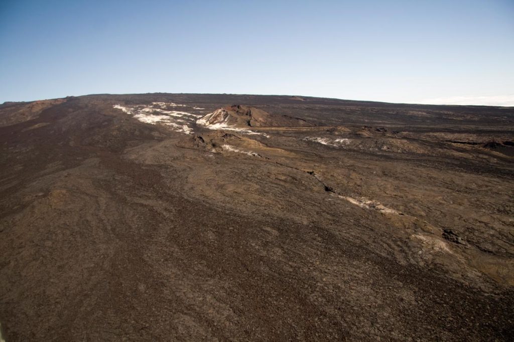
Sulphur Cone
Observations:
During the past week, HVO seismometers recorded around 70 small-magnitude earthquakes beneath the volcano’s upper elevations. Most of these events occurred at shallow depths of less than 5 kilometers (~3 miles) below ground level. Separately, a flurry – totaling around 70 small-magnitude earthquakes so far – has been occurring just south of the Mauna Loa Northeast Rift Zone, where known fault structures commonly produce shallow seismicity.
The strongest earthquake on Mauna Loa in this period was a magnitude-3.7 event in the early morning of 28 February, for which the USGS received 64 felt-reports. This earthquake was located approximately 10 kilometers (~6 miles) northeast of Hawaiian Ocean View Estates, in a region where earthquakes of similar magnitude normally occur several times per year.
Global Positioning System (GPS) measurements show continued slow summit inflation, consistent with magma supply to the volcano’s shallow storage system.
Gas concentrations at the Sulphur Cone monitoring site on the Southwest Rift Zone remain stable. Fumarole temperatures as measured at both Sulphur Cone and the summit have not changed significantly.
Source : HVO.

