March 21 , 2018.
Kilauea , Hawaï :
19°25’16 » N 155°17’13 » W,
Summit Elevation 4091 ft (1247 m)
Current Volcano Alert Level: WATCH
Current Aviation Color Code: ORANGE
Activity Summary:
The eruptions at Kīlauea Volcano’s summit and East Rift Zone continue without significant changes. This morning’s measurement of the depth to the lava lake surface within the Halemaʻumaʻu Overlook vent was 32.5m (~107ft) beneath the adjacent crater floor. The Episode 61g lava flow is active, issuing surface flows on upper parts of the flow field and on Pulama pali. These lava flows pose no threat to nearby communities. Lava is not flowing into the ocean at this time. Tiltmeters at Kīlauea summit and Puʻu ʻŌʻō are registering gradual inflationary tilt. Low rates of ground deformation and seismicity continue across the volcano.
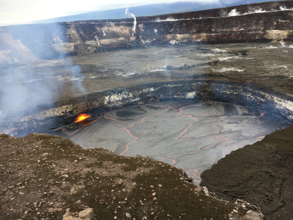
When the lava lake level was measured this morning, the lake surface was 89 feet (27 m) below the Overlook crater rim. With the lava lake at that level, spattering on the lake surface could be seen from the Jaggar Museum overlook in Hawai‘i Volcanoes National Park today.
Summit Observations:
The surface of the lava lake within the Halemaʻumaʻu Overlook vent has risen to a depth, measured this morning, of 32.5m (~107ft) below the adjacent Halemaʻumaʻu crater floor. Accompanying the drop in lava lake surface level from yesterday’s measurement, summit tiltmeters recorded small deflationary tilt since yesterday afternoon. Seismicity in the summit area is within normal, background rates, with tremor amplitude fluctuations associated with lava lake spattering. Elevated summit sulfur dioxide emission rates persist.
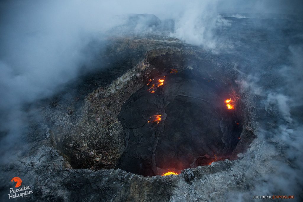
The small lava pond on the west side of the crater of Pu’u’Ō’ō.
Puʻu ʻŌʻō Observations:
Though rates have slowed since yesterday, Puʻu ʻŌʻō tiltmeters have continued to register gradual inflationary tilt over the past day. Webcam views are obscured by clouds, but long-term sources of glow within Puʻu ʻŌʻō crater and from a small lava pond on the west side of the crater appear to persist. The sulfur dioxide emission rate from the East Rift Zone vents has been steady over the past several months and remains significantly lower than the summit emission rate.
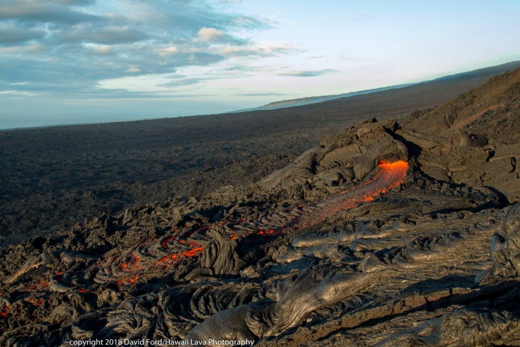
Surface flow on the upper parts of the lava flow field of episode 61g, on Pulama pali.
Lava Flow Observations:
Webcam images show continuing surface flow activity on upper parts of the Episode 61g lava flow field and on Pulama pali. No lava is flowing into the ocean at this time. The inland lava flows are not posing any threats to nearby communities.
Source : HVO
Photos : HVO , Bruce Omori , David Ford .
Stromboli , Italy:
Stromboli: eruptive activity, March 18, 2018
On March 18, there was a violent explosive sequence that involved the mouths placed on the crater terrace of the Stromboli volcano. A first explosion, which occurred at 19:27 local time from the mouths of the South-Central Zone, emitted an abundant column of ash mixed with incandescent material and large blocks of lava that fell back into the summit area and along the Sciara del Fuoco. The delivered products exceeded a height of 350 m above the crater terrace, as evidenced by the CCTV cameras of the Etneo Observatory of the National Institute of Geophysics and Volcanology (INGV-OE). About 40 seconds after the first, a second explosion occurred from the mouths in the North crater area, but less intense.
In this case, more coarse ash and material (lapilli and bombs) were emitted and reached a height of about 100 m above the mouth. In both explosions, a cloud of ash was generated that quickly dispersed in the eastern areas of the volcano. The duration of the sequence was about 40 seconds. Violent explosive sequences, such as the one described, have also occurred recently: March 7 and July 26, October 23, November 1, and December 1, 2017. These are more violent explosions than ordinary Strombolian activity. , during which coarse material and ashes are emitted, which fall back into the area of the summit. These events, occasional and unpredictable, abruptly interrupt ordinary Strombolian activity. However, they are part of the volcanic phenomenology typical of the activity of the Stromboli summit characterized by explosions of variable energy. The activity of Stromboli is constantly monitored by the INGV through its sections of Catania, Naples and Palermo.
Source : INGV
Photo : Nicola Tranquillo
Cumbal , Colombia :
Subject: Cumbal Volcano Activity Bulletin.
The level of activity of the volcano is maintained at the level:
YELLOW LEVEL ■ (III): CHANGES IN THE CONDUCT OF VOLCANIC ACTIVITY
Following the activity of the CUMBAL VOLCANIC COMPLEX, the COLOMBIAN GEOLOGICAL SERVICE informs that:
For the period from March 13 to 19, 2018, seismic activity recorded a slight decrease compared to the previous week, with a predominance of events associated with the fracturing of solid materials inside the volcano. fracturing-type earth were located in the vicinity of Plazuela Crater, in the northeast of the volcanic complex, with depths up to 10 km from the top (4700 m) and a maximum local magnitude of 0.3 degrees on the Richter scale.
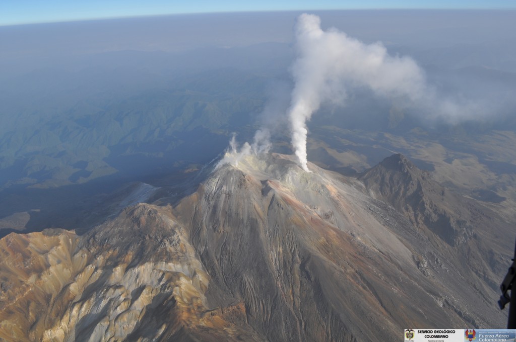
Thanks to favorable climatic conditions at the summit it was possible to observe the gas emissions every day of the evaluation period, mainly coming from the El Verde fumarole fields, in the North-East volcanic complex; the emission columns were observed white, of low height and direction of dispersion variable according to the direction of the wind.
The Colombian Geological Survey continues to monitor the evolution of the volcanic phenomenon and will continue to report in a timely manner on the changes detected.
Source : Ingeominas
Ruapehu , New Zealand :
VOLCANIC ALERT BULLETIN: RUA – 2018/01
Volcanic Alert Level remains at 1
Aviation Colour Code remains at Green
An episode of volcanic earthquakes is occurring beneath Mt Ruapehu since 15 March. This is a common observation during a heating phase of the crater lake (Te Wai ā-moe).
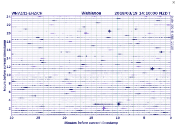
Since 15 March (NZ local time) GNS Science volcanologists have detected an ongoing sequence of seismic events beneath Mt Ruapehu that can be categorised as volcanic earthquakes. They have relatively small magnitudes and cannot be located by GeoNet’s automatic earthquake detection system but the pattern of seismic recordings indicates a source beneath the summit area. The distinction between volcanic earthquakes and volcanic tremor is gradational and a sequence of discrete volcanic earthquakes can evolve into a more continuous seismic signal which would then be called volcanic tremor. The crater lake (Te Wai ā-moe) temperature is currently at 39 oC, which is above the 95th percentile of the long-term distribution of measured temperatures at the lake (i.e. only 5% of temperature measurements made since 2009 are equal or greater than 39 oC). It has been at an elevated temperature since August 2017 (see also RUA -2017/01).
Wahianoa seismic record showing the small volcanic earthquakes
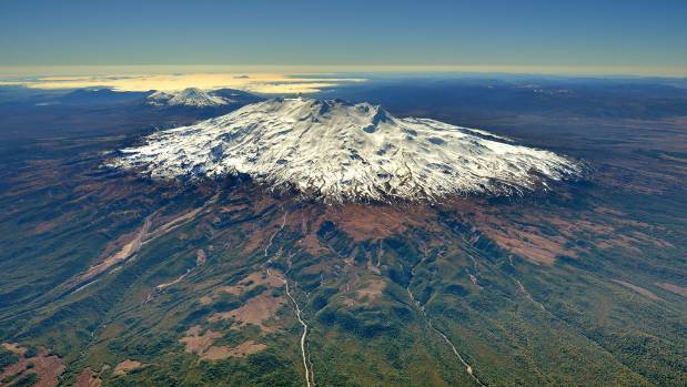
Aerial View of Mt Ruapehu from the South West. (D. Townsend) VML 150292
It is not unusual to observe volcanic earthquakes during phases of increased heat input into the lake. Similar episodes were observed during April 2016 and September 2017 but did not result in an increase in volcanic unrest. The Volcanic Alert Level, therefore, remains at 1 and the Aviation Colour Code at Green.
GNS Science continues to closely monitor Mt Ruapehu and our other active volcanoes through the GeoNet project.Source : Geonet , Yannik Behr Duty Volcanologue


