July 12 , 2021 .
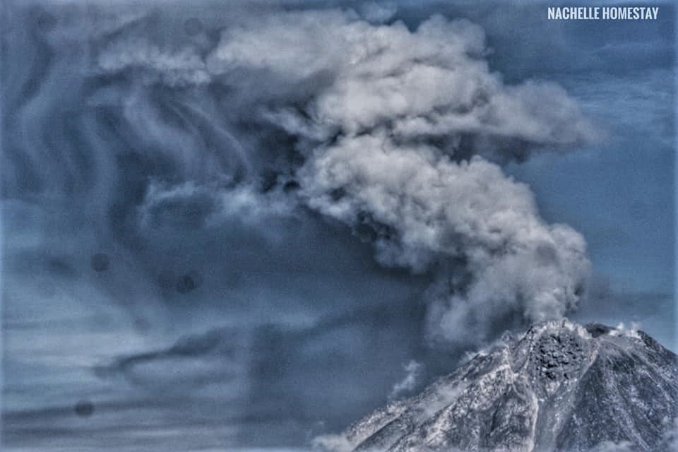
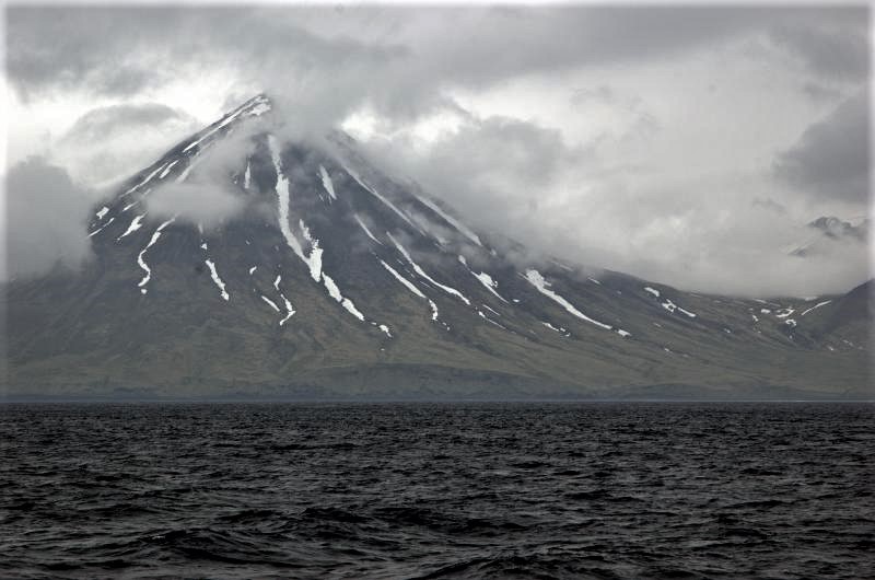
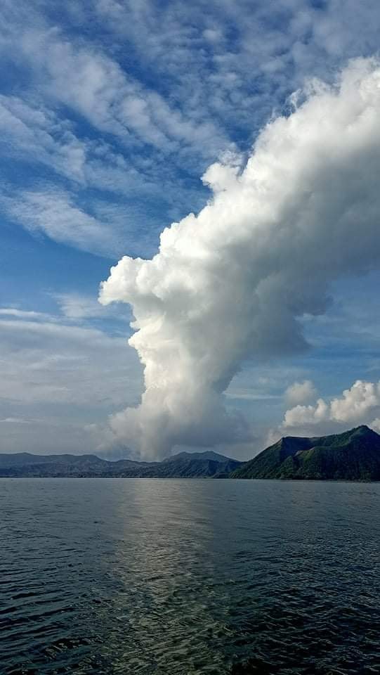
Philippines , Taal :
TAAL VOLCANO BULLETIN 12 July 2021 8:00 AM
In the past 24-hour period, the Taal Volcano Network recorded one hundred eighty-five (185) volcanic earthquakes, including seven (7) low frequency volcanic earthquakes, one hundred seventy-six (176) volcanic tremor events having durations of one (1) to sixteen (16) minutes, and low-level background tremor that has persisted since 07 July 2021. High levels of volcanic sulfur dioxide or SO2 gas emissions and steam-rich plumes that rose one thousand five hundred (1,500) meters before drifting southwest and west-northwest were generated from the Taal Main Crater. Sulfur dioxide (SO2) emission averaged 6,421 tonnes/day on 11 July 2021. Based on ground deformation parameters from electronic tilt, continuous GPS and InSAR monitoring, Taal Volcano Island has begun deflating in April 2021 while the Taal region continues to undergo very slow extension since 2020.
Alert Level 3 (Magmatic Unrest) now prevails over Taal Volcano. At Alert Level 3, magma extruding from the Main Crater could drive explosive eruption. The public is reminded that the entire Taal Volcano Island is a Permanent Danger Zone (PDZ), and entry into the island as well as into the high-risk barangays of Agoncillo and Laurel must be prohibited due to the hazards of pyroclastic density currents and volcanic tsunami should strong eruptions occur. All activities on Taal Lake should not be allowed at this time. Communities around the Taal Lake shores are advised to remain vigilant, take precautionary measures against possible airborne ash and vog and calmly prepare for possible evacuation should unrest intensify. Civil aviation authorities must advise pilots to avoid flying over Taal Volcano Island as airborne ash and ballistic fragments from sudden explosions and pyroclastic density currents such as base surges may pose hazards to aircraft.
DOST-PHIVOLCS maintains its close monitoring of Taal Volcano and any new development will be communicated to all concerned stakeholders.
Source : Phivolcs
Photo : R. Olazo
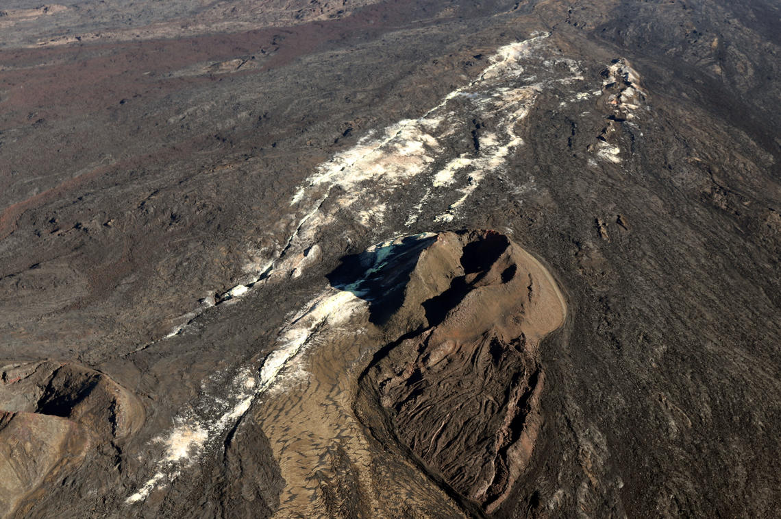
Hawaii , Mauna Loa :
19°28’30 » N 155°36’29 » W,
Summit Elevation 13681 ft (4170 m)
Current Volcano Alert Level: ADVISORY
Current Aviation Color Code: YELLOW
Activity Summary:
Mauna Loa Volcano is not erupting. Rates of seismicity at the summit remain slightly elevated and above long-term background levels. Other Mauna Loa monitoring data streams show no significant changes that would indicate increased volcanic hazard at this time.
Observations:
During the past week, HVO seismometers recorded approximately 147 small-magnitude (below M2.5) earthquakes below Mauna Loa. 46 of these occurred beneath the summit and upper-elevation flanks of the volcano, and 90 were located under the volcano’s southeast flank. The majority of these earthquakes occurred at shallow depths less than 8 kilometers (~5 miles) below sea level.
Global Positioning System (GPS) measurements show low rates of deformation in the summit region continuing through the past week.
Gas concentrations (0 ppm SO2; up to 4 ppm H2S) and fumarole temperatures (below 100°C/212°F) at both the summit and at Sulphur Cone on the Southwest Rift Zone remain stable.
Webcam views have shown no changes to the volcanic landscape on Mauna Loa over the past week.
Source : HVO.
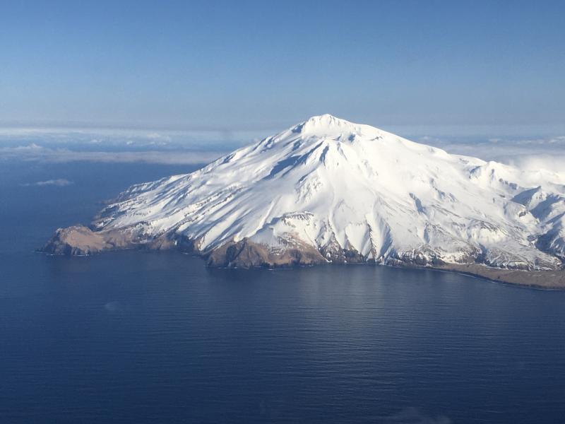
Photo : Sulfur Cône , USGS.
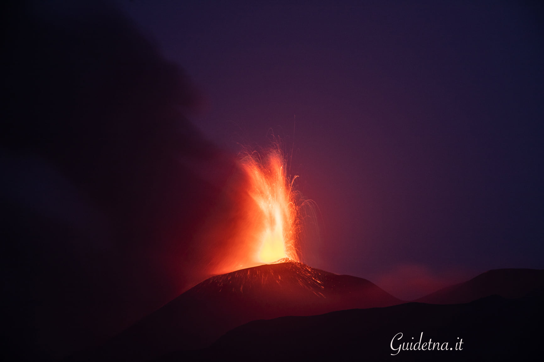
New Zealand , Ruapehu :
Mt Ruapehu status update: new heating phase starts at the crater lake (Te Wai ā-moe) Published: Mon Jul 12 2021 3:00 PM
Volcanic Alert Level remains at 1
Aviation Colour Code remains at Green
Another heating phase has started at Mt Ruapehu. Over the last three months the temperature of the crater lake (Te Wai ā-moe) has cooled from 41°C (12 April 2021) to 20°C (2 July 2021). The turnaround of the lake temperature early July has followed two small volcanic earthquakes and has been accompanied by a higher level of volcanic tremor over the weekend, as is often the case at the start of a heating episode. The Volcanic Alert Level at Mt Ruapehu remains at Level 1.
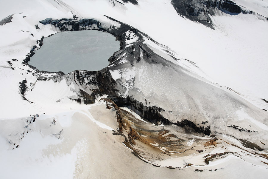
Typically, over periods of months, Ruapehu’s crater lake (Te Wai ā-moe) experiences heating and cooling cycles. In late December 2020 the lake heated to around 43°C marking the high point of the previous cycle. Early 2021 the lake cooled through to February 2021, before starting to heat again in early March. A maximum of 41°C was reached on 12 April 2021. The lake then started to cool down to 20°C on 2 July. The lake temperature started to rise again last week and is currently 23°C.
While the lake was cooling (April-July) the modelled heat input into the lake was around 80-100 MW (megawatt). To heat the lake water temperature by 3°C our modelling indicates that ~300-600 MW (megawatt) of heat is now entering the lake.
Two small earthquakes have been located, and higher level of volcanic tremor has accompanied the start of the increase in the lake temperature. The occurrence of tremor is quite typical of the start of such heating phase.
Routine monitoring at Mt Ruapehu includes gas measurement flights and crater lake (Te Wai ā-moe) water samplings. The results from these visits and of our continuous monitoring of volcanic earthquake activity, tremor levels, and crater lake (Te Wai ā-moe) temperature and water level indicate that key monitoring parameters remain within normal ranges. The lake is currently overflowing into the Whangaehu river.

The Volcanic Alert Level remains at Level 1 which reflects the current level of volcanic unrest. Mt Ruapehu is an active volcano and has the potential to erupt with little or no warning when in a state of volcanic unrest. The Aviation Colour Code remains colour Green.
The Volcanic Alert Level should not be used to forecast future activity, however at Volcanic Alert Level 1, eruptions are less likely than at Volcanic Alert Level 2.
Volcanic Alert Level 1 indicates the primary hazards are those expected during volcanic unrest: steam discharge, volcanic gas, earthquakes, landslides and hydrothermal activity. While Volcanic Alert Level 1 is mostly associated with environmental hazards, eruptions can still occur with little or no warning.
Source : Geonet .
Read the article : https://www.geonet.org.nz/vabs/6PrRLr54CAHD1ILMooeN3I
Photos : Photovolcanica , Bradd Scott.
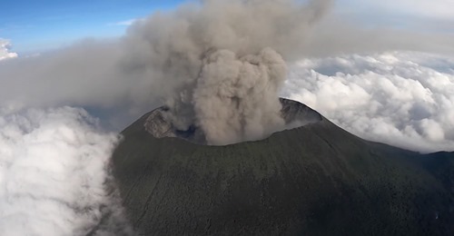
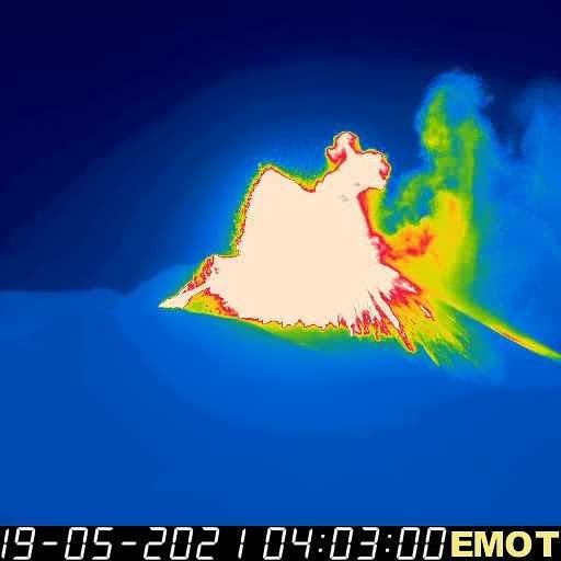
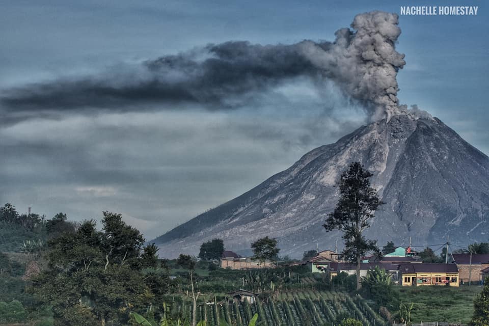
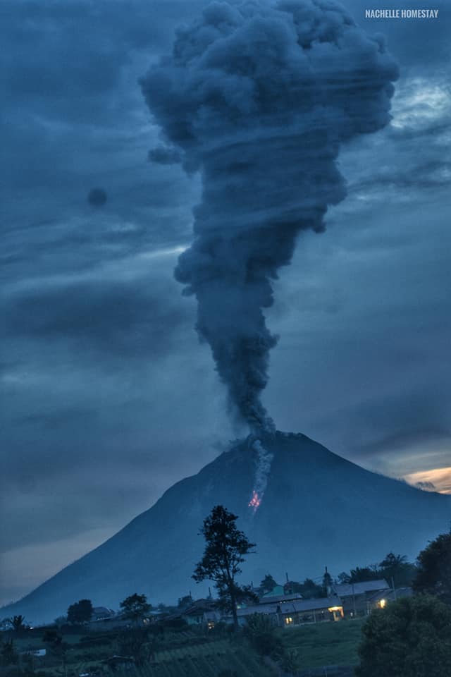
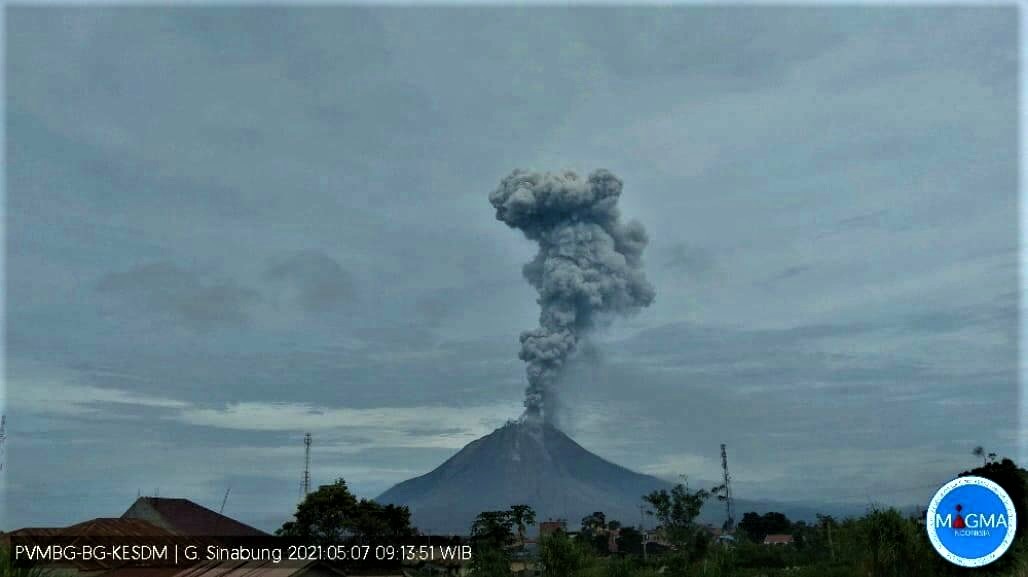
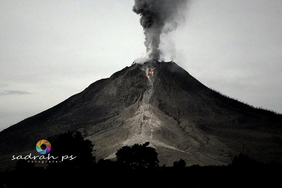
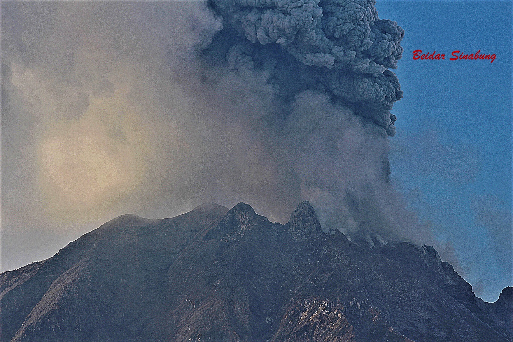
Indonesia , Sinabung :
Level III activity level (SIAGA) since May 20, 2019 at 10:00 a.m. WIB. The Sinabung volcano (2,460 m above sea level) has been erupting since 2013.
The volcano was clearly visible until it was covered in fog. The smoke observable from the main crater is white with high intensity, thick, about 100-500 meters above the summit. The weather is cloudy to rainy, the wind is weak to the east, west and northwest. The air temperature is around 17-23 ° C.
According to the seismographs of July 11, 2021, it was recorded:
6 emissions earthquakes
2 low frequency earthquakes
12 hybrid / multi-phase earthquakes
1 deep volcanic earthquake
2 local tectonic earthquakes
2 distant tectonic earthquakes
Recommendation:
Communities and visitors / tourists should not conduct activities in villages that have been displaced, as well as in locations within a radial radius of 3 km around the summit of Mount Sinabung, as well as within a sector radius of 5 km for the South-East sector, and 4 km for the North-East sector.
Source : PVMBG.
Photo : Beidar Sinabung 18 avril 2021
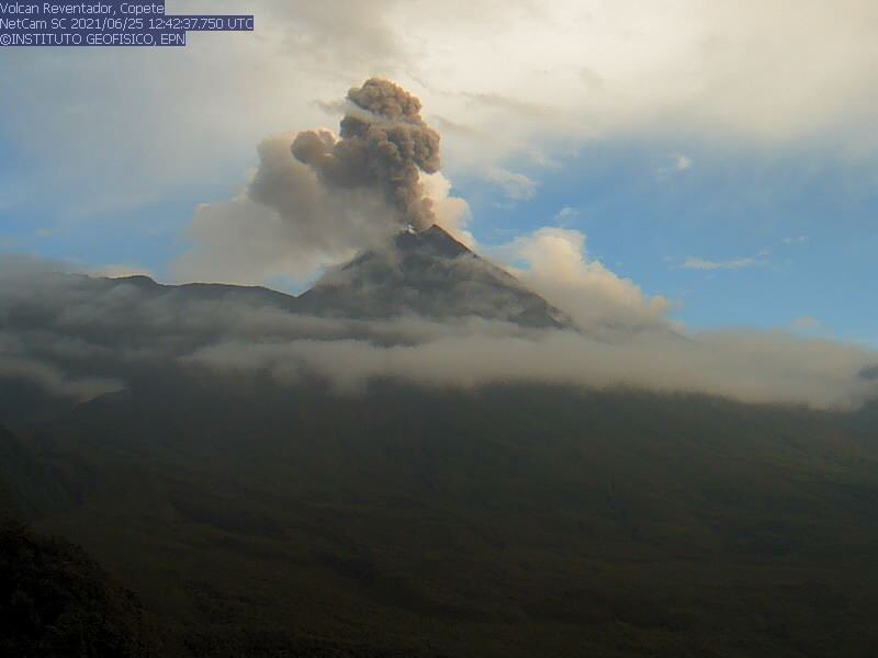
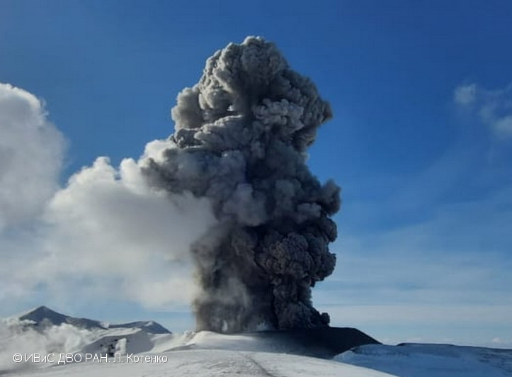
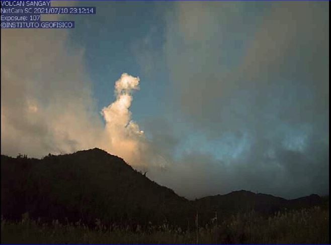
Ecuador , Sangay :
DAILY REPORT ON THE STATE OF SANGAY VOLCANO.
Surface activity level: High, Surface trend: No change.
Internal activity level: High, Internal trend: No change.
Seismicity: From July 10, 2021, 11:00 a.m. to July 11, 2021, 11:00 a.m .:
Explosion (EXP) 13
Long period (LP) 10
Tremors of emission (TREMI) 2
Lahars: 1
Emission column / ash:
Gas emissions were observed up to 800 meters above crater level in a northwest direction. The Washington VAAC reported gas and ash emissions up to 570 meters above the summit in a southwest direction.
Rains / Lahars:
Moderate rains were recorded in the area of the volcano. This morning, a high frequency signal was observed, probably associated with the appearance of mudslides and debris (lahars) that descend into the ravines of the volcano. ** In the event of heavy rains, these could re-mobilize the accumulated material, generating mudslides and debris that would descend on the sides of the volcano and flow into the adjacent rivers. *
Other monitoring parameters:
No thermal alerts have been recorded in the last 24 hours.
Observation:
The area of the volcano cleared mainly in the late afternoon yesterday, the rest of the time it remained cloudy. No ash fall report has been received.
Niveau d’alerte: jaune.
Source et photo : IGEPN.
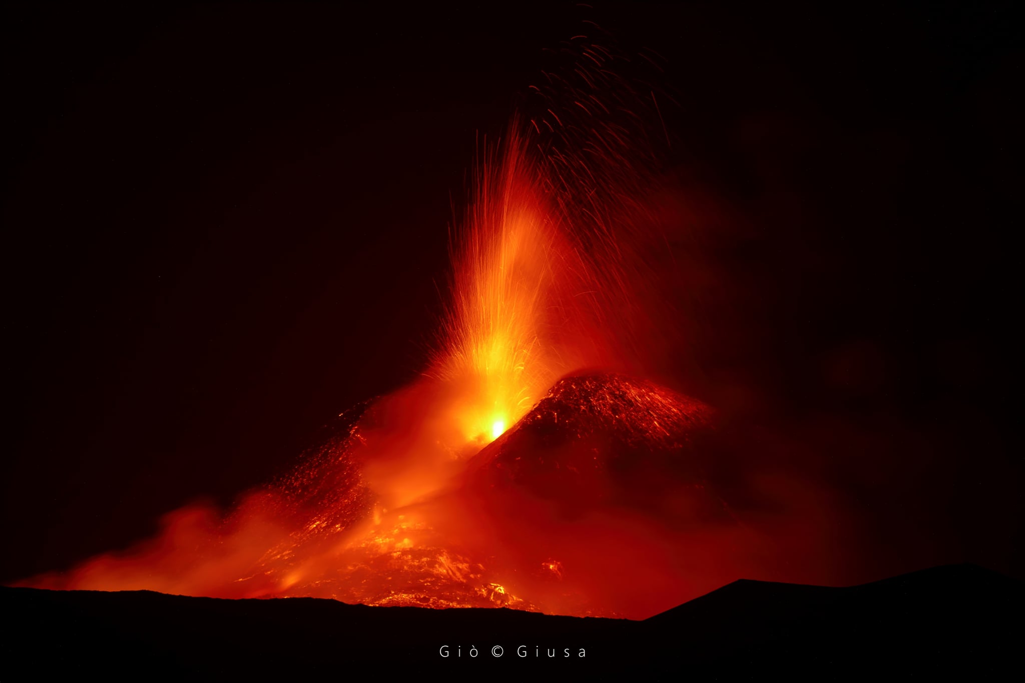
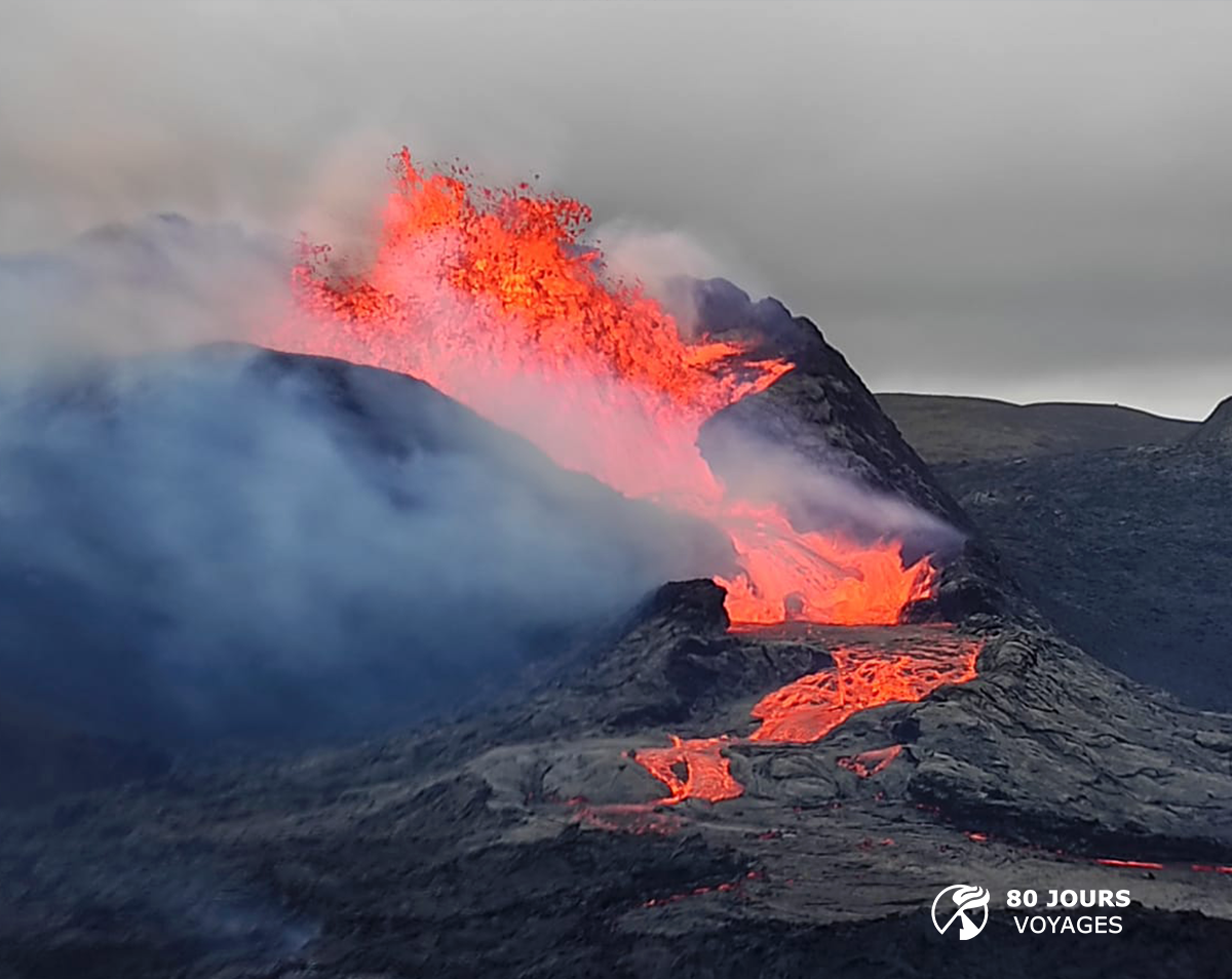
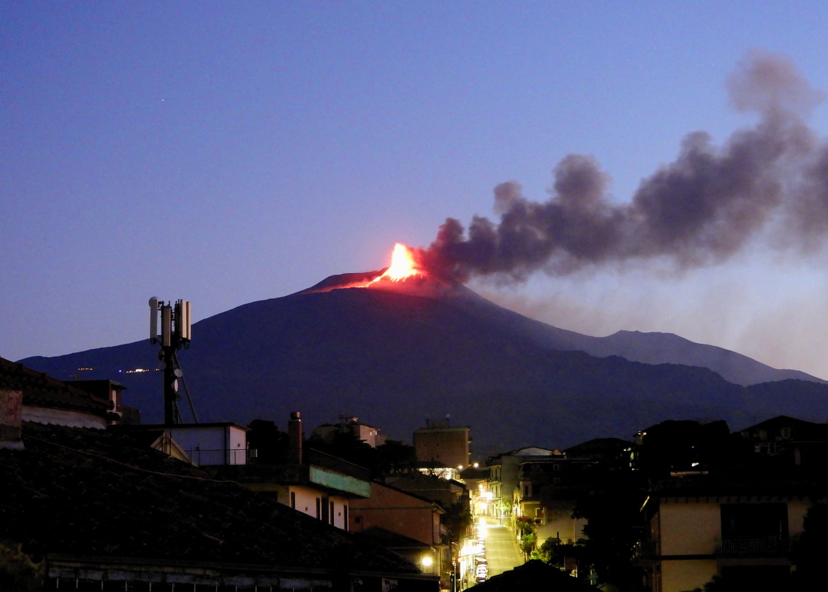
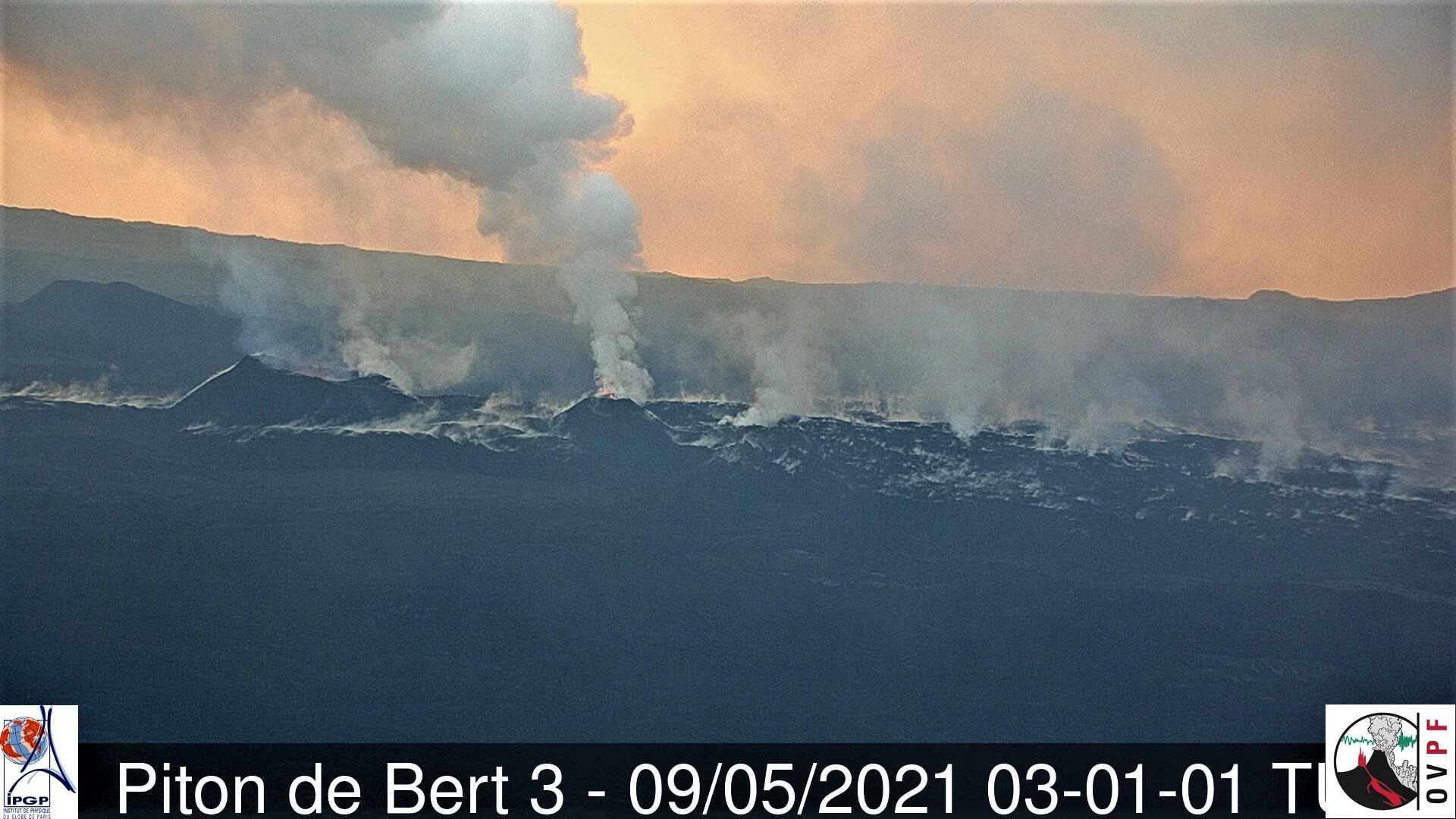
Iceland , Geldingadalur / Fagradalsfjall :
A powerful lava cascade flows from the crater towards Meradali
The Fagradalsfjall eruption came back to life after activity fell on July 6. Activity started to increase around ten o’clock last night and has increased quite quickly and steadily since then.
The eruption hasn’t been much of a sight lately, but now there have been some changes. Magnús Tumi Guðmundsson, a geophysicist, told RÚV lunch news that it is clear that the eruption is not over.
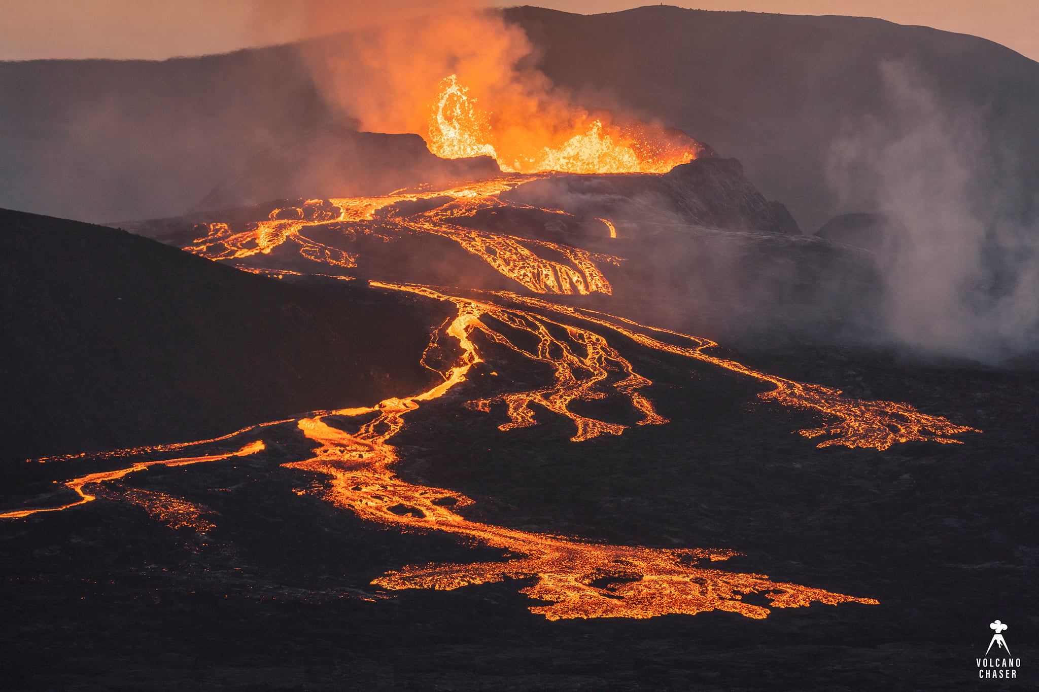
View of the cinder cone with low lava fountains inside the crater and the lava overflow that forms many lava rivers towards Syðri-Meradalur. Some of the lava was flowing also towards Geldingadalir (behind Gónhóll, on the left side of the pic) and Meradalir (to the right), but this was not visible because it was moving mainly inside lava tubes.
« We see a powerful lava cascade from the crater down to Meradali. The eruption has resumed and now new lava is covering all of the western part of Meradalana. The eruption is still going on, it’s just a simple question, » said Magnús Tumi.
Those who walk to the site of the eruption may notice yellow signs that have been placed on the slopes around the lava flows. Magnús Tumi says they take lava flow measurements over a period of one, two days to several weeks. An aerial map is used for the measurements.
Source : RUV.
Photo and comments : Volcano Chaser via Alicia Szojer