May 13 , 2021.
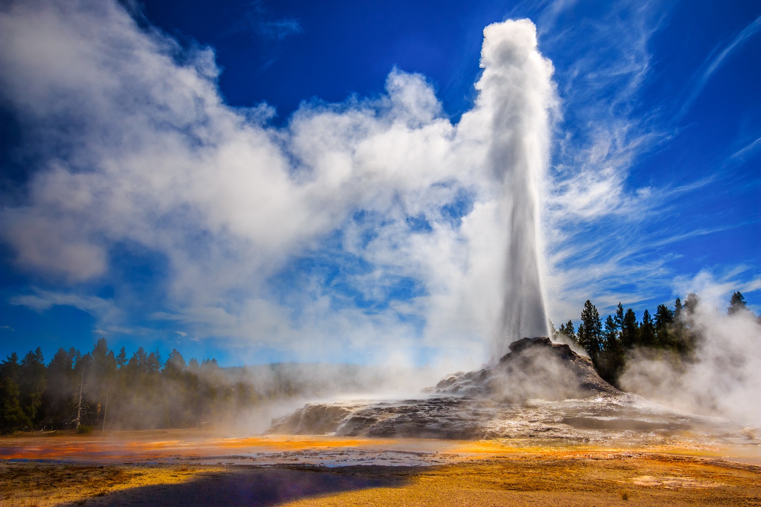
Alaska , Great Sitkin :
VOLCANO OBSERVATORY NOTICE FOR AVIATION (VONA)
Issued: May 13 , 2021
Volcano: Great Sitkin (VNUM #311120)
Current Color Code: YELLOW
Previous Color Code: GREEN
Source: Alaska Volcano Observatory
Notice Number: 2021/A250
Volcano Location: N 52 deg 4 min W 176 deg 6 min
Area: Aleutians
Summit Elevation: 5709 ft (1740 m)
Volcanic Activity Summary:
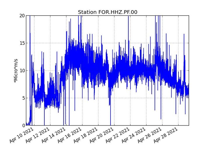
Elevated surface temperatures have been observed in satellite images of Great Sitkin Volcano beginning in January and detections have increased over the past two months. Satellite detections of increased volcanic gas emissions have been observed beginning on May 10. In addition, there has been a slight increase in local seismicity over the past two days. These data indicate a potential for increased eruptive activity at Great Sitkin. As a result, AVO is raising the Aviation Color Code to YELLOW and the Volcano Alert Level to ADVISORY.
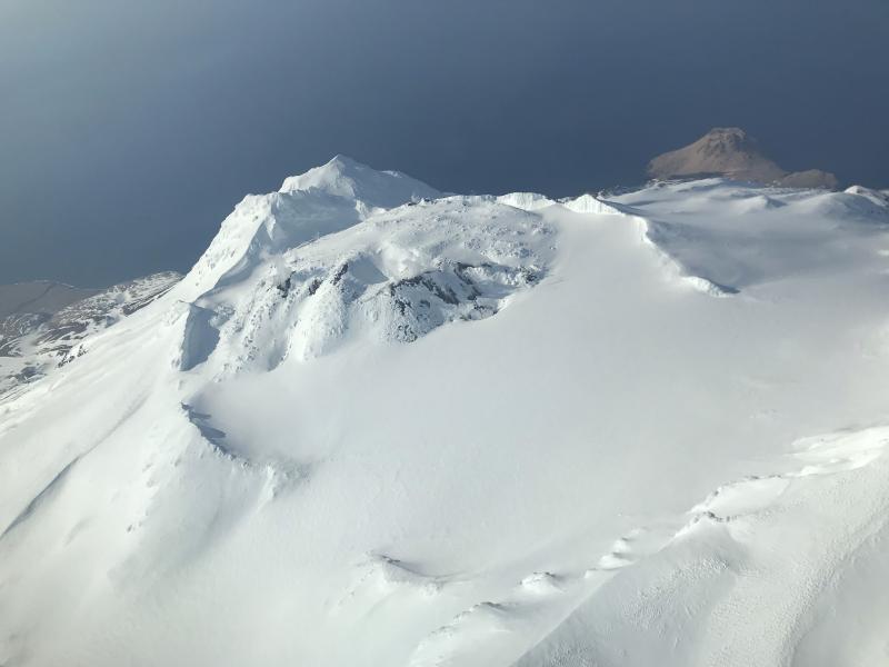
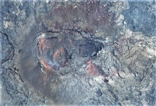
Views of Great Sitkin volcano taken on an Alaska Airlines flight from Anchorage to Adak, Alaska on March 21, 2020. Snow free ground due and light steaming observed.
Great Sitkin is monitored with a local real-time seismic network, which will typically allow AVO to detect changes in unrest that may lead to an explosive eruption. Rapid detection of an ash-producing eruption would be accomplished using a combination of seismic, infrasound, lightning, and satellite data.
Remarks:
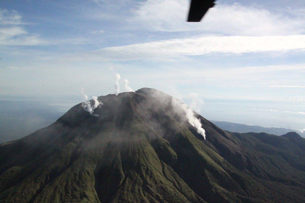
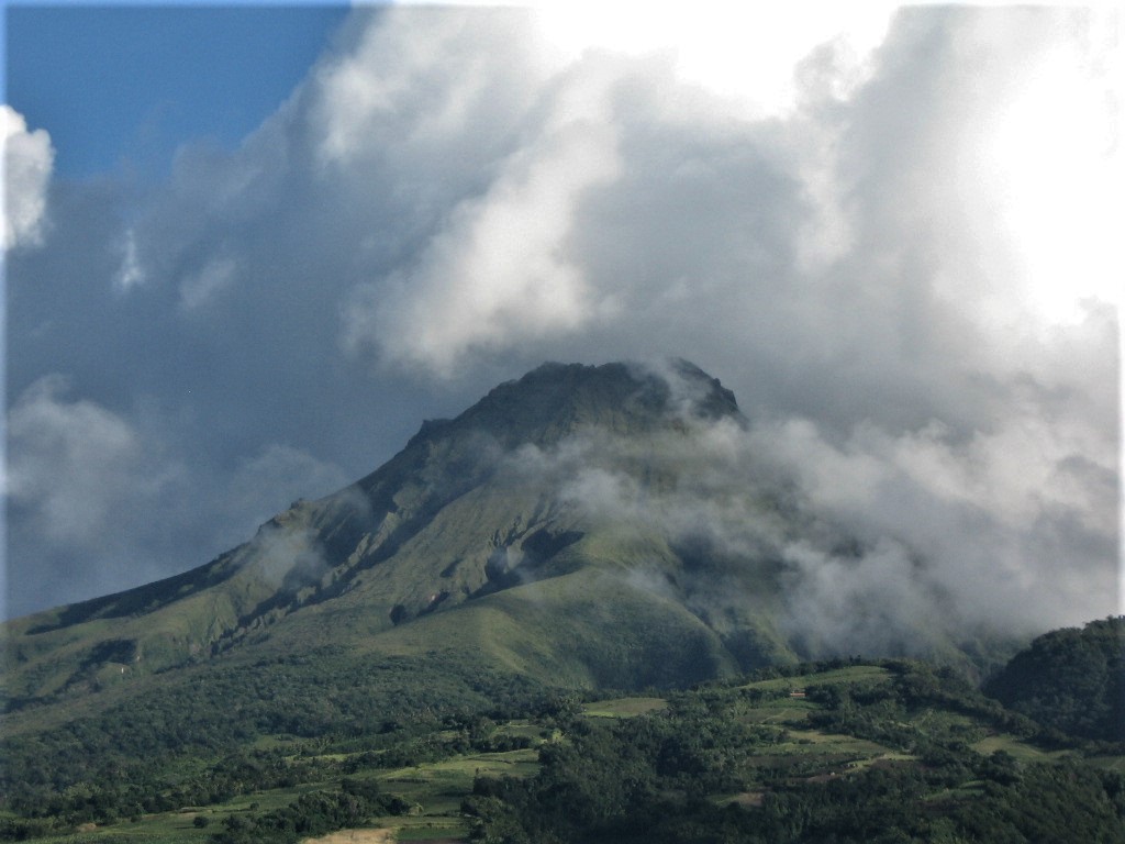
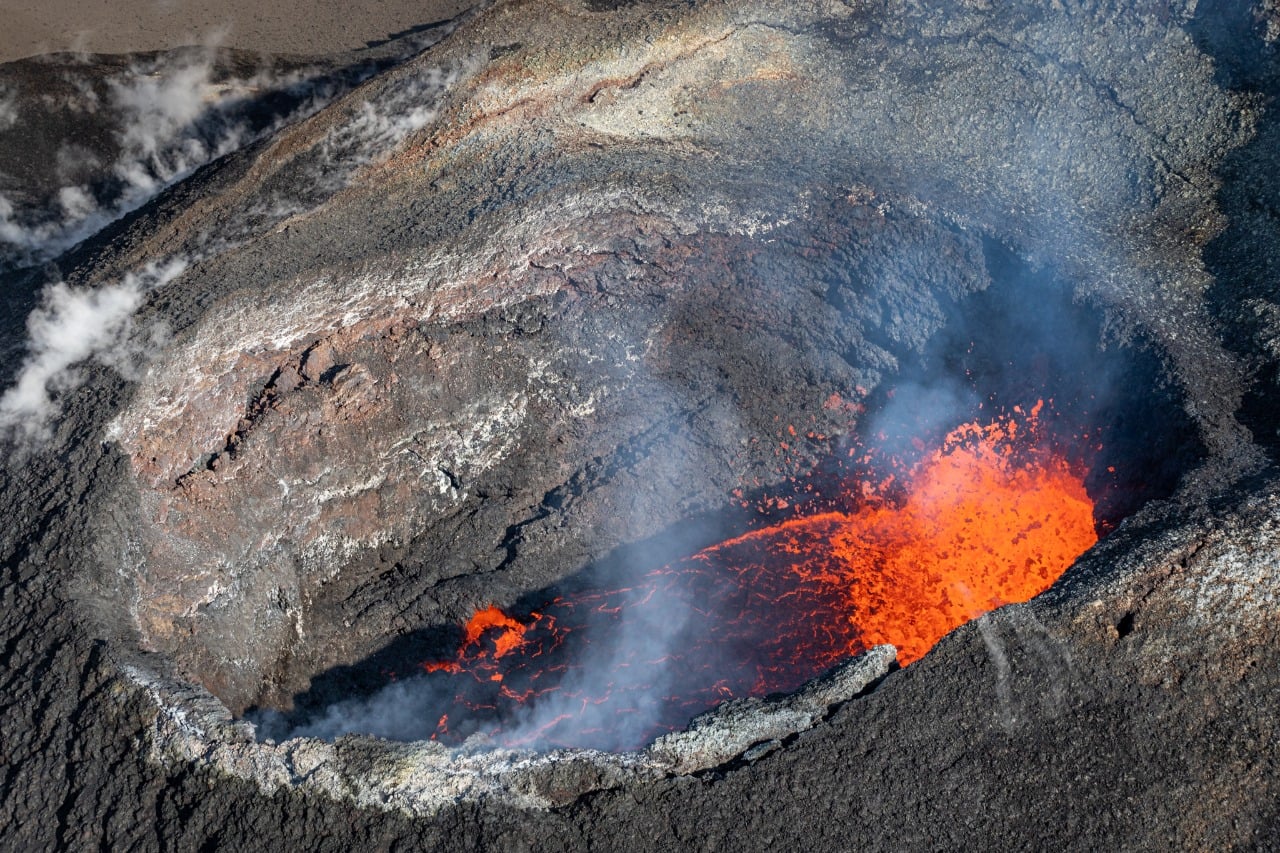
Great Sitkin Volcano is a basaltic andesite volcano that occupies most of the northern half of Great Sitkin Island, a member of the Andreanof Islands group in the central Aleutian Islands. It is located 43 km (26 miles) east of the community of Adak. The volcano is a composite structure consisting of an older dissected volcano and a younger parasitic cone with a 3-km-diameter summit crater. A steep-sided lava dome, emplaced during an eruption in 1974, occupies the center of the crater. Great Sitkin erupted at least three times in the 20th century, most recently in 1974. That eruption produced at least one ash cloud that likely exceeded an altitude of 25,000 ft above sea level. A poorly documented eruption occurred in 1945, also producing a lava dome that was partially destroyed in the 1974 eruption. Within the past 280 years a large explosive eruption produced pyroclastic flows that partially filled the Glacier Creek valley on the southwest flank.
Source : AVO
Photo : McConnell, Angela.
Iceland , Geldingadalur :
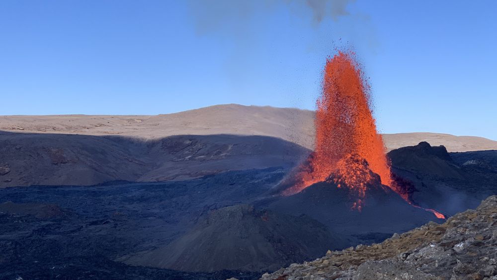
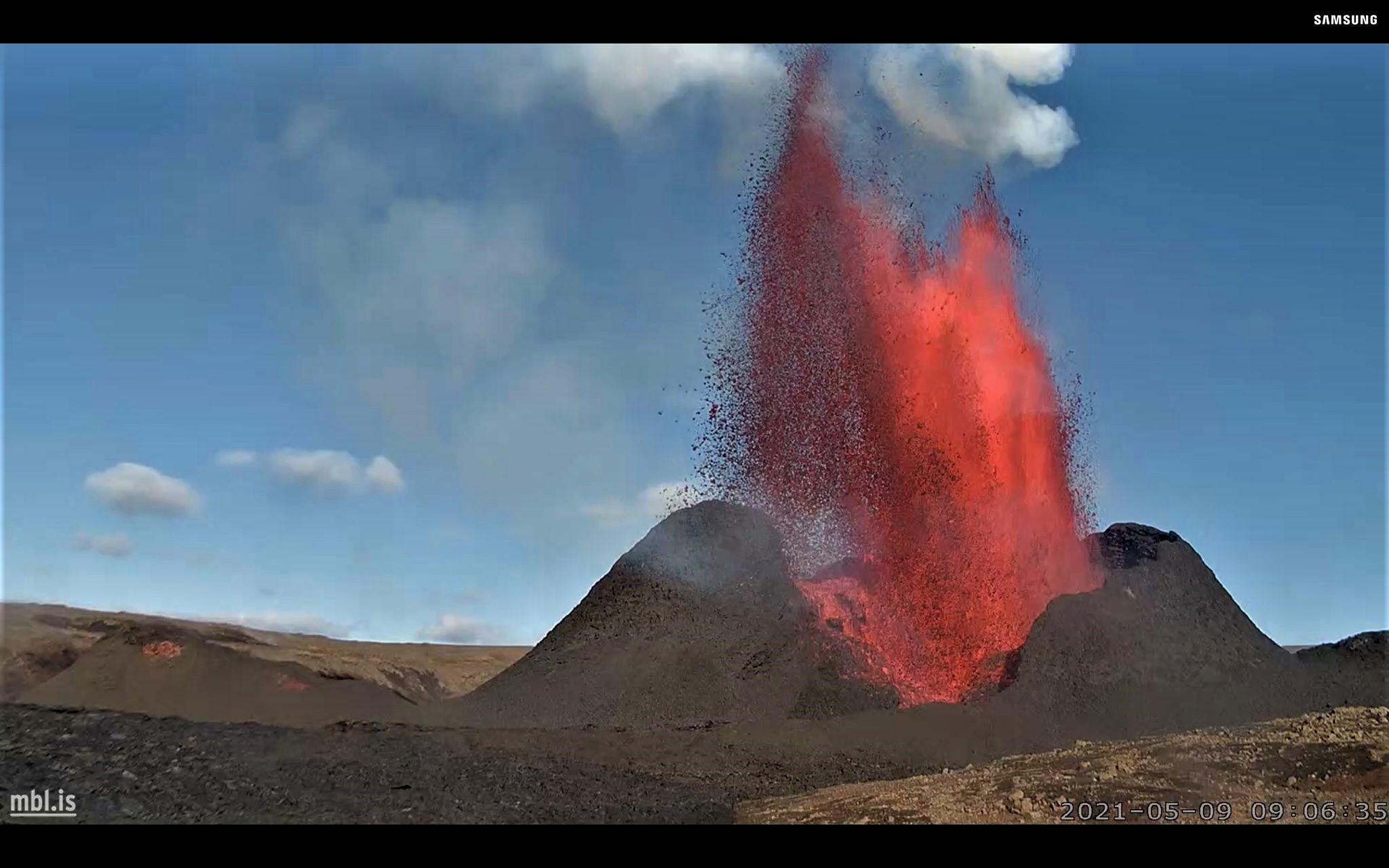
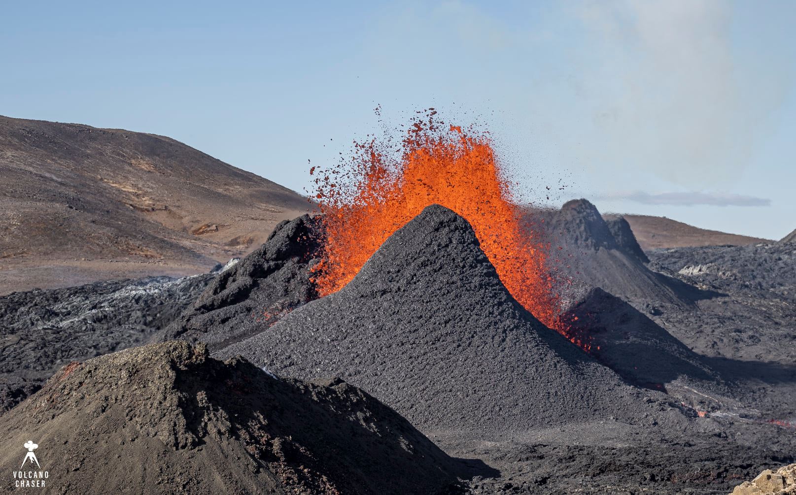
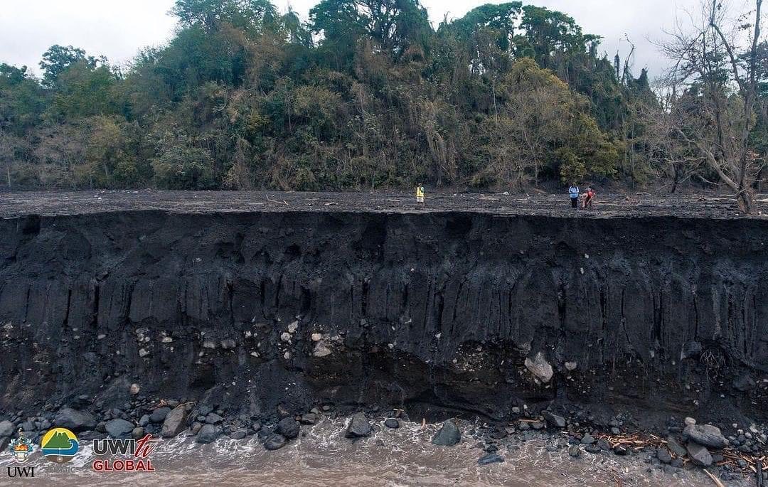
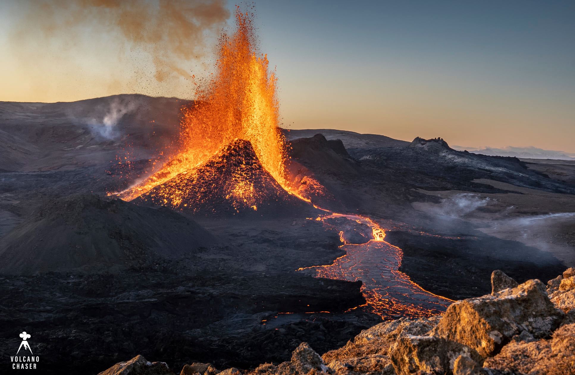
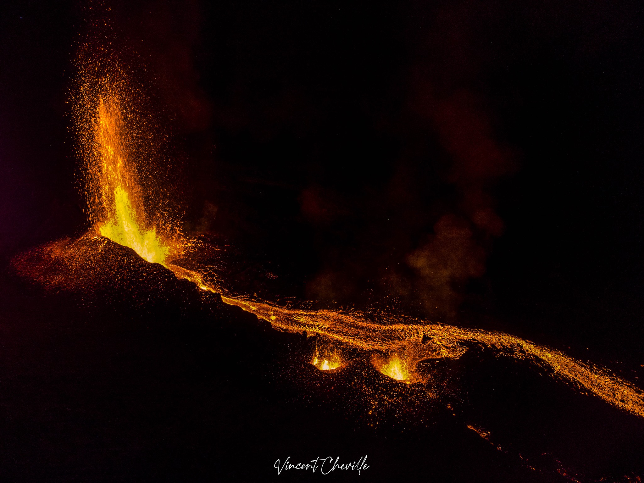
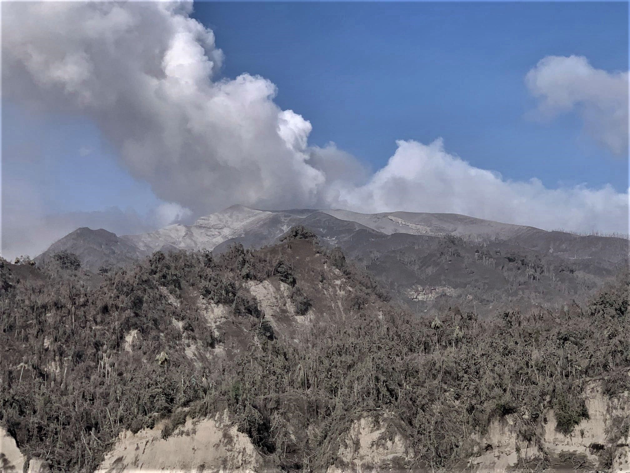
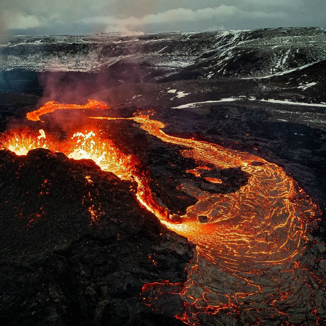
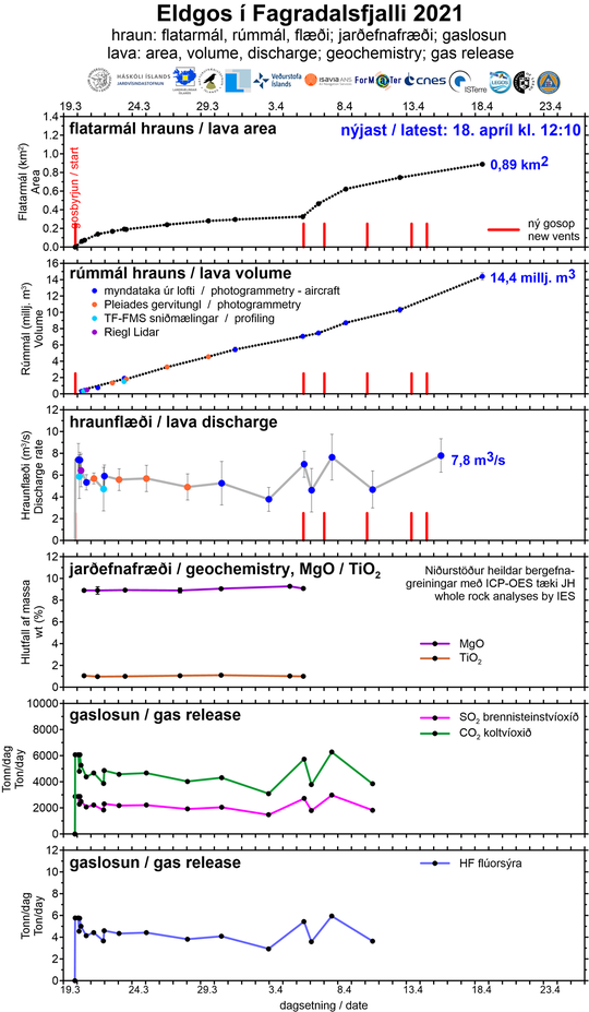
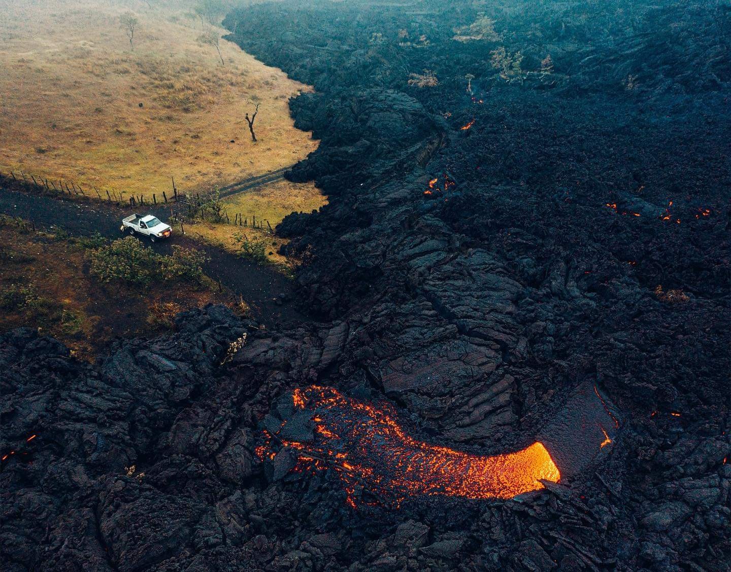
IMO reported that the fissure eruption in the W part of the Krýsuvík-Trölladyngja volcanic system, close to Fagradalsfjall on the Reykjanes Peninsula, continued during 5-11 May. On 2 May pulsating high jets of lava from crater 5 prompted authorities to widen the restricted zone because; ash and lava could be deposited several hundred of meters away. Cycles of lava jetting and effusion periodically continued during 3-7 May, with lava steadily enlarging the flow field. By 4 May the area of the flow field had grown to 1.41 square kilometers, and the total volume erupted was 23 million cubic meters. Activity was quiet for a period of time during 8-9 May, though IMO noted that fountaining quickly resumed during the morning of 9 May.
High jets of lava occurred every 10 minutes, sometimes with jets rising as high as 300 m. Tephra (a few centimeters in diameter) was deposited as far as 1 km from the vent and small amounts of tephra were reported in Gríndavík. Hot deposits have caused small vegetation fires within a few hundreds of meters around the eruption site. On 10 May gas plumes rose higher than 2 km a.s.l. The eruption area was closed due to local wildfires and unfavorable wind conditions. Very high fountains were visible in Reykjavik. On 11 May lava fountains again rose up to 300 m tall and were seen from the capital. The cone had grown to about 50 m high. The Aviation Color Code remained at Orange due to the lack of ash and tephra emissions.
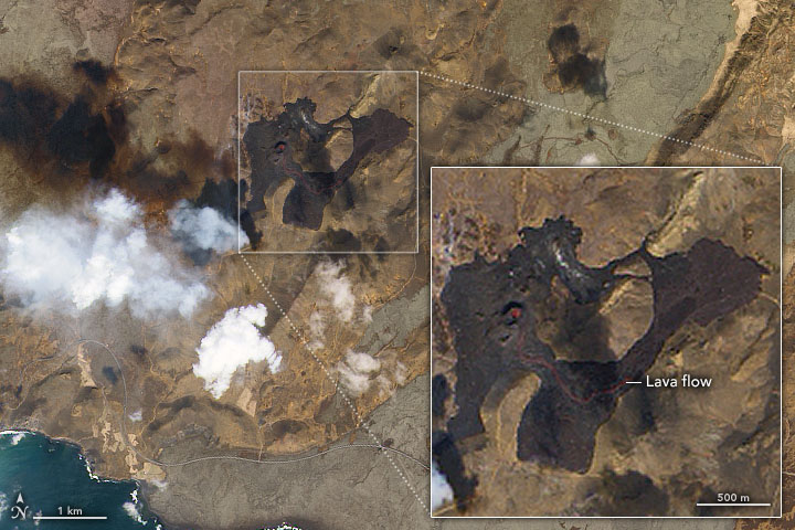
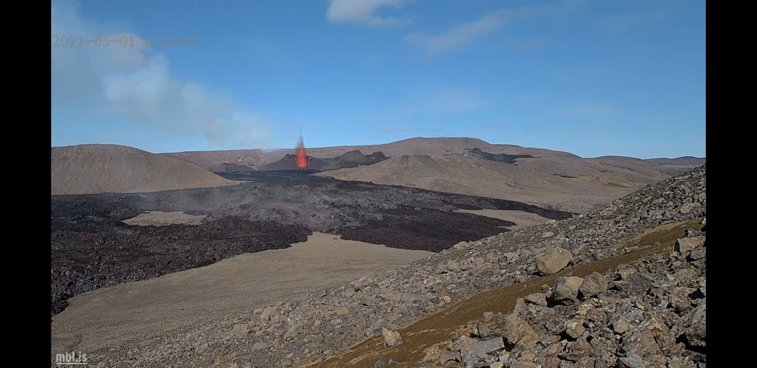
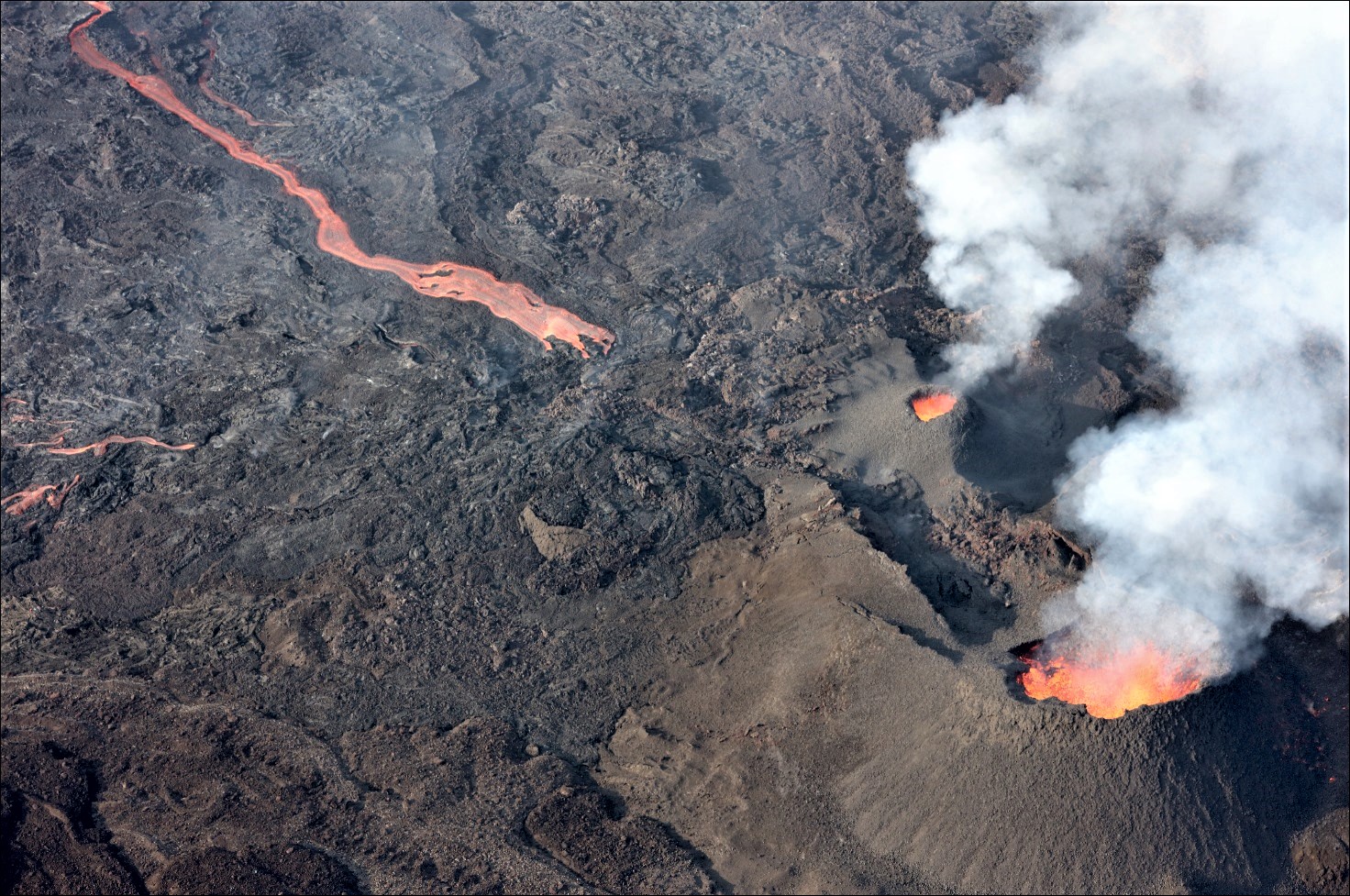
The Operational Land Imager (OLI) on Landsat 8 acquired this image around midday on May 9, 2021. Dark brown areas indicate where cooling lava has piled up and spread across valley floors. Notice the lava (red) actively pouring from one of the vent systems.
A volcano activity update from the Icelandic Met Office on May 12 noted that the vents associated with this eruption have spilled nearly 30 million cubic meters of lava since the start of the eruption in late March. Measurements on May 10 indicated that the lava discharge rate was increasing, reaching 13 cubic meters per second.
According to a video by Reykjavík Newscast, the nearby town of Grindavík has voted to name the lava field Fagradalshraun: beautiful valley lava.
NASA Earth Observatory image by Joshua Stevens, using Landsat data from the U.S. Geological Survey. Story by Kathryn Hansen.
Source : GVP. earthobservatory.nasa.gov
Video : GutnTog
Photo : NASA / Joshua Stevens,
Guatemala , Pacaya :
ACTIVITY:
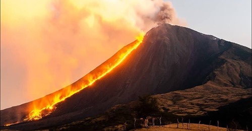
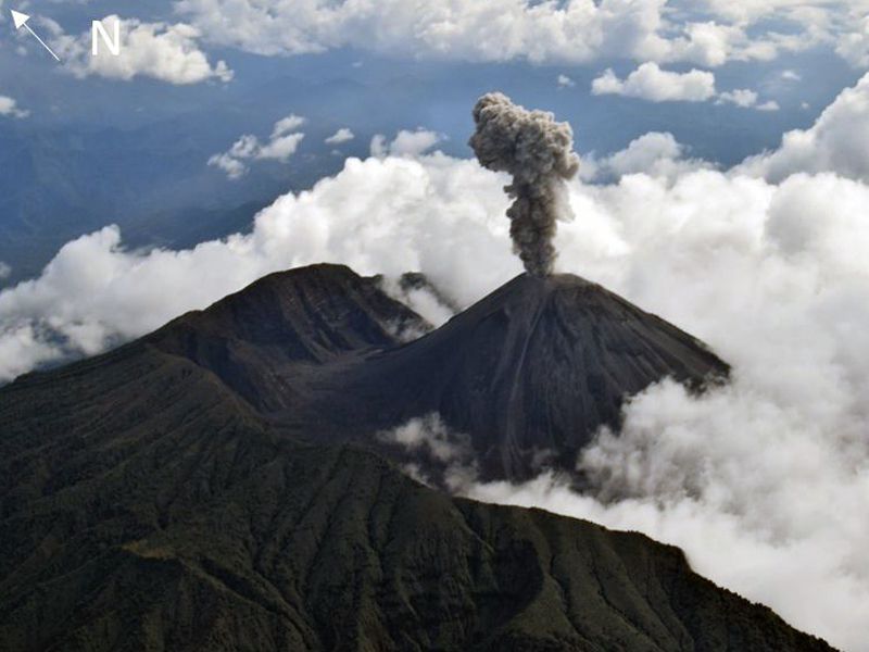
OVSAN reports that due to atmospheric conditions during the night and part of the morning, periods of abundant white degassing have been observed in the Mackenney crater, which reaches an approximate height of 900 meters above the crater and is move west. There is no expulsion of matter or ash activity in the crater. Effusive activity is maintained in the crack located on the northwest flank, which feeds the lava flow which descends towards the southwest flank and has an approximate length of 2300 meters which does not maintain displacement on its front. On the slope near Cerro Chino, lava promontories continue to form several meters high. It is not excluded that new lava flows and eruptive columns accompanied by ash may appear in the crack or in the Mackenney crater. The seismic stations record an internal tremor which is associated with the rise of magma, the movement of the lava flow and the emanation of gas.
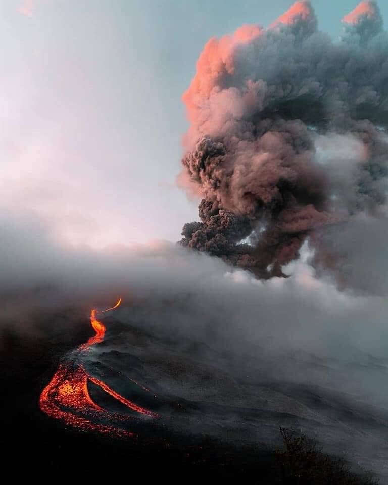
INSIVUMEH reported that during 4-11 May the lava flow on Pacaya’s N flank continued to advance, lengthening from 2.1 to 2.4 km, and spreading laterally in some areas. Incandescent blocks detached from the flow, especially along the flow margins and steep slopes. Occasional explosions at the vent (near Cerro Chino) ejected incandescent material as high as 100 m. Around 0600 on 6 May explosions at the summit produced ash plumes that drifted S. Dense ash plumes were visible drifting W and SW during 7-9 May. On 11 May an advancing lava flow on the SW flank was 2.3 km long.
Source : Insivumeh , GVP.
Photo : Morales Tierra de la amistad te Informa.
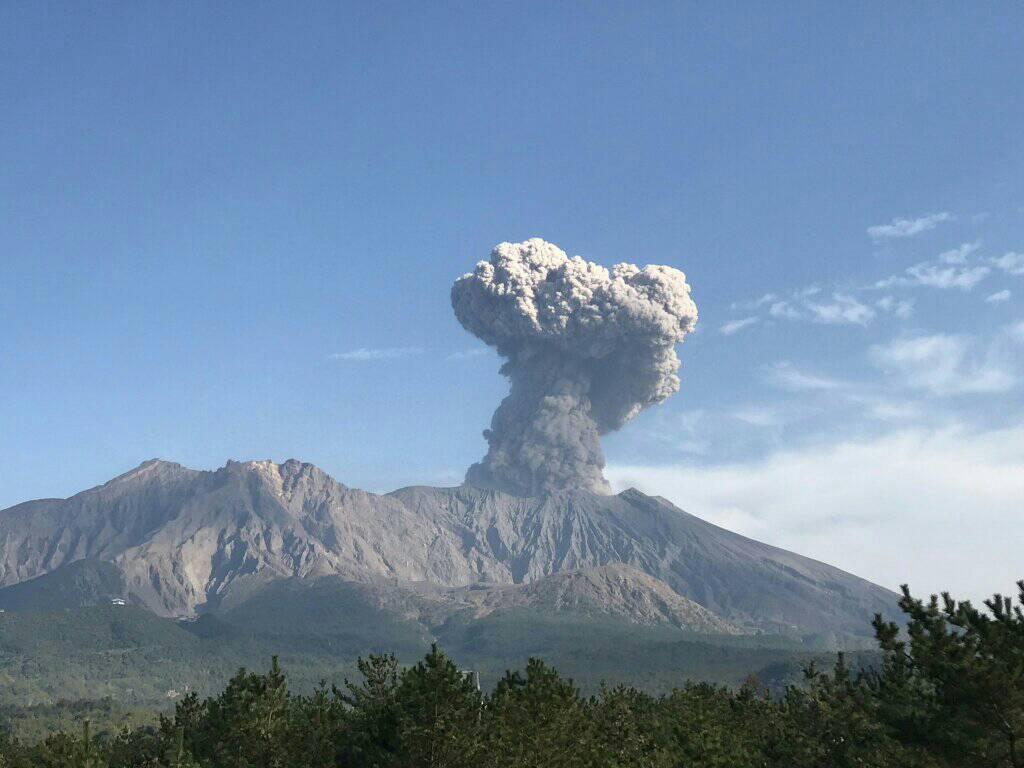
Japan , Sakurajima :
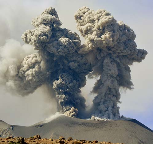
JMA reported that during 3-10 May incandescence from Minamidake Crater (at Aira Caldera’s Sakurajima volcano) was visible nightly. There were four explosions and four non-explosive events during 3-7 May, producing ash plumes that rose as high has 2.5 km above the summit and ejecting bombs 0.8-1.1 km away from the crater.
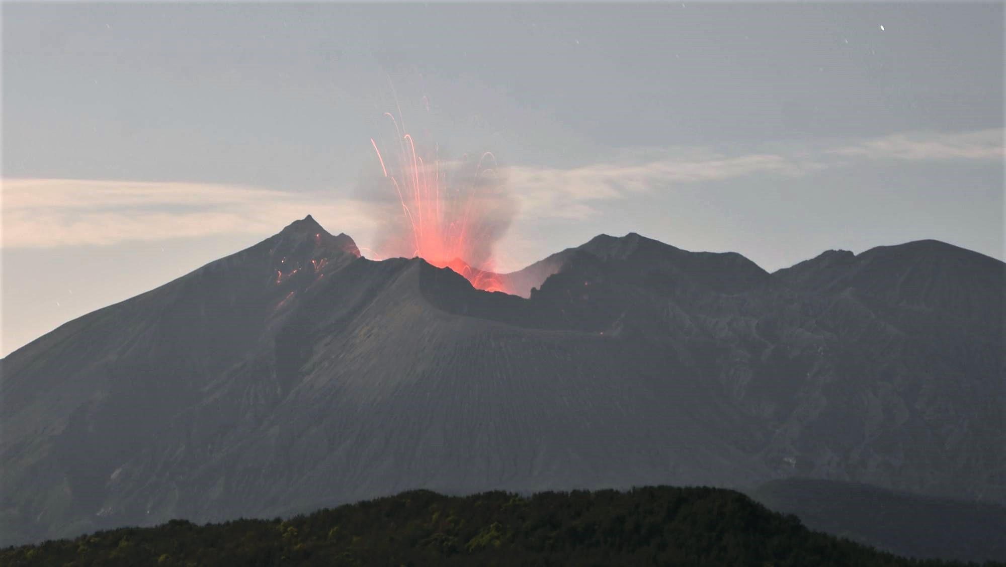
Very small eruptive events were recorded during 7-10 May. The sulfur dioxide emission rate was 1,300 tons per day on 19 May. The Alert Level remained at 3 (on a 5-level scale), and residents were warned to stay 2 km away from the crater.
Source : GVP.
Photo : Kyodo news .
Indonesia , Semeru :
VOLCANO OBSERVATORY NOTICE FOR AVIATION – VONA.
Issued : May 12 , 2021
Volcano : Semeru (263300)
Current Aviation Colour Code : ORANGE
Previous Aviation Colour Code : orange
Source : Semeru Volcano Observatory
Notice Number : 2021SMR21
Volcano Location : S 08 deg 06 min 29 sec E 112 deg 55 min 12 sec
Area : East java, Indonesia
Summit Elevation : 11763 FT (3676 M)
Volcanic Activity Summary :
Eruption with volcanic ash cloud at 23h58 UTC (06h58 local).
Volcanic Cloud Height :
Best estimate of ash-cloud top is around 13683 FT (4276 M) above sea level, may be higher than what can be observed clearly. Source of height data: ground observer.
Other Volcanic Cloud Information :
Ash cloud moving to north
Remarks :
Seismic activity is characterized by eruption, avalanche and gas emission earthquakes.
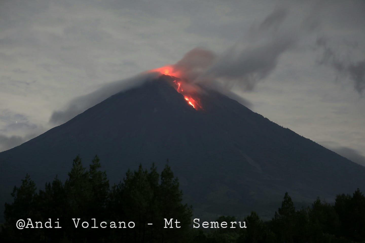
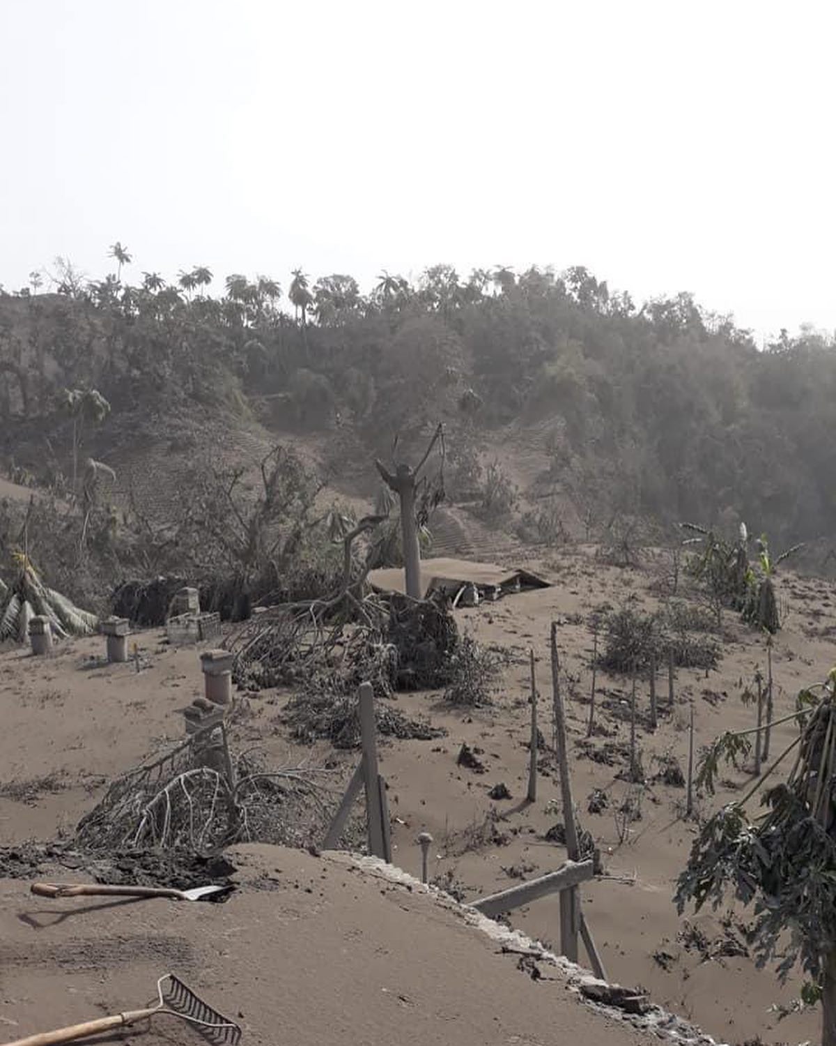
Level of activity at level II (WASPADA). The Semeru volcano (3676 m above sea level) is continuously erupting. There are explosive and effusive eruptions, causing lava flows towards the south and south-eastern slopes, as well as explosions of incandescent rocks around the summit crater.
The volcano is clearly visible until it is covered in fog, the smoke from the crater and the eruption column was not observed. The weather is cloudy to rainy, the winds weak in the North.
According to the seismographs of May 12, 2021, it was recorded:
41 eruption earthquakes / explosions
4 avalanche earthquakes
25 earthquakes of emissions
2 distant tectonic earthquakes
Source : Magma Indonésie , PVMBG.
Photo : Andi volcanist.