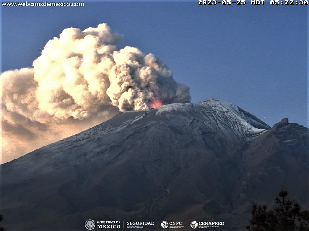
May 26 , 2023.
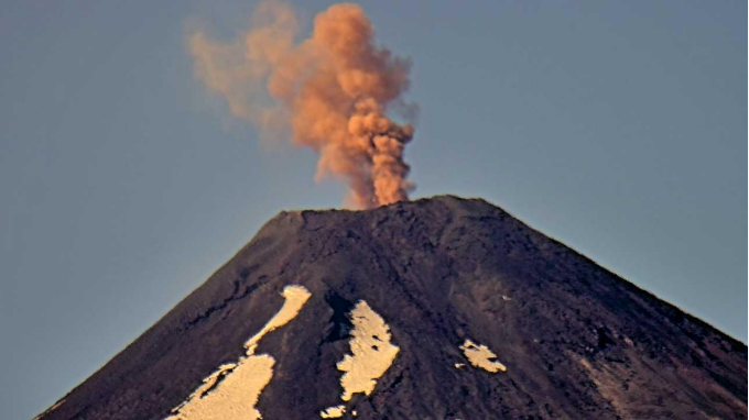
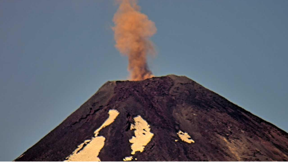
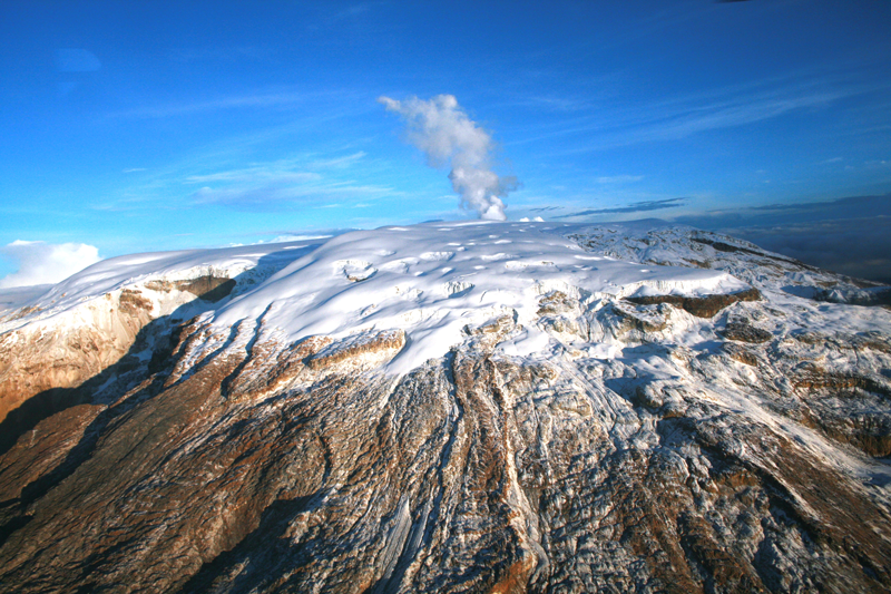
Mexico , Popocatepetl :
May 25, 11:00 a.m. (May 25, 5:00 p.m. GMT)
During the last 24 hours, according to the monitoring systems of the Popocatépetl volcano, 19 exhalations accompanied by water vapor, volcanic gases and ash have been detected.
1,089 minutes of high frequency tremors of low to moderate amplitude were recorded, associated with the continuous emission of gas, water vapor and ash, as well as the expulsion of incandescent material at a short distance from the volcano .
A slight fall of ash was recorded in the municipalities of Atlixco, San Pedro Cholula and Puebla Capital at 00:45 and a slight fall of ash in the municipality of Tetela del Volcán, Morelos at 06:00.
At the time of this report, an emission of water vapor, volcanic gases and light amounts of ash is observed in a South-South-East direction.
The volcanic alert traffic light is in YELLOW PHASE 3.
May 25, 7:00 p.m. (May 26, 01:00 GMT). Actualization
The tremor signal continues, while its amplitude continues to decrease. The weather conditions prevailing in the area do not allow visibility towards the volcano, however, it was sometimes possible to observe an emission of steam and gas with low ash content towards the South-South-East. Any changes in activity will be reported in a timely manner.
CENAPRED insistently reiterates the recommendation NOT TO CLIMB to the crater of the volcano, because there is the possibility of explosions, as we have seen on several occasions in the past, involving the emission of incandescent fragments. Therefore, he is required to respect the exclusion radius of 12 km. Also, in heavy rain, stay away from the bottom of ravines due to the danger of mudslides and debris.
Source and photo : Cenapred.
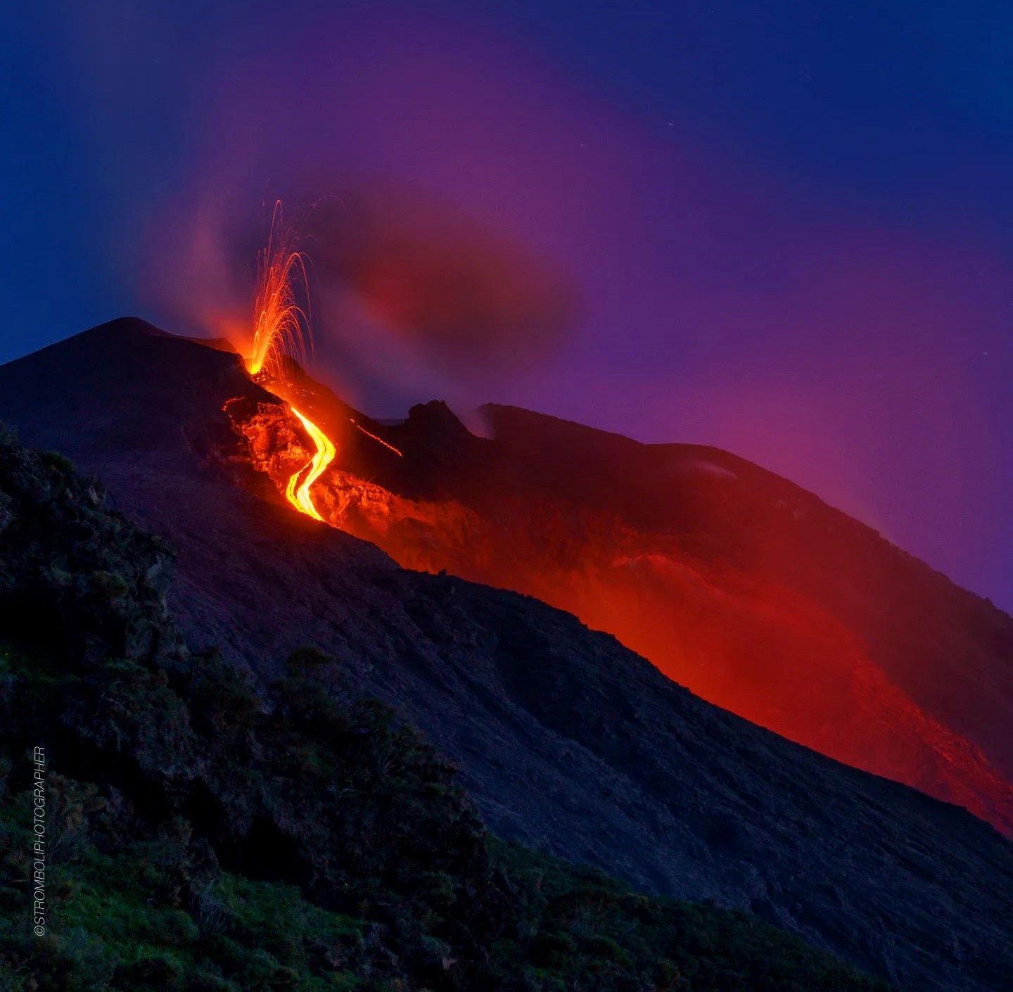
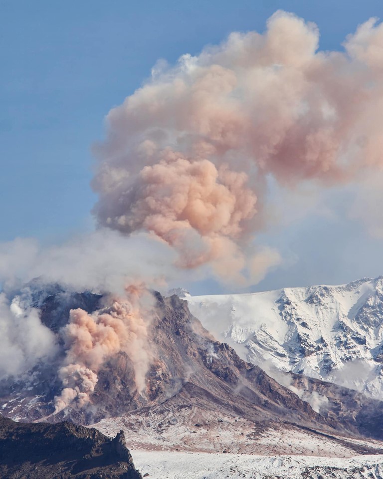
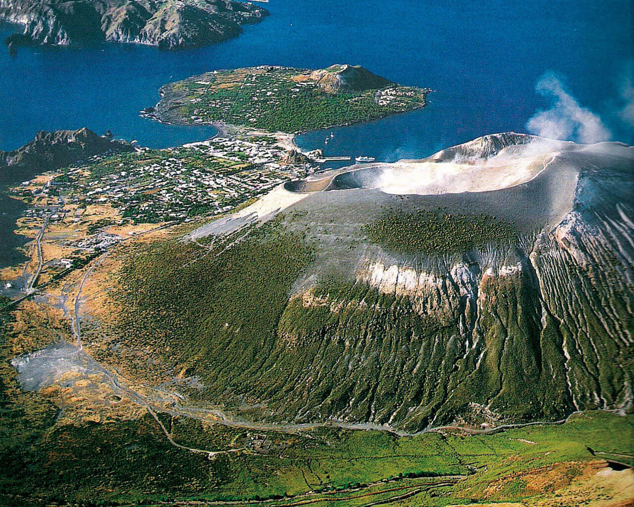
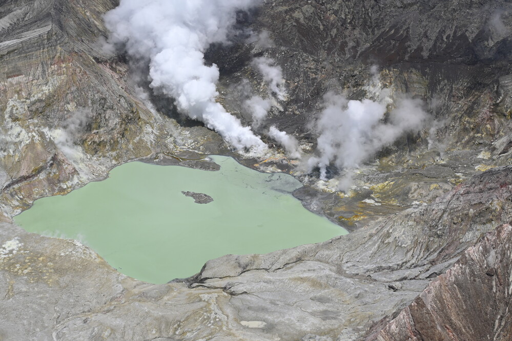
Italy , Vulcano :
WEEKLY BULLETIN, May 15, 2023 to May 21, 2023 (issue date May 23, 2023)
ACTIVITY STATUS SUMMARY
In the light of the monitoring data, it is highlighted:
1) Temperature of the crater fumaroles: The temperature signal recorded on the edge of the crater is strongly disturbed by the intense rainfall events but always remains at high values.
2) CO2 flux in the crater area: There are no updates on CO2 flux values in the crater area.
3) SO2 flux in the crater area: at an average level
4) Geochemistry of fumarolic gases: There are no updates.
5) CO2 fluxes at the base of the La Fossa cone and in the Vulcano Porto area: The CO2 fluxes recorded at the sites of Rimessa, C. Sicilia show stable values, always above background levels. In the P4max site the flows decrease slightly on medium-high levels, while in the Faraglione site values close to the background level are recorded.
6) Geochemistry of thermal aquifers: stable but still high temperature values are recorded in the Camping Sicilia well and no variation in conductivity values; in the Bambara well, no significant change in the monitored parameters was observed.
7) Local seismicity: The rate of occurrence of local events was on average low.
8) Regional seismicity: No regional seismic event was recorded during the week
9) Deformations – GNSS: The network of permanent GNSS stations has not recorded any significant variations
10) Deformations – Inclinometry: The inclinometric network did not record any significant variations
11) Gravimetry: No significant change was recorded.
12) Other Comments: Mobile GNSS.
The time series acquired so far by the mobile GNSS network do not show significant variations around the Porto di Levante area.

In particular, the persistence of the danger linked to the diffusion of CO2 from the ground and the resulting accumulation near the emission zones at sea, in the leeward, topographically lowered zones, and especially in closed places , although monitoring data has shown that CO2 accumulations with life-threatening concentrations are also possible in open locations. However, the achievement of these CO2 levels seems to be highly dependent on the intensity of the smoke from the ground and on the meteorological conditions, both of which are highly variable in space and time, thus making it extremely difficult to forecast locally dangerous conditions. Finally, the intense condition and abnormal degassing in the area of Levante Beach, the mud basin and the expanse of sea facing it, suggests high activity of the local hydrothermal system and very sustained fluid dynamics, making the danger of groundwater explosions higher (although not quantifiable) throughout the area shown.
Source et photo : INGV
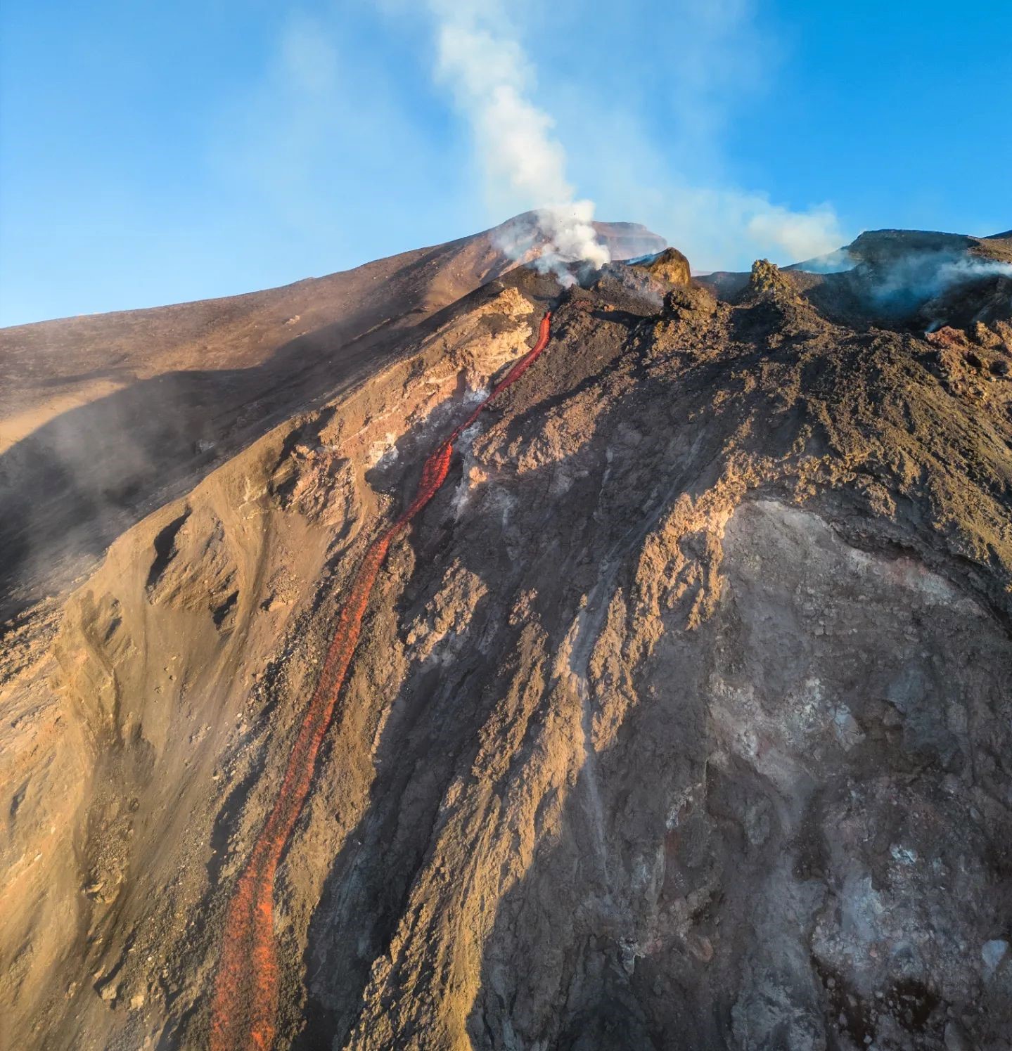
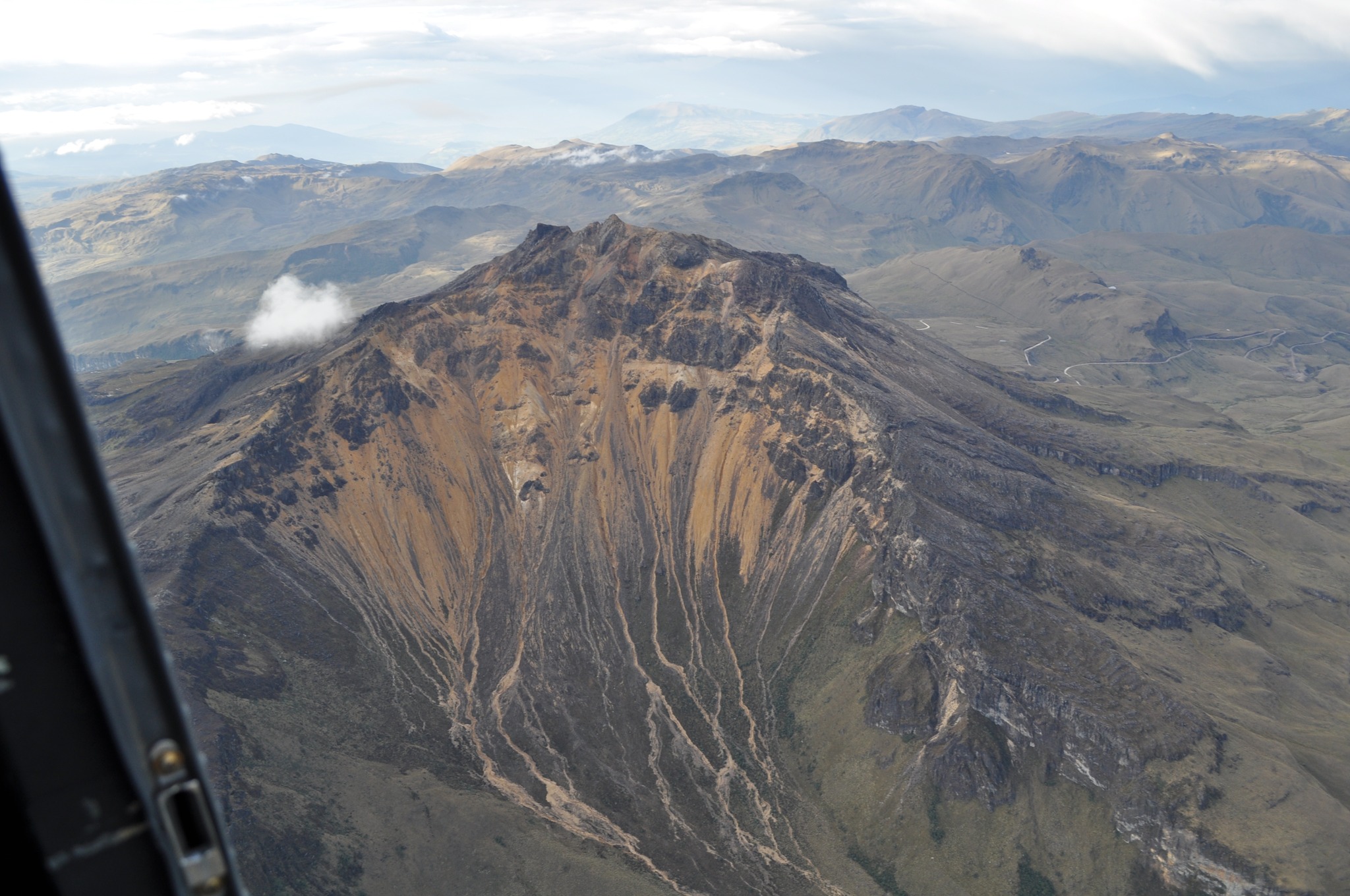
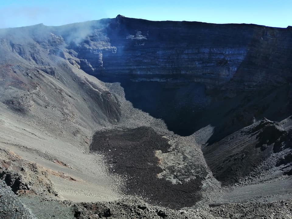
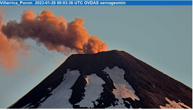
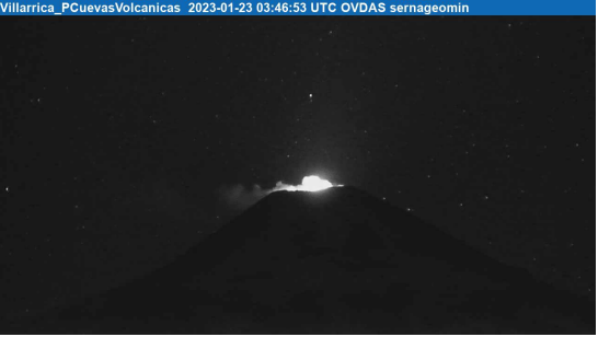
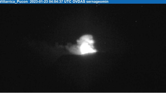
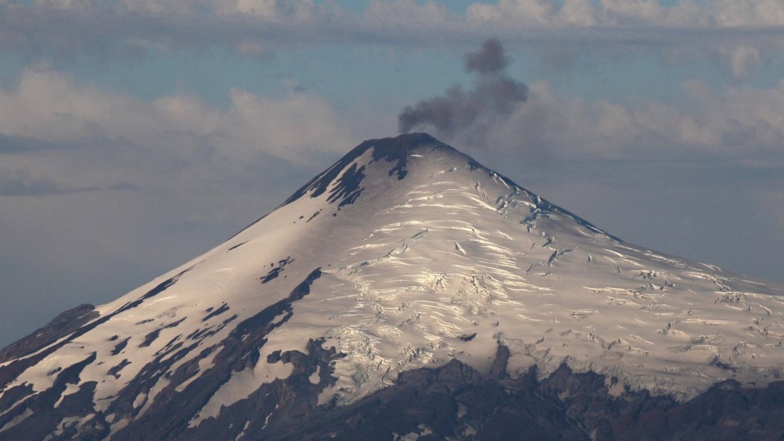
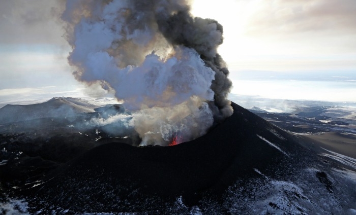
Chile , Villarica :
Seismology
The seismological activity of the period was characterized by the recording of:
A continuous tremor signal associated with the fluid dynamics inside the volcano, which during the period presented a stability of its energy evaluated with the RSAM parameter between 0.4 and 0.7 µm / s, values considered in its basic level.
5,630 LP-type seismic events, associated with fluid dynamics within the volcanic system (Long Period). The size of the largest earthquake assessed from the Reduced Displacement (DR) parameter was equal to 33 cm2. No event presented the minimum energy to locate 445 TR-type seismic events, associated with the dynamics maintained over time of the fluids within the volcanic system (TRemor). The size of the largest earthquake assessed from the Reduced Displacement (DR) parameter was equal to 13 cm2. No event presented the minimum energy to be located
Fluid Geochemistry
The sulfur dioxide (SO2) emissions data obtained by optical differential absorption spectroscopy (DOAS) equipment, corresponding to the Los Nevados and Tralco stations, installed respectively 10 km to the East-North-East and 6 km east-southeast of the active crater, had an average value of 1,826 ± 482 t / d, a value higher than that reported for the previous period and which is within the usual values for this volcanic system. The maximum daily value was 5,155 t/d on May 13.
Satellite thermal anomalies:
During the period, 2 thermal alerts were recorded in the area associated with the volcano, with a maximum volcanic radiative power (VRP) of 1 MW on May 6 and 14, a value considered moderate according to data processed by Middle Infrared Observation of Volcanic Activity (MIROVA). Through analysis of Sentinel 2L2A satellite images, 5 radiance anomalies in the area associated with the crater, on May 3, 5, 8, 13 and 15, with a maximum anomalous radiance area of 7,600 m2 on May 15.
Surveillance cameras
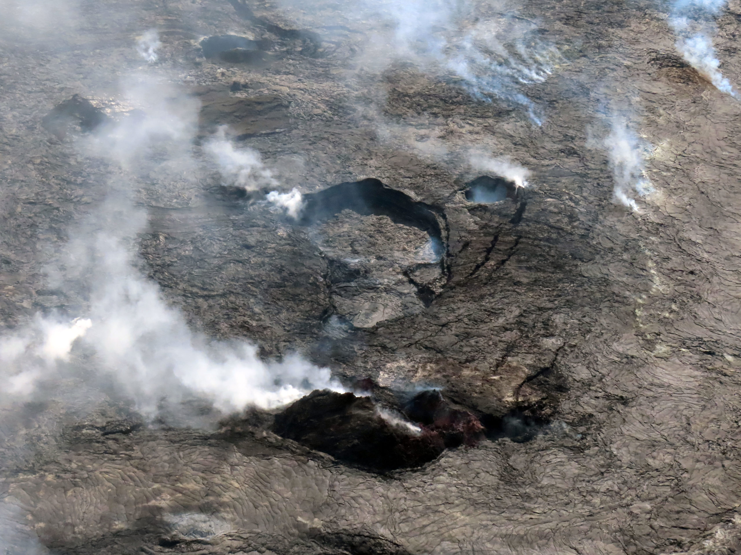
From the surveillance cameras, surface activity characterized by continuous whitish degassing is observed, which reached heights of up to 340 m on May 4. During the night, the degassing column was observed with incandescence, reaching heights less than 100 m above the edge of the crater. No pyroclastic emission is recorded.
It should be noted that on May 13, a massive retreat was identified, possibly occurring on May 12, on the eastern flank of the volcano, originating 50 m from the edge of the crater, and reaching a distance of 300 m.
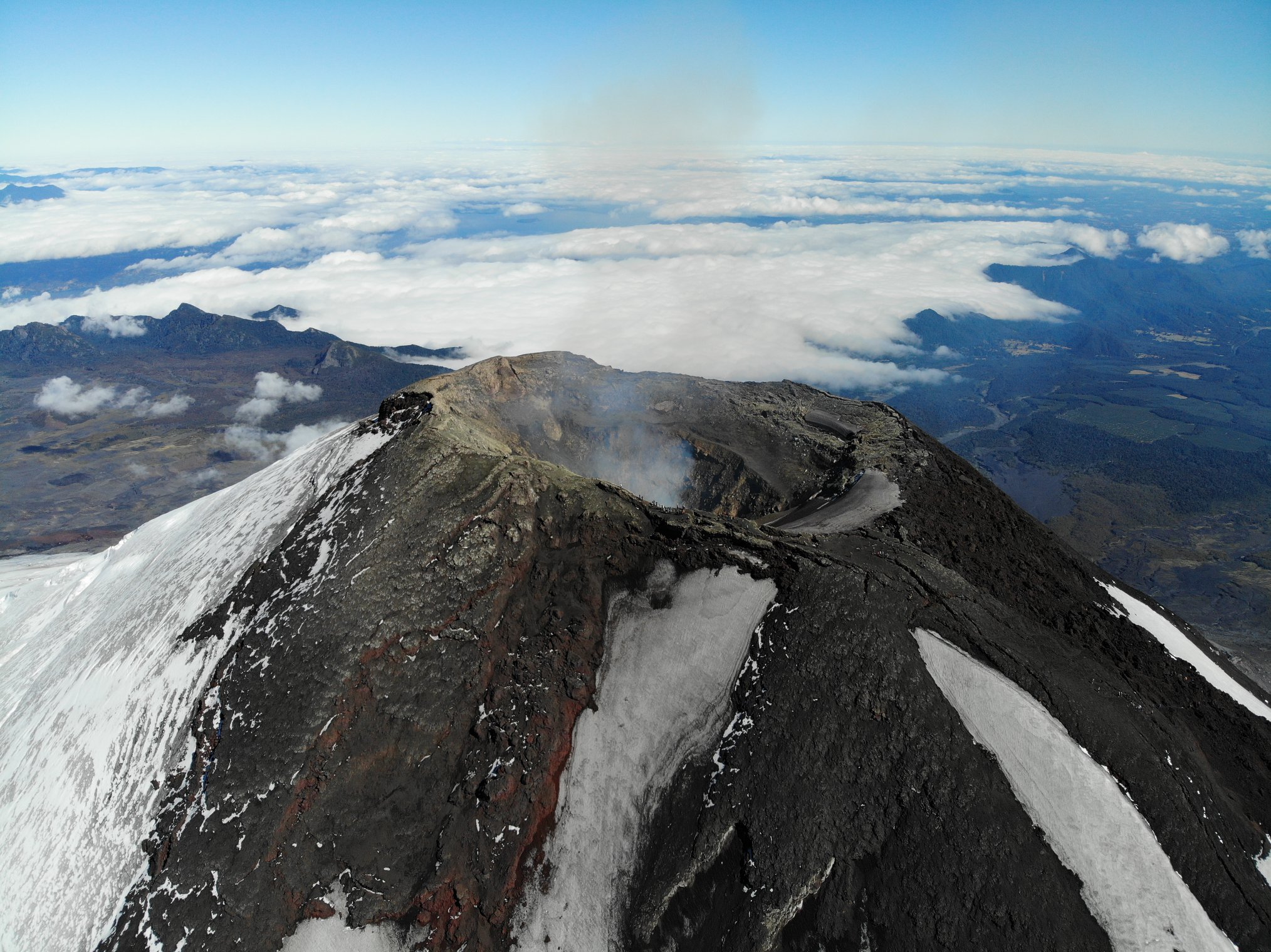
Satellite geomorphological analysis
Thanks to the observation and analysis of Planet Scope, Sentinel 2-L2A and Skysat Collect satellite images, a North-East-South-West elongation pyroclast cone is identified inside the crater of the Villarrica volcano, with an opening through which outgassing is emitted. Recent pyroclastic deposits are not identified, nor is the near-surface lava lake observed.
During this fortnight, two trends in behavior were observed. During the first week, the continuous seismic energy, evaluated from the RSAM parameter, maintained a downward trend; however, for the following week, a slight but sustained upward trend was observed, which was related on the surface to an increase in SO2 gas values and with a slight increase in thermal emissivity. Therefore, signals are observed suggesting that surface processes remain unstable, albeit with lower explosiveness. This leads to maintaining the yellow technical alert and the possible assignment area within a radius of 1 km from the center of the active crater.
YELLOW TECHNICAL ALERT: Changes in volcanic activity behavior
Source : Sernageomin
Photo : 24 horas, Take a Way .
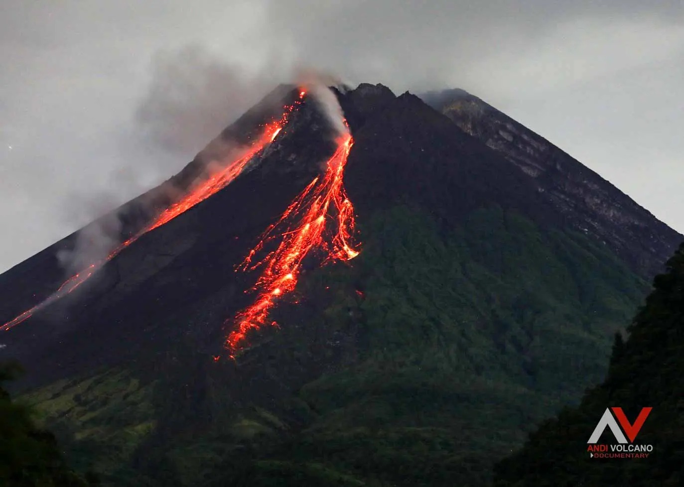
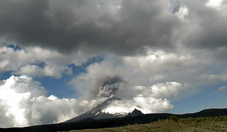
Colombia , Galeras :
Galeras Volcano Weekly Activity Bulletin
Regarding the monitoring of the activity of the GALERAS VOLCANO, the MINISTRY OF MINES AND ENERGY through the COLOMBIAN GEOLOGICAL SERVICE (SGC) informs that:
During the period evaluated between May 16 and May 22, 2023 and despite low levels, an increase in seismic occurrence was observed compared to what was reported the previous week. The predominance of events associated with rock fracture within the volcanic system has been maintained.
The fracture seismicity was located very close to the volcanic cone, with depths less than 4 km from the summit (4200 m asl) and a maximum magnitude of 0.9.

When the weather conditions were favorable, it was possible to observe the emission of gases from some of the existing fumarolic fields in the active cone with low height, white color (mainly water vapor), low pressure at the outlet and variable dispersion due to wind action. .
Other geophysical and geochemical monitoring parameters of the Galeras volcano did not show significant changes.
The activity level of the volcano remains at YELLOW LEVEL (III): CHANGES IN THE BEHAVIOR OF VOLCANIC ACTIVITY
Source et photo : SGC
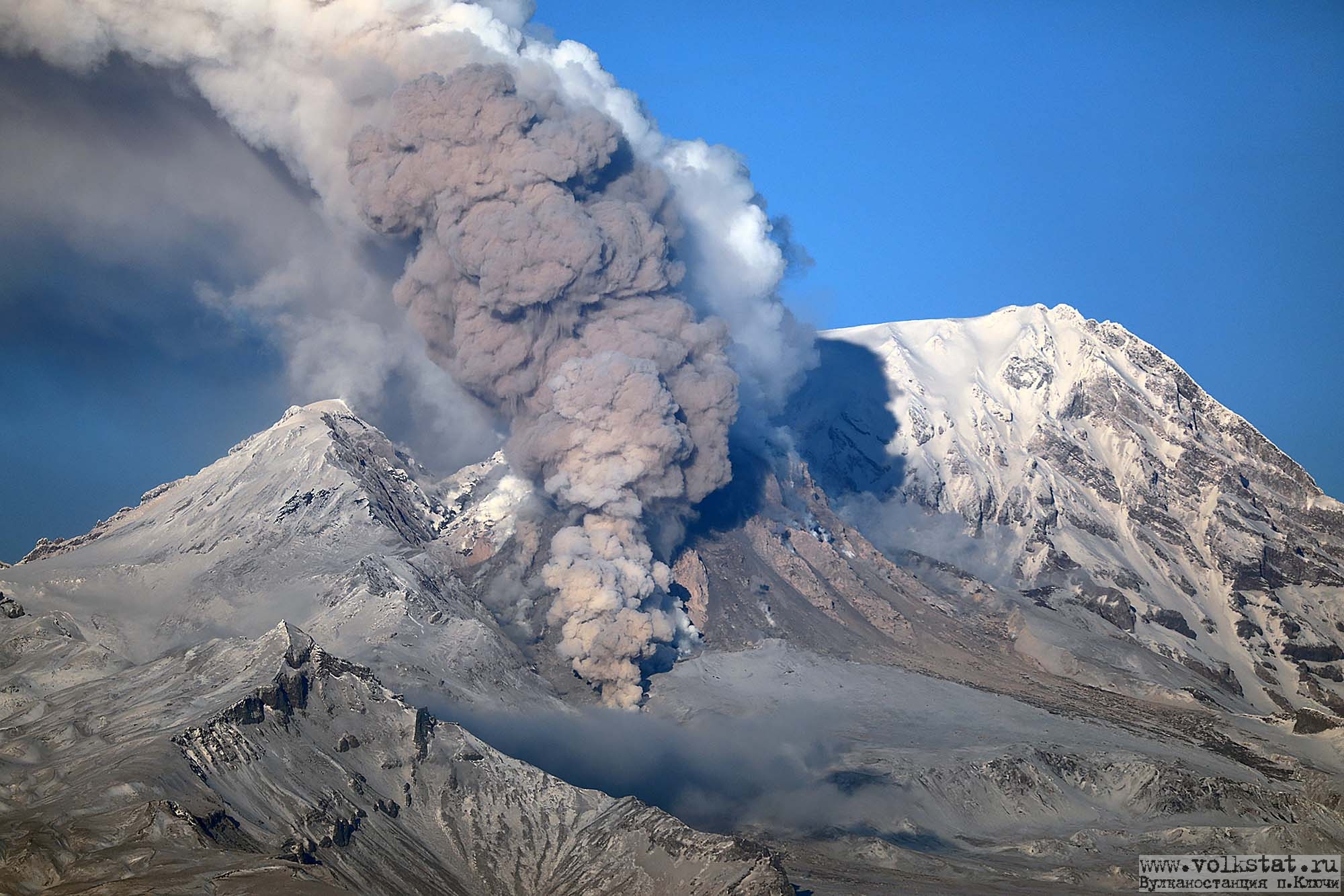
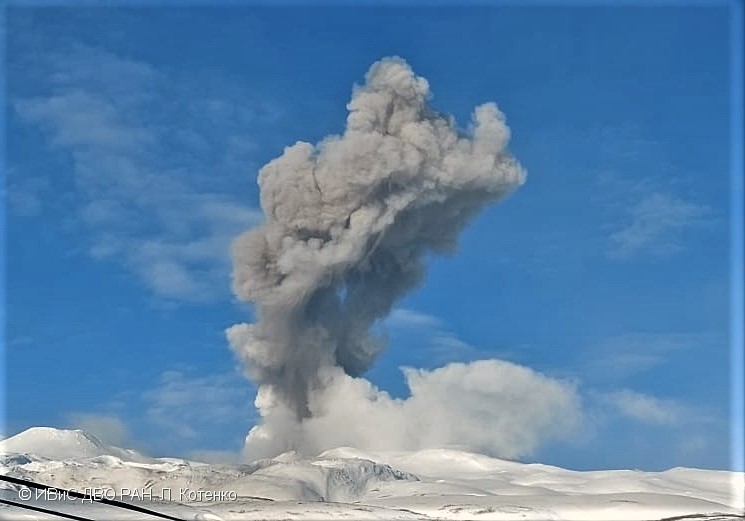
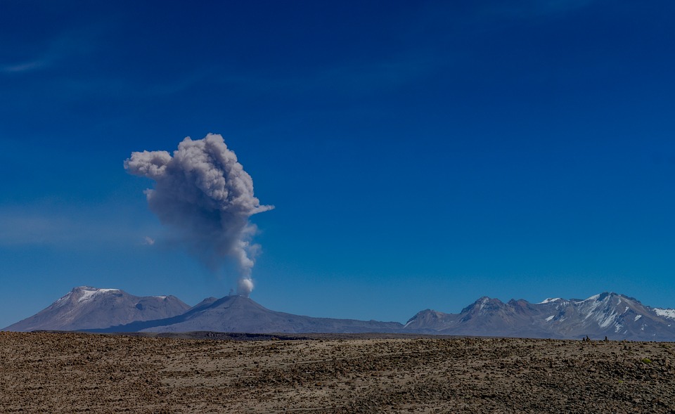
Russia / Kuril Islands , Ebeko :
VOLCANO OBSERVATORY NOTICE FOR AVIATION (VONA)
Issued: May 25 , 2023
Volcano: Ebeko (CAVW #290380)
Current aviation colour code: ORANGE
Previous aviation colour code: orange
Source: KVERT
Notice Number: 2023-70
Volcano Location: N 50 deg 41 min E 156 deg 0 min
Area: Northern Kuriles, Russia
Summit Elevation: 1156 m (3791.68 ft)
Volcanic Activity Summary:
A moderate explosive activity of the volcano continues. According to visual data an explosion sent ash up to 3.5 km a.s.l., an ash cloud is drifting to the east of the volcano.
A moderate eruptive activity of the volcano continues. Ash explosions up to 6 km (19,700 ft) a.s.l. could occur at any time. Ongoing activity could affect low-flying aircraft and airport of Severo-Kurilsk.
Volcanic cloud height:
3500 m (11480 ft) AMSL Time and method of ash plume/cloud height determination: 20230525/0630Z – Visual data
Other volcanic cloud information:
Distance of ash plume/cloud of the volcano: 5 km (3 mi)
Direction of drift of ash plume/cloud of the volcano: E / azimuth 80 deg
Time and method of ash plume/cloud determination: 20230525/0630Z – Visual data
Source : Kvert
Photo : Yuri Demyanchuk