March 14 , 2023.
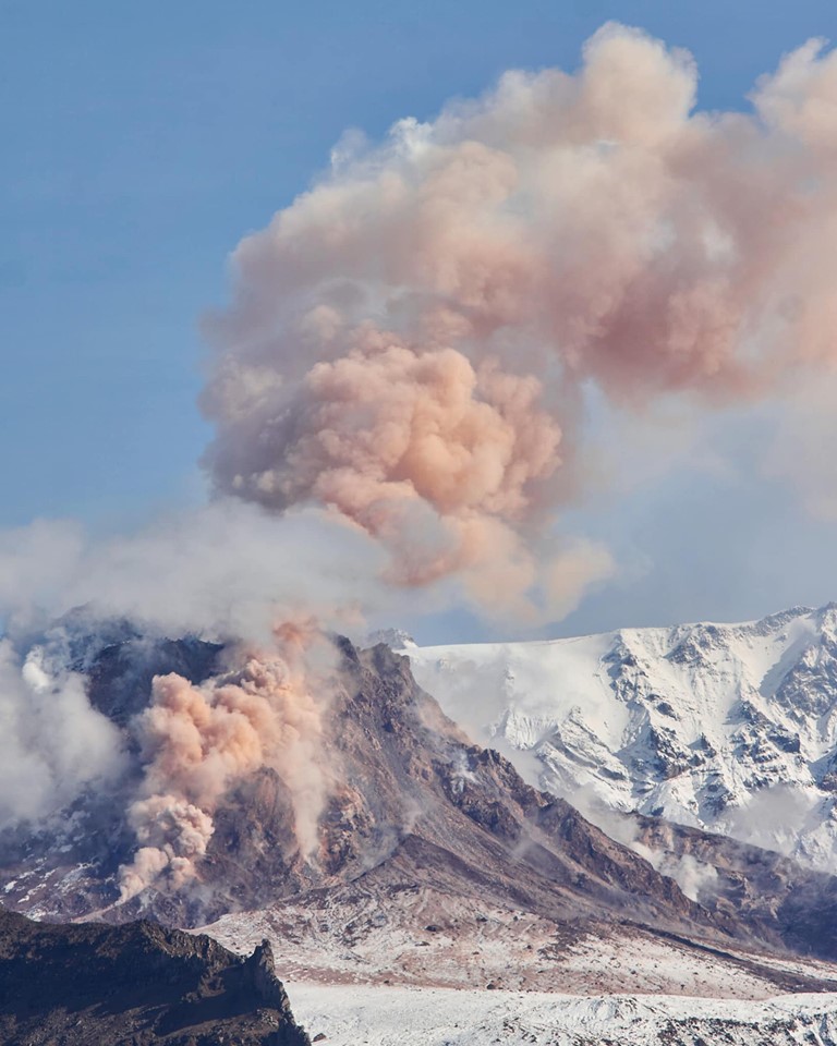
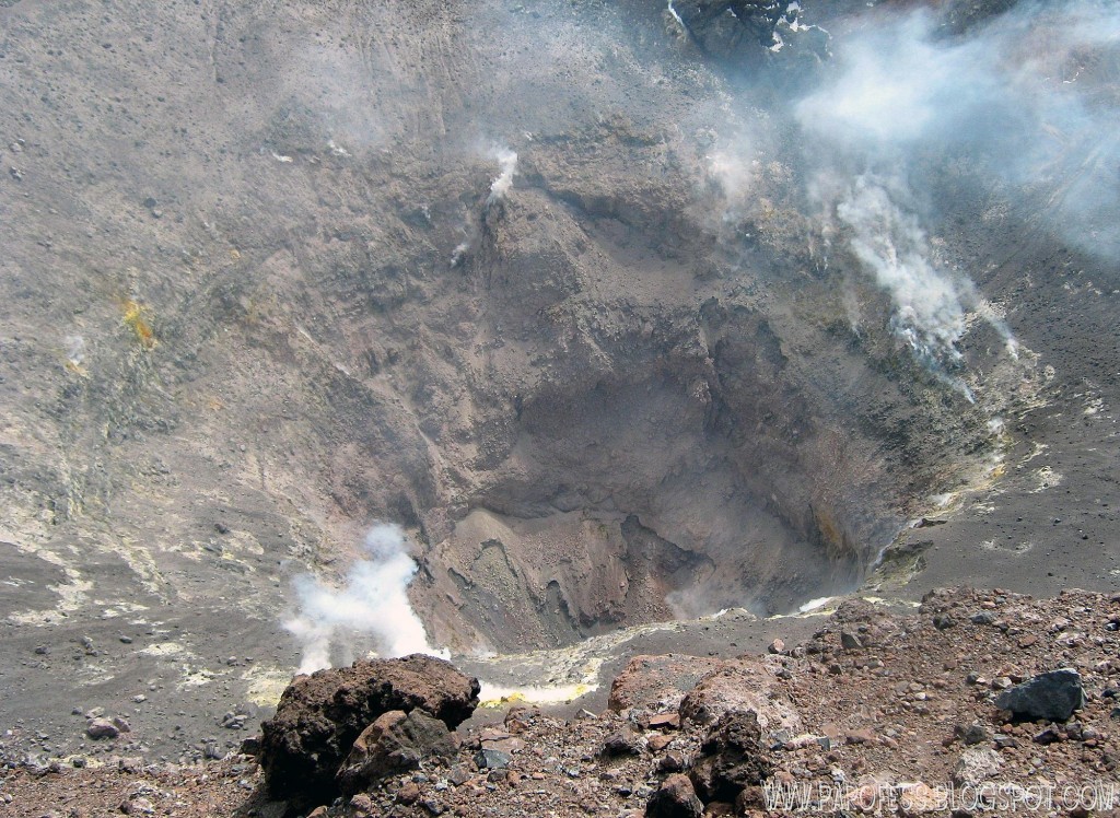
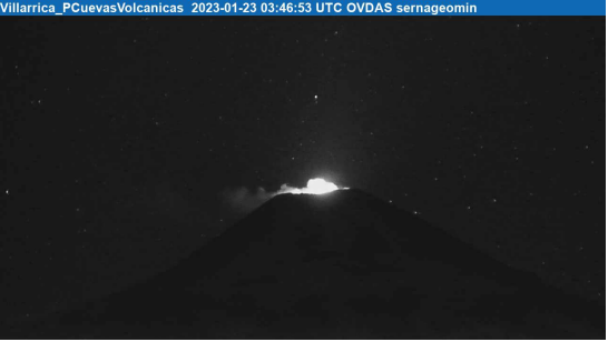
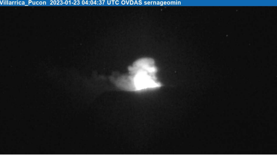
Democratic Republic of Congo , Nyamulagira :
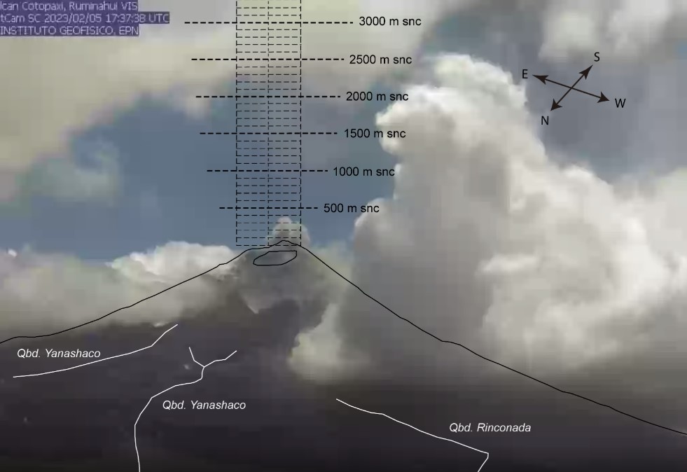
The Volcanological Observatory of Goma issues a press release to inform the population of Goma and its surroundings of the recent seismic activity of the Nyamulagira volcano. According to current seismic data, magmas are moving at shallow depths towards the central crater of the volcano. This activity is confirmed by a fiery glow observed at the top of the volcano since 6 p.m. local time.
The Observatory also reported that hybrid earthquakes (break followed by magmatic intrusion) have been located in the Nyamulagira volcano field. If this activity continues and leads to an eruption on the flank, the lava would orient into Virunga National Park. However, volcanic products such as ash, Pelé’s hair and scoria can fall back into inhabited areas as a result of this activity in the crater.
The Observatory advised the people of Goma to remain calm and go about their business freely. The inhabitants must scrupulously follow the recommendations concerning the washing of vegetables and the consumption of cistern water. Airmen are also advised to consider the direction of the wind when flying over the Virunga region.
The OVG continues observations on the ground and from its surveillance network and promises to keep the population informed of the evolution of the situation. Residents are therefore invited to remain vigilant and to keep themselves informed of updates from the Observatory.
Source : Interwiew CD, via Manfred Meyer .
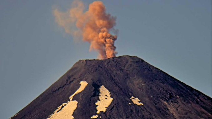
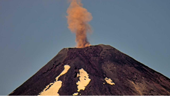
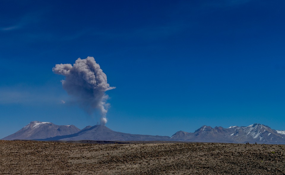
Peru , Sabancaya :
Analysis period: from March 06, 2023 to March 12, 2023, Arequipa, March 13, 2023.
Alert level: ORANGE
The Geophysical Institute of Peru (IGP) reports that the eruptive activity of the Sabancaya volcano remains at moderate levels, that is to say with the recording of an average of 48 daily explosions, with columns of ash and of gas up to 2.1 km altitude above the summit of the volcano and their subsequent dispersion. Therefore, for the following days, no significant change is expected in eruptive activity.
The IGP recorded and analyzed the occurrence of 380 earthquakes of volcanic origin, associated with the circulation of magmatic fluids inside the Sabancaya volcano. An average of 48 explosions was recorded daily, in addition to recording Volcano-Tectonic (VT) type events associated with rock fracturing inside the Sabancaya volcano.
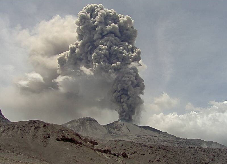
Monitoring the deformation of the volcanic structure using GNSS techniques (processed with fast orbits) does not show any significant anomalies. Visual surveillance identified columns of gas and ash up to 2.1 km above the summit of the volcano, which were dispersed towards the West, South, South-West and North-West sectors. of the Sabancaya. Satellite recordings have identified the presence of 2 thermal anomalies, with a maximum value of 4 MW, associated with the presence of a lava body on the surface of the crater of the volcano.
RECOMMENDATIONS
• Keep the volcanic alert level orange.
• Do not approach within a radius of less than 12 km from the crater.
Source : Cenvul
Photo : Ingemmet
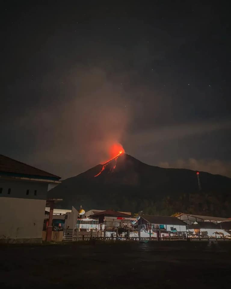
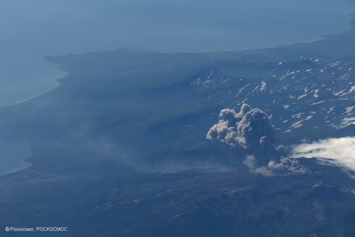
Indonesia , Merapi :
VOLCANO OBSERVATORY NOTICE FOR AVIATION – VONA
Issued : March 13 , 2023
Volcano : Merapi (263250)
Current Aviation Colour Code : ORANGE
Previous Aviation Colour Code : orange
Source : Merapi Volcano Observatory
Notice Number : 2023MER005
Volcano Location : S 07 deg 32 min 31 sec E 110 deg 26 min 31 sec
Area : Special Region of Yogyakarta, Indonesia
Summit Elevation : 9498 FT (2968 M)
Volcanic Activity Summary :
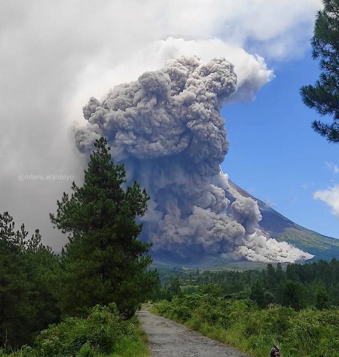
Eruption with volcanic ash cloud at 22h50 UTC (05h50 local).
Volcanic Cloud Height :
Best estimate of ash-cloud top is around 14298 FT (4468 M) above sea level or 4800 FT (1500 M) above summit. May be higher than what can be observed clearly. Source of height data: ground observer.
Other Volcanic Cloud Information :
Ash cloud moving from east to southeast. Volcanic ash is observed to be gray to brown. The intensity of volcanic ash is observed from medium to thick.
Remarks :
Eruption recorded on seismogram with maximum amplitude 70 mm and maximum duration 160 second. Ash cloud generated by pyroclastic density currents.
SEISMICITY OBSERVATION
29 earthquake avalanches with an amplitude of 3 to 25 mm and a duration of 29.1 to 147.4 seconds.
15 hybrid/multi-phase earthquakes with amplitudes of 3 to 17 mm, and durations of 5.3 to 9.7 seconds.
2 shallow volcanic earthquakes with an amplitude of 45 to 75 mm and a duration of 8.2 to 16.3 seconds.
1 distant tectonic earthquake with an amplitude of 3 mm, duration of 160.9 seconds.
Source : Magma Indonésie.
Photo : Andaru Wardoyo .
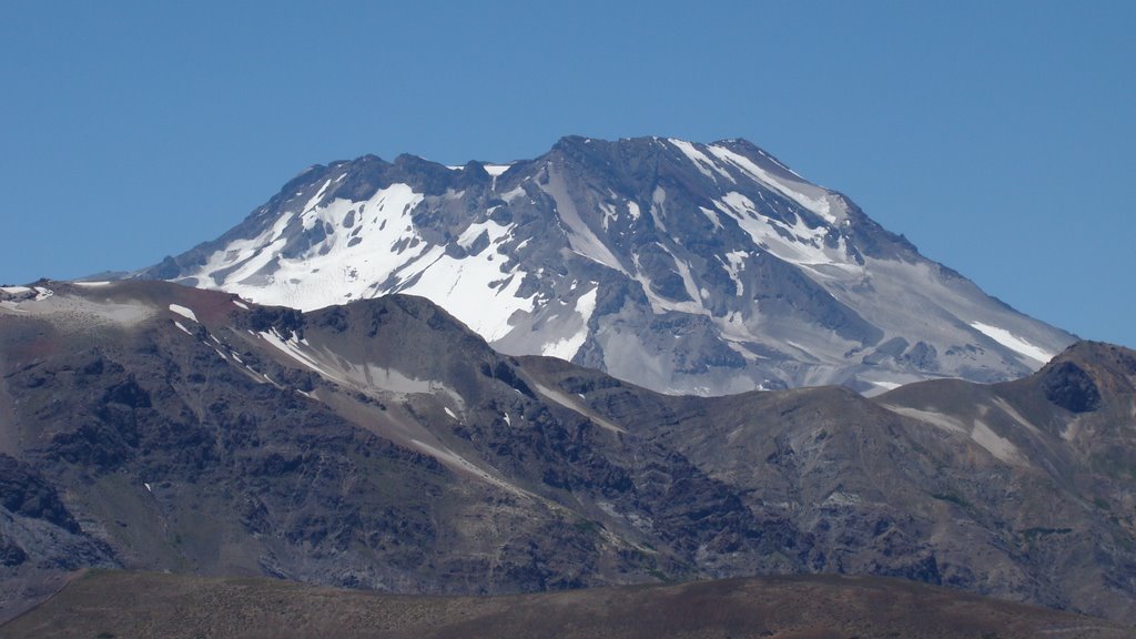
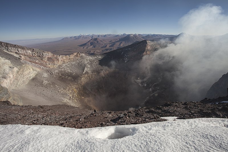
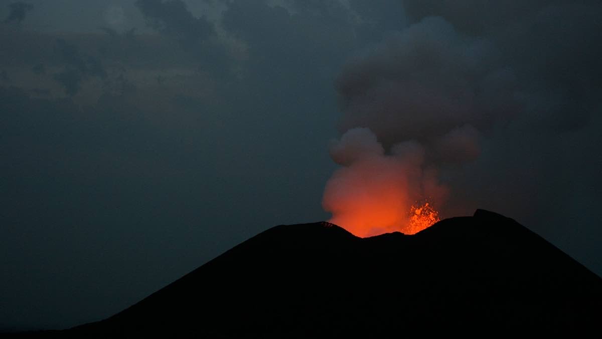
Chile , Tupungatito :
Seismology
The seismological activity of the period was characterized by the recording of:
103 VT-type seismic events, associated with rock fracturing (Volcano-Tectonics). The most energetic earthquake presented a value of local magnitude (ML) equal to 2.0, located 5.1 km north-northeast of the volcanic edifice, at a depth of 17.2 km by relative to the crater.
100 LP-type seismic events, associated with fluid dynamics within the volcanic system (Long Period). The size of the largest earthquake assessed from the Reduced Displacement (DR) parameter was equal to 5 cm2.
Fluid Geochemistry
No anomalies in sulfur dioxide (SO2) emissions in the atmosphere have been reported in the area close to the volcanic system, according to data published by the Tropospheric Monitoring Instrument (TROPOMI) and Ozone Monitoring Instrument (OMI) Sulfur Dioxide Group .
Satellite thermal anomalies
During the period, no thermal alert was recorded in the area associated with the volcanic edifice, according to the analytical processing of Sentinel 2-L2A satellite images, in combination with false color bands.
Surveillance cameras
The images provided by the fixed camera, installed near the volcano, recorded a concentrated degassing at low altitude.
Activity remained at levels considered low, suggesting stability of the volcanic system. The volcanic technical alert is maintained at:
GREEN TECHNICAL ALERT: Active volcano with stable behavior – There is no immediate risk.
Source et photo : Sernageomin
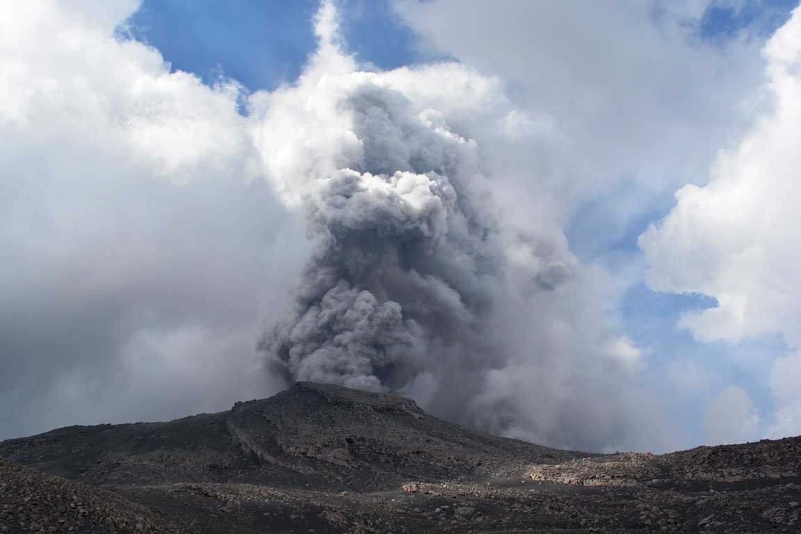
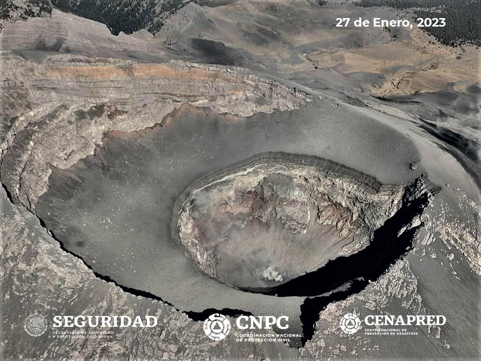
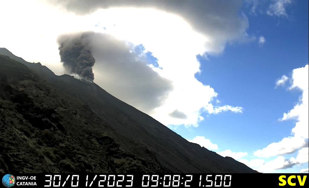
Guatemala , Santiaguito :
Weather conditions: Clear weather
Wind: West
Precipitation: 18.4 mm.
Activity:
A constant degassing is recorded 800 meters above the Caliente dome. Similarly, the incandescence observed during the night and in the early morning on the dome of the Caliente dome, remains constant. Seismic stations continue to record weak explosions and reports from field observers indicate that they are generating low to moderate rumblings. Weak to moderate avalanches are generated from the Caliente dome.
The lava flow continues to be active on the southwest and west flanks, causing degassing and weak avalanches along its path. This causes a fall of fine ash particles and a foggy environment near the volcano. Explosions, strong avalanches and audible sounds can be generated several kilometers from the volcanic edifice. The occurrence of stronger avalanches of blocks and ash is not excluded, as well as possible pyroclastic flows over long distances in different directions.
Source : Insivumeh
Photo : Armando Pineda
Mexico , Popocatepetl :
March 13, 11:00 a.m. (March 13, 5:00 p.m. GMT)
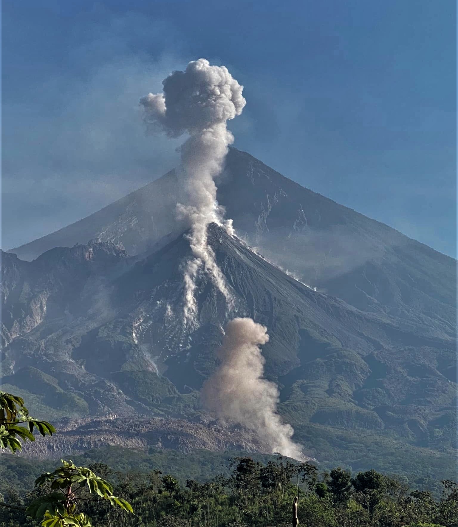
During the past 24 hours, according to the monitoring systems of the Popocatépetl volcano, 206 exhalations have been detected, accompanied by water vapor, volcanic gases and sometimes slight amounts of ash. In addition, 17 minutes of high frequency and harmonic tremor were recorded.
Similarly, today two minor explosions were recorded at 05:37 and 07:18 local time.
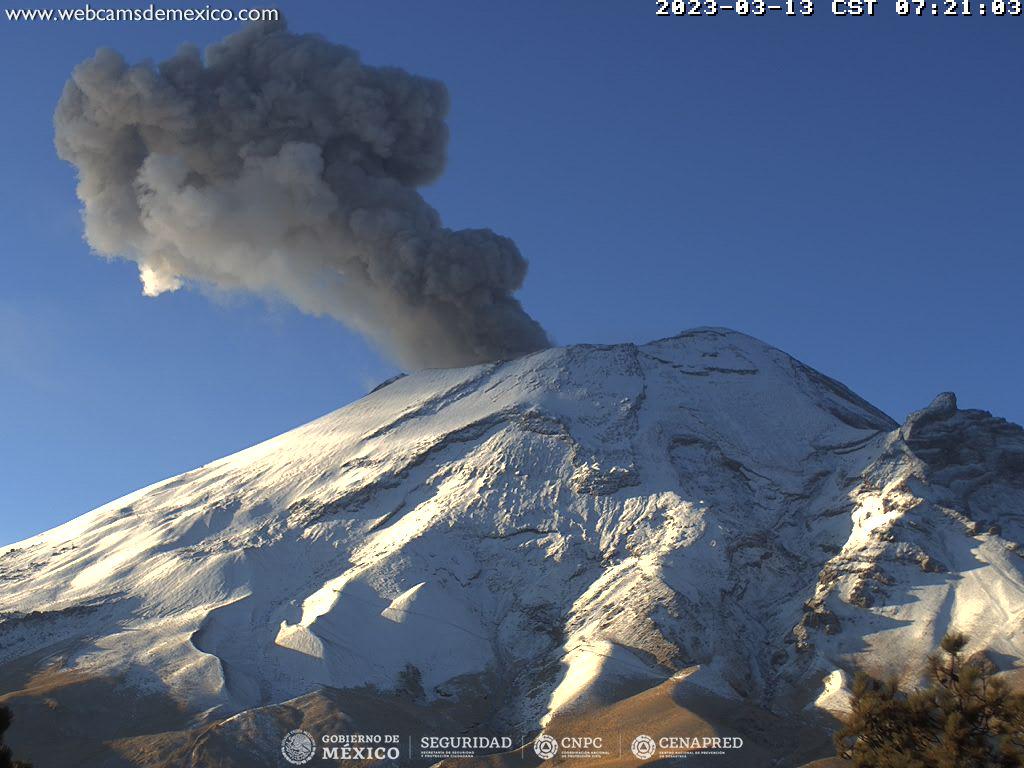
During the morning, and at the time of this report, an emission of water vapor and volcanic gases was observed in a northeast (NE) direction.
CENAPRED insistently reiterates the recommendation NOT TO CLIMB to the crater of the volcano, because there is the possibility of explosions, as we have seen on several occasions in the past, involving the emission of incandescent fragments. In heavy rain, stay away from the bottom of the ravines due to the danger of mudslides and debris.
The Popocatépetl volcanic alert traffic light is in YELLOW PHASE 2.
Source : Cenapred.