June 09 , 2018.
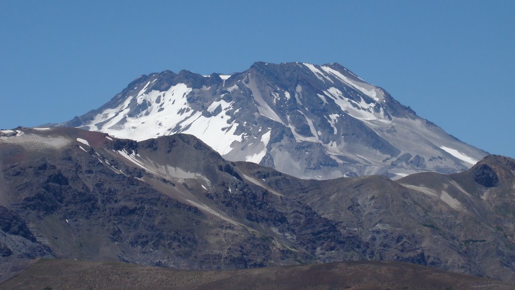
Pu’u ‘Ō’ō / Kilauea , Hawai :
Thursday, June 7, 2018, 10:22 PM HST (Friday, June 8, 2018, 08:22 UTC)
19°25’16 » N 155°17’13 » W,
Summit Elevation 4091 ft (1247 m)
Current Volcano Alert Level: WARNING
Current Aviation Color Code: RED
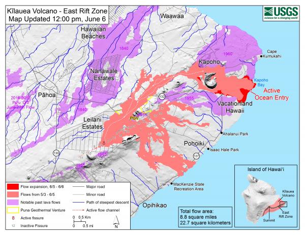
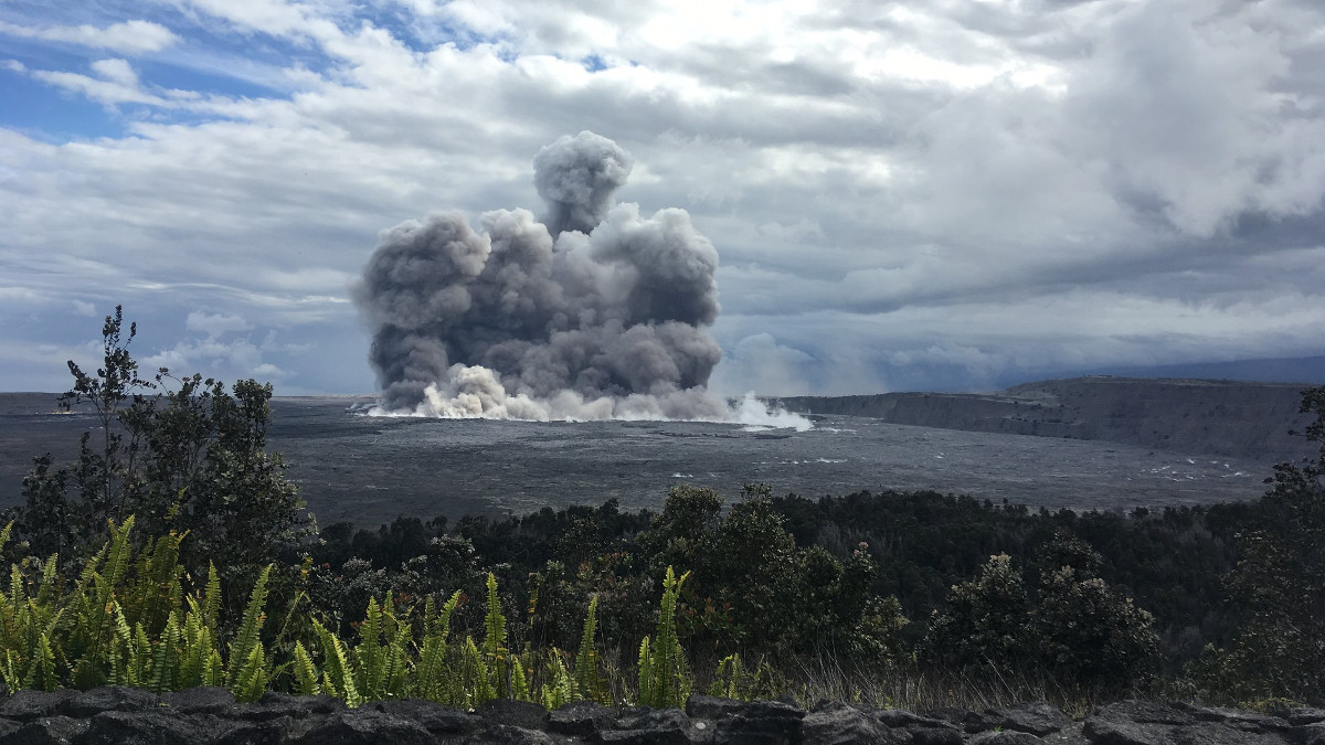
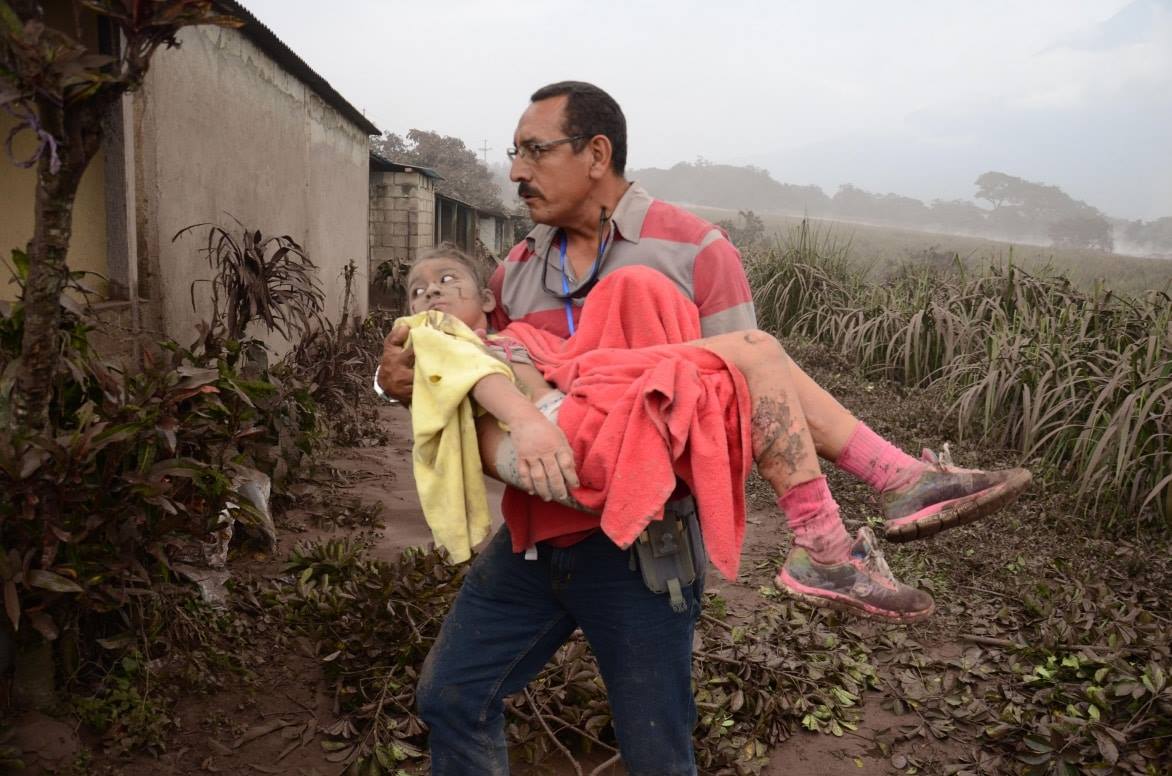
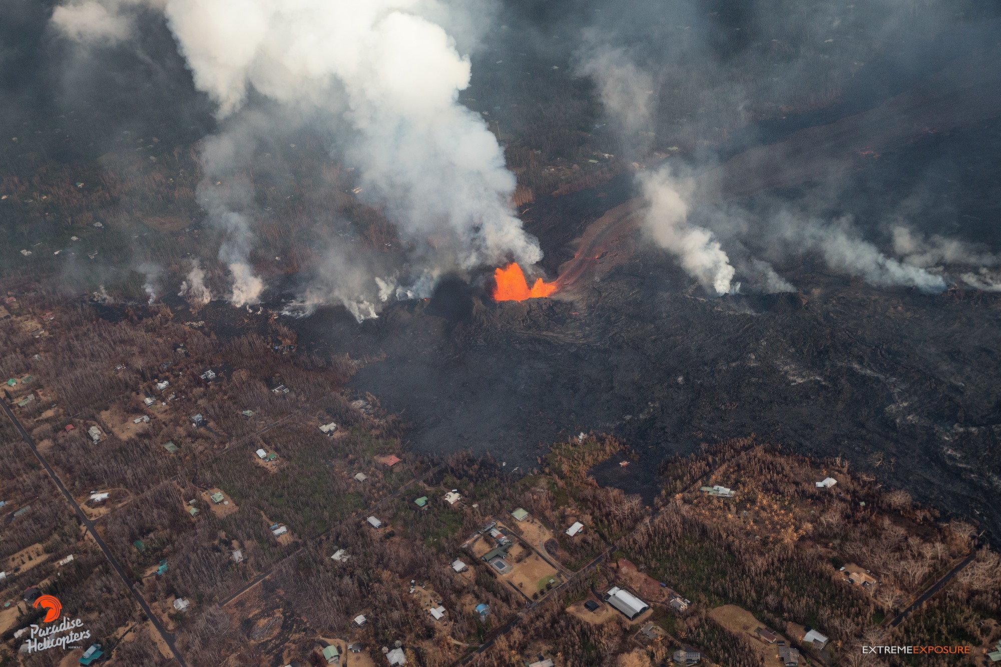
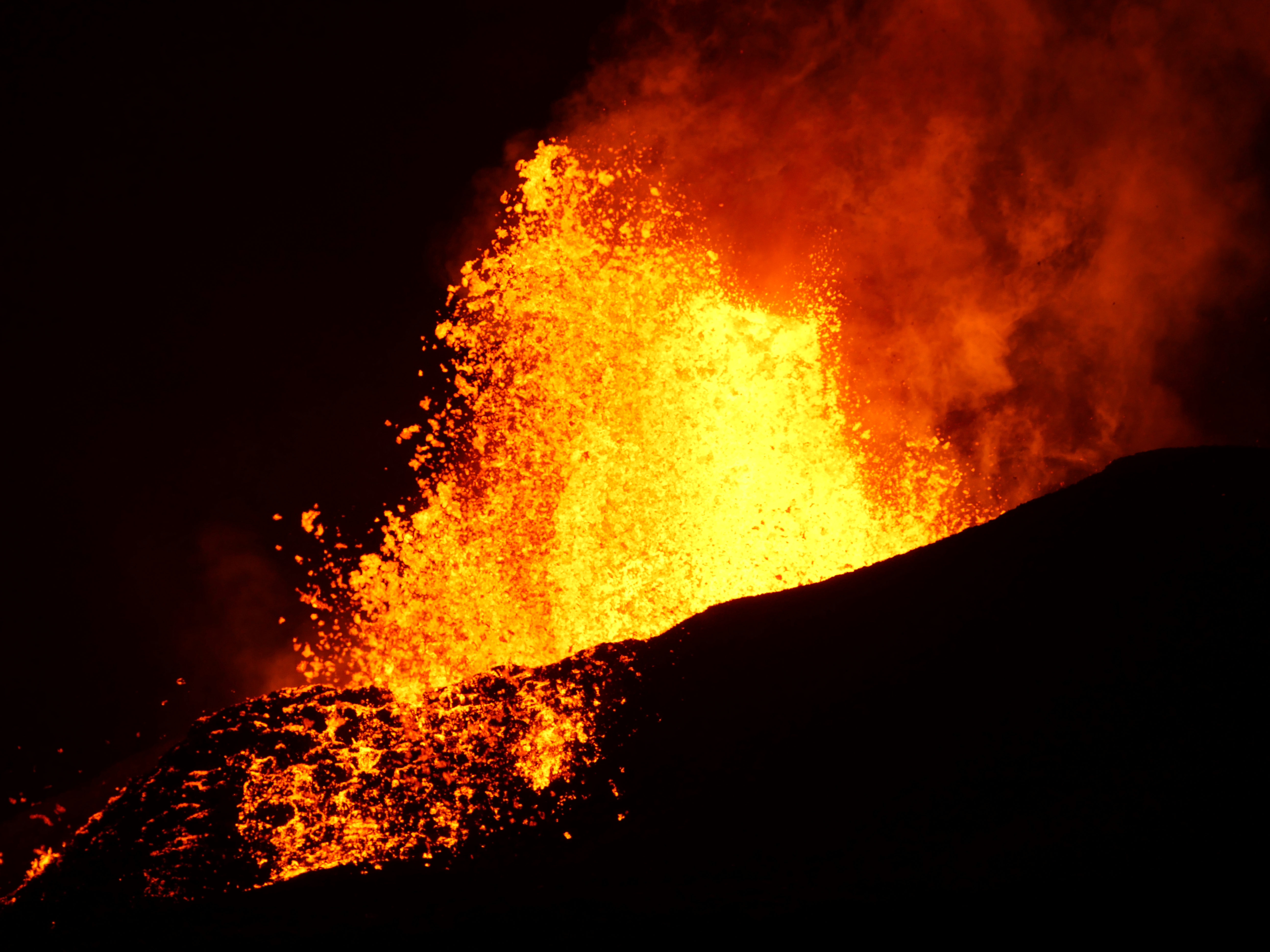
Kīlauea Volcano Lower East Rift Zone
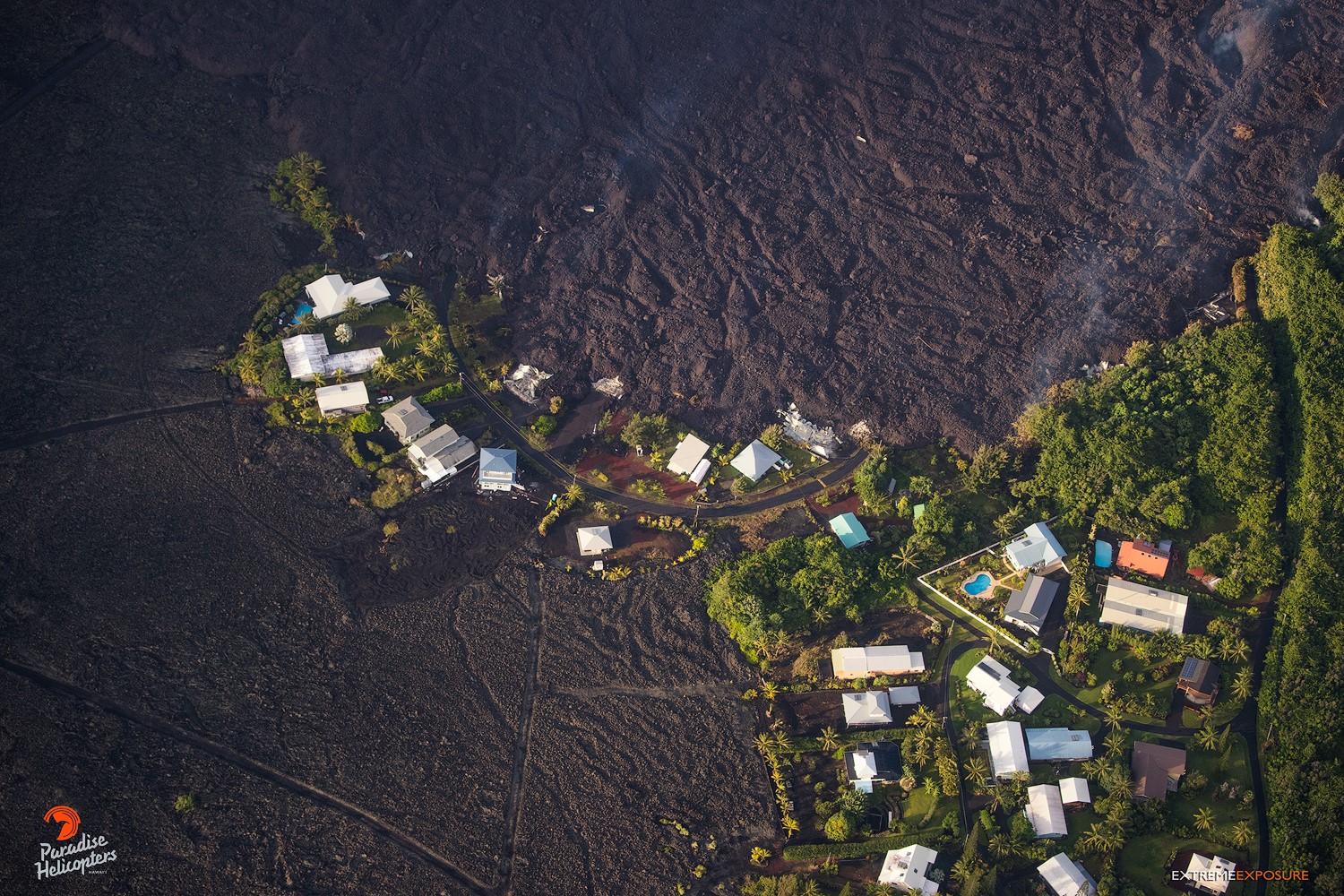
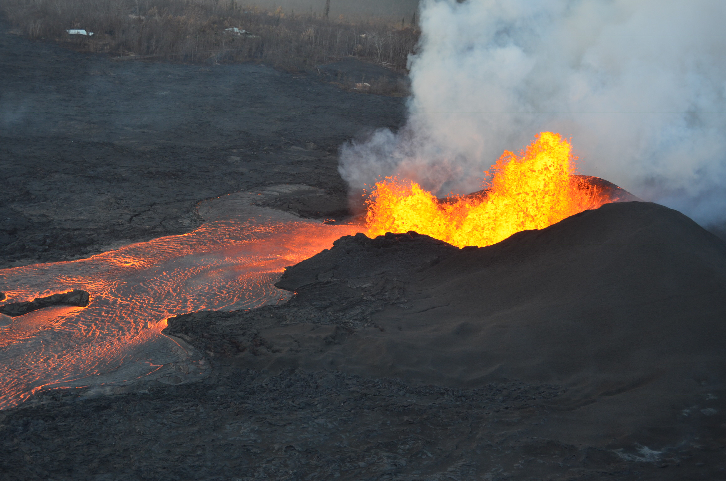
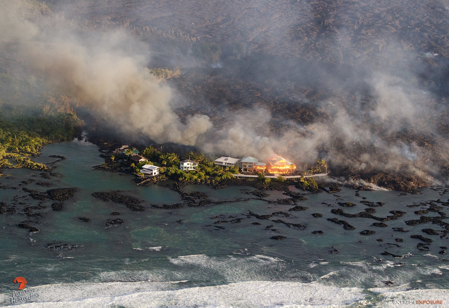
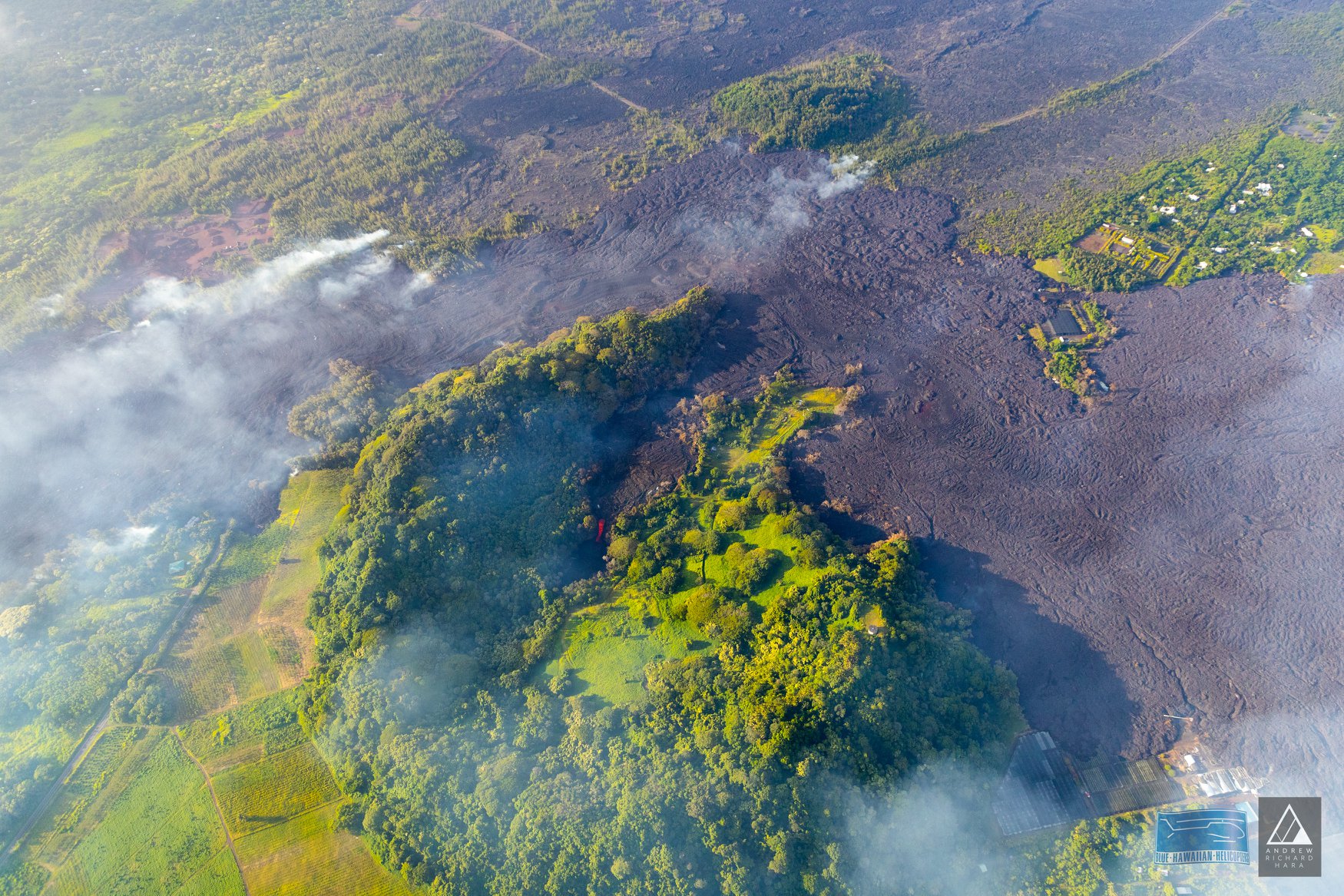
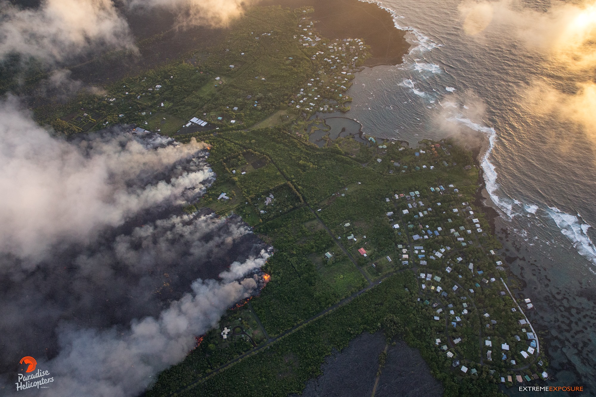
Vigorous eruption of lava continues from the lower East Rift Zone (LERZ) fissure system in the area of Leilani Estates.
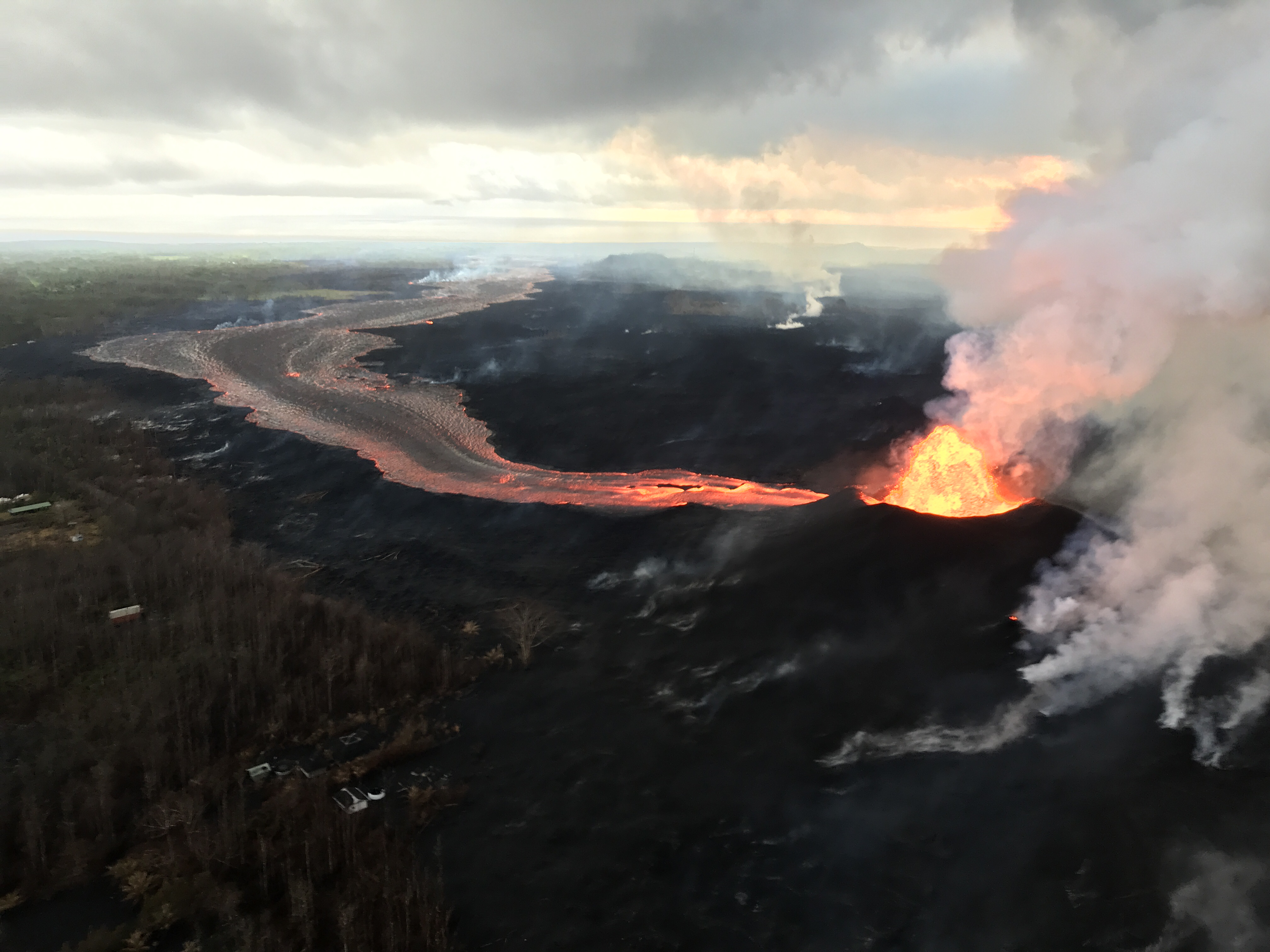
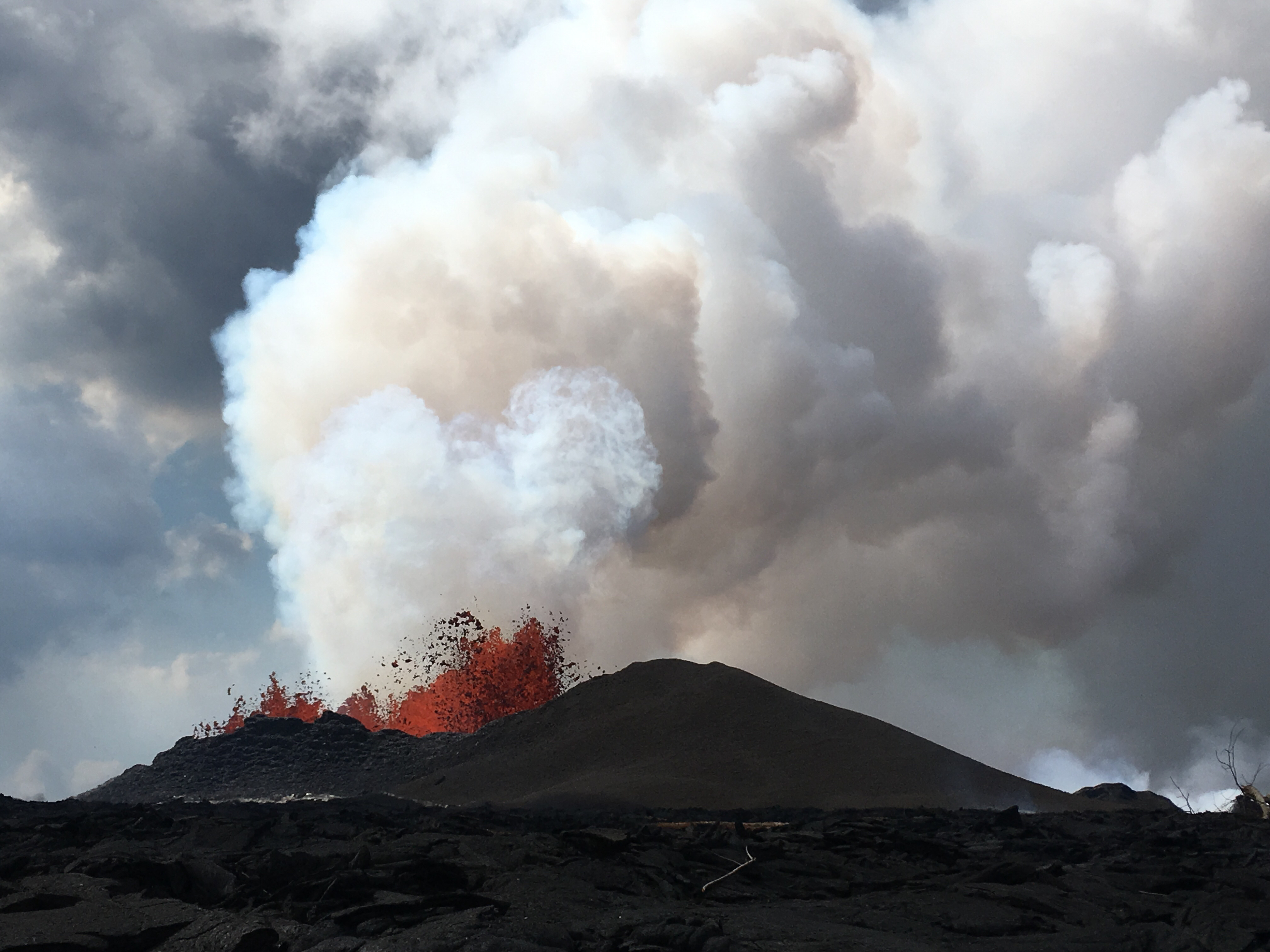
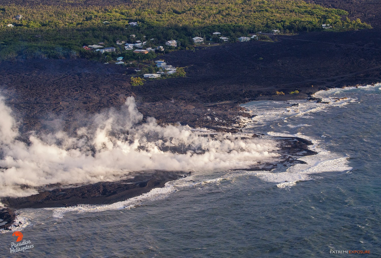
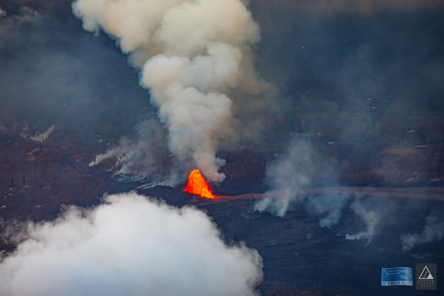
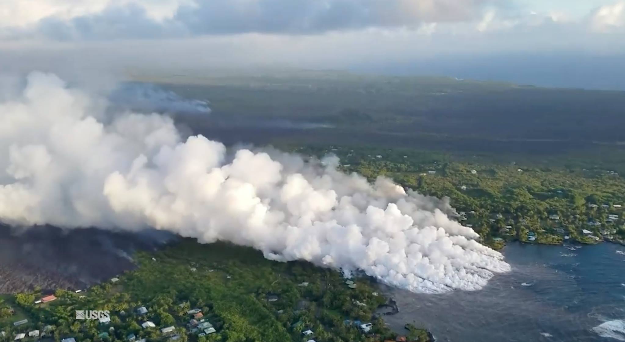
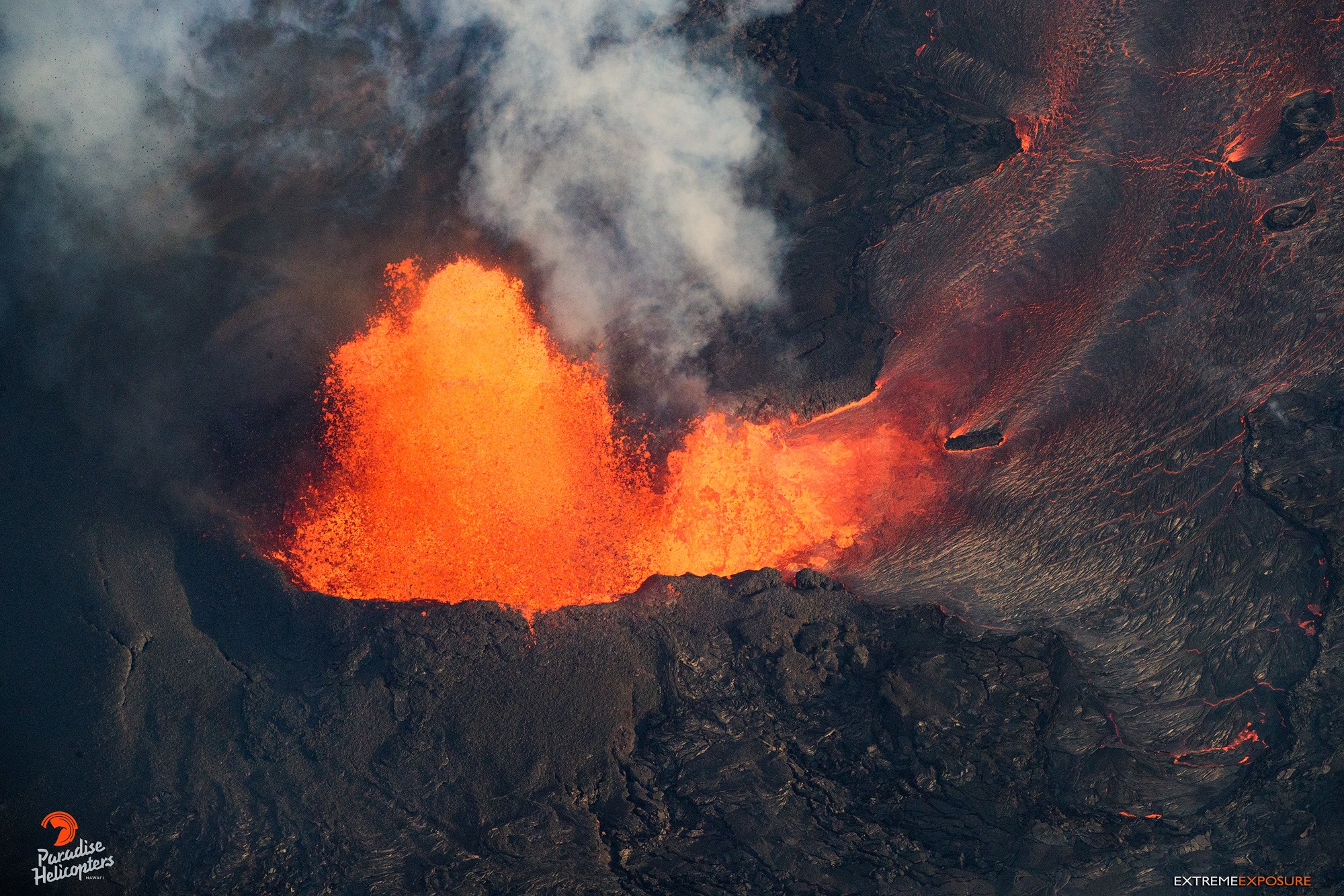
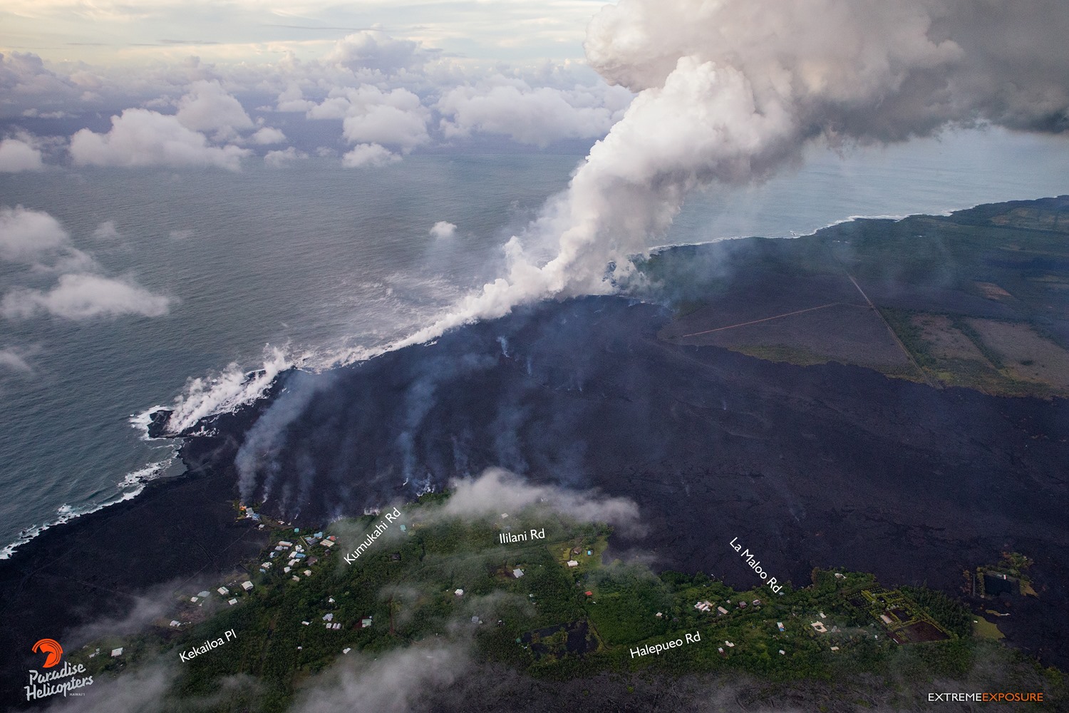
Lava fountaining at Fissure 8 continues unabated with fountain tops reported between 170-200 feet. This activity continues to feed a lava channel flowing east towards the ocean entry in the Kapoho Bay area. Bad weather and poor visibility grounded the late afternoon overflight but ground observers confirm lava continues to enter the sea as of early evening.
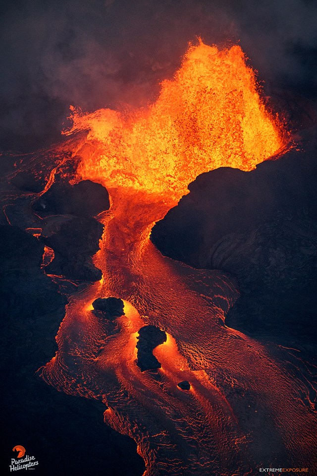
Kilauea’s east rift zone overflight: Fissure 8 continues to fountain vigorously, feeding the massive channelized flow that snakes its way to the sea at Kapoho. The elevated channel of lava presents a risk, being that any breach of its walls could potentially send flows laterally, changing directions, and/or involving much more than currently affected.
No other fissures are active.
Pele’s hair and other lightweight volcanic glass from high fountaining of Fissure 8 are falling downwind of the fissure and accumulating on the ground within Leilani Estates. High winds may waft lighter particles to greater distances. Residents are urged to minimize exposure to these volcanic particles, which can cause skin and eye irritation similar to volcanic ash.
HVO field crews are on site tracking the fountains, lava flows, and spattering from Fissure 8 as conditions allow and are reporting information to Hawaii County Civil Defense. Observations are also collected on a daily basis from cracks in the area of Highway 130; no changes in temperature, crack width, or gas emissions have been noted.
Volcanic gas emissions remain very high from Fissure 8 eruptions. For the next few days, easterly wind conditions may bring vog not only to the south and west sides of the Island of Hawaii, but also upslope to the island’s interior.
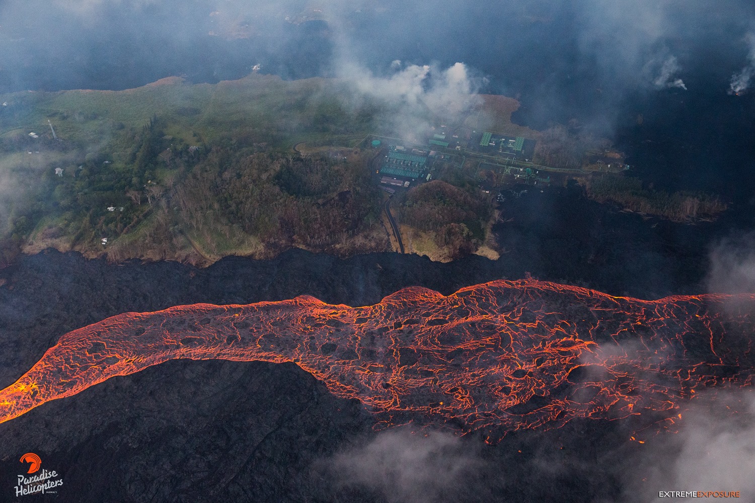
Thursday, June 7, 2018, 5:45 am – Kilauea’s east rift zone overflight: The Puna Geothermal Venture facility is surrounded by lava on three sides. A substantial breach of the perched channel could threaten to cover it.
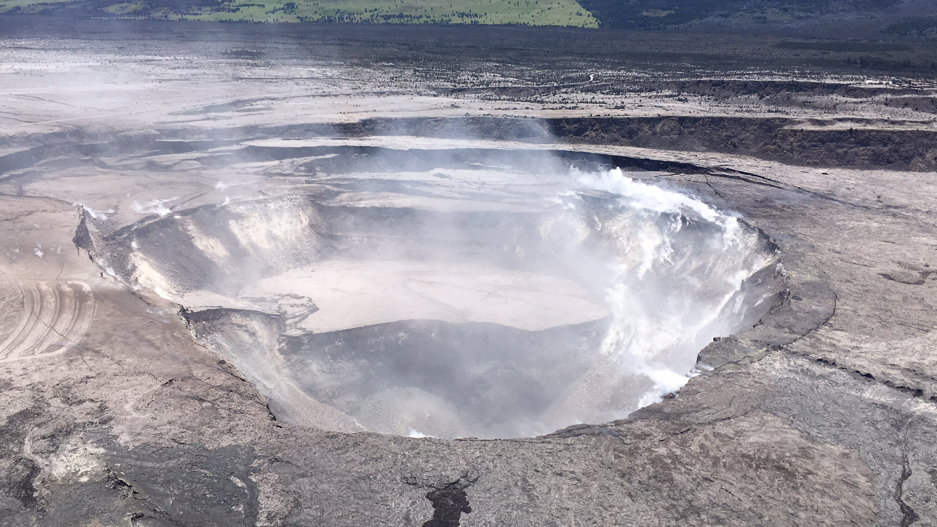
Kīlauea Volcano Summit
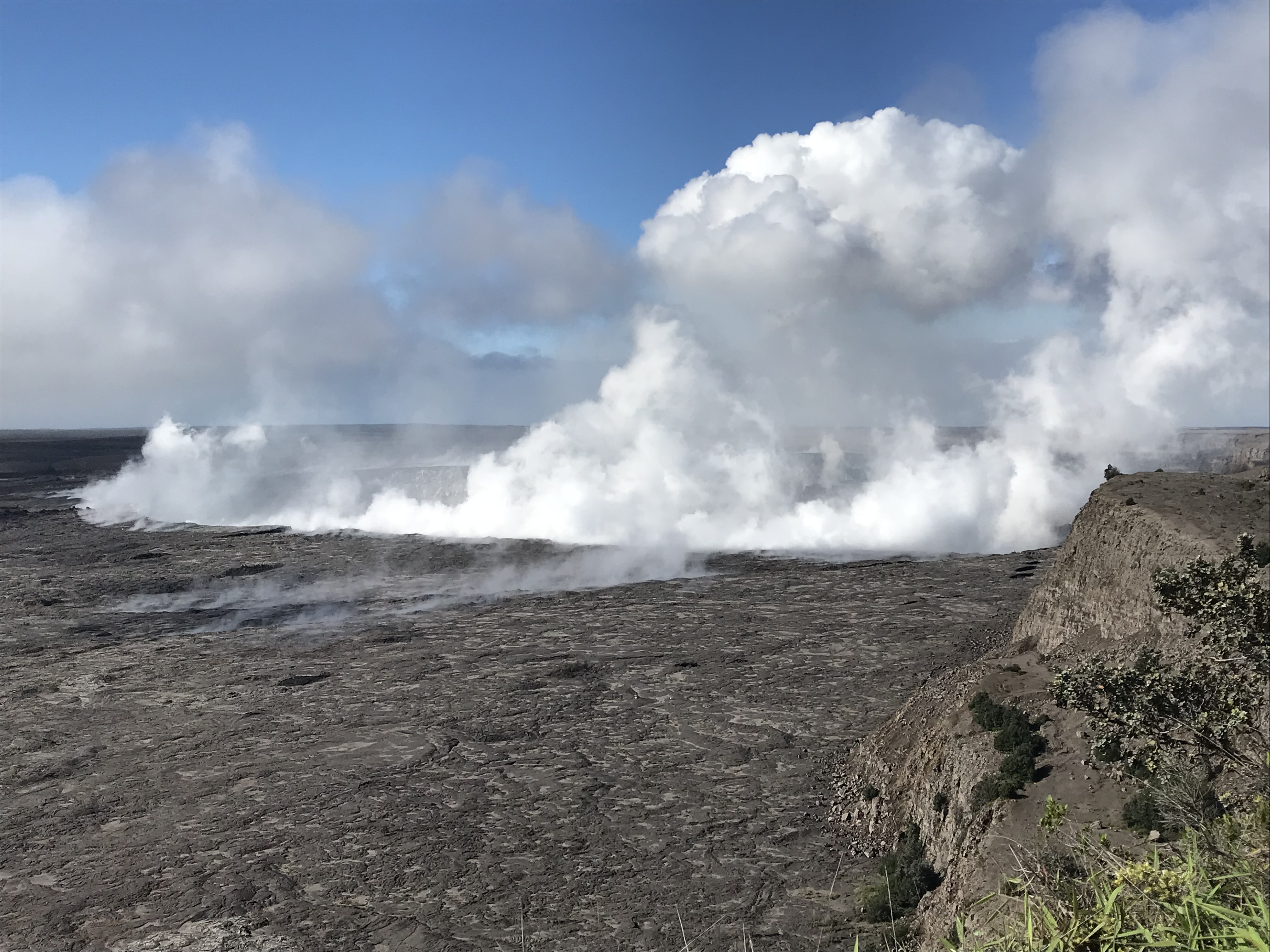
Seismic activity at the summit is increasing, with a few M3 events in the past several hours. Based on the pattern of previous days, we expect a small explosion to occur overnight. Inward slumping of the rim and walls of Halema`uma`u continues in response to ongoing subsidence at the summit.
Over the last week, sulfur dioxide emissions from the volcano’s summit have decreased, but emission rates remain high enough to impact air quality in downwind regions. Additional bursts of gas released with intermittent explosive activity are also transported downwind and may temporarily affect air quality as well.
Friday, June 8, 2018, 8:25 AM HST (Friday, June 8, 2018, 18:25 UTC)
Kīlauea Volcano Lower East Rift Zone
Vigorous eruption of lava continues from the lower East Rift Zone (LERZ) fissure system in the area of Leilani Estates.
Overnight, lava fountaining at Fissure 8 continue to reach heights of about 220 feet. Geology and UAS crews observed no significant changes in the Fissure 8 flow field. HVO’s morning overflight revealed. There is no lava activity from the other fissures but Fissure 24 is incandescent and Fissures 24, 9, and 10 are fuming heavily.
Around 3:00 a.m. HST today (June 8), lava fountains erupting from fissure 8 on Kīlauea Volcano’s Lower East Rift Zone were reaching heights of 180–220 feet.
Volcanic gas emissions remain very high from Fissure 8 eruptions. For the next few days, easterly wind conditions may bring vog not only to the south and west sides of the Island of Hawaii, but also upslope to the island’s interior.
Vog is a hazy mixture of SO2 gas and aerosols (tiny particles or droplets) which are primarily sulfuric acid and other sulfate (SO4) compounds. Aerosols are created when SO2 and other volcanic gases combine in the atmosphere and interact chemically with oxygen, moisture, dust, and sunlight over minutes to days.
The exact composition of vog depends on how much time the volcanic plume has had to react in the atmosphere. In areas such as the Kona coast, far from Kīlauea Volcano’s active vents, aerosols are the main component of vog. Closer to the volcano, vog contains both aerosols and unreacted SO2 gas.
June 7, 2018 Phenomenal Fissure & Flow from Mick Kalber on Vimeo.
Kīlauea Volcano Summit
At 2:44 AM HST, a small explosion occurred at the summit of Kilauea. No weather radar observations of plume heights are possible, but satellite data suggest that any plume that might have been generated did not exceed 10,000 feet above sea level. Since the small explosion, seismic activity in the summit region has been low. Inward slumping of the rim and walls of Halema`uma`u continues in response to ongoing subsidence at the summit.
Friday, June 8, 2018, 4:54 PM HST (Saturday, June 9, 2018, 02:54 UTC)
Kīlauea Volcano Lower East Rift Zone
Vigorous eruption of lava continues from the lower East Rift Zone (LERZ) fissure system in the area of Leilani Estates.
Lava eruption continued at Fissure 8 with vigorous fountains reaching heights of about 220 feet. Geology crews reported no significant changes in the Fissure 8 flow field and two large plumes at the broad ocean entry. The Kapoho Beachlots boundary has not changed since this morning’s overflight. There is no lava activity from the other fissures.
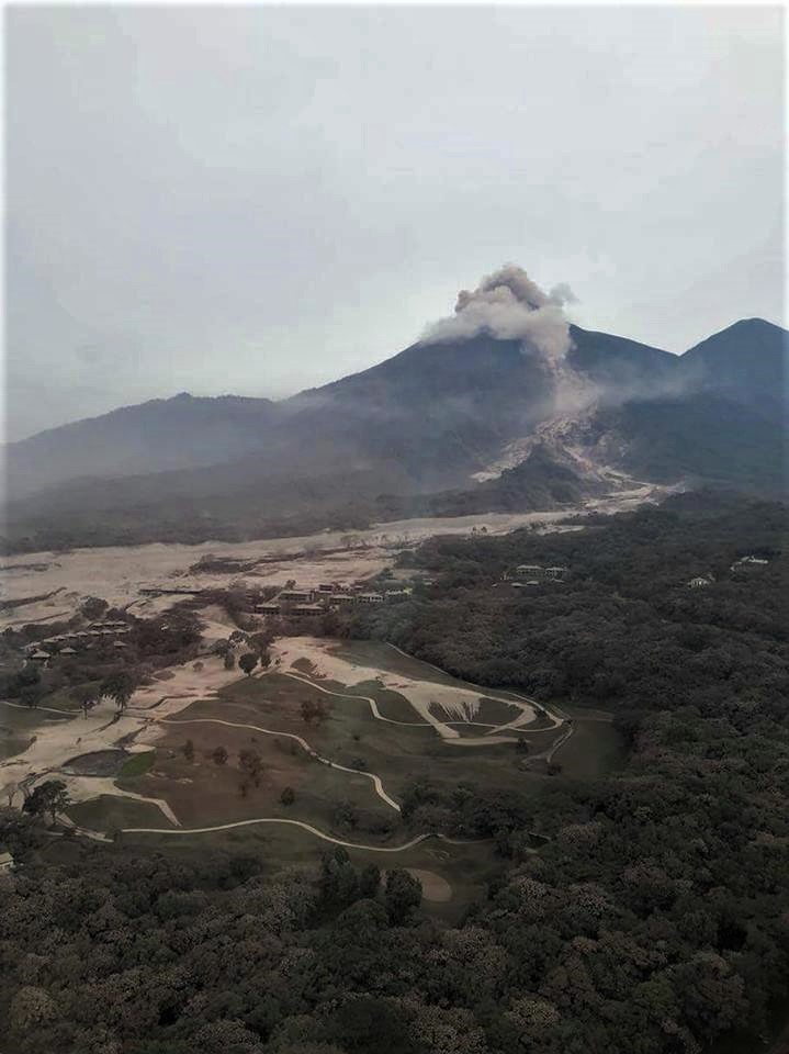
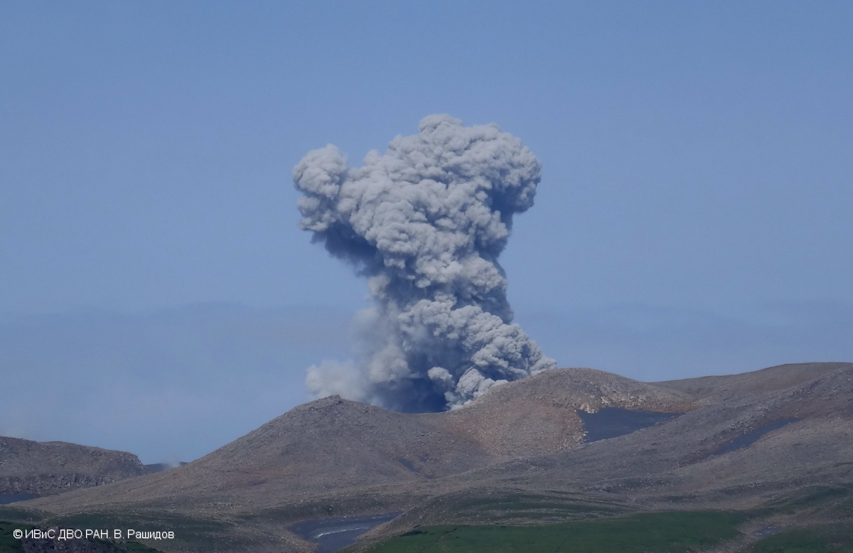
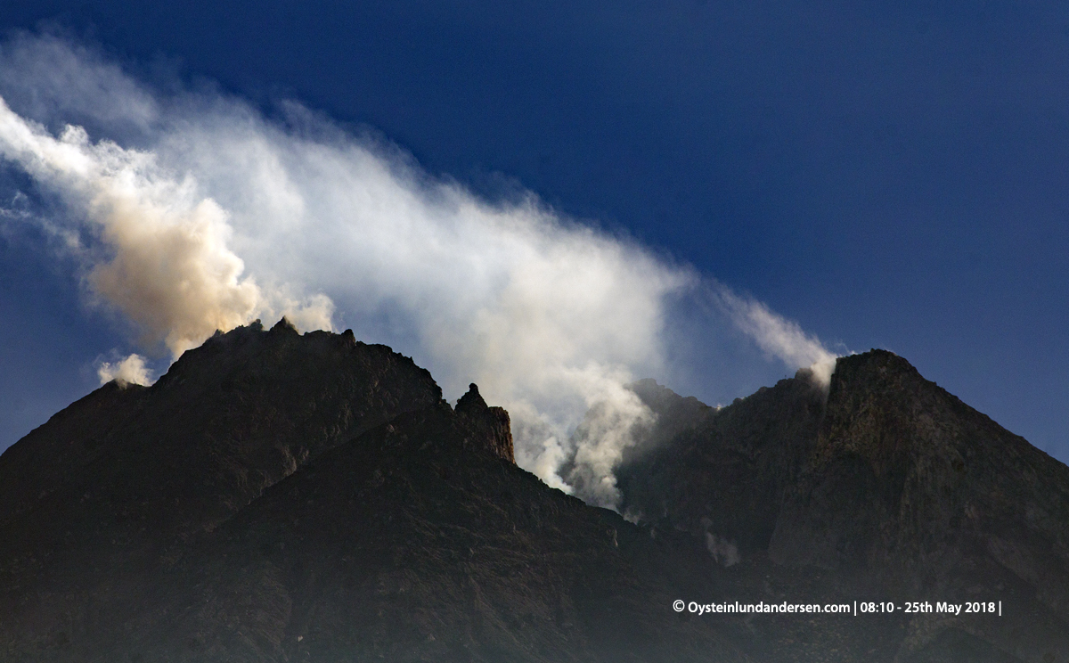
Following a magnitude-3.2 earthquake at the summit, twelve rockfalls were recorded in Puʻu ʻŌʻō between 10:31 and 10:56 AM with a prominent, but brief, red dust plume ejected into the air around 10:50 AM.
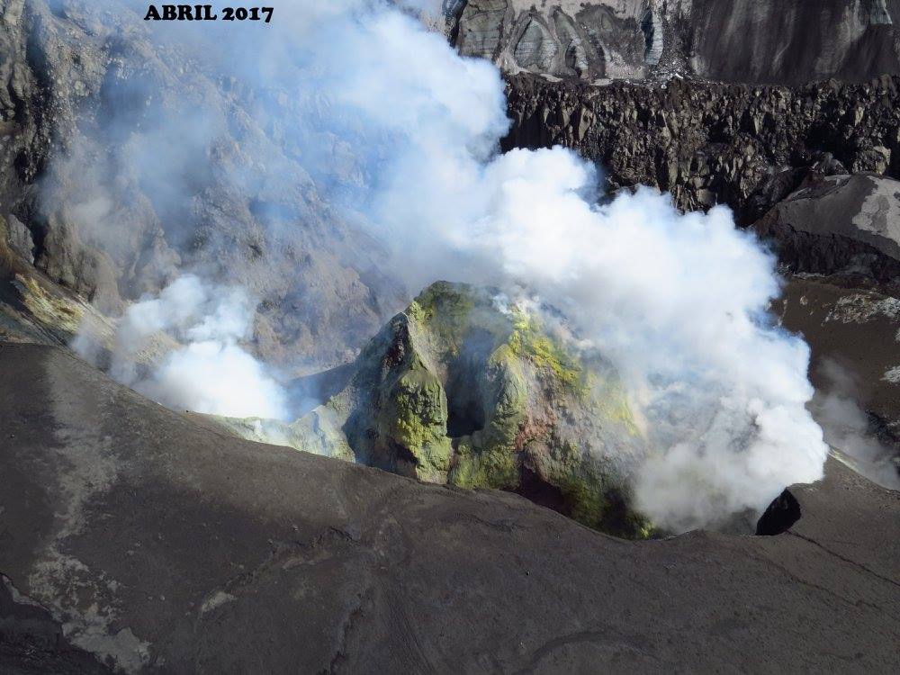
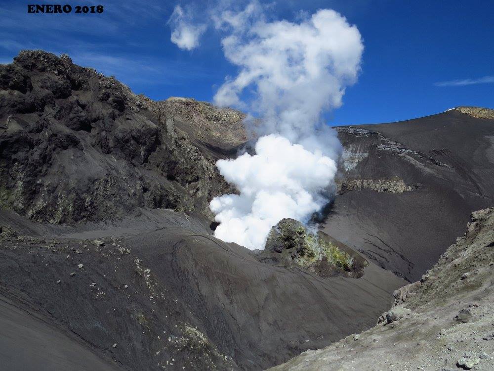
Clear views into Pu‘u ‘Ō‘ō
Kīlauea Volcano Summit
Low level ash emissions continue and seismicity levels increase at the summit of Kilauea. Inward slumping of the rim and walls of Halema`uma`u continues in response to ongoing subsidence at the summit.
Sulfur dioxide emissions from the volcano’s summit, while lower than those recorded in early-mid May, remain high enough to impact air quality in downwind regions. Additional bursts of gas released with intermittent explosive activity are also transported downwind and may temporarily affect air quality as well.
Source : HVO
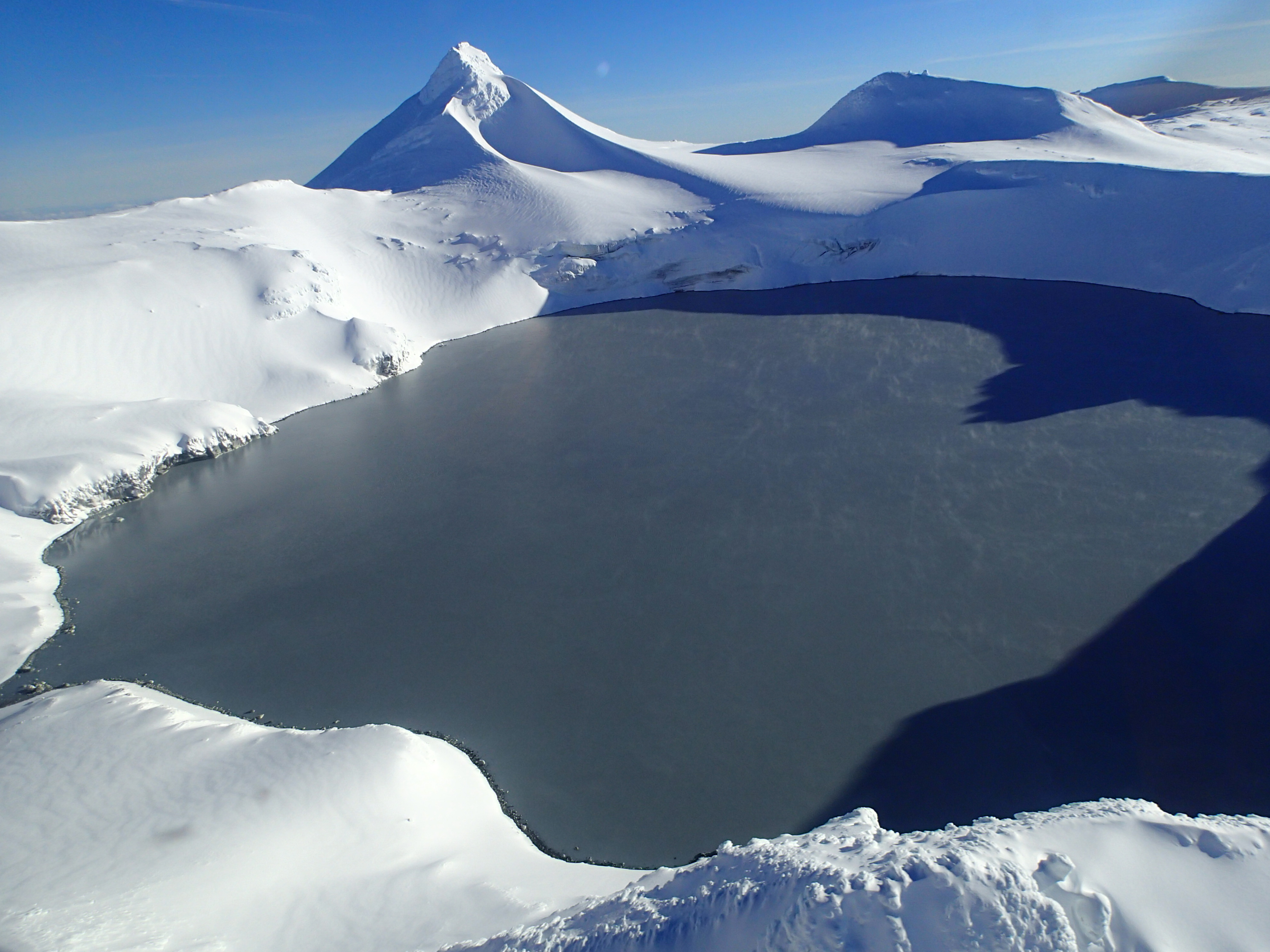
Copahue , Chile :
During the reporting period Twenty-two seismic events classified as volcano tectonic (VT) associated with fracturing processes of rigid materials were recorded. The highest energy event had a local magnitude (ML) of 1.4 and was located 8.2 km east (E) of the active El Agrio crater, at a depth of about 6, 1 km.
Similarly, 53 earthquakes associated with fluid dynamics within the volcanic edifice were recorded and cataloged as long-period (LP) events, with reduced displacement values (DRC) of 2, 2 cm2. Finally, 8 very long-lived events (VLPs) associated with fluid dynamics within the volcanic edifice were recorded, with maximum displacement values (DRCs) of up to 6.2 cm2
The bottom tremor signal at the Copahue reference station (2 km from El Agrio crater) showed fluctuating trends between 0.4 and 2.3 cm2 of reduced displacement (DRC), values considered low and moderate, respectively. , always with a dominant frequency band between 0.8 and 3.4 Hz.
IP cameras installed near the volcano recorded a constant degassing of the active crater (El Agrio) with a maximum height of 300 m (23 May). In addition, during the night, a constant glow was recorded in the crater El Agrio when weather conditions allowed to observe the volcano.
From the data obtained from the geodetic monitoring stations, during the last month, stability was observed in all the stations, recording rates of variation tending towards zero.
No emissions of sulfur dioxide (SO2) to the atmosphere in the volcano area have been reported, according to data published by the Ozone Monitoring Instrument (OMI) Sulfur Dioxide Group (http: / /so2.gsfc.nasa.gov/) and the National Environmental Satellite Information and Data Service (NESDIS) (http: // satepsanoine.nesdis.noaa.gov).
No thermal warning has been reported in the volcano-associated area, according to infrared data, a means of observing volcanic activity (Mirova) (http://www.mirovaweb.it/) and (MODVOLC) (http://modis.higp.hawaii.edu/).
Under the current conditions highlighted by the development that the monitoring parameters have shown, it is possible to see the appearance of minor explosions, with expulsion of incandescent materials around the crater El Agrio, in addition to constant or pulsatile particle emissions (ashes).
Therefore, the technical alert is maintained at the level:
YELLOW LEVEL: Changes in the behavior of volcanic activity – Probable time for an eruption: WEEKS / MONTH.
Observation: A radius of 1 kilometer around the active crater is considered a danger zone.
Source : Sernageomin
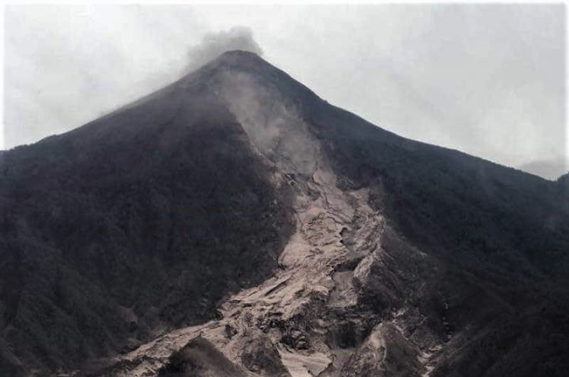
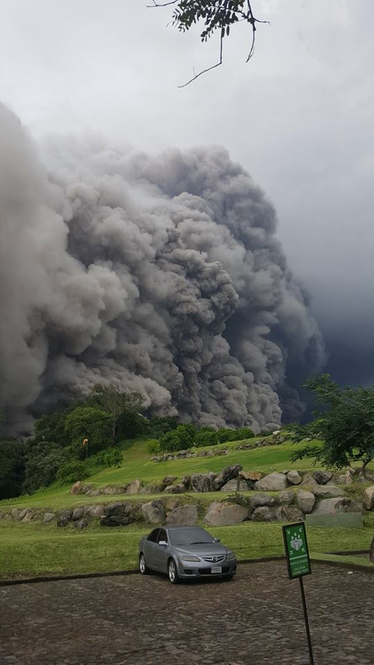
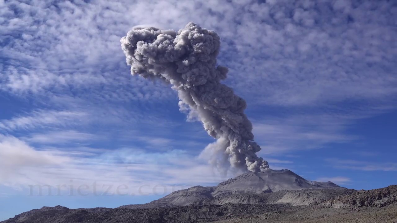
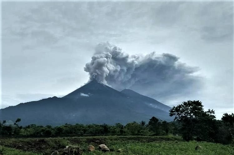
Fuego , Guatemala :
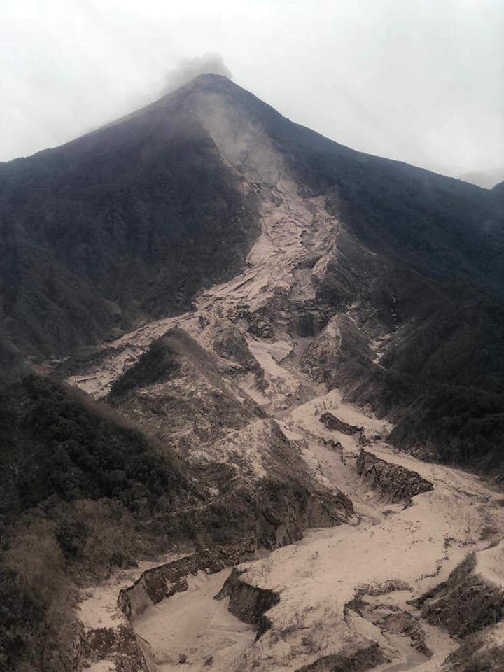
Pyroclastic flows in ravines LAS LAJAS AND JUTE, Fuego volcano (1402-1409)
Type of activity: Vulcanian
Morphology: Composite Stratovolcan
Geographical location: 14 ° 28’54˝ N Latitude; 90 ° 52’54˝Longitude W.
Height: 3,763msnm
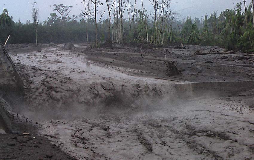
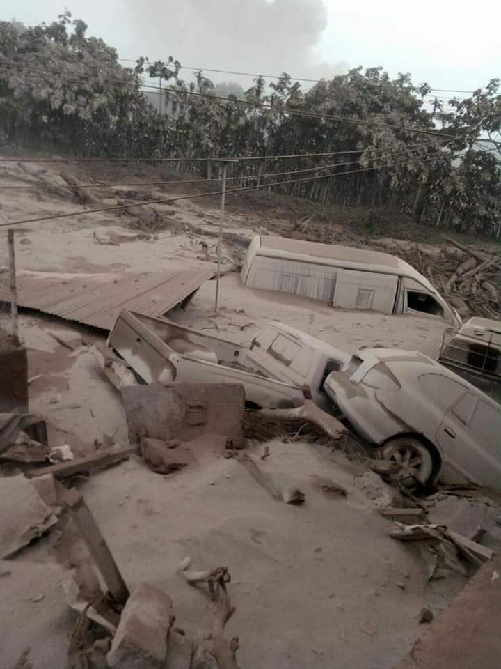
The seismic station FG3 has recorded an increase in the amount of pyroclastic flows, this time down the canyon of Las Lajas and probably El Jute, and in major canyons, This phenomenon produces plumes of ash that can reach 6000 meters above the sea level . These are mainly dispersed by the wind towards the West, the Southwest and the South. Ash falls are expected in these areas.
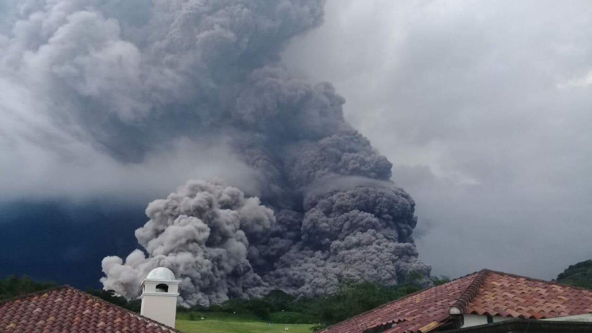
Pyroclastic flows carry gases and materials of different sizes, are very hot, so it is recommended not to stay in the canyons or nearby. Because the ravines are full of materials, they can extend further. These events may continue to occur over the coming hours and days, impacting major canyons and avalanche production in the area.
Source : Insivumeh
Photo : Infos Françaises
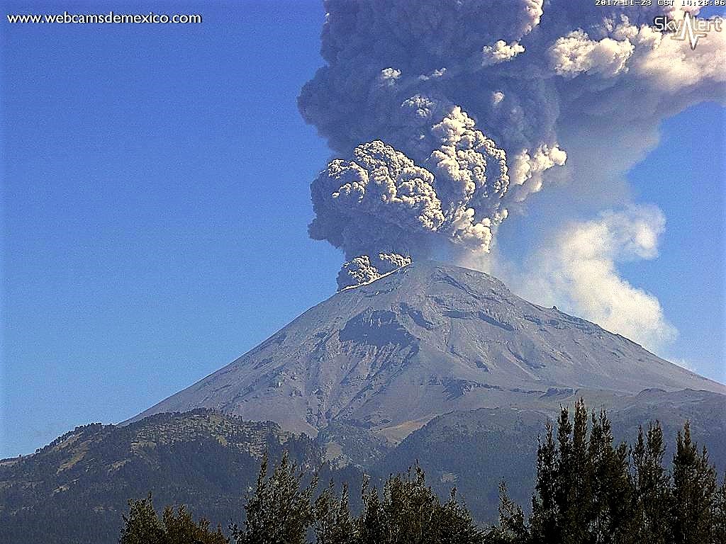
Popocatepetl , Mexico :
June 8, 11:15 am (June 8, 16:15 GMT)
In the last 24 hours, thanks to the monitoring systems of the Popocatepetl volcano, 31 low intensity exhalations accompanied by water vapor and gas have been identified. In addition, two explosions were recorded at 20:26 and 01:30. Finally, two volcano-tectonic events were recorded at 14:39 and 04:06 with amplitudes of M2,0 and M2,2, respectively.
During the night, an incandescence was observed which increased during certain exhalations.
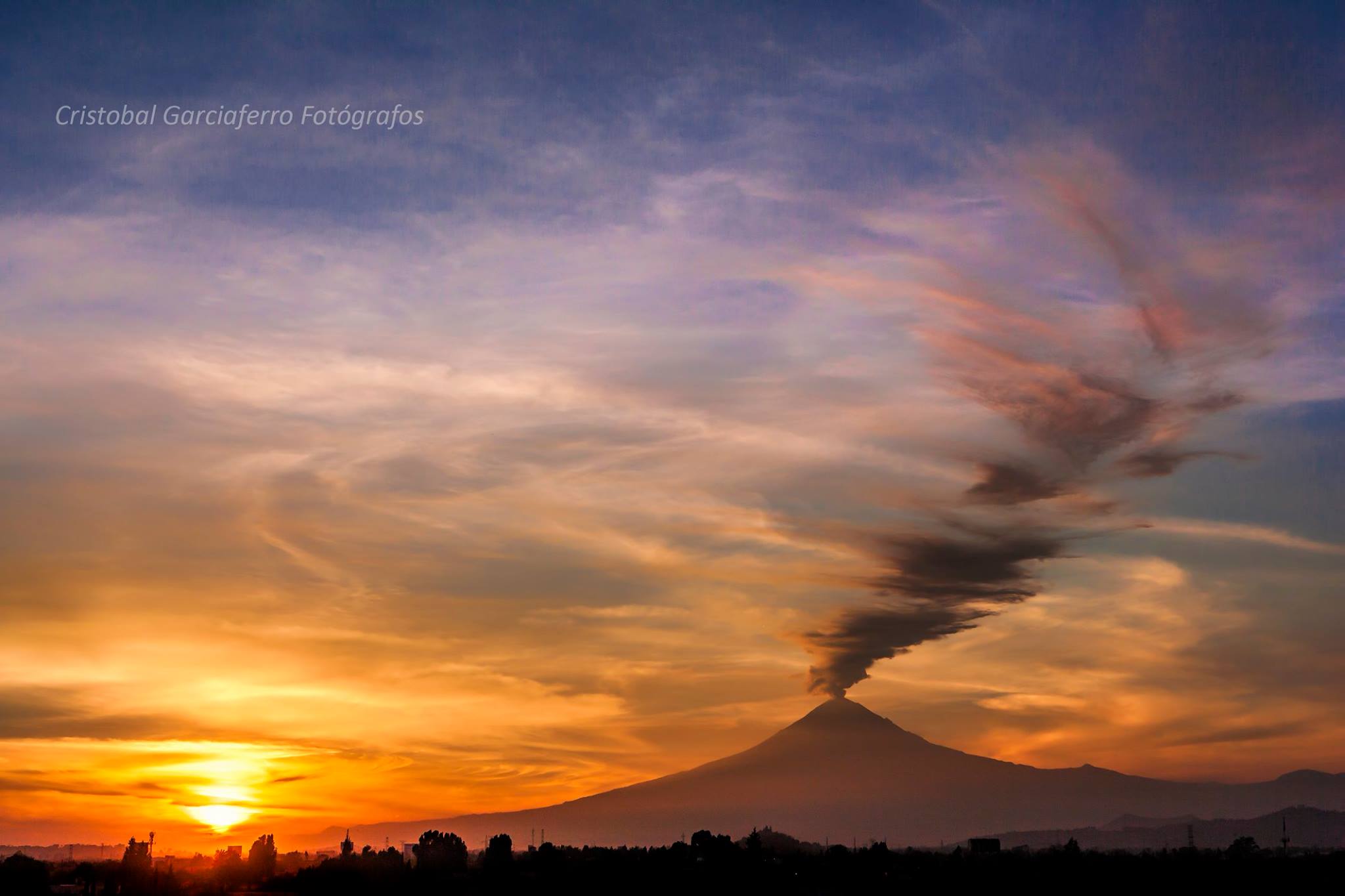
At the time of this report, it is observed that the wind disperses the emissions towards South-South-West.
CENAPRED urges not to approach the volcano and especially the crater, because of the risk of falling ballistic fragments, and in case of heavy rains, to move away from the bottoms of the ravines because of the risk of landslides and mudslides.
The Popocatepetl volcanic warning light is located at Amarillo Phase 2.
Source : Cenapred.
Photo : Cristobal Garciaferro