September 30 2023.
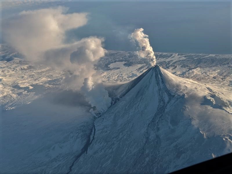
Alaska , Katmai :
58°16’44 » N 154°57’12 » W,
Summit Elevation 6716 ft (2047 m)
Current Volcano Alert Level: NORMAL
Current Aviation Color Code: GREEN
On Wednesday September 27, strong northwesterly winds in the vicinity of Katmai and the Valley of Ten Thousand Smokes picked up loose volcanic ash erupted during the 1912 Novarupta-Katmai eruption and carried it to the northwest beginning about 02:00 am AKDT (10:00 UTC). The National Weather Service has issued a SIGMET for this low-level event and suggests that the maximum cloud height is 6,000 ft (1.8 km) above sea level. A Special Weather Statement has also been issued by the National Weather Service warning of possible trace ashfall on communities downwind on Kodiak Island. A hazy skyline and a spectacular a sunset on September 27, and small amounts of ash were reported to have fallen over night in the City of Kodiak on September 28.
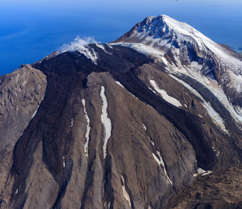
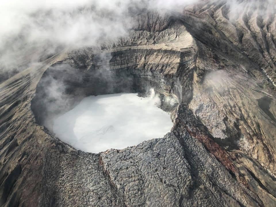
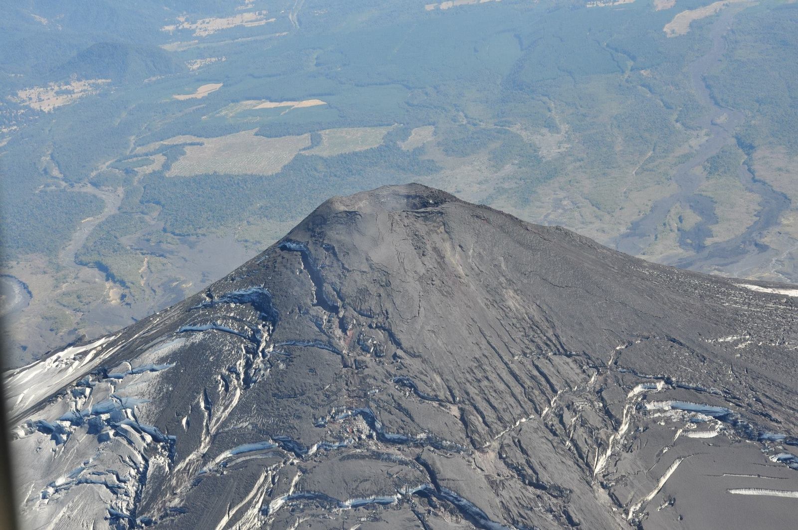
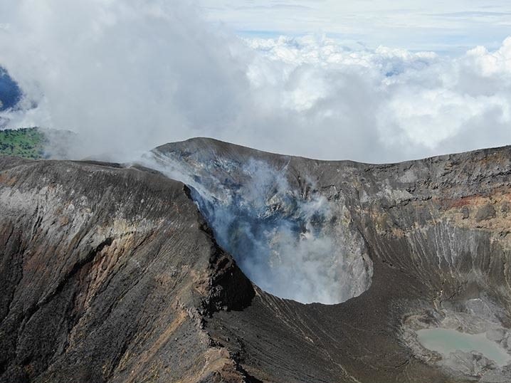
Katmai Caldera, a collapse feature that formed during the catastrophic eruption of nearby Novarupta volcano in June, 1912. Katmai Caldera is a steep-walled, 1.5-km (1 mi)-diameter crater that truncates a formerly 2,290-m (7,513 ft)-high stratovolcano. The caldera is partially filled by a blue-green lake about 250 m (820 ft) deep. The lake level was still rising when last measured in the mid-1970’s. Beyond the caldera are the multiple peaks of Trident Volcano; Mount Mageik volcano is the snow and ice-covered cone on the skyline. View is to the northeast
This phenomenon is not the result of recent volcanic activity and occurs during times of high winds and dry snow-free conditions in the Katmai area and other young volcanic areas of Alaska. No eruption is in progress. Trident Volcano remains at color code YELLOW due to elevated earthquake activity, while other volcanoes of the Katmai area (Snowy, Griggs, Katmai, Novarupta, Mageik, Martin) remain at color code GREEN.
Source : AVO
Photo : C. Nye/ Alaska Volcano Observatory / Alaska Division of Geological & Geophysical Surveys.
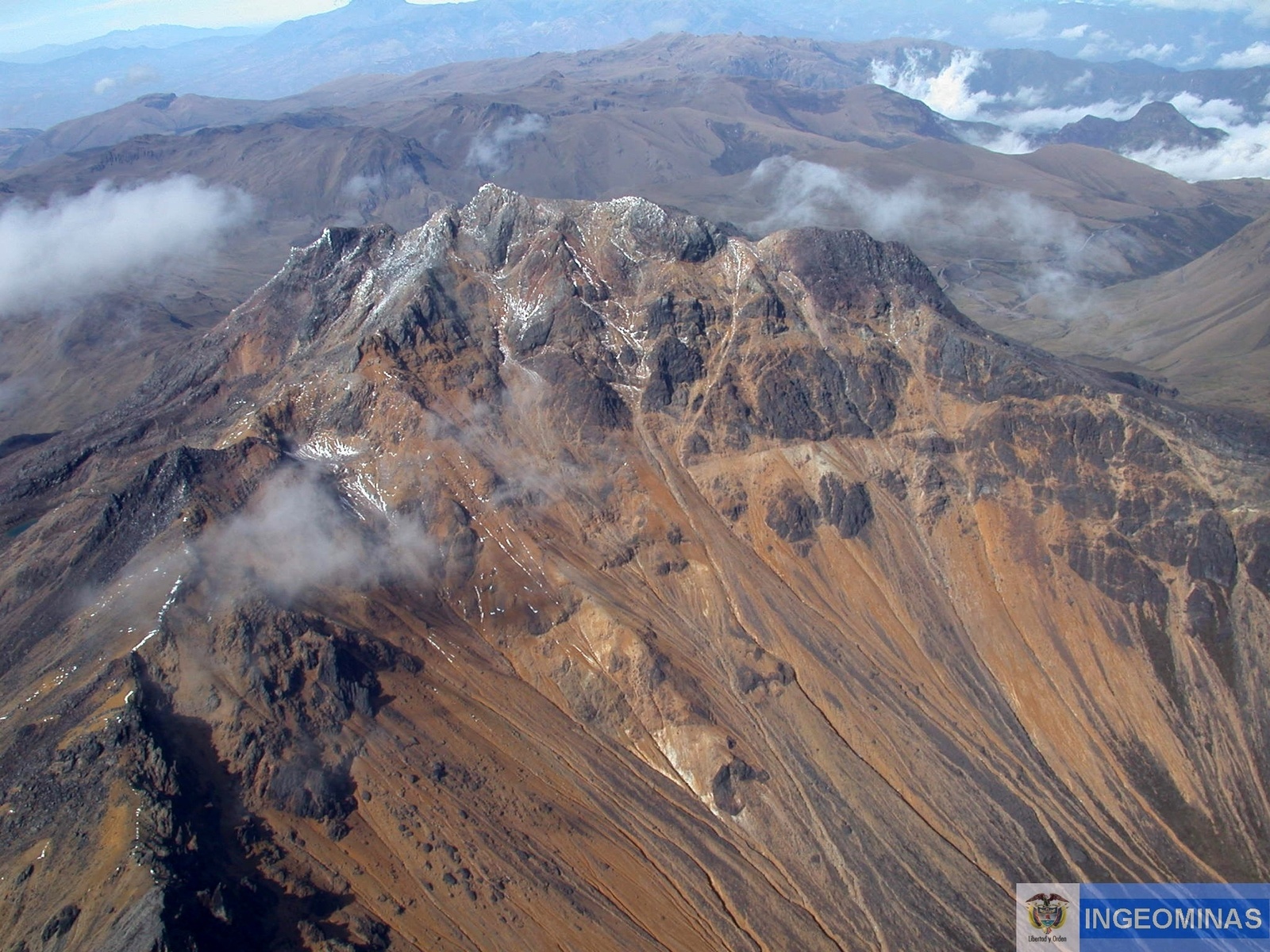
Colombia , Nevado del Ruiz :
Manizales, September 28, 2023, 9:25 a.m.
From the monitoring of the activity of the NEVADO DEL RUIZ VOLCANO, the MINISTRY OF MINES AND ENERGY through the COLOMBIAN GEOLOGICAL SERVICE (SGC) reports that:
From 05:12 a.m. on September 28, 2023, a significant increase in seismic activity associated with the fracturing of rocks within the volcanic edifice, located in the South-South-East sector of the volcanic structure, between 2 and 4 km of the crater, was recorded. with a depth of between 3 and 4 km. Up to the time of publication of this bulletin, more than 1,000 earthquakes of varying magnitude and two earthquakes of magnitude greater than 3.0 have been recorded. The seismic events recorded at 5:12 a.m. and 6:14 a.m. are notable for their magnitude, measuring 3.5 and 3.8, respectively. Both would have been felt by residents in the volcano’s zone of influence.
It is important to emphasize that this increase in the activity of the volcano is considered within the framework of the state of yellow alert. However, you should not get used to this behavior since, as we have mentioned, the volcano can quickly destabilize, which would cause it to go into an Orange alert state or even into a Red alert state.
The community is recommended to remain calm and pay attention to the information provided by the Colombian Geological Service on the evolution of the state of the volcano.
Source : SGC
Photo : Cesar Rios
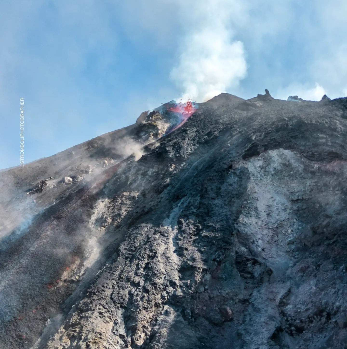
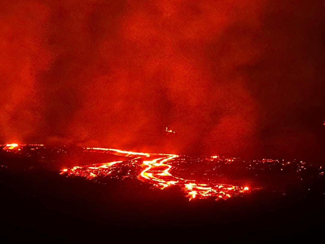
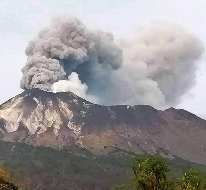
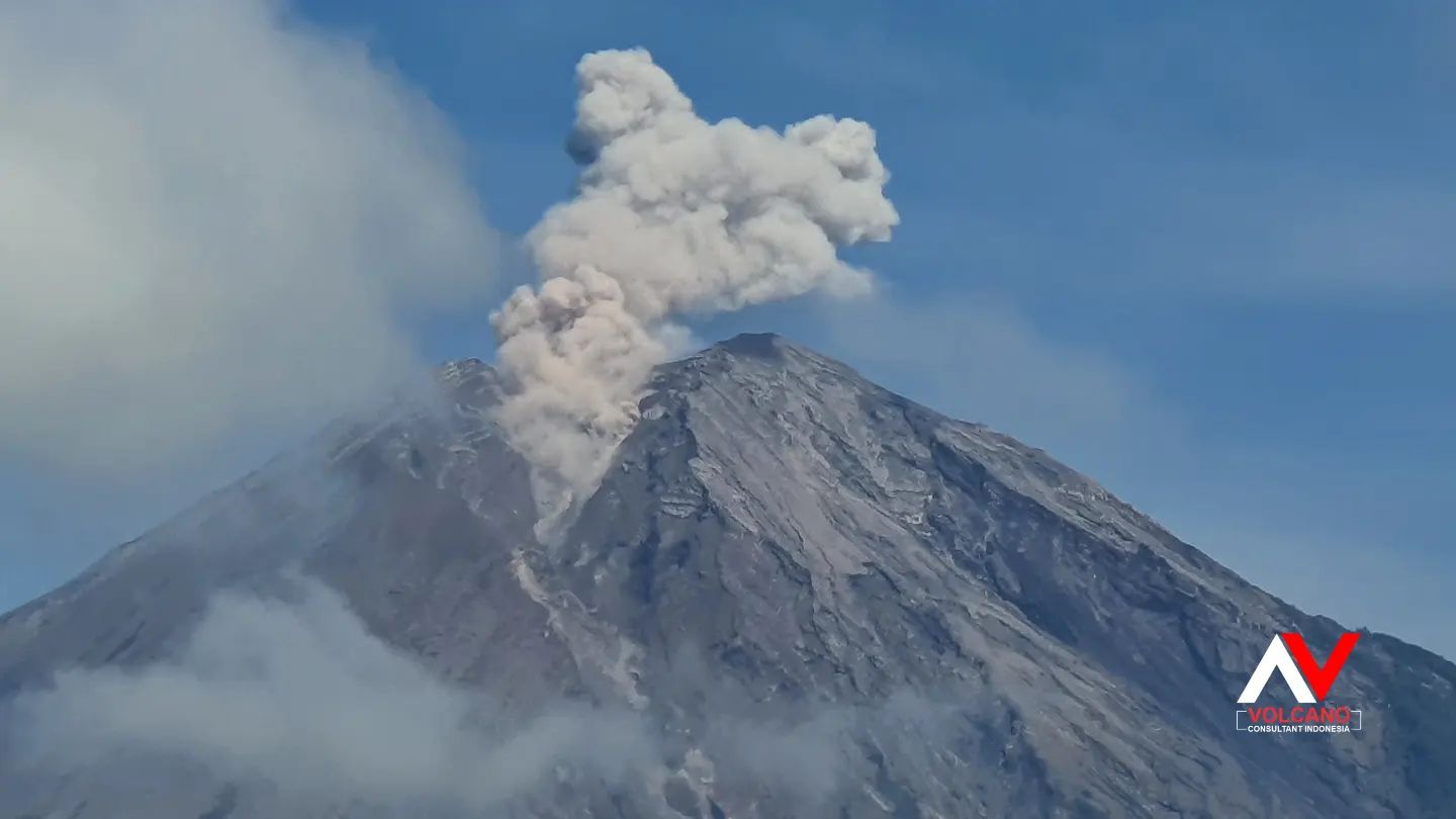
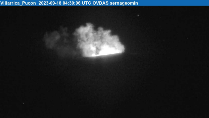
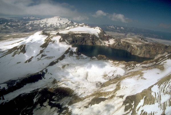
Chile , Villarica :
Seismic activity:
The activity observed over the last 24 hours mainly showed discrete LP (long period) seismic activity associated with more recurrent fluid dynamics and energies without significant variations. The RSAM value remained stable at 0.8 µm/s, the same as reported in the hours leading up to yesterday’s report.
Comments:
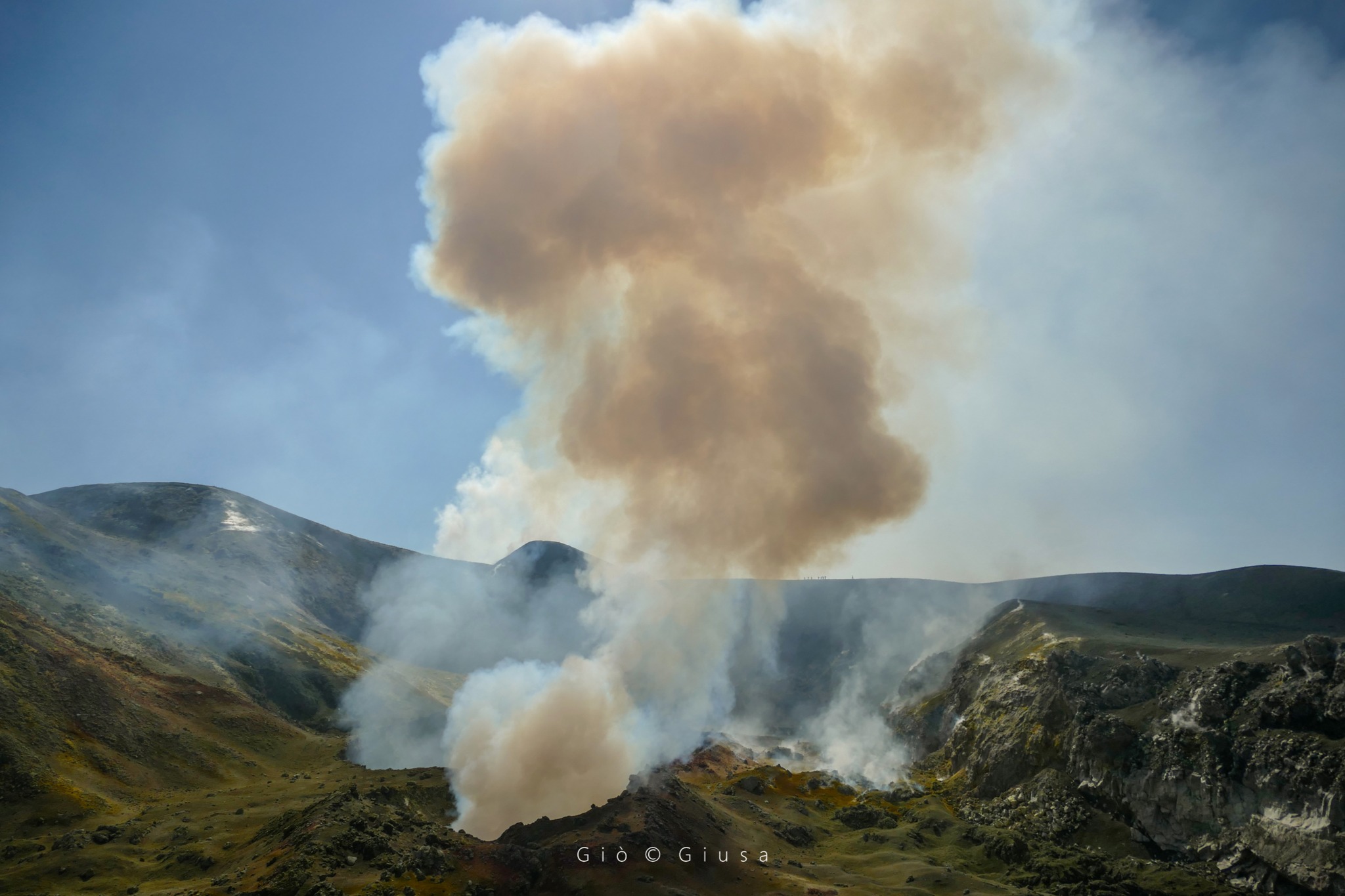
Between 10:20 a.m. and 12:50 p.m. UTC, an ash emission was recorded with a northwest dispersion and a maximum height. of 60 m.
The Strombolian activity observed during the night was of moderate intensity remaining inside the crater.
Today, at 10:00 a.m. HL, an inspection flyover was carried out to monitor the internal morphological evolution of the crater and on the slopes.
A large accumulation of pyroclasts was observed inside the crater, with visualization of a vent where molten material was observed which, during the flyby, did not present high intensity explosiveness. In addition, energetic degassing was identified near this whitish vent, in certain sectors with a slight ash load.
Block-sized pyroclasts abound on the inner and proximal walls of the crater, while a distal ash deposit is observed.
Other observations:
– No satellite thermal anomaly was detected for the period evaluated (date of last image: September 29).
– No new satellite anomaly of sulfur dioxide (SO2) emissions into the atmosphere has been detected (date of last image: September 28).
– The latest available SO2 flow data corresponds to September 28, with an average flow of 344 t/d. The measurements were carried out using differential optical absorption spectroscopy (DOAS) equipment installed 6 km in the East-South-East direction from the active crater.
Source : Sernageomin
Photo : Auteur inconnu ( archive)
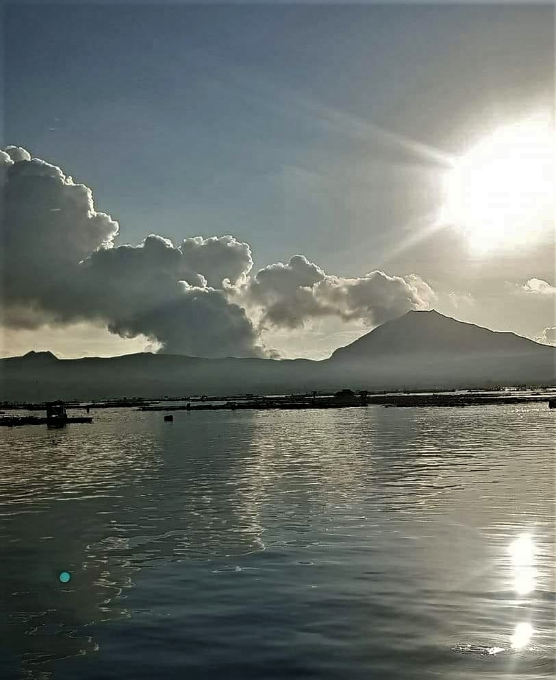
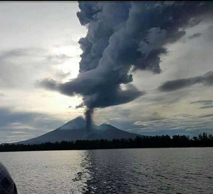
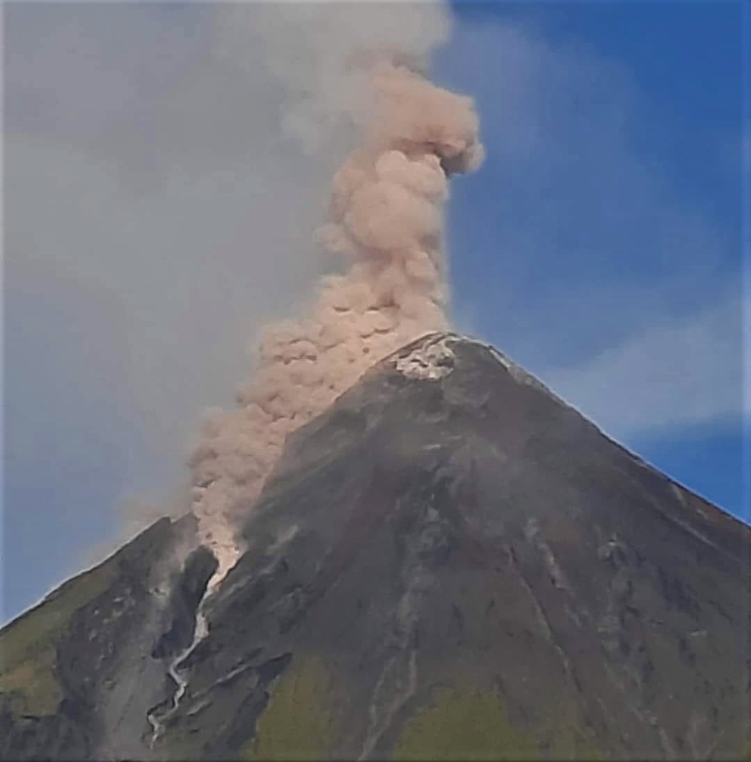
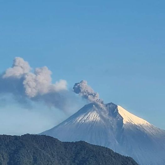
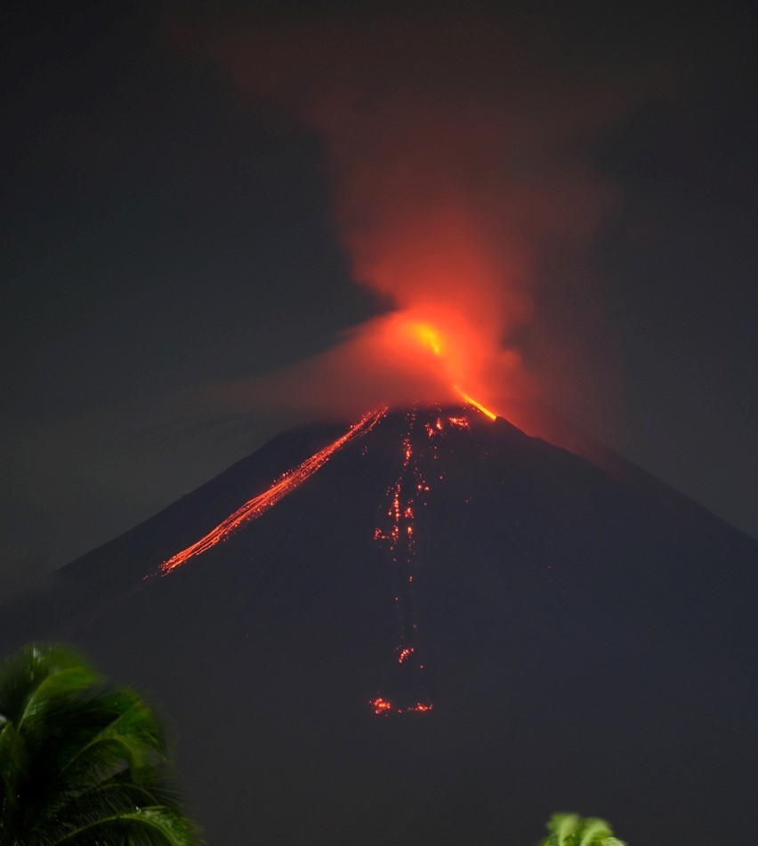
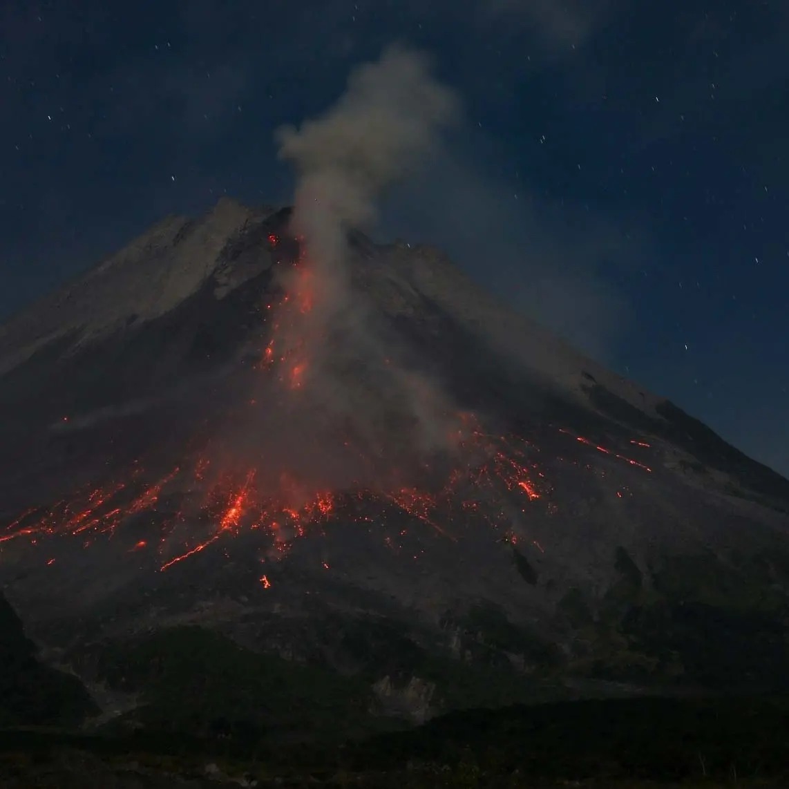
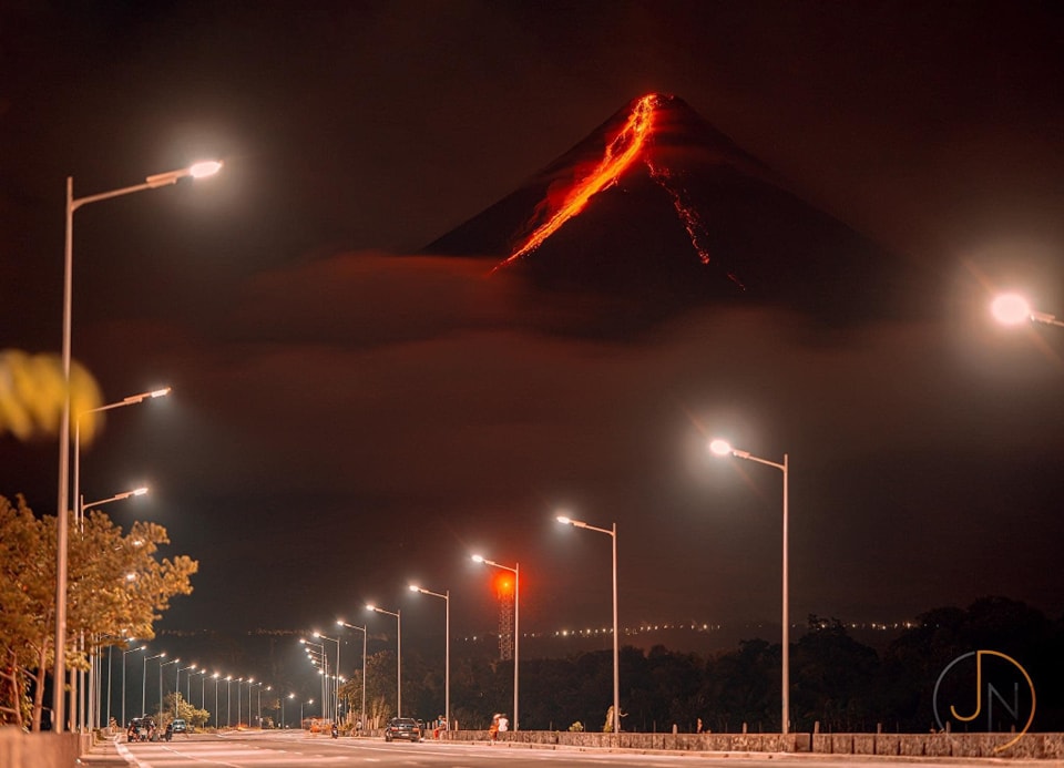
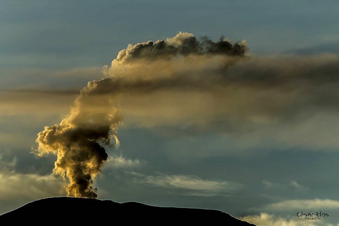
Philippines , Mayon :
MAYON VOLCANO BULLETIN 30 September 2023 8:00 AM
In the past 24-hour period, the Mayon Volcano Network recorded eighteen (18) volcanic earthquakes, one hundred twenty-five (125) rockfall events, and three (3) pyroclastic density current (PDC) events. The lava flows have maintained their advances to approximately 3.4 kilometers in Bonga (southeastern), 2.8 kilometers in Mi-isi (south), and 1.1 kilometers in Basud (eastern) Gullies. Rockfalls and PDCs generated by collapses of the lava flow margins as well as of the summit dome deposited debris still within four (4) kilometers of the crater. Volcanic sulfur dioxide (SO2) emission averaged 915 tonnes/day on 29 September 2023.
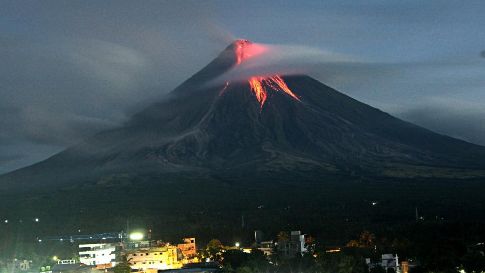
Short-term observations from electronic tilt and GPS monitoring indicate continued inflation of the northwestern upper slopes since the fourth week of July 2023. Meanwhile, electronic tilt measurements show slight deflation on the northwestern middle slope starting on the third week of September. Longer-term ground deformation parameters from EDM, precise leveling, continuous GPS, and electronic tilt monitoring indicate that Mayon is still generally inflated relative to baseline levels.
Alert Level 3 is maintained over Mayon Volcano, which means that it is currently in a relatively high level of unrest and hazardous eruption within weeks or even days could still be possible.
Source : Phivolcs.
Photo : Auteur inconnu ( archive).
Costa Rica , Rincon de la Vieja / Poas / Turrialba :
Rincón de la Vieja Volcano
Latitude: 10.83
Longitude:-85.324
Altitude: 1,916 meters above sea level
Activity observed:
No eruptions were recorded. The banded tremor continues, with high amplitudes and frequencies. From the point of view of surface deformation, the inflation of the volcanic massif continues.
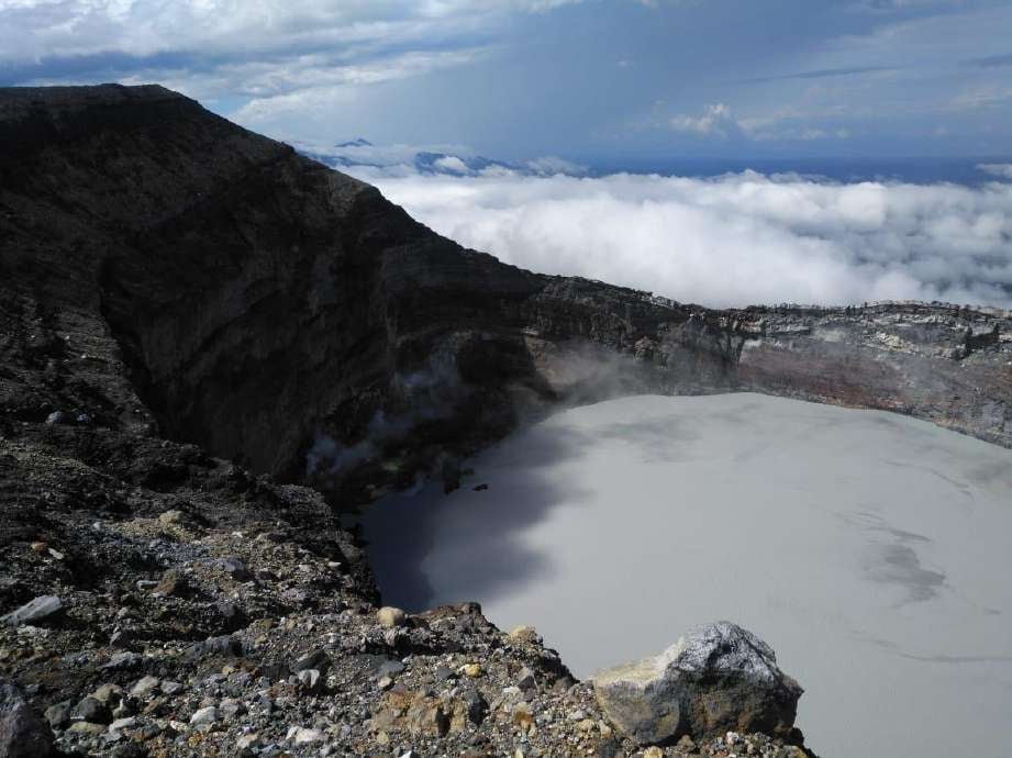
Date: September 29, 2023, Time: 4:17:00 p.m.
Plume height (above crater): 3280 feet. (1000 meters)
Plume observation source: Seismic, infrasound and webcam.
Activity observed:
A phreatic eruption was recorded, rich in water vapor and gas, it does not generate lahars or ash emanation.
Preferential wind direction: North-West (NW)
Environmental conditions:
Winds coming from the West. There are clouds at the top, so it’s not visible.
Activity level: Caution
Poas Volcano
Latitude: 10.2
Longitude: -84,233
Altitude: 2,687 meters above sea level
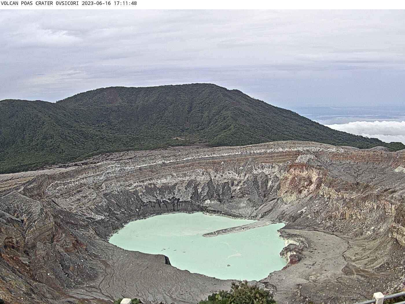
Activity observed:
No eruptions were recorded. A continuous background tremor is observed with dominant amplitudes between 2 and 5 Hz. From geodetic measurements, contraction and subsidence of the volcano continues to be observed. The CO2/SO2, H2S/SO2 and SO2 ratios appear stable. The concentration of SO2 in the crater is also stable, peaking at 2 ppm.
Environmental conditions:
Winds coming from the North-West (NW). The crater has heavy cloudiness, with no visibility.
Activity Level: Warning
Turrialba Volcano
Latitude: 10,025
Longitude: -83,767
Altitude: 3,325 meters above sea level
Activity observed:
No eruptions were recorded. Seismic activity remains stable, characterized by the appearance of low frequency and low amplitude earthquakes. Geodetic measurements continue to demonstrate contraction of the volcanic massif. The CO2/SO2, H2S/SO2 and SO2 ratios remain stable.
Environmental conditions:
Prevailing winds from the North-West. High cloudiness and zero visibility of the crater.
Activity Level: Warning
Source : Ovsicori
Photos : Waldo Taylor de ICE , Ovsicori , G. Avard / Ovsicori