January 19 , 2018.
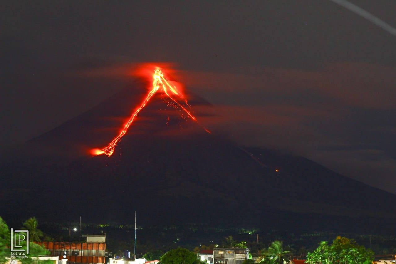
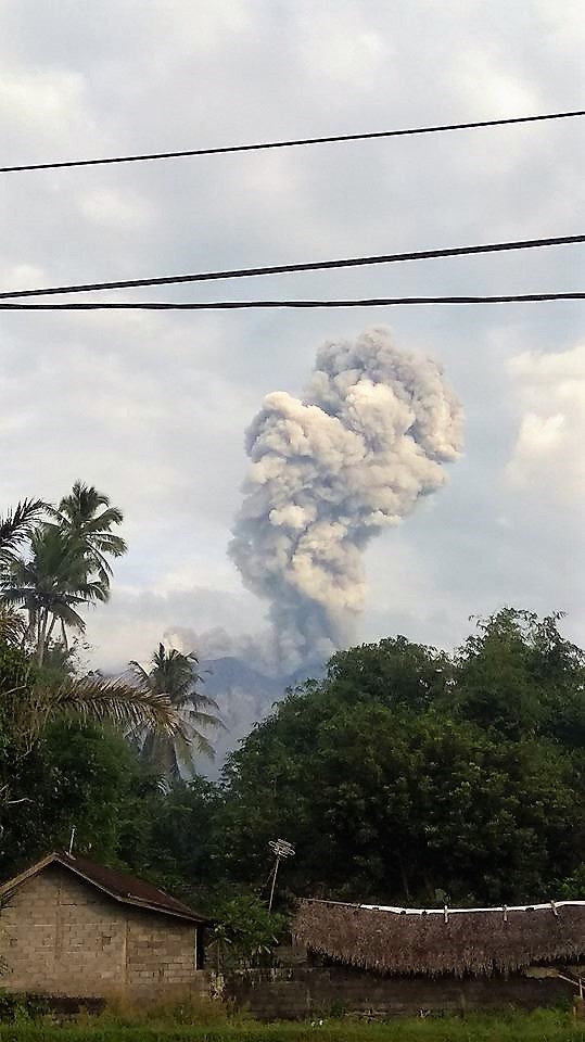
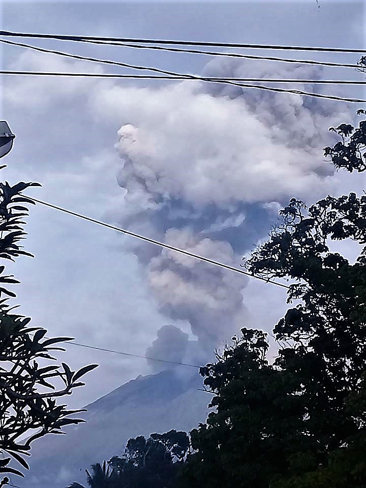
Mayon , Philippines :
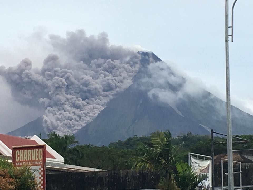
MAYON VOLCANO BULLETIN 19 January 2018 8:00 A.M.
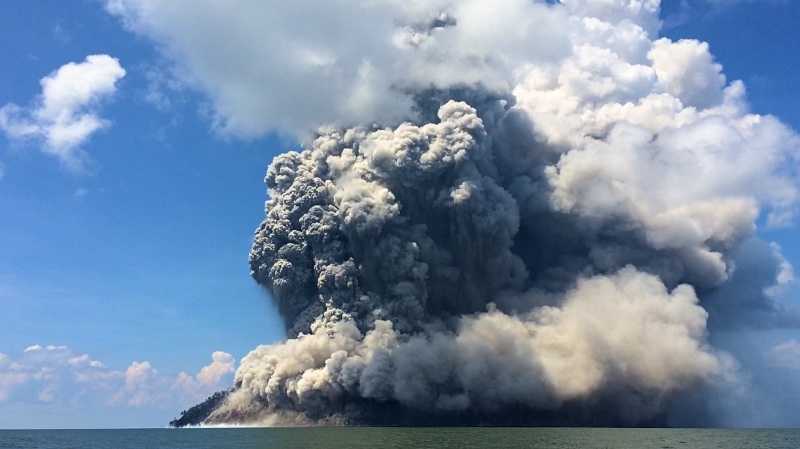
Quiet lava effusion from the new summit lava dome and lava collapse events characterized Mayon Volcano’s eruptive activity in the past 24 hours. Twenty four (24) rockfall events and one (1) volcanic earthquake were recorded by Mayon’s seismic monitoring network. Rockfall events were generated by the collapsing lava front and margins of the advancing lava flow on the Miisi Gully and by shedding from the summit dome onto the Bonga Gully. Currently, the Miisi lava flow has advanced to approximately three (3) kilometers from the summit crater well within the Permanent Danger Zone (PDZ). Ash clouds were lofted from the rockfall events as well as from the persistent disintegration of lava on the advancing front of the Miisi lava flow before drifting to the southwest. Sulfur dioxide gas emission was measured at an average of 1478 tonnes/day on January 18, 2018.
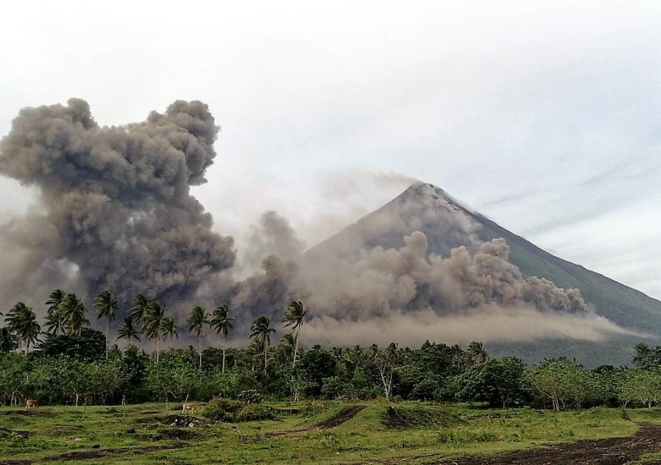
Alert Level 3 remains in effect over Mayon Volcano, which means that it is currently in a relatively high level of unrest as magma is at the crater and hazardous eruption is possible within weeks or even days. The public is strongly advised to be vigilant and desist from entering the six (6) kilometer-radius Permanent Danger Zone (PDZ) and the 7-km Extended Danger Zone (EDZ) on the southern flanks due to the danger of rockfalls, landslides and sudden explosions or dome collapse that may generate hazardous volcanic flows. Increased vigilance against pyroclastic density currents, lahars and sediment-laden streamflows along channels draining the edifice is also advised. Civil aviation authorities must also advise pilots to avoid flying close to the volcano’s summit as ash from any sudden eruption can be hazardous to aircraft. Based on the seasonal wind pattern, ash fall events may most likely occur on the southwest side of the volcano. DOST-PHIVOLCS maintains close monitoring of Mayon Volcano and any new development will be communicated to all concerned stakeholders.
Source : Phivolcs .
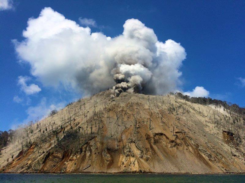
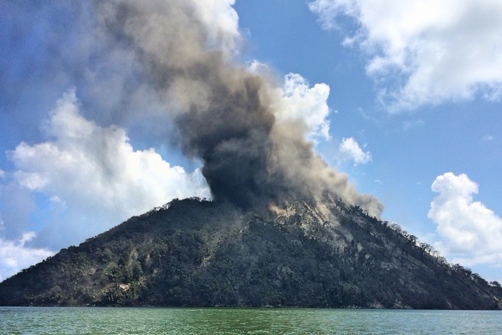
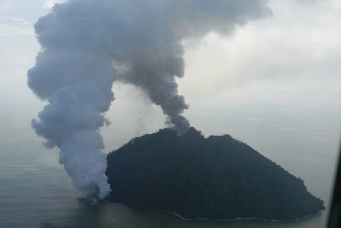
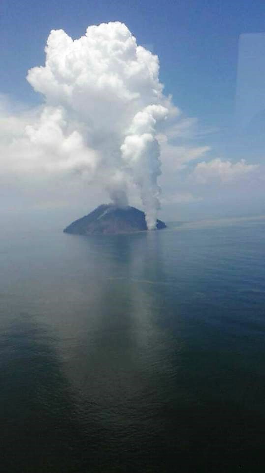
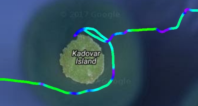
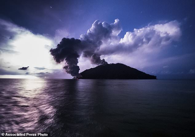
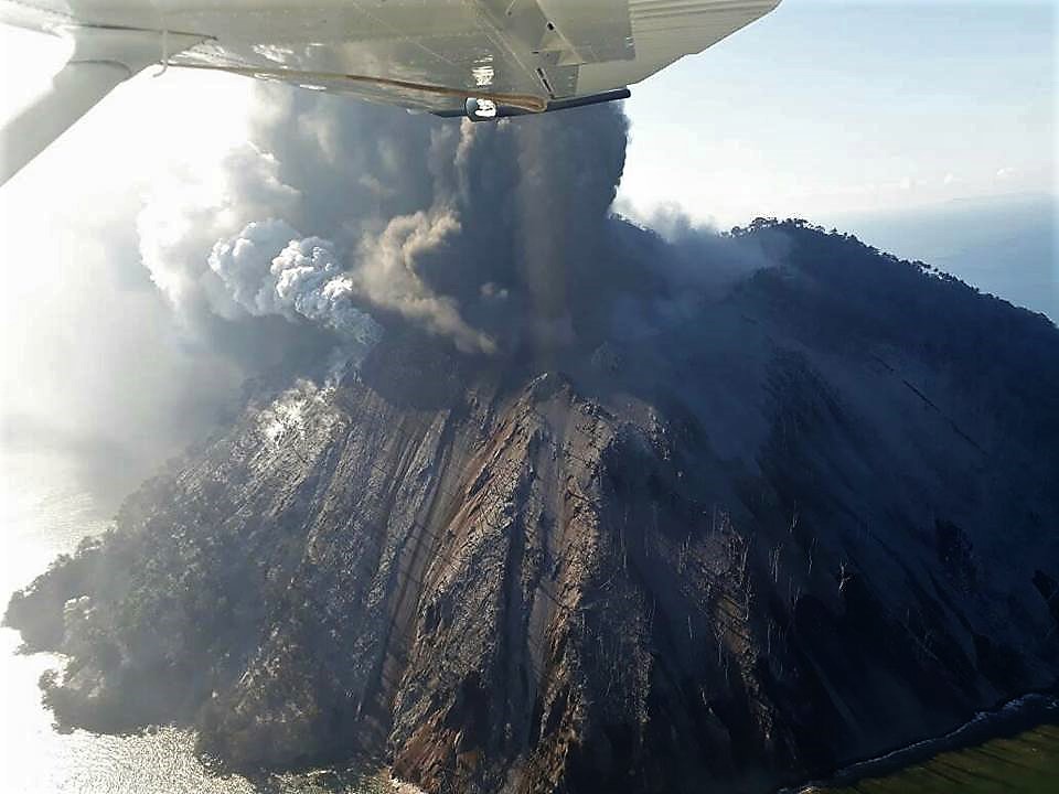
Kadovar , Papua New Guinea :
3.608°S, 144.588°E
Elevation 365 m
Expert says major eruption in Papua New Guinea could be soon.
CANBERRA, Australia (AP) – Seismic activity beneath a Papua New Guinea volcano could mean that a major eruption was imminent, a scientist said Thursday.
Thousands of people have been evacuated from islands surrounding Kadovar Island off the South Pacific nation’s north coast since a volcano there began erupting on Jan. 5, spouting ash. Flights nearby have been canceled due to the risk posed by ash plumes and ships were warned to stay away from the island.
Steve Saunders, principal geodetic surveyor at the Rabaul Volcano Observatory in Papua New Guinea, said seismic activity had recently increased beneath the volcano.
« The reason we’re getting activity is probably because new magma is moving up from deeper down, » Saunders told Australian Broadcasting Corp.
Prime Minister Peter O’Neill has said state resources were being made available to support evacuations and he warned northern coastal communities to be alert for possible tsunamis. Kadovar is offshore to the north of New Guinea, the larger island that includes Papua New Guinea’s capital, Port Moresby.
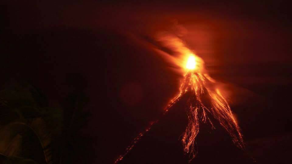
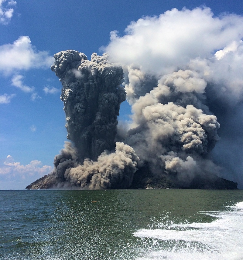
RVO reported that activity significantly escalated on 12 January characterized by a large blast of a substantial amount of material and “big” glowing red rocks directed to the S; the report noted that the blast was the only one reported to date. Observers on Blup Blup saw incandescence emanating from either the summit or an area out of view on the S flank. Large amounts of sulfur dioxide had been detected since 8 January, and continued to be emitted. A fracture had previously been reported on 6 January extending from the summit to the coast. When seen on 12 January, the fracture was wider and vigorous steaming was occurring at sea level. Ash plumes drifted tens of kilometers W and NW. RVO noted that the displaced villagers were getting transferred to the mainland, along with islanders from Bam, due to the relatively close proximity to the eruption plus the logistics of supplying them.
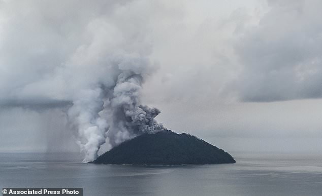
Five newly-named vents were observed during an overflight conducted on 13 January: Main Crater, Western vent, and Southern vent (all three are at the summit), the SE Coastal vent, and the Southern Coastal vent. Sometimes voluminous steam and dense gray plumes rose 1 km above the Main Crater. The emissions obscured views of Southern and Western vents. The SE Coastal Vent was very active, emitting dense white steam plumes 600 m a.s.l. A possible lava dome was at the base of the plumes but showed no evidence of incandescence. The Southern Coastal Vent, located where the original fractures entered the sea, was inactive.
Post of Beth Acknonero :
The Rabaul Volcanic Observatory has put Kadovar island on RED ALERT as there is likely to be an huge explosion from the volcano that will result in a TSUNAMI that will affect the people living on the coast of Bogia , Kopar , Murik Lakes , Turubu , Wewak and the islands of Ruprup , Biem , Wei, Koil, Vokeo , Muschu , Kairiru and others. I have translated the warning into Tok Pisin and provided it to all media outlets in PNG. In this regard, the total number of people to be evacuated to Turubu would be 5000 and this includes the population of both Ruprup and Biem Island. ( I have posted a separate Warning Notice or Toksave in Tok Pisin for people from Bogia in the East right up to Sowom in the West to be on alert in case there is a Tsunami in the event that Kadovar Island does explode).
Source : dailymail.co.uk. GVP , Beth Acknonero .
Photo : Brenton-James Glover via AP ( January 16 , 2018 ), Barbara Short .
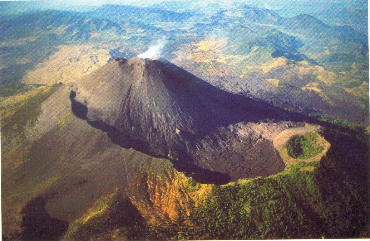
San Miguel , El Salvador :
Special Report No. 1
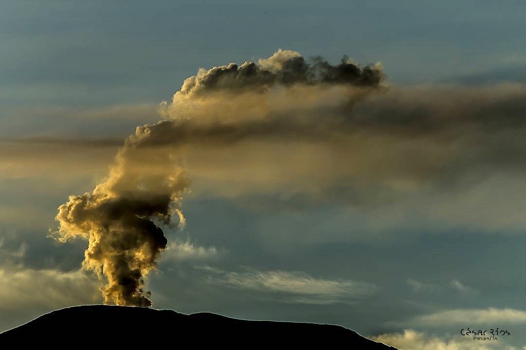
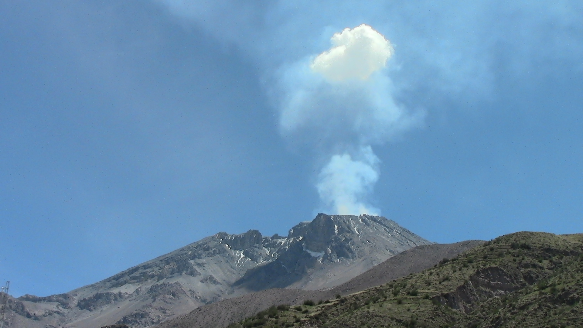
Small explosions of the Chaparrastique volcano
Date and time of issue: January 15 , 2018, 17:15:00
This day at 04:15 in the afternoon, the Chaparrastique volcano presented gas emissions accompanied by ash. The column did not exceed 300 meters in height of the crater and was displaced by winds in the southwest direction of the crater. Similar activity was presented yesterday at 4:53 p.m.
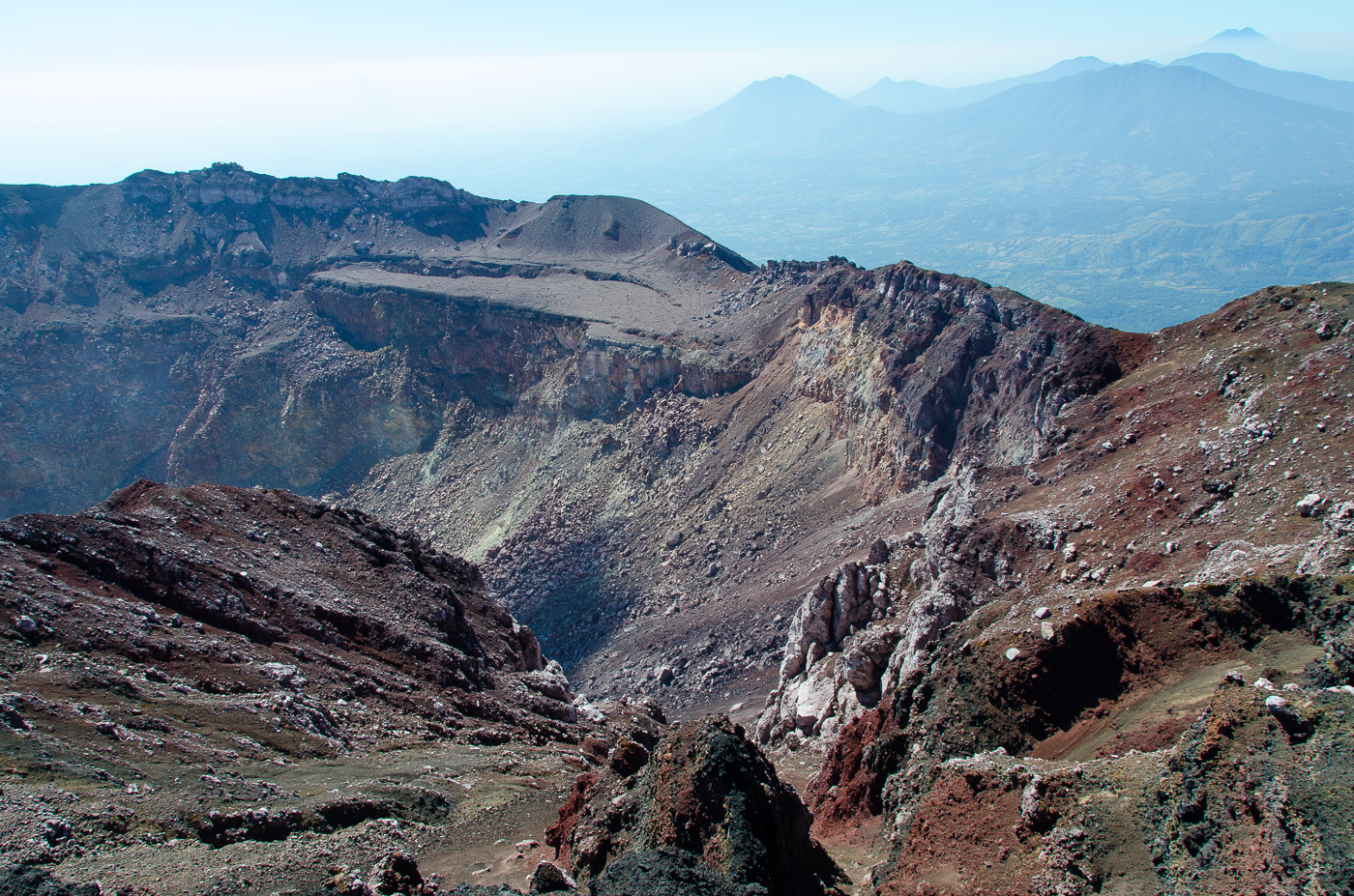
In both cases, the activity described was preceded by a decrease in the seismicity of the volcano, which subsequently increases suddenly, these signals are associated with the rupture of bubbles in the internal system of the volcano, which manifests itself with the subsequent development of a volcano. gases accompanied by ashes. The above shows the strombolian character of the volcano.
The Local Observer Network so far has not reported falling ash in populated areas, which indicates that the material emitted has been deposited in the upper area of the volcano.
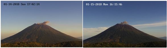
Figure 1. Small pulses of gases with ash from Chaparrastique volcano. Left: January 14 at 04:53; right: January 15 at 04:15 p.m.
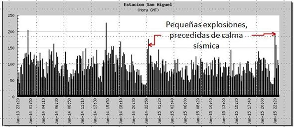
Figure 2. Changes in the vibration of the Chaparrastique volcano associated with small explosions.
The MARN continues with the systematic monitoring of the volcano and maintains a close communication with the General Directorate of Civil Protection and Local Observers; It also calls on tourists and mountaineers to stay away from the top of the volcano due to the sudden changes in their activity that often occur.
Source : Snet.
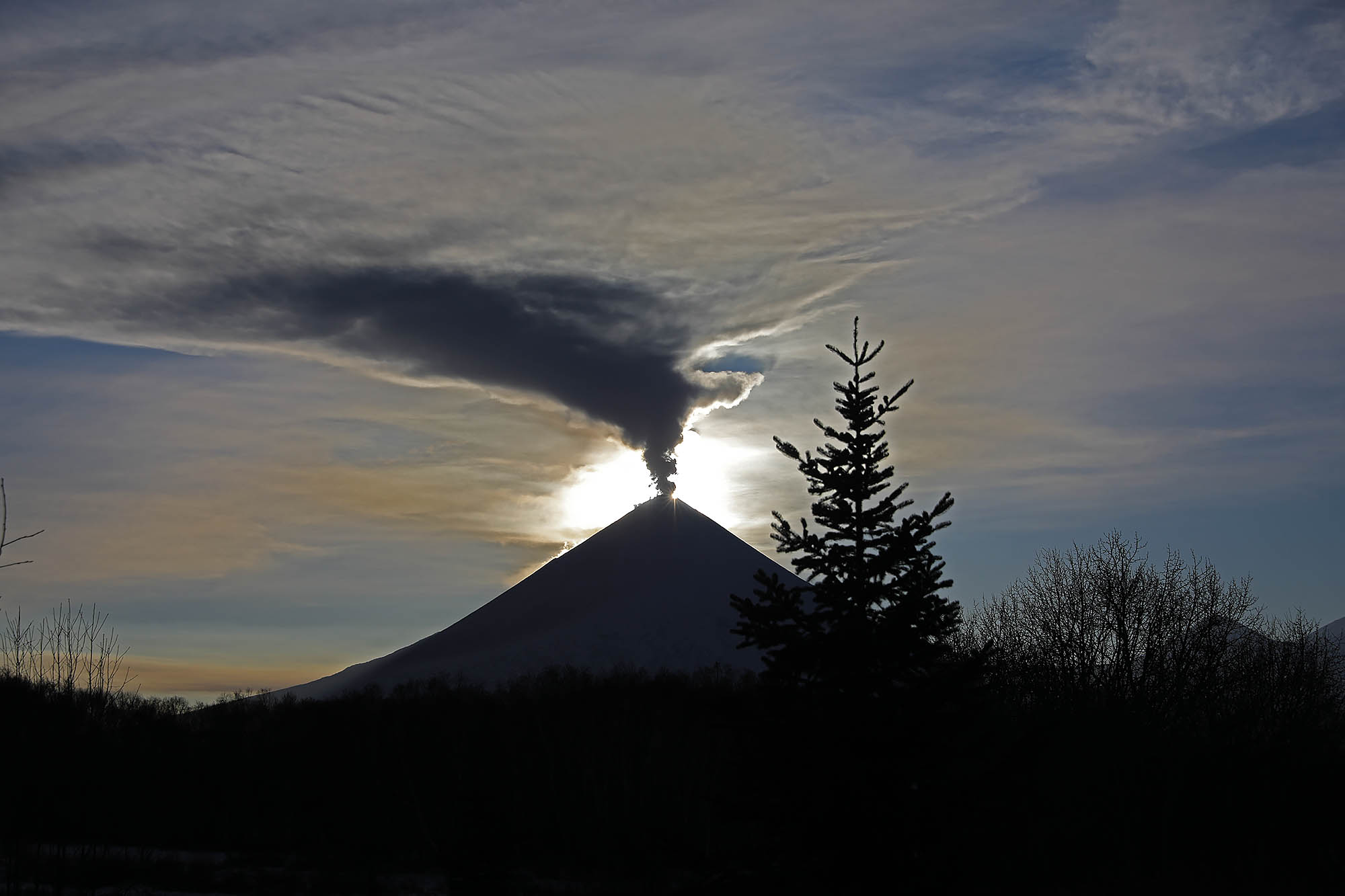
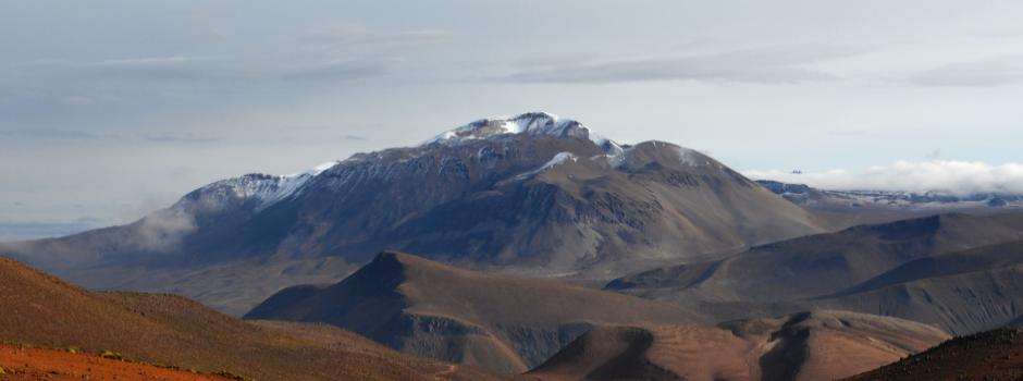
Great Sitkin , Alaska :
AVO/USGS Volcanic Activity Notice
Current Volcano Alert Level: NORMAL
Previous Volcano Alert Level: ADVISORY
Current Aviation Color Code: GREEN
Previous Aviation Color Code: YELLOW
Issued: Thursday, January 18, 2018, 1:36 PM AKST
Source: Alaska Volcano Observatory
Notice Number: 2018/A55
Location: N 52 deg 4 min W 176 deg 6 min
Elevation: 5709 ft (1740 m)
Area: Aleutians
Volcanic Activity Summary:
Earthquake activity at Great Sitkin Volcano has declined over the past two months to near background levels. No significant activity has been observed in satellite data during this time period and no steam plumes have been reported. AVO is thus lowering the Aviation Color Code and Alert Level to GREEN/NORMAL.
The number of earthquakes located at Great Sitkin increased as early as late July 2016, and the elevated seismicity continued throughout most of 2017. The unrest was likely the result of a magma intrusion beneath the volcano. The decline over the past two months in the number of earthquakes suggests the intrusion has stalled and the volcano is returning to a period of background seismicity. Future intrusions at Great Sitkin should also lead to an increase in earthquakes prior to any eruptive activity.
Great Sitkin Volcano is monitored by a five-station seismic network on Great Sitkin Island and with additional seismic stations on the nearby islands of Igitkin, Adak, Kagalaska, and Kanaga. A six-element infrasound array to detect explosions (atmospheric pressure waves) was installed on Adak Island in June, 2017. AVO also uses satellite imagery to monitor Great Sitkin Volcano.

Recent Observations:
[Volcanic cloud height] not applicable
[Other volcanic cloud information] Unknown
Remarks:
Great Sitkin Volcano is a basaltic andesite volcano that occupies most of the northern half of Great Sitkin Island, a member of the Andreanof Islands group in the central Aleutian Islands. It is located 43 km (26 miles) east of the community of Adak. The volcano is a composite structure consisting of an older dissected volcano and a younger parasitic cone with a 3-km-diameter summit crater. A steep-sided lava dome, emplaced during an eruption in 1974, occupies the center of the crater. Great Sitkin erupted at least three times in the 20th century, most recently in 1974. That eruption produced at least one ash cloud that likely exceeded an altitude of 25,000 ft above sea level. A poorly documented eruption occurred in 1945, also producing a lava dome that was partially destroyed in the 1974 eruption. Within the past 280 years a large explosive eruption produced pyroclastic flows that partially filled the Glacier Creek valley on the southwest flank.
Source : AVO