
June 01, 2023.
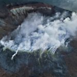
Indonesia , Karangetang :
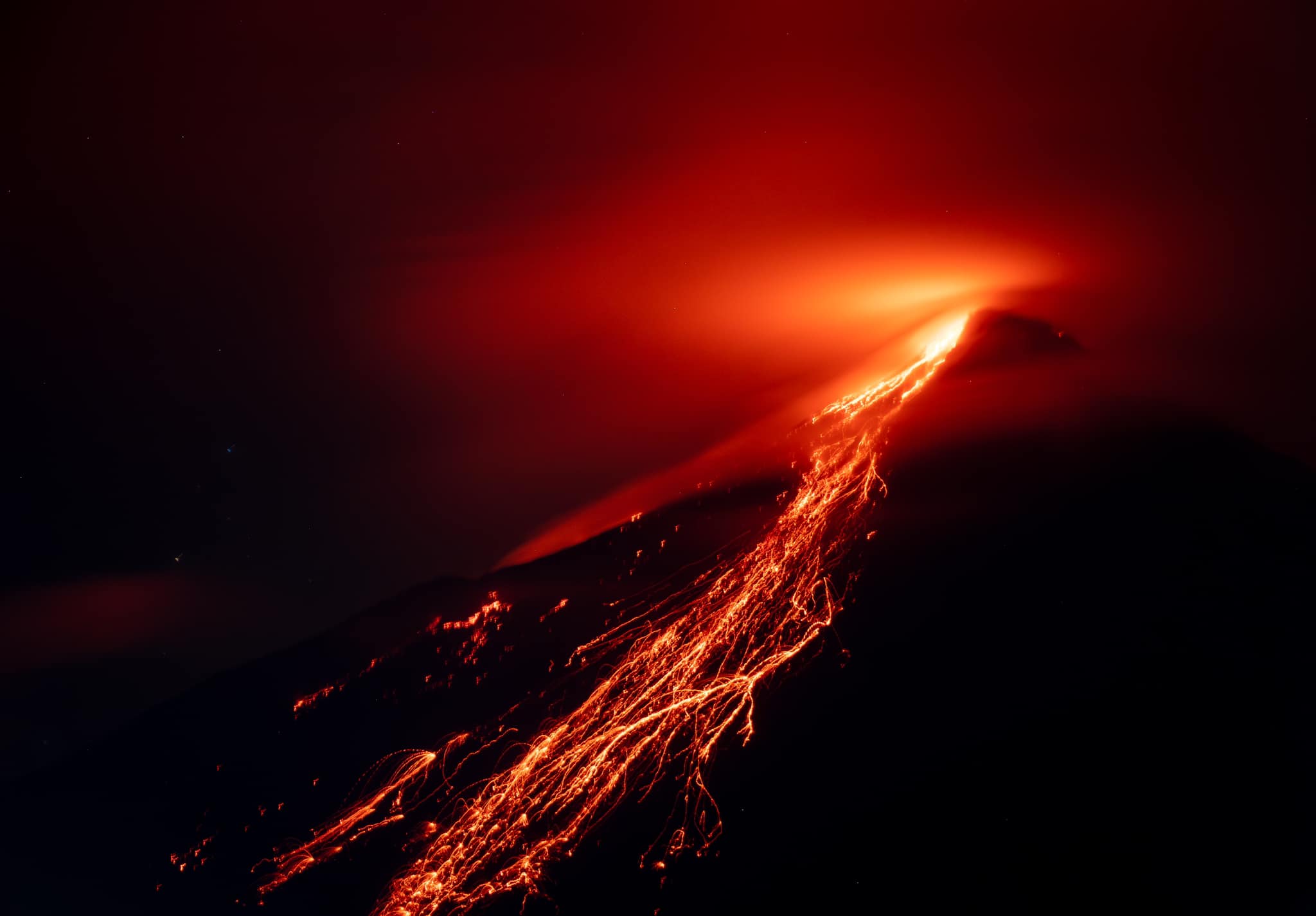
Webcam images of Karangetang published in PVMBG daily reports periodically showed incandescence at Main Crater (S crater) and from material on the flanks of Main Crater during 23-30 May. Incandescence at the summit was most intense in the webcam images from 23h32 on 26 May and 23h04 on 29 May; the material on the flanks was brightest in the 29 May image. White gas-and-steam plumes were visible on most days rising as high as 150 m above the summit and rifting in various directions. The Alert Level remained at 3 (on a scale of 1-4) and the public were advised to stay 2.5 km away from Main Crater with an extension to 3.5 km on the S and SE flanks. The Alert Level remained at 3 (on a scale of 1-4) and the public was warned to stay 2.5 km away from the craters on the S and SW flanks and 1.5 km away on the other flanks.
Karangetang (Api Siau) volcano lies at the northern end of the island of Siau, about 125 km NNE of the NE-most point of Sulawesi. The stratovolcano contains five summit craters along a N-S line. It is one of Indonesia’s most active volcanoes, with more than 40 eruptions recorded since 1675 and many additional small eruptions that were not documented (Neumann van Padang, 1951). Twentieth-century eruptions have included frequent explosive activity sometimes accompanied by pyroclastic flows and lahars. Lava dome growth has occurred in the summit craters; collapse of lava flow fronts have produced pyroclastic flows.
Source: Pusat Vulkanologi dan Mitigasi Bencana Geologi (PVMBG ), GVP.
Photo : Baptiste Apps.
Japan , Sakurajima :
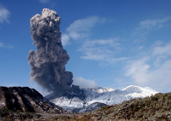
JMA reported ongoing activity at both Minamidake Crater and Showa Crater (Aira Caldera’s Sakurajima volcano) during 22-29 May. Crater incandescence was observed nightly at Minamidake, and during 25-29 May at Showa; incandescence at Showa had not been visible since 5 March. The only eruptive event at Showa during this period was at 11h25 on 22 May, when material was ejected 200-300 m from the crater and an ash plume rose 1.5 km above the crater rim. At 06h10 on 24 May an explosion at Minamidake ejected material 300-500 m from the crater and generated an ash plume that rose 1.5 km above the crater and drifted to the SW. An eruptive event at 13h27 on 25 May produced an ash plume that rose 2.3 km. On 26 May two explosions (at 06h47 and 14h41) and an eruptive event (13h11) generated ash plumes that rose as high as 1.6 km and drifted N and S. The explosion at 14h41 ejected blocks 500-700 m from the vent. An explosion at 15h20 on 28 May ejected material 600-900 m from the crater and produced an ash plume that rose 2.3 km from the summit . The Alert Level remained at 3 (on a 5-level scale), and residents were warned to stay 2 km away from both craters.
The Aira caldera in the northern half of Kagoshima Bay contains the post-caldera Sakurajima volcano, one of Japan’s most active. Eruption of the voluminous Ito pyroclastic flow accompanied formation of the 17 x 23 km caldera about 22,000 years ago. The smaller Wakamiko caldera was formed during the early Holocene in the NE corner of the Aira caldera, along with several post-caldera cones. The construction of Sakurajima began about 13,000 years ago on the southern rim of Aira caldera and built an island that was finally joined to the Osumi Peninsula during the major explosive and effusive eruption of 1914. Activity at the Kitadake summit cone ended about 4850 years ago, after which eruptions took place at Minamidake. Frequent historical eruptions, recorded since the 8th century, have deposited ash on Kagoshima, one of Kyushu’s largest cities, located across Kagoshima Bay only 8 km from the summit. The largest historical eruption took place during 1471-76.
Source: Japan Meteorological Agency (JMA), GVP.
Photo : S.Nakano
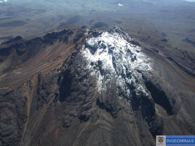
Colombia , Chiles / Cerro Negro :
Weekly activity bulletin of the volcanic complex of Chiles and Cerro Negro (CVCCN)
Regarding the monitoring of the activity of the VOLCANOES CHILES AND CERRO NEGRO, the MINISTRY OF MINES AND ENERGY through the COLOMBIAN GEOLOGICAL SERVICE (SGC) informs that:
For the period between May 23 and May 29, 2023, volcanic activity showed a significant increase in earthquake frequency compared to previous weeks.
However, this seismicity is lower than that presented during the months of March or April 2023.
The predominance of earthquakes associated with rock fractures within the volcano continues and, although to a lesser extent, the persistent record of events related to the movement of fluids within the volcanic system.
Most fracture earthquakes continue to be located near and to the south of the Chiles volcano, at distances up to 4 km, with depths less than 6 km from its summit (level 4700 m). Other earthquakes were located near the Cerro Negro and Chiles volcanoes, with depths between 3 and 5 km. The occurrence of 6 earthquakes of magnitude greater than 2.5 is highlighted, 4 of which were reported as felt by the inhabitants of the regions close to the CVCCN: May 25 at 02:20. and 2:23. (magnitudes of 2.8 and 3.1 respectively), May 27 at 8:05 a.m. (magnitude 2.8), and May 28 at 11:36 a.m. (magnitude 2.9).
The soil deformation processes recorded by the sensors installed on the volcanoes persist, as well as by the use of remote satellite sensors.
It is important to remember that due to the fluctuating behavior of the CVCCN, the possibility of high energy earthquakes that can be felt by the inhabitants is not excluded in their area of influence.
The activity level of volcanoes remains at the YELLOW LEVEL ■ (III): CHANGES IN THE BEHAVIOR OF VOLCANIC ACTIVITY.
Source : SGC
Photo : Ingeominas.
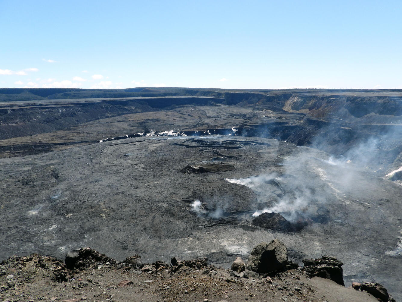
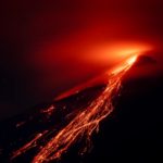
Hawaii , Kilauea :
Wednesday, May 31, 2023, 9:14 AM HST (Wednesday, May 31, 2023, 19:14 UTC)
19°25’16 » N 155°17’13 » W,
Summit Elevation 4091 ft (1247 m)
Current Volcano Alert Level: ADVISORY
Current Aviation Color Code: YELLOW
Activity Summary:
Kīlauea volcano is not erupting. Kīlauea summit is currently exhibiting signs of heightened unrest. Summit seismicity remains elevated. No unusual activity has been noted along Kīlauea’s East Rift Zone or Southwest Rift Zone.
Halemaʻumaʻu Lava Lake Observations:
No active lava has been observed over the past day.
Summit Observations:
Inflationary tilt and elevated seismicity continue at Kīlauea’s summit. Daily rates have been variable, but over the past several months, both deformation and seismicity have been elevated beyond observations preceding the January 5, 2023 summit eruption. Earthquake rates remain elevated beneath Kīlauea summit and Nāmakanipaio. Over the past 24 hours, 93 earthquakes were located beneath Kīlauea summit, with an increase in number overnight. Most of the earthquakes have been smaller than magnitude-2 and not reported felt. The most recent sulfur dioxide (SO2) emission rate of approximately 120 tonnes per day was measured on May 26, 2023.
Rift Zone Observations:
No unusual activity has been noted along the East Rift Zone or Southwest Rift Zone; steady rates of ground deformation and seismicity continue along both. Measurements from continuous gas monitoring stations in the middle East Rift Zone—the site of 1983–2018 eruptive activity—remain below detection limits for SO2.
Source : HVO.
Photo : USGS / K. Mulliken.
Mexico , Popocatepetl :
May 31, 11:00 a.m. (May 31, 5:00 p.m. GMT)
During the last 24 hours, according to the monitoring systems of the Popocatépetl volcano, 315 exhalations accompanied by water vapor, other volcanic gases and ash have been detected as well as 502 minutes (8.35 hours) of tremor at high frequency, of low to medium amplitude, associated with the continuous emission of gas, water vapor and ash, and sometimes with the expulsion of incandescent fragments a short distance from the crater.
In addition, two minor explosions were detected yesterday at 2:23 p.m. and 5:08 p.m. and a volcano-tectonic earthquake, of magnitude 1.6, recorded today at 9:52 a.m.
During this period, the National Center for Communication and Civil Protection Operations (CENACOM) reported a slight ash fall in the municipalities of Ayapango and Acatzingo, State of Mexico.
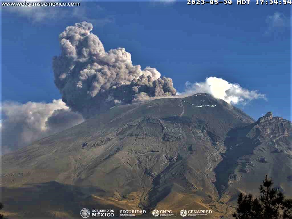
At the time of publication of this report, an emission of water vapor, volcanic gases and small amounts of ash is observed in a southeasterly direction.
Activity over the past few days has primarily consisted of the emission of ash and incandescent fragments, associated with the recording of tremor of fluctuating duration and amplitude.
Update May 31, 7:00 p.m. (June 01, 01:00 GMT)
At the moment, the high frequency tremor signal has attenuated. Eventually, episodes of low amplitude and short duration occur. This tremor signal is associated with the emission of light amounts of ash and the occasional expulsion of incandescent fragments.
The volcanic alert traffic light remains at YELLOW PHASE 3.
Source et photo : Cenapred.


No comment yet, add your voice below!