19 Septembre 2021.
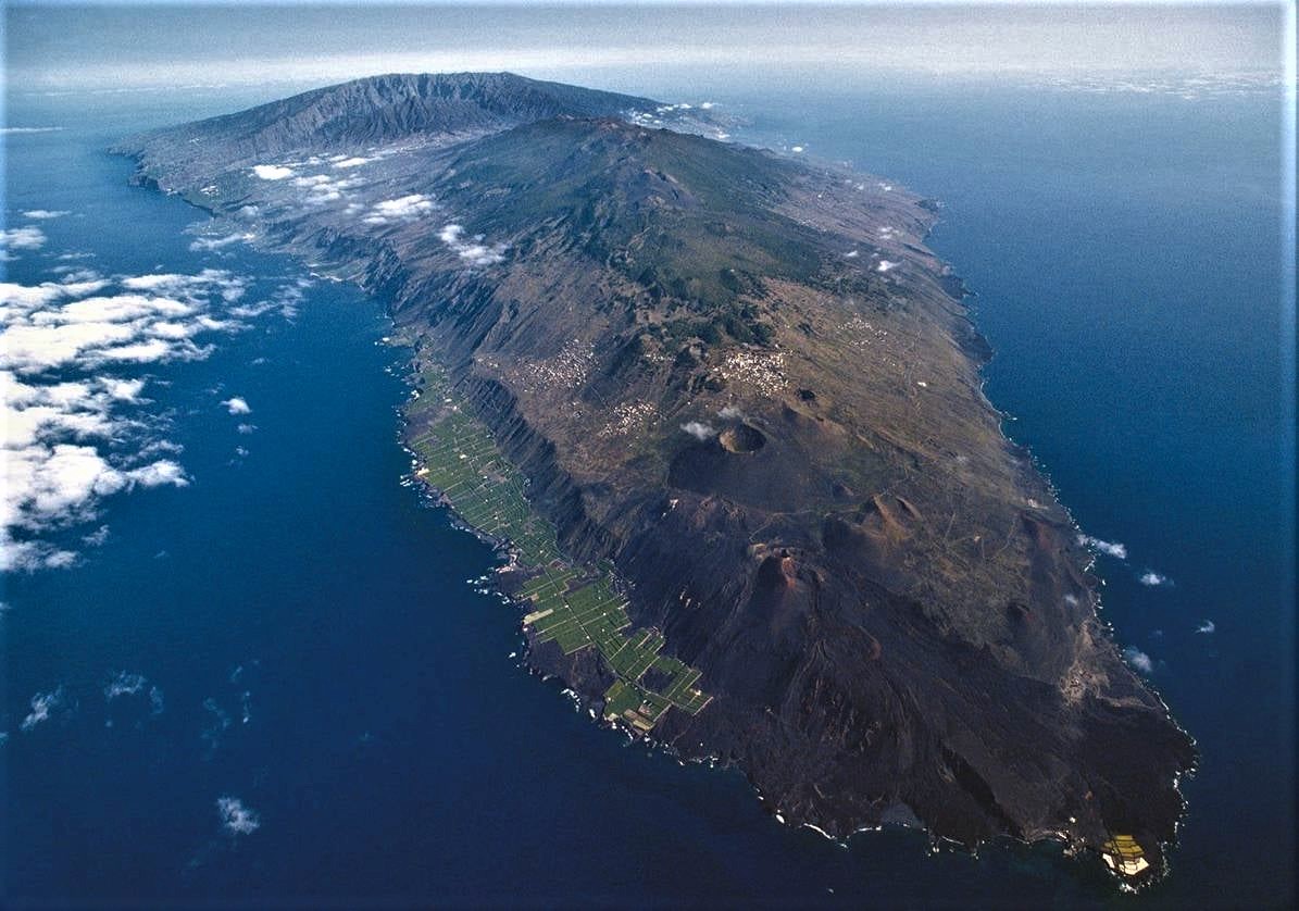
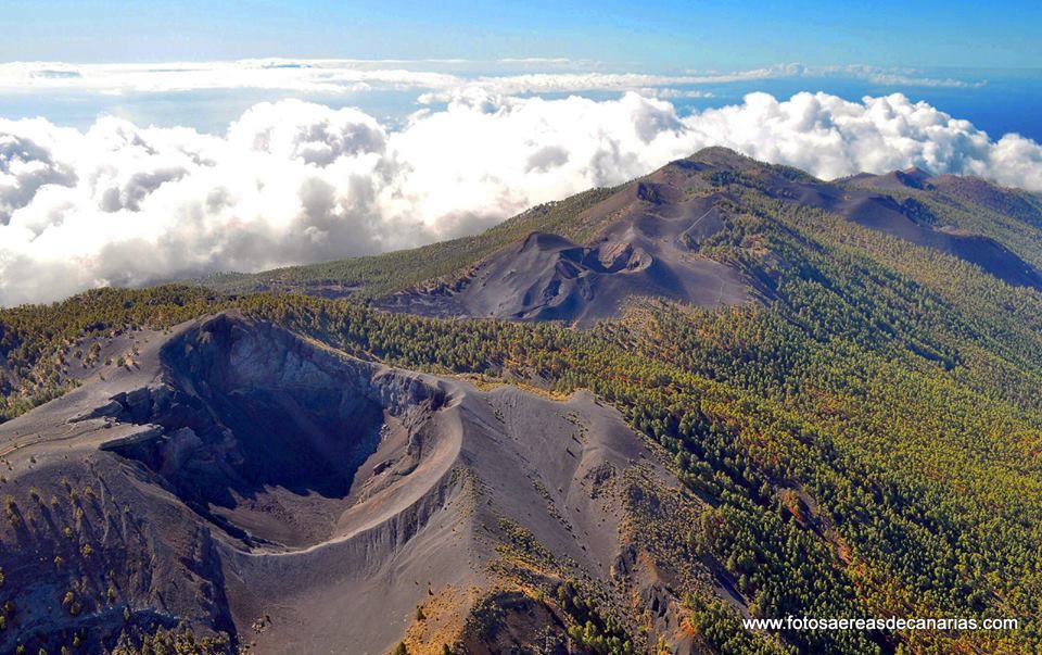
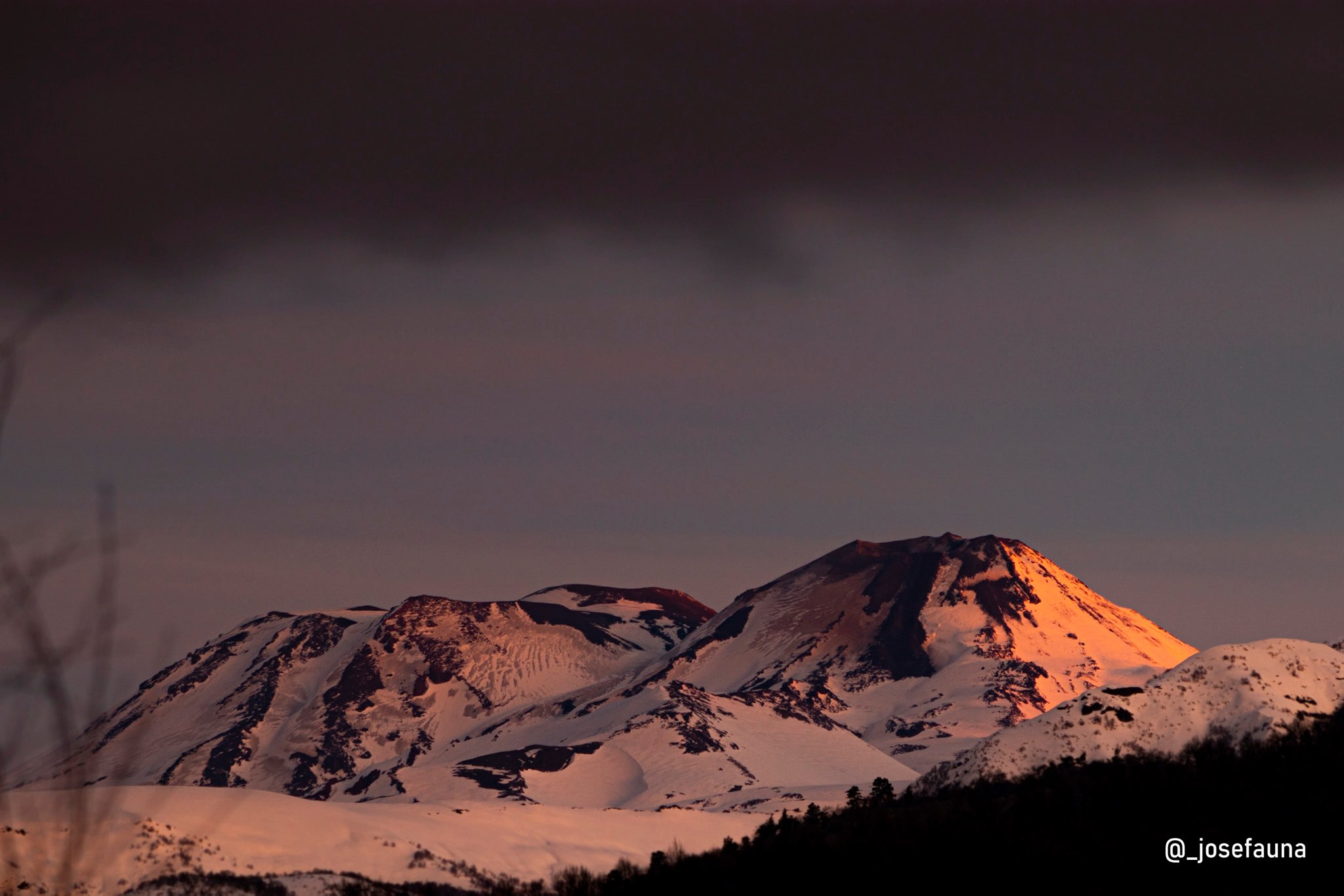
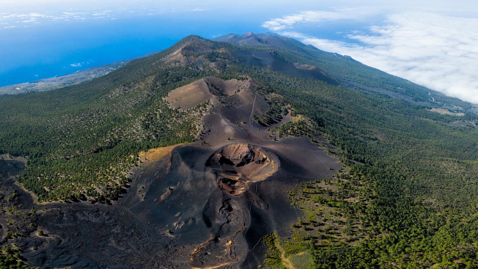
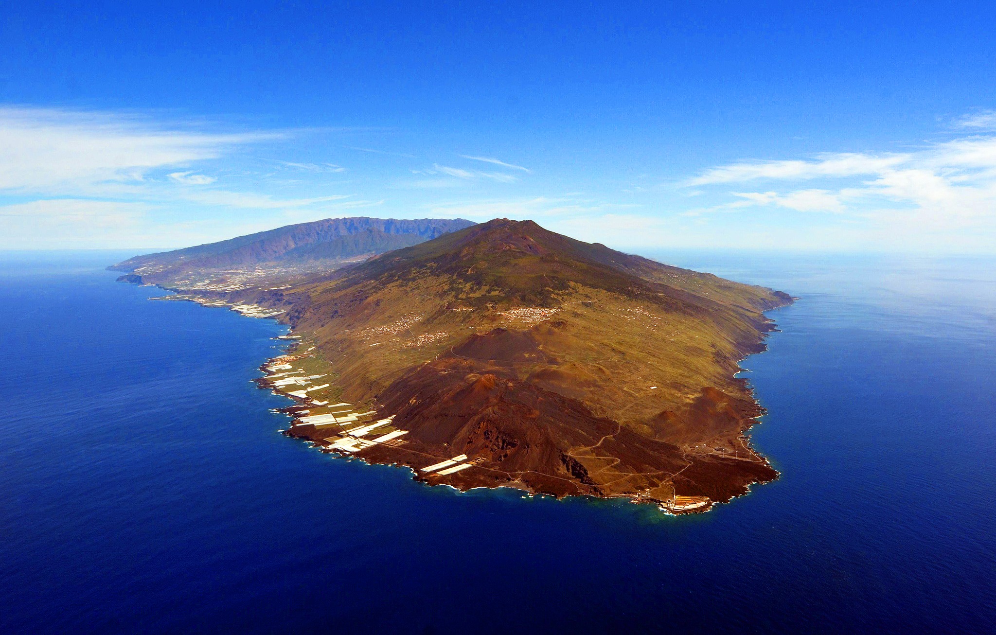
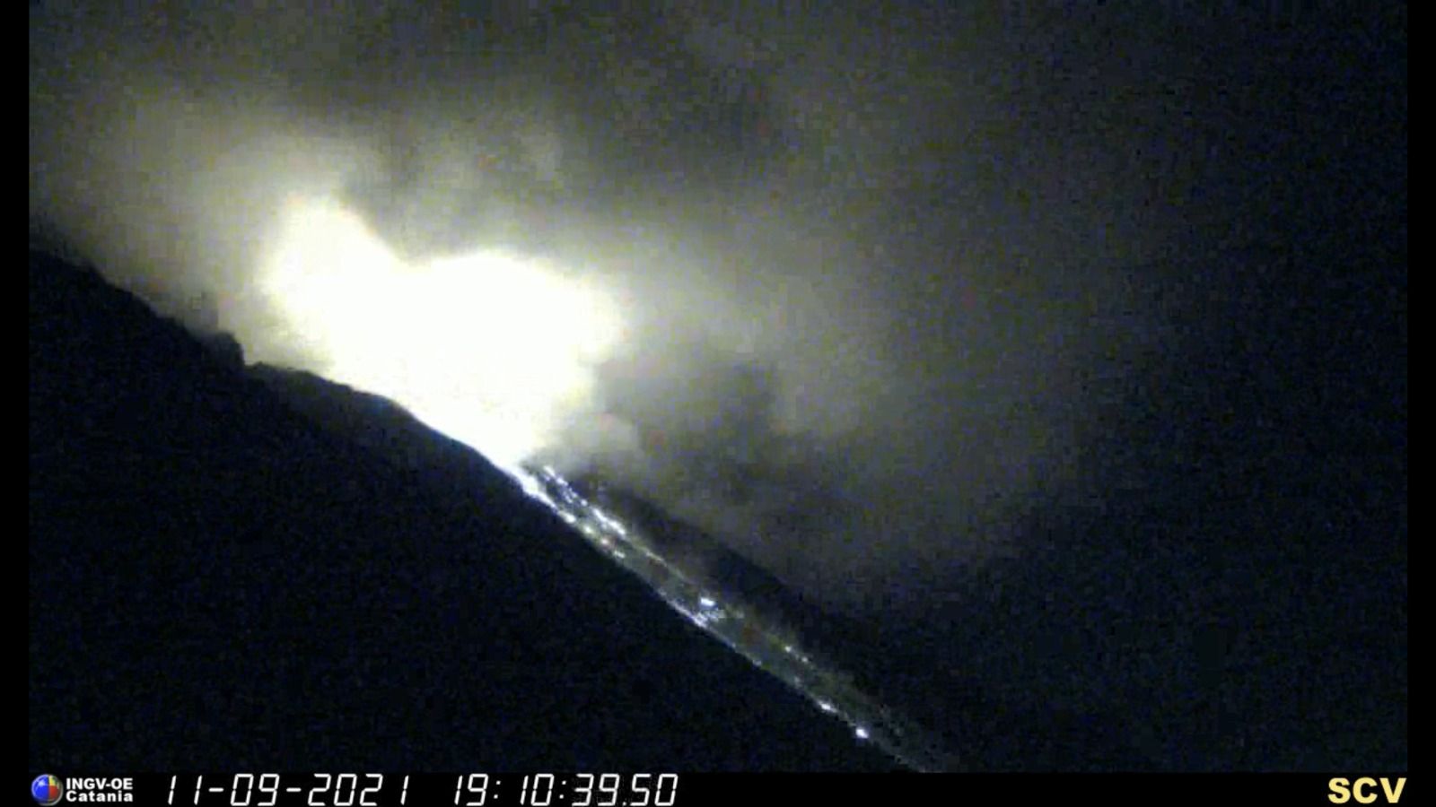
Espagne / La Palma , Cumbre Vieja :
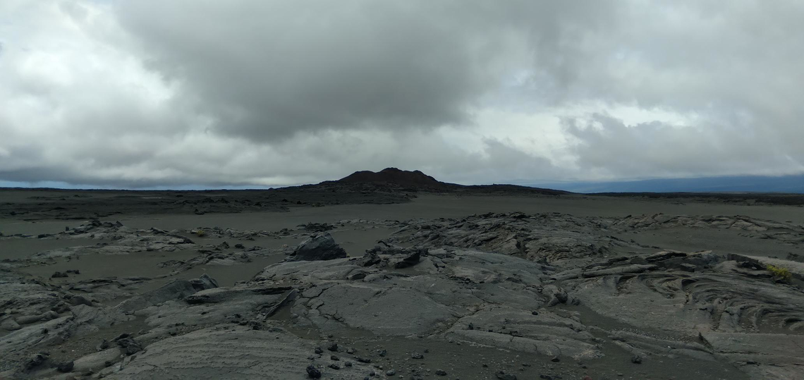
Mise à jour des informations sur l’activité volcanique dans le Ssud de l’île de La Palma. 18 Septembre 2021 , 12:00 UTC.
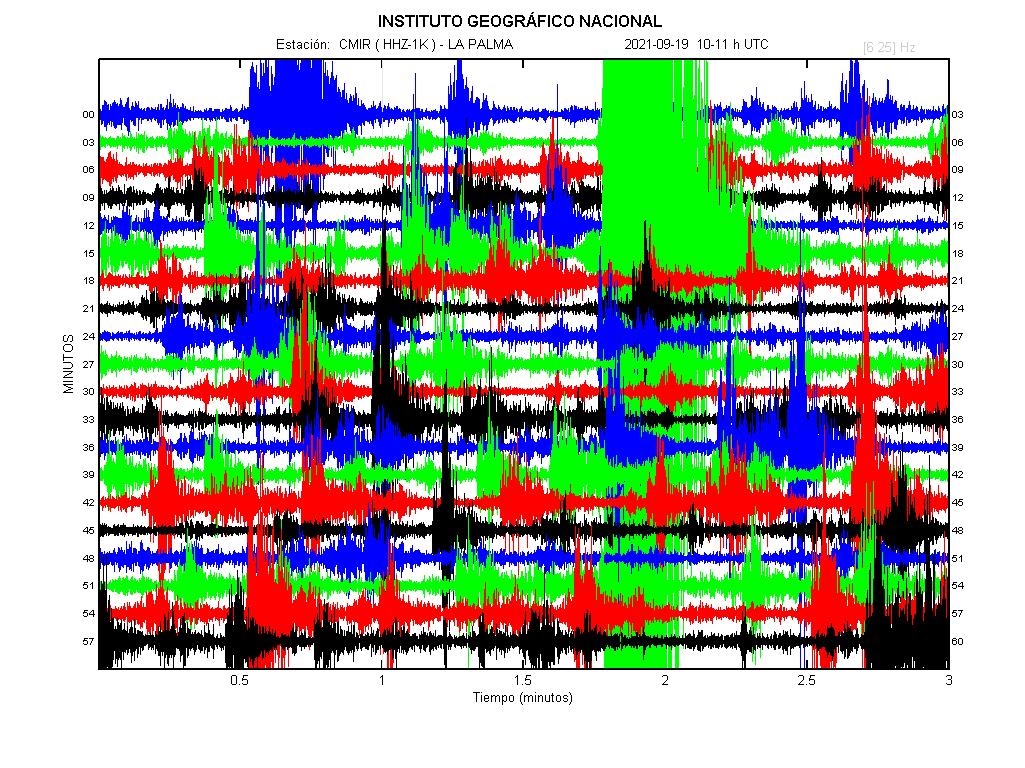
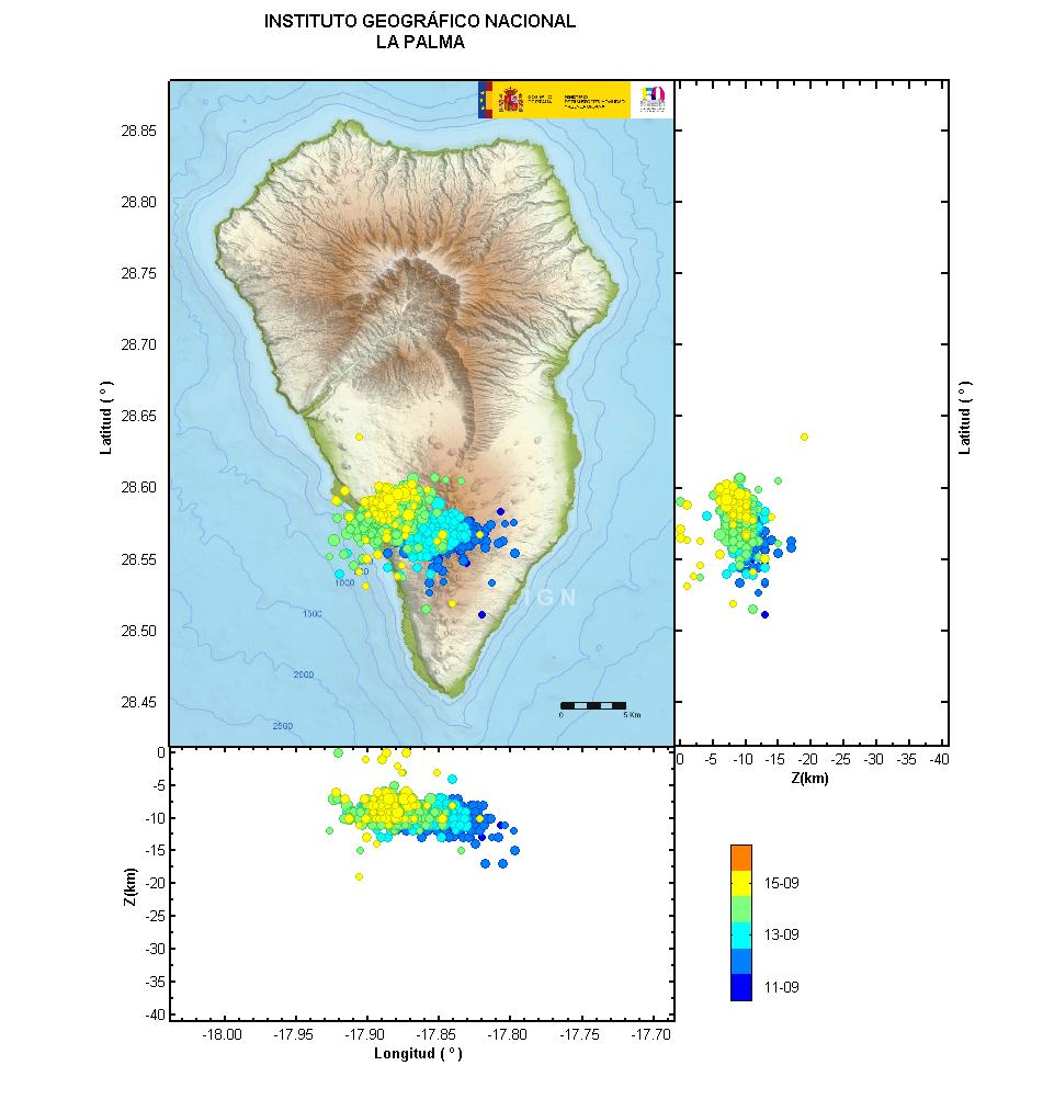
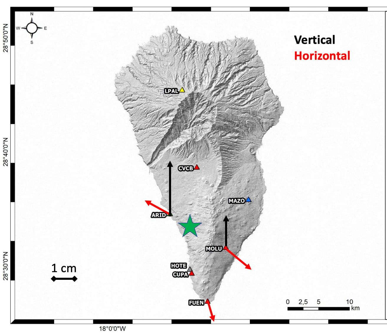
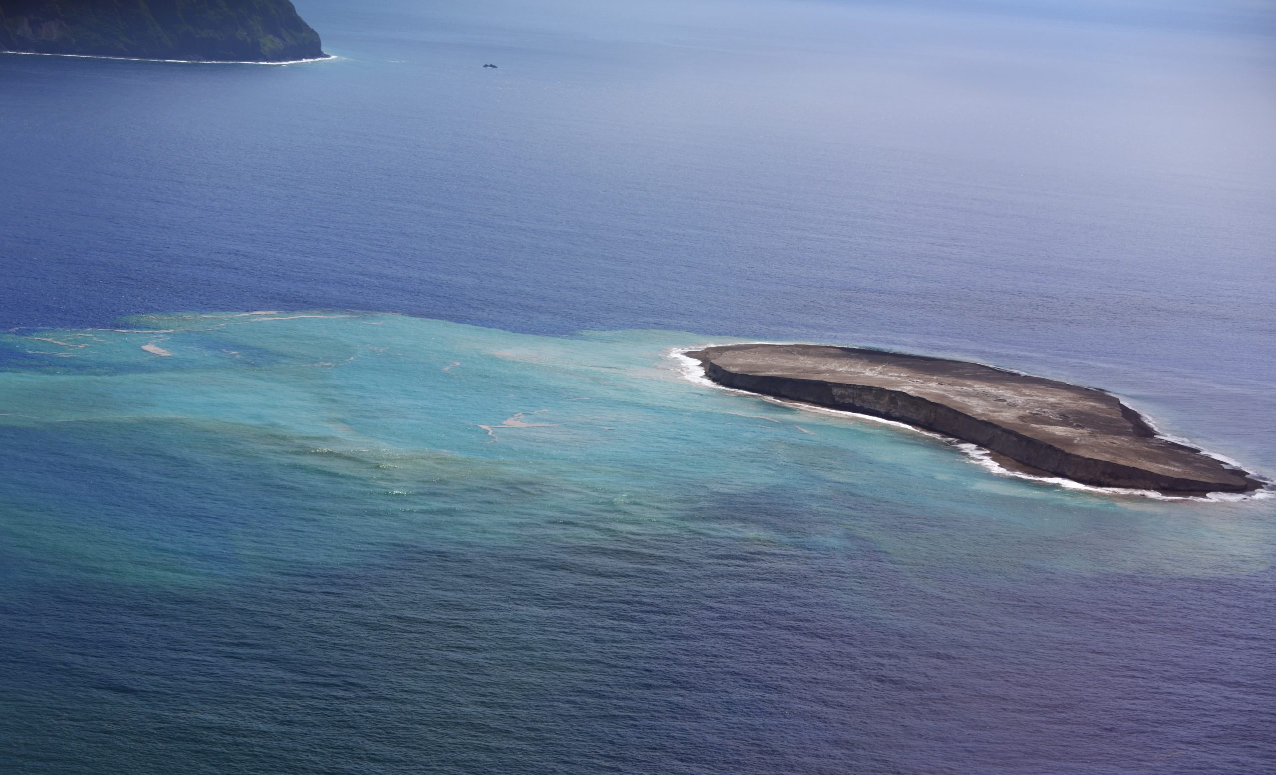
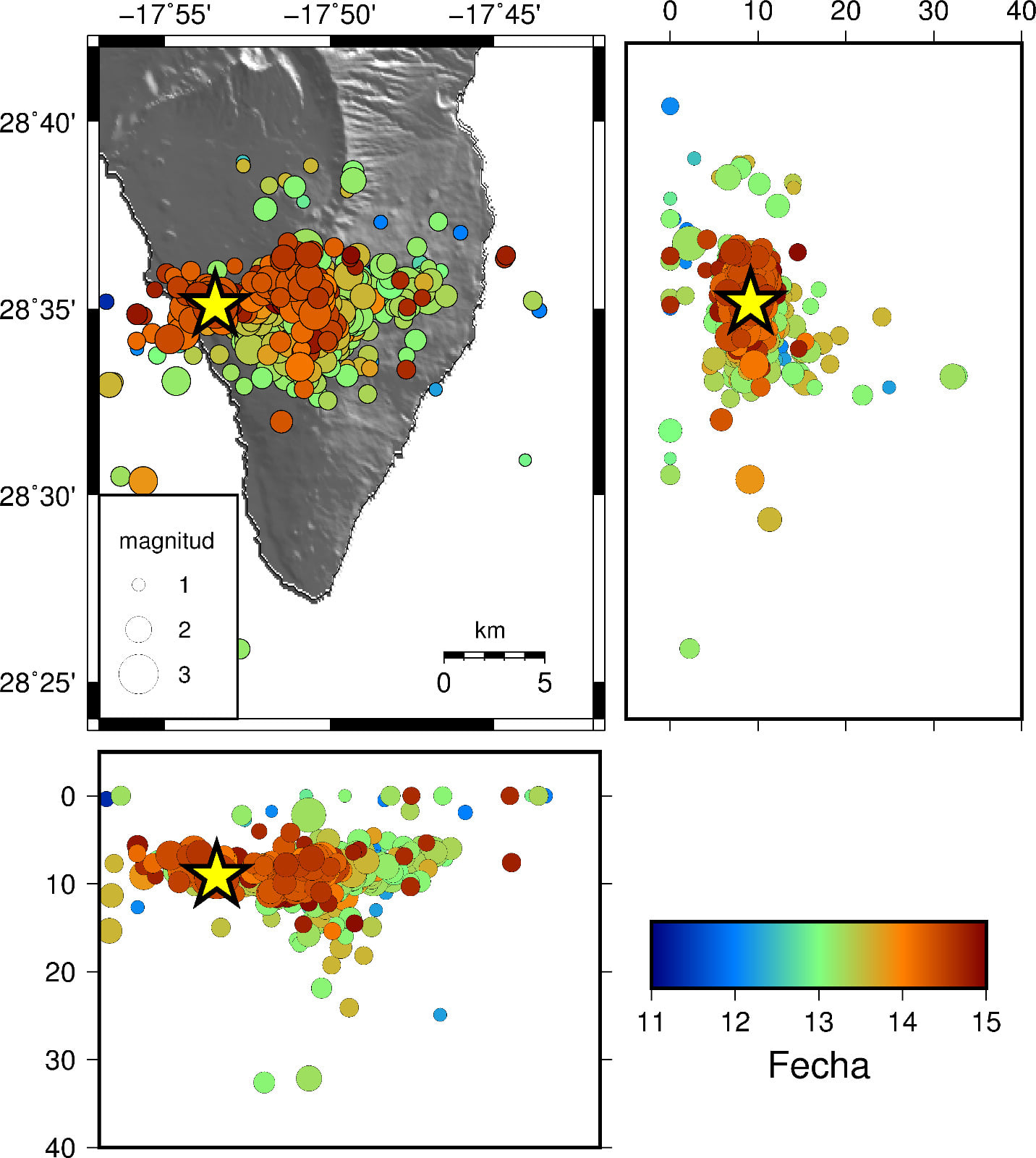
L’activité sismique à Cumbre Vieja, qui a commencé le 11 à 03h18 (UTC), a diminué au cours des dernières 48 heures, cependant, au cours des 12 dernières heures, il y a eu une légère augmentation avec un séisme de magnitude M 3, 2, à 03h26 (UTC) aujourd’hui, à une profondeur de 0,1 km, ce qui a été ressenti par la population avec une intensité III (EMS98). Jusqu’à ce moment et depuis le début de la série, 5391 séismes ont été détectés, dont 1102 ont été localisés.
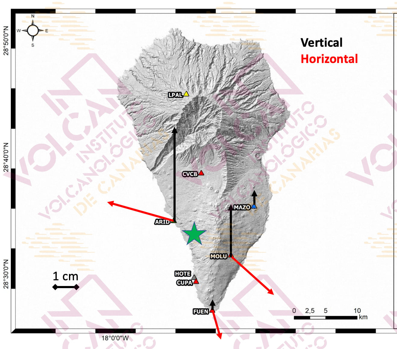
La déformation verticale cumulée maximale est de l’ordre de 10 cm dans la zone proche de la sismicité et sa répartition est encore compatible avec un centre de pression dans cette zone. Ces mouvements ont été observés à la fois avec le réseau GNSS de l’île et grâce aux données InSAR (Sentinel-1).
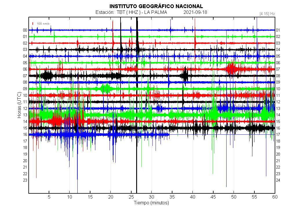
Mise à jour des informations : L’essaim sismique se poursuit sur le volcan Cumbre Vieja (La Palma, Îles Canaries) avec plus de 22 700 séismes de faible magnitude détectés.
À partir de 04h18 (heure des Canaries) le samedi 11 septembre 2021, le réseau sismique des îles Canaries, géré par l’Institut volcanique des îles Canaries (INVOLCAN), enregistre un nouvel essaim d’événements sismiques de faible magnitude sous le volcan Cumbre Vieja.
Mise à jour 16:30 heures (heure canarienne) : aucune anomalie thermique significative n’a été observée dans l’environnement superficiel de Cumbre Vieja Ouest et de la zone sommitale.
Afin de renforcer la vigilance sismique / volcanique de Cumbre Vieja , une équipe d’INVOLCAN a installé aujourd’hui un tableau sismique dans la région d’El Charco.
Un tableau sismique est un ensemble de stations sismiques installées à courte distance les unes des autres qui, outre la détection des ondes sismiques, permet d’établir la direction à partir de laquelle ces ondes proviennent.
En utilisant des techniques d’analyse similaires à celles utilisées par les antennes de télécommunication, cet outil permettra de détecter avec plus de sensibilité tout signal sismique venant de l’intérieur du volcan, y compris le trémor volcanique, qui est un précurseur important d’une éventuelle phase éruptive.
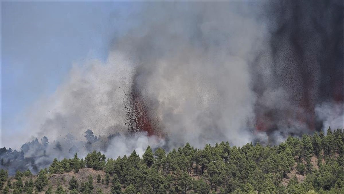
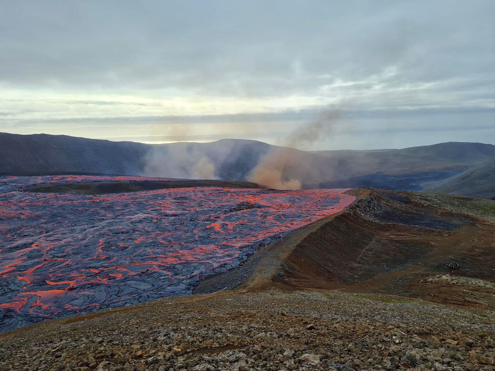
Ces dernières années, le volcan Cumbre Vieja a connu 10 essaims sismiques dont celui qui a débuté samedi dernier (1 en 2017, 1 en 2018, 5 en 2020 et 3 en 2021). Les tremblements de terre dans ce dernier essaim sont moins profonds que dans les essaims sismiques précédents, où la profondeur variait entre 20 et 30 km. Sans aucun doute, l’essaim sismique actuel représente un changement significatif dans l’activité du volcan Cumbre Vieja et est lié à un processus d’intrusion magmatique sous l’île de La Palma.
INVOLCAN continuera d’être informé de l’évolution de ce nouvel essaim sismique au volcan Cumbre Vieja. Nous vous rappelons qu’il n’est pas exclu que la sismicité ressentie dans les prochains jours s’intensifie, en fonction de l’évolution de l’activité.
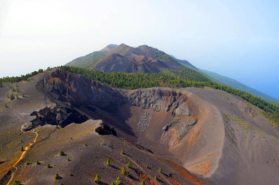
Sources : IGN , Involcan.
Photos : IGN , Involcan.
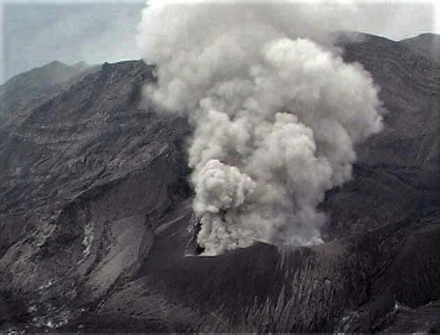
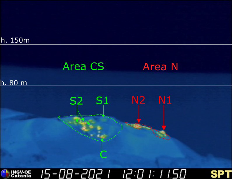
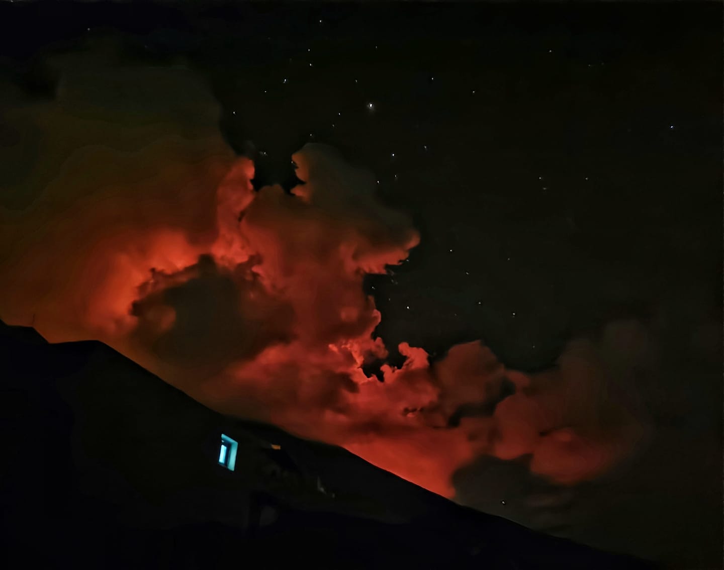
Indonésie , Ibu :
AVIS D’OBSERVATION DU VOLCAN POUR L’AVIATION – VONA.
Date d’émission : 18 septembre 2021.
Volcan : Ibu (268030)
Code Couleur Aviation Actuel : ORANGE
Code Couleur Aviation précédent : orange
Source : Observatoire du volcan Ibu
Numéro d’avis : 2021IBU17
Emplacement du volcan : N 01 deg 29 min 17 sec E 127 deg 37 min 48 sec
Zone : North Maluku, Indonésie
Élévation du sommet : 4240 FT (1325 M)
Résumé de l’activité volcanique :
Eruption avec nuage de cendres volcaniques à 02h35 UTC (11h35 local).
Hauteur des nuages volcaniques :
La meilleure estimation du sommet du nuage de cendres est d’environ 7440 FT (2325 M) au-dessus du niveau de la mer, peut être plus élevée que ce qui peut être observé clairement. Source des données de hauteur : observateur au sol.
Autres informations sur les nuages volcaniques :
Nuage de cendres se déplaçant vers l’Ouest.
Remarques :
L’éruption et l’émission de cendres se poursuivent.
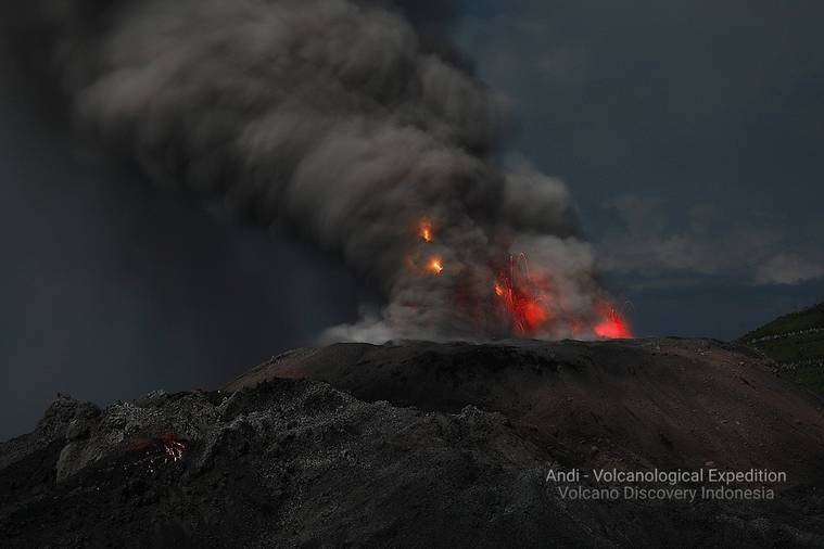
Le niveau d’activité est de niveau II (WASPADA) depuis le 10 décembre 2013. Le volcan Ibu (1340 m d’altitude) est en éruption continue depuis 2008. L’éruption produit des roches qui s’accumulent dans le cratère.
Le volcan était clairement visible jusqu’à ce qu’il soit recouvert de brouillard. La fumée issue du cratère , de pression faible à modérée a été observée comme étant blanche / grise avec une intensité faible à moyenne et une hauteur de 200 à 800 m au-dessus du cratère. Une éruption a été observée avec une hauteur de colonne de 200-800 m. La couleur de la fumée était blanche / grise. Le temps est ensoleillé à nuageux, les vents sont faibles à modérés au Sud et à l’Ouest.
Selon les sismographes du 17 septembre 2021, il a été enregistré :
78 tremblements de terre d’éruptions/explosions
71 tremblements de terre d’avalanches
26 tremblements de terre d’émissions
104 tremors Harmoniques
3 tremblements de terre tectoniques lointains.
Source : Magma Indonésie , PVMBG.
Photo : Andi Rosati / Volcanodiscovery.
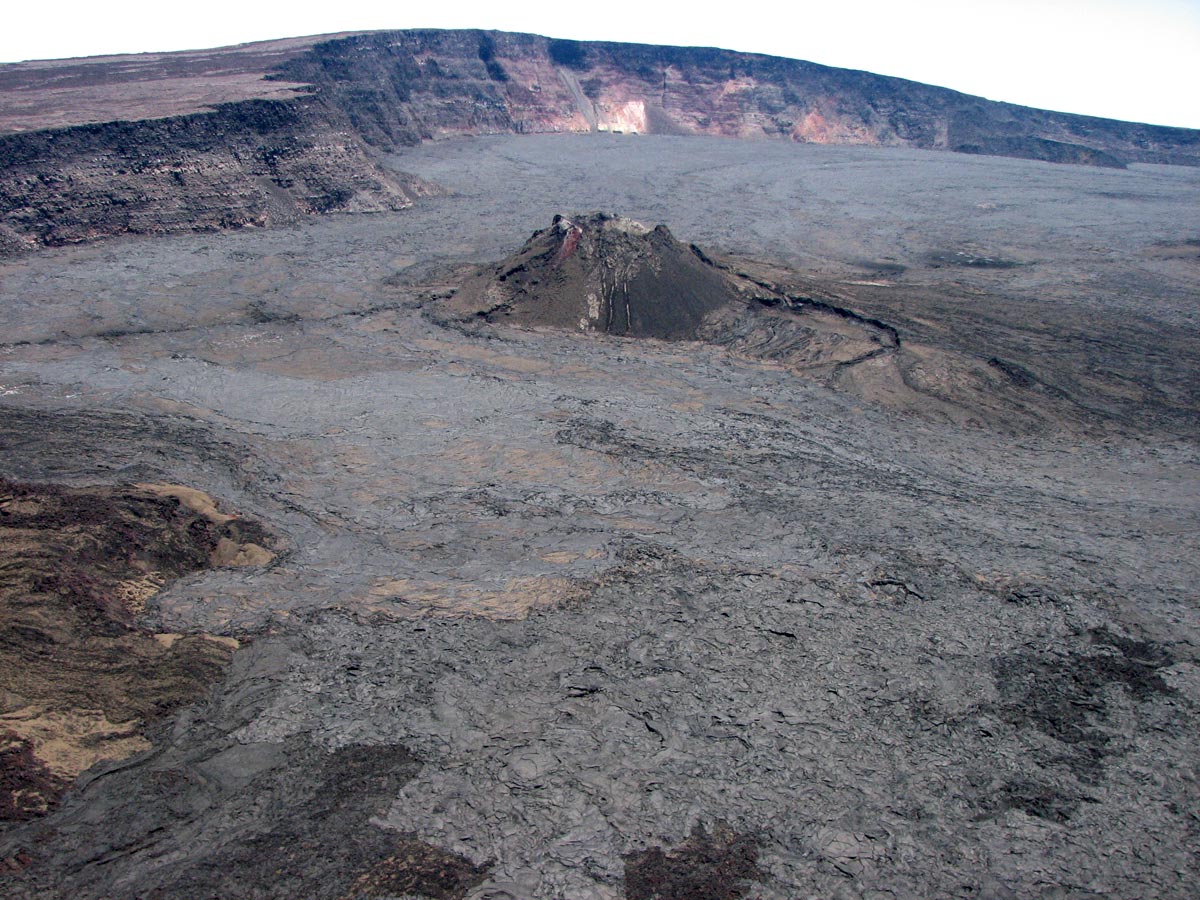
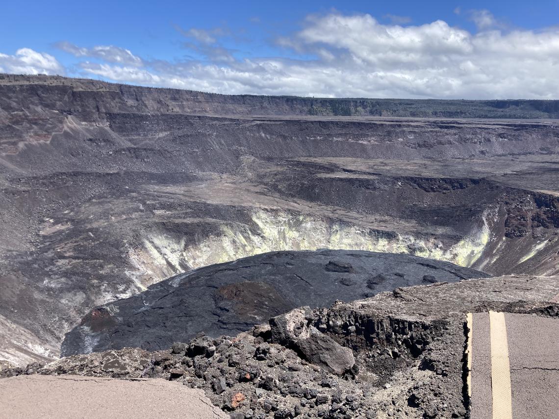
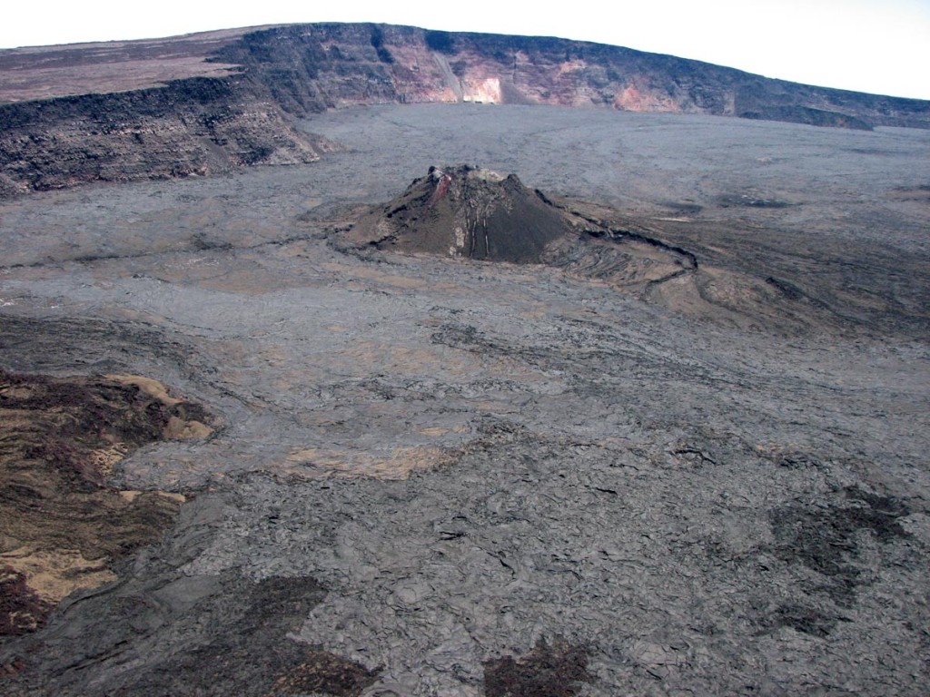
Hawaii , Mauna Loa :
19°28’30 » N 155°36’29 » O,
Élévation du sommet : 13681 pi (4170 m)
Niveau d’alerte volcanique actuel : AVIS
Code couleur de l’aviation actuel : JAUNE
Résumé de l’activité :
Le volcan Mauna Loa n’est pas en éruption. Les taux de sismicité au sommet restent légèrement supérieurs aux niveaux de fond à long terme, mais n’ont pas changé de manière significative au cours de la semaine dernière. Les autres flux de données de surveillance (déformation du sol, décharge de gaz et observations visuelles) ne montrent aucun changement significatif.
Remarques :
Au cours de la semaine dernière, les sismomètres du HVO ont enregistré 66 tremblements de terre de faible magnitude, tous inférieurs à M2,8, sous le sommet et les flancs d’altitude du Mauna Loa. La majorité de ces tremblements de terre se sont produits à de faibles profondeurs inférieures à 8 kilomètres (5 miles) sous le niveau de la mer.
Les mesures de la déformation du sol, à l’aide des instruments du système de positionnement global (GPS), confirment que la surface du volcan n’a pas bougé de manière appréciable au cours de la semaine dernière.
Les concentrations de gaz et les températures des fumerolles à la fois dans la caldeira du sommet et à Sulphur Cone dans la zone du Rift Sud-Ouest restent stables.
Les vues de la webcam n’ont montré aucun changement dans le paysage au sommet du Mauna Loa ou sur les flancs inférieurs du volcan au cours de la semaine dernière.
Source et photo : HVO
Costa Rica , Rincon de la Vieja / Turrialba / Poas :
Bulletin Hebdomadaire du Programme de Veille Volcanique, 14 septembre 2021
Volcan Rincón de la Vieja
Lat : 10,83°N ; Long : 85,324°W ;
Altitude : 1895 m.s.n.m.
Niveau d’activité actuel : 3 (volcan en éruption)
Dangers potentiellement associés : lahars, gaz, éruptions phréatiques, projections balistique proximale , chutes de cendres, pluies acides.
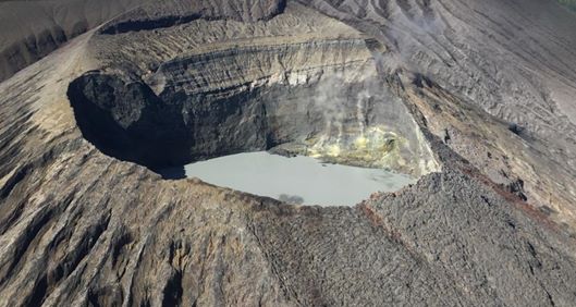
La dernière éruption phréatique a eu lieu le 1er septembre. Le nombre d’évènements de type » Tornillos » diminue et le nombre d’évènements de type LP est stable. Le RSAM reste faible et peu d’évènements de type VT ont été enregistrées. La surveillance géodésique GPS montre un retrait localisé au sommet et un soulèvement des stations dans le Nord.
Volcan Turrialba
Lat : 10,025 ° N ; Long : 83,767°O ;
Altitude : 3340 m.s.n.m.
Niveau d’activité actuel : 2 (volcan actif)
Dangers potentiellement associés : gaz, émission de cendres, projections balistiques proximales, pluies acides.
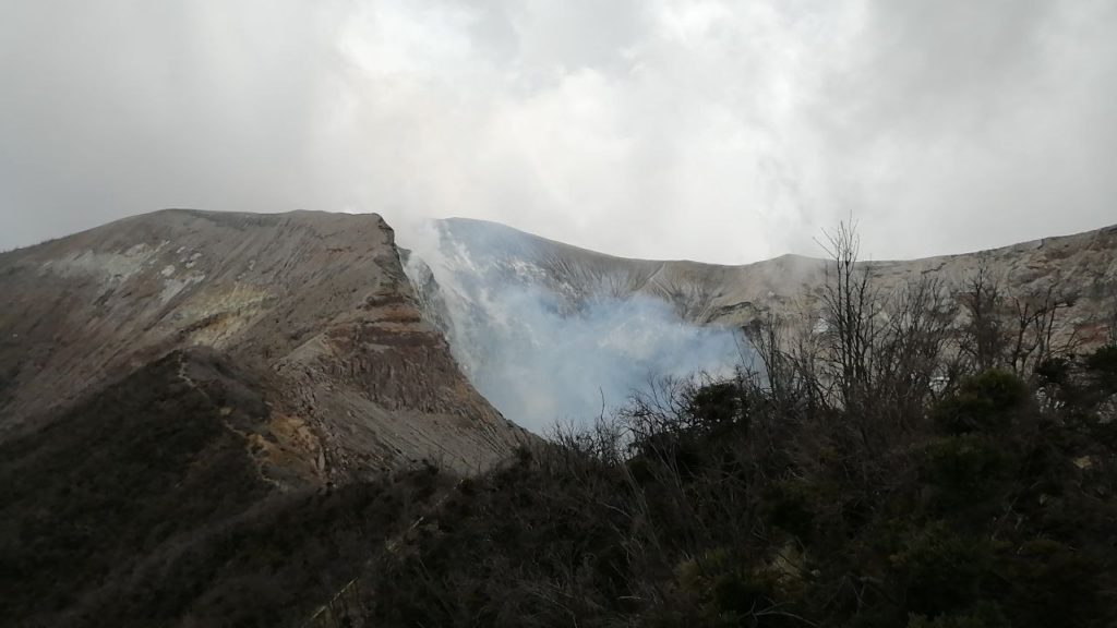
La dernière éruption confirmée a eu lieu le 26 juillet. Le nombre d’évènements de type LP à basse fréquence diminue, le nombre d’évènements de type LP à haute fréquence est stable et les tremors courts augmentent. Le RSAM reste relativement faible. Le suivi géodésique montre une contraction sur le massif d’Irazú-Turrialba au cours des 3 derniers mois. Les ratios de gaz CO2/SO2 et H2S/SO2 ne montrent pas de changements significatifs, avec des moyennes hebdomadaires de 22 +/- 3 et 0,4 +/- 0,2 respectivement.
Volcan Poas
Lat : 10,2°N ; Long : 84,233°W ;
Hauteur : 2780 m.s.n.m.
Niveau d’activité actuel : 2 (volcan actif)
Dangers potentiellement associés : gaz, éruptions phréatiques, projections balistique proximale , lahars, pluies acides.
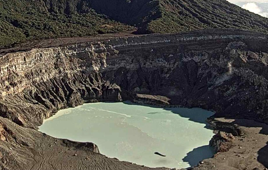
Aucune éruption n’a été observée. Le nombre d’évènements de type LP quotidiens reste élevé. De courts tremors continuent d’être enregistrés toutes les 10 à 60 minutes, avec une faible amplitude. Le RSAM continue de baisser. La surveillance géodésique montre une extension et une inflation à long terme, une petite extension à court terme. Les ratios SO2/CO2 et H2S/SO2 gaz restent stables, avec des moyennes hebdomadaires de 0,36 +/- 0,12 et 0,02 +/- 0,01. La concentration maximale de SO2 détectée au belvédère était de 2,4 ppm la semaine dernière. Le niveau du lac hyperacide est resté stable.
Source : Ovsicori.
Photos : Chris Allen / Sunquest Helitours , Jean Paul Calvo /RSN , Ovsicori.
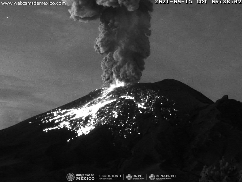
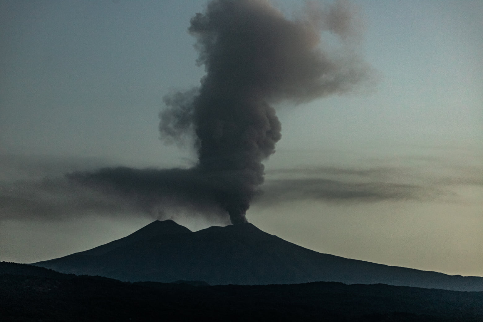
Mexique , Popocatepetl :
18 septembre, 11h00 (18 septembre, 16h00 GMT)
Au cours des dernières 24 heures, selon les systèmes de surveillance du volcan Popocatépetl, 90 exhalations ont été identifiées, certaines accompagnées de vapeur d’eau, de gaz volcaniques et de cendres. Les émissions étaient principalement dispersées vers le Nord-Ouest (NO). Une explosion mineure a été détectée hier à 11h38 .
De plus, 267 minutes de tremor de faible et moyenne amplitude ont été enregistrées.
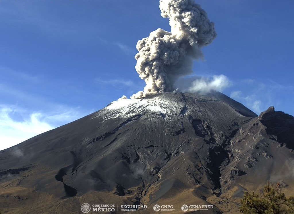
D’après les informations du Centre national de communication et d’opérations de protection civile (CENACOM), il y a eu hier une légère chute de cendres dans certains secteurs de la municipalité de Cuernavaca.
Au moment de ce rapport, il n’y a pas de visibilité en raison de nuages denses.
Le CENAPRED recommande de NE PAS S’APPROCHER du volcan et surtout du cratère, en raison du danger que représentent les chutes de fragments balistiques et, en cas de fortes pluies, de se tenir à l’écart du fond des ravins en raison du danger de coulées de boue .
Le feu de signalisation volcanique du Popocatépetl est en JAUNE PHASE 2.
Source et photo : Cenapred.