
October 04 , 2020.
Italy / Sicily , Etna :
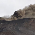
COMMUNICATION ON THE ACTIVITY OF ETNA [UPDATE n. 82], 03 October 2020. 12:22 (10:22 UTC).
The National Institute of Geophysics and Volcanology, Osservatorio Etneo, reports that as of 6:00 GMT, the New Southeast Crater shows a slight and variable increase in explosive activity. The ash emission, observed by surveillance cameras and INGV-OE personnel, is mainly localized in the summit area and is dispersed towards the Valle del Bove.
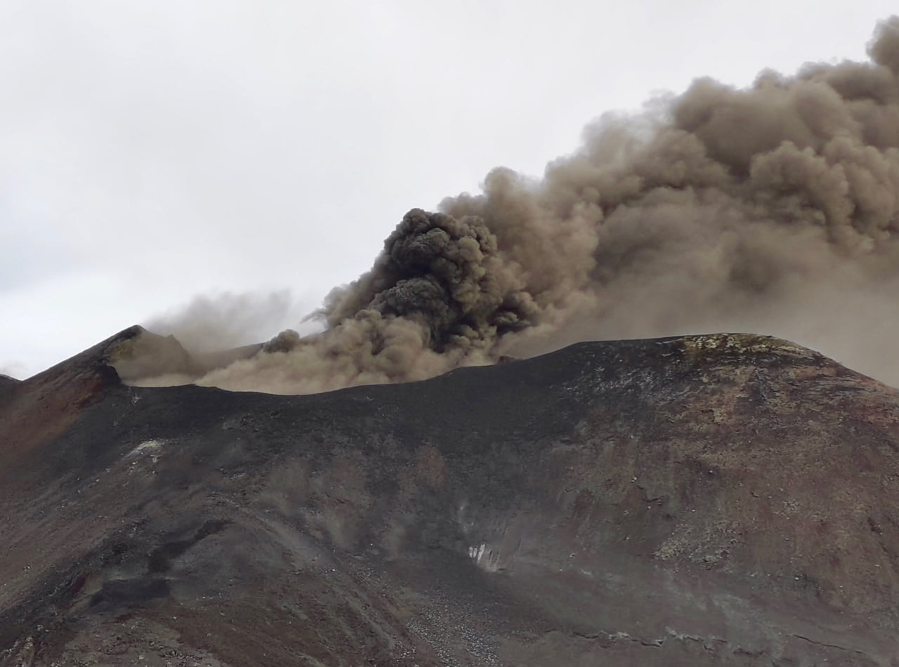
The tremor is constant at medium levels. The infrasound activity is low.
Etna’s GPS and Tilt-meter surveillance networks show no significant changes in progress.
Further updates will be communicated shortly.
Source : INGV .
Photo : Jackie Zwahlen
La Réunion , Piton de la Fournaise :
Activity bulletin for Sunday, October 4, 2020 at 8:45 a.m. (local time)
Alert level: Alert 1
Seismic activity is still recorded under the Piton de la Fournaise (summit area and east flank) even if it continues to decrease. Thus for the day of 10/03/2020, 25 volcano-tectonic earthquakes deep under the eastern flank, 4 earthquakes classified as « undetermined » (because of low magnitudes) and 24 shallow landslides / collapses in the eastern flank sector, have been manually pointed. No superficial summit volcano-tectonic earthquake has been recorded.

During the day of 10/03/2020, no significant deformation occurred in the Grandes Pentes sector. On the other hand, the inflation (swelling) of the summit zone continues, testifying to the pressurization of a source under the summit, where the superficial supply system is located (magmatic reservoir from which the intrusions of magma leave towards the top. area). This resumption of inflation is consistent with the increase in CO2 concentrations in the soil, which are increasing in the far field (Plaine des Cafres sector). This increase is often associated with a rise of magma from the mantle.
The persistence of even lower seismicity shows that the intrusion of magma towards the eastern flank is still active and that an eruption cannot be excluded. The inflation of the summit area and the increase in CO2 concentrations show that a new intrusion cannot be excluded. The observatory teams remain mobilized.
Source : OVPF.
Read the article : http://www.ipgp.fr/fr/ovpf/bulletin-dactivite-dimanche-4-octobre-2020-a-8h45-heure-locale
Photo : Imaz Press
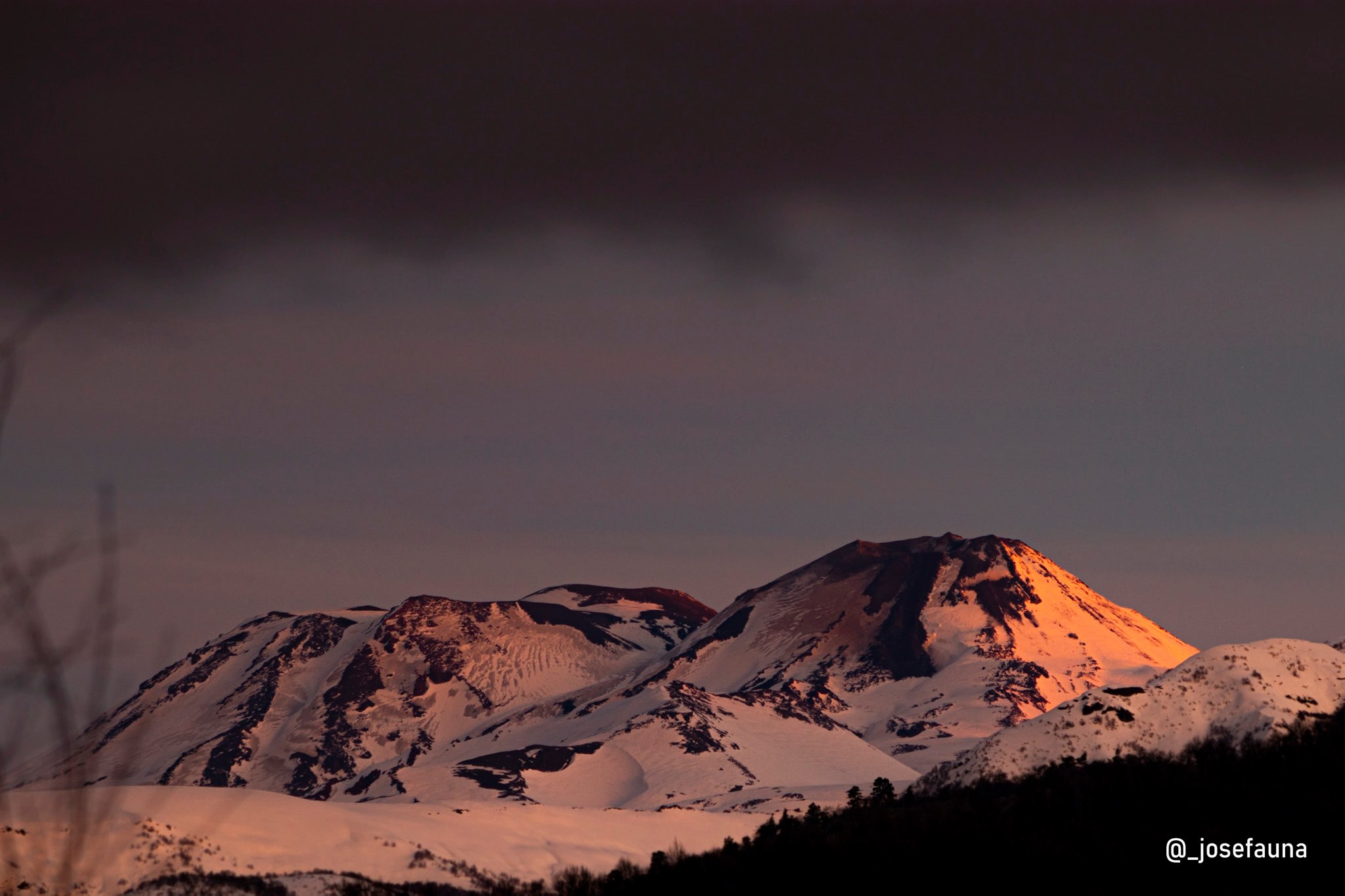
Chile , Nevados of Chillan :
Special Report on Volcanic Activity (REAV) Ñuble Region, Nevados de Chillán Volcanic Complex 03 October 2020, 17:30 Local time (Continental Chile)
The National Geological and Mining Service of Chile (Sernageomin) publishes the following PRELIMINARY information, obtained thanks to the monitoring teams of the National Volcanic Monitoring Network (RNVV), processed and analyzed at the Volcanological Observatory of the Southern Andes (Ovdas):
Yesterday, Saturday October 3 at 4:55 p.m. local time (7:55 p.m. UTC), monitoring stations installed near the Nevados de Chillán volcanic complex recorded an earthquake associated with fluid dynamics inside the volcanic system (long period type ).
The characteristics of the earthquake after analysis are as follows:
TIME OF ORIGIN: 4:55 p.m. local time (19:55 UTC)
LATITUDE: 36,864 ° S
LONGITUDE: 71.383 ° W
DEPTH: 0.6 km
REDUCED DISPLACEMENT: 526 (cm2)
OBSERVATIONS:
Despite the weather conditions in the area, it was not possible to verify the surface activity of the active crater.
The volcanic technical alert remains at the Yellow level.
Source : Sernageomin.
Photo : Josefauna.
Ecuador , Reventador :
The Geophysical Institute of the National Polytechnic School (IG-EPN) reported this Saturday, October 3, 2020 that the Reventador volcano was emitting ash, steam and gases, heading towards the West and the North with heights ranging up to 600 meters above the crater level. In the IG-EPN report, in the section on seismic events, it is also detailed that from 11 a.m. on October 2 to 11 a.m. on Saturday 3, 33 explosions were recorded. The Reventador volcano is located between the provinces of Napo and Sucumbíos, located about 90 kilometers east of Quito, with permanent volcanic activity so the orange alert is maintained.
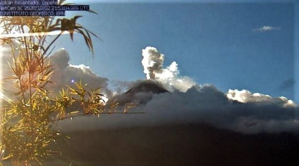
The institute’s report, published on Saturday 3, detailed the activity of the volcano, where it indicates that an incandescence was observed in the crater as well as bearings of incandescent blocks on the eastern flank, up to 600 meters below the level of the crater. IG-EPN added that a lava flow is observed on the northeast flank. The volcano is located on a spur of the eastern branch of the Andean mountain range which is lost with the start of the Amazon basin. This Saturday, October 3, the summit of the Reventador volcano is cloudy.
Source : Diario EL COMERCIO .
Read the article : https://www.elcomercio.com/actualidad/volcan-reventador-lava-ceniza-vapor.html?fbclid=IwAR14ftu1cwGoJJ4ejfj4MeA9fqY8dXb7_IgPzXLkWRhVDtxlw7lZqikUlL8.
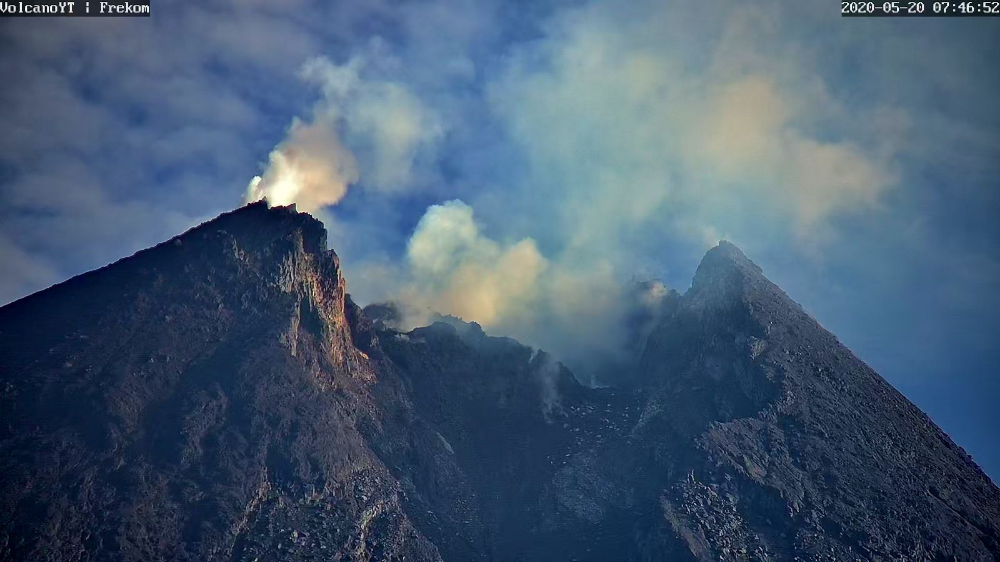
Indonesia , Merapi :
Mount Merapi Activity Report September 25 – October 1, 2020
I. OBSERVATION RESULTS
Visual
The weather around Mount Merapi is generally sunny in the morning and at night, while the afternoon until evening is foggy. There is white smoke, thin to thick with low pressure. A maximum smoke height of 150 m is observed from the Mount Merapi observation post in Babadan on September 30, 2020 at 05:30 WIB.
Morphological analysis of the crater area based on photos of the southeast sector showed no change in the morphology of the dome. The volume of the lava dome based on measurements using aerial photos with drones from July 26, 2020 is 200,000 m3.
Seismicity
This week, the seismicity of Mount Merapi recorded:
30 emissions earthquakes (DG),
1 deep volcanic earthquake (VTA),
15 shallow volcanic earthquakes (VTB),
134 multiphase earthquakes (MP),
7 low frequency earthquakes (LF),
32 avalanche earthquakes (RF),
11 tectonic earthquakes (TT).
The seismic intensity this week is relatively the same as last week.
Deformation
The deformation of Mount Merapi which was monitored by EDM this week showed a shortening of the distance of the reflectors of about 3 cm.
Rain and lahars
This week there was rain at Mount Merapi Observation Post with the highest rainfall intensity of 40mm / hour for 30 minutes at Kaliurang Post on September 26, 2020. There was no rain. lahars or additional flow in the rivers that descend from Mount Merapi.
Conclusion
Based on the results of visual and instrumental observations, it is concluded that:
1. The lava dome is currently in stable condition.
2. The volcanic activity of Mount Merapi is still quite high and is defined as the “WASPADA” activity level.
Source : BPPTKG.
Photo : archive frekom


No comment yet, add your voice below!