
July 18 , 2020.
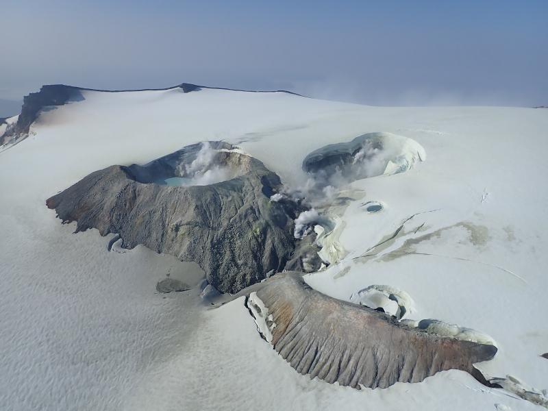
Indonesia , Merapi :
Activity report of the Merapi volcano from July 10 to 16, 2020
OBSERVATION RESULTS
Visual
The weather around Mount Merapi is generally sunny in the morning and at night, while the day until evening is foggy. There is a white smoke, from thin to thick with a low pressure. The maximum smoke height of 150 m was observed from the Mount Merapi observation post in Kaliurang on July 16, 2020 at 07:10 WIB.
Morphological analysis of the crater area based on photos of the Southeast sector showed no change in the morphology of the dome. The volume of the lava dome based on measurements using aerial photos with drones on July 11, 2020 of 200,000 m3. Relatively unchanged compared to the measurement data of June 13, 2020.
Seismicity:
This week, the seismicity of Mount Merapi recorded
11 emission earthquakes (DG),
2 deep volcanic earthquakes (VTA),
8 shallow volcanic earthquakes (VTB),
46 Multiple Phase (MP) earthquakes,
3 low frequency earthquakes (LF),
15 avalanche earthquakes (RF),
20 tectonic earthquakes (TT).
The earthquake intensity this week is relatively lower than last week.

Deformation
G. Merapi’s deformation, which was monitored by EDM this week, showed a shortening of the sensor distance of around 2 cm.
Rain and lahars:
This week there have been no reports of rain and lahars, nor additional flows in the rivers flowing down from Mount Merapi.
Conclusion
Based on the results of visual and instrumental observations, it was concluded that:
1. The lava dome is currently in a stable state.
2. The volcanic activity of Mount Merapi is still quite high and determined by the level of activity « WASPADA ».
3. The danger potential today is in the form of hot clouds from the collapse of the lava dome and explosions of volcanic material from explosive eruptions.
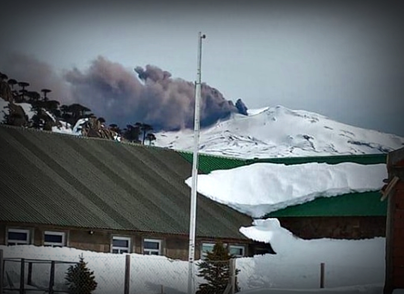
Chile , Copahue :
Copahue volcano: worrying activity.
NEUQUÉN.- The white mantle that covers the Copahue volcano has highlighted a disturbing activity recorded by the locals.
A dense column of ash was seen yesterday leaving the crater of the active volcano located between the Biobío region in Chile and Neuquén. According to what reports the National Service of Geology and Mines of Chile (Sernageomin), this behavior of the massif does not imply any danger for the inhabitants of Caviahue and the towns near Copahue. It was clarified that this is not a phenomenon that causes a change of alert in its level of activity, which remains green and is within the expected parameters of the behavior of a volcano of these characteristics.
Particle emission from the volcano occurred in the area of El Agrio crater, where smoke was constantly present, with an acid lake inside.
Real time control. It should be recalled that the Neuquén government incorporated a high-tech drone to make permanent observations from the air. The device can resist the atmosphere of an active volcano and cope with gusts of wind at altitude. Based on that reported by the aforementioned trans-Andean body, ash emission related to « a column of low temperature gas from the active crater » took place.
The eruptive impulse of the Copahue volcano reached 1 kilometer in height seen from Caviahue. It has been detailed that its behavior has presented different changes of volcanic alerts in recent years, due to its periodic movements of small magnitude …
Source et photo : minutoneuquen.com.
Alaska , Makushin :
53°53’24 » N 166°55’30 » W,
Summit Elevation 5906 ft (1800 m)
Current Volcano Alert Level: ADVISORY
Current Aviation Color Code: YELLOW
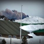
Small earthquakes have continued throughout the week at Makushin Volcano. The earthquakes are occurring within an area about 10 km (6 miles) east of the summit at a depth of about 8 km (5 miles) and are part of a sequence that began on June 15, 2020. Thus far, seismicity has been variable, though the earthquakes have generally decreased in both size and rate. At this time, the earthquake rate remains above background, but most events over the past week were smaller than M1.0 and no earthquakes were greater than M2.0. No signs of unusual activity have been noted at the surface, apart from typical steaming from the summit crater lake.
The exact cause of this increased earthquake activity, in terms of possible volcanic or tectonic processes, remains uncertain at this time. The earthquakes may be related to the movement of magma beneath the east side of Makushin Volcano, interactions between an earthquake fault and the nearby geothermal field, the activation of more than one fault in this area, or a combination of these scenarios. Because of the distance and depth of the locations of the earthquakes from the summit of Makushin Volcano, and the absence of other forms of volcanic unrest such as increased steaming, gas emission, or ground deformation, there is no indication that the present earthquake sequence will necessarily lead to a volcanic eruption.
Source : AVO .
Photo : Kern, Christoph .
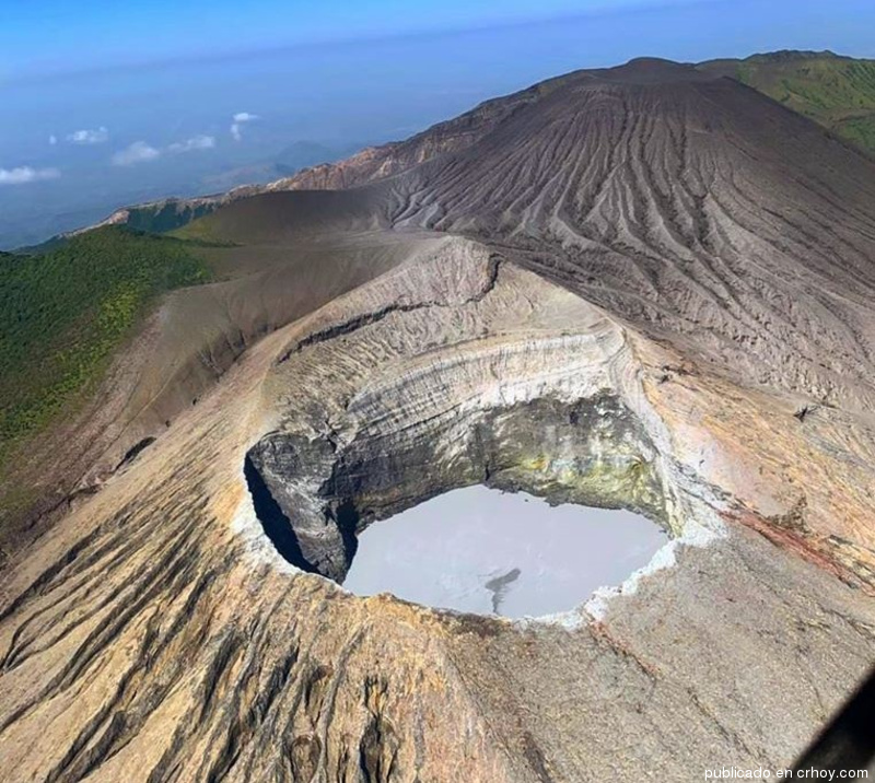
Costa Rica , Turrialba / Poas / Rincon de la Vieja / Irazu :
Daily report on the state of volcanoes. Date: July 17, 2020
Update at: 11:22:00.
Turrialba volcano:
At 12:09 p.m. local time on July 17, 2020, an eruption was recorded on the Turrialba volcano, with a column that rose 200 meters above the crater height and 3540 meters above sea level. (meters above sea level, 11611.2 ft).
Duration of activity: 1 minute.
The seismic activity is similar to that of yesterday.
At the time of this report, the winds are blowing west.
An ash-rich pulse occurred at noon yesterday along with several other very diluted emissions throughout the day. A peak in the CO2 / SO2 and H2S / SO2 ratios was recorded overnight, before returning to values similar to those of yesterday.
Poas volcano:
No eruption is reported.
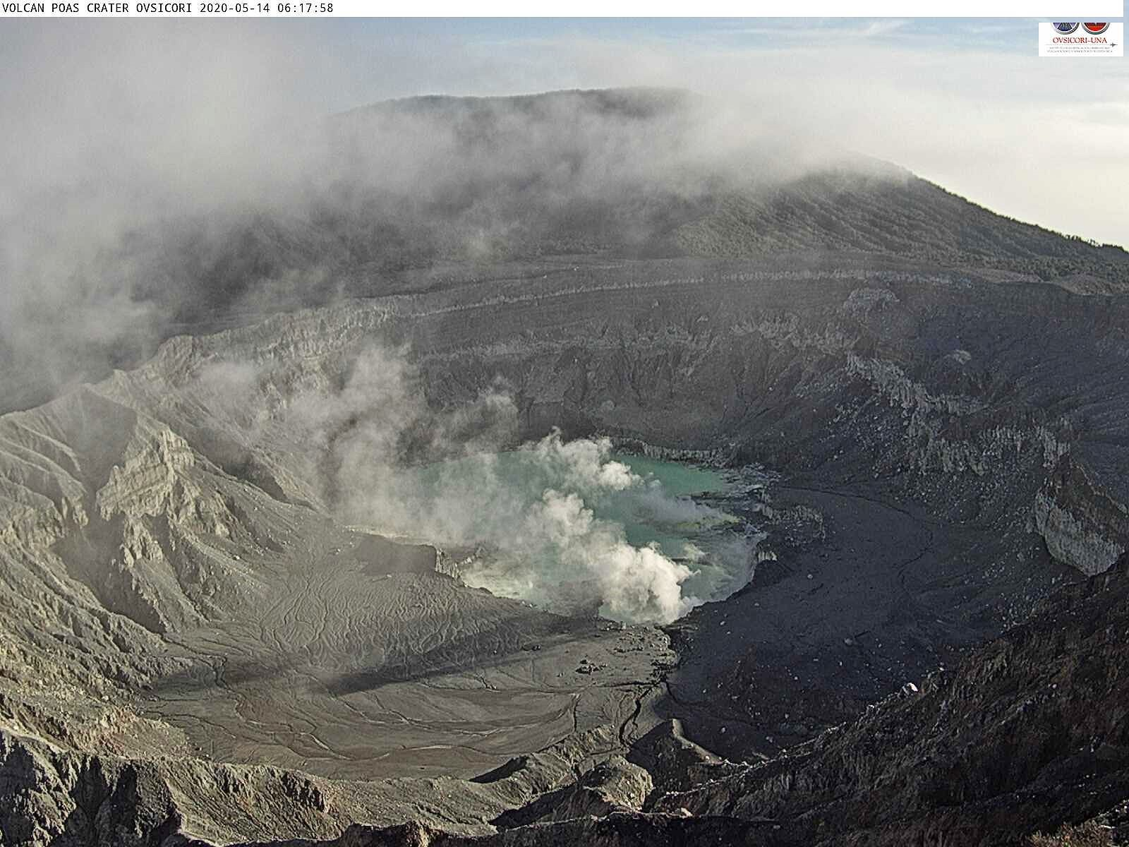
The seismic activity is similar to that of yesterday.
At the time of this report, the winds are blowing southwest.
A peak is recorded in the H2S / SO2 ratio. The park level SO2 concentration reached 4 ppm in the morning.
Rincon de la Vieja volcano:
No eruption is reported.
The seismic activity is similar to that of yesterday.
At the time of this report, the winds are blowing west.
There may have been an eruption at 3:47 p.m. yesterday when the amplitude of the seismic activity suddenly increased for an hour before almost disappearing until dawn (around 3 a.m.) when a continuous tremor of small amplitude reappeared. The cloudiness did not confirm the occurrence of the rash.
Irazu volcano:
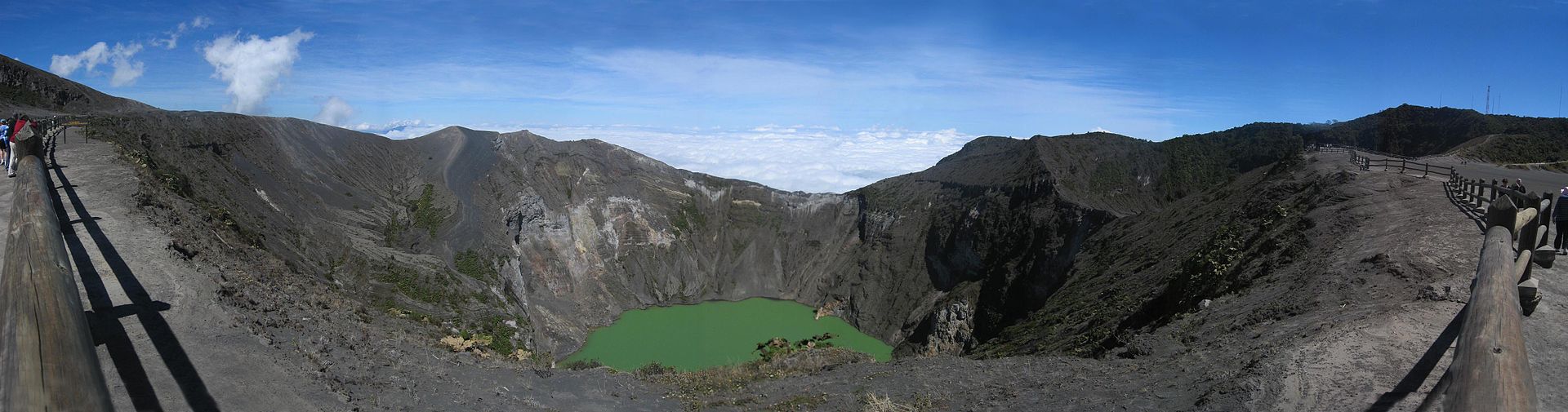
On July 13, 2020 at 9:38 p.m. local time, a landslide was recorded in the area of the aerials of the Irazú volcano, it was observed by means of the signal
which was recorded in our seismic stations located in the area. When we have more information about it, we will let you know.
Source : Ovsicori .
Photos : Ovsicori , crhoy ,Wikipedia.
Video : Ovsicori .


No comment yet, add your voice below!