
February 09 , 2020 .
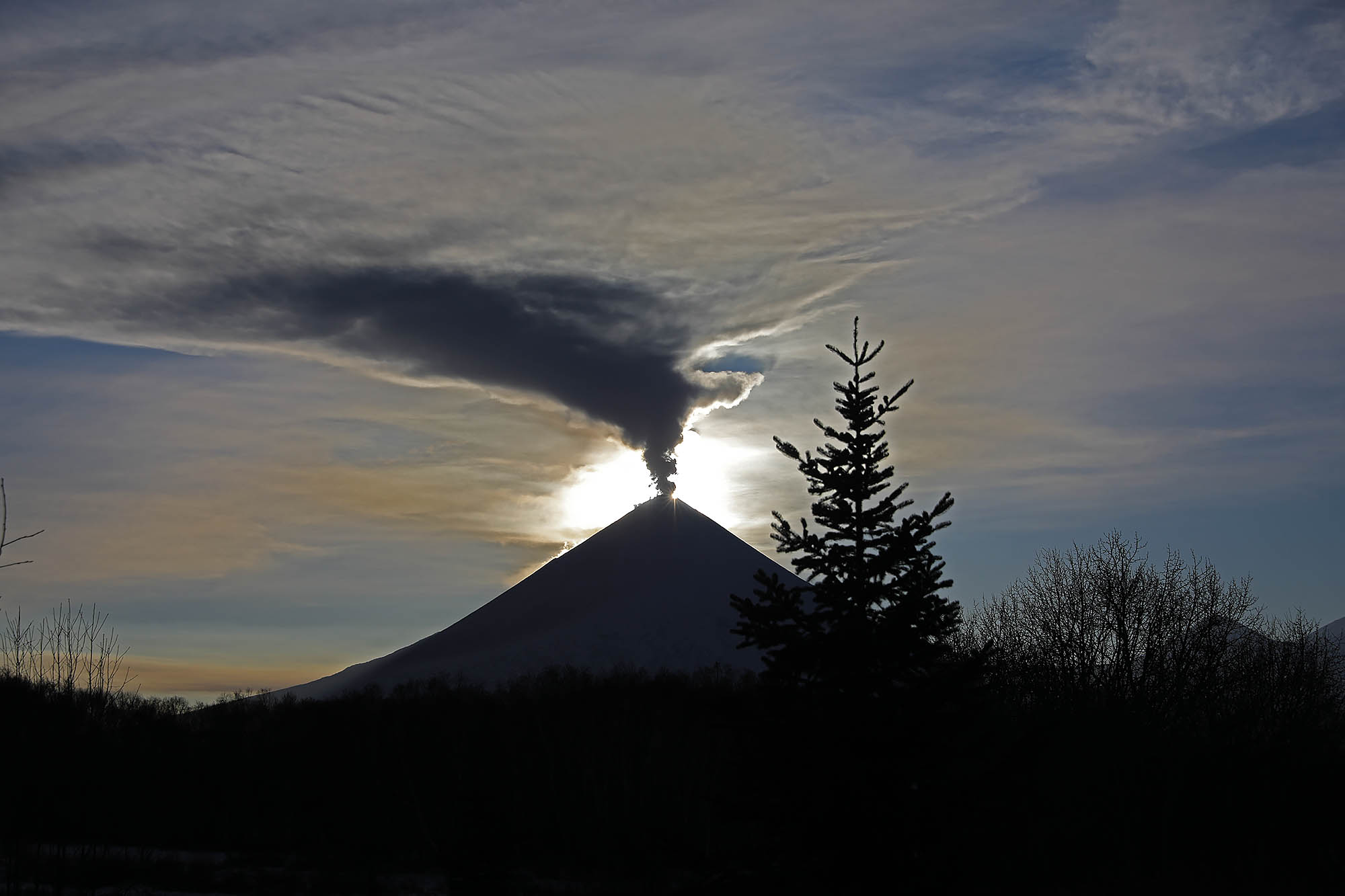
Kamchatka , Klyuchevskoy :
VOLCANO OBSERVATORY NOTICE FOR AVIATION (VONA).
Issued: February 07 , 2020
Volcano: Klyuchevskoy (CAVW #300260)
Current aviation colour code: ORANGE
Previous aviation colour code: orange
Source: KVERT
Notice Number: 2020-22
Volcano Location: N 56 deg 3 min E 160 deg 38 min
Area: Kamchatka, Russia
Summit Elevation: 15580 ft (4750 m)
Volcanic Activity Summary:
A moderate eruptive activity of the volcano continues. Weak ash plume extended about 30 km to the north-west from the volcano.
A moderate eruptive activity of the volcano continues. Ash explosions up to 16,400-23,000 ft (5-7 km) a.s.l. could occur at any time. Ongoing activity could affect low-flying aircraft.
Volcanic cloud height:
16400-18040 ft (5000-5500 m) AMSL Time and method of ash plume/cloud height determination: 20200207/2320Z – Video data
Other volcanic cloud information:
Distance of ash plume/cloud of the volcano: 19 mi (30 km)
Direction of drift of ash plume/cloud of the volcano: WNW / azimuth 290 deg
Time and method of ash plume/cloud determination: 20200207/2320Z – Video data
Source : Kvert .
Photo : Auteur Inconnu .
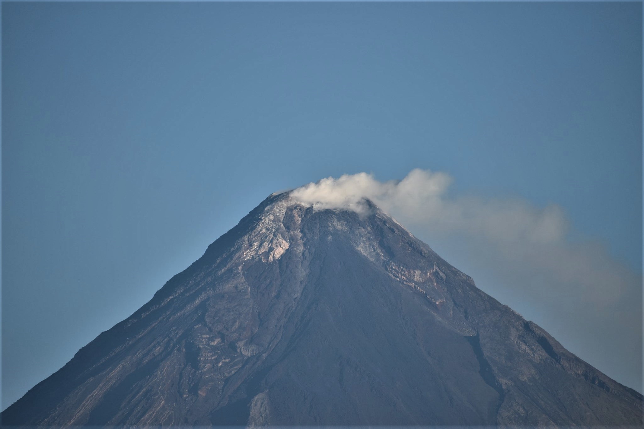
Philippines , Taal / Mayon :
TAAL VOLCANO BULLETIN 09 February 2020 8:00 A.M.
Activity in the Main Crater in the past 24 hours has been characterized by moderate emission of white to dirty white steam-laden plumes rising 200 to 300m high before drifting southwest.
Weak steaming from fissure vents along the Daang Kastila trail rising 10 to 20m high is currently ongoing. Sulfur dioxide (SO2) emission was measured at an average of 116 tonnes/day on February 8, 2020. The Taal Volcano Network recorded one hundred fifteen (115) volcanic earthquakes including two (2) low-frequency events and five (5) harmonic tremors having durations of one (1) to four (4) minutes. These earthquakes signify magmatic activity beneath the Taal edifice that could lead to eruptive activity at the Main Crater.
MAYON VOLCANO BULLETIN 09 February 2020 8:00 A.M.
Mayon Volcano’s seismic monitoring network did not detect any volcanic earthquake during the 24-hour observation period. Moderate emission of white steam-laden plumes that crept downslope before drifting west-southwest and east-northeast was observed.
Sulfur dioxide (SO2) emission was measured at an average of 115 tonnes/day on 10 January 2020. Recent electronic tilt data showed inflation trend on the northwest and northeastern sectors of the volcanic edifice that began in the last quarter of 2019. This is consistent with continuous GPS data which also showed inflation of the edifice since February 2019.
Source : Phivolcs .
Photos : Julien Monteillet via 80 Jours Voyages ( https://80joursvoyages.com/ ) .
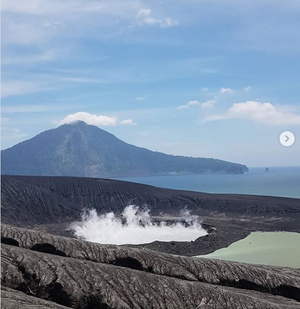
Indonesia , Anak Krakatau :
VOLCANO OBSERVATORY NOTICE FOR AVIATION – VONA.
Issued: February 08 , 2020 .
Volcano: Anak Krakatau (262000)
Current Aviation Colour Code: ORANGE
Previous Aviation Colour Code: orange
Source: Anak Krakatau Volcano Observatory
Notice Number: 2020KRA07
Volcano Location: S 06 deg 06 min 07 sec E 105 deg 25 min 23 sec
Area: Lampung, Indonesia
Summit Elevation: 502 FT (157 M)
Volcanic Activity Summary:
Eruption with volcanic ash cloud at 11h10 UTC (18h10 local)
Volcanic Cloud Height:
Ash-cloud is not visible
Other Volcanic Cloud Information:
Ash cloud is moving to North-West from Anak Krakatau
Remarks:
Seismic activity is characterized by continuous volcanic tremor.
Level of activity at level II (Waspada), since March 25, 2019. The Anak Krakatau (157 m above sea level) has experienced an increase in its volcanic activity since June 18, 2018, which was followed by a series of eruptions in the period from September 2018 to February 2019.
Volcano covered with fog. No smoke from the crater is observed. The weather is sunny to rainy, the winds are weak to strong towards the North-East, the East and the North-West. The temperature is around 24.5 to 29.7 ° C.
According to the seismographs of February 8, 2020, it was recorded:
3 eruption earthquakes.
1 low frequency earthquake
2 Hybrid earthquakes / Multiple phase
4 continuous tremors, amplitude 0.5-16 mm (dominant value 2 mm)
Recommendation: People / tourists are not allowed to approach the crater within a radius of 2 km.
Source : Magma Indonésie , PVMBG.
Photo : Tapani .
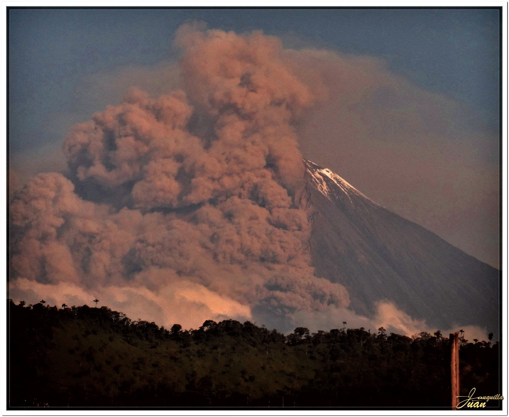
Ecuador , Sangay :
Information Bulletin, FRIDAY 07 FEBRUARY 2020
In the early morning, an ash emission was recorded, additional pyroclastic flows were observed on the southwest flank. Currently, ash falls are reported in the cantons of Alausí, Guamote and Chunchi, province of Chimborazo
The Geophysical Institute of the National Polytechnic School monitors activity on the volcano and will report any changes that may be recorded.
Gas flow (SO2, ton / day): 2715.0 +/- 3292.0, 2 validated measurements.
Rains / lahars: There was no rain. In case of heavy rain, the accumulated volcanic material can be remobilized, generating mudslides and debris (secondary lahars) in the Volcan and Upano rivers.
Emissions / Ashes column: During the afternoon of yesterday, thanks to satellite images, several ash emissions were observed with an approximate height between 500 and 1200 meters above the level of the crater oriented towards the North-west.
Alert level: yellow.
Source : IGEPN.
Photo : Janquillo Juan via Shérine France .
Costa Rica , Poas / Rincon de la Vieja :
Poás Volcano:
Seismic activity remains highly variable, dominated by LP-type earthquakes of low amplitude and intermittent tremors of very low amplitude. Although the deformations are not significant, an extension pattern is observed in the 4 GPS stations located at the top, with a little inflation. The SO 2 / CO 2 ratio shows a slow increase in the values normally associated with increased activity.
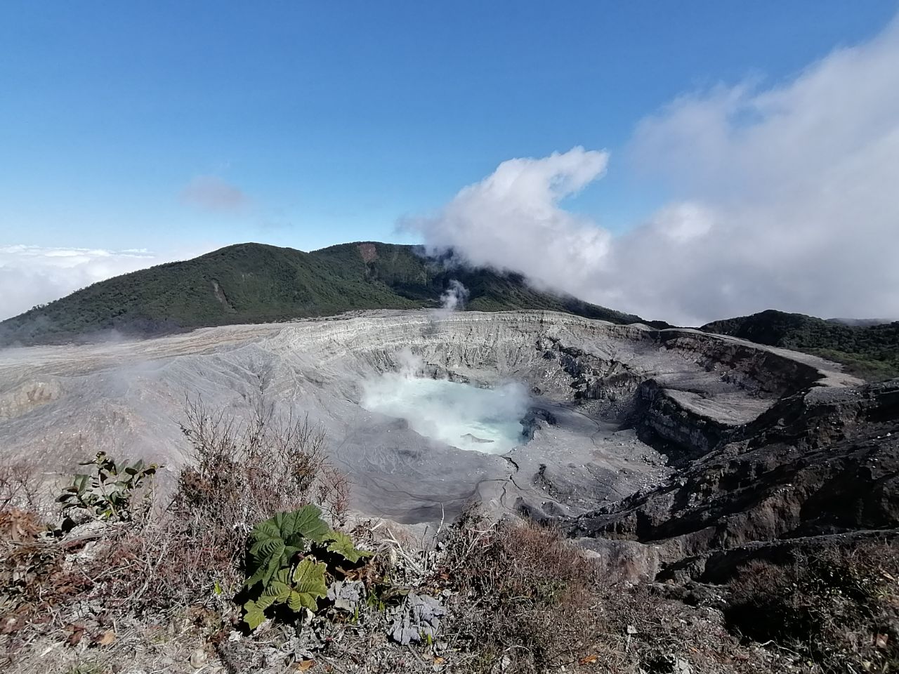
There is no detectable H 2 S, which corresponds to a less hydrothermal influence on the magmatic gases. The point of view SO 2 concentration reached 7 ppm last week. The lake level is stable. The activity level of the volcano is 3 considering that the possibility of eruptions remains high compared to the previous months.
Rincon de la Vieja volcano:
Since the end of January, the Rincón de la Vieja volcano has shown an increase in its seismicity, both with LP-type earthquakes and tremors. On January 28 and 29, two small phreatic eruptions were recorded. On January 30 at 12:13 p.m., a phreatic eruption was observed which projected lake sediments and ash up to 100 meters high and the gas plume rose between 1500 and 2000 m above the level from the crater, i.e. up to 3,400 – 3,900 m above sea level.
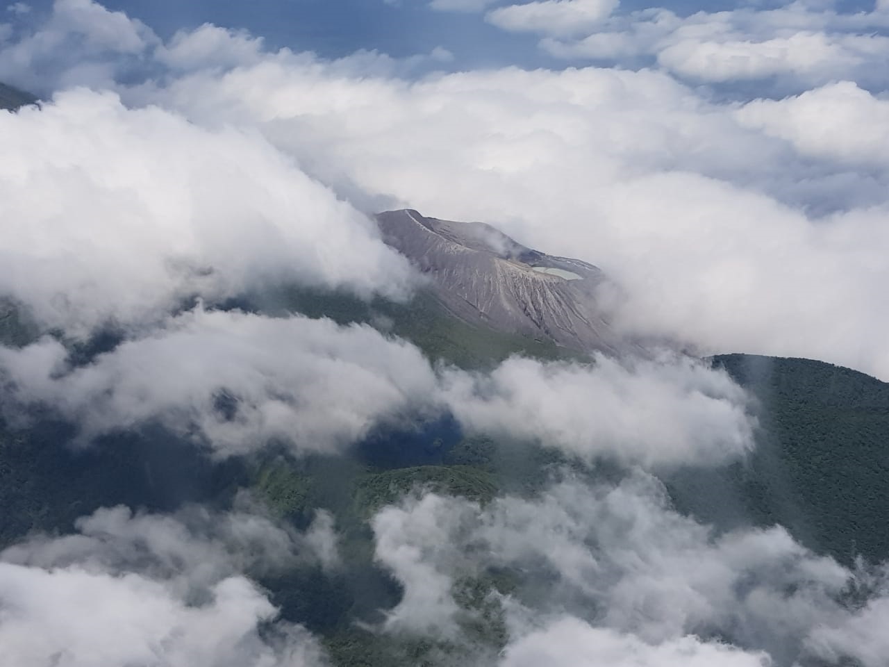
This eruption generated pyroclastic density currents (PDC: pyroclastic density currents) up to> 2 km from the crater and the lahars which descended by the rivers north of the volcano, reaching the populated areas, between 4 to 10 km, passing through Buenos Aires from Upala therefore only 40 minutes after the eruption (according to reports by the local population). No damage has been reported. From this event, the seismicity decreased, but remains with intermittent tremors. There is no significant deformation, but a tendency for the volcanic building to contract. The activity level of the volcano remains at 3 considering that the possibility of eruptions remains.
Source : Ovsicori .
Photos : RSN , Dr. Paulo Ruiz (réseau sismologique national) et Dr. Cyril Muller (ovsicori).


No comment yet, add your voice below!