September 20 , 2023.
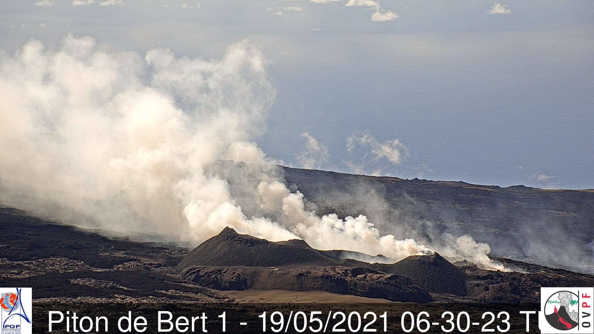
Italy , Stromboli :
WEEKLY BULLETIN, from September 11, 2023 to September 17, 2023. (issue date September 19, 2023)
SUMMARY STATEMENT OF ACTIVITY
In light of the monitoring data, it appears:
1) VOLCANOLOGICAL OBSERVATIONS: During this period, normal Strombolian activity was observed with splashing activity in the North Crater area. The total hourly frequency fluctuated between medium values (11 events/h) and high values (19 events/h). The intensity of the explosions varied from low to medium in the North Crater area and from low to high in the South-Central area.
2) SISMOLOGY: The monitored seismological parameters do not show significant variations.
3) GROUND DEFORMATIONS: The island’s ground deformation monitoring networks did not show significant variations during the period studied.
4) GEOCHEMISTRY: Mid-level SO2 flux.
The CO2 flow in the Pizzo area shows stable values at average levels.
There is no update on the C/S ratio in the plume.
There is no update on the isotope ratio of dissolved helium in groundwater.
5) SATELLITE OBSERVATIONS: Thermal activity observed by satellite was generally at a moderate level.
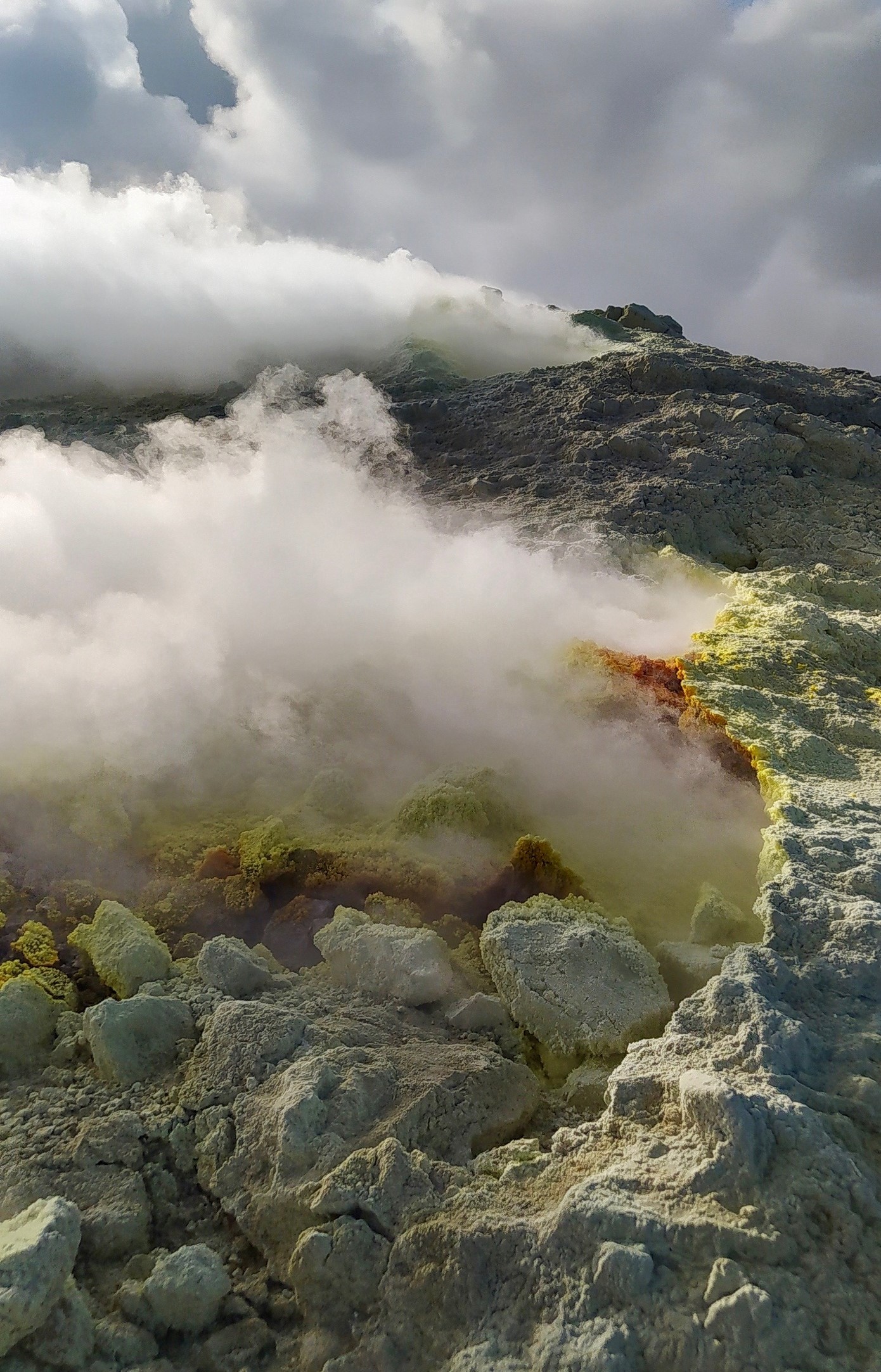
VOLCANOLOGICAL OBSERVATIONS
In the observed period, the eruptive activity of Stromboli was characterized through the analysis of images recorded by the INGV-OE surveillance cameras at altitude 190m (SCT-SCV), from
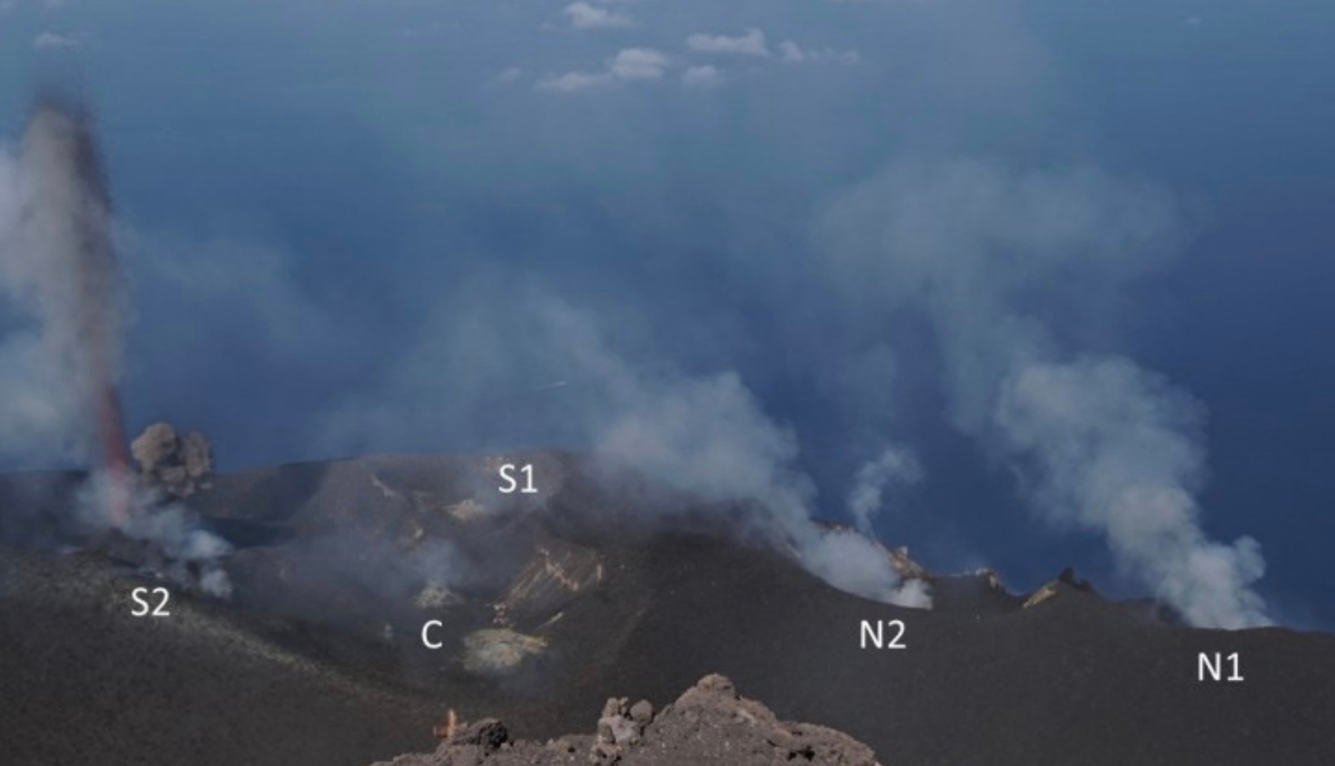
Pizzo and Punta dei Corvi. The explosive activity was mainly produced by 3 (three) eruptive vents located in the North area of the crater and by 3 (three) vents located in the South Central area.
Observations of explosive activity captured by surveillance cameras
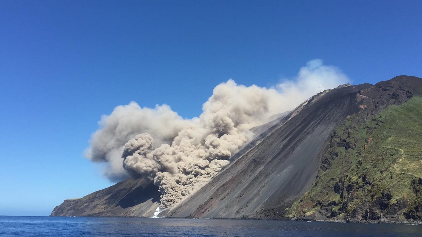
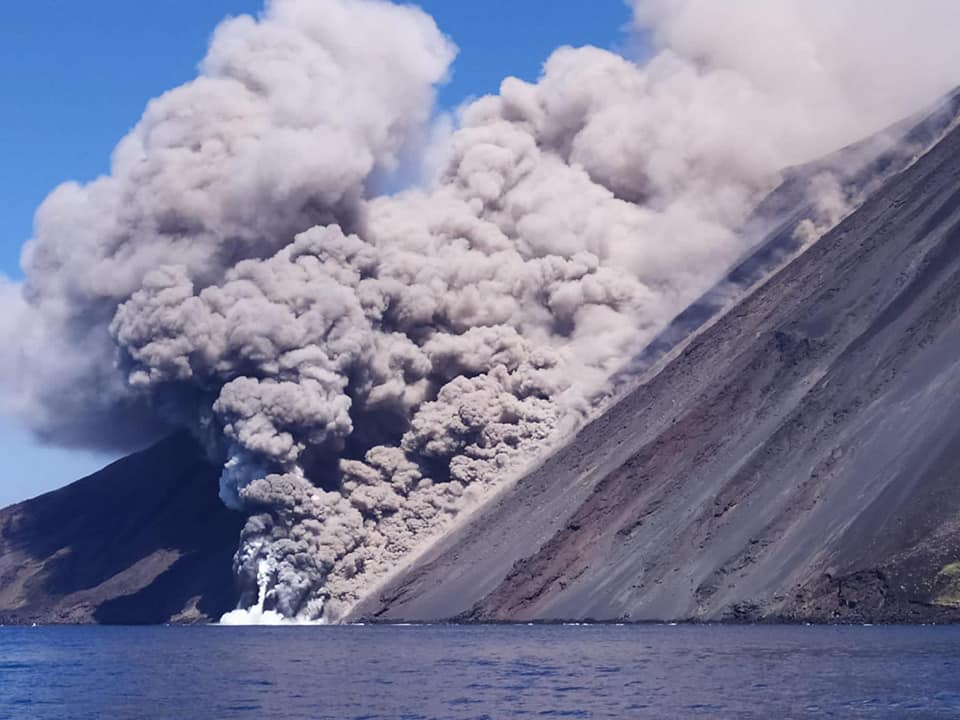
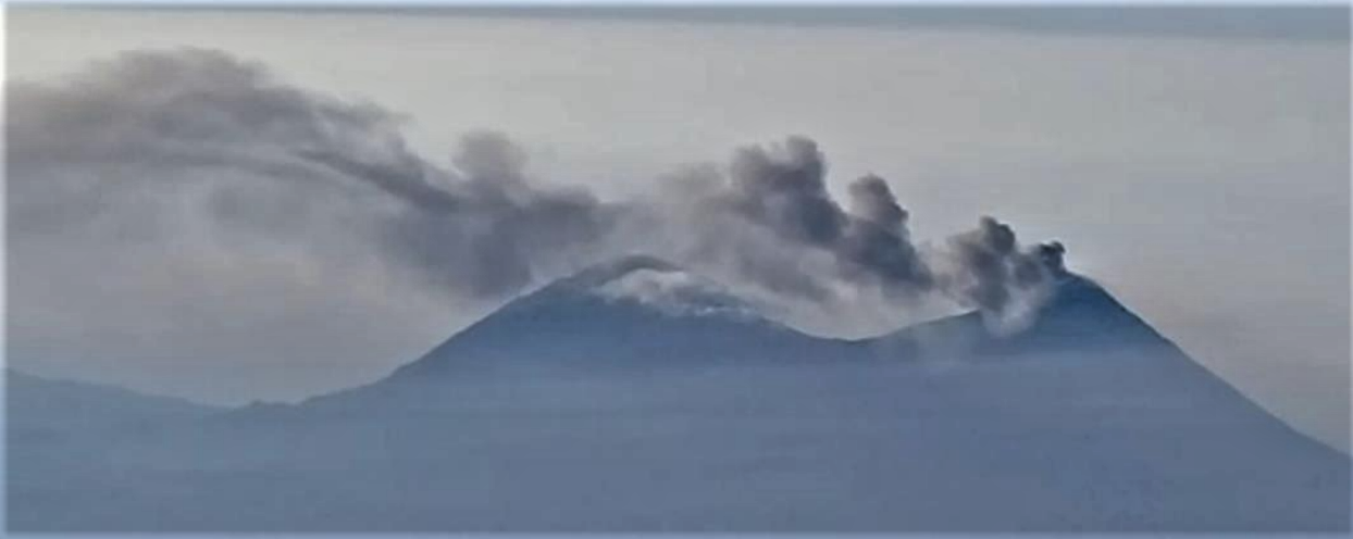
In the area of the North crater (N), with two vents located in sector N1 and one in sector N2, explosive activity of varying intensity from low (less than 80 m high) to medium (less than 150 m high). top) was observed. The products emitted in the eruption were mainly coarse materials (bombs and lapilli) sometimes mixed with fine materials (ashes). Furthermore, projection activity was observed in sector N1 which was intense on September 12. The average frequency of explosions fluctuated between 5 and 10 events/h.
In the South-Central (CS) zone, sectors S1 and C did not show significant activity while sector S2, with three active vents, even simultaneously, mainly showed explosive activity of variable intensity of low to high (more than 150 m in height), emitting coarse matter mixed with fine ashes. The average frequency of explosions oscillated between 6 and 9 events/h.
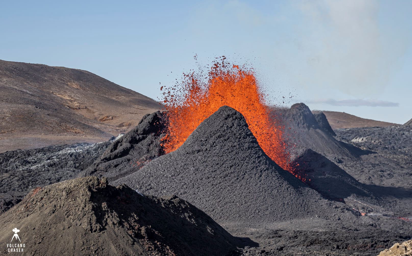
Field observations of September 11, 2023
On the morning of September 11, an inspection was carried out in the summit area in order to check the morpho-structural structure of the crater area and to observe the explosive activity produced by the crater areas.
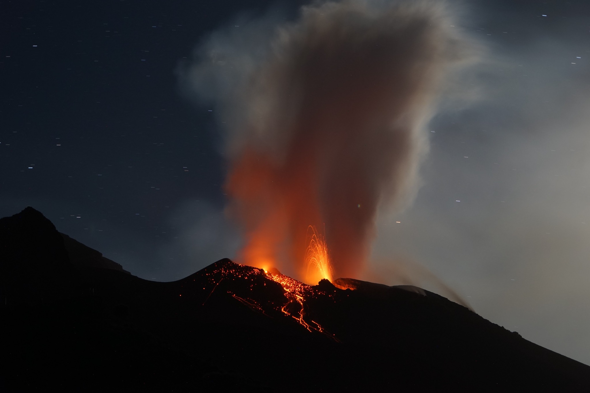
In the area of the North crater, in sector N1, a very intense explosive activity was observed with the launch of coarse materials mainly towards the Sciara del Fuoco and the external side of the cone and a discontinuous projection activity both in frequency and in intensity, while in sector N2, two vents were noted with intense deflagrations linked to gas explosions, associated with weak and episodic projection activity coming only from the most central vent.
In the South-Central zone of the crater, in sector C, continuous degassing of the most central cone and alternating blasts with continuous degassing of the 2 hornitos were observed. In sector S1 there was a hornito characterized by slight degassing. In sector S2, activity was visible from at least 4 vents: a hornito near sector C which produced very noisy blast activity associated with discontinuous splashes; in addition, a second vent was adjacent to the previous one with frequent degassing alternating with modest explosions. From the other two vents in sector S2, violent vertical launches of mainly coarse material often occurred from the bulky hornito positioned in a near central position in the sector, often associated with a vent probably placed to the side of the hornito itself in which visible oblique emissions of ash were generated.
The products of the explosions in sector S2 fell back inside the crater terrace as they were almost vertical because there was no wind at high altitude. A sampling of fresh lapilli was carried out in the area near Fortini (under Pizzo towards Ginostra).
Source : INGV
Photos : G Costa , INGV
Peru , Ubinas :
Analysis period: September 11 to 17, 2023. Arequipa, September 18, 2023.
Alert level: ORANGE
The Geophysical Institute of Peru (IGP) reports that the eruptive processes of the Ubinas volcano (Moquegua region) maintain low to moderate levels. During this period, a volcanic explosion and gas emissions were recorded which reached up to 2600 m above the summit of the volcano. For this, it is suggested that the authorities maintain the volcanic alert level at Orange level.
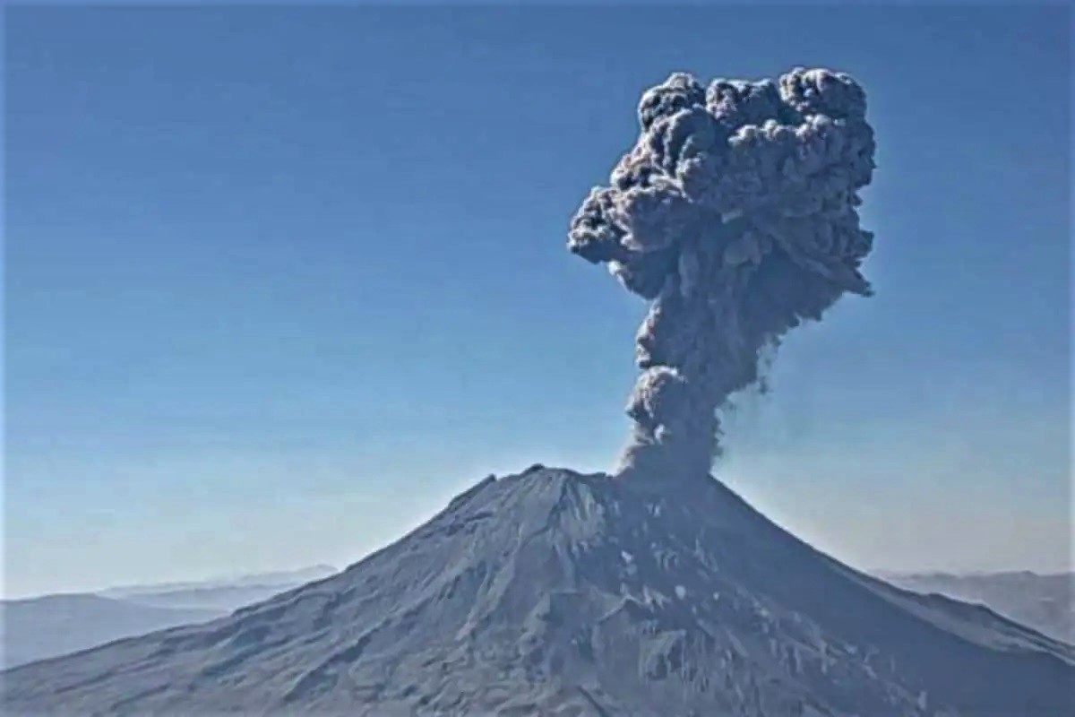
During the analysis period, the occurrence of 144 volcano-tectonic (VT) type earthquakes was detected, associated with rock rupture processes that occur inside the volcano. In addition, 86 long-period (LP) seismic signals were recorded, associated with the movements of volcanic fluids (gas and magma), with a maximum energy of 0.3 Megajoules. During this period, a volcanic explosion was recorded on September 14, as well as 3 hours accumulated per day of seismic tremor in relation to ash emissions observed between September 14 and 16.
Surveillance cameras made it possible to identify emissions of gas and water vapor which reached heights of 2600 m above the summit of the volcano, which were dispersed mainly towards the South, South-East, East sectors. and North-East of the Ubinas volcano with a radius of 15 km. On the other hand, monitoring of the deformation of the volcanic structure shows variations of less than 5 mm of displacement (slight tendency towards inflation). Satellite monitoring has not shown thermal anomalies in the Ubinas crater.
RECOMMENDATIONS
• Keep the volcanic alert level at ORANGE level.
Source : Cenvul.
Photo : Ingemmet
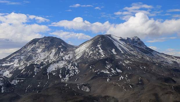
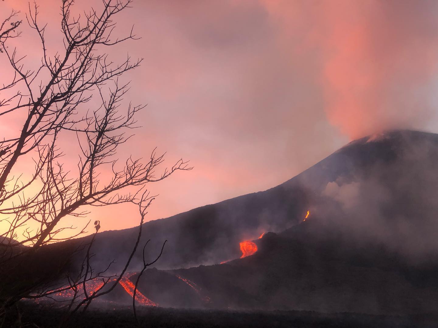
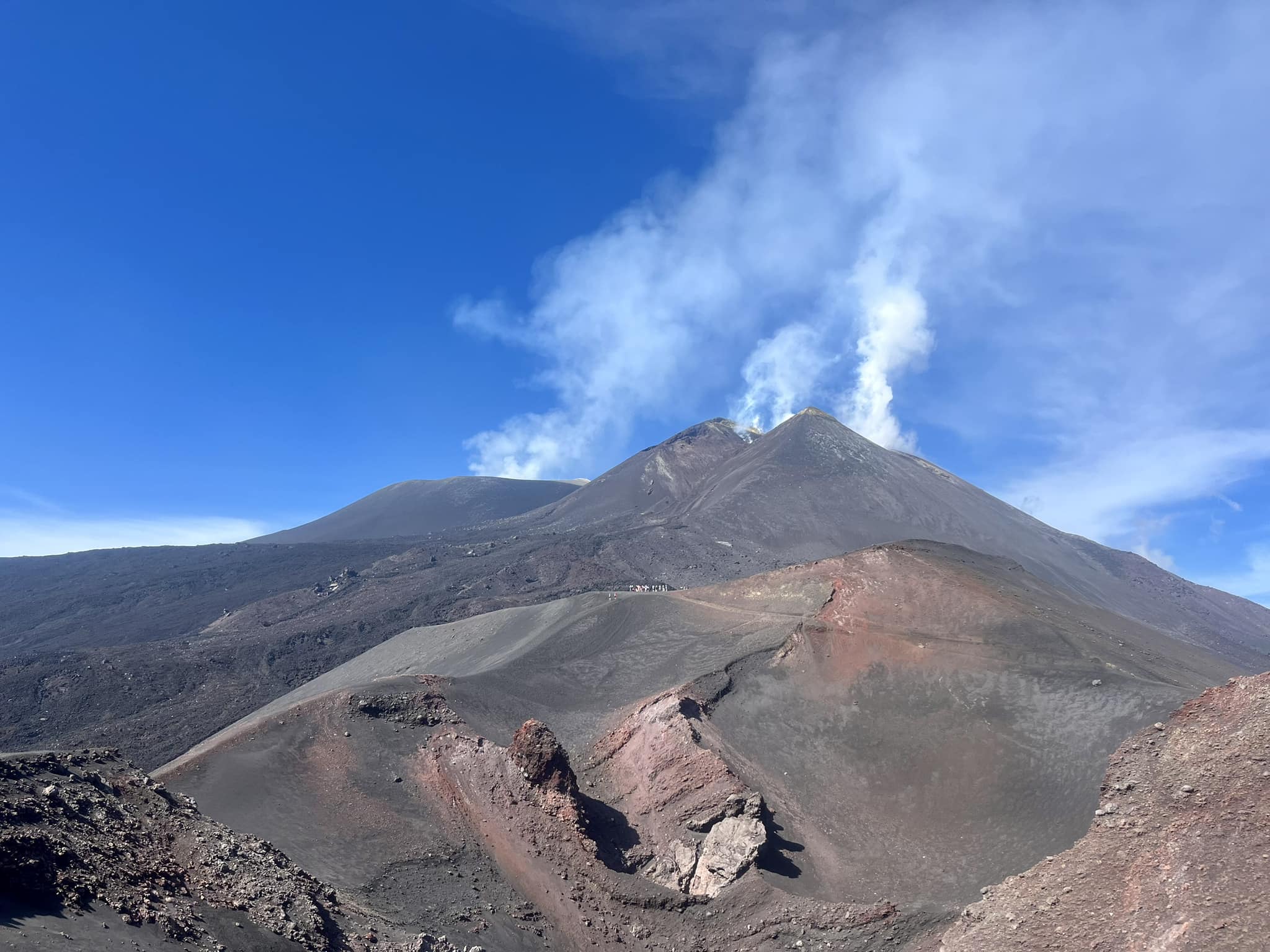
Italy / Sicily , Etna :
WEEKLY BULLETIN, from September 11, 2023 to September 17, 2023. (issue date September 19, 2023)
SUMMARY STATEMENT OF ACTIVITY
In light of the monitoring data, it appears:
1) VOLCANOLOGICAL OBSERVATIONS: Degassing activity at the summit craters of the Bocca Nuova crater and the South-East crater.
2) SEISMOLOGY: Low seismic activity due to fracturing. Stationarity of volcanic tremor parameters.
3) INFRASOUND: Moderate to weak infrasound activity.
4) GROUND DEFORMATIONS: Over the past week, ground deformation monitoring networks have not recorded any significant changes.
5) GEOCHEMISTRY: SO2 flux at medium level
Soil CO2 flux slightly increasing compared to average values.
There is no update on the helium isotope ratio.
The partial pressure of dissolved CO2 does not show significant variations.
6) SATELLITE OBSERVATIONS: Thermal activity observed by satellite was generally weak.
VOLCANOLOGICAL OBSERVATIONS
During the reference week, monitoring of the activity of Etna was carried out through the network of surveillance cameras of the INGV – Osservatorio Etneo (INGV-OE) and through field observations carried out during certain inspections carried out by INGV-OE staff in the summit area.
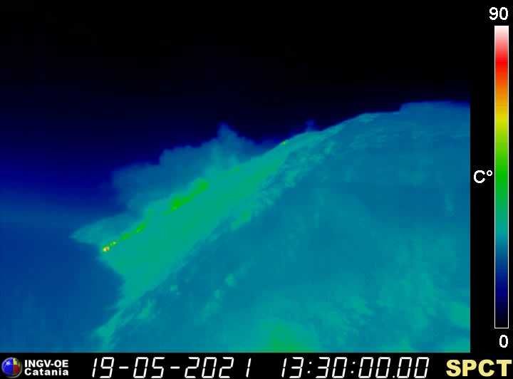
During the observation days, the activity of Etna’s summit craters continued to be dominated by an intense degassing regime mainly affecting the Bocca Nuova (BN) crater. As observed in recent months, the gases emitted by this crater are characterized by a high temperature (~500 degrees) which is reflected in the flashes visible at night through the INGV surveillance cameras; on September 13 in particular, there was a transient degassing with particularly high temperatures observed by thermal surveillance cameras. The second gas contribution to Etna’s volcanic plume comes from the Southeast Crater (SEC), and is produced by the two vents located in the eastern sector of the cone by the numerous fumaroles located along the crater rim. Finally, the North-East crater (CNE) and the Voragine crater (VOR) showed, the first a weak fumarolic activity while the second showed no specific volcanic activity.
Source : INGV.
Photo : Etna guide ,
Indonesia , Semeru :
VOLCANO OBSERVATORY NOTICE FOR AVIATION – VONA
Issued : September 20 , 2023
Volcano : Semeru (263300)
Current Aviation Colour Code : ORANGE
Previous Aviation Colour Code : orange
Source : Semeru Volcano Observatory
Notice Number : 2023SMR301
Volcano Location : S 08 deg 06 min 29 sec E 112 deg 55 min 12 sec
Area : East java, Indonesia
Summit Elevation : 11763 FT (3676 M)
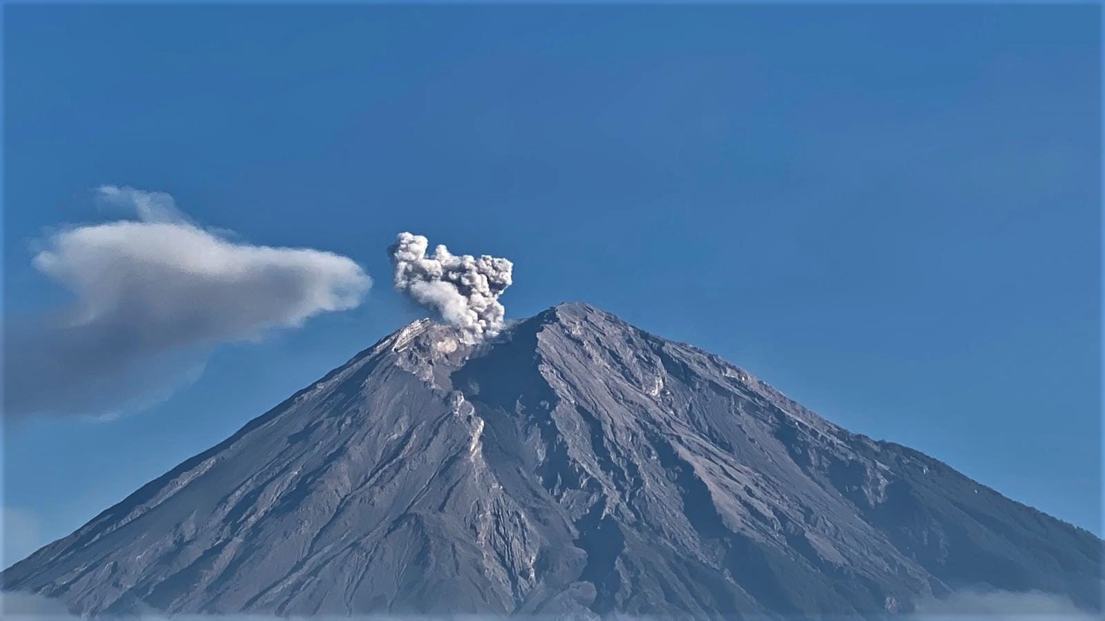
Volcanic Activity Summary :
Eruption with volcanic ash cloud at 01h50 UTC (08h50 local).
Volcanic Cloud Height :
Best estimate of ash-cloud top is around 13683 FT (4276 M) above sea level or 1920 FT (600 M) above summit. May be higher than what can be observed clearly. Source of height data: ground observer.
Other Volcanic Cloud Information :
Ash cloud moving to north. Volcanic ash is observed to be gray. The intensity of volcanic ash is observed to be medium.
Remarks :
Eruption recorded on seismogram with maximum amplitude 22 mm and maximum duration 100 second.
Source : Magma Indonésie
Photo : Andi Volcanist.
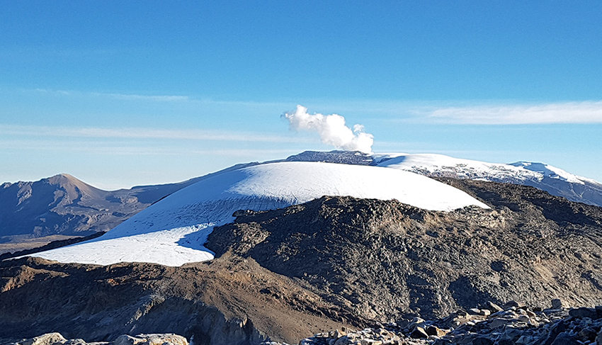
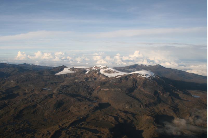
Colombia , Nevado Santa Isabel :
Nevado Santa Isabel Dome Complex Weekly Activity Bulletin
From the monitoring of the activity of the NEVADO SANTA ISABEL DOMES COMPLEX, the MINISTRY OF MINES AND ENERGY through the COLOMBIAN GEOLOGICAL SERVICE (SGC) reports that:
Due to the change in the system for measuring volcanic activity in the country that was presented on September 14, 2023 (Colombia modifies its system for measuring volcanic activity ), this volcanic structure goes to “yellow alert”. Indeed, since 2013, seismic activity has occurred at moderate levels, above its base level, characteristic of the Yellow volcanic activity alert state. In addition, certain geodetic data modeling work has shown a possible source of deformation towards the northwest sector of this volcanic structure. For all this, the SGC considers that this complex of domes must be placed on alert due to yellow volcanic activity: changes in the behavior of the base level of the monitored parameters and other manifestations.
For this reason, a bulletin on the activity of this volcanic structure will be published every week.
In the week of September 12 to 18, 2023, the low recording of seismicity linked to the fracturing of rocks inside the volcanic edifice continued. This seismic activity decreased in number of earthquakes recorded and seismic energy released, compared to the previous week. The earthquakes were of low energy (magnitude less than 1) and were located in the East and South-West sector, at an approximate distance of 4 to 5 km and at depths of between 4 and 5 km from the summit of the volcano.
The other parameters measured and used for the diagnosis of volcanic activity did not present significant changes during the period evaluated.
The alert status for volcanic activity remains at: YELLOW ALERT: ACTIVE VOLCANO WITH CHANGES IN THE BEHAVIOR OF THE BASE LEVEL OF MONITORED PARAMETERS.
Source : SGC
Photo : Helmer Parra