July 20 , 2022.
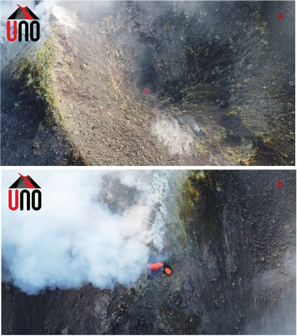
Italy / Sicily , Etna :
WEEKLY BULLETIN from July 07, 2022 to July 07, 2022 (Issue date July 19, 2022)
ACTIVITY STATUS SUMMARY
In the light of the surveillance data, it is highlighted:
1) VOLCANOLOGICAL OBSERVATIONS: Degassing activity of the summit craters, mainly carried out by the Bocca Nuova crater.
2) SEISMOLOGY: Low seismic activity of fracturing; average amplitude of the volcanic tremor on a medium-high level.
3) INFRASOUND: Moderate to high infrasound activity with sources concentrated in the Bocca Nuova crater area.
4) GROUND DEFORMATIONS: Signals from deformation networks did not show significant changes in this reference week
5) GEOCHEMISTRY: SO2 flux at an average level.
Soil CO2 flux shows average values.
The partial pressure of dissolved CO2 in the aquifer shows values in seasonal variability.
There are no updates on the isotope ratio of helium. The latest data related to 06/23/2022 and was at medium-high values.
6) SATELLITE OBSERVATIONS: The thermal activity observed by satellite in the summit area was weak.
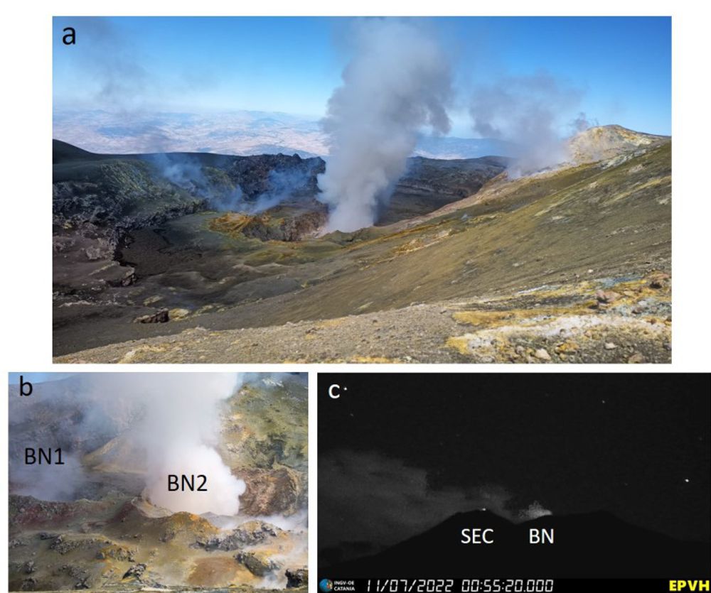
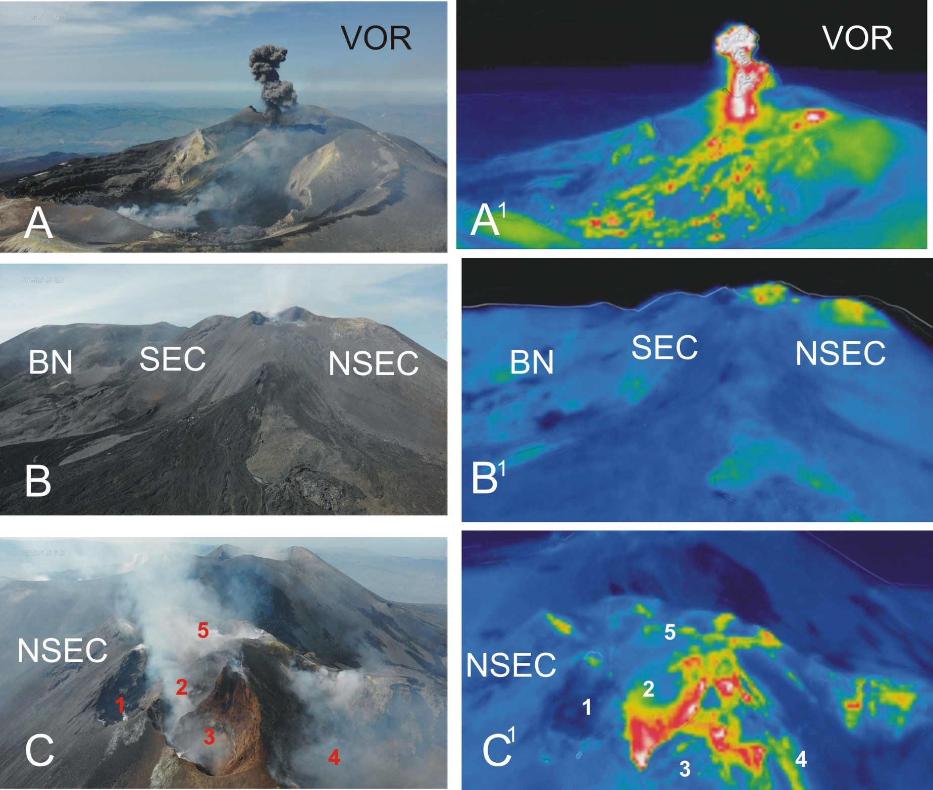
a) Bottom of the Bocca Nuova taken from the northern edge of the Voragine; b) BN1 and BN2 collapse craters present at the bottom of Bocca Nuova; c) nocturnal flashes of the Bocca Nuova filmed by the visible camera of Piedimonte. Photos a) and b) by F. Ciancitto, taken during the inspection on 16 July.
VOLCANOLOGICAL NOTES
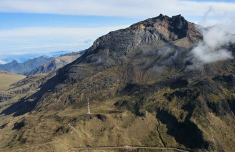
During the week in question, the monitoring of the volcanic activity of Etna was carried out through the analysis of images from the network of surveillance cameras of the INGV, Osservatorio Etneo Observatory (INGV-OE) and a inspection carried out Saturday, July 16 in the summit area by INGV-OE staff. The state of activity of the summit craters of Etna (Bocca Nuova, BN; South-East Crater, SEC; North-East Crater, NEC; Voragine, VOR) was also observed thanks to the analysis of data extrapolated to from the P72A aircraft of the 41st group of the Italian Air Force (AM); visible and infrared data were acquired during an overflight performed on July 11 as part of an exploratory collaborative process between INGV and AM (Fig. 3.2 a, b).
In general, the state of activity of the summit craters did not show significant changes compared to what was observed during the last week, and was characterized by degassing activities, mainly carried out by Bocca Nuova .
In particular, the two collapse craters present inside the Bocca Nuova, were characterized by degassing. Specifically, during the July 11 flyby and July 16 inspection, the BN1 vent showed variable rate and pulsating degassing, while the BN2 showed intense degassing with continuous emission of reddish ash, which rapidly diluted in the atmosphere. During the inspection, occasional rumblings were heard coming from the bottom. At night, images from the CCTV system showed lightning in correspondence with the collapse craters.
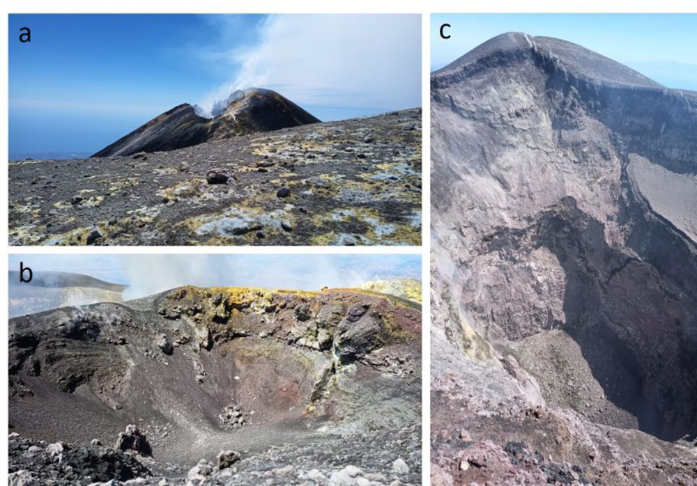
a) Fumarolic degassing of the southeast crater seen from the southeast edge of Bocca Nuova; b) obstructed bottom of the main cone present in the Voragine; c) obstructed floor of the northeast crater, taken from the southern edge of the crater. Photo by F. Ciancitto, taken during the July 16 inspection.
The Southeast crater showed modest degassing produced by a fumarolic field located on the rim of the crater. The Voragine crater and the North-East crater had the bottom clogged with debris and did not present thermal and degassing anomalies, except of fumarolic type.
Source : INGV
Photos : INGV , F. Ciancitto .
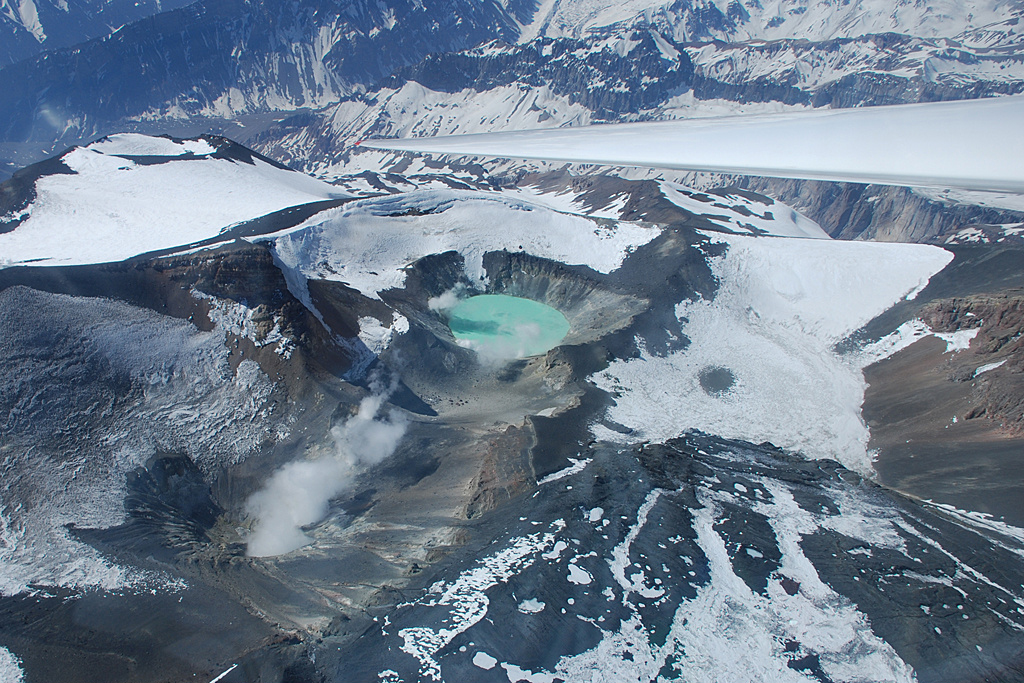
Hawaii , Lōʻihi :
HAWAIIAN VOLCANO OBSERVATORY INFORMATION STATEMENT. U.S. Geological Survey , Sunday, July 17, 2022, 2:53 PM HST (Monday, July 18, 2022, 00:53 UTC)
KAMA’EHUAKANALOA (Lōʻihi) (VNUM #332000)
18°55’12 » N 155°16’12 » W,
Summit Elevation -3199 ft (-975 m)
Current Volcano Alert Level: UNASSIGNED
Current Aviation Color Code: UNASSIGNED

HAWAIIAN VOLCANO OBSERVATORY INFORMATION STATEMENT
HVO has revised the format of earthquake information statements; the new format includes the same information as that provided in HVO’s past earthquake information statements.
Increased seismic activity beneath Kamaʻehuakanaloa (Lōʻihi) seamount, south of the Island of Hawaiʻi, began at approximately 2:00 a.m. HST on July 16, 2022. The U.S. Geological Survey’s Hawaiian Volcano Observatory detected seismic tremor marked by pulses of seismic energy every 15-20 seconds, which is still ongoing at the time of this release. Approximately 24 hours after this activity began, two dozen M1.8-M3.0 earthquakes occurred from 1:30 a.m. to 6:00 a.m. on July 17th.
According to HVO Scientist-in-Charge Ken Hon “This seismic activity is likely the result of magma movement beneath Kamaʻehuakanaloa seamount and currently shows no sign of leading to an eruption. If the swarm intensifies or changes significantly, HVO will issue an additional notice. Because of the great depth of the volcano within the ocean and style of Hawaiian eruptions, an eruption of Kamaʻehuakanaloa would pose no threat to the Island of Hawaiʻi. Neither Mauna Loa nor Kīlauea volcanoes show any change in activity associated with this earthquake swarm.”
Source : HVO.
Photo : HVO ( archive) .
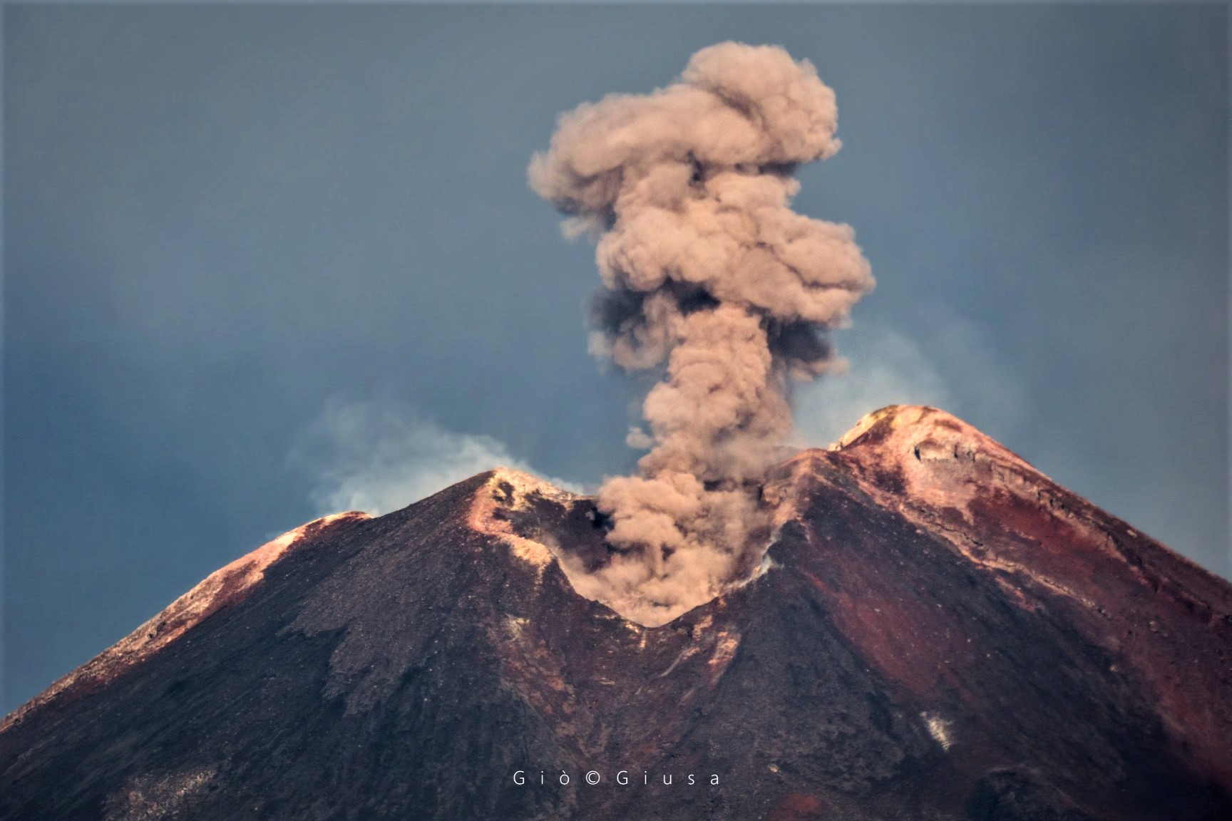
Kamchatka , Sheveluch :
VOLCANO OBSERVATORY NOTICE FOR AVIATION (VONA)
Issued: July 20 , 2022.
Volcano: Sheveluch (CAVW #300270)
Current aviation colour code: ORANGE
Previous aviation colour code: orange
Source: KVERT
Notice Number: 2022-78
Volcano Location: N 56 deg 38 min E 161 deg 18 min
Area: Kamchatka, Russia
Summit Elevation: 3283 m (10768.24 ft), the dome elevation ~2500 m (8200 ft)
Volcanic Activity Summary:
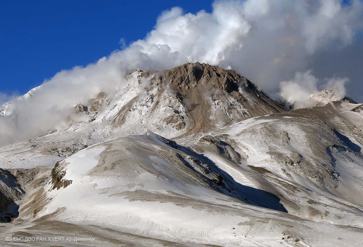
A growth of the lava dome continues, a strong fumarolic activity, and an incandescence of the lava dome, explosions, and hot avalanches accompanies this process. Video data by KVERT showed an ash plume up to 5 km a.s.l. extending to the east from the volcano.
The extrusive eruption of the volcano continues. Ash explosions up to 10-15 km (32,800-49,200 ft) a.s.l. could occur at any time. Ongoing activity could affect international and low-flying aircraft.
Volcanic cloud height:
5000 m (16400 ft) AMSL Time and method of ash plume/cloud height determination: 20220720/0508Z – Video data
Other volcanic cloud information:
Distance of ash plume/cloud of the volcano: 15 km (9 mi)
Direction of drift of ash plume/cloud of the volcano: E
Time and method of ash plume/cloud determination: 20220720/0508Z – Video data
Source : Kvert.
Photo : Yu. Demyanchuk, IVS FEB RAS, KVERT
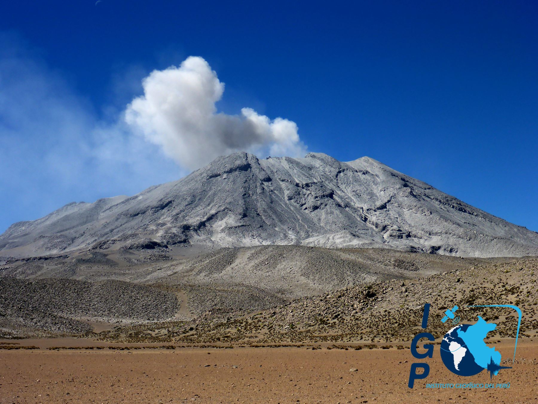
Chile , Tupungatito :
Special Report on Volcanic Activity (REAV), Santiago Metropolitana Region, Tupungatito Volcano, July 19, 2022, 2:58 p.m. local time (mainland Chile).
The National Service of Geology and Mines of Chile (Sernageomin) publishes the following PRELIMINARY information, obtained through the monitoring equipment of the National Volcanic Monitoring Network (RNVV), processed and analyzed at the Volcanological Observatory of the Southern Andes ( Ovdas):
On Tuesday July 19, 2022, at 2:15 p.m. local time (6:15 p.m. UTC), the monitoring stations installed near the Tupungatito volcano recorded an earthquake associated with the fracturing of rocks (volcano-tectonic type) in the volcanic system.
The characteristics of earthquakes after their analysis are as follows:
ORIGINAL TIME: 2:15 p.m. local time (6:15 p.m. UTC)
LATITUDE: 33.282°S
LONGITUDE: 69.758°W
DEPTH: 2.3 km
LOCAL MAGNITUDE: 3.4ml
COMMENTS:
Following the occurrence of the volcano-tectonic event, at the time of the issuance of this report, 23 events of similar characteristics of lower energy were recorded.
The volcanic technical alert remains at the Green level.
Sources : Sernageomin.
Photo : Sernageomin.
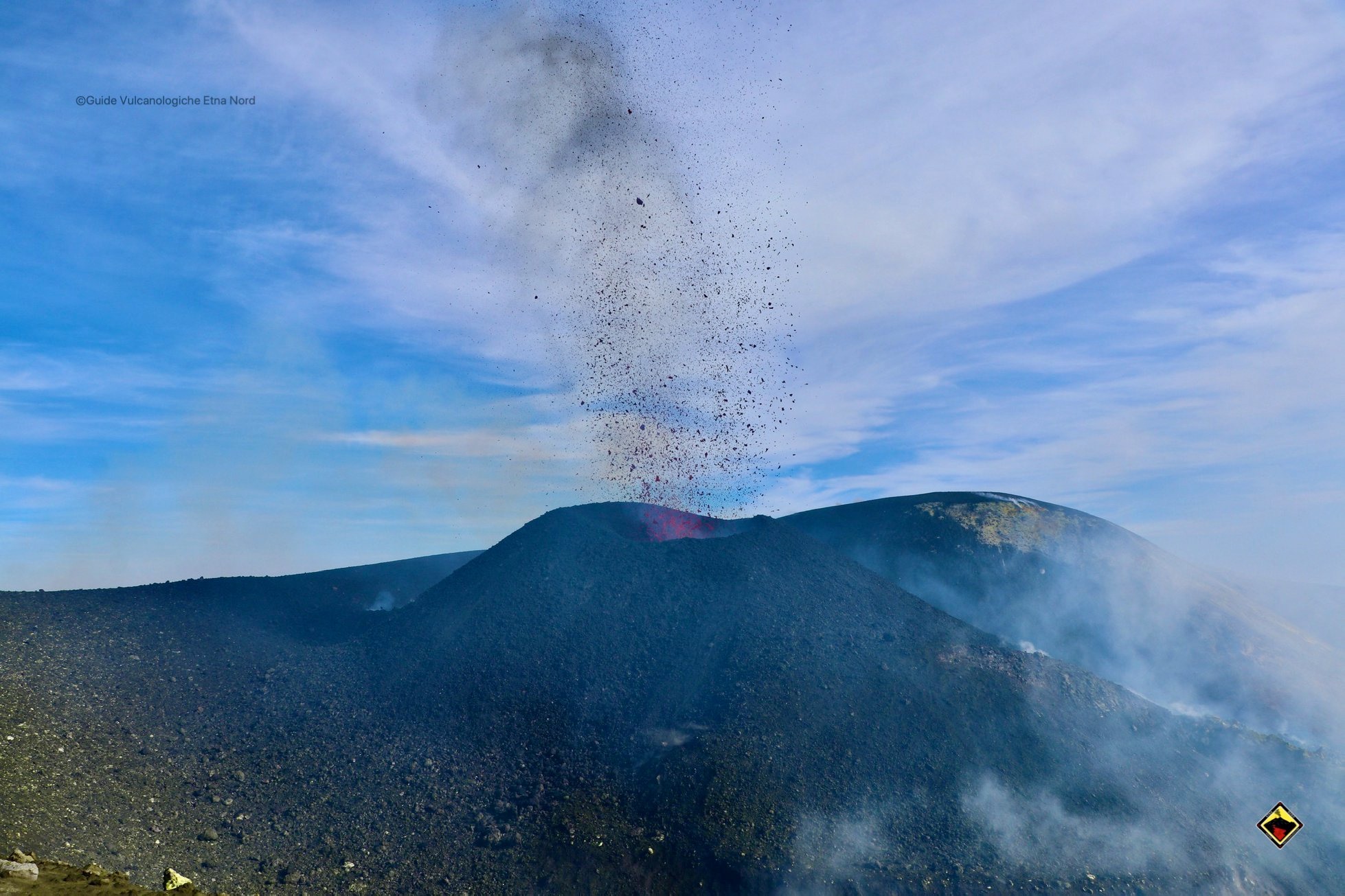
Italy , Stromboli :
WEEKLY BULLETIN from July 07, 2022 to July 07, 2022 (Issue date July 19, 2022)
ACTIVITY STATUS SUMMARY
In the light of the surveillance data, it is highlighted:
1) VOLCANOLOGICAL OBSERVATIONS: In this period a normal explosive activity of Strombolian type was observed. The total hourly frequency of explosions varied at low values (3-5 events/h) with the sole exception of 6 events/h on July 17. The intensity of the explosions was low to medium in both the North Crater area and the Center-South Crater area.

2) SEISMOLOGY: The seismological parameters monitored do not show any significant variations.
3) GROUND DEFORMATIONS: During the period studied, the island’s ground deformation monitoring networks did not record any significant variations.
4) GEOCHEMISTRY: SO2 flux at a low level
CO2 fluxes in the crater area remain at average values (about 7200 g/m2*g).
The average weekly value of the C/S ratio in the plume is on average values (C/S = 9.6)
There are no updates on the isotope ratio of helium in groundwater.
5) SATELLITE OBSERVATIONS: The thermal activity observed by satellite in the summit area was weak.
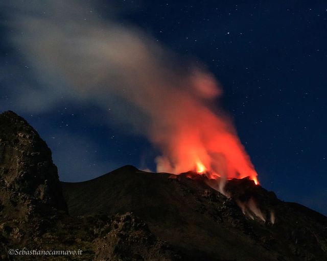
VOLCANOLOGICAL NOTES:
Field observations following the inspection in the summit area:
As part of the UN departmental project, volcanic activity was observed on Stromboli on July 14-15-16-17-18, 2022. On July 15, 2022 the observation was made from the Pizzo and the Roccette shelters, 14, 16 and 17 at an altitude of 400m along the northern edge of the Sciara del Fuoco and 18 at an altitude of 190m. The activity, in general, was low both in terms of intensity of explosions and number of events.
In the Center-South zone, there was continuous degassing which affected the entire area.
The explosive activity of the Center-South zone was localized near S2 where sporadic explosions occur with the production of diluted plumes of ash, mainly remodeled, of light brown color.
a) Mouth of circular shape present inside the N2 characterized by an incandescence. b) Detail of the external N2 mouth (Sciara side) characterized by the presence of incandescence.
In the northern zone, the N2 crater showed modest and discontinuous degassing. Through overflights with drones, the presence of a circular vent characterized by the presence of incandescence was observed. In addition, from the 15th, continuous intense degassing/puffing activity was observed from the mouth positioned on the outer side of the N2 (Sciara side). This outgassing produced an incandescence due to the heating of the rocks by the gas, visible during the day thanks to drone overflights and at night in the form of a persistent glow. The N2 crater produces mostly gas explosions every few tens of minutes which can be heard as dry rumblings.
In the crater area N1 there are at least 2 main vents, the first faces the Pizzo and is characterized by weak but continuous degassing; the second vent, facing the Sciara, showed explosive activity of varying intensity. Explosions up to 18 emitted coarse, low-energy, partly weathered material that fell in the immediate vicinity of the innermost vent of the N1 zone mixed with fine ash, which remained suspended in the atmosphere a few tens of meters above the crater and dispersed as a light-colored plume. The emissions last for tens of seconds and are associated with a continuous jet noise. These explosions occur quite regularly, approximately every 20 to 35 minutes. During the five days of observation, it was possible to observe an increase in the intensity of the explosions, which was gradually enriched with juvenile material. On the 18th, the explosions were characterized by increased energy and almost exclusively from juvenile material.
Source : INGV
Photos : INGV , Sebastiano Cannavo / Stromboli Stati d’animo , INGV.