July 29 , 2022.
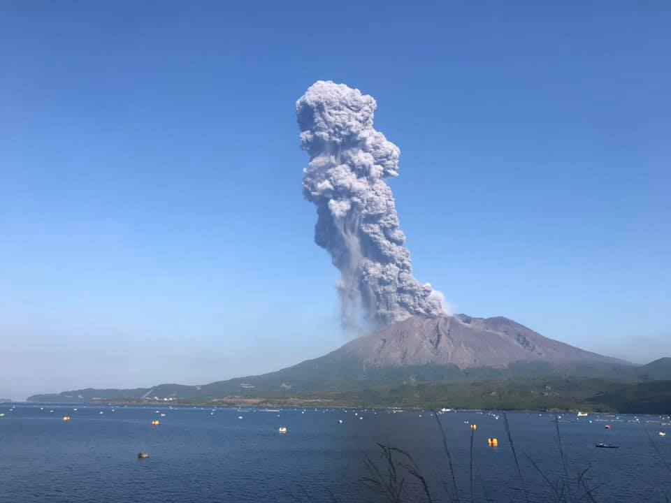
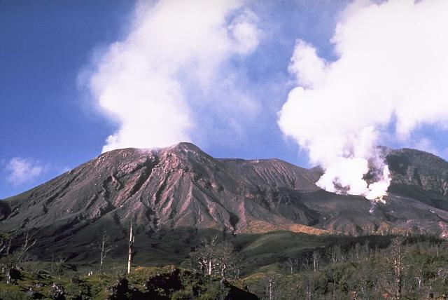
Japan , Sakurajima :
The Japan Meteorological Agency has lowered the volcanic alert level for Sakurajima in Kagoshima Prefecture, southwestern Japan, from 5 to 3 on a 5-point scale.
Level 5 forces nearby residents to evacuate.
Level 3 advises people to stay away from the volcano.
Agency officials lowered the alert level to 3 at 8 p.m. Wednesday on the grounds that the possibility of projections of large volcanic rocks more than 2 kilometers away is now low.
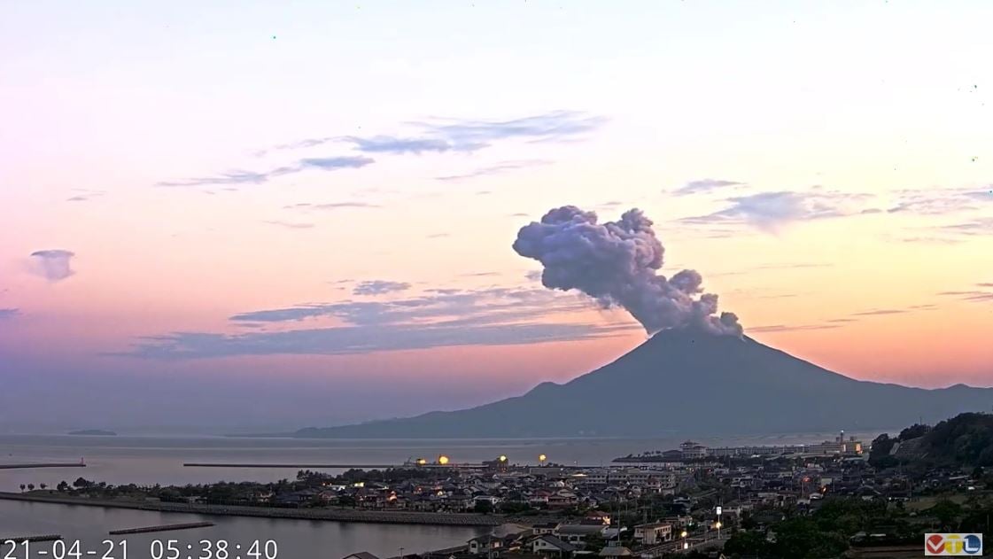
With the downgrade, Kagoshima city officials lifted the evacuation order for residents living nearby. The order had been put in place after the massive eruption on Sunday.
But officials are urging people to watch out for possible pyroclastic flows and rock throwing within a radius of about 2 kilometers around the volcano’s two craters.
Source : 3.nhk.or.jp
Photo : VTL via Alicja Szojer ( archive).
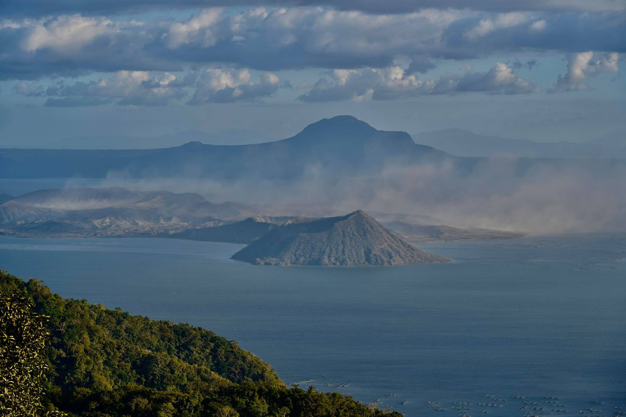
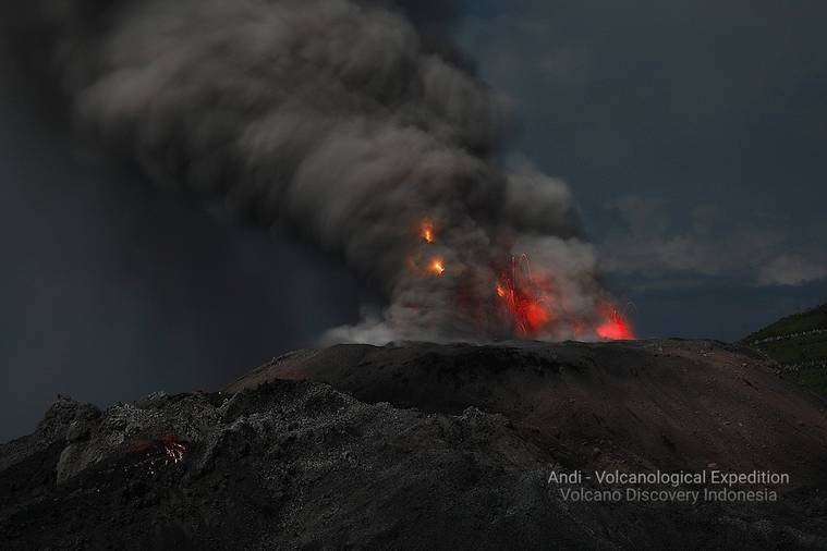
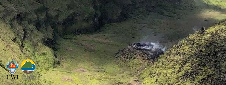
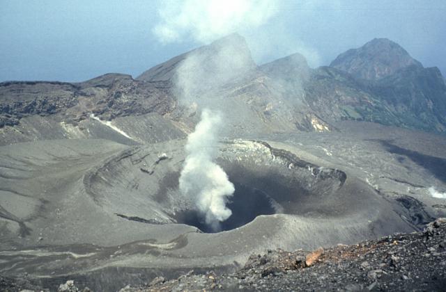
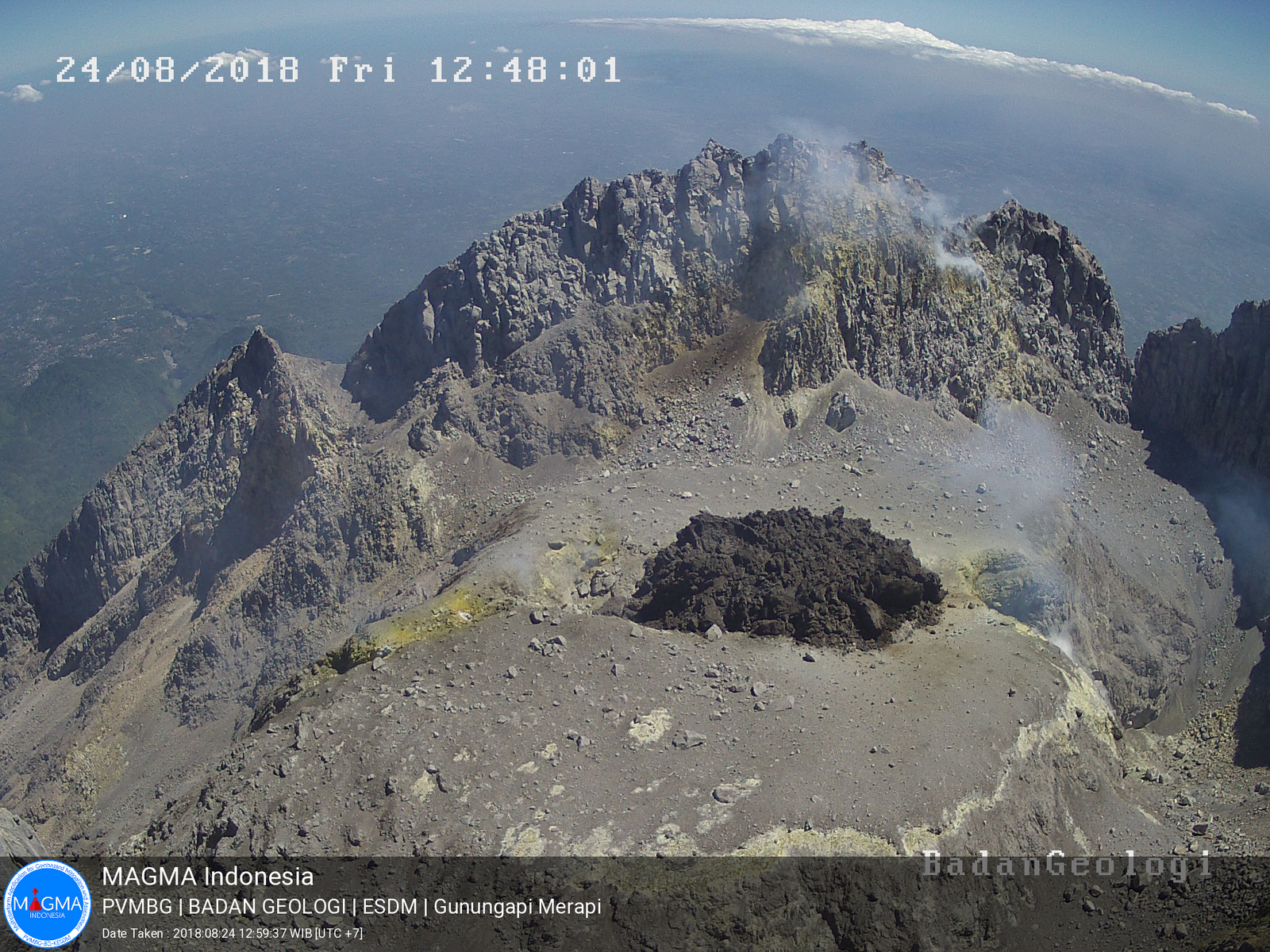
Indonesia , Raung :
Mount Raung erupted on Wednesday, July 27, 2022 at 5:19 p.m. WIB with an ash column height observed at ± 1500 m above the summit (± 4832 m above sea level). The ash column is observed to be gray with moderate intensity, oriented to the west and northwest. This eruption was recorded on a seismograph with a maximum amplitude of 32 mm and a duration of 540 seconds.
Center for Volcanology and Geological Hazard Mitigation (PVMBG) coordinator Oktory Prambada said the eruption was not caused by the activity of a magma movement. “There is no interaction of the magma in the magma chamber, it is in the pockets above,” he said, contacted by Tempo, Thursday, July 28, 2022. “It happened in 540 seconds. »
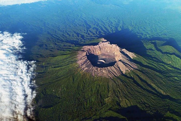
According to him, the ash column observed during the eruption was not dense, indicating that the collapse only occurred on the surface. « There are no inland earthquakes, only surface dynamics with very many parameters that can trigger eruptions, » he said.
Oktory said there were no volcanic earthquakes associated with magma chamber activity before the eruption. Monitoring equipment found that the dominant event was in the form of surface earthquakes, including swarms.
« It is concluded that the dynamics of the pressure source is located at the shallow depth of the crater. It is related to the blockage of the eruption center when a new cone forms in the Mount Raung crater. The consequence of the blockage causes excessive pressure on the surface, resulting in an eruption, » Oktory said.
The eruption that occurred was considered relatively small. « It’s just a release of energy or an outgassing, but more because what collapsed was on the surface, because it was clogged.
Source : Magma Indonésie , Tempo . com.
Photo : Paula Caiado
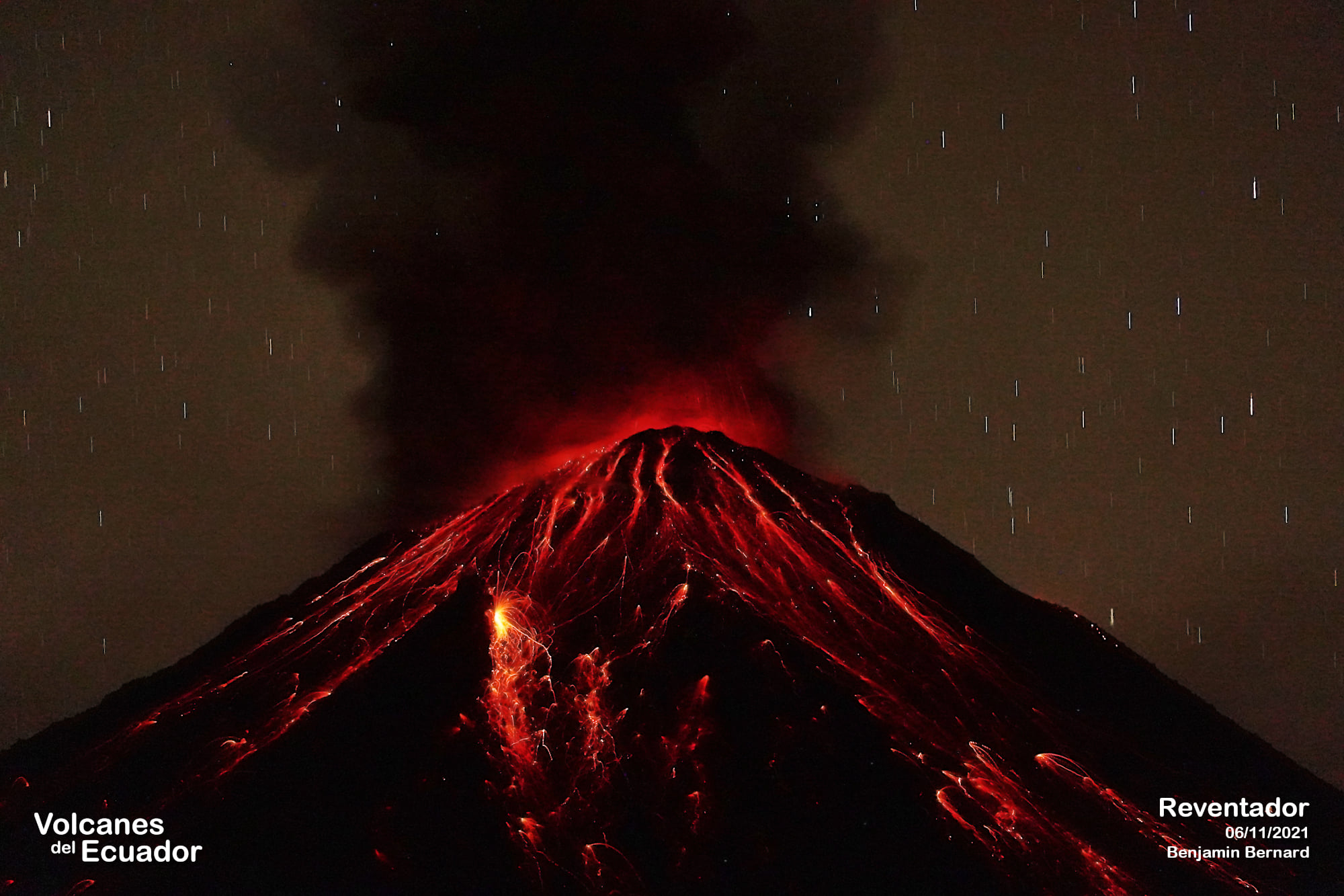
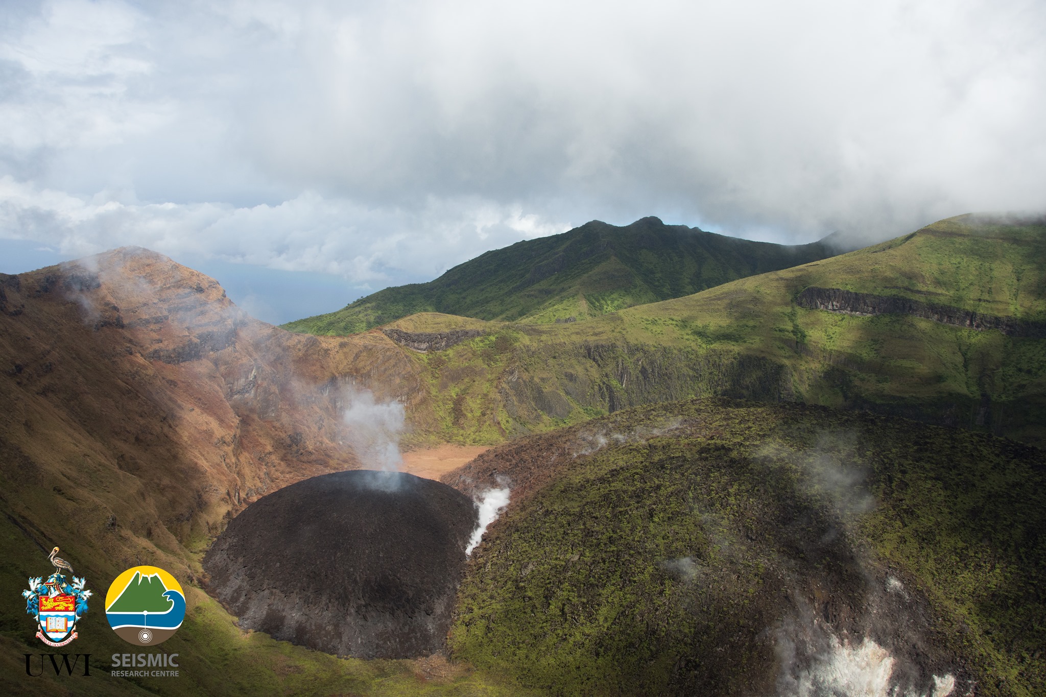
Colombia , Chiles / Cerro Negro :
Joint Technical Report: Increased Seismic and Volcanic Activity.
context
Since 2013, in the area surrounding the volcanic complex Chiles – Cerro Negro (CVCCN) began a series of seismic manifestations that triggered a crisis with earthquakes that were felt by residents of the populations of Chiles in Colombia and Tufiño in Ecuador. Seismicity peaked on October 20, 2014 with the appearance of an earthquake of magnitude 5.6 Mw (magnitude of the moment) and a count of more than 8000 volcano-tectonic (VT) earthquakes per day. This earthquake, although relatively large, did not cause significant damage, but was felt in very distant areas, such as Quito, the capital of Ecuador located more than 120 km away, and the city of Pasto, capital of the department of Nariño, Colombia, located 90 km. Since then, several earthquake swarms have been recorded in the region, including events felt with magnitudes close to 5. The complex interaction between the CVCCN magmatic system, regional tectonic faults and the hydrothermal system plays a role crucial for the interpretation of the processes occurring in this area.

Given its location in the border area, belonging to the province of Carchi – Ecuador and the department of Nariño – Colombia, the CVCCN is jointly monitored by the Geophysical Institute of the National Polytechnic School (Ecuador) and the Colombian Geological Service through the Volcanological and Seismological Observatory of Pasto (Colombia).
Seismicity
The CVCCN shows a further increase in seismic activity from May 27, 2022. Figure 1a shows the histogram with the number of daily events since the seismic crisis that began to stand out since the end of 2013; Figure 1b shows an extended window of the current period, which shows the increase in the number of VT earthquakes that average more than 1000 events per day. This seismicity is mainly characterized by VT type earthquakes, which are generally related to rock fracturing. However, in the last week, the seismic monitoring networks of Ecuador and Colombia have also detected the presence of long period (LP) and very long period (VLP) type events, which are generally linked to the movements of magmatic or hydrothermal fluids in volcanic systems.
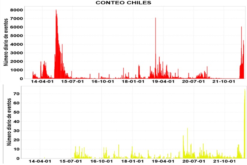
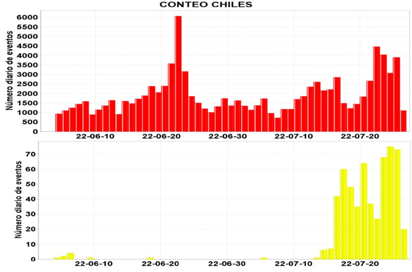
Daily occurrence of VT (red bars) and LP (yellow bars) events in the CVCCN from automatic detection and counting and assisted in its review by the Colombian Geological Survey for the periods: a) November 2013 to July 2022 , and b) from May to July 26, 2022.
Geodesy
The cGPS geodetic bases located near the Chiles volcano are currently recording deformation patterns on the flanks of the volcano. The figure shows the data series of the vertical component, corresponding to the CHLW base, located on the southwest flank. The yellow band highlights the period between April and July 2022, during which the data can be seen to show an upward trend, describing an inflation pattern. Compared to the rate or rate of ascent recorded by CHLW between 2016 and 2020 (approximately 28 mm/year), it is currently at an average speed of 106 mm/year, the most notable inflation rate recorded since 2014 in the Chiles-Cerro Negro volcanic complex.
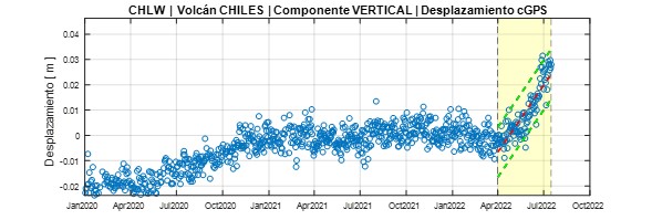
Time series of displacement (deformation) data recorded in a vertical direction by the cGPS CHLW base, located on the southwest flank of the Chiles volcano, between January 2020 and July 2022. The red segmented line represents the data trend since April 2022 and the green lines represent the reliability margins of the mathematical model that describes them.
Conclusions
According to indicators derived from volcanic monitoring, there is evidence of an evolution of activity in the CVCCN region characterized by:
An increase in deformation from April 2022 with an inflationary pattern on the southern flank of Chiles and the Caldera de Potrerillos.
Increase in the occurrence of earthquakes associated with rock fracturing (VT) since the end of May 2022, highlighting the presence of seismic sources closer to the Chiles volcano, with more superficial hypocenters. This is coupled with greater attenuation of coda waves, suggesting a medium with greater fluid input, and which is also reflected in the occurrence of earthquakes associated with fluid dynamics (LP).
Physico-chemical changes in hot springs: gaseous emissions, high temperatures and morphological changes (El Hondón) indicating disturbance of the hydrothermal system caused by seismicity and interaction with the magmatic system.
Source : IGEPN.
Read the article : https://www.igepn.edu.ec/servicios/noticias/1946-informe-especial-complejo-volcanico-chiles-cerro-negro-no-2022-03
Photos : IGEPN
Hawaii , Kilauea :
19°25’16 » N 155°17’13 » W,
Summit Elevation 4091 ft (1247 m)
Current Volcano Alert Level: WATCH
Current Aviation Color Code: ORANGE
Activity Summary:
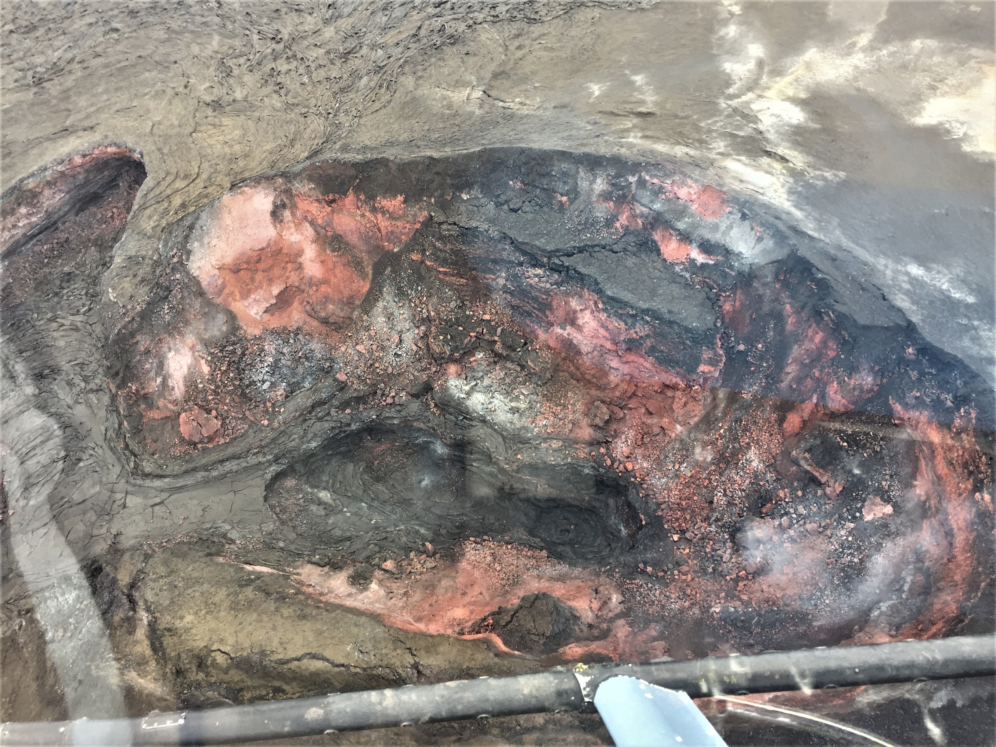
The summit eruption of Kīlauea Volcano, within Halemaʻumaʻu crater, has continued over the past 24 hours. All recent lava activity has been confined to the crater and current data indicate that this scenario is likely to continue. No significant changes have been noted at the summit or in either rift zone.
Summit Observations:
Eruption of lava from the Halemaʻumaʻu western vent into the active lava lake has continued over the past 24 hours. The lava level of the active lake surface remained at the level of the bounding levees. Over the last 24 hours, there were no significant ooze-outs along the margins of the crater floor. Summit tiltmeters show a gradual inflationary trend over the last 24 hours. A sulfur dioxide (SO2) emission rate of approximately 1,700 tonnes per day (t/d) was measured on July 25, 2022. Summit tremor is steady for this eruption’s long term base-line level.
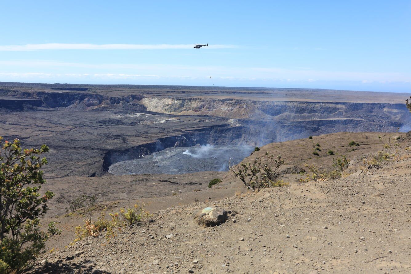
A view of the Airborne Electromagnetic and Magnetic (AEM) survey over Kaluapele—Kīlauea summit caldera—taken from Uēkahuna overlook in Hawai‘i Volcanoes National Park. The loop system below the helicopter transmits weak, low-frequency radio waves into the ground and measures the Earth response as well as passively detects variations in the Earth’s magnetic field. These variations will allow scientists to image the shallow (upper 2,000 ft) magmatic structure, fault systems, and groundwater pathways beneath Kīlauea’s surface.
Rift Zone Observations:
No unusual activity has been noted along the East Rift Zone or Southwest Rift Zone; steady rates of ground deformation and seismicity continue along both. Measurements from continuous gas monitoring stations downwind of Puʻuʻōʻō in the middle East Rift Zone remain below detection limits for SO2, indicating that SO2 emissions from Puʻuʻōʻō are negligible.
Source : HVO
Photo : USGS / K. Mulliken.
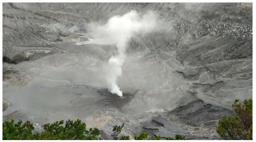
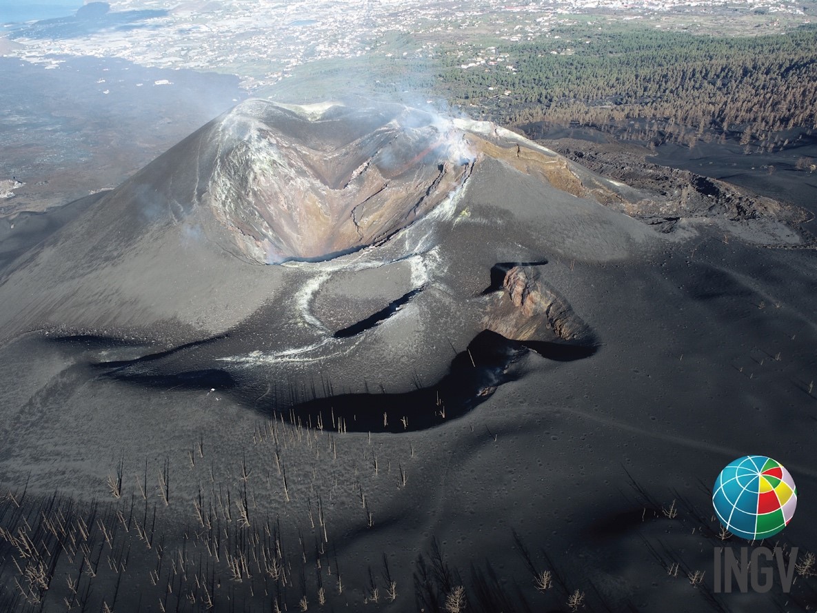
Canary Islands , La Palma / Tenerife :
More than five months after the end of the eruption on the island of La Palma, the geophysical and geochemical parameters have still not returned to normal; therefore, its volcanic fire is in the YELLOW position. This implies that residents and visitors should continue to be attentive to communications from civil protection authorities.
Regarding seismicity, we note that during the last week the Canarian seismic network has recorded 75 seismic events of low magnitude, whose maximum value of M3.3 has been linked to an earthquake located in the North from the island of Tenerife on July 16. The total seismic energy released last week in the archipelago was 9.2 gigajoules, an amount similar to the electricity demand of the island of El Hierro for about 28 minutes.
The earthquakes were located mainly on the islands of Tenerife and La Palma. Low magnitude seismicity remains in the latter, much lower than the seismicity observed during the 2021 eruption. The Canary Islands are also characterized by moderate tectonic activity; therefore, some earthquakes were also recorded along some active seismic faults such as the one between Tenerife and Gran Canaria.
Regarding land deformation, during the last week, no relevant variation was observed on any island. With regard to the emission of gases and excluding the areas of La Bombilla and Puerto Naos, where abnormal emissions of carbon dioxide (CO₂) continue to be recorded, the Canarian Geochemical Network indicates that the values of Relatively higher diffuse emission of volcanic gases are recorded on Tenerife, where it is already known that from 2016 a process of pressurization of the volcano-hydrothermal system is recorded. We specify that this process is normal in active volcanic systems and does not imply the possibility of a volcanic eruption in the short and medium term.
Source : Involcan.
Photo : INGV ( Cumbre Vieja).