
May 16 , 2022.
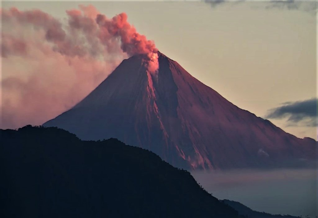
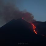
Italy / Sicily , Etna :
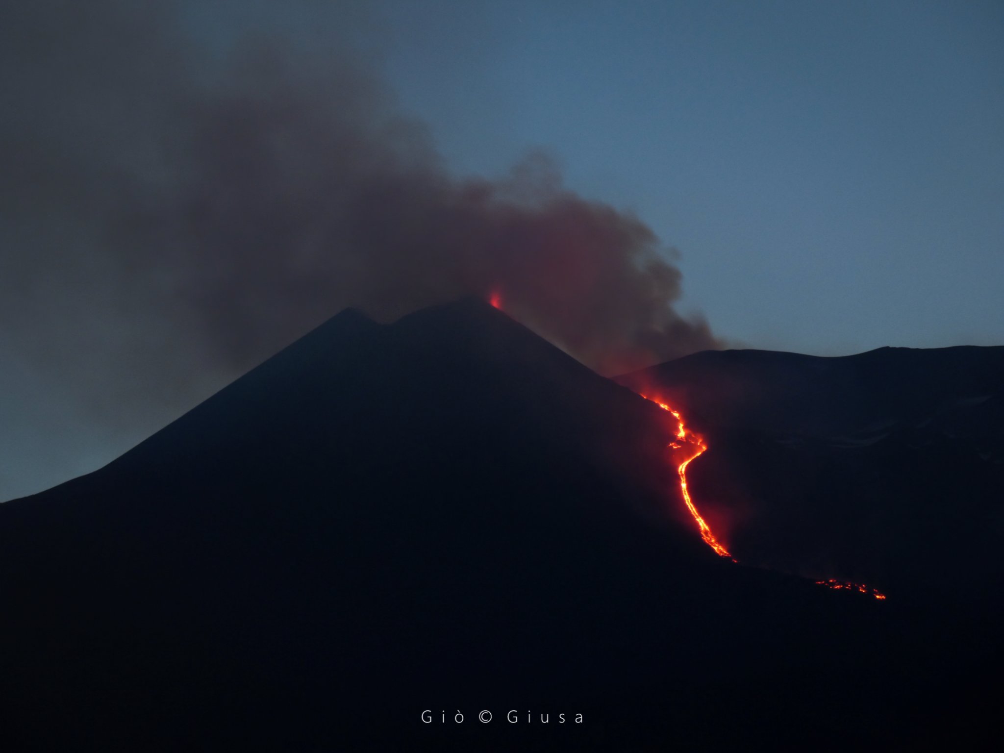
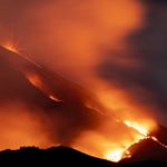
This May 15, 2022, the lava flow on the upper east side of Etna continues to be fed. It is possible to see weak Strombolian activity from the Southeast Crater. There are no changes in the amplitude of the volcanic tremor.
No press release from the INGV for the moment.
Source : Le Chaudron de Vulcain.
Photo : Gio Giusa.
Iceland , Reykjanes Peninsula :
An earthquake swarm started by Eldvörp on Reykjanes at 11:30 yesterday, May 15th. At 17:38 a M4.7 occurred, 14:17 an earthquake of M4,2 in that area, the earthquake was felt. At 11:35 a M3.5 occurred. Another earthquake of M3.7 occurred at 12:01.
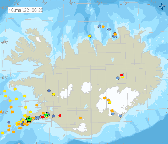
Landslides can occur in slopes and mountain sides when earthquakes of these magnitudes occur. Caution is advised for people in those areas.
At 16:56 on Saturday an earthquake of magnitude 4.8 occurred in Þrengslin east of Lambafell at 8km depth. The earthquake was felt in south and west Iceland. Aftershocks may be expected.
Source et photos : Vedur is
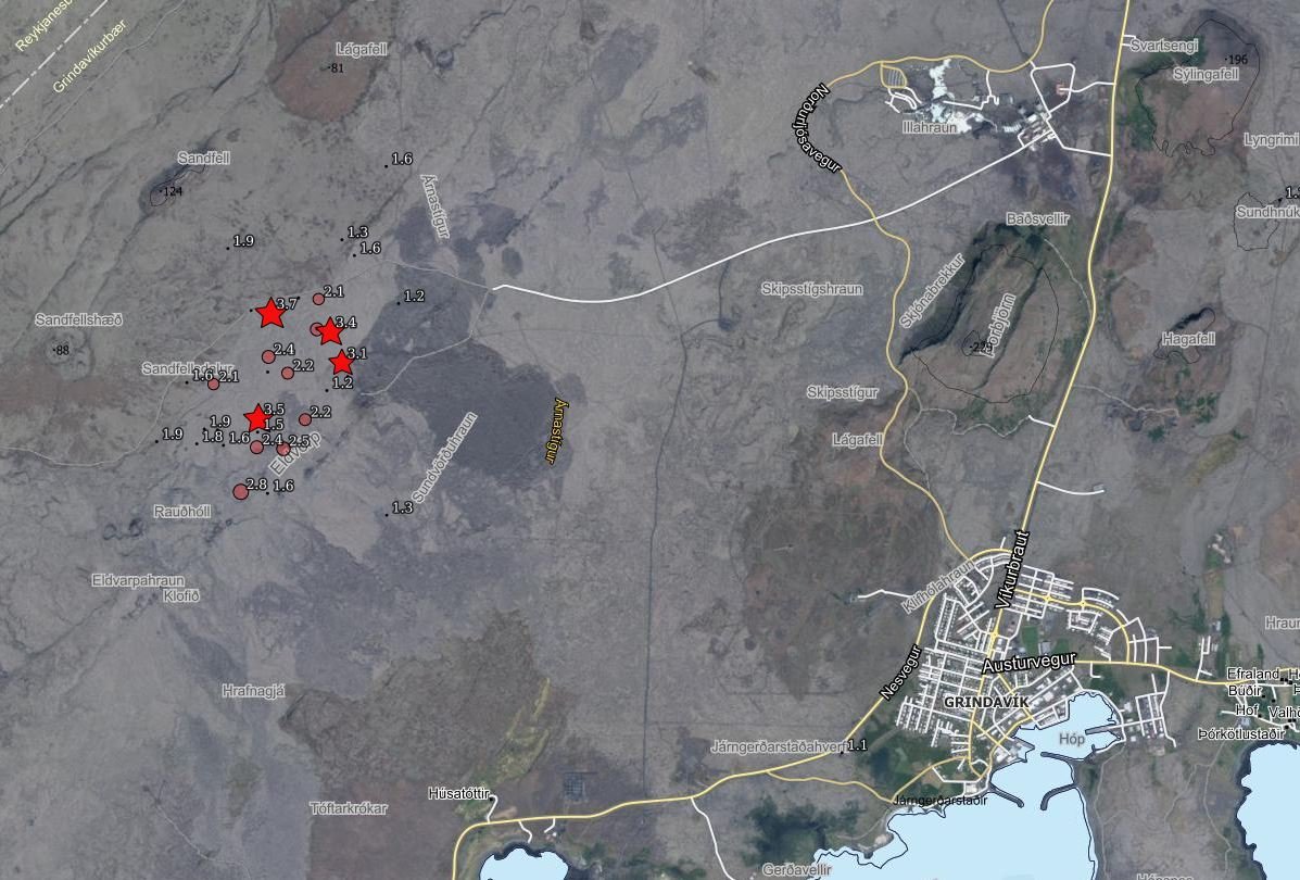
Alaska , Semisopochnoi :
51°55’44 » N 179°35’52 » E,
Summit Elevation 2625 ft (800 m)
Current Volcano Alert Level: WATCH
Current Aviation Color Code: ORANGE
Low-level eruptive activity continues. Seismicity remains elevated with intermittent tremor. Several explosions were detected in seismic and infrasound data over the last day. Clear satellite and web camera images showed low-level ash emissions.
Small eruptions producing minor ash deposits within the vicinity of the active north crater of Mount Cerberus and ash clouds usually under 10,000 ft (3 km) above sea level have characterized the recent activity. Small explosions and associated ash emissions may continue and could be difficult to detect, especially when thick cloud cover obscures the volcano.
Semisopochnoi is monitored by local seismic and infrasound sensors, satellite data, web cameras, and remote infrasound and lightning networks.
Source : AVO
Photo : Read, Cyrus / Alaska Volcano Observatory / U.S. Geological Survey
Hawaii , Kilauea :
19°25’16 » N 155°17’13 » W,
Summit Elevation 4091 ft (1247 m)
Current Volcano Alert Level: WATCH
Current Aviation Color Code: ORANGE
Activity Summary:
The summit eruption of Kīlauea Volcano, within Halemaʻumaʻu crater, has continued over the past 24 hours. All recent lava activity has been confined to the crater, and current data indicate that this scenario is likely to continue. No significant changes have been noted in the summit or East Rift Zone.
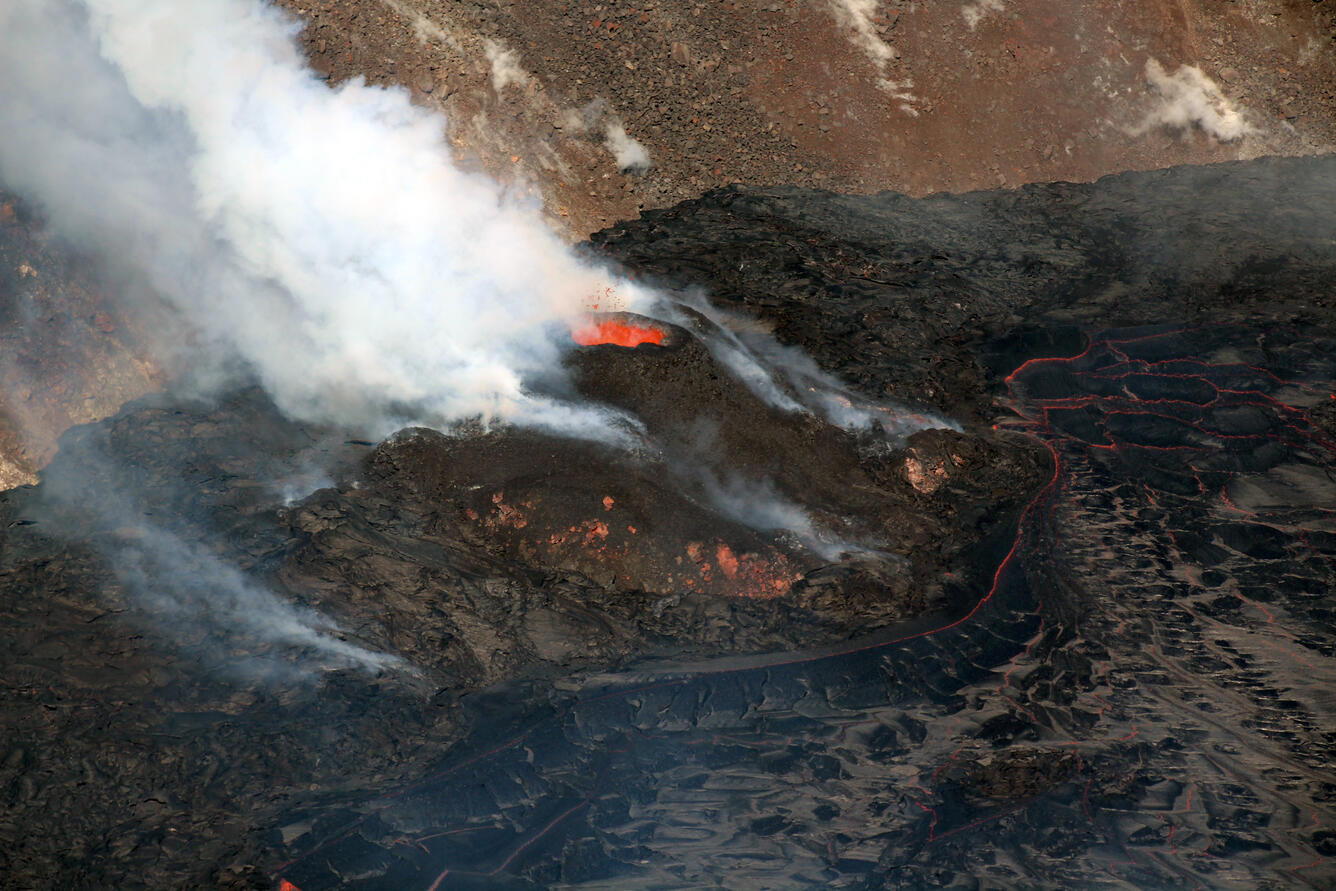
Halemaʻumaʻu Lava Lake Observations:
Eruption of lava from the Halemaʻumaʻu western vent into the active lava lake and onto the crater floor has continued over the past 24 hours. The active lava lake has shown continuous surface activity, with lake level remaining relatively high. Lava ooze-outs were active over the course of the day, though slightly diminished compared with earlier last week. Overflight measurements on April 6, 2022 indicated that the crater floor had seen a total rise of about 99 meters (325 feet) and that 66 million cubic meters (18 billion gallons) of lava had been effused since the beginning of this eruption on September 29, 2021.
Summit Observations:
Summit tiltmeters showed weak deflation over the past 24 hours. A sulfur dioxide (SO2) emission rate of approximately 2,800 tonnes per day (t/d) was measured on May 12, 2022.
Source : HVO
Photo : Archive USGS/N. Deligne.
Ecuador , Sangay / Reventador :
DAILY REPORT OF THE STATE OF SANGAY VOLCANO, Sunday May 15, 2022.
Information Geophysical Institute – EPN.
Surface Activity Level: High, Surface Trend: No change.
Internal activity level: High , Internal trend: ascending .
Seismicity: From May 14, 2022, 11:00 a.m. to May 15, 2022, 11:00 a.m.:
Explosion (EXP) 28
Long Periods (LP) 33
Emission Tremors (TREMI ) 4
Lahar (HL): 1
Rains / Lahars:
Moderate rains were recorded in the volcano sector thanks to the Windy application. At dawn today, a high frequency signal possibly associated with the descent of mudslides and debris (lahars) was observed. **In the event of heavy rains, these could remobilize the accumulated materials, generating mudslides and debris that would descend on the flanks of the volcano and flow into the adjacent rivers.**
Emission / ash column:
No emission was observed by the cameras due to the low visibility of the volcano sector. However, the Washington VAAC reported ash emissions up to 870 meters above crater level to the west.
Other Monitoring Parameters:
No thermal anomaly has been recorded in the last 24 hours.
Observation:
The volcano area remained mostly cloudy. No ash fall report was received.
Alert level: Orange.
——————————————————————————————
DAILY REPORT OF THE STATE OF THE REVENTADOR VOLCANO, Sunday May 15, 2022.
Information Geophysical Institute – EPN.
Surface Activity Level: High, Surface Trend: No change.
Internal activity level: Moderate, Internal trend: No change.
Seismicity: From May 14, 2022, 11:00 a.m. to May 15, 2022, 11:00 a.m.:
Explosion (EXP) 58
Long Periods (LP) 95
Emission Tremors (TREMI ) 21
Harmonic Tremors (TRAM): 9
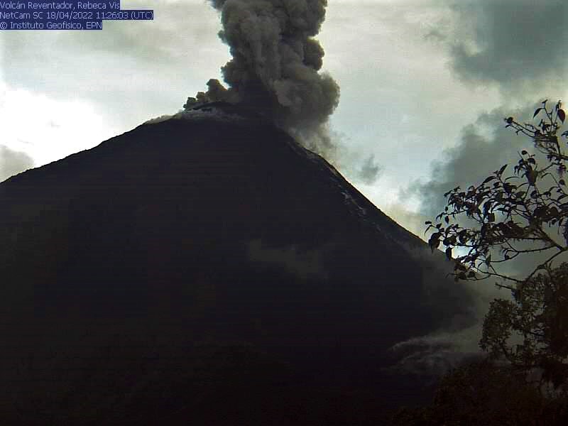
Rains / Lahars:
Moderate rain was reported yesterday night, according to information from the SOTE guardian of the Reventador area and via the Windy application.
Emission / ash column:
No emissions were observed due to low visibility. The Washington VAAC reported no alerts.
Gas:
The MOUNTS system recorded 19.1 tons of SO2, on 05/14/2022 at 1:41 p.m. TL.
Other Monitoring Parameters:
No thermal anomalies have been reported in the last 24 hours.
Observation:
The volcano remained cloudy most of the time.
Alert level: Orange.
Source : IGEPN
Photos : archives IGEPN .


No comment yet, add your voice below!