
March 14 , 2022.
Hawaii , Mauna Loa :
19°28’30 » N 155°36’29 » W,
Summit Elevation 13681 ft (4170 m)
Current Volcano Alert Level: ADVISORY
Current Aviation Color Code: YELLOW
Activity Summary:
Mauna Loa volcano is not erupting. Rates of seismicity and CO2 concentrations at Sulphur Cone are slightly elevated above long-term background levels, but have not changed significantly over the past week. Other Mauna Loa monitoring data streams—ground deformation, all other gas concentrations, visual appearance in webcams—show no significant changes.
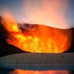
An early morning view looking north across Moku‘āweoweo, Mauna Loa’s summit caldera, from a spot near the summit cabin on the volcano’s south caldera rim. Frost covered much of the caldera floor that was still shadowed, and weak steaming issued from the usual areas. Overall, there were no significant changes observed at the summit. The 1940 and 1949 cones are visible in the sunlit area at left, and the gap that connects the caldera to South Pit is visible at the far left.
Observations:
During the past week, HVO seismometers recorded approximately 202 small-magnitude (below M2.5) earthquakes below Mauna Loa last week, 55 of which were under the summit and upper-elevation flanks. The majority of these earthquakes occurred at shallow depths less than 10 kilometers (6 miles) below sea level. Global Positioning System (GPS) measurements show very low rates of deformation in the summit region continuing through the past week.
Concentrations of sulfur dioxide (SO2) and hydrogen sulfide (H2S), as well as fumarole temperatures, remain stable at both the summit and at Sulphur Cone, on the upper Southwest Rift Zone. Concentrations of carbon dioxide (CO2) are also stable at the summit, but have slowly increased over the past year at Sulphur Cone. The CO2 measured concentrations remain low compared to many other volcanic areas globally.
Webcam views have shown no changes to the volcanic landscape on Mauna Loa over the past week.
Source : HVO.
Photo : M. Patrick, 09-08-2019.
Alaska , Great Sitkin :
52°4’35 » N 176°6’39 » W,
Summit Elevation 5709 ft (1740 m)
Current Volcano Alert Level: WATCH
Current Aviation Color Code: ORANGE
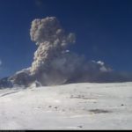
Slow lava effusion likely continues. Elevated surface temperatures were observed in satellite data, and robust steaming was observed in satellite and web camera images over the past day. These observations are consistent with continued slow effusion of lava. Seismicity remains low. It remains possible that explosive activity could occur with little or no warning.
Great Sitkin is monitored by local seismic and infrasound sensors, satellite data, web cameras, and remote infrasound and lightning networks.
Source : AVO
Photo : Loewen, Matt
Guatelama , Santiaguito :
Cloudy weather
Wind: North-East
Precipitation: 0.0 mm.
Activity:
The volcanic complex is completely covered with clouds, the seismic stations record prolonged and abundant periods of degassing coming from the crater and the lava flow which moves towards the West and the South-West, as well as weak avalanches which affected the southwest and west flanks. This causes fine ash particles to fall into the volcanic perimeter. Explosions, strong avalanches and audible sounds can be generated several kilometers from the volcanic edifice. Due to the permanent extrusion of lava in blocks in the Caliente dome, in a West-South-West direction, the occurrence of stronger avalanches of blocks and ash is not excluded, as well as possible pyroclastic flows over long distances in different directions. The recommendations of the special bulletin BESAN 003-2022 are still valid.
Source : Insivumeh.
Photo : La Hora
Costa Rica , Rincon de la Vieja / Turrialba / Poas / Irazu :
Volcanic Monitoring Program Weekly Bulletin, March 11, 2022.
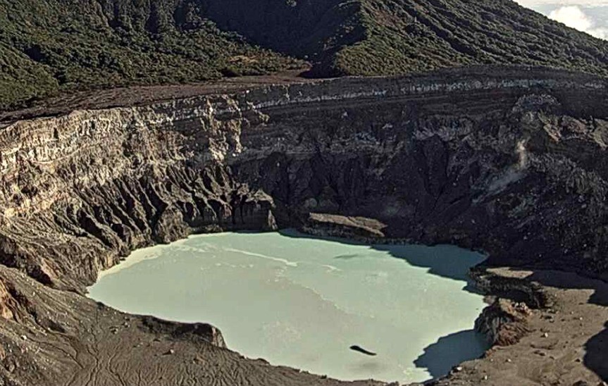
Rincon de la Vieja Volcano
Latitude: 10.83°N;
Longitude: 85.324°W;
Altitude: 1895m
Current activity level: 3 (volcanic eruption)
Potentially associated dangers: Lahars, gas, phreatic and phreato-magmatic eruptions, proximal ballistic projections, acid rain, ashes.
The last phreatic eruption was recorded on February 20, 2022. A moderate energy explosion was recorded inside the volcano on March 9. Seismographs continue to record low amplitude volcanic tremors with frequencies between 2 and 4 Hz. Some earthquakes of the « tornillos » type (5 events), a distal earthquake of the VT type and a strong earthquake of type LP have been recorded. Geodetic observations do not show a significant deformation pattern. Residents of northern Rincón report a color change of Quebrada Azufrada from milky gray to bright orange. The color change is due to the deposition of an abundant quantity of ochre-orange iron oxides on the rocks and sediments of the creek bed induced by the marked decrease in precipitation and river flow.
Turrialba Volcano
Latitude: 10.025°N;
Longitude: 83.767°W;
Altitude: 3340m
Current activity level: 3 (volcanic eruption)
Potentially associated hazards: gas, ash emission, proximal ballistic projections, acid rain.
The last phreatic eruption occurred on February 28, since that date several rumblings have been recorded, some associated with small ash emissions. Seismic activity remains stable, the frequency of earthquakes has decreased again after showing an increase for several days. Many low and medium frequency LP type earthquakes are observed (about 250 LF and LPH events). Over the past 3 months, geodetic monitoring shows a more marked contraction of the Turrialba-Irazú massif around the active crater of Turrialba. The CO2/SO2 ratio shows some sporadic peaks. The weekly average for the CO2/SO2 ratio is 24.3 +/- 7.5, a similar value to the previous week, and for the H2S/SO2 ratio it is 0.26 +/- 0.11. The SO2 flow presented a peak at the beginning of the week and a decrease thereafter, it is estimated at 229 +/- 120 t/d. The SO2 analyzer at the Coronado Volcanic Gas and Aerosol Monitoring Station, EMVA/OVSICORI-UNA, recorded a maximum hourly average of 0.56 ppb SO2 over the past 24 hours, well below the regulatory limit value, which is an hourly average of 75 ppb SO2. On the other hand, the dust analyzer recorded a daily average of 6.8 ug/m3 of PM10, i.e. less than a tenth of the regulatory limit value, which averages 100 ug/m3 for 24 time. Data from the EMVA station indicate that the air quality in Coronado is good and that the levels of fumarolic emissions from the Turrialba and Poás volcanoes are negligible.
Poas Volcano
Latitude: 10.2°N;
Longitude: 84.233°W;
Altitude: 2780m
Current activity level: 2 (quiet active volcano)
Potentially associated dangers: gas, phreatic eruptions, proximal ballistic projections, acid rain, lahars.
No eruption has been detected so far in 2022. Seismicity remains stable, a proximal VT type earthquake was recorded on March 11. The geodetic network shows the stability of the volcanic edifice over the past 4 months. The weekly average of the SO2/CO2 ratio is 0.58 +/- 0.09 and H2S/SO2 remains stable with a value <0.012. The SO2 concentration around the crater was low during the week (<2 ppm SO2 at El Mirador). The flow of SO2 decreased a little (80 +/- 30 t/d). The level of the hyper-acidic lake has risen about 40 cm. The lake waters remain rich in chloride ion compared to sulfate ion, however, the composition of the lake shows a gradual trend towards waters with less chloride but with stable relative proportions of chloride and sulfate.
Irazu Volcano
Latitude: 9.979°N;
Longitude: 83.852°W;
Altitude: 3432m
Current activity level: 1 (quiet active volcano)
Potentially associated hazards: landslides, lahars, proximal ballistic projections, gas, acid rain, ash fall, debris avalanches.

The March 3 GPS measurement campaign on the main landslide in the Las Torres sector shows a stable trend except in the part west of the main fissure where a vertical acceleration is observed. Remember that the part near the edge of the cliffs remains very unstable and can collapse without warning. Geochemical gas monitoring in the fumarolic field in the northern sector of the volcano indicates that degassing remains light with concentrations of ~500 ppm CO2 and CO2/H2S ratios of ~350 +/- 304.
Source : Ovsicori.
Photos : Chris Allen, Javier Elizondo ( 2019) , Ovsicori , Herediahoy.com.
Canary Islands / La Palma , Cumbre Vieja :
Why does seismic activity continue on Cumbre Vieja?
The seismicity associated with active volcanoes can have different origins. On Cumbre Vieja, the seismicity recorded during the week preceding the eruption was mainly related to the rise of magma towards the surface. On the contrary, during the eruption, the intense seismicity observed was caused by the readjustment of the rocks located around the magmatic reservoirs which were gradually emptying. Once the eruption is over, there is daily seismicity characterized by a few dozen earthquakes, the magnitude of which is generally less than 2.
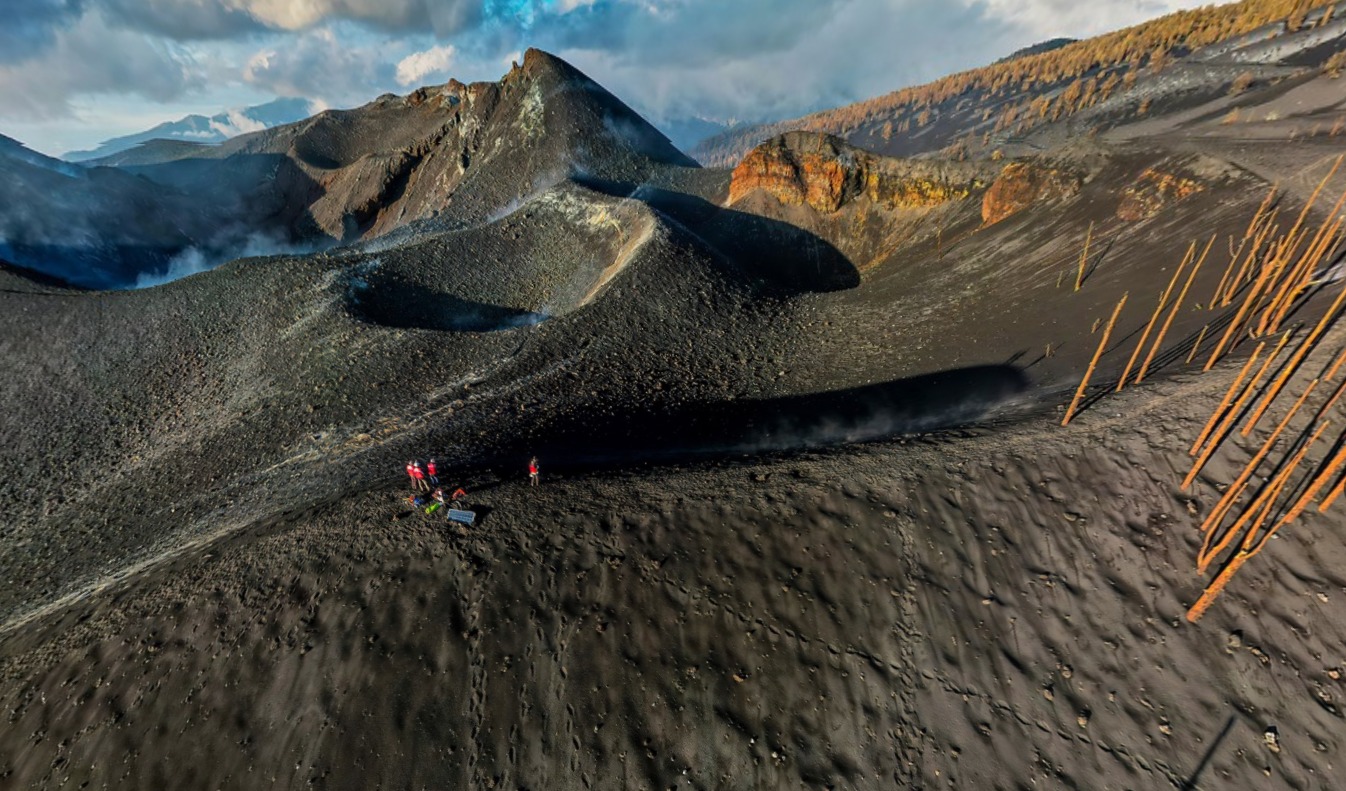
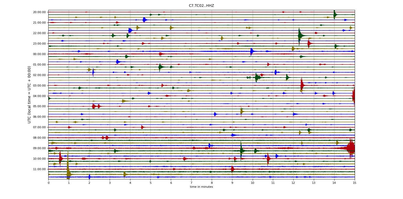
For a better characterization of this seismicity of such small magnitude, an INVOLCAN team installed during the last week a temporary seismic network around the volcanic building. The figure above shows the hundreds of long-period events recorded in a few hours, many of which are of a magnitude small enough to be less than zero.
Source : Involcan.
Photos : I love the world , Involcan.


No comment yet, add your voice below!