
March 01 , 2022.
Peru , Sabancaya :
Analysis period: from February 21, 2022 to February 27, 2022, Arequipa, February 28, 2022.
Alert level: ORANGE
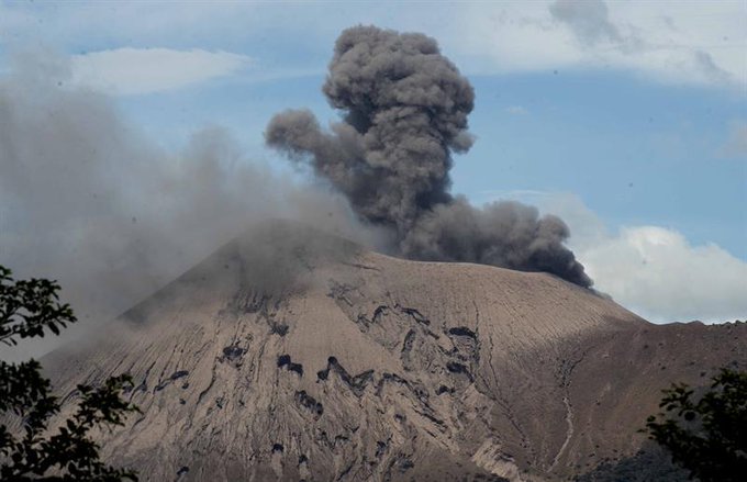
The Geophysical Institute of Peru (IGP) reports that the eruptive activity of the Sabancaya volcano remains at moderate levels, that is to say with the recording of an average of 35 daily explosions, with columns of ash and of gas up to 2.5 km altitude above the summit of the volcano and their subsequent dispersion. Therefore, for the following days, no significant change is expected in eruptive activity.
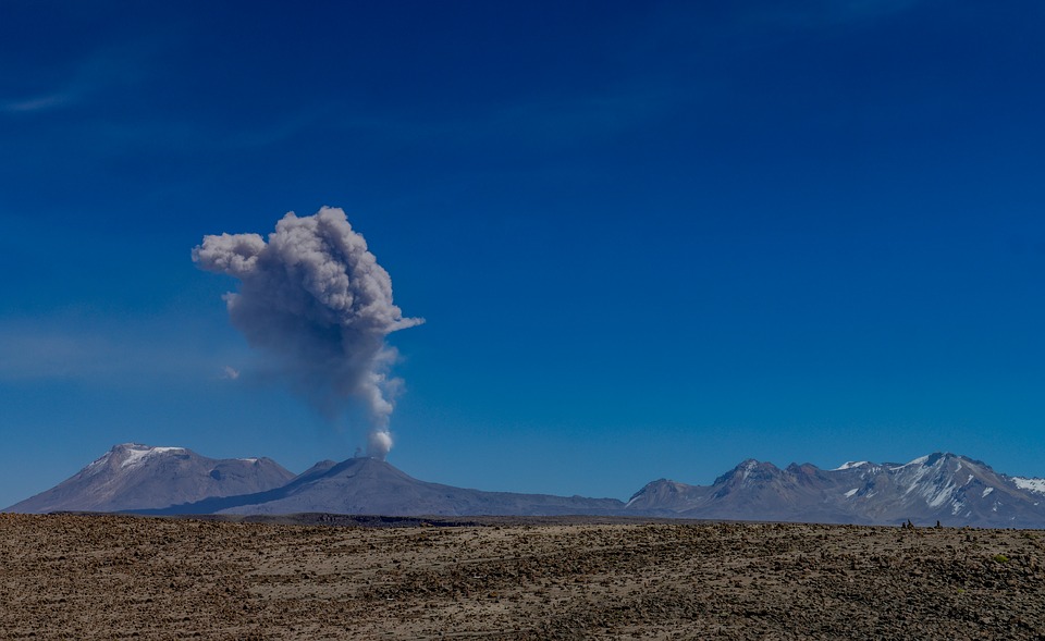
The IGP recorded and analyzed the occurrence of 210 earthquakes of volcanic origin, associated with the circulation of magmatic fluids inside the Sabancaya volcano. An average of 35 explosions was recorded daily. During this period, Volcano-Tectonic (VT) type earthquakes associated with rock fracturing were located mainly in the northeast of Sabancaya and presented magnitudes of M 2.3.
Monitoring the deformation of the volcanic structure using GNSS techniques (processed with fast orbits) does not show any significant anomalies. However, in general, an inflation process has been observed in the northern sector (surroundings of the Hualca Hualca volcano). Visual surveillance identified columns of gas and ash up to 2.5 km above the summit of the volcano, which were dispersed to the northwest, west, south and southwest sectors of the volcano. Sabancaya. Satellite recordings have identified the presence of 3 thermal anomalies, with a maximum value of 20 MW, associated with the presence of a lava body on the surface of the volcano’s crater.
RECOMMENDATIONS
• Keep the volcanic alert level orange.
• Do not approach within a radius of less than 12 km from the crater.
Source : CENVUL
Photo : pixabay.
Alaska , Pavlof :
55°25’2″ N 161°53’37 » W,
Summit Elevation 8261 ft (2518 m)
Current Volcano Alert Level: WATCH
Current Aviation Color Code: ORANGE
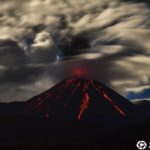
Local seismometers and regional infrasound sensors detected several small explosions from Pavlof over the last day, along with ongoing seismic tremor. No ash emissions were detected in satellite or webcam images, however, highly elevated surface temperatures in satellite images suggest lava effusion continues.

The small explosions associated with this eruption could happen at any time and may be accompanied by small ash plumes within the immediate vicinity of the volcano. The level of unrest at Pavlof can change quickly and the progression to more significant eruptive activity can occur with little or no warning.
Pavlof is monitored by local seismic and infrasound sensors, satellite data, web cameras, and remote infrasound and lightning networks.
Source : AVO.
Photo : Jacob, Ben David
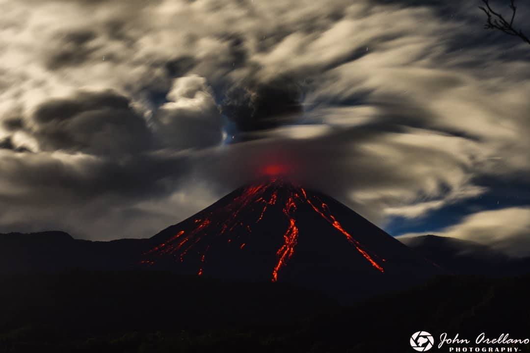
Ecuador , Reventador :
DAILY REPORT OF THE STATE OF THE REVENTADOR VOLCANO, Monday February 28, 2022.
Information Geophysical Institute – EPN.
Surface Activity Level: High, Surface Trend: No change.
Internal activity level: Moderate, Internal trend: No change.
Seismicity: From February 27, 2022, 11:00 a.m. to February 28, 2022, 11:00 a.m.:
Explosions (EXP) 9
Long Periods (LP) 19
Emission Tremors (TREMI) 14
Harmonic Tremor (TRARM): 6
Rains / Lahars:
Rains were recorded in the volcano area but no lahars were generated.
Emission / ash column:
No VAAC alerts have been recorded. The cloudiness of the volcano does not allow the observation of surface activity.
Other Monitoring Parameters:
No thermal alert has been recorded.
Observation:
Weather conditions do not allow direct observation of the crater.
Alert level: Orange.
Source : IGEPN.
Photo : John Arellano.
Hawaii , Kilauea :
19°25’16 » N 155°17’13 » W,
Summit Elevation 4091 ft (1247 m)
Current Volcano Alert Level: WATCH
Current Aviation Color Code: ORANGE
Activity Summary:
Lava effusion resumed at the summit eruption of Kīlauea Volcano beginning approximately 10:00 am HST yesterday and continues at this time. Tremor at the summit increased at approximately 9:30 am HST yesterday and remains elevated and steady. The steep inflation at the summit of Kīlauea Volcano that began yesterday at approximately 5:00 am HST has slowed. All activity remains confined to the active lava lake and west vent area within the western part of Halemaʻumaʻu with few or no ooze outs along the margins of the Halemaʻumaʻu crater floor. All recent lava activity has been confined to the crater, and there are no indications of activity migrating elsewhere on Kīlauea.
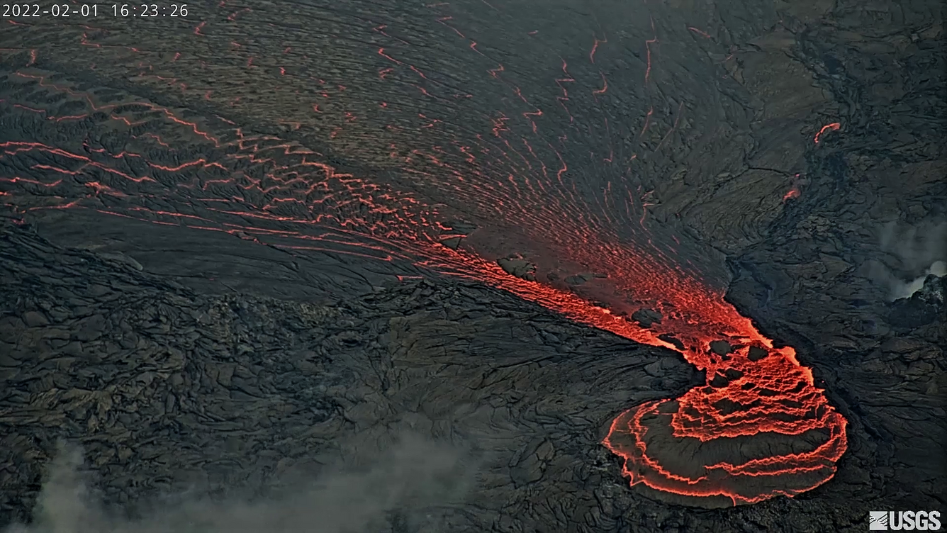
Halemaʻumaʻu Lava Lake Observations:
Eruption of lava from the western vent into the active lava lake within Halemaʻumaʻu crater resumed at approximately 10:00 am HST yesterday. Continuous flows of active lava are erupting from the west vent and flowing to the south, west, and into the western active lava lake. There were few to no ooze outs along the margins of the crater floor over the past 24 hours. The active lava lake surface of Halemaʻumaʻu crater has risen approximately 10 meters (33 feet) over the last 24 hours. This resumption of effusive activity corresponds with an increase in summit tilt and an increase in tremor at the summit The highest point on the Halemaʻumaʻu crater floor has risen approximately 96 meters (315 feet) since the eruption began on September 29, 2021. The erupted volume is 45 million cubic meters (59 million cubic yards) of lava as measured on January 25, 2021.
Summit Observations:
At approximately 5:00 am HST yesterday, summit tilt started a steep inflationary trend with a total increase of approximately 1.6 microradians that began to slow around 10 am HST yesterday and now remains steady with a gradual deflationary trend. Seismic data shows that the volcanic tremor signal increased at approximately 9:30 am HST yesterday and currently remains elevated and steady. Earthquake activity at the summit remains below background levels. A sulfur dioxide (SO2) emission rate of approximately ~2500 tonnes per day (t/d) was measured on February 25.
Source : HVO.
Photo : USGS / M. Patrick.
Japan , Suwanosejima :
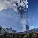
13 eruptions observed on Suwanosejima, Toshima village. (at 11:30 a.m. on August 28).
Suwanosejima, near the village of Toshima, Kagoshima Prefecture, erupted one after another on February 28. 13 events were observed at 11:30 a.m. the 28th.
According to the Fukuoka Regional Weather Observatory, 13 eruptions with medium or large plumes were observed at Mitake on Suwanosejima Island as of 11:30 a.m. on the 28th, two of which rose more than 2,000 meters above the crater.
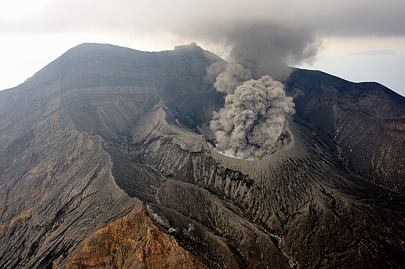
Although the number of eruptions has increased, the meteorological observatory indicates that Suwanosejima’s activity is within the range of Level 3 eruption alert, and it is called to pay attention to ashfall and projections with a range of 2 km around the crater.
Source : fnn.jp
Photo : N. Geshi. Geological Survey of Japan.
Nicaragua , Telica :
The Telica volcano continues to record small explosions.
The Telica volcano, located in the department of León, continues to record low intensity expirations and explosions with ash emanation. This will continue in the hours and days to come, the Nicaraguan Institute for Territorial Studies (INETER) reported on Monday.
According to the report, this phenomenon does not constitute a danger for the population.
Meanwhile, the San Cristóbal, Cerro Negro, Masaya, Momotombo and Concepción volcanoes are within the normal range of behavior for active volcanoes.
Source : nuevaya.com.ni
Photo : Enfoque Noticias


No comment yet, add your voice below!