
February 03 , 2022.
Montserrat Island , Soufrière Hills :
MVO issued a statement about Soufrière Hills on 28 January explaining overall trends observed in monitoring data since lava extrusion ended in 2010. They noted that although activity at the volcano had been low when analyzed on a week-to-week basis, subtle trends have emerged in the data in recent months that indicate an overall but small increase in unrest. The number of volcano-tectonic earthquakes were low, averaging one per day since the last eruption ended, though during 2018-2021 the average increased from 0.4 to 1.2 per day.
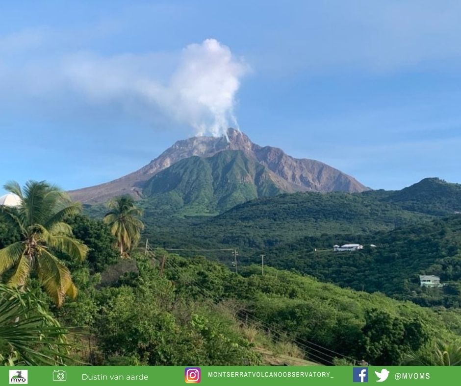
Fumarolic temperatures which initially showed a cooling trend during 2013-2017 began to rise in 2018. The increase was most notable at one specific fumarole that had a temperature increase from 200 to 500 degrees Celsius; the high temperature was similar to those last recorded in 2013. Sulfur dioxide gas flux during 2020-2021 averaged 100-200 tonnes per day higher than the fluxes recorded 2018-2019, though remained below 2012-2013 levels. Slow inflation of the whole island had continued since 2010, with no changes to the patterns of deformation; changes associated with volcano-tectonic swarms were only observed in areas close to the dome. An increase in rockfall activity was also noted. MVO reiterated that these changes since about 2018 were minor and did not merit an increase in the Hazard Level, which remained at 1 (on a scale of 1-5).
The complex, dominantly andesitic Soufrière Hills volcano occupies the southern half of the island of Montserrat. The summit area consists primarily of a series of lava domes emplaced along an ESE-trending zone. The volcano is flanked by Pleistocene complexes to the north and south. English’s Crater, a 1-km-wide crater breached widely to the east by edifice collapse, was formed about 2000 years ago as a result of the youngest of several collapse events producing submarine debris-avalanche deposits.
Block-and-ash flow and surge deposits associated with dome growth predominate in flank deposits, including those from an eruption that likely preceded the 1632 CE settlement of the island, allowing cultivation on recently devegetated land to near the summit. Non-eruptive seismic swarms occurred at 30-year intervals in the 20th century, but no historical eruptions were recorded until 1995. Long-term small-to-moderate ash eruptions beginning in that year were later accompanied by lava-dome growth and pyroclastic flows that forced evacuation of the southern half of the island and ultimately destroyed the capital city of Plymouth, causing major social and economic disruption.
Source : GVP.
Photos : MVO / Dustin Van Aarde , MVO.
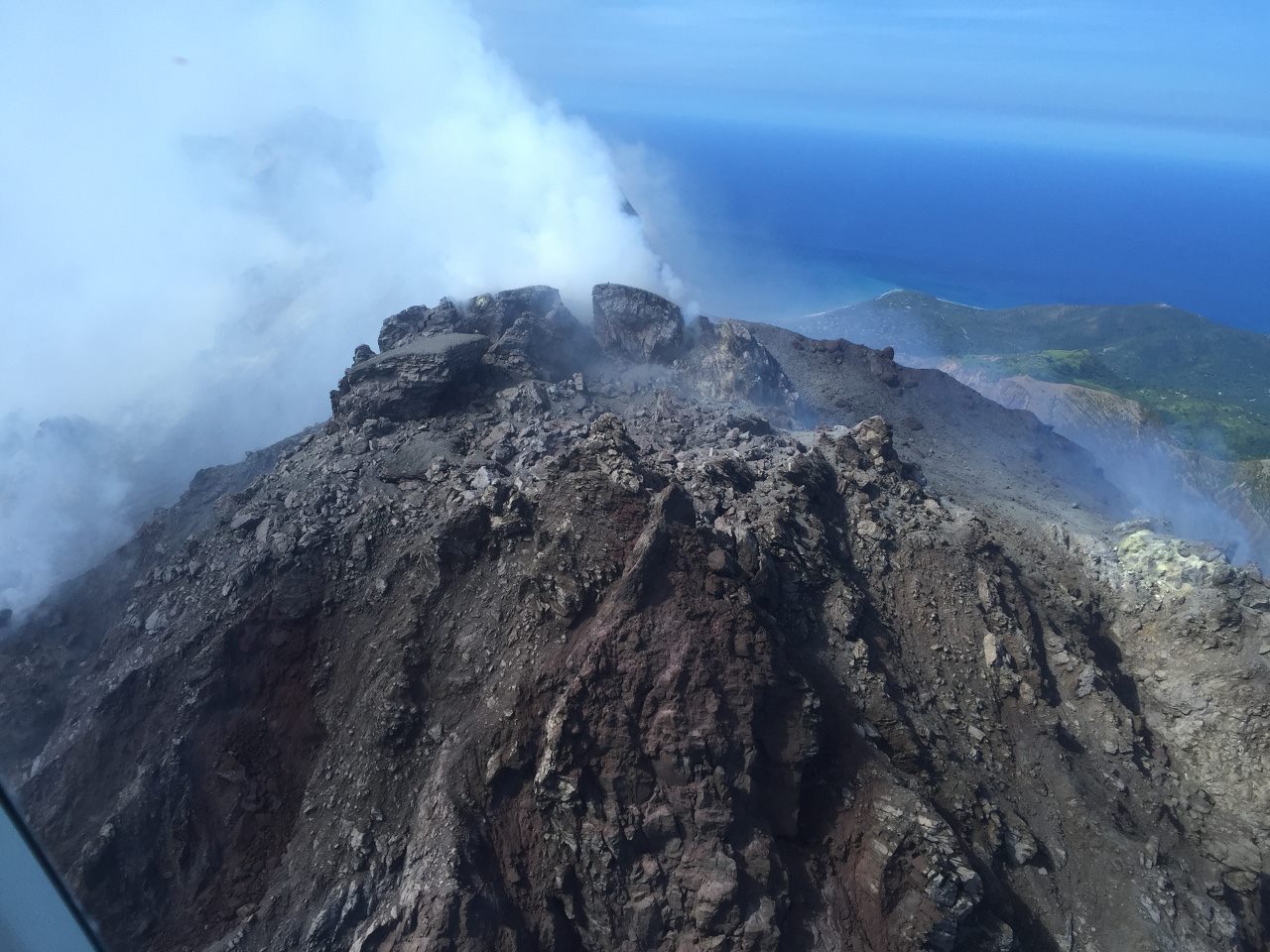
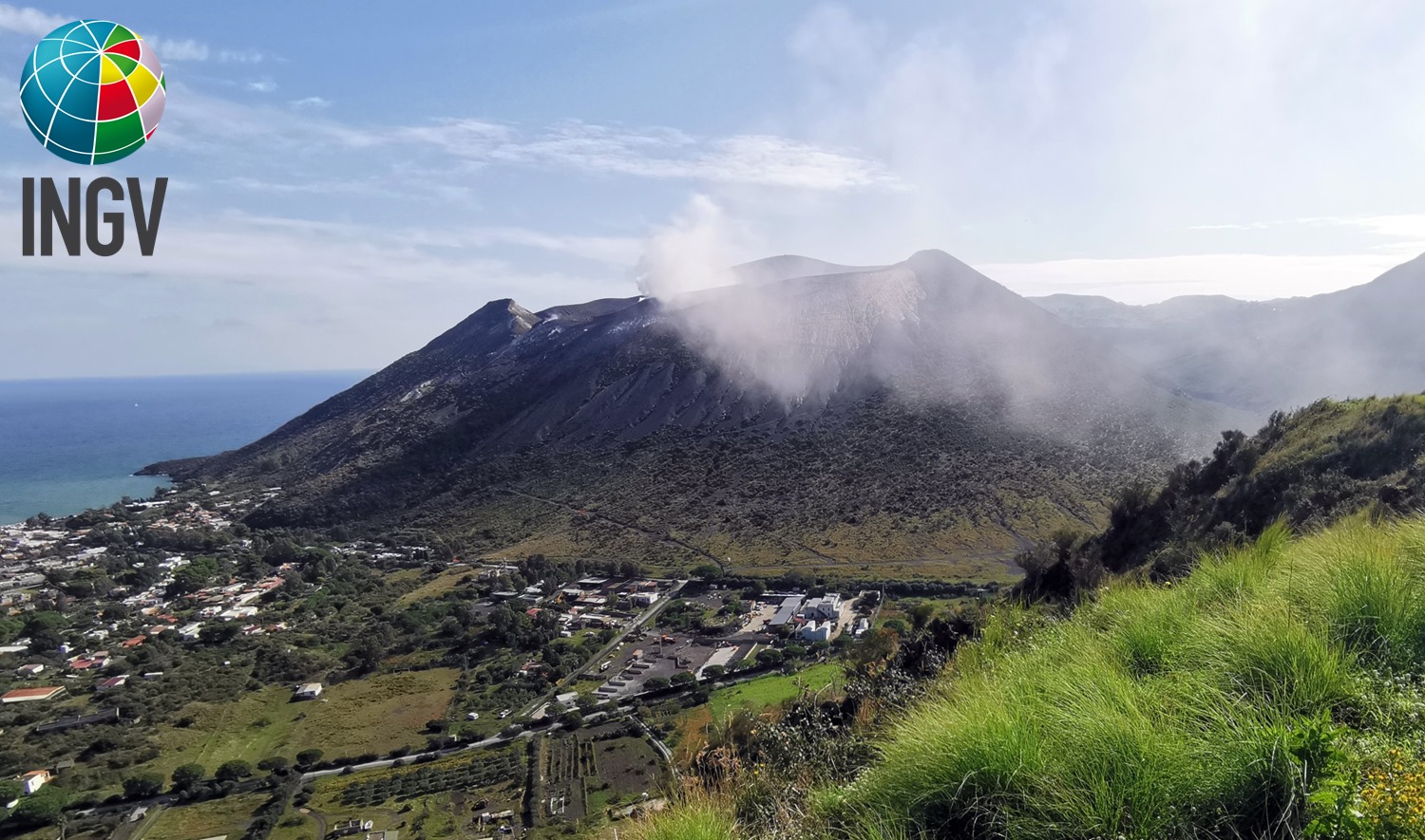
Italy , Vulcano :
WEEKLY BULLETIN, from January 24, 2022 to January 30, 2022. (issue date February 01, 2022)
ACTIVITY STATUS SUMMARY
In the light of the surveillance data, it is highlighted:
1) Temperature of the crater fumaroles: The temperatures recorded on the edge of the crater show a strong variability linked to atmospheric phenomena, while on the internal side they continue to remain stable.
2) CO2 flux in the crater area: The CO2 flux in the crater area remains at high values.
3) SO2 flux in the crater area: An update is not available, the values of the previous period place the SO2 flux at a high level
4) Geochemistry of fumarolic gases: No update is available.
5) CO2 fluxes at the base of the La Fossa cone and in the Vulcano Porto area: The CO2 fluxes at the base of the crater remain at medium-high values with the exception of the Faraglione site, where the values near background level are recorded.
6) Geochemistry of thermal aquifers: The physico-chemical parameters recorded in the Camping Sicilia and Bambara wells remain stable.
7) Local seismicity: Number of weak micro-tremors, decreasing VLP.
8) Regional seismicity: Regional seismicity essentially absent.
9) Deformations – GNSS: The GNSS monitoring network did not show any significant changes during the previous week.
10) Deformations – Inclinometry: The inclinometric network does not show any significant variations.
11) Other observations: Mobile GNSS: The mobile GNSS stations do not seem to show significant variations during the period considered.
GB-RAR: The GB-RAR monitoring results referring to the period December 14, 2021 – January 31, 2022, show a general stability of the area, with deformations along the LOS of less than 1 mm.
Gravimetry: During the period under review, the continuous gravimetry measurement stations did not record any significant changes
CRATER FUMEROLES TEMPERATURE:
In the current week, the fumaroles of the summit perimeter showed a trend strongly disturbed by atmospheric phenomena. The decrease in temperature on the edge corresponds to rainy events. The temperatures recorded on the interior side remain stable, at 114°C.
CO2 FLOW AT THE BASE OF LA FOSSA CONE AND IN THE VULCANO PORTO AREA
The CO2 fluxes from the ground, acquired automatically by the VULCANOGAS network, showed a slight increase today at the Camping Sicilia and Rimessa sites, probably linked to a modulation of the atmospheric pressure. Values remain at high levels, although below those reached at the height of the crisis. On the Faraglione site, the values are comparable to those recorded the previous week.
Source : INGV.
Photos : INGV.
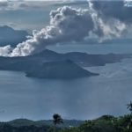
Philippines , Taal :
TAAL VOLCANO BULLETIN 03 February 2022 8:00 AM
In the past 24-hour period, the Taal Volcano Network recorded one hundred fifty-two (152) volcanic earthquakes, including thirty-three (33) volcanic tremor events having durations of one (1) to two (2) minutes, one hundred fourteen (114) low-frequency volcanic earthquakes, five (5) hybrid events and low-level background tremor that has persisted since July 7, 2021.
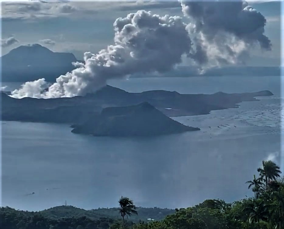
One short-lived phreatomagmatic burst was recorded at 3:55 PM yesterday, that lasted 2 minutes based on seismic record. This event produced plume 300 meters tall that drifted southwest. Activity at the Main Crater was dominated by upwelling of hot volcanic fluids in its lake which generated plumes 900 meters tall that drifted south-southwest. Sulfur dioxide (SO2) emission averaged 7,902 tonnes/day on 02 February 2022. Based on ground deformation parameters from electronic tilt, continuous GPS and InSAR monitoring, Taal Volcano Island and the Taal region has begun deflating in October 2021.
Source : Phivolcs .
Photo : Kyle Aranza
Chile , Lascar :
SERNAGEOMIN reported minor increases in surficial activity at Láscar. Nighttime incandescence from the crater began to be visible at least since 11 January. A total of 14 thermal anomalies were identified in satellite data during 13-28 January; the intensity of the anomalies increased on 17 January and peaked on 22 January. Emissions of gas and steam were more frequent and robust as compared to previous months, with the highest plume rising over 1 km above the crater rim on 22 January. Sulfur dioxide emissions were identified in satellite data on 8 and 17 January; instruments at EMU station, 6 km ESE, recorded increased emission rates during 17-19 January with a peak average of 1,787 tons per day on 18 January.
![]()
Seismicity was at normal levels overall during 12-28 January. Low numbers and magnitudes of volcano-tectonic (VT) and long-period (LP) earthquakes were recorded by the seismic network, though 27 VT events that were low magnitude (M 1 or below) were recorded on 22 January. Satellite images acquired on 26 January showed no recent morphological changes at the crater nor deposits around the crater area. The Alert Level remained at Green (the lowest level on a four-color scale).

View of Láscar (center left), Aguas Calientes (center), and Acamarachi (center right) from Laguna Lejía.
Láscar is the most active volcano of the northern Chilean Andes. The andesitic-to-dacitic stratovolcano contains six overlapping summit craters. Prominent lava flows descend its NW flanks. An older, higher stratovolcano 5 km E, Volcán Aguas Calientes, displays a well-developed summit crater and a probable Holocene lava flow near its summit (de Silva and Francis, 1991). Láscar consists of two major edifices; activity began at the eastern volcano and then shifted to the western cone. The largest eruption took place about 26,500 years ago, and following the eruption of the Tumbres scoria flow about 9000 years ago, activity shifted back to the eastern edifice, where three overlapping craters were formed. Frequent small-to-moderate explosive eruptions have been recorded since the mid-19th century, along with periodic larger eruptions that produced ashfall hundreds of kilometers away. The largest historical eruption took place in 1993, producing pyroclastic flows to 8.5 km NW of the summit and ashfall in Buenos Aires.
Source : GVP.
Photos : Sernageomin / Gabriel Orozco. RudiR/ commons.wikimedia.org .
Japan , Sakurajima :
JMA reported that incandescence from Minamidake Crater (at Aira Caldera’s Sakurajima volcano) was visible at night during 24-31 January. Two explosions occurred on 28 January. One of them, recorded at 1319, produced an ash plume that rose 3.4 km above the crater rim and ejected blocks as high as 1.7 km. Ash fell in Arimura (4.5 km SE) and Kurokami (4 km E). JMA noted that until this event explosion plumes had not exceeded 3 km since 5 April 2021. The Alert Level remained at 3 (on a 5-level scale), and residents were warned to stay 2 km away from the crater.
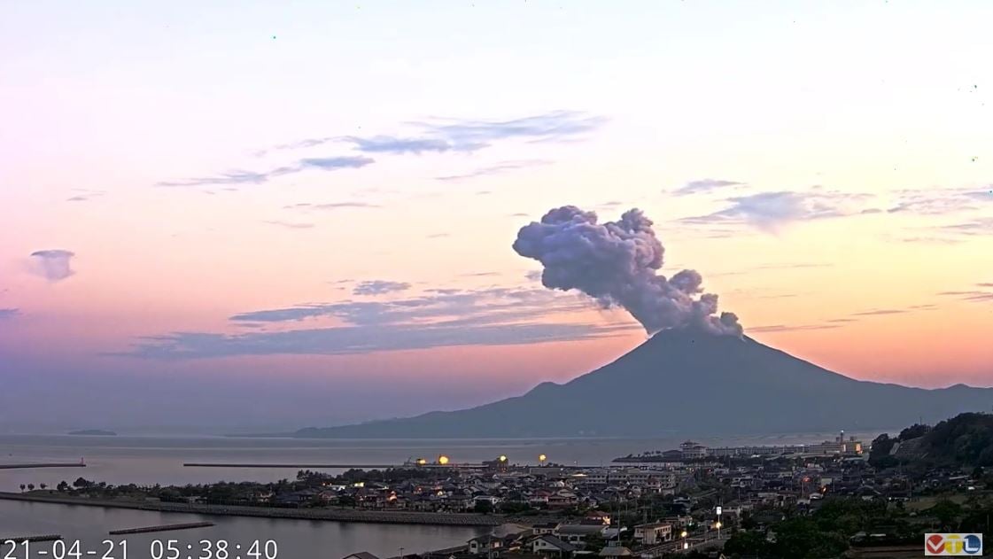
The Aira caldera in the northern half of Kagoshima Bay contains the post-caldera Sakurajima volcano, one of Japan’s most active. Eruption of the voluminous Ito pyroclastic flow accompanied formation of the 17 x 23 km caldera about 22,000 years ago. The smaller Wakamiko caldera was formed during the early Holocene in the NE corner of the Aira caldera, along with several post-caldera cones. The construction of Sakurajima began about 13,000 years ago on the southern rim of Aira caldera and built an island that was finally joined to the Osumi Peninsula during the major explosive and effusive eruption of 1914. Activity at the Kitadake summit cone ended about 4850 years ago, after which eruptions took place at Minamidake. Frequent historical eruptions, recorded since the 8th century, have deposited ash on Kagoshima, one of Kyushu’s largest cities, located across Kagoshima Bay only 8 km from the summit. The largest historical eruption took place during 1471-76.
Source : GVP.
Photo : VTL via Alicja Szojer


No comment yet, add your voice below!