
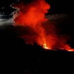
December 12, 2021 .
Spain / La Palma , Cumbre Vieja :
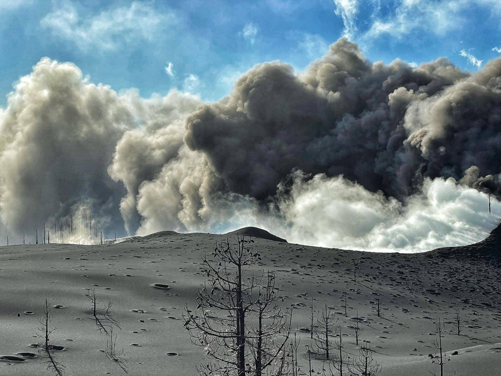
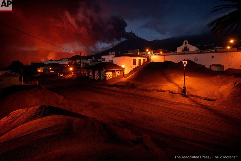
December 11, 2021, 09:00 UTC. Eruptive activity continues on La Palma.
Since the last declaration, a total of 44 earthquakes have been located on the island of La Palma, three of which were felt by the population.
The maximum recorded magnitude is 3.7 (mbLg), corresponding to yesterday’s earthquake at 21:57 UTC, at a depth of 13 km, felt with intensity II-III (EMS98).
Seismicity continues under the central area of Cumbre Vieja in the same areas of the previous days, most earthquakes (42) are located at depths between 10 and 18 km, the rest (only 2) were located at depths between 33 and 38 km.
No earthquake was located at depths less than 10 km.
The amplitude of the tremor signal was maintained at low levels.
As in previous days, the island’s network of permanent GNSS stations does not show a clear trend in the deformation of the stations closest to the eruptive centers.
In the rest of the stations, the slight deflation possibly linked to the deep seismicity has stabilized, except in LP01 which continues to record it.
In view of the image calibrated at 08:39 UTC, an ash cloud height of 2000 m is estimated to be oriented towards the West.
The volcano of La Palma will reach 84 days of duration this weekend, corresponding to the longest eruption on the island.
The volcano emitted more than 120 million cubic meters of magma, according to data from the 47th day of activity, in which the scientific committee provided this information.
No one was killed in the eruption of La Palma due to the direct effect of the volcano. However, there is an accident under investigation: on Saturday, November 13, the lifeless body of a 72-year-old man who entered the exclusion zone was found, he was cleaning a house in the neighborhood of Corazoncillo of ashes. The autopsy was inconclusive.
The maximum magnitude of the earthquakes that occurred during this crisis on La Palma was recorded in the early morning hours of November 19 and was 5.1.
The maximum intensity that earthquakes have reached, on a scale up to XI, is V. An earthquake of this intensity is already classified as « strong ».
The area of the two lava deltas which have gained over the sea is 50 hectares. These two deltas are the youngest parcels of land in Spain. In the larger one, 44 hectares, would fit the whole of the Vatican State, which only has that area, or 19 St. Peter’s Basilicas (2.3 hectares).
The lava affected 360 hectares of crops: 224.99 hectares of banana plantations, 62.37 hectares of vines and 27.33 hectares of avocado trees.
The record number of earthquakes recorded by the island’s seismic networks in a single day was 375 on November 30.
Sources : IGN es , El Pais .
Photos : CARLOS LORENZO / IGME_CSIC , AP / emilio morenatti / Patrice Zwenger.
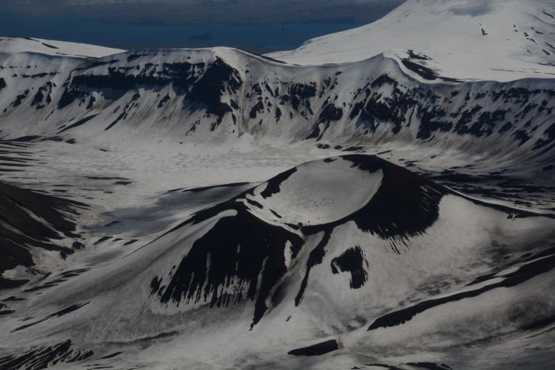
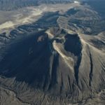
Aleutian Islands , Omok
53°23’49 » N 168°9’58 » W,
Summit Elevation 3520 ft (1073 m)
Current Volcano Alert Level: NORMAL
Current Aviation Color Code: GREEN
AVO released an Information Statement for Okmok volcano on December 8 in response to a change in the long-term deformation pattern between September and November 2021. The deformation has since returned to background levels. There have been no notable changes in seismic activity during this time period, and satellite images have shown no surface changes.
The deformation observed recently suggests a pressure increase at a shallow depth—less than 1 km (0.6 miles) below the caldera floor. This is consistent with a small intrusion of magma at that depth, but other non-magmatic processes such as hydrothermal activity cannot be ruled out. If the deformation was caused by a shallow magma intrusion, this may increase the likelihood of an eruption. Previous eruptions at Okmok have occurred with little precursory seismic activity, and AVO continues to monitor the volcano closely. The Aviation Color Code and the Volcanic Alert Level at Okmok remain at GREEN/Normal.
Ground deformation at Okmok is monitored with 4 continuous GNSS instruments, two inside the caldera and two outside. Data for these stations are downloaded remotely and analyzed daily. The volcano has had a local real-time seismic monitoring network since 2003. Currently, the network consists of 7 three-component seismometers on the eastern portion of Umnak Island, including 4 within the caldera. Okmok is also monitored by satellite data, a web camera, and remote infrasound and lightning networks.
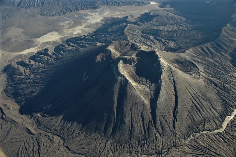
Okmok volcano is a 10-kilometer (6-mile) -wide caldera that occupies most of the eastern end of Umnak Island, located 120 kilometers (75 miles) southwest of Unalaska/Dutch Harbor in the eastern Aleutian Islands. Okmok has had several eruptions in historical time typically consisting of lava flows crossing the caldera floor, such as in 1945, 1958, and 1997. However, in 1817, Okmok produced an explosive eruption that resulted in ash fall in the Dutch Harbor area. The volcano last erupted in July–August 2008, producing continuous ash emissions that fluctuated between about 1,500 and 9,000 meters (5,000 and 30,000 feet) above sea level for the 5-week duration of the eruption, with an initial plume height of 15,000 meters (50,000 feet) during the first 12 hours. This eruption resulted in the construction of a new cone (Ahmanilix) within the caldera.
The nearest settlement is Nikolski, about 70 kilometers (45 miles) west of the volcano. A ranch caretaker family lives at Fort Glenn on the flank of the volcano about 10 kilometers (6 miles) east of the caldera rim during the summer months.
Source : AVO.
Photos : Mees Burke , Larsen Jessica / Alaska Volcano Observatory / University of Alaska Fairbanks, Geophysical Institute.
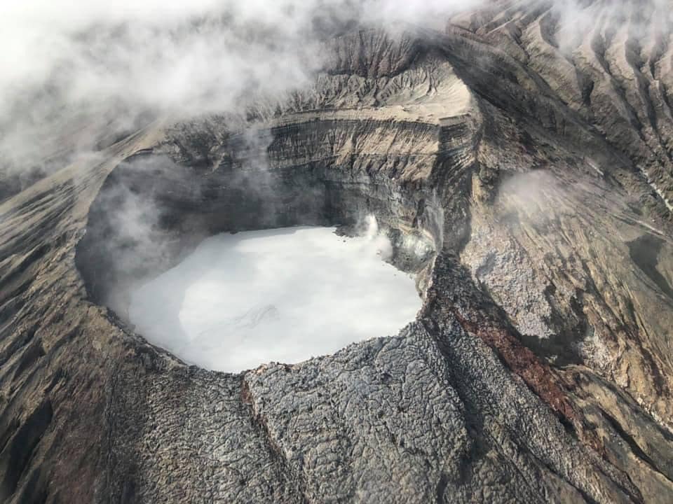
Costa Rica , Turrialba / Poas / Rincon de la Vieja :
Turrialba volcano
Lat: 10.025 ° N;
Long: 83.767 ° W;
Altitude: 3340 m
Current activity level: 2 (active volcano)
Potentially associated hazards: gas, ash emission, proximal ballistic projections, acid rain.
The last eruption took place on November 23. The seismic activity remains stable (weekly number of high frequency earthquakes) or decreasing from August to September (low frequency earthquakes which have gone from ~ 250 to ~ 50 events per week, number of short tremors which have gone from <150 at> 50 events per week). The number of VT type events remains variable but always in the low range of events (2 to 10 events per week). Geodetic monitoring continues to show a subsidence trend of the Irazú-Turrialba massif over a period of 3 months. Although this remains to be confirmed, a small inflation is observed on the GPS station of the southern flank of the summit cone of Turrialba.

The CO2 / SO2 and H2S / SO2 gas ratios have returned to normal values after peaking in both ratios last week. No eruptive manifestation was observed during this period, but rather a rainy episode. The weekly average SO2 flow shows a slight downward trend (223 +/- 54 t / d) after 1.5 months of increase. The data does not justify maintaining the level of activity of the volcano at level 3 (erupting volcano), so it goes down to level 2 (active volcano), but we must insist on the unpredictability of the volcano that made phreatic eruptions without warning signs in June-August and in November 2021.
The phreatic eruptions correspond to the sudden release of gas which accumulates under or inside the hydrothermal system, and which on heating the hydrothermal system itself, partially vaporizes after the rupture of a plug or on approaching. the hot surface.
Groundwater eruptions can occur without appreciable precursor volcanic activity in real time, and have the potential to emit ash and even proximal ballistic projections.
Poas volcano
Lat: 10.2 ° N;
Long: 84.233 ° W;
Altitude: 2780 m
Current activity level: 2 (active volcano)
Potentially associated hazards: gas, phreatic eruptions, proximal ballistic projections, acid rain.

No eruption has been detected so far. Seismic activity continues to decrease in number and amplitude (> 1000 events per week in October, <200 events per week in December). Geodetic tracking indicates that inflation observed in recent months has stopped in recent weeks. Gas concentrations are not sufficient to reliably measure SO2 / CO2 and H2S / SO2 ratios. The SO2 flux remains stable, calculated at 30 +/- 14 t / d. The SO2 concentration in the vent did not exceed 0.57 ppm during the week. The level of the hyperacid lake rose by about 40 cm in one week, submerging the cone around the mouth A. Its temperature remains at 38 ° C and its composition reflects little the entry of gas into the lake.
Rincón de la Vieja volcano
Lat: 10.83 ° N;
Long: 85.324 ° W;
Altitude: 1895 m.s.n.m.
Current activity level: 2 (active volcano)
Potentially associated hazards: Lahars, gas, phreatic eruptions, proximal ballistic projections, acid rain.
The last phreatic eruption was recorded on October 21. Seismic activity remains very low: between November and December the number of LP type events increased from 30 to ~ 2 LP per week, the number of VT type events increased from> 15 to ~ 2 VT per week . RSEM and RSAM graphics remain very weak, VT type events continue to occur in the Las Pailas area. The GPS geodetic monitoring shows some contractions and subsidence during the last 3 months, more marked subsidence to the south of the massif. The oxidation-reduction potential (ORP) of Santuarium Ojo de Agua north of the volcano shows stability with a slight upward trend between November 2020 and December 2021.
Source : Ovsicori.
Photos : RSN ( archive 2018 ) , RSN, Jean Paul Calvo , Chris Allen.
Philippines , Taal :
TAAL VOLCANO BULLETIN 12 December 2021 8:00 AM
In the past 24-hour period, the Taal Volcano Network recorded ninety-one (91) volcanic earthquakes, including ninety (90) volcanic tremor events having durations of two (2) to thirty (30) minutes and low-level background tremor that has persisted since July 7, 2021. Sulfur dioxide (SO2) emission averaged 3,375 tonnes/day on 10 December 2021. Based on ground deformation parameters from electronic tilt, continuous GPS and InSAR monitoring, Taal Volcano Island and the Taal region has begun deflating in October 2021.
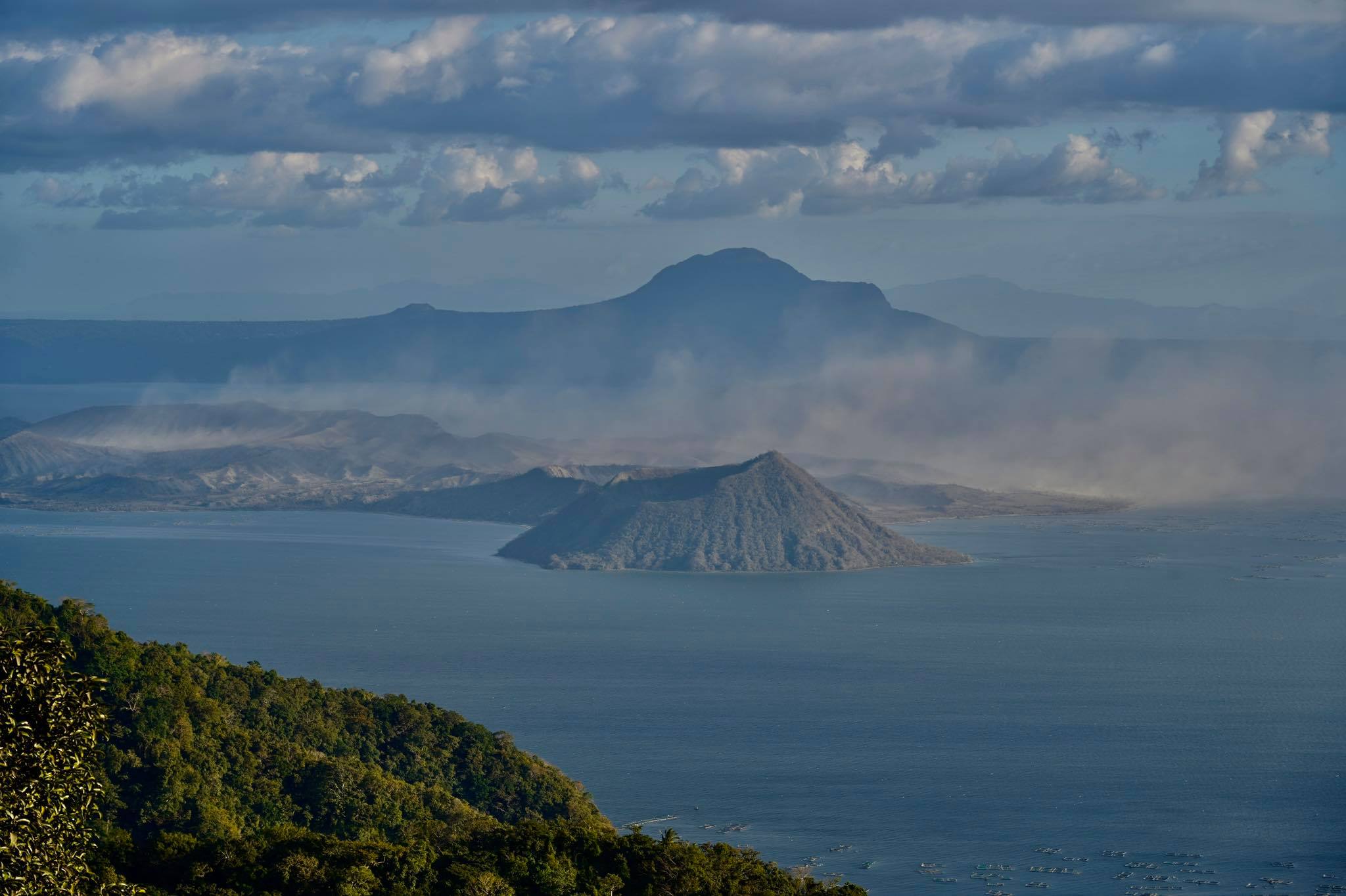
Alert Level 2 (Increased Unrest) prevails over Taal Volcano. DOST-PHIVOLCS reminds the public that at Alert Level 2, sudden steam- or gas-driven explosions, volcanic earthquakes, minor ashfall, and lethal accumulations or expulsions of volcanic gas can occur and threaten areas within and around TVI. DOST-PHIVOLCS strongly recommends that entry into Taal Volcano Island, Taal’s Permanent Danger Zone or PDZ must be strictly prohibited, especially the vicinities of the Main Crater and the Daang Kastila fissure, and extended stays on Taal Lake.
Source : Phivolcs .
Photo : Raffy Tima


No comment yet, add your voice below!