
September 20 , 2021.
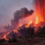
Spain / La Palma, Cumbre Vieja:
Updated information on the new volcanic eruption in Cumbre Vieja.
The Canary Islands Volcanic Institute (INVOLCAN) has made a first estimate of the amount of sulfur dioxide (SO2) emitted into the atmosphere by the current eruptive process of Cumbre Vieja during its first day (September 19, 2021).
This first estimate turned out to be of the order of 6,000 to 9,000 tonnes per day, assuming that the wind at 3,000 meters was in the afternoon of September 19 with intensities of the order of. 2.8 to 4.2 meters per second (meteorological data provided by AEMET).
The estimate was made after having carried out 4 measurement transects with an optical sensor of the miniDOAS type in a land mobile position. From September 20, this type of measurements will be carried out in a mobile position thanks to the collaboration of the Helicopter Unit of the Civil Guard of Tenerife, as happened during the underwater eruption of El Hierro. Daily monitoring of this parameter will be essential to analyze the evolution of the current process and to be able to use this methodology to certify the date of the end of the eruption.
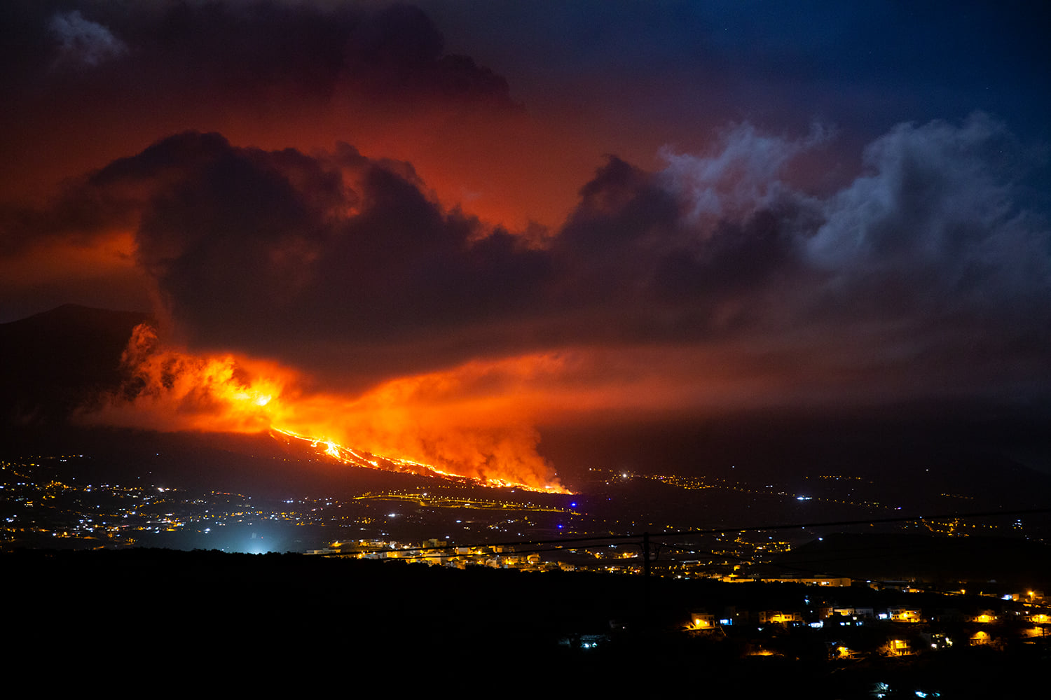
The steering committee of the Special Plan for Civil Protection and Emergency for Volcanic Risk (PEVOLCA), meeting today at night, stressed that the eruption recorded this afternoon in La Palma did not cause personal damage , thanks to the coordination work of the system. Although the eruption occurred in an unpopulated area, around five thousand people were evacuated for security reasons. The lava has affected eight houses so far and the focus is now on the advancement of the lava flows towards the coast and the bushfires that the phenomenon itself generates.
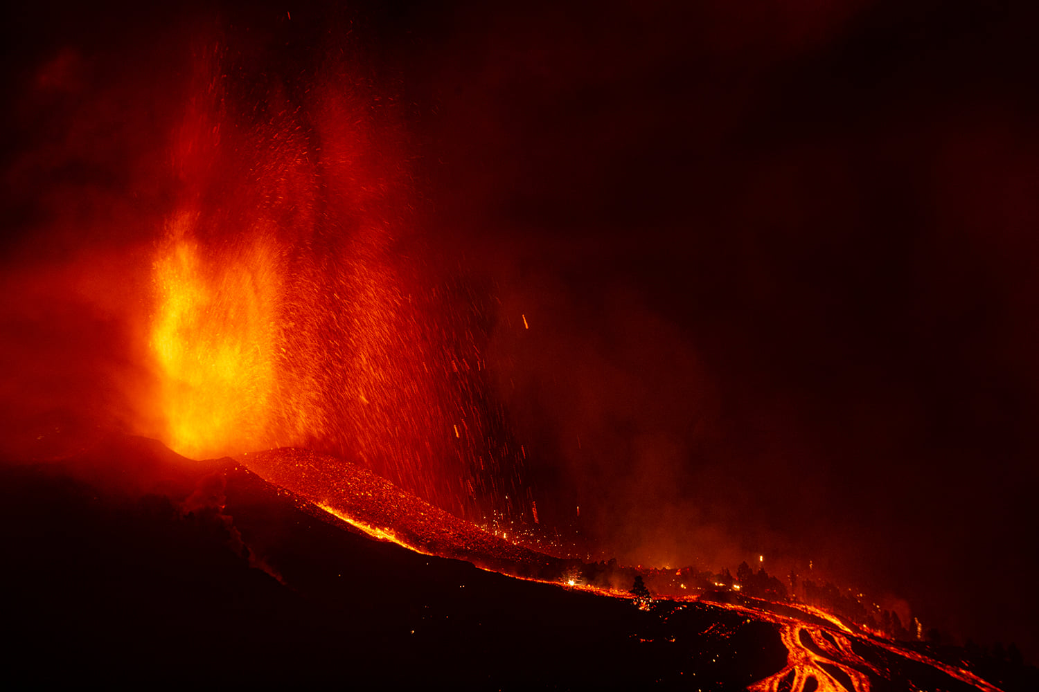
Experts reported that at 3:12 PM a magma fissure eruption began, with a typical Strombolian mechanism, and some phreato-magmatic impulses. With the information currently available, two cracks of hundreds of meters in length were observed, aligned in the North-South direction and separated from each other by about 200 meters, with several points of pyroclastic emissions and lava flows. The surface temperature of the lava emitted reaches 1075º. There is also the formation of a main cone. The coordinates provided for the first emission point are: 28º36’N, 17º52’W. It is estimated that the column of volcanic ash reaches a height of 1500m and that the gases emitted reach 3000m (according to the VAAC of Toulouse).
The committee said the onset of the eruption coincided with a volcanic tremor signal recorded in all seismic seasons. There is a decrease in seismicity, although some low magnitude tremors remain. The occurrence of felt earthquakes is not excluded. We also note that the deformations continue to be recorded, mainly in the area closest to the eruption, with a cumulative deformation of 19 cm.
The volcanic alert level is RED.
Sources : Involcan , Pevolca .
Photos : ATHOS Centro Astronómico La Palma ,
Alaska , Semisopochnoi :
VOLCANO OBSERVATORY NOTICE FOR AVIATION (VONA)
Issued: September 20 , 2021
Volcano: Semisopochnoi (VNUM #311060)
Current Color Code: RED
Previous Color Code: ORANGE
Source: Alaska Volcano Observatory
Notice Number: 2021/A811
Volcano Location: N 51 deg 55 min E 179 deg 35 min
Area: Aleutians
Summit Elevation: 2625 ft (800 m)
Volcanic Activity Summary:
Ash emissions from the ongoing eruption at Semisopochnoi have increased in frequency and intensity. Satellite images show an ash cloud at an estimated altitude of 15,000 ft. above sea level extending approximately 60 miles (100 km) to the southeast through 05:00 UTC. Explosions have been observed throughout the day and increased sulfur dioxide gas emissions have been observed in satellite data this afternoon. These observations represent an increase in eruptive activity and Aviation Color Code and Volcano Alert level are being increased to RED/WARNING.
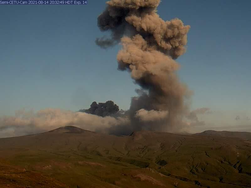
Increasing high clouds over Semisopochnoi will likely obscure satellite views of ash emissions within the hour. Seismic and infrasound monitoring will continue to provide notice of ongoing explosive activity, however it cannot determine the height or extent of ash emissions. The Alaska Volcano Observatory will continue to closely monitor all available data.
Volcanic cloud height: 15,000 ft. asl
Other volcanic cloud information:
Ash and sulfur dioxide observed in satellite extending 60 miles to the SE
Remarks:
Semisopochnoi is monitored by a local seismic and infrasound network, local web cameras, regional lightning and infrasound sensors, and satellite data.
Source : AVO
Photo : Alaska Volcano Observatory / U.S. Geological Survey.
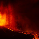
Iceland , Geldingadalur / Fagradalsfjall :
Today, the eruption in Fagradalsfjall has lasted for six months. There is little activity right now after a busy week.
This week, pulsating activity that had not been observed since April and May began. Then the commotion rises and it begins to subside outside the crater.
Salóme Jórunn Bernharðsdóttir, a natural hazards specialist at the National Weather Service, says there was a glow last night, but it was probably lava that was cooling but not coming out of the crater.
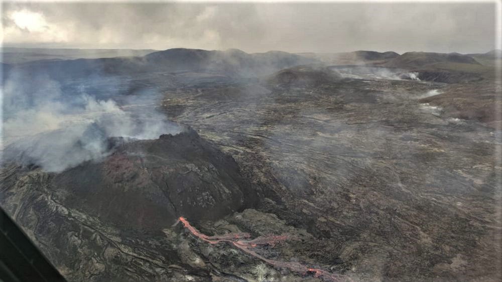
The eruption began around 3:00 p.m. on Friday, March 19. According to the last measurement taken on September 9, lava covers 4.63 square kilometers and 142.7 million cubic meters of lava has occurred. Salome says the next measurement should be done soon.
RÚV’s webcam in Langahryggur is broken right now. Repair works are in progress.
Source : RUV.
Photo : Matthias Vogt – Volcano Heli.
Ecuador , Reventador :
DAILY REPORT OF THE STATE OF THE REVENTADOR VOLCANO, Sunday September 19, 2021.
Information Geophysical Institute – EPN.
Surface activity level: High, Surface trend: No change.
Internal activity level: Moderate, Internal trend: No change.
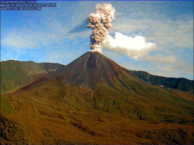
Seismicity: From September 18, 2021, 11:00 a.m. to September 19, 2021, 11:00 a.m.
Explosions (EXP): 75 events
Rains / lahars: No rain was recorded in the volcano region
Emission / ash column: Gas and ash emissions were observed between 600 and more than 1200 meters above the level of the crater in a north-west, west and north-east direction. The Washington VAAC reported ash emissions up to 1,338 meters above crater level in a northwest direction.
Other monitoring parameters: No thermal alerts have been recorded in the last 24 hours.
Observations: The volcano sector was cleared from late afternoon yesterday until early morning today. At night and in the early morning, explosions, incandescences in the crater and rolling blocks were observed up to 500 meters below the summit on all sides of the volcano. Right now it’s cloudy.
Alert level: Orange.
Source et photo : IG-EPN.
Guatemala , Santiaguito :
ACTIVITY:
According to the STG8 webcam, and the OVSAN observers, it is possible to hear sounds similar to airplane turbines generated by the degassing of the dome, as well as by the gray and white explosions which rise to 3400 meters above sea level (11,154 feet) dispersing in a westerly and southwest direction. At night and early in the morning they generated weak incandescent avalanches from the dome to the vegetation.
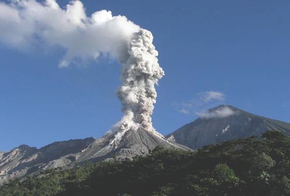
Ash falls are reported on the volcanic perimeter. Due to the permanent extrusion of materials and their instability, weak to moderate debris avalanches have been observed from the Caliente Dome on the west and southwest flanks. There is a likelihood of moderate to strong pyroclastic flows.
Source : Insivumeh.
Photo : la hora.


No comment yet, add your voice below!