
July 17 , 2021.
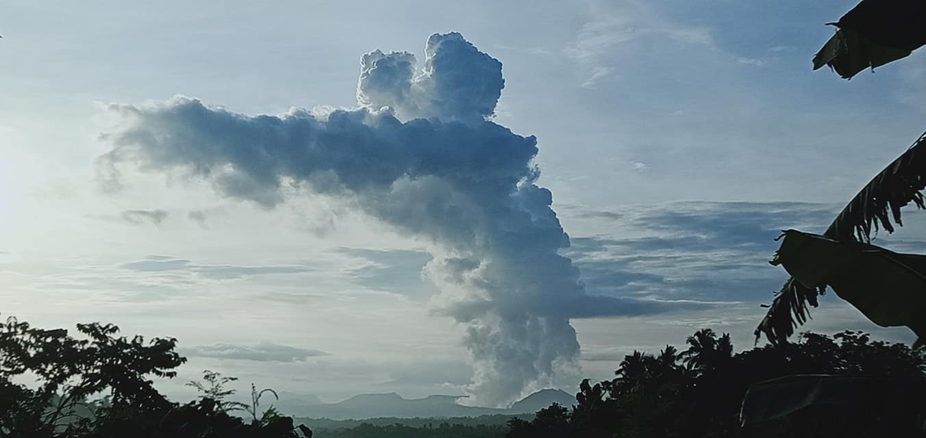
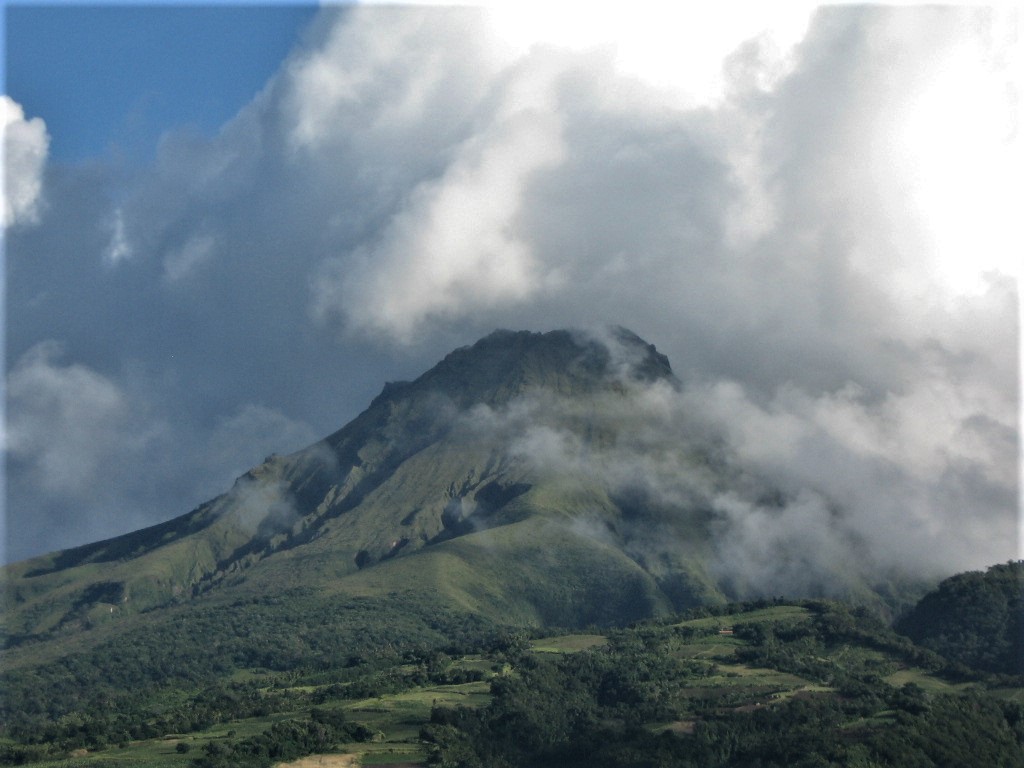
Philippines , Taal :
TAAL VOLCANO BULLETIN 17 July 2021 8:00 AM
In the past 24-hour period, the Taal Volcano Network recorded ninety-nine (99) volcanic earthquakes, including ninety (90) volcanic tremor events having durations of one (1) to eleven (11) minutes, nine (9) low frequency volcanic earthquakes, and low-level background tremor that has persisted since 07 July 2021. High levels of volcanic sulfur dioxide or SO2 gas emissions and steam-rich plumes that rose one thousand two hundred (1,200) meters before drifting north and northeast were generated from the Taal Main Crater. Sulfur dioxide (SO2) emission averaged 6,574 tonnes/day on 16 July 2021. Based on ground deformation parameters from electronic tilt, continuous GPS and InSAR monitoring, Taal Volcano Island has begun deflating in April 2021 while the Taal region continues to undergo very slow extension since 2020.
Alert Level 3 (Magmatic Unrest) now prevails over Taal Volcano. At Alert Level 3, magma extruding from the Main Crater could drive explosive eruption. The public is reminded that the entire Taal Volcano Island is a Permanent Danger Zone (PDZ), and entry into the island as well as into the high-risk barangays of Agoncillo and Laurel must be prohibited due to the hazards of pyroclastic density currents and volcanic tsunami should strong eruptions occur. All activities on Taal Lake should not be allowed at this time. Communities around the Taal Lake shores are advised to remain vigilant, take precautionary measures against possible airborne ash and vog and calmly prepare for possible evacuation should unrest intensify. Civil aviation authorities must advise pilots to avoid flying over Taal Volcano Island as airborne ash and ballistic fragments from sudden explosions and pyroclastic density currents such as base surges may pose hazards to aircraft.
DOST-PHIVOLCS maintains its close monitoring of Taal Volcano and any new development will be communicated to all concerned stakeholders.
Source : Phivolcs.
Photo : JhuLia Mendoza
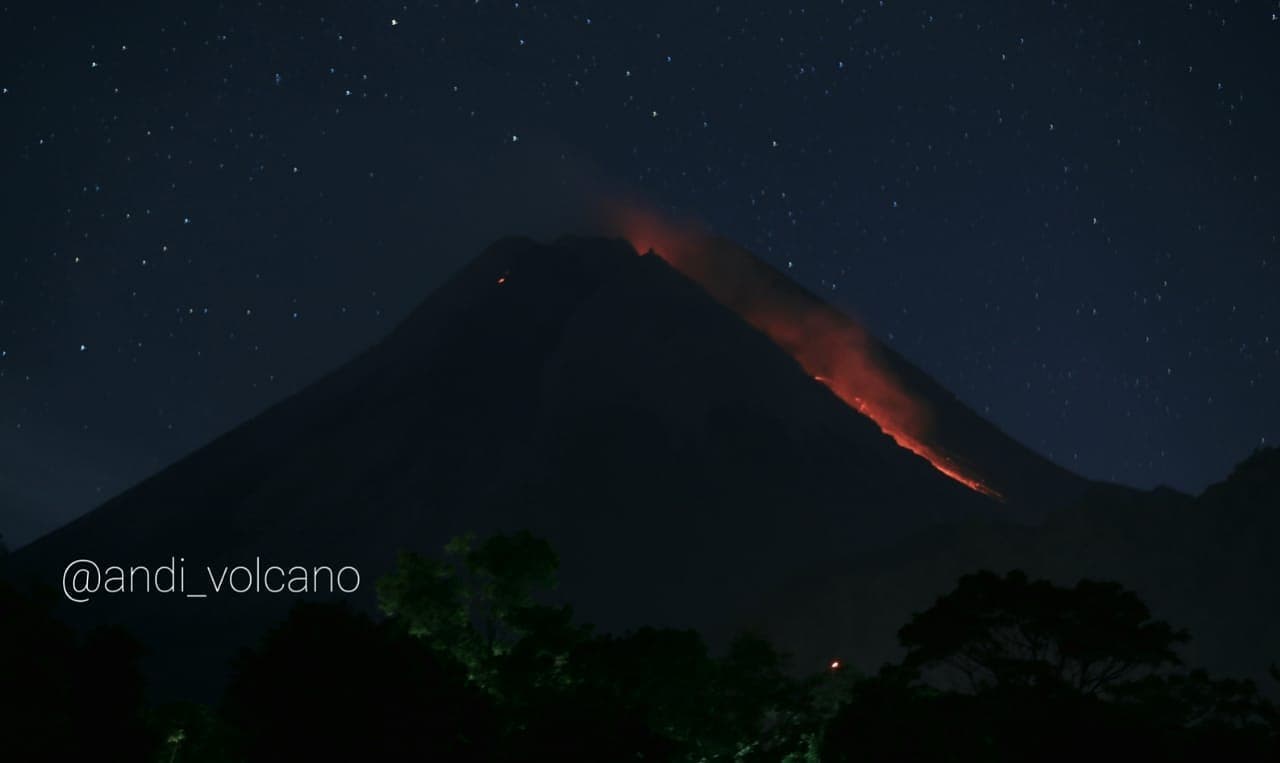
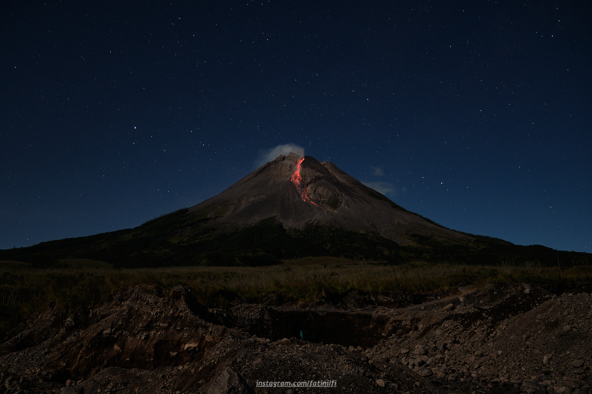
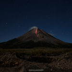
Indonesia , Merapi :
Mount Merapi Activity Report July 9-15, 2021
OBSERVATION
Visual
The weather around Mount Merapi is generally sunny in the morning and evening, while it is foggy in the afternoon. White fumes, weak to thick, of low pressure and 750 m high were observed from the observation post of Mount Merapi of Babadan on July 10, 2021 at 07:00 WIB.
This week, hot avalanche clouds were observed once to the southwest with a sliding distance of 1,100 m. Lava avalanches were observed 58 times to the South-East with a maximum slide distance of 1500 m, 98 times to the South-West with a maximum slide distance of 2000 m, 1 time to the West with a sliding distance of 1000 m and 3 times to the North-West with a maximum sliding distance of 700 m. .
Morphological analysis of the images from the Tunggularum Camera Station shows the volume of the dome in the southwest sector of 1,830,000 m3, while the analysis of the Deles3 Camera Station shows the volume of the central dome of 2,796,000 m3.
Seismicity
This week, the seismicity of Mount Merapi recorded
1 hot cloud avalanche (AP),
267 shallow volcanic earthquakes (VTB),
3 low frequency earthquakes (LF),
1,222 multi-phase earthquakes (MP),
1655 Avalanche earthquakes (RF),
133 emissions earthquake (DG),
7 tectonic earthquakes (TT).
The intensity of the seismicity this week was higher than last week.
Deformation
The deformation of Mount Merapi, which was monitored using EDM this week, showed a distance shortening rate of 8cm / day.
Rain and lahars
This week, it rained at the Mount Merapi observation post with an intensity of 27 mm / hour for 70 minutes at the Ngepos post on July 10, 2021. There were no reports of lahars or additional flow in the mountains. rivers that originate from Mount Merapi.
Conclusion
Based on the results of visual and instrumental observations, it is concluded that:
The volcanic activity of Mount Merapi is still quite high in the form of effusive eruption activity. The status of the activity is defined in the “SIAGA” level.
Source : BPPTKG.
Photos : Andi Volcanist , merapi_uncover .
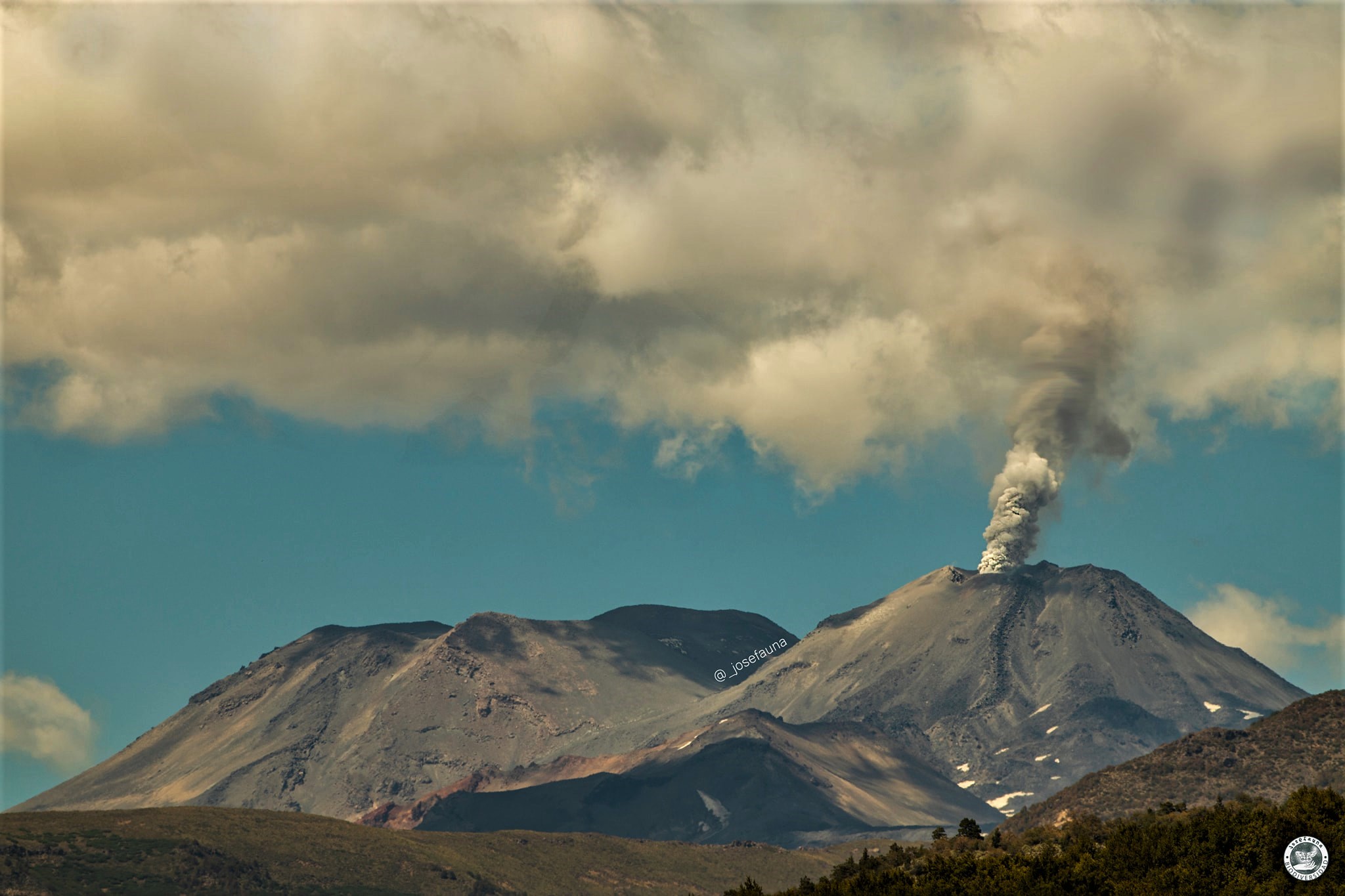
Chile , Nevados de Chillan :
Special Report on Volcanic Activity (REAV), Ñuble region, Nevados de Chillán volcanic complex, July 16, 2021, 1:25 p.m. local time (Continental Chile).
The National Service of Geology and Mines of Chile (Sernageomin) publishes the following PRELIMINARY information, obtained thanks to the monitoring equipment of the National Volcanic Monitoring Network (RNVV), processed and analyzed at the Volcanological Observatory of the Southern Andes ( Ovdas):
On Friday July 16, at 1:05 p.m. local time (5:05 p.m. UTC), monitoring stations installed near the Nevados de Chillán volcanic complex recorded an earthquake associated with fluid dynamics (long period type) in the volcanic system.
The characteristics of the earthquake after its analysis are as follows:
ORIGINAL TIME: 13:05 local time (17:05 UTC)
LATITUDE: 36.853 ° S
LONGITUDE: 71.372 ° W
DEPTH: 2 km
REDUCED DISPLACEMENT: 561 (cm2)
ACOUSTIC SIGNAL: Not recorded.
The characteristics of the surface activity are as follows:
Maximum column height: Not determined due to weather conditions.
OBSERVATIONS:
Due to the weather conditions in the region, it was not possible to observe the surface activity of the active crater of the volcanic complex. At the time of publication of this report, no changes have been observed in the level of volcanic activity.
The volcanic technical alert remains at the Yellow level.
Source : Sernageomin.
Photo : Josefauna
La Martinique , Montagne Pelée :
Weekly report on the activity of Mount Pelée for the period from July 9 to 16, 2021.
Repair work on computer systems damaged by lightning on the night of June 29 to 30, 2021 at the old observatory building is continuing. To date, 73% of the Montagne Pelée seismological station network and 86% of the volcano’s deformation detection network are operational again. The OVSM IPGP team is taking advantage of this hazard to accelerate the modernization of the network of seismological stations on Mount Pelée, by replacing analog stations with digital stations, thereby improving data transmission to the new observatory.
Between July 9, 2021 at 4 p.m. (UTC) and July 16, 2021 at 4 p.m. (UTC), OVSM recorded at least 76 volcano-tectonic earthquakes of magnitude less than or equal to 0.2. These earthquakes were located inside the volcanic edifice between sea level and 1 km above sea level. None of these earthquakes were felt by the population. This volcano-tectonic-type superficial seismicity is associated with the formation of micro-fractures in the volcanic edifice.
During phases of volcanic reactivation, periods of higher seismic activity often alternate with phases of lower seismicity. Seismicity above the baseline is always recorded. No other changes were noted in the activity of Mount Pelée.
A main area of heavily degraded vegetation is still observed on the southwest flank of Mount Pelée, between the upper Claire River and the Chaude River. These observations reflect the variable dynamics of the processes of magmatic and hydrothermal origin at Mount Pelée in line with its renewed activity since April 2019.
The alert level remains YELLOW: vigilance.
Source : Direction de l’OVSM IPGP.
Photo : Jmp48 / Wikipedia
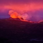
Iceland , Geldingadalur / Fagradalsfjall :
The eruption continues.
The eruption on the Reykjanes Peninsula is rekindled after a little over 24 hours of hiatus. Now the crater is erupting and lava is flowing into Meradali, according to information from the Meteorological Bureau. Early yesterday morning the eruption subsided, but this morning it increased slightly.
A helicopter pilot flew over around noon and said the crater was filling up well. Then nothing came out of him. Now, in the afternoon, the lava has started to slide out of the crater again.
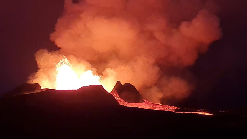
Magnús Tumi Guðmundsson, professor of geophysics, said in the lunch diary that the eruption had been emptied in the past two to three weeks and that five to six cubic meters could be estimated to have occurred per second during this. period. That would be more than half of what happened in May and June. Visibility has improved at the eruption site and it can be clearly seen on the RÚV webcam on Langahrygg.
Source : RUV.
Photo : Matan Fidel


No comment yet, add your voice below!