
June 6 , 2021 .
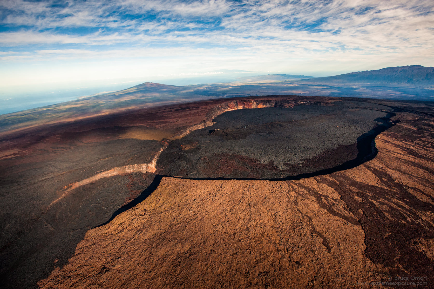
Hawaii , Mauna Loa :
19°28’30 » N 155°36’29 » W,
Summit Elevation 13681 ft (4170 m)
Current Volcano Alert Level: ADVISORY
Current Aviation Color Code: YELLOW
Activity Summary:
Mauna Loa Volcano is not erupting. Rates of seismicity at the summit remain slightly elevated and above long-term background levels. Other Mauna Loa monitoring data streams show no significant change in deformation rates or patterns that would indicate increased volcanic hazard at this time.
Observations:
During the past week, HVO seismometers recorded approximately 55 small-magnitude earthquakes below Mauna Loa, most concentrated below the summit and upper-elevation flanks of the volcano. All of the earthquakes over the past week were less than M3 and occurred mostly at depths of less than 8 km (about 5 mi) below ground level.
Global Positioning System (GPS) measurements show low rates of deformation in the summit region over the past week.
Gas concentrations (below 2 ppm SO2) and fumarole temperatures (below 100 degrees Celsius or 212 degrees Fahrenheit) at both the summit and at Sulphur Cone on the Southwest Rift Zone remain stable.
Webcam views have shown no changes to the volcanic landscape on Mauna Loa over the past week.
Source : HVO.
Photo : Bruce Omori .
Alaska , Semisopochnoi :
51°55’44 » N 179°35’52 » E,
Summit Elevation 2625 ft (800 m)
Current Volcano Alert Level: WATCH
Current Aviation Color Code: ORANGE
Unrest at the north crater of Mount Cerberus volcano on Semisopochnoi Island has continued over the past week. Low-level seismic activity has occurred throughout most of the week and only minor steaming from the active vent has been occurring over the past several days as reported by AVO field crews working on the island. Last weekend (May 29-30), low-level ash emissions reaching 3,000 to 10,000 feet above sea level were observed by AVO personnel. Ash also was detected in GOES satellite data that showed several narrow, thin plumes extending towards the southwest over Amchitka Island. The ash emissions coincided with a period of relatively continuous seismic tremor that lasted for about 9 hours. Minor ash fall occurred on the southern part of Semisopochnoi Island, but there were no reports of ash fall on Amchitka Island southwest of the volcano where AVO personnel were located.
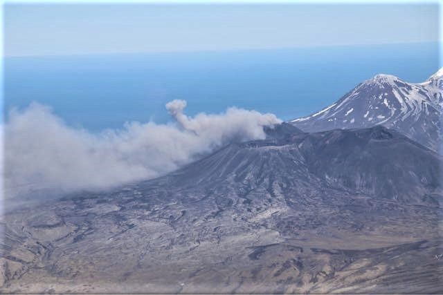
Minor ash emissions from Cerberus observed during AVO field work at Semisopochnoi Island.
Satellite observations were mostly obscured by clouds over the past week, but occasional clear views of Semisopochnoi Island indicated elevated surface temperatures at north crater on several days. Emissions of sulfur dioxide gas also were detected in satellite data throughout the week. Overall, activity at north crater remains elevated and above background levels but the volcano appears to have entered a quiet period characterized by passive degassing following the short period of ash emission on May 29-30.
Image of low-level ash emissions emanating from the North Cone of Mount Cerberus on Semisopochnoi Island. Ash emission were at altitude of about 5,000 ft above sea level. Photo taken at 18:48 UTC (9:48 HADT) on May 29, 2021.
Small eruptions producing minor ash deposits within the vicinity of the active north crater of Mount Cerberus and ash clouds under 10,000 ft above sea level are typical of recent activity at Semisopochnoi. This type of activity is not always detected by regional infrasound sensors and often not observed due to cloudy weather conditions. New explosions could occur at any time with no warning.
Source : AVO.
Photos : Dietterich, Hannah , Mayo, Wyatt .
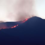
Italy / Sicily , Etna :
Press release on ETNA’s activity, 05 June 2021, 13:43 (11:43 UTC).
The National Institute of Geophysics and Volcanology, Osservatorio Etneo, reports that from around 01:20 UTC, surveillance cameras showed discontinuous ash emissions from the Southeast Crater. At present, these emissions have decreased in intensity and, at present, appear occasional, very mild and disperse rapidly in the summit area. Regarding the lava overflow described in previous press releases, the front appears to be at the same elevation as that reported in update # 348 (approximately 2800m elevation).
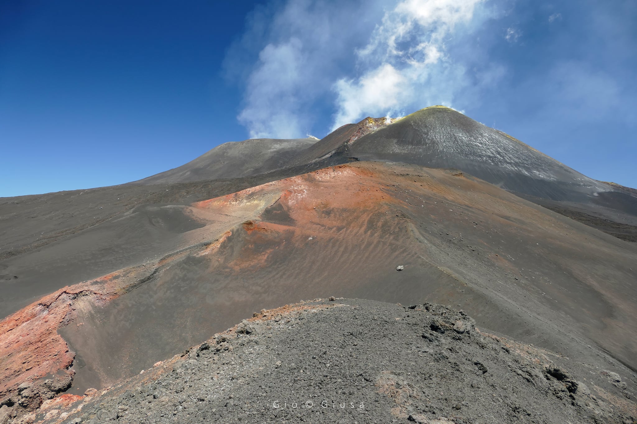
The average amplitude of the volcanic tremor after showing fluctuations at medium-low values last night is currently at a low level.
The location of the centroid of the volcanic tremor sources remains located in the area of the Southeast Crater at an altitude of about 3000 m above sea level. Infrasound activity continues to remain low and infrasound events are located in the Bocca Nuova crater area.
No significant change in the time series of soil deformation monitoring stations.
Further updates will be communicated shortly.
Source : INGV.
Photo : Gio Giusa.
Indonesia , Anak Krakatau :
Level of activity level II (WASPADA) since March 25, 2019. The Anak Krakatau volcano (157 m above sea level) has experienced increased volcanic activity since June 18, 2018, which was followed by a series of eruptions during the period from September 2018 to February 2019.
The volcano is covered in fog. No smoke from the crater was observed. The weather is sunny to cloudy, the wind is weak in the South, South-West and North-West. The air temperature is around 25-31 ° C. Humidity 47-58%. Thanks to video surveillance on the island of Sertung, a smoke, of medium intensity, white, was observed at a height of 100 to 150 m above the summit.

According to the seismographs of June 5, 2021, it was recorded:
1 emission earthquake
6 low frequency earthquake
Continuous tremor, amplitude 1-12 mm (predominance of 2 mm)
Recommendation:
The public / tourists are not allowed to approach the crater within a radius of 2 km.
Source : PVMBG.
Photo : sentinel 03/06/2021.
Guatemala , Fuego :
ACTIVITY:
The OVFGO reports that the crater is observed with weak and moderate explosions, in a range of 8 to 12 per hour, expelling ash at 4,500 and 4,800 meters above sea level. (14,763 to 15,748 feet) dispersing west and southwest over a distance of approximately 15 kilometers. Fine particles of ash fall on the communities of Panimache, Morelia, El Porvenir, Santa Sofía and others in this area.
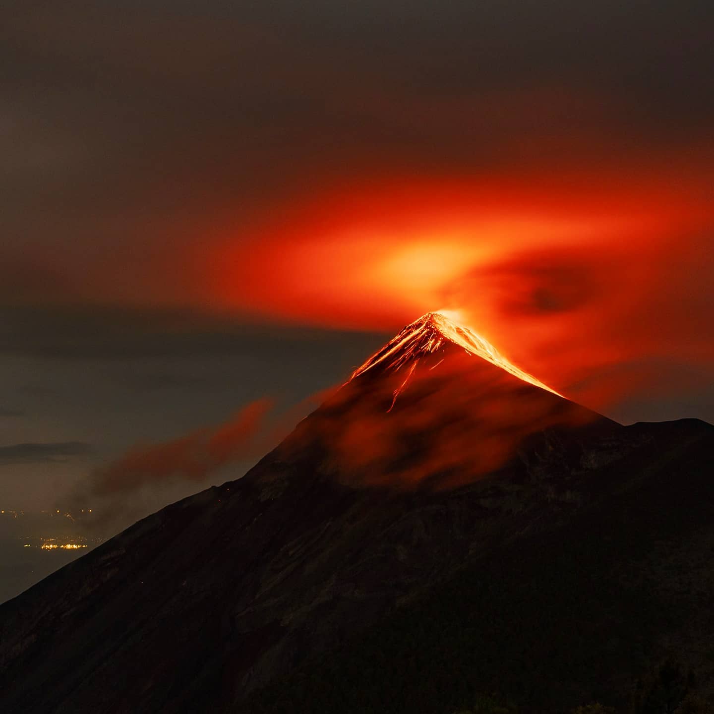
Moderate explosions generate rumblings, with shock waves and train engine noises for periods of 1 to 3 minutes. At night and early in the morning, incandescent pulses and avalanches were observed towards the canyons, Seca, Ceniza, Taniluya, Trinidad, Las Lajas and Honda. Intense rains continue in the volcanic area, mainly in the afternoon, which can generate lahars in the ravines around the volcano, so it is recommended to take precautions when passing the various ravines.
Source : Insivumeh.
Photo : Diego Rizzo .


No comment yet, add your voice below!