
February 04 , 2021.
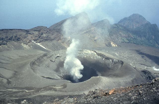
Indonesia , Karangetang :
Level of activity at level III (SIAGA). The Karangetang volcano (1784 m above sea level) has entered an eruption period since November 25, 2018. The last eruption took place on November 29, 2019 resulting in a column height of 100 m above the summit.
The volcano was clearly visible until it was covered in fog. The crater emits white smoke with a strong intensity and rising about 200 meters above the summit. The weather is sunny to rainy, with weak winds to the northeast and east.
According to the seismographs of February 3, 2021, it was recorded:
9 emission earthquakes
2 shallow volcanic earthquakes
1 hybrid / multi-phase earthquake
1 local tectonic earthquake
12 distant tectonic earthquakes
Continuous tremor, amplitude 0.25 mm (dominant value 0.25 mm).

Recommendation:
The public and visitors / tourists should not approach, climb or engage in activities in the hazard forecast area, i.e. a radius of 2.5 km around the summit of Kawah Dua (Kawah Utara ) and Kawah Utama (South) and in the area of sectoral expansion of Dua crater to the Northwest and North East of 4 km, as well as to the main crater up to 3 km to the West.
The Darwin VAAC reported that on 29 January a pilot observed an eruption plume rising from Karangetang to 2.4 km (8,000 ft) a.s.l. and drifted SW. The next day an ash plume identified in satellite images rose to 3 km (10,000 ft) a.s.l. and drifted SW. The Alert Level remained at 2 (on a scale of 1-4).
Sources : PVMBG, GVP.
Photo : visit siau island , mai 2019.
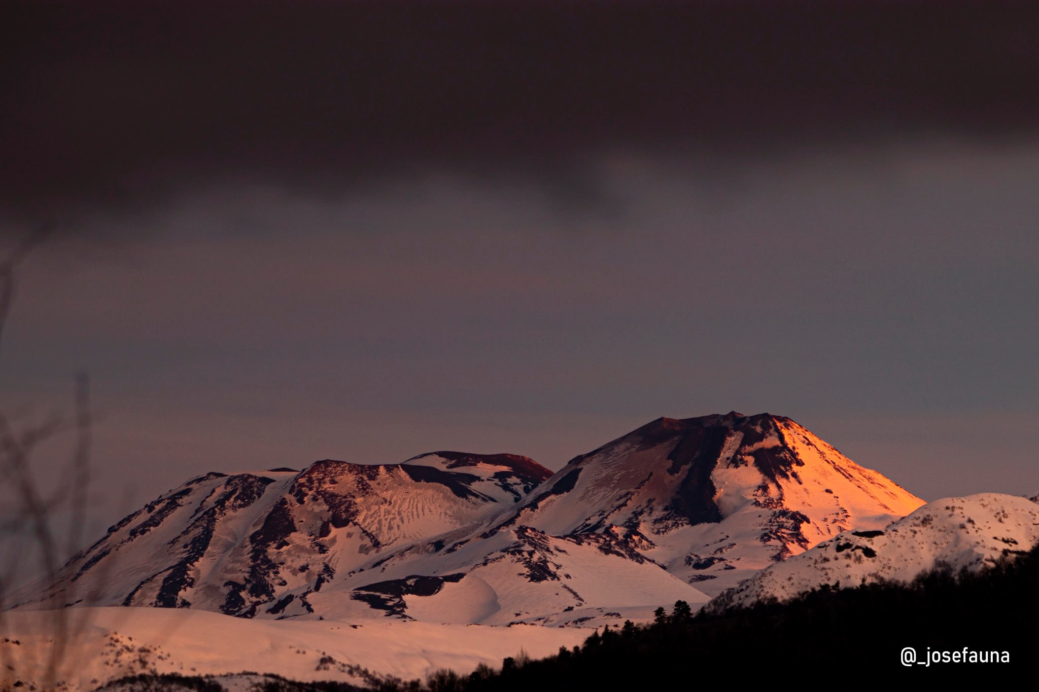
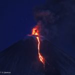
Chile , Nevados of Chillan :
Special Report on Volcanic Activity (REAV), Ñuble region, Nevados de Chillán volcanic complex, February 3, 2021, 6:38 p.m. local time (Continental Chile).
The National Service of Geology and Mines of Chile (Sernageomin) publishes the following PRELIMINARY information, obtained thanks to the monitoring equipment of the National Volcanic Surveillance Network (RNVV), processed and analyzed in the Volcanological Observatory of the Southern Andes ( Ovdas):
Yesterday, Wednesday February 3, at 16:02 local time (19:02 UTC), the monitoring stations installed near the volcanic complex of Nevados de Chillán recorded an earthquake linked to the fracturing of the rock (Volcano-Tectonic).
The characteristics of the earthquake after its analysis are as follows:
ORIGINAL TIME: 16:02 local time (19:02 UTC)
LATITUDE: 36.856 ° S
LONGITUDE: 71.362 ° W
DEPTH: 3.7 km
LOCAL MAGNITUDE: 3.1 (ML)
OBSERVATIONS:
No surface activity associated with this seismic event was observed.
The volcanic technical alert remains at the Yellow level.
Source : Sernageomin .
Photo : Josefauna .
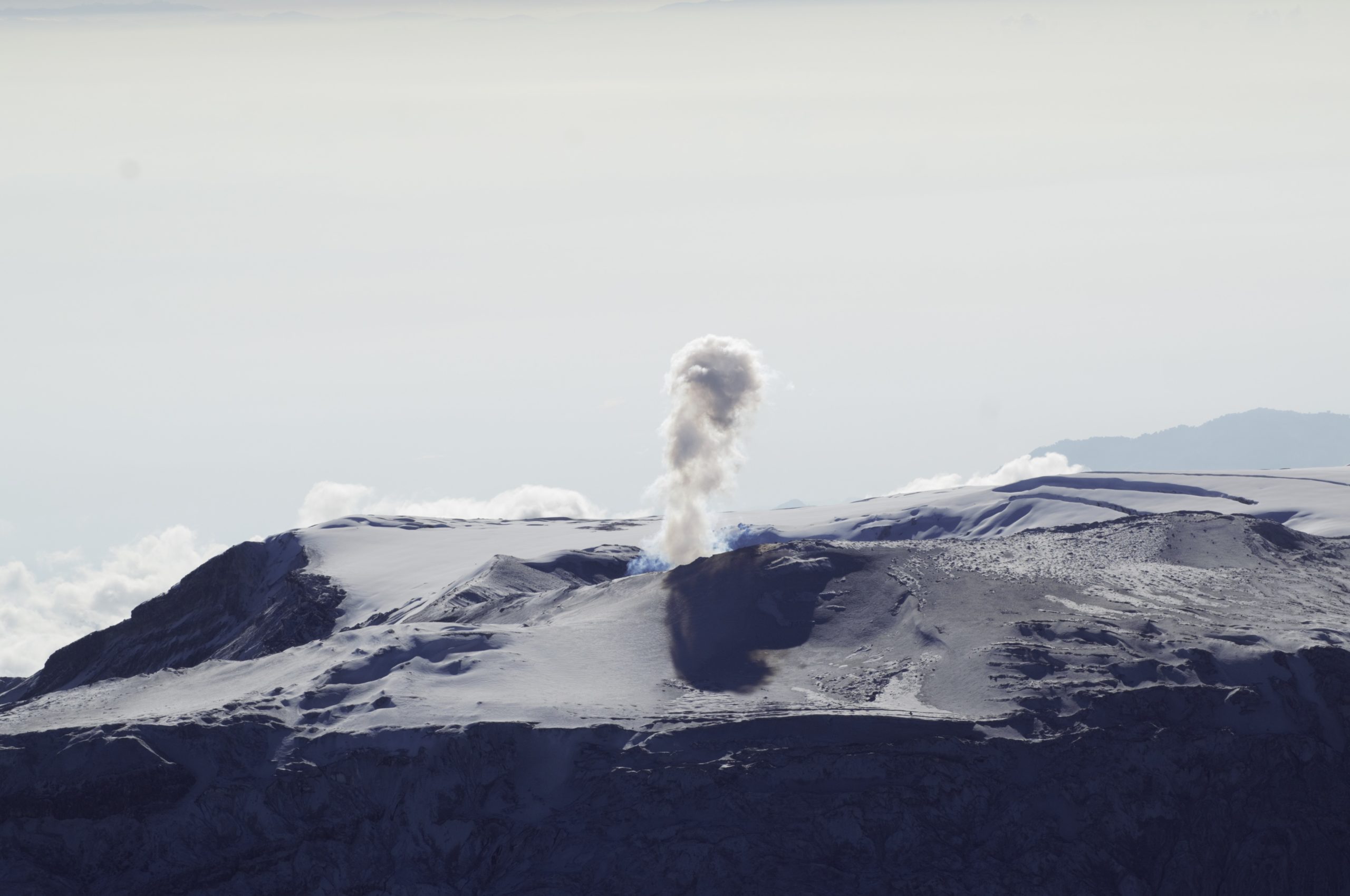
Colombia , Nevado del Ruiz :
The seismicity generated by the fracturing of the rock increased slightly in the number of earthquakes and decreased in the seismic energy released, compared to the previous week. An increase in seismicity between January 28 and 29 stands out, located south-southwest of the Arenas crater, between 2.6 and 4.0 km deep, the maximum magnitude recorded during this increase was 0, 6 ML (local magnitude) associated with the earthquakes that occurred on January 28 at 1:53 p.m. (local time) and January 29 at 7:20 p.m. (local time).
During the week, seismic activity also occurred in the eastern sector of the volcano and in the Arenas crater, at depths between 0.46 and 4.51 km. The highest magnitude recorded during the week was 0.6 ML (local magnitude), corresponding to the earthquakes that occurred during the aforementioned increase and the seismic event recorded on January 29 at 9:25 p.m. (local time). located in the crater, 1.3 km deep.
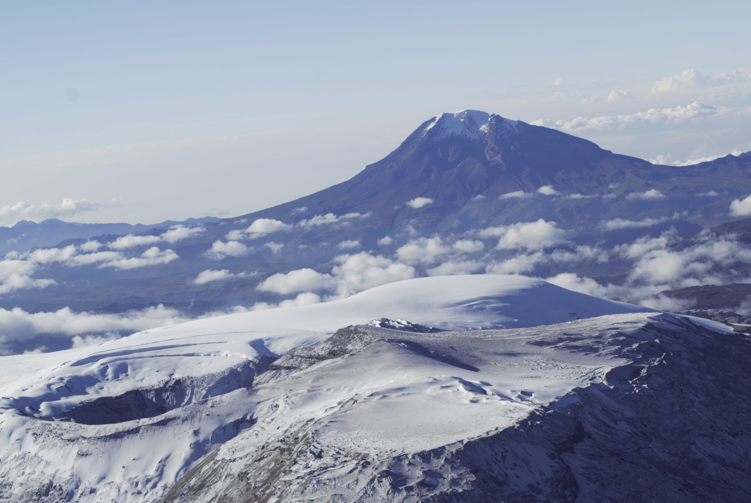
Regarding the seismicity associated with the dynamics of the fluids inside the volcanic conduits, it decreased both in the number of events and in the seismic energy released, compared to the previous week. This seismic activity was characterized by the occurrence of continuous volcanic tremor, tremor pulses, long and very long period type earthquakes, which presented variable energy levels and spectral content. The earthquakes were located mainly in the Arenas crater.
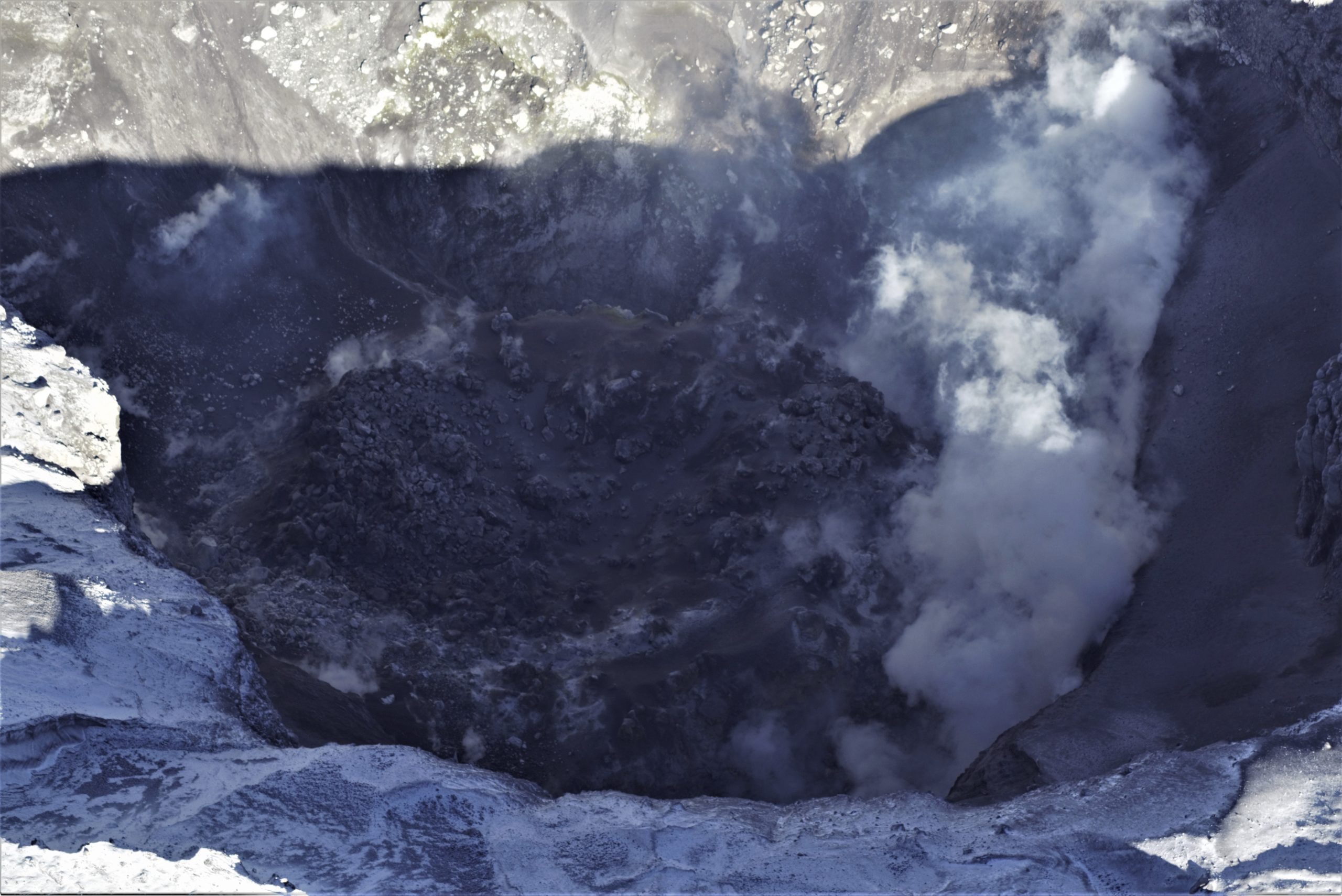
As part of its monitoring and investigation work, the Colombian Geological Service (SGC) carried out on the morning of Friday, January 29, with the support of the Colombian Air Force (FAC), a follow-up flight of the dome located in the Arenas Crater of the Nevado del Ruiz Volcano. By comparing photographic and video shots of flyovers taken last year and today, scientists at SGC have identified morphological changes in the lava dome, which are analyzed in more detail.
Source et photos : SGC.
Japan , Suwanosejima :
JMA reported that incandescence at Suwanosejima’s Ontake Crater was occasionally visible at night during 22-29 January. Intermittent explosions produced ash plumes that rose as high as 1.4 km above the crater rim and ejected bombs 200 m away from the crater. The Alert Level remained at 2 (on a 5-level scale).
The 8-km-long, spindle-shaped island of Suwanosejima in the northern Ryukyu Islands consists of an andesitic stratovolcano with two historically active summit craters. The summit is truncated by a large breached crater extending to the sea on the east flank that was formed by edifice collapse. Suwanosejima, one of Japan’s most frequently active volcanoes, was in a state of intermittent strombolian activity from Otake, the NE summit crater, that began in 1949 and lasted until 1996, after which periods of inactivity lengthened. The largest historical eruption took place in 1813-14, when thick scoria deposits blanketed residential areas, and the SW crater produced two lava flows that reached the western coast. At the end of the eruption the summit of Otake collapsed forming a large debris avalanche and creating the horseshoe-shaped Sakuchi caldera, which extends to the eastern coast. The island remained uninhabited for about 70 years after the 1813-1814 eruption. Lava flows reached the eastern coast of the island in 1884. Only about 50 people live on the island.
Source: Agence météorologique japonaise (JMA) , GVP.
Photo : Yukio Hayakawa, 1998 (Gunma University).
Mexico , El Chichon :
Specialists in the field made known the situation of « Chichonal », by participating in a videoconference organized by UNAM, Dr Xyoli Pérez Campos, head of the National Seismology Service; Dr Carlos Valdés González, researcher at the Institute of Geophysics, engineer Enrique Guevara Ortiz, director general of the National Center for Disaster Reduction and Hugo Delgado Granados, director of the Institute of Geophysics (IGf).
Dr Xyoli Pérez Campos explained the movements that have been recorded in recent weeks “Since December 25 of last year, movements started to be recorded in Pichucalco and Teapa, and until January 11, 15 events had been recorded, the recorded magnitude was M 3.5 « Two other earthquakes in Tabasco, 3 in Teapa.
He said there are 8 temporary seismological stations that have been integrated to monitor the volcano.
He pointed out that from December 25, 2020 to February 2, 2021, 41 earthquakes were recorded, the most significant was M 4.1, which occurred on December 27. The depths vary between 3 and 83 kilometers.
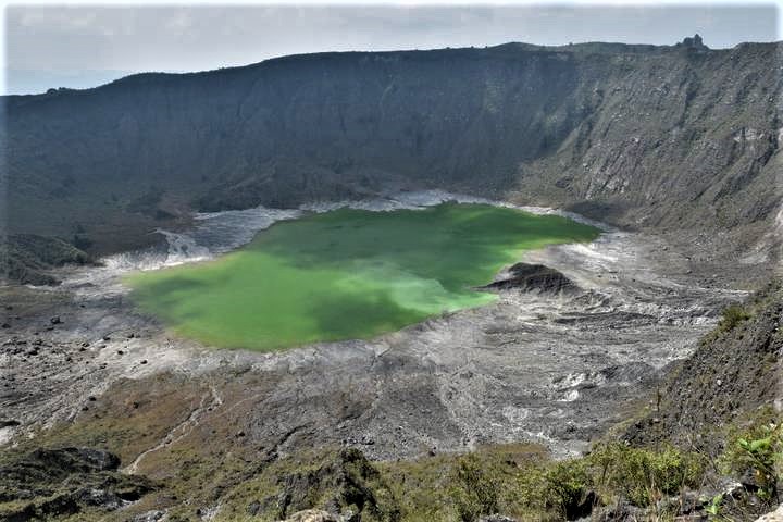
El Chichón is a small, but powerful trachyandesitic tuff cone and lava dome complex that occupies an isolated part of the Chiapas region in SE México far from other Holocene volcanoes. Prior to 1982, this relatively unknown volcano was heavily forested and of no greater height than adjacent nonvolcanic peaks. The largest dome, the former summit of the volcano, was constructed within a 1.6 x 2 km summit crater created about 220,000 years ago.
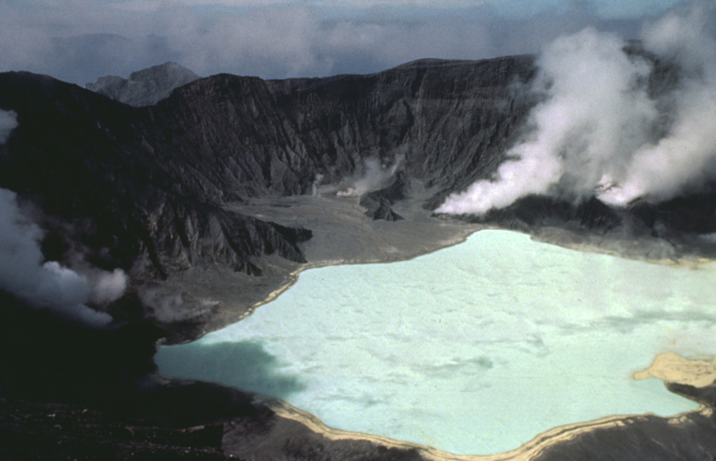
Two other large craters are located on the SW and SE flanks; a lava dome fills the SW crater, and an older dome is located on the NW flank. More than ten large explosive eruptions have occurred since the mid-Holocene. The powerful 1982 explosive eruptions of high-sulfur, anhydrite-bearing magma destroyed the summit lava dome and were accompanied by pyroclastic flows and surges that devastated an area extending about 8 km around the volcano. The eruptions created a new 1-km-wide, 300-m-deep crater that now contains an acidic crater lake.
Sources : Gob mx , GVP.
Photos : Javier Chávez , Bill Rose( 1983 ).


No comment yet, add your voice below!