
November 04 , 2020.
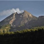
Kamchatka , Klyuchevskoy :
KVERT reported that Strombolian activity at Klyuchevskoy continued during 23-30 October and lava advanced down the Apakhonchich drainage on the SE flank. Gas-and-steam emissions contained some ash. A large, bright thermal anomaly was identified daily in satellite images. The Aviation Color Code was raised to Orange (the second highest level on a four-color scale) on 8 October.
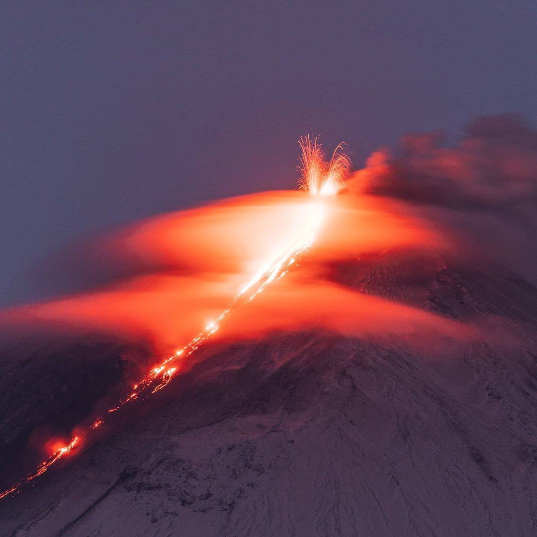
Klyuchevskoy (also spelled Kliuchevskoi) is Kamchatka’s highest and most active volcano. Since its origin about 6000 years ago, the beautifully symmetrical, 4835-m-high basaltic stratovolcano has produced frequent moderate-volume explosive and effusive eruptions without major periods of inactivity. It rises above a saddle NE of sharp-peaked Kamen volcano and lies SE of the broad Ushkovsky massif. More than 100 flank eruptions have occurred during the past roughly 3000 years, with most lateral craters and cones occurring along radial fissures between the unconfined NE-to-SE flanks of the conical volcano between 500 m and 3600 m elevation. The morphology of the 700-m-wide summit crater has been frequently modified by historical eruptions, which have been recorded since the late-17th century. Historical eruptions have originated primarily from the summit crater, but have also included numerous major explosive and effusive eruptions from flank craters.
Sources: KVERT , GVP .
Photo : Камчатский Репортёр ,3 novembre, 08:00 · via Sherine France.
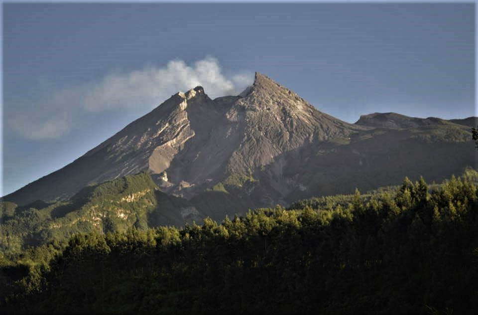
Indonesia , Merapi :
Increased activity status of Mount Merapi, from « Waspada (level II) to Siaga (level III) »
I. Context:
After the great eruption of 2010, Mount Merapi experienced another magmatic eruption on August 11, 2018 which lasted until September 2019. Along with the cessation of magma extrusion, Mount Merapi entered a new phase magmatic intrusion marked by an increase in internal volcanic earthquakes (VA) and a series of explosive eruptions until June 21, 2020. Volcanic activity continues to increase so far.
II. Chronology of monitoring data for volcanic activity:
After the explosive eruption of June 21, 2020, the internal seismicity namely deep volcanic (VA), shallow volcanic (VB) and Multi-Phase (MP) type events began to increase. For comparison, in May 2020, VA and VB type earthquakes had not occurred, and MP type earthquakes had occurred 174 times. In July 2020, there are 6 VA type earthquakes, 33 VB type earthquakes and 339 MP type earthquakes. There was a shortening of the basic distance EDM (Electronic Distance Measurement) in the Northwest sector Babadan-RB1 (hereinafter abbreviated EDM Babadan) of 4 cm shortly after the explosive eruption of June 21, 2020. After that , the shortening of the distance continued at a rate of approximately 3 mm / day until September 2020.
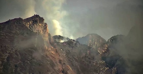
Since October 2020, the seismicity has intensified. On November 4, 2020, the average VB type seismicity was 29 / day, MP 272 / day, Avalanches (RF) 57 / day, emissions (DG) 64 times / day. Babadan’s EDM shortening rate reached 11 cm / day. The cumulative energy of earthquakes (VT and MP) in one year is 58 GJ (Giga Joules). The above monitoring data status has exceeded pre-lava dome conditions on April 26, 2006, but is still below pre-2010 eruption conditions. Based on observations from the morphology of the crater of Mount Merapi using the aerial photography method (Drone) on November 3, 2020, no new lava dome has yet been observed. So far, seismicity and deformation are still increasing. Based on this, it is possible to have a rapid extrusion of magma or an explosive eruption. Potential dangers are in the form of lava avalanches, throwing materials and hot clouds up to a maximum of 5 km.
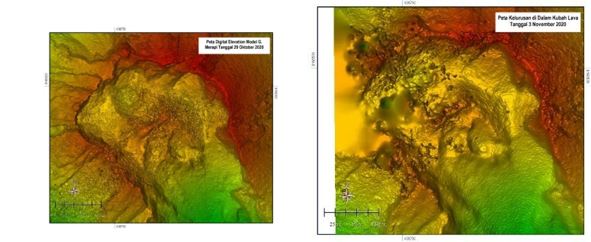
Aerial photos from November 3, 2020 compared to October 28, 2020, not yet showing a new lava dome.
III. Conclusion:
Based on the evaluation of the monitoring data above, it is concluded that the current volcanic activity may continue and lead to an eruption, endangering the population. In this context, the activity status of Mount Merapi has been raised from Waspada (level II) to Siaga (level III) as of November 5, 2020 at 12:00 WIB.
Source : PVMBG.
Photos : VolcanoYT.
Nicaragua , Telica :
INETER reported that a series of three explosions at Telica began at 1910 on 29 October and ended at 2137. The events ejected rock fragments onto the flanks and produced gas-and-ash plumes that rose as high as 1 km above the crater rim and drifted W. Ashfall was reported in areas downwind including the communities of El Bosque, Jacinto Baca (15 km WSW), Filiberto Morales (15 km WSW), Carlos Huete, Linda Vista, Divino Niño (31 km W). Three explosions produced gas-and-ash plumes that rose 250-600 m above the rim during 30-31 October. A minor amount of ash fell on the flanks.
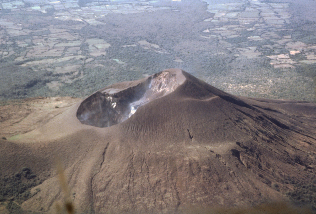
The 700-m-wide double summit crater of Telica volcano is seen here in an aerial view from the north with farmlands of the Nicaraguan depression in the background. The 1061-m-high volcano is the highest and most recently active of the Telica volcanic complex. The Telica volcano group consists of several interlocking cones and vents with a general NW alignment. The bench at the lower right and the ridge at the left are remnants of older craters of the complex.
Source: Instituto Nicaragüense de Estudios Territoriales (INETER) , GVP.
Japan , Suwanosejima :
JMA reported nighttime incandescence and intermittent eruptive activity at Suwanosejima’s Ontake Crater during 23-30 October. Eight explosions were recorded; an explosion at 02h04 on 24 October ejected bombs 300 m from the crater and an explosion at 17h10 on 28 October produced an ash plume that rose 2 km above the crater rim. Ashfall was periodically reported in Toshima village (4 km SSW). The Alert Level remained at 2 (on a 5-level scale).
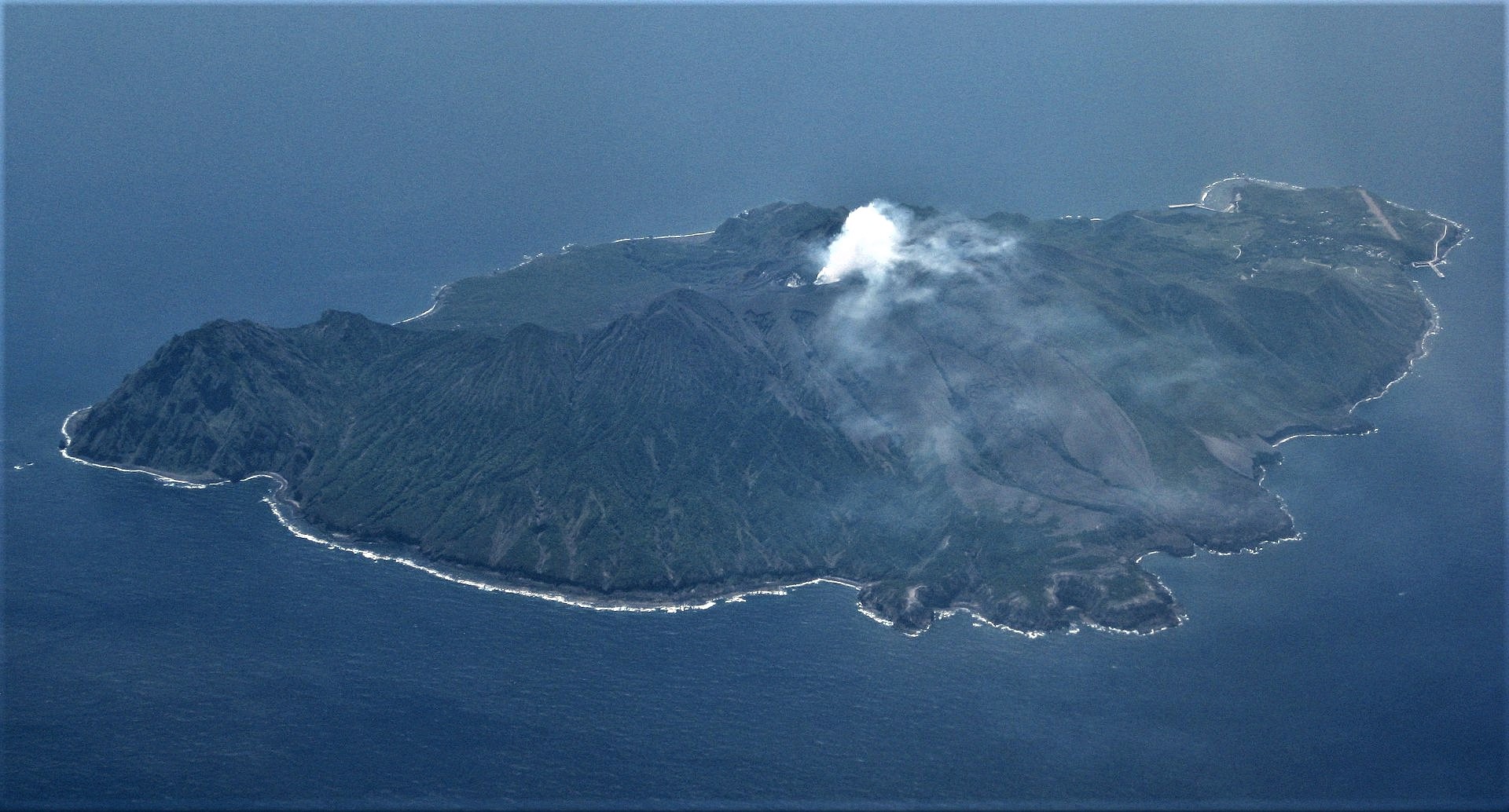
The 8-km-long, spindle-shaped island of Suwanosejima in the northern Ryukyu Islands consists of an andesitic stratovolcano with two historically active summit craters. The summit is truncated by a large breached crater extending to the sea on the east flank that was formed by edifice collapse. Suwanosejima, one of Japan’s most frequently active volcanoes, was in a state of intermittent strombolian activity from Otake, the NE summit crater, that began in 1949 and lasted until 1996, after which periods of inactivity lengthened. The largest historical eruption took place in 1813-14, when thick scoria deposits blanketed residential areas, and the SW crater produced two lava flows that reached the western coast. At the end of the eruption the summit of Otake collapsed forming a large debris avalanche and creating the horseshoe-shaped Sakuchi caldera, which extends to the eastern coast. The island remained uninhabited for about 70 years after the 1813-1814 eruption. Lava flows reached the eastern coast of the island in 1884. Only about 50 people live on the island.
Source: Japan Meteorological Agency (JMA) , GVP.
Photo : Ray Go.


No comment yet, add your voice below!