
October 07 , 2020.
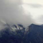
La Réunion , Piton de la Fournaise :
Activity bulletin for Tuesday April 6, 2020 at 11:15 a.m. (local time)
Alert level: alert 1
Seismic activity is still recorded under the Piton de la Fournaise (summit area and east flank) even if it continues to decrease. Thus for the day of 04/10/2020, 20 volcano-tectonic earthquakes deep under the eastern flank, 1 top-surface volcano-tectonic earthquake, 2 earthquakes classified as « undetermined » (because of low magnitude) and 19 landslides / shallow collapses in the eastern flank sector, were manually pointed. 48 events of smaller amplitudes and not visible to operators were detected and relocated automatically (Figure 1).
During the day of 04/10/2020, no large-scale deformation occurred in the Grandes Pentes sector.

The inflation (swelling) of the summit zone continues testifying to the pressurization of a source under the summit, where the superficial supply system is located (magmatic reservoir from which the intrusions of magma leave towards the surface) . This resumption of inflation is consistent with the CO2 concentrations in the soil, which are still increasing in the far field (Plaine des Cafres sector) even if the rate remains moderate. This increase is often associated with a rise of magma from the mantle.
The compositions of the fumaroles at the top have returned to compositions usually observed “without crises”, namely very low in CO2 and SO2.
Following discussions between the OVPF and the prefecture, it was decided to maintain the alert level at « Alert 1 » given the unusual nature of the situation and the uncertainties that remain. Indeed, the persistence of seismicity shows that the intrusion of magma under this flank is still active and that an eruption cannot be excluded in this area. The inflation of the summit area and the continued increase in CO2 concentrations in the soil in recent days show that a new magmatic injection from the summit reservoir cannot be excluded. This could happen quickly following the weakening and opening of the volcano’s power system during the intrusion of September 28-29. The observatory teams remain mobilized.
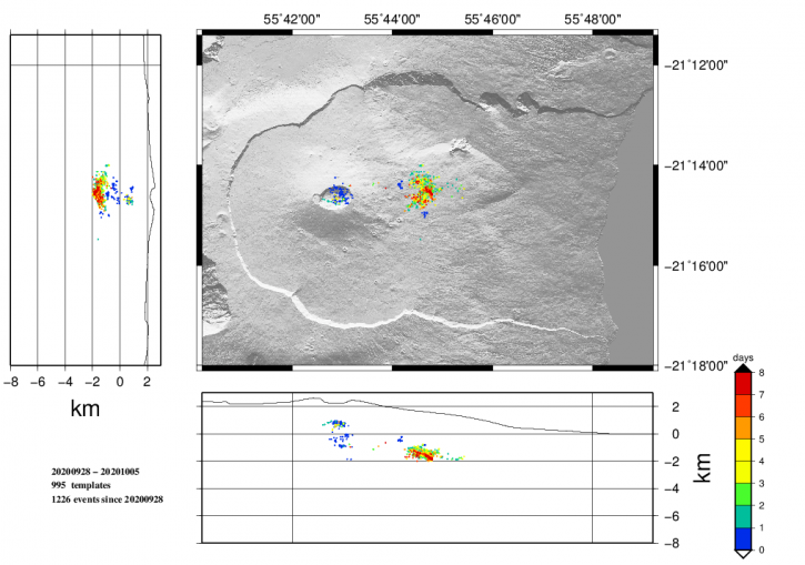
Figure 1: Location map (epicenters) and north-south and east-west sections (showing the location in depth, hypocenters) of the earthquakes recorded and located by the OVPF-IPGP between 09/26/2020 and 10/05 / 2020 under the Piton de la Fournaise massif. Only localizable earthquakes have been shown on the map (© OVPF-IPGP).
For the day of 06/10/2020, 5 volcano-tectonic earthquakes deep under the eastern flank and 4 shallow landslides / collapses in the eastern flank sector were manually pointed. 43 events of smaller amplitudes and not visible to operators were detected and automatically relocated (Figure 1).
During the day of 06/10/2020, no large-scale deformation occurred in the Grandes Pentes sector.
Source : OVPF.
Read the article : http://www.ipgp.fr/fr/ovpf/bulletin-dactivite-mardi-6-avril-2020-a-11h15-heure-locale
Photo : G Vitton
Peru , Ubinas :
Analysis period: September 28 to October 4, 2020. Arequipa, October 5, 2020.
Alert level: YELLOW
The Geophysical Institute of Peru (IGP) reports that the Ubinas volcano (region of Moquegua) continues to record a slight increase in seismic activity during the analysis period; therefore, it is suggested that the authorities and the public pay attention to the bulletins published by the IGP.
During the period of analysis, the occurrence of 42 volcano-tectonic (VT) earthquakes with a magnitude less than M1.3 was identified, associated with rock fracturing processes that occur at inside the volcano. On average, 6 earthquakes were recorded per day. Likewise, 18 seismic signals were recorded, associated with the movements of volcanic fluids (gas, mainly water vapor), among these, we note the presence of 2 « Tornillos » type earthquakes.
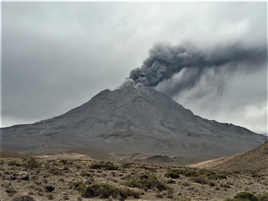
Surveillance cameras recorded columns of volcanic gas and water vapor reaching heights of up to 300 m above the summit of the volcano. These emissions dispersed towards the eastern sector of the volcano.
Monitoring of the deformation of the volcanic structure, using GNSS equipment (processed with fast orbits) does not show significant changes. Satellite monitoring, carried out through the SENTINEL, OMI-NASA (SO2 gas) and MIROVA (thermal anomalies) systems, does not record any anomalies.
RECOMMENDATIONS
• Do not approach within a radius of less than 4 km around the crater of the volcano.
Source : IGP
Photo : archive ingemmet.
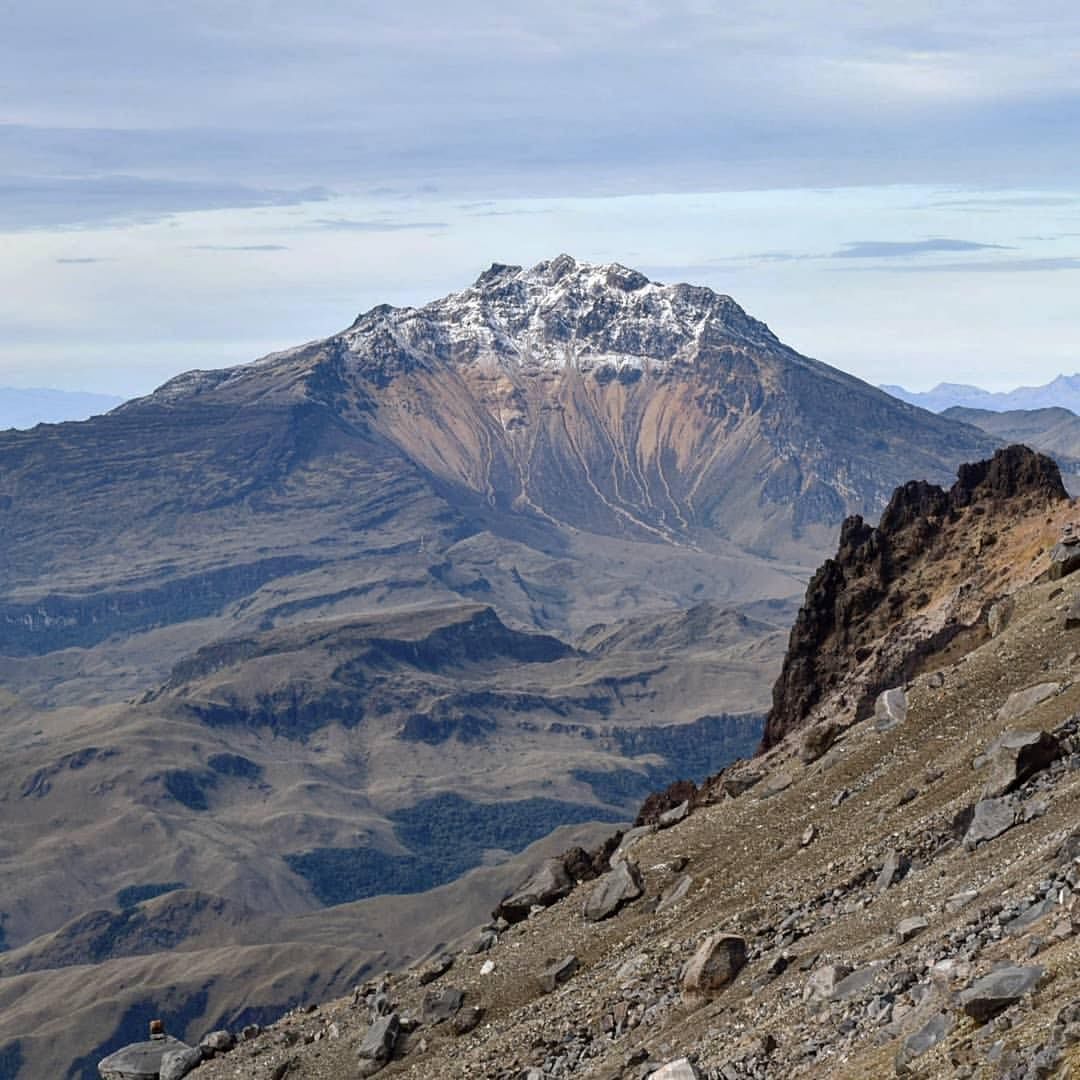
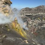
Colombia , Chiles / Cerro Negro :
Weekly activity bulletin of Chiles and Cerro Negro volcanoes
The activity of volcanoes continues at YELLOW LEVEL ■ (III): CHANGES IN THE BEHAVIOR OF VOLCANIC ACTIVITY.
From the monitoring of the activities of the CHILE VOLCANS AND CERRO NEGRO, the COLOMBIAN GEOLOGICAL SERVICE (SGC) reports that:
For the period between September 29 and October 5, 2020, the seismic activity in the region of influence of the Chiles volcanoes – Cerro Negro recorded an increase in the occurrence and the energy released compared to the previous week .
The recorded earthquakes were mainly related to the fracture of rock inside the volcanic building, although some of these were also associated with fluid dynamics processes. The fracture earthquakes were located mainly to the south-southwest of the Chiles volcano, at distances mostly up to 4.0 km and at depths less than 8 km from its summit (reference level close to 4700 m). The maximum local magnitude was 3.7 on the Richter scale, which corresponds to the earthquake of September 30 at 10:51 p.m., reported as felt in the area of influence of these volcanoes.
The changes recorded by the volcanic deformation sensors continue. No manifestation of surface activity was observed, nor significant variations in other volcanic monitoring parameters.
Source : SGC.
Photo : Volcan Chiles , Travelgrafia/Viajes por Colombia .
Indonesia , Sinabung :
The activity level has moved to level III (SIAGA) since May 20, 2019 at 10:00 a.m. The Sinabung volcano (2460 m above sea level) has been erupting since 2013. The last eruption occurred on September 5, 2020, causing a column of gray eruption reaching 800 meters above the summit.
The volcano is clearly visible until it is covered with fog. The crater is observed to emit white smoke with a low height of about 50-200 meters above the summit. The weather is cloudy to rainy, with weak to moderate winds to the east and southeast. The air temperature is around 17-27 ° C.
According to the seismographs of October 6, 2020, it was recorded:
19 emission earthquake
4 low frequency earthquakes
2 local tectonic earthquakes
3 distant tectonic earthquakes.
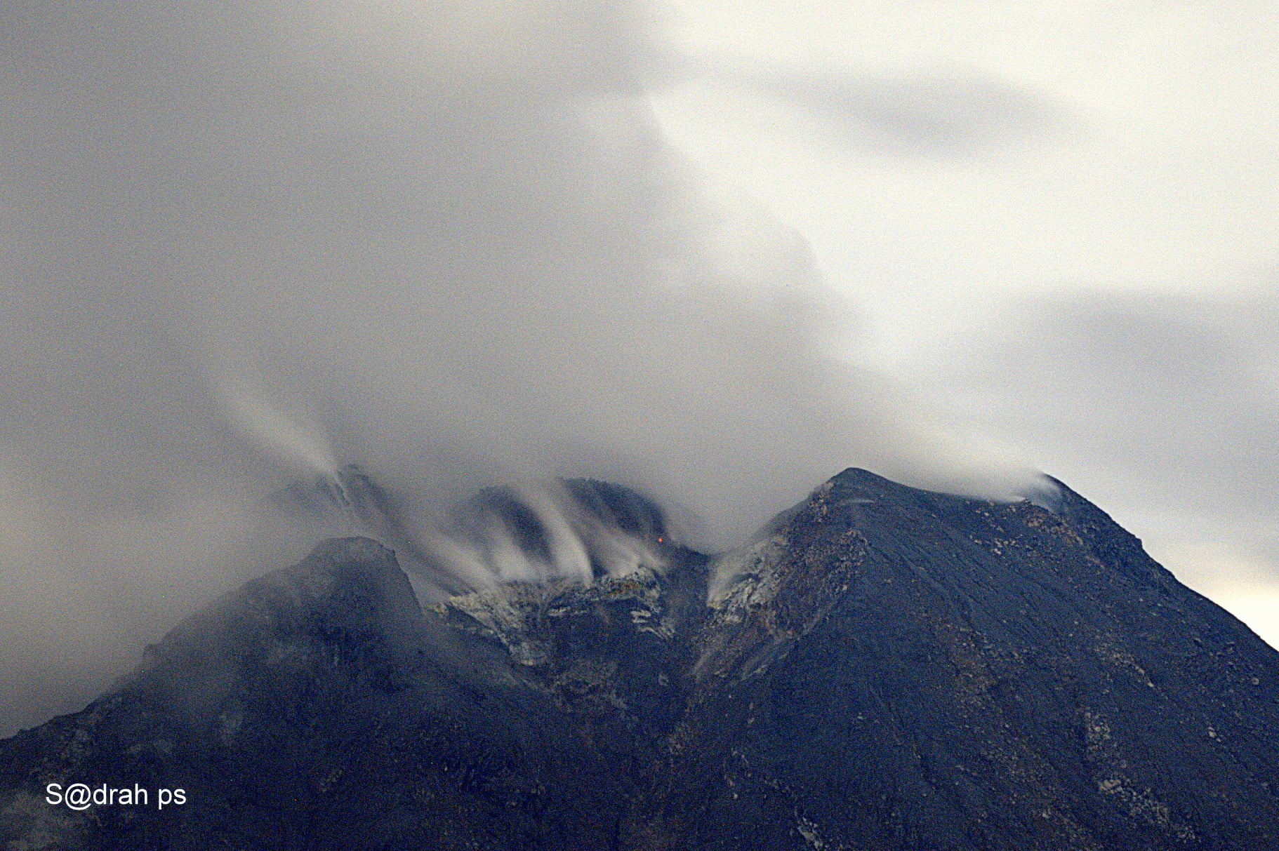
The Sinabung lava dome, with small hot spots, photographed from Tiga Kicat on October 01, 2020 at 8:36 p.m.
Recommendation:
The public and visitors / tourists should not carry out activities in the villages which have been relocated, as well as within a radius of 3 km around the summit of G. Sinabung, and a sector radius of 5 km for the South sector. East and 4 km for the East-North sector.
In the event of ash rain, people are advised to wear masks when leaving the house to reduce the health effects of volcanic ash. Secure drinking water facilities and clean roofs of houses from dense volcanic ash so that they do not collapse.
People who live near the rivers that flow from Mount Sinabung should be aware of the dangers of lahars.
VONA: The latest VONA message received the color code ORANGE, published on September 5, 2020 at 05:34:00. Volcanic ash was observed at an altitude of 3,260 m above sea level or about 800 m above the summit.
Source : PVMBG.
Photo : Sadrah Peranginangin


No comment yet, add your voice below!