
September 21 , 2020.
Ecuador , Sangay :
SPECIAL REPORT ON THE SANGAY VOLCANO N ° 4-2020
Significant increase in activity
In the early morning of September 20, the Sangay volcano recorded a significant increase in its level of eruptive activity. In particular, from 4:20 a.m. (TL), the seismic recordings show the occurrence of explosions and ash emissions much more energetic than those observed in previous months (Fig. 1).
At 4:40 a.m., several satellite images show a large ash cloud, rising to a height probably greater than 6 km / 10 km above the crater of the volcano (Fig. 2a and 2b), with the highest part of the le cloud heading east, while the lower part heading west of the volcano. Due to weather and night conditions, no direct observations could be made.
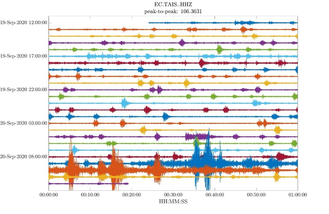
Fig. 1. Seismic recording of Sangay in the early morning of September 20. Note the increase of 09:20 (universal time), which is equivalent to 04:20 (local time).
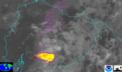
Fig. 2a. Satellite images of the Sangay corresponding to the GOES16 satellite, at 06:00 local time.
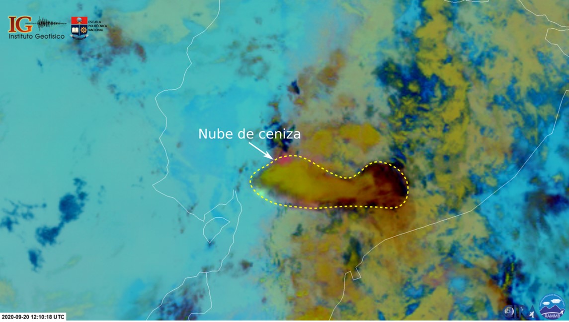
Fig. 2b. Satellite image of the Sangay corresponding to the GOES16 satellite, at 07:10 local time. The ash cloud heads east and west of the volcano.
The ash dispersion models show that there is a high probability of ash fall in the provinces of Chimborazo, Bolívar, Guayas and Los Ríos, and less probability in Santa Elena and Manabí (Fig. 3). The provinces potentially most affected would be Chimborazo and Bolívar, where ash accumulations could be> 3 millimeters and> 1 millimeter respectively, which is enough to affect agriculture.
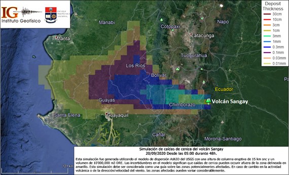
Fig. 3. Ashfall dispersion model corresponding to the current activity of Sangay. Areas with the highest probability of ash fall are shown.
General recommendations:
Stay away from the danger zones of the Sangay volcano. If you are in an ash fall area, protect yourself with a mask, glasses and limit your exposure (more information: http://www.ivhhn.org/es/ash-protection). Stay informed of the evolution of eruptive activity on the site of the Geophysical Institute and on its social networks Twitter, Facebook. Follow the recommendations of the risk management authorities (SNGRE and GAD).
The IGEPN is keeping an eye on the evolution of the activity of the Sangay volcano and will report on its details.
Source : Institut géophysique / Ecole polytechnique nationale
Photo : climate change world .
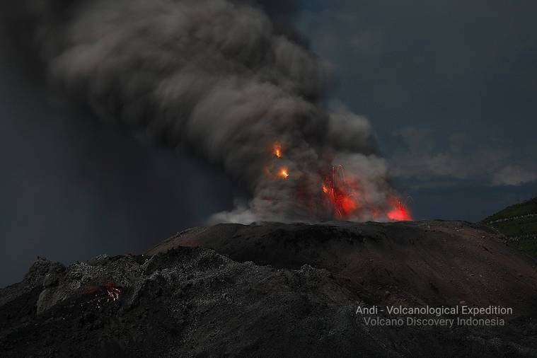
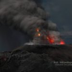
Indonesia , Ibu :
VOLCANO OBSERVATORY NOTICE FOR AVIATION – VONA
Issued : September 20 , 2020 .
Volcano : Ibu (268030)
Current Aviation Colour Code : ORANGE
Previous Aviation Colour Code : orange
Source : Ibu Volcano Observatory
Notice Number : 2020IBU15
Volcano Location : N 01 deg 29 min 17 sec E 127 deg 37 min 48 sec
Area : North Maluku, Indonesia
Summit Elevation : 4240 FT (1325 M)
Volcanic Activity Summary :
Eruption with volcanic ash cloud at 21h13 UTC (06h13 local).
Volcanic Cloud Height :
Best estimate of ash-cloud top is around 4880 FT (1525 M) above sea level, may be higher than what can be observed clearly. Source of height data: ground observer.
Other Volcanic Cloud Information :
Ash-cloud moving to north
Remarks :
Eruption and ash emission is continuing.
Level of activity at level II (WASPADA). G. Ibu (1340 m altitude) has been in continuous eruption since 2008. The eruption caused the emission of rocky materials and ash which accumulated in the crater. The last eruption occurred on September 18, 2020, resulting in a column height of 800 m. The color of the ash column was white / gray.
The volcano was clearly visible until it was covered in fog. The smoke from the crater was observed to be white / gray with low to medium intensity about 600 meters above the top of the peak. The weather is sunny / rainy, with weak to moderate winds in the North and East.
According to the seismographic records of September 20, 2020, it was noted:
– 74 eruption earthquakes
– 15 avalanche earthquakes
– 30 earthquakes of emissions
– 13 harmonic tremors
Recommendation:
The community around G. Ibu and visitors / tourists should not be active within a radius of 2.0 km, with a sector expansion of 3.5 km towards the opening of the crater in the northern part of the active crater of G Ibu.
In the event of ash rain, people who have activities outside the home are advised to wear a nose, mouth (mask) and eyes (goggles).
VONA:
The latest VONA message received the color code ORANGE, published on August 5, 2020 at 18:04:00 WIT. Volcanic ash had been observed at an altitude of 1825 m above sea level or about 500 m above the summit.
Source : Magma Indonésie , PVMBG.
Photos : Andi Rosati / Volcanodiscovery , Andrey Nikiforov .
Alaska , Semisopochnoi :
51°55’44 » N 179°35’52 » E,
Summit Elevation 2625 ft (800 m)
Current Volcano Alert Level: ADVISORY
Current Aviation Color Code: YELLOW
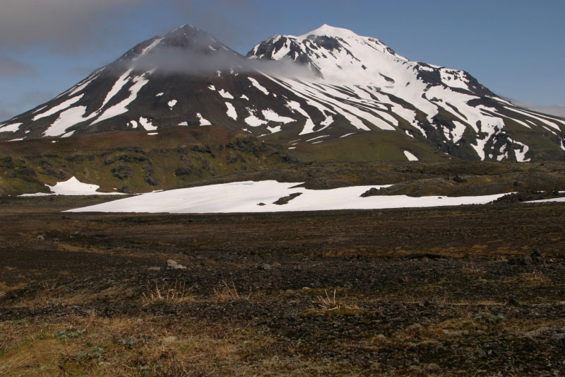
The local seismic network went gone down yesterday afternoon due to local storm activity and is expected to become operational again later today. No activity however, was detected on the regional infrasound nework. Cloudy conditions obscured views of the volcano by satellite.
Semisopochnoi is monitored by local seismic sensors, satellite data, and regional infrasound and lightning detection instruments. An infrasound array on Adak Island may detect explosive emissions from Semisopochnoi with a slight delay (approximately 13 minutes) if atmospheric conditions permit.
Source : AVO.
Photo : Jones, I. L. 30 Juin 2004.
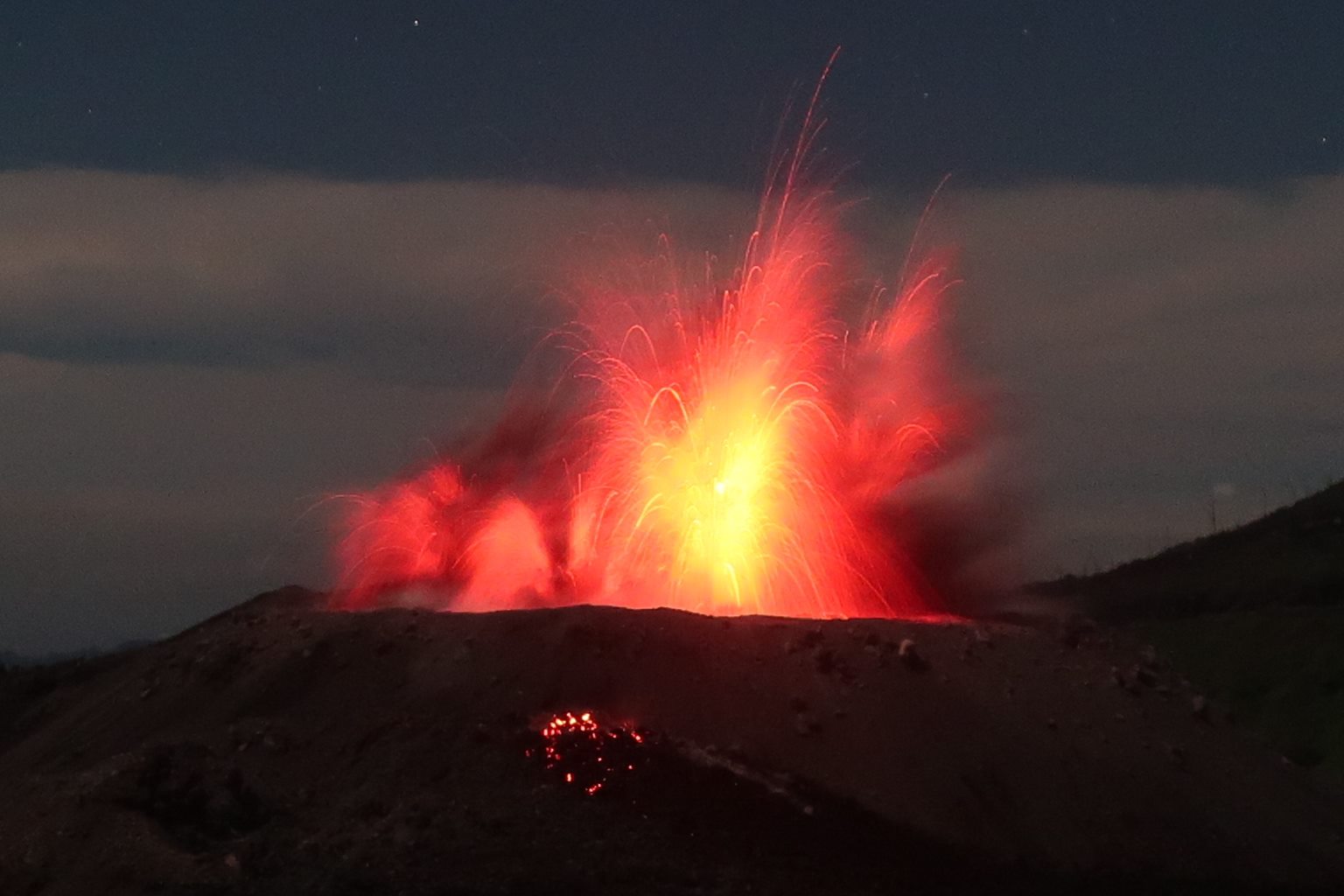
Russia / Kurile Islands , Ebeko :
50.69 N, 156.01 E;
Elevation 3792 ft (1156 m)
Aviation Colour Code is ORANGE
A moderate eruptive activity of the volcano continues. Ash explosions up to 19,700 ft (6 km) a.s.l. could occur at any time. Ongoing activity could affect low-flying aircraft and airport of Severo-Kurilsk.
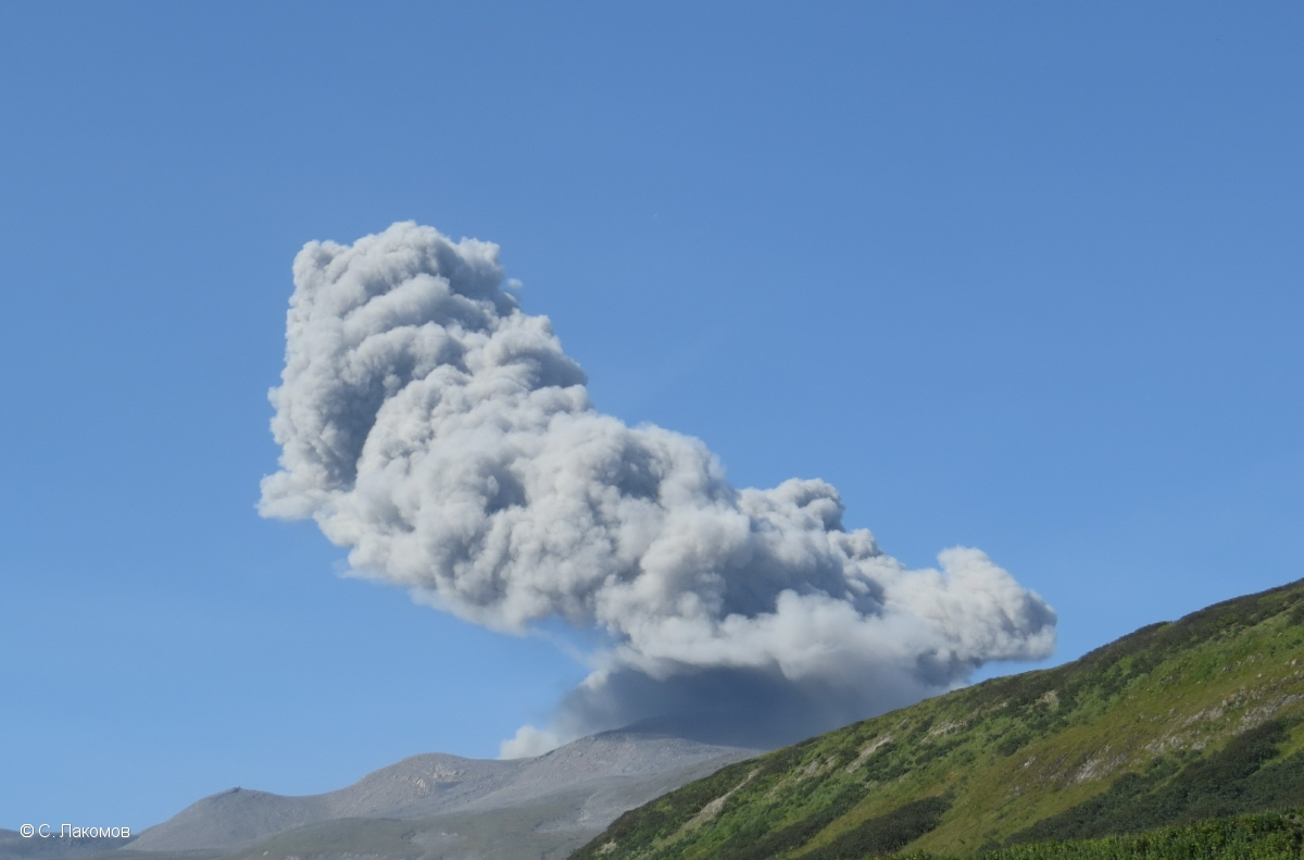
Explosive activity of Ebeko volcano on 16 September, 2020.
A moderate explosive eruption of the volcano continues. According to visual data by volcanologists from Severo-Kurilsk, explosions sent ash up to 3.0 km a.s.l. on 11 and 14-17 September; ash clouds drifted to the south-east, east, north and north-west of the volcano; ashfalls were noted at Severo-Kurilsk on 14-15 September. Satellite data showed a thermal anomaly over the volcano on 13 and 15 September, the volcano was quiet or obscured by clouds in the other days of week.
Source : Kvert .
Photo : S. Lakomov


No comment yet, add your voice below!