
September 12 , 2020.
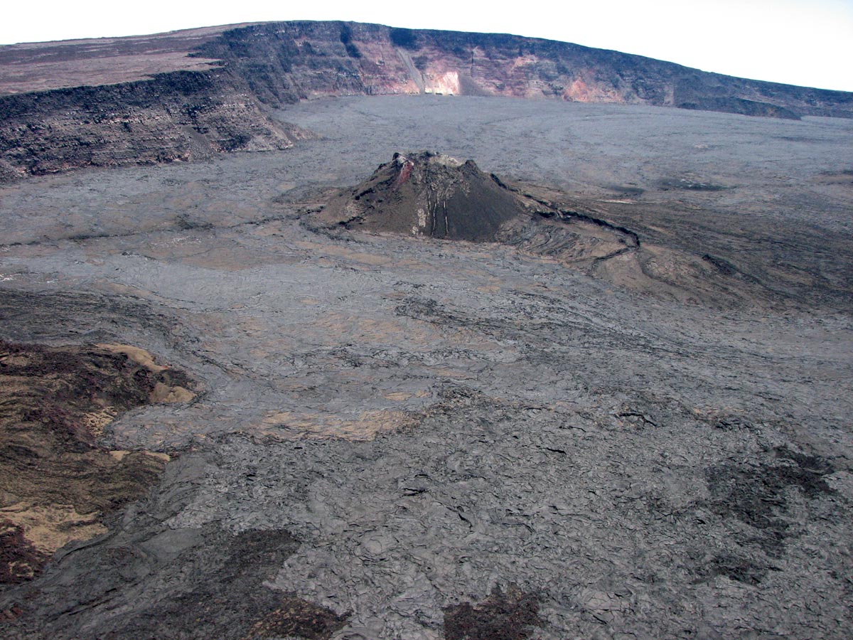
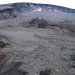
Hawaii , Mauna Loa :
19°28’30 » N 155°36’29 » W,
Summit Elevation 13681 ft (4170 m)
Current Volcano Alert Level: ADVISORY
Current Aviation Color Code: YELLOW
Activity Summary:
Mauna Loa Volcano is not erupting. Rates of deformation and seismicity have not changed significantly over the past week and remain above long-term background levels.
Observations:
Over the past week, HVO seismometers recorded approximately 70 small-magnitude earthquakes – all below M2.5 – beneath the volcano’s summit and upper-elevation flanks. The majority of these earthquakes occurred at shallow depths of less than 8 kilometers (approximately 5 miles) below ground level.
Global Positioning System (GPS) measurements continue to indicate slow, long-term summit inflation, consistent with magma supply to the volcano’s shallow storage system.
Gas concentrations and fumarole temperatures at both the summit and Sulphur Cone on the Southwest Rift Zone remain stable.
Webcam views have revealed no changes to the landscape over the past week.
Source : HVO.
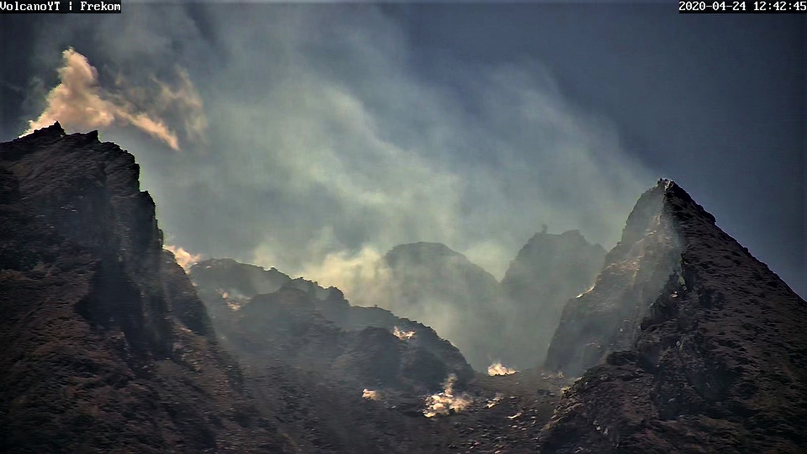
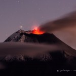
Indonesia , Merapi :
Mount Merapi Activity Report September 4-10, 2020
OBSERVATION RESULT
Visual
The weather around Mount Merapi is generally sunny in the morning and at night, while the afternoon until evening is foggy. White smoke, thin to thick, is observed with low pressure. A maximum smoke height of 200 m is observed from the Mount Merapi observation post in Selo on September 10, 2020 at 4:45 p.m.
Morphological analysis of the crater area based on photos of the south-eastern sector shows no change in the morphology of the dome. The volume of the lava dome based on measurements using aerial photos with drones on July 26, 2020 amounted to 200,000 m3.
Seismicity
This week, the seismicity of Mount Merapi recorded:
6 emission earthquakes (DG),
1 deep volcanic earthquake (VTA),
9 shallow volcanic earthquake (VTB),
63 multiphase earthquakes (MP),
7 low frequency earthquakes (LF),
29 avalanche earthquake (RF),
24 tectonic earthquakes (TT).
The seismic intensity this week is relatively the same as last week.
Deformation
The deformation of Mount Merapi which was monitored by EDM this week showed a shortening of the distance of the reflectors of about 2 cm.
Rain and lahars:
This week, there have been no reports of rain, lahar or additional runoff in the rivers flowing down from Mount Merapi.
Conclusion
Based on the results of visual and instrumental observations, it is concluded that:
1. The lava dome is currently in stable condition.
2. The volcanic activity of Mount Merapi is still quite high and is at the “WASPADA” activity level.
Source :BPPTKG
Photo :Archive Frekom.
Philippines , Kanlaon :
KANLAON VOLCANO BULLETIN: 12 September 2020 08:00 A.M.
Kanlaon Volcano’s monitoring network recorded nine (9) volcanic earthquakes during the 24-hour observation period. Weak to moderate emission of white steam-laden plumes that rose 500 meters before drifting northwest and southwest was observed. Sulfur dioxide (SO2) emission was measured at an average of 686 tonnes/day on 07 September 2020. Ground deformation data from continuous GPS measurements indicate slight inflation of the lower and mid slopes since May 2020, while short-term electronic tilt monitoring on the southeastern flanks recorded inflation on the lower to mid slopes that began on June 21, 2020. These parameters may indicate hydrothermal or magmatic processes occurring beneath the edifice.

DOST-PHIVOLCS would like to remind the public that Kanlaon Volcano is at Alert Level 1, which means that it is at an abnormal condition and has entered a period of unrest. The local government units and the public are strongly reminded that entry into the 4-kilometer radius Permanent Danger Zone (PDZ) must be strictly prohibited due to the further possibilities of sudden and hazardous steam-driven or phreatic eruptions. Civil aviation authorities must also advise pilots to avoid flying close to the volcano’s summit as ejecta from any sudden phreatic eruption can be hazardous to aircraft.
DOST-PHIVOLCS is closely monitoring Kanlaon Volcano’s activity and any new development will be relayed to all concerned.
Source et photo : Phivolcs
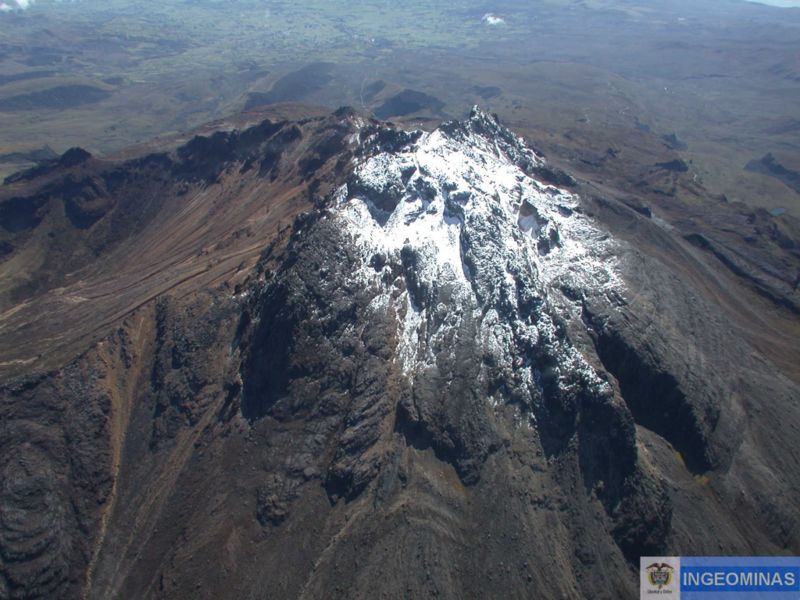
Colombia , Chiles / Cerro Negro :
Weekly activity bulletin of the Chiles and Cerro Negro volcanoes
Volcanic activity continues at YELLOW LEVEL ■ (III): CHANGES IN THE BEHAVIOR OF VOLCANIC ACTIVITY.
From the monitoring of the activity of VOLCANS CHILES AND CERRO NEGRO, the COLOMBIAN GEOLOGICAL SERVICE (SGC) reports that:
During the period between September 1 and 7, 2020, the seismic activity in the region of the Chiles – Cerro Negro volcanoes showed a decrease in the occurrence and the energy released,
from 1144 to 1113 events, all related to a fracture of the cortical material. It was possible to locate 187 earthquakes, the vast majority preferentially located in the southwest quadrant of the Chiles volcano, at distances between 0 and 3 km, with depths less than 6 km from its summit (reference level 4700 m above sea level) and a maximum local magnitude of 2.5 on the Richter scale. No felt earthquake report has been received.
The changes recorded by the volcanic deformation sensors continue. No manifestation of surface activity was observed, nor significant variations in other volcanic monitoring parameters.
The COLOMBIAN GEOLOGICAL SERVICE and the INSTITUTO GEOFÍSICO DE LA ESCUELA POLITÉCNICA NACIONAL del ECUADOR follow the evolution of the volcanic phenomenon and will report the observed changes in due course.
Source : SGC.
Photo : Ingeominas.
Guatemala , Santiaguito :
SPECIAL VOLCANOLOGICAL BULLETIN
Type of activity: Pelean
Morphology: Complex of dacitic domes
Geographical location: 14 ° 44 ’33 ˝ Latitude N; 91 ° 34’13˝ Longitude W.
Height: 2,500msnm.
LAHAR IN THE RIO CABELLO DE ANGEL RAVINE, TRIBUTARY OF RIO NIMÁ I
Heavy rains in the area of the volcanic complex of Santa María-Santiaguito, generate at this time, lahars in the channels of the rivers Nimá I and Cabello de Ángel, tributaries of the river Samalá, with a height of 1 meter and 25 meters of large, carrying pasty volcanic matter, giving off an odor of sulfur during its passage. This lahar transports blocks of 30 cm to 2 meters, ash and materials, products of eruptions and daily activity that are deposited in the upper part of the volcano.
Source : Insivumeh


No comment yet, add your voice below!