July 14, 2020. EN . Guatemala : Pacaya , Peru : Sabancaya , Kamchatka : Klyuchevskoy , Iceland : Seismic Swarms , Italy / Sicily : Etna .

July 14 , 2020 .


Guatemala , Pacaya :

Type of activity: Strombolian
Morphology: composite stratovolcano
Location: 14 ° 22’50˝ Latitude N; 90 ° 36’00˝ Longitude W.
Height: 2,552 m above sea level.
Atmospheric conditions: Cloudy
Wind: North 7 km / h
Precipitation: 0.0 mm

Activity:
The Mackenney crater is observed, with an emission of white fumaroles, that the wind moves towards the South and the Southwest of its slopes. At night and early in the morning, Strombolian explosions with projections of volcanic materials at 50, 75 and 100 meters high were observed. The PCG and PCG5 seismic stations record tremors associated with the rise of magma and gases. Two active lava flows heading southwest and northwest. (The recommendations of the special bulletin of the Pacaya volcano n ° 42-2020 are still in force).

Source : Insivumeh.

Vidéo : El Express via Escenario final .


Peru , Sabancaya :

Analysis period: July 6 to 12, 2020, Arequipa, July 13, 2020.
Alert level: ORANGE

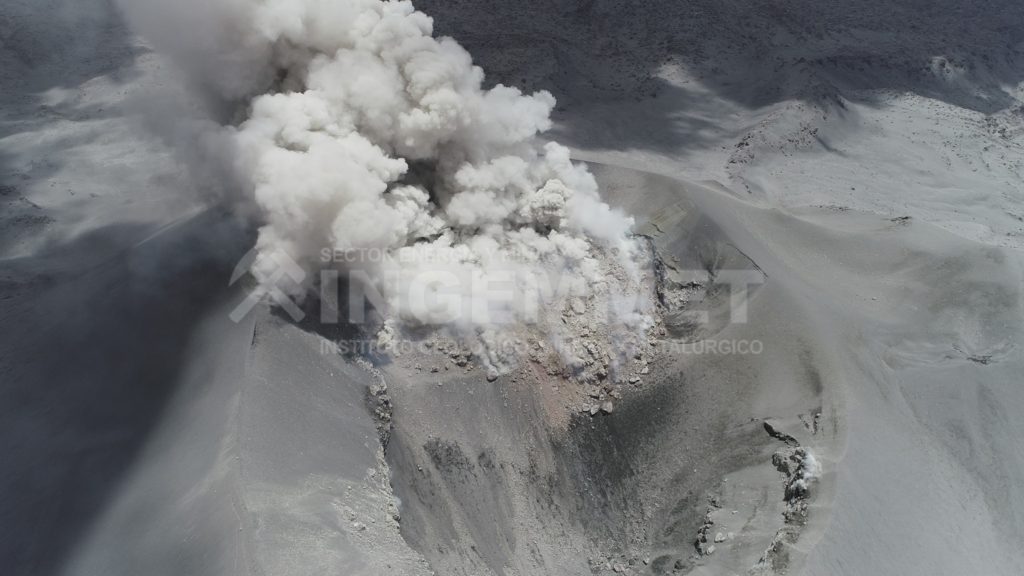
The Peruvian Geophysical Institute (IGP) reports that the eruptive activity of the Sabancaya volcano remains at moderate levels; that is to say with the continuous recording of explosions with the formation of columns of ash and gas up to 2.5 km altitude on the summit of the volcano. Therefore, for the following days, no significant change is expected regarding its eruptive activity.

The IGP recorded and analyzed the occurrence of approximately 596 earthquakes of volcanic origin, associated with the circulation of fluids (magma, gas, etc.) inside the Sabancaya volcano (Arequipa region), with , in addition, an average of 17 daily explosions of low to medium intensity.


Deformation monitoring, using GNSS data (processed with fast orbits), does not present any significant anomalies; however, slight inflation was recorded in the North and Southeast sector of the Sabancaya. Visual surveillance helped identify columns of gas and ash up to 2.5 km high on the top of the volcano, which were scattered towards
the South-East, East and North-East sectors of Sabancaya.

Satellite surveillance has identified the presence of 6 thermal anomalies of values ​​between 4 MW and 10 MW, associated with the presence of a body of lava on the surface of the crater of the volcano. On July 8, an ash scattering alert was issued for the districts of Lari, Maca, Achoma, Ichupampa, Yanque, Chivay, Coporaque and Tuti, addressed to the authorities and residents of the districts mentioned.

RECOMMENDATIONS:
• Maintain the volcanic alert level in orange.
• Do not approach within a radius of less than 12 km from the crater.
• In the event of ash fall, cover your nose and mouth with rags or wet masks. Keep the doors and windows of the apartment closed.

Source : IGP.

Photo : Ingemmet .


Kamchatka , Klyuchevskoy :

VOLCANO OBSERVATORY NOTICE FOR AVIATION (VONA).

Issued: July 13 , 2020 .
Volcano: Klyuchevskoy (CAVW #300260)
Current aviation colour code: YELLOW
Previous aviation colour code: orange
Source: KVERT
Notice Number: 2020-157
Volcano Location: N 56 deg 3 min E 160 deg 38 min
Area: Kamchatka, Russia
Summit Elevation: 15580 ft (4750 m)

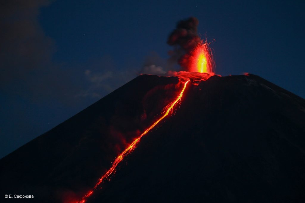
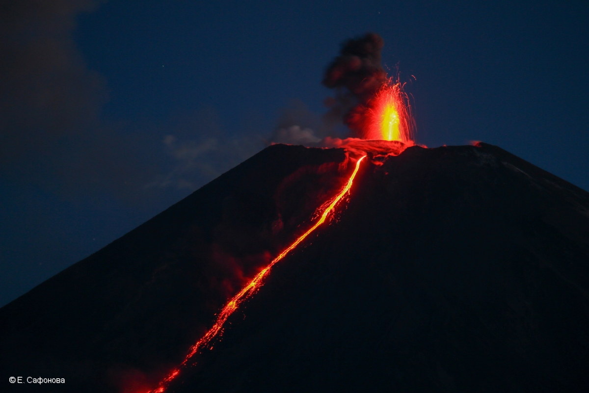
Strombolian activity of Klyuchevskoy volcano and an effuse of a lava flow into Apakhonchich chute on 10 June, 2020.


Volcanic Activity Summary:
The explosive-effusive eruption of the volcano is over. Temperature of the thermal anomaly of the volcano dropped sharply on 03 July, and continues to decline. On this and subsequent days only weak fumarole activity of the volcano was noted. Probably 03 July can be considered the end of the eruption. Activity of the volcano continues, and the danger of ash explosions remains. KVERT continues to monitor Klyuchevskoy volcano.

A moderate activity of the volcano continues. The danger of ash explosions up to 19,700-23,000 ft (6-7 km) a.s.l. remains. Ongoing activity could affect low-flying aircraft.

Volcanic cloud height: NO ASH CLOUD PRODUSED

Other volcanic cloud information: NO ASH CLOUD PRODUSED

Source : Kvert .

Photo :  E. Saphonova , 10/06/2020 .


Iceland , Seismic Swarms :

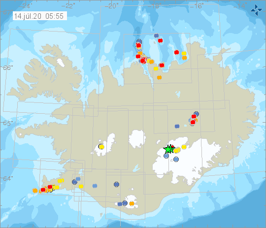
Yesterday evening at 23:41 an M3.0 earthquake occurred in SE-ern Bárðarbunga caldera and about an hour later an M3.3 earthquake occurred in similar location. Last time an M3.0 or larger earthquake occurred there was about a month ago. Earthquakes of this magnitude are common in the area and ten earthquakes equal to or larger than M3.0 have been detected there this year.

Earthquake activity around Grindavík has been ongoing there during the last months due to deformation in the area.

The earthquake swarm NE of Siglufjörður is still ongoing. The earthquake swarm began on 19th of June. Over 13.000 earthquakes have been detected, three of which measured greater than magnitude 5. The largest one was M5.8 on 21. June, around 30 km NNE of Siglufjörður. Other earthquakes above M5.0 were M5.6 and M5.4 on 20. June and were located around 20 km NE of Siglufjörður.

Seismic activity if still ongoing and there are chances of more earthquakes of this magnitude occurring in the area.

Source : Vedur IS.


Italy / Sicily , Etna :

Date: July 13, 2020, 13 4:02 p.m. (2:02 p.m. UTC)
ETNA PRESS RELEASE [UPDATE n. 59]

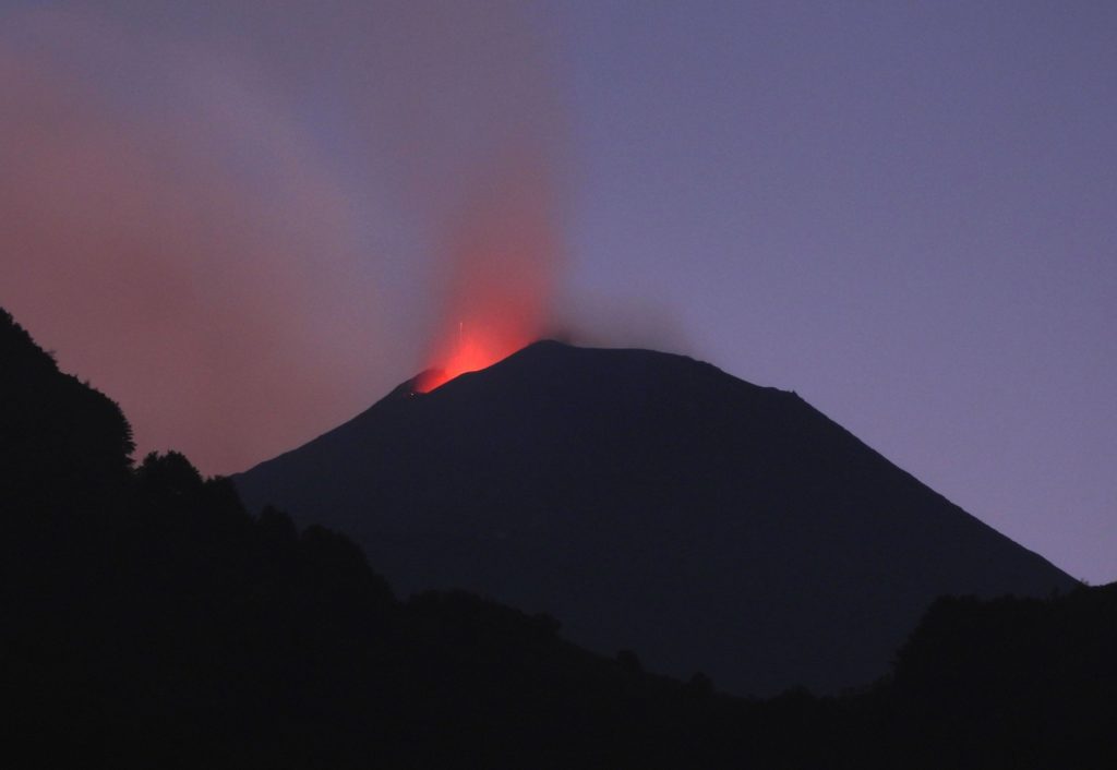
The National Institute of Geophysics and Volcanology, Etneo Observatory, announces that since the observations provided by the surveillance cameras and the INGV-OE personnel on the ground, it is emphasized that an explosive intra-crater activity persists in the New Crater South East, characterized by variable intensity coupled with modest ash emissions that disperse quickly at high altitudes. In addition, ash emissions from the Voragine crater were observed.

The amplitude of the volcanic tremor did not show significant variations compared to what is reported in press release n. 58. Currently, the amplitude of the tremor shows fluctuations around the average values. The location of the source of the tremor seems to be confined to the area of the New Southeast Crater (NSEC), at an altitude of 2900-3000 m above sea level.
As for infrasonic activity, it is mainly located in the New Southeast Crater (NSEC) area.
Regarding the Etna soil deformation monitoring networks (GNSS and inclinometric), they did not show any significant variation.

Other updates will be communicated shortly.

Source : INGV.

Read the article : http://www.ct.ingv.it/Dati/informative/vulcanico/ComunicatoETNA20200713140157.pdf

Photo : INGV Vulcani .


14 Juillet 2020 . FR . Guatemala : Pacaya , Pérou : Sabancaya , Kamchatka : Klyuchevskoy , Islande : Essaims Sismiques , Italie / Sicile : Etna .

14 Juillet 2020 .


Guatemala , Pacaya :

Type d’activité: Strombolienne.
Morphologie: stratovolcan  composite
Situation géographique: 14 ° 22’50˝ Latitude N; 90 ° 36’00˝ Longitude O.
Hauteur: 2,552 m d’altitude.
Conditions atmosphériques: Nuageux
Vent: Nord 7 km / h
Précipitations: 0,0 mm

Activité :
Le cratère Mackenney est observé, avec une émission de fumerolles blanches, que le vent déplace vers le Sud et le Sud-Ouest de ses pentes. La nuit et tôt le matin, des explosions stromboliennes avec des projections de matériaux volcaniques à 50, 75 et 100 mètres de haut ont été observées. Les stations sismiques PCG et PCG5 enregistrent des tremors associés à la remontée du magma et des gaz. Deux coulées de lave actives se dirigeant vers le Sud-Ouest et le Nord-Ouest. (Les recommandations du bulletin spécial du volcan Pacaya n ° 42-2020 sont toujours en vigueur).

Source : Insivumeh.

Vidéo : El Express via Escenario final .


Pérou , Sabancaya :

Période d’analyse: 6 au 12 juillet 2020, Arequipa, 13 juillet 2020.
Niveau d’alerte: ORANGE

L’Institut géophysique du Pérou (IGP) rapporte que l’activité éruptive du volcan Sabancaya reste à des niveaux modérés; c’est-à-dire avec l’enregistrement continu d’explosions avec la formation de colonnes de cendres et de gaz jusqu’à 2,5 km d’altitude sur le sommet du volcan. Par conséquent, pour les jours suivants, aucun changement significatif n’est attendu concernant son activité éruptive.

L’IGP a enregistré et analysé la survenue d’environ 596 tremblements de terre d’origine volcanique, associés à la circulation des fluides (magma, gaz, etc.) à l’intérieur du volcan Sabancaya (région d’Arequipa), avec , de plus, une moyenne de 17 explosions quotidiennes d’intensité faible à moyenne.


La surveillance de la déformation, utilisant des données GNSS (traitées avec des orbites rapides), ne présente pas d’anomalies significatives; cependant, une légère inflation a été enregistrée dans le secteur Nord et Sud-Est du Sabancaya. La surveillance visuelle a permis identifier les colonnes de gaz et de cendres jusqu’à 2,5 km de haut sur le sommet du volcan, qui ont été dispersées vers
les secteurs Sud-Est, Est et Nord-Est du Sabancaya.

La surveillance par satellite a permis d’identifier la présence de 6 anomalies thermiques de valeurs comprises entre 4 MW et 10 MW, associées à la présence d’un corps de lave à la surface du cratère du volcan. Le 8 juillet, une alerte de dispersion de cendres a été émise pour  les districts de Lari, Maca, Achoma, Ichupampa, Yanque, Chivay, Coporaque et Tuti, adressé aux autorités et aux résidents des districts mentionnés.

RECOMMANDATIONS:
• Maintenir le niveau d’alerte volcanique en orange.
• Ne pas s’ approcher dans un rayon inférieur à 12 km du cratère.
• En cas de chute de cendres, se couvrir le nez et la bouche avec des chiffons ou des masques humides. Garder les portes et les fenêtres du logement fermées .

Source : IGP.

Photo : Ingemmet .


Kamchatka , Klyuchevskoy :

AVIS D’OBSERVATION DU VOLCAN POUR L’AVIATION (VONA).

Délivré: 13 juillet 2020.
Volcan: Klyuchevskoy (CAVW # 300260)
Code couleur actuel de l’aviation: JAUNE
Code couleur de l’aviation précédent: orange
Source: KVERT
Numéro de l’avis: 2020-157
Emplacement du volcan: N 56 deg 3 min E 160 deg 38 min
Région: Kamchatka, Russie
Altitude du sommet: 15580 pi (4750 m).

Activité strombolienne du volcan Klyuchevskoy et effusion d’une coulée de lave dans la « goulotte » d’Apakhonchich le 10 juin 2020.


Résumé de l’activité volcanique:
L’éruption explosive-effusive du volcan est terminée. La température de l’anomalie thermique sur le volcan a fortement chuté le 03 juillet et continue de baisser. Ce jour-là et les jours suivants, seule une faible activité de fumerolles du volcan a été notée. Le 03 juillet est probablement considéré comme la fin de l’éruption. L’activité du volcan se poursuit et le danger d’explosions de cendres demeure. Le KVERT continue de surveiller le volcan Klyuchevskoy.

Une activité modérée du volcan se poursuit. Le danger d’explosions de cendres jusqu’à 19 700-23 000 pi (6-7 km) d’altitude persistes. L’activité en cours pourrait affecter les avions volant à basse altitude.

Hauteur des nuages ​​volcaniques: AUCUN NUAGE DE CENDRES PRODUIT

Autres informations sur les nuages ​​volcaniques: AUCUN NUAGE DE CENDRES PRODUIT

Source : Kvert .

Photo :  E. Saphonova , 10/06/2020 .


Islande , Essaims Sismiques :

Hier soir à 23h41, un tremblement de terre de M3.0 s’est produit dans la caldeira Sud-Est du Bárðarbunga et environ une heure plus tard, un tremblement de terre de M3.3 s’est produit à un endroit similaire. La dernière fois qu’un tremblement de terre de M3.0 ou plus s’est produit, c’était il y a environ un mois. Des tremblements de terre de cette ampleur sont courants dans la région et dix tremblements de terre égaux ou supérieurs à M3.0 y ont été détectés cette année.

L’activité sismique autour de Grindavík s’y est poursuivie au cours des derniers mois en raison de la déformation de la région.

L’essaim de tremblements de terre au Nord-Est de Siglufjörður est toujours en cours. L’essaim de tremblements de terre a commencé le 19 juin. Plus de 13 000 tremblements de terre ont été détectés, dont trois mesuraient plus que la magnitude 5. Le plus grand était de M5,8 le 21 juin, à environ 30 km au Nord-Nord-Est de Siglufjörður. Les autres tremblements de terre au-dessus de M5.0 ont été de M5.6 et M5.4 le 20 juin et ont été localisés à environ 20 km au Nord-Est de Siglufjörður.

L’activité sismique est toujours en cours et il y a des chances que d’autres tremblements de terre de cette ampleur se produisent dans la région.

Source : Vedur IS.


Italie / Sicile , Etna :

Date: 13 Juillet 2020, 13 16:02 (14:02 UTC)
COMMUNIQUE DE PRESSE ETNA [MISE A JOUR n. 59]

L’Institut National de Géophysique et de Volcanologie, Observatoire Etneo, annonce que depuis les observations assurées par les caméras de surveillance et le personnel INGV-OE sur le terrain, il est souligné qu’une activité explosive intra-cratère persiste dans le Nouveau Cratère Sud Est , caractérisée par une intensité variable couplée à de modestes émissions de cendres qui se dispersent rapidement à haute altitude. De plus, des émissions de cendres du cratère de la Voragine ont été observées.

L’amplitude du tremor volcanique n’a pas montré de variations significatives par rapport à ce qui est rapporté dans le communiqué de presse n. 58. Actuellement, l’amplitude du tremor montre des fluctuations autour des valeurs moyennes. La localisation de la source du tremor semble confinée dans la zone du Nouveau Cratère du Sud-Est (NSEC), à une altitude de 2900-3000 m d’altitude.
Quant à l’activité infrasonore, elle est principalement localisée dans la zone du Nouveau Cratère Sud-Est (NSEC).
En ce qui concerne les réseaux de surveillance des déformations du sol de l’Etna (GNSS et inclinométrique) ils n’ont montré aucune variation significative.

D’autres mises à jour seront communiquées rapidement.

Source : INGV.

Lire l’articlehttp://www.ct.ingv.it/Dati/informative/vulcanico/ComunicatoETNA20200713140157.pdf

Photo : INGV Vulcani .