
July 05 , 2020 .
Alaska , Veniaminof :
56°11’52 » N 159°23’35 » W,
Summit Elevation 8225 ft (2507 m)
Current Volcano Alert Level: ADVISORY
Current Aviation Color Code: YELLOW
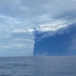
Low-level seismic unrest continues at Veniaminof with occasional small earthquakes and a few periods of weak tremor detected. No volcanic activity was seen in satellite views or web camera images over the past day.
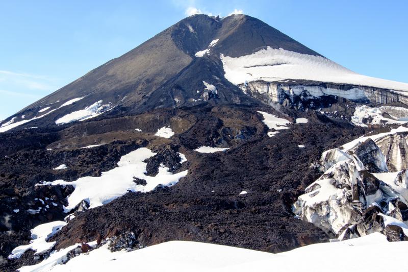
Veniaminof summit cone and 2018 lava flows during summer 2019 field visit.
The type of seismic activity observed intermittently over the last two weeks typically precedes eruptions at Veniaminof but does not mean that an eruption will occur. Eruptions usually result in minor ash emissions, lava fountaining, and lava flows from the small cone in the summit caldera. Ash emissions are typically confined to the summit crater, but larger events can result in ash fall in nearby communities and drifting airborne ash.
Veniaminof volcano is monitored with a local real-time seismic network, which will typically allows AVO to detect changes in unrest that may lead to a more significant explosive eruption. AVO combines seismic, infrasound, lightning, and satellite data for rapid detection of such events.
Source : AVO .
Photo : Loewen, Matt.
Japan , Nishinoshima :
Date of the last update: 04 July 2020-.
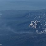
The Japanese Meteorological Agency said on July 4 that the « Helianthus 8 » weather satellite had observed the continuous eruption of the volcanic island Nishinoshima, in the Ogasawara Islands. Its eruption plume rose approximately 8,300 meters, which is the highest record for this volcano since 2013. The National Land Science Institute has discovered that the south side of the island stretches for approximately 150 meters outward compared to two weeks ago.

The Maritime Safety Agency plane observed on June 29 that its crater at the top of the mountain had extended to the southwest, while lava was flowing towards the ocean in the same direction.
Expansion of the island area and output of Magma:
The National Institute of Earth Sciences compares the observation data of the Earth observation satellite « Dadi 2 » on July 3 with the observation data of June 19 and finds that the south side of the island s ‘extends over a distance of about 150 meters. The diameter of the central cone of the volcano is also about half as large as before, and the southern slope has also collapsed on a large scale. Massive volcanic cones are formed by the accumulation of materials, especially volcanic ash.
![]()
Nishinoshima – topographic changes – The light blue line indicates the area where topographic changes were observed from June 5, 2020 to June 19, 2020, and the red line indicates the area where topographic changes were subsequently observed. – DoC. GSI 03.07.2020
Professor Kenji Nogami, a professor at the Tokyo Institute of Technology who is familiar with the activity of the Nishinoshima volcano said: « There is a large amount of magma underground in Nishinoshima, and it could still flow to the to come up. »
Source : hk01.com / Hong Yilin , via Sherine France .
Document : Via Bernard Duyck. http://www.earth-of-fire.com/2020/07/actualite-de-nishinoshima-du-poas-et-de-le-nouvelle-zone-thermale-de-tern-lake-au-yellowstone.html?fbclid=IwAR3WcGyA1tvdjM7X0J32Az5VgPjDweu5p43XWvAXy_xV-7xSpmC5DNJHYiE
Photo : Red climatica mundial.
Costa Rica , Turrialba / Poas / Rincon de la Vieja :
Turrialba volcano:
Lat: 10.025 ° N; Long: 83,767 ° W;
Height: 3340 m above sea level
Current activity level: 3 (erupting volcano)
Potentially associated hazards: gas, ash emission, proximal ballistic projections.
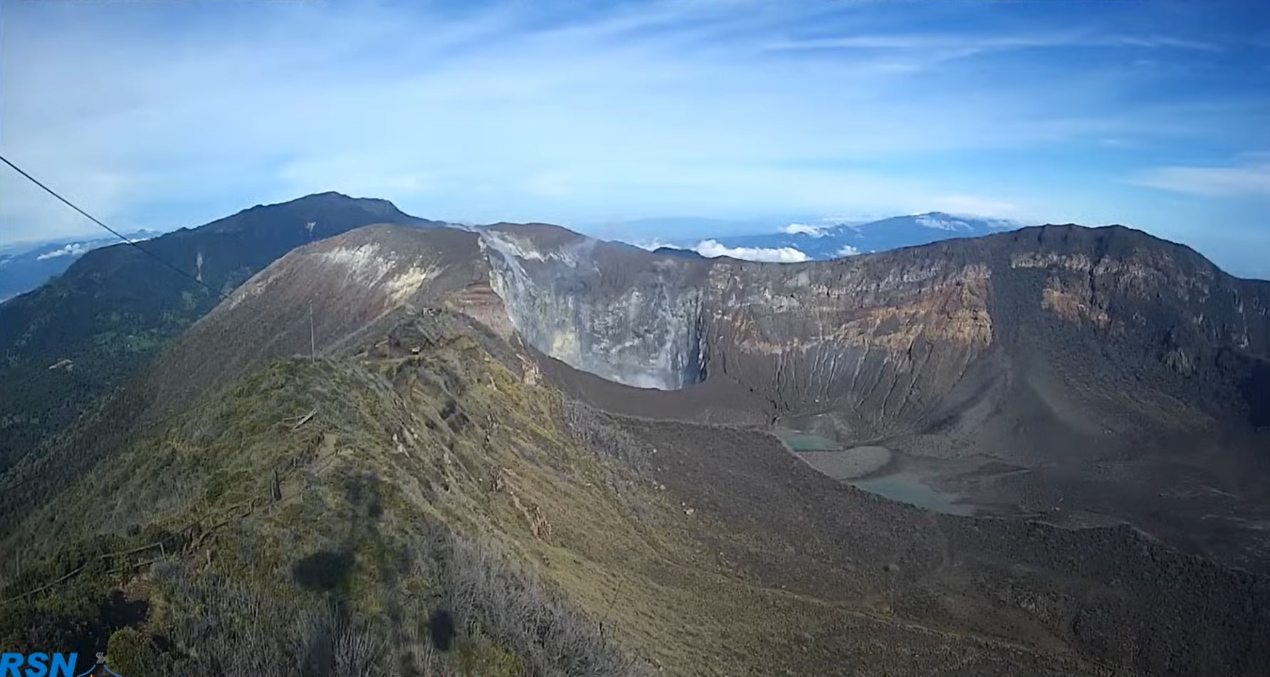
Various ash emissions were observed up to the blocks which came out of the active crater (June 29 at dawn). The contraction and subsidence of the Turrialba-Irazú massif continues.
The CO2 / SO2 and CO2 / H2S Total ratios confirmed the downward trend observed since the beginning of the month. The SO2 flux presents a certain variability but always around normal values. No thermal anomaly was detected by the MODIS analysis. The ash collected during the week does not present any juvenile material, so at the time of this report there are no signs that could indicate a new magma intrusion.
Poas Volcano:
Lat: 10.2 ° N; Long: 84 233 ° W;
Height: 2780 m above sea level
Current activity level: 2 (active volcano)
Potentially associated hazards: gas, groundwater eruptions, proximal ballistic projections.
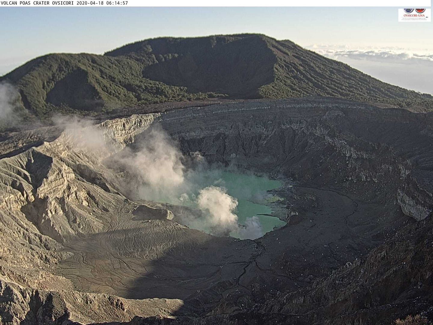
No eruption was detected. Some inflation is detected but does not represent a significant deformation of the volcano. The CO2 / SO2 and H2S / SO2 gas ratios remain variable within the normal range of values. The flow of SO2 is stable. The level of the lake has increased slightly. SO2 concentrations of up to 10 ppm have been recorded at the National Park viewpoint.
Rincon de la Vieja volcano:
Lat: 10.83 ° N; Long: 85.324 ° W;
Height: 1895 m above sea level
Current activity level: 3 (erupting volcano)
Potentially associated hazards: gas, phreatic eruptions, proximal ballistic projections, lahars.

A decrease in the activity of the volcano is confirmed. Geodetic measurements again show an extension of the summit from mid-June. No thermal anomaly was detected by the MODIS analysis.
Source : Ovsicori .
Photos : RSN , Ovsicori , Federico Chavarría-Kopper – Ovsicori.
Mexico , Popocatepetl :
04 July, 11.15 a.m. (04 July, 4.15 p.m. GMT)
Over the past 24 hours, 169 low-intensity exhalations have been identified through the Popocatépetl volcano monitoring system, accompanied by volcanic gases and sometimes small amounts of ash. In addition, 32 minutes of low amplitude tremors were recorded and a minor explosion was recorded yesterday at 3:49 p.m.
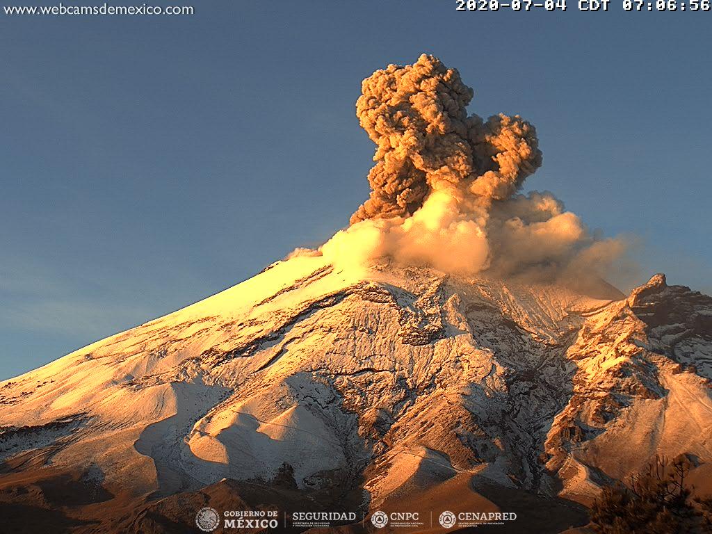
At the time of this report, there is no visibility of the volcano, however during the morning, a slight constant emission of volcanic gases dispersed towards the North-West West.
CENAPRED urges not to get close to the volcano and especially the crater, because of the danger involved in the fall of ballistic fragments and, in the event of heavy rain, to move away from the bottom of the ravines because of the danger of mud and debris.
The Popocatépetl volcanic warning signal light is in YELLOW PHASE 2.
Source : Cenapred .


No comment yet, add your voice below!