
June 25 , 2020.
Chile , Laguna del Maule :
36.058°S, 70.492°W
Elevation 2162 m
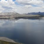
SERNAGEOMIN’s Volcanological Observatory of the Southern Andes (OVDAS) of Chile and SEGEMAR’s Argentine Observatory of Volcanic Surveillance (OAVV) reported anomalous activity at Laguna del Maule Volcanic Complex. Elevated levels of carbon dioxide were detected in an area SW of the caldera lake, along the lower part of the Cabecera de Troncoso River, about 5 km from the lake’s shore. Carbon dioxide emissions were measured in February 2020 and notably elevated relative to March 2019 measurements. An impacted area possibly stretched as far as 500 m from the point representing the highest carbon dioxide emission rate; observers noted areas of discolored brown and orange soil aonlg with dead or emaciated animals.

Three swarms of volcano-tectonic (VT) earthquakes recorded in mid-June were mainly located in the Las Nieblas area, SW of the lake, at depths of 2-8 km. The first began at 0340 on 11 June and totaled at least 400 events. The second swarm began at 2338 on 12 June was characterized by 121 events, located 8.8 km W of the crater. The third swarm began at 2334 on 15 June and was characterized by 190 events located 10.4 km SW of the crater. All of the earthquakes were small magnitudes; the largest event was a local M 2.5. On 18 June the Alert Level was raised to Yellow, the second lowest color on a four-color scale; ONEMI recommended restricting access within a radius of 2 km from the emission center. Seismic activity continued to be recorded, though at lesser magnitudes.

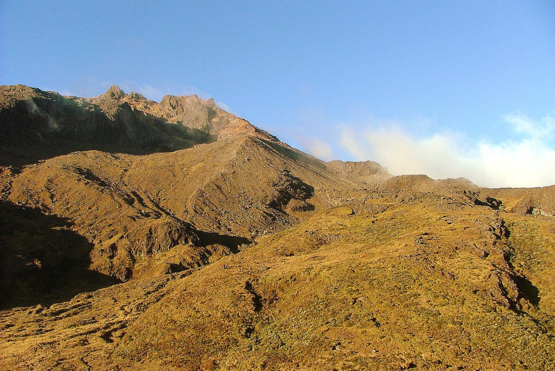
The 15 x 25 km wide Laguna del Maule caldera contains a cluster of small stratovolcanoes, lava domes, and pyroclastic cones of Pleistocene-to-Holocene age. The caldera lies mostly on the Chilean side of the border, but partially extends into Argentina. Fourteen Pleistocene basaltic lava flows were erupted down the upper part of the Maule river valley. A cluster of Pleistocene cinder cones was constructed on the NW side of the Maule lake, which occupies part of the northern portion of the caldera. The latest activity produced an explosion crater on the E side of the lake and a series of Holocene rhyolitic lava domes and blocky lava flows that surround it.
Source : Sernageomin , GVP.
Photos : Segemar .ar. , Dr Katie Keranen.
Colombia , Chiles / Cerro Negro :
Weekly activity bulletin of the Chiles and Cerro Negro volcanoes.
Volcanic activity continues at the YELLOW LEVEL ■ (III): CHANGES IN THE BEHAVIOR OF VOLCANIC ACTIVITY.
According to the monitoring of the activity of VOLCANS CHILE AND CERRO NEGRO, the COLOMBIAN GEOLOGICAL SERVICE (SGC) reports that:
Between June 16 and 22, 2020 and compared to the previous week, seismic activity in the region of Chiles – Cerro Negro volcanoes recorded a decrease in the occurrence and the released energy.
The predominance of events associated with rock rupture is maintained, located in two main sources:
one to the southwest and one to the south-southeast of the Chiles volcano. In general, these events are located at distances between 1 and 9 km from this volcano and at depths up to 10 km from its summit. The maximum local magnitude for this type of event was 1.5 on the Richter scale.
Some changes recorded by one of the volcanic deformation sensors have continued since May 2019. The other volcanic monitoring parameters did not show significant variations and no manifestation of surface activity was observed.
Source : SGC.
Photo : Boriss Andean / summit post .
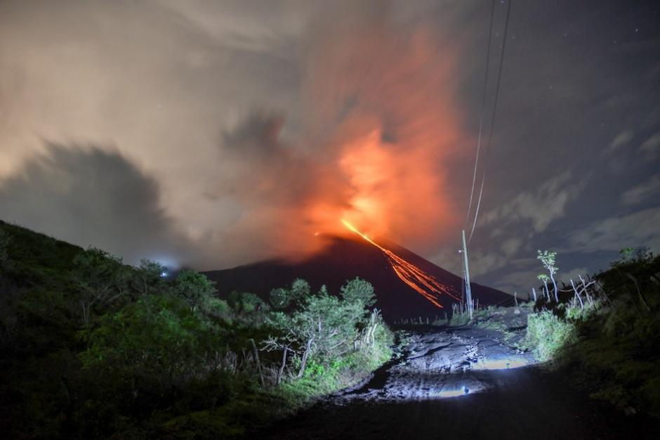
Guatemala , Pacaya :
Type of activity: Strombolian.
Morphology: composite stratovolcano
Location: 14 ° 22’50˝ Latitude N; 90 ° 36’00˝ W longitude.
Height: 2,552 m above sea level.
Atmospheric conditions: Clear
Wind: South West at 25 km / h
Precipitation: 0.0 mm.
Activity:
The MacKenney crater is observed, with a white fumarole that the wind moves towards the South. At night and early in the morning, Strombolian explosions were observed which expel incandescent materials at a height of up to 200 meters above the crater, which can be audible up to 5 km. The PCG and PCG5 seismic stations record tremors associated with the rise of magma and gases. A lava flow about 600 meters long is observed in a southwest direction. The above represents the continuity of the increase in Strombolian activity reported in the special bulletin BEPAC n ° 35-2020.
Source : Insivumeh .
Photo : photographe inconnu via objectif volcan .
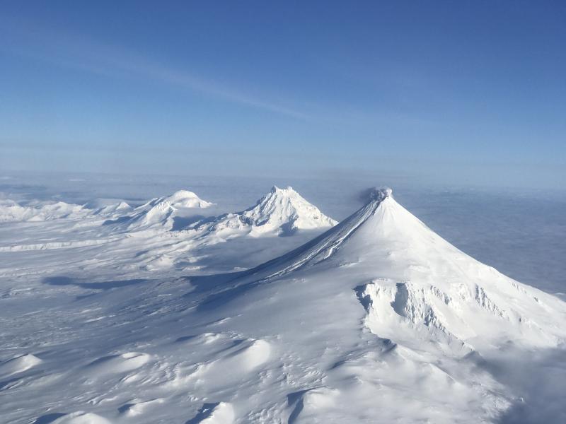
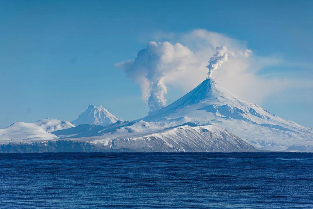
Alaska , Shishaldin :
AVO/USGS Volcanic Activity Notice
Current Volcano Alert Level: NORMAL
Previous Volcano Alert Level: ADVISORY
Current Aviation Color Code: GREEN
Previous Aviation Color Code: YELLOW
Issued: Wednesday, June 24, 2020, 12:00 PM AKDT
Source: Alaska Volcano Observatory
Location: N 54 deg 45 min W 163 deg 58 min
Elevation: 9373 ft (2857 m)
Area: Aleutians
Volcanic Activity Summary:
Seismicity at Shishaldin Volcano has decreased to background levels. Satellite views over the past few weeks suggest typical background surface temperatures and light steaming at the summit and no signs of new volcanic activity within the crater. Due to this decrease in activity, the Alaska Volcano Observatory is decreasing the Aviation Color Code for Shishaldin Volcano to GREEN and the Alert Level to NORMAL.
This most recent eruptive cycle at Shishaldin began in July 2019 with pauses in activity in late September/early October 2019 and February 2020. The most recent activity in mid-March was confined to the summit crater except for minor ash deposits near the summit. Only minor rockfalls within the summit crater, not associated with eruptive activity, have been detected since early April. Pauses in eruptions are common at Shishaldin, and therefore eruptive activity could resume with little warning. The Alaska Volcano Observatory will continue to monitor the volcano closely.
Shishaldin is monitored by local seismic and infrasound sensors, satellite data, a web camera, a telemetered geodetic network, and distant infrasound and lightning networks.
Recent Observations:
[Volcanic cloud height] na
[Other volcanic cloud information] na
Remarks:
Shishaldin volcano, located near the center of Unimak Island in the eastern Aleutian Islands, is a spectacular symmetric cone with a base diameter of approximately 16 km (10 mi). A 200-m-wide (660 ft) funnel-shaped summit crater typically emits a steam plume and occasional small amounts of ash. Shishaldin is one of the most active volcanoes in the Aleutian volcanic arc, with at least 54 episodes of unrest including over 24 confirmed eruptions since 1775. Most eruptions are relatively small, although the April-May 1999 event generated an ash column that reached 45,000 ft above sea level.
Source : AVO .
Photo : Jacob, Ben David. elysha agne .


No comment yet, add your voice below!