
March 24 ,2020.
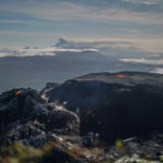
Peru , Sabancaya :
Analysis period: March 16 to 22, 2020. Arequipa, March 23, 2020.
Alert level: ORANGE
The Peruvian Geophysical Institute (IGP) reports that the eruptive activity of the Sabancaya volcano remains at moderate levels; that is to say with the continuous recording of moderate explosions and consequent emissions of ash and gas. Consequently, for the following days, no significant change is expected regarding its activity.
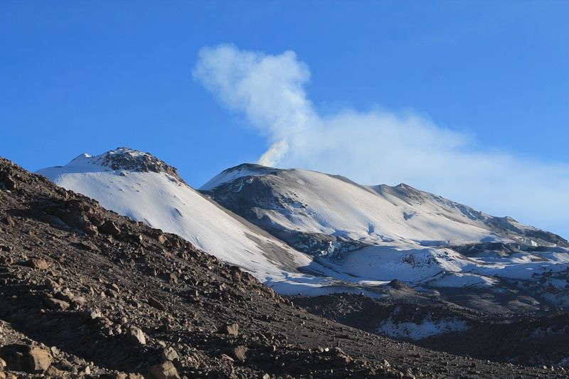
The IGP recorded and analyzed approximately 738 earthquakes of volcanic origin, associated with the circulation of fluids (magma, gas, etc.) within the Sabancaya volcano. In addition, an average of 19 medium to low intensity explosions were recorded daily.
Monitoring the deformation of the volcanic structure does not record any significant anomalies. Visual surveillance identified columns of gas and ash up to 3 km above the summit of the volcano, which were scattered towards the southwest and south sectors of the Sabancaya. Satellite surveillance identified the presence of a thermal anomaly worth 1 MW, associated with the presence of a body of lava on the surface of the volcano crater.
Source : IGP.
Photo : Unknown author
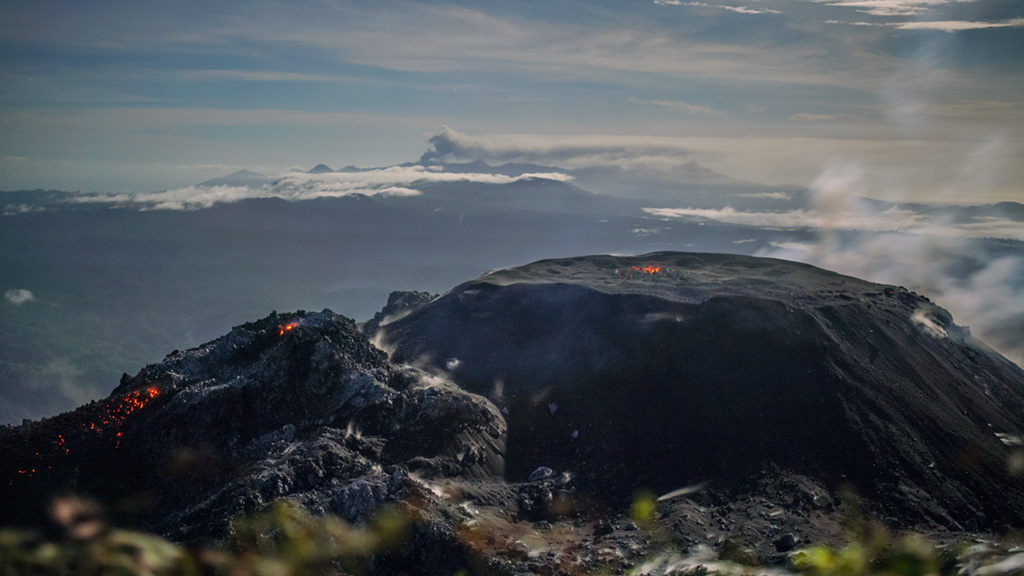
Indonesia , Ibu :
Level of activity at level II (WASPADA). G. Ibu (1,340 m above sea level) has experienced a continuous eruption since 2008.
The volcano is clearly visible until it is covered with fog. Smoke from the crater is observed white / gray in color, with low / thick intensity, about 200 to 800 meters high. The smoke direction is oriented to the South and West. The weather is sunny to rainy, the winds are light to moderate to the south and west.
According to the seismographs of March 23, 2020, it was recorded:
105 eruption earthquakes
84 emission earthquakes
7 avalanche earthquakes
41 harmonic tremors.
Recommendation:
The communities around G. Ibu and visitors / tourists must not move within a radius of 2 km, with a sectoral expansion of 3.5 km until the crater opens in the northern part of the active crater of G Ibu.
In case of ash rain, people active outside the house are advised to protect their nose, mouth (mask) and eyes (glasses).
VONA: The last VONA code sent had an ORANGE color code, published on March 10, 2020, at 10:44:00. Volcanic ash was observed at an altitude of 1725 m above sea level or about 400 m above the summit.
Source : PVMBG .
Photo : Martin Rietze .
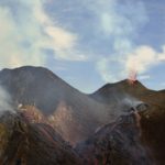
Colombia , Nevado del Ruiz :
Emission of ash from the Nevado del Ruiz volcano, March 23, 2020.
Emissions of ash and gas were recorded yesterday on March 23 at 6:30 am, observed through web cameras installed in the area of the Nevado del Ruiz volcano and in Manizales.
The Colombian Geological Survey reports that in recent days, the Nevado del Ruiz volcano continues to experience low energy earthquakes associated with small ash emissions.
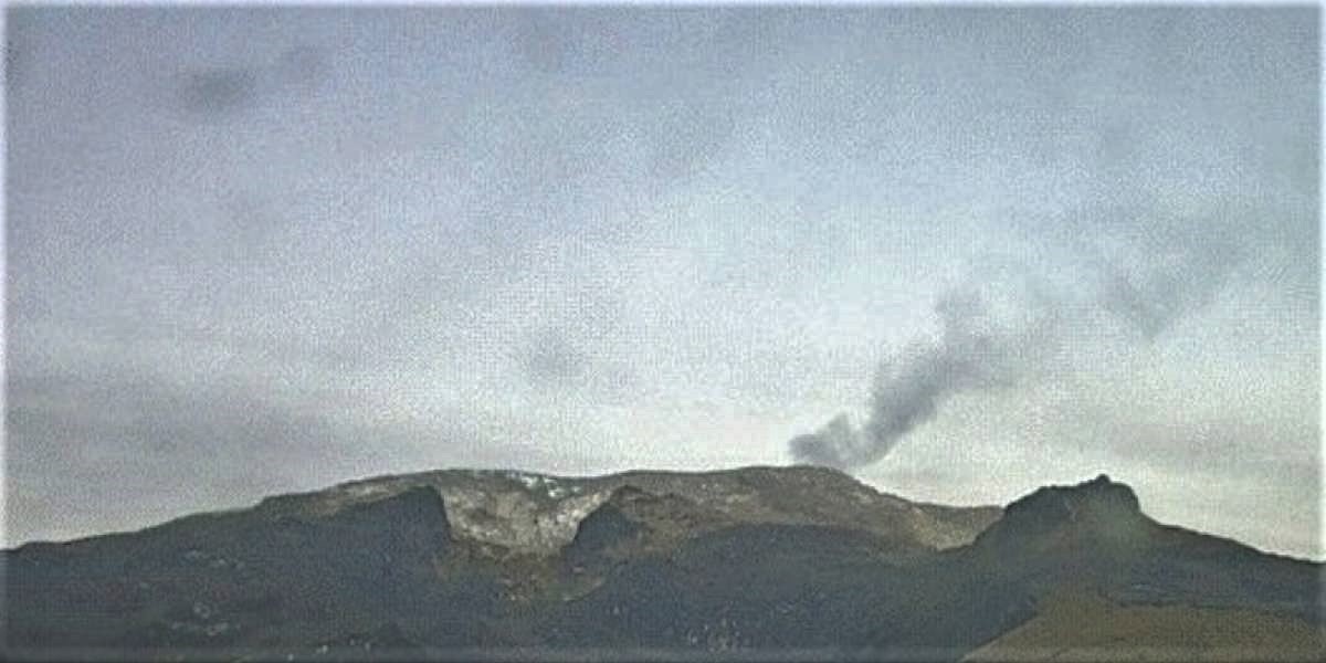
Some of these shows, like the one that happened yesterday at 6:25 a.m., were appreciated thanks to the web cameras installed in the area of the volcano.
The direction of dispersion of the last emissions was governed by the wind direction, mainly towards the Northeast and the Southeast of the volcano. A possible fall of ash in the populations there is not excluded.
New earthquakes associated with gas and ash emissions are also not excluded.
The level of activity continues at the yellow level or (III), that is to say changes in the behavior of volcanic activity.
The Colombian geological service and the municipal and departmental risk management councils will report any change in the activity of the volcano through their official channels.
Source : SGC.
Guatemala , Fuego :
Atmospheric conditions: Clear
Wind: North at 5 km / h
Precipitation: 0.0 mm
Activity:
Presence of degassing fumaroles of white / blue color at a height of 4200 m above sea level moving towards the Southwest. 6 to 8 low to moderate explosions are generated per hour which eject columns of gray ash at a height of 4400 to 4700 m above sea level (14435- 14765 feet) which are dispersed over 15 to 20 km towards the Southwest. Incandescent pulses were observed at night and early in the morning at 300 – 400 m high with strong avalanches around the crater, mainly in the Seca, Taniluya, Ceniza, Trinidad and Las Lajas ravines. Moderate to loud rumblings are perceived which cause moderate to strong shock waves perceptible at 25 km distance, as well as sounds similar to train locomotives with intervals of one minute. There are falls of fine particles of ash in Panimache II, Panimache I, El Porvenir, Palo Verde and others.
Note: The description above corresponds to the activity described in special bulletin # 4-2020 generated on 2020-03-21.
Source : Insivumeh.
Mexico , Popocatepetl :
March 23, 11:00 a.m. (March 23, 5:00 p.m. GMT)
In the past 24 hours, 73 exhalations have been identified according to the Popocatépetl volcano monitoring system, accompanied by emissions of volcanic gases, small amounts of ash and sometimes incandescent fragments. In addition, 206 minutes of low amplitude tremors were recorded as well as a moderate explosion at 00:41 h, which expelled incandescent fragments at a maximum distance of 700 m on the slopes of the volcano. The height of the eruptive column reached 1 km in height and dispersed towards the Southwest. A volcano-tectonic earthquake of magnitude M1.7 was also recorded.
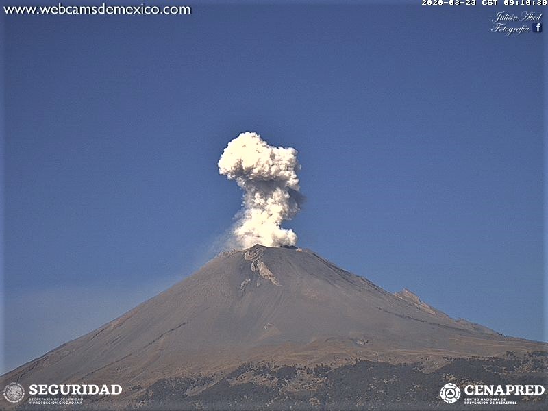
This morning and at the time of this report, we observe the constant emission of volcanic gases and sometimes light amounts of ash, which are dispersed towards the Southwest.
CENAPRED urges NOT TO APPROACH the volcano and especially the crater, because of the danger of falling ballistic fragments and, in the event of heavy rain, to move away from the bottom of the ravines because of the danger of flows mud and rubble.
The Popocatépetl volcanic alert signaling light is in YELLOW PHASE 2.
Source : Cenapred .


No comment yet, add your voice below!